E Foster Island Road

This street, which runs about ¼ mile from Lake Washington Boulevard E to the beginning of the Foster Point Trail, all within the Washington Park Arboretum, was without a name until 1968, when it was named for the island in Union Bay to which it led. (It remained unsigned until a few decades later, however. There was no sign at the intersection until at least the 1990s, as I know since my parents’ house was at the south end of the Arboretum and I drove or biked by there weekly, if not more often, while I was growing up.)

Foster Island is known by the Duwamish tribe, who once used it as a burial ground, as Stitici, or ‘little island’. It was named by the settlers for Joel Wellington Foster, who came to Washington in the 1870s from St. Joseph, Missouri. He is said to have donated the island to the city in one HistoryLink article, but another says the city bought it in 1917.

(Note added November 6, 2022: David B. Williams, the “Street Smart Naturalist,” recently posted The Lost Islands of Seattle, in which he wrote that he had seen various sources for the name Foster but none with good documentation. I asked him about the HistoryLink article I cite above:

I’m embarrassed to have missed that, but of course he’s right. So if not Joel Wellington Foster, then who? The search continues

E Jansen Court

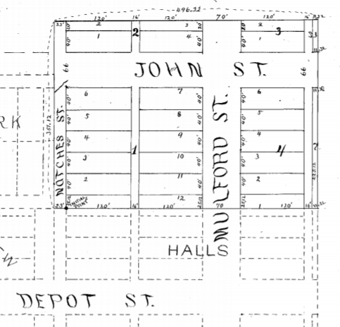
When I saw that E Jansen Court fell within Jansen’s Addition to the City of Seattle, filed in 1889 by Mary Jansen, I thought “Ah, another case of a landowner naming a street after themselves,” though I did note it was rare to see a single woman’s, and no one else’s, name on such a plat. But once I got a good look at the plat map I realized that, as is often the case, things weren’t quite that simple.

There’s no Jansen Court on this map — instead, John Street keeps its name as it crosses Mulford Street (now 20th Avenue E). So what happened?

In 1954, E John Street — the arterial east of 21st Avenue E — and E Thomas Street — the arterial west of 20th — were connected directly to each other by lopping off a small part of Miller Playfield (creating Miller Triangle in the process). As part of this, a one-way extension of John was built east of 20th, connecting with the arterial just before 21st. But this meant what is now Jansen Court needed a new name (remember, it originally remained John Street after crossing 20th). The powers that be decided to simply name it after Mary Jansen (or her subdivision). So even though she hadn’t named it after herself, 65 years after she filed her plat Jansen finally had her name on a street sign.

Roosevelt Way NE

This street runs nearly 6 miles from the north end of the University Bridge in the south (at Eastlake Avenue NE and NE Campus Parkway) to Aurora Avenue N in the north, just shy of Seattle city limits at N 145th Street. It runs north–south for most of its length, but starting at NE 125th Street, its last 1½ miles cut a northwest–southeast diagonal across the street grid, making it Roosevelt Way N once it crosses 1st Avenue NE between N 133rd and N 135th Streets.

Originally 10th Avenue NE south of NE 125th Street, Roosevelt received its current name in 1933. According to local historian Feliks Banel, this was first proposed in 1927 by businesses in the Roosevelt district, itself having taken that name earlier in the decade in honor of President Theodore Roosevelt, who died in 1919. Nothing came of it for six years, but in 1933 they tried again and asked that 10th Avenue be renamed after both Theodore and Franklin Delano Roosevelt, who had been elected president the previous November. As Banel notes in his piece, The Seattle Times had this to say:

This change, we assume, must be pleasing to local Democrats of all sorts and shades. At the same time, due to the incidence of somewhat tenuous family ties, it cannot be at all displeasing to Republicans. The name of Roosevelt has high standing in both political parties, as indeed it has throughout the world. Even now it is quite certain that those who may traverse our Roosevelt Way in years to come will neither know nor particularly care whether it was named for Teddy or for Frank.

As for its diagonal stretch, it appears on old King County maps as M. Roy Sayles Road (County Road 2240), Golf Way, and State Highway 1J (predecessor of today’s SR 513). It ceased to be a state highway in 1991. As for when it, too, became Roosevelt Way, it’s difficult to tell as King County doesn’t have as good a system for looking up ordinances online as Seattle’s. It appears as Roosevelt Way on a 1966 map in local historian Rob Ketcherside’s maps album on Flickr, but as Golf Way in another one from 1947. As the area in question wasn’t annexed into Seattle until 1953, the name must have been changed by the county sometime between 1947 and 1953 in anticipation. (The 1933 Seattle ordinance is the only one on file relating to Roosevelt Way’s name, so this must have been a county change.)

As for M. Roy SaylesThe International Confectioner’s January 1915 issue reports that he, along with Annie B. Sayles, C.M. Sayles, and W.H. Rogers, founded the Rogers Candy Co. in Seattle in 1915; and Golf Way almost certainly comes from the road’s proximity to the public course at Jackson Park, which opened in 1928.

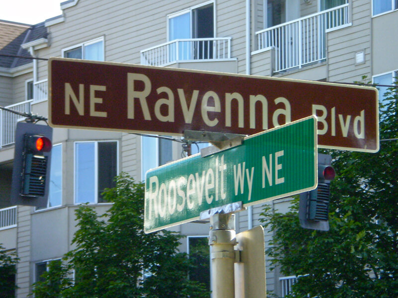
Sign at corner of NE Ravenna Boulevard and Roosevelt Way NE, July 4, 2009
Signs at corner of NE Ravenna Boulevard and Roosevelt Way NE, July 4, 2009. Photograph by Benjamin Lukoff. Copyright © 2009 Benjamin Lukoff. All rights reserved.

W Marina Place

This street, established in 1991 as part of the development of the Elliott Bay Marina at the southern foot of Magnolia Bluff, runs ⅖ of a mile west from 23rd Avenue W to just shy of the 30th Avenue W street end beach.

While the origin of its name may not be interesting, the story of its establishment is a bit more so:

  • The marina itself began the permitting process in 1983, but lawsuits delayed its creation for nearly a decade. The Muckleshoot Indian Tribe and Suquamish Tribe sued to block its construction on the basis that “construction of the Marina would eliminate a portion of one of their usual and accustomed fishing areas in Elliott Bay and thus would interfere with their treaty right to fish at the Marina site.” Homeowners on the bluff above intervened on the side of the developers, as “the area has had numerous major landslides that have left several homes at the crest of the bluff at risk and have repeatedly caused breaks in a trunk sewer line located at the base of the bluff.… The Marina construction includes the placement of 500,000 cubic yards of fill at the toe of the bluff, which would stabilize the area.” Eventually, a settlement was reached, which “calls for ongoing fisheries-related expenses paid to the tribe, which will be funded by a percentage of the moorage income.… [the] ‘Indian Treaty Surcharge.’”
  • I believe this was the last major fill operation within Seattle city limits. Such a development would be all but unthinkable today.
  • The marina was built on tidelands where W Lee Street and Puget Avenue W were platted but never built. They were vacated and W Marina Place was established. When it came to naming the access road, the developers originally proposed W Marina Boulevard, contending that as the road fell between the W Oakes Street right-of-way and the former W Lee Street right-of-way, it wasn’t a violation of the city’s principle of maintaining street grid names as much as possible. This was initially rejected by the city, which preferred W Lee Street, but after further discussion, W Marina Place was settled on. An interesting point the developers made was that as W Lee Street had never physically existed in Magnolia, though it had been platted there, calling the access road W Lee Street could actually be confusing, as “people familiar with Seattle streets know that there is no W Lee Street on Magnolia. Rather, they know W Lee Street as being on Queen Anne Hill.” Still, though, I have to believe they were more interested in their own vanity — Marina Boulevard? — than any particular concern for folks’ ability to navigate.
  • For some reason, the public street ends just feet from the 30th Avenue W street end beach. I’m not entirely sure why that is; I don’t think the marina is opposed to public access to the beach; otherwise, they wouldn’t be in favor of the Magnolia Trail project, which would connect W Marina Place to W Galer Street, 32nd Avenue W, and thence to Magnolia Village.
Aerial photograph of Elliott Bay Marina area in the 1930sAerial photograph of Elliott Bay Marina area, present day
Elliott Bay Marina site, 1930s and today

University Way NE

This street runs 1¼ mile from NE Pacific Street in the south to NE Ravenna Boulevard and Cowen Park in the north. Until 2001, it was a block longer, starting farther south at NE Boat Street, but that portion was vacated as part of the development of the University of Washington campus.

Originally Columbus Avenue and then 14th Avenue NE, it was renamed University Way in 1920 after the University of Washington, which had moved to the neighborhood from its original home downtown in 1895. As local historian Paul Dorpat explains in this HistoryLink essay,

[In 1919] the University Commercial Club… ran [a contest] to rename 14th Avenue…. Club member Arthur Quigley’s “University Way” won the street name contest easily. To deflect any charges that the contest was fixed, Quigley donated the prize money to charity.

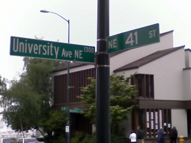
Even though it’s been a “way” for 101 years now, to locals University Way has always been, and always will be, “The Ave.” And that in itself will always cause some confusion, as this street sign demonstrates.

Even the city gets street names wrong sometimes. Photograph by Benjamin Lukoff, May 23, 2008. Copyright © 2008 Benjamin Lukoff. All rights reserved.

E Conover Court

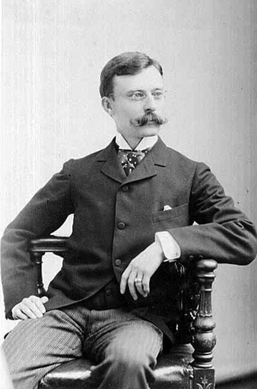
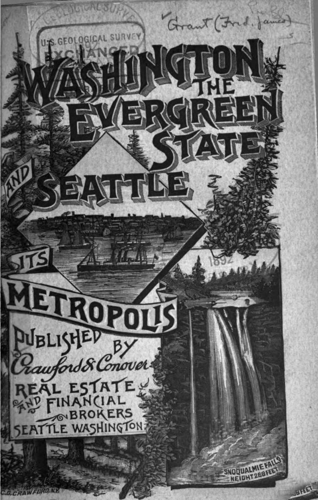
This cul-de-sac, which runs about 300 feet from the end of 35th Avenue just south of E James Street, was named by journalist and real estate developer C.T. (Charles Tallmadge) Conover after himself. Unlike many developers, he didn’t do this when his plat (“Conover Park”) was first filed in 1907, but rather 15 years later when a new street was established in the subdivision. Perhaps his most lasting achievement was Washington’s nickname, “The Evergreen State,” which he coined in 1890.

CT Conover in 1893
C.T. Conover in 1893
Cover of Washington the Evergreen State and Seattle Its Metropolis brochure
Cover of brochure “Washington the Evergreen State and Seattle Its Metropolis”

Portage Bay Place E

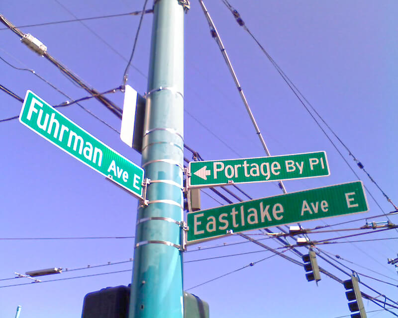
This street, which runs ³⁄₁₀ of a mile from Fuhrman Avenue E to E Allison Street, was established as an alley in 1890 as part of the Denny–Fuhrman Addition to the City of Seattle, but only received a name in 1936. It was named for Portage Bay, the eastern arm of Lake Union, which it parallels. Portage Bay was in turn named for the portage from Union Bay (part of Lake Washington) to Lake Union over the Montlake Isthmus, which is today the Montlake Cut of the Lake Washington Ship Canal.

Sign at corner of Fuhrman Avenue E, Eastlake Avenue E, and Portage Bay Place E, August 24, 2009
Sign at corner of Fuhrman Avenue E, Eastlake Avenue E, and Portage Bay Place E, August 24, 2009. Portage By Pl is an error; it should read Portage Bay Pl E, as it’s [[Portage Bay] [Place]], not [[Portage] [Bay Place]]. The original Red Robin restaurant was founded at this intersection in 1940. It has since been demolished, but I’ve seen imagery of this sign — including the error — on the walls of other Red Robin locations. Photograph by Benjamin Lukoff. Copyright © 2009 Benjamin Lukoff. All rights reserved.