Broadmoor Drive E

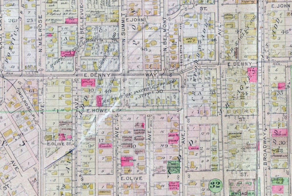
This street runs just shy of a mile through the gated Broadmoor neighborhood and golf course from its south entrance at E Madison Street at 36th Avenue E to its north entrance at E Foster Island Road.

An article in the May 18, 1924, issue of The Seattle Times noted that “[Broadmoor’s] roadways will not be public streets as in other residential sections of the city,” calling this “one of the unmatched features of this community,” and adds that “certain restrictions have been named both as to the class of residences that may be constructed as well as to those who will be admitted to membership.” The entire community being private was a first for Seattle, and in fact has never been repeated — the Sand Point Country Club was also established in the late 1920s, but was in unincorporated King County at the time and wasn’t annexed until 1953, whereas Windermere, established within Seattle city limits around the same time, was in fact platted as a traditional neighborhood, albeit one with private amenities.

Speaking of those “certain restrictions,” by the way, it seems that even in the 1920s one could not say openly in the press what one really meant. But Broadmoor deeds and their racial restrictive covenants are public record:

No part of said property hereby conveyed shall ever be used or occupied by any Hebrew or by any person of the Ethiopian, Malay or any Asiatic Race, and the party of the second part, his heirs, personal representatives or assigns, shall never place any such person in the possession or occupancy of said property or any part thereof, nor permit the said property, or any part thereof, ever to be used or occupied by any such person, excepting only employees in the domestic service on the premises of persons qualified hereunder as occupants and users and residing on the premises.

Broadmoor: Restricted Residential Park With Golf Course, 1924.
Broadmoor: Restricted Residential Park With Golf Course, 1924. Courtesy of the Seattle Municipal Archives, Identifier 1423.

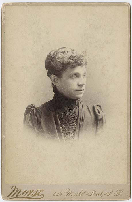
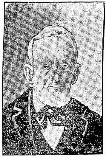
The origin of the Broadmoor name is not entirely clear. Did it have anything to do with the Broadmoor Golf Club in Colorado Springs, which opened in 1918? Or with the moors of Scotland, home of modern golf? The above-mentioned Seattle Times article, which is so similar to one in the Seattle Post-Intelligencer it must have been based on a Puget Mill Company press release, doesn’t say. (My friend, local historian Joe Mabel, notes the best-known Broadmoor in the U.K. is actually a high-security psychiatric hospital founded in 1863.) It may just be that “Broadmoor” was considered to be “elegant.” Perhaps the answer lies somewhere in the personal papers of Edwin Gardner Ames, Puget Mill president and one of the developers of Broadmoor along with Grosvenor Folsom and George W. Johnson.

Lakeview Boulevard E

Lakeview Boulevard E, which originated in David and Louisa Denny’s 1886 East Park Addition to the City of Seattle, is named for its view of Lake Union to the west. For a time part of the Pacific Highway (now routed onto Aurora Avenue N), it begins today at an overpass over Interstate 5 at Eastlake Avenue E and Mercer Street and goes a mile north to Boylston Avenue E and E Newton Street.

Interstate 5 blocks the view of the lake from much of the northern section of the street, but the southern section’s view is still more or less intact.

View of Lake Union looking northwest from Lakeview Boulevard overpass at Belmont Avenue E, May 12, 2018
View of Lake Union, Eastlake, and Wallingford, looking northwest from Lakeview Boulevard overpass at Belmont Avenue E, May 12, 2018. Photograph by Flickr user GabboT, licensed under Creative Commons Attribution-ShareAlike 2.0 Generic
View of Lake Union looking southwest from Lakeview Boulevard overpass at Belmont Avenue E, May 12, 2018
View of Lake Union, Westlake, and Queen Anne looking southwest from Lakeview Boulevard overpass at Belmont Avenue E, May 12, 2018. Photograph by Flickr user GabboT, licensed under Creative Commons Attribution-ShareAlike 2.0 Generic

E Louisa Street

Louisa Street was named for Louisa Boren Denny (1827–1916), who was 24 years old when she and her future husband David Thomas Denny (1832–1903) arrived in Seattle as part of the Denny Party. Their marriage in 1853 was the first in King County. The street name originates in the 1890 plat of the Denny-Fuhrman Addition to the City of Seattle, filed by the Dennys, Henry Fuhrman (Fuhrman Avenue E), and his wife, Carrie Fuhrman.

Daguerreotype portrait of Louisa Boren Denny, no date
Undated daguerreotype portrait of Louisa Boren Denny

Today, E Louisa Street begins at Minor Avenue E and goes a block east to Yale Avenue E. It resumes half a block east at the alley west of Eastlake Avenue E and makes it 2½ blocks before being stopped by Interstate 5 at Boylston Avenue E. Resuming in the Montlake neighborhood just west of W Montlake Place E, it then goes ¼ mile east to 25th Avenue E.

Eastlake Avenue E

Like NE Northlake Way, Eastlake Avenue E is so named because it runs along the shore of Lake Union — in this case, obviously, the eastern one. It, too, was earlier named Lake Avenue (in part), but this was changed as part of the Great Renaming of 1895. Ordinance 4044, Section 6 reads

That the names of Albert Street, Waterton Street, Lake Avenue and Green Street from Depot Street [changed by the same ordinance to Denny Way] to the shore of Lake Union at the northerly point of the Denny–Fuhrman addition, be and the same are hereby changed to Eastlake Avenue.

Today, Eastlake, at 2⁹⁄₁₀ miles in length, extends slightly farther north and south than the roadway mentioned in the ordinance. It starts in the south at the intersection of Court Place and Howell Street as Eastlake Avenue, then becomes Eastlake Avenue E a block north as it crosses Denny Way. From here to just south of E Galer Street it divides the Avenue: E; Street: E section of town from the Avenue: N; Street section. Just north of Portage Bay Place E it crosses Lake Union as the University Bridge, then continues on as the one-way–northbound Eastlake Avenue NE to 11th Avenue NE just north of NE 41st Street. (Southbound, it is fed by Roosevelt Way NE at NE Campus Parkway.)

Eastlake, like Fairview and Boren Avenues, is one of the few north–south streets in Seattle to have three different directional designations.

Looking northeast at the University Bridge from the Ship Canal Bridge in Seattle, July 2018
Looking northeast at the University Bridge from the Ship Canal Bridge, July 2018. Photograph by SounderBruce, Wikimedia Commons, licensed under Creative Commons Attribution-Share Alike 4.0 International

Turner Way E

This 275-foot-long diagonal street connects 23rd Avenue E to 24th Avenue E between E Ward Street and E Helen Street, allowing the arterial that begins at Jefferson Park on Beacon Hill to have “an easy grade to the Boulevard and Washington Park,” as the advertisement below for the Capitol Hill Addition, Division No. 6 in the October 28, 1905, issue of The Seattle Times explains. (The prediction that “in the near future there is almost sure to be a street car direct to the University” along this route was an accurate one.”

Advertisement for Capitol Hill Addition Division No. 6 in October 28, 1905, issue of The Seattle Times

The plat was filed at the request of H.S. Turner on May 25, 1905. Herbert S. Turner (1866–1941) was also involved in developing parts of Montlake, the International District, and the University District.

This was a route I took often as a child, and my working theory then was that it was called Turner because, well, you turned onto it when going from 23rd to 24th, or vice versa. Now, 40 years later, I know better.

Street sign at corner of Turner Way E, E Helen Street, and 24th Avenue E, August 24, 2009
Street sign at corner of Turner Way E, E Helen Street, and 24th Avenue E, August 24, 2009. Note that 24th Avenue E is incorrectly labelled 24th Avenue. Photograph by Benjamin Lukoff. Copyright © 2009 Benjamin Lukoff. All rights reserved.

Olive Way

This street is named for Olive Julia Bell Stewart (1846–1921), daughter of William Nathaniel Bell and Sarah Ann Peter Bell. Belltown and Bell Street were named for her father, Virginia Street for her sister, and Stewart Street for her husband, Joseph. She was one of the younger members of the Denny Party, being five years old when they initially settled at Alki Point in 1851.

Olive Julia Bell Stewart, circa 1860
Olive Bell, circa 1860

Originally called Olive Street in the Plat of an Addition to the Town of Seattle, Washington Territory, Laid Off by the Heirs of Sarah A. Bell, Deceased in 1872, it begins at Stewart Street just east of 3rd Avenue and goes one mile northeast, then east, to Broadway E and E John Street.

On September 3, 1920, The Seattle Times reported that:

Extension of Olive Street, by the establishment of a diagonal thoroughfare to be known as Olive Way, running from the intersection of Olive Street in a northeasterly direction to Boylston Avenue North and East Denny Way, is provided in an ordinance completed yesterday afternoon by the city engineer’s office…. The purpose of the whole improvement is to afford an east and west arterial highway, leading from the business district into the residence section of the city, supplementary to Pike Street and Pine Street.

According to the Seattle Post-Intelligencer’s June 24, 1923, issue, it “formally opened to traffic yesterday… a public improvement for which a fight extending over a period of fifteen years was waged,” so this 1920 ordinance was certainly not the first time an improved connection between Downtown and Capitol Hill was proposed. I’m not entirely sure what happened in 1908 the writer might have been referring to, but perhaps it was the Bogue Plan and he was off by a few years?

Route of Olive Way drawn on 1912 Baist Atlas plate of Capitol Hill
Portion of plate 7, Baist’s Real Estate Atlas of Seattle (1912), planned route of E Olive Way drawn in pencil. The portion of E Olive St between Melrose and Bellevue Avenues is now E Olive Place.

It appears from the 1921 ordinance establishing the extension that the Olive Way name was originally only applied to the street east of Bellevue Avenue; it wasn’t until 1926 that it was extended west to the street’s origin.

One curiosity about E Olive Way addresses: the block numbers are out of sync with other east–west streets in the area. For example, the block east of Melrose Avenue is the 300 block, east of Bellevue Avenue the 400 block, east of Summit 500, east of Belmont 600, east of Boylston 700, etc. — for other streets. For E Olive Way, east of Melrose is 1300, east of Bellevue 1400 and 1500, east of Summit and Belmont 1600, east of Boylston 1700, etc. — essentially continuing on from Downtown, not starting over at what is now the route of Interstate 5, as the other streets do. 

Pike Street

Pike Street first appears in the Plat of an Addition to the Town of Seattle as Laid Out by Arthur A. Denny, filed on April 5, 1869. It was named by Denny for John Henry Pike (1814–1903), best known for being the architect and builder of the original Territorial University of Washington in 1861. This article by Rob Ketcherside is the most comprehensive information available online about Pike. “Early Pikes in Seattle,” by Stuart Pike, is also worth a read. (Also of note: Pike’s son, Harvey Lake Pike [1842–1897], was the first person to try to connect Lake Washington’s Union Bay to Lake Union’s Portage Bay by a canal. This was unsuccessful, but he did end up platting the land in 1869 as Union City. His E North Street [north of the proposed canal] survives to this day.)

John Pike, from his obituary in the November 22, 1903, issue of The Seattle Times

In the original plat, Pike Street (as well as Union and Pine Streets) begins at Front Street — today’s 1st Avenue — but today it begins on the Elliott Bay waterfront at Alaskan Way as the Pike Street Hillclimb. Pike Street proper begins at Pike Place (home of the eponymous market) and Post Alley (underneath the Market Theater sign), both shown below, and makes it a full 1⅔ miles to just past 18th Avenue in the Central District before being interrupted. It then resurfaces at 23rd Avenue and goes another ⅘ of a mile to Grand Avenue in Madrona, a few blocks east of Lake Washington.

Pike Place Market entrance, corner of Pike Street and Pike Place, 2012
Pike Place Market entrance, corner of Pike Street and Pike Place, 2012. Photograph by kissmykumbaya, Wikimedia Commons (public domain)

Boyer Avenue E

This street, which runs just over 1⅓ miles from Lake Washington Boulevard E northwest to Fuhrman Avenue E, was established in 1905 as part of Interlaken, an Addition to the City of Seattle, platted by the Interlaken Land Company, whose president was John E. Boyer (1866–1961).

Advertisement for Interlaken in the Seattle Post-Intelligencer, May 30, 1906

Madison Street

Madison Street — another of Seattle’s “first streets” — was named for James Madison, president of the United States from 1809 to 1817. It is the only street in town that stretches, uninterrupted, from the salt water of Elliott Bay and Puget Sound to the fresh water of Lake Washington.

Originating as the McGilvra Road in 1861, Madison Street begins on the Elliott Bay waterfront at Alaskan Way and ends 3¾ miles northeast of there at a small fishing pier, just east of 43rd Avenue E and north of Madison Park Beach. Apart from a slight bend to the northeast at 22nd Avenue, it is as straight as an arrow from beginning to end.

Signs at corner of E Madison Street and 43rd Avenue E, October 11, 2009
Signs at corner of E Madison Street and 43rd Avenue E, October 11, 2009. Photograph by Benjamin Lukoff. Copyright © 2009 Benjamin Lukoff. All rights reserved.

E Foster Island Road

This street, which runs about ¼ mile from Lake Washington Boulevard E to the beginning of the Foster Point Trail, all within the Washington Park Arboretum, was without a name until 1968, when it was named for the island in Union Bay to which it led. (It remained unsigned until a few decades later, however. There was no sign at the intersection until at least the 1990s, as I know since my parents’ house was at the south end of the Arboretum and I drove or biked by there weekly, if not more often, while I was growing up.)

Foster Island is known by the Duwamish tribe, who once used it as a burial ground, as Stitici, or ‘little island’. It was named by the settlers for Joel Wellington Foster, who came to Washington in the 1870s from St. Joseph, Missouri. He is said to have donated the island to the city in one HistoryLink article, but another says the city bought it in 1917.

(Note added November 6, 2022: David B. Williams, the “Street Smart Naturalist,” recently posted The Lost Islands of Seattle, in which he wrote that he had seen various sources for the name Foster but none with good documentation. I asked him about the HistoryLink article I cite above:

I’m embarrassed to have missed that, but of course he’s right. So if not Joel Wellington Foster, then who? The search continues

E Jansen Court

When I saw that E Jansen Court fell within Jansen’s Addition to the City of Seattle, filed in 1889 by Mary Jansen, I thought “Ah, another case of a landowner naming a street after themselves,” though I did note it was rare to see a single woman’s, and no one else’s, name on such a plat. But once I got a good look at the plat map I realized that, as is often the case, things weren’t quite that simple.

There’s no Jansen Court on this map — instead, John Street keeps its name as it crosses Mulford Street (now 20th Avenue E). So what happened?

In 1954, E John Street — the arterial east of 21st Avenue E — and E Thomas Street — the arterial west of 20th — were connected directly to each other by lopping off a small part of Miller Playfield (creating Miller Triangle in the process). As part of this, a one-way extension of John was built east of 20th, connecting with the arterial just before 21st. But this meant what is now Jansen Court needed a new name (remember, it originally remained John Street after crossing 20th). The powers that be decided to simply name it after Mary Jansen (or her subdivision). So even though she hadn’t named it after herself, 65 years after she filed her plat Jansen finally had her name on a street sign.

Portage Bay Place E

This street, which runs ³⁄₁₀ of a mile from Fuhrman Avenue E to E Allison Street, was established as an alley in 1890 as part of the Denny–Fuhrman Addition to the City of Seattle, but only received a name in 1936. It was named for Portage Bay, the eastern arm of Lake Union, which it parallels. Portage Bay was in turn named for the portage from Union Bay (part of Lake Washington) to Lake Union over the Montlake Isthmus, which is today the Montlake Cut of the Lake Washington Ship Canal.

Sign at corner of Fuhrman Avenue E, Eastlake Avenue E, and Portage Bay Place E, August 24, 2009
Sign at corner of Fuhrman Avenue E, Eastlake Avenue E, and Portage Bay Place E, August 24, 2009. Portage By Pl is an error; it should read Portage Bay Pl E, as it’s [[Portage Bay] [Place]], not [[Portage] [Bay Place]]. The original Red Robin restaurant was founded at this intersection in 1940. It has since been demolished, but I’ve seen imagery of this sign — including the error — on the walls of other Red Robin locations. Photograph by Benjamin Lukoff. Copyright © 2009 Benjamin Lukoff. All rights reserved.

Canterbury Lane E

This stub of a street in Madison Park serves mostly as a driveway to the Canterbury Shores Condominiums, although it is public right-of-way. It appears to have been dedicated to the public in 1965, and its name was changed from 40th Avenue E the next year.

My assumption is the street was named for the condominiums, and that the condominiums were named for the Canterbury subdivision to the south, which was laid out in 1951. According to Shaping Seattle Architecture: A Historical Guide to the Architects, John L. Scott’s Canterbury Land Company purchased the land in 1938. (My further assumption is that the subdivision was named for Canterbury, England.)

E Interlaken Boulevard

The establishment of E Interlaken Boulevard — the first of Seattle’s Olmsted parks and boulevards we’re covering — was first proposed, according to Seattle parks historian Don Sherwood, in 1903 as Volunteer Hill Parkway. Two years later, the current name was adopted. There is speculation, but no documentation, that it was named for the Swiss resort town of that name. Ask a Seattleite how to pronounce “Interlaken” and you may hear either lake or lock, the latter being more common according to an informal Twitter poll I ran (but the former being the one I grew up with).

Interlaken Boulevard runs for about 1⅔ miles west to east from Delmar Drive E, by Seattle Preparatory School on Capitol Hill, to Lake Washington Boulevard E, in the Washington Park Arboretum. The middle section, between 19th and 21st Avenues E, is closed to motor vehicles and functions as a pedestrian and bicycle trail. The name also appears on Interlaken Drive E and Interlaken Place E — and should not be confused with Interlake Avenue N, a street in North Seattle.

Advertisement for Interlaken in the Seattle Post-Intelligencer, May 30, 1906
Street sign at corner of Lake Washington Boulevard E and E Interlaken Boulevard, October 11, 2009. Copyright © 2009 Benjamin Lukoff. All rights reserved.
Street sign at corner of Lake Washington Boulevard E and E Interlaken Boulevard. Photograph by Benjamin Lukoff, October 11, 2009. Copyright © 2009 Benjamin Lukoff. All rights reserved.

E North Street

Seattle has a number of streets whose names incorporate directions, such as Northlake Way, Eastern Avenue, Eastlake Avenue, Western Avenue, Westlake Avenue, and Southern Street. But the one I drove by most growing up — and the only one to simply bear the name of a direction in its uncompounded, nominal form — is E North Street, which runs between E Montlake Place E and 24th Avenue E in Montlake, just south of the 520 interchange.

Two questions should spring to mind with a street name like this: North of what? and What happened to South Street?

Portion of Plan of Union City, 1869

The answer to the first question is north of where Harvey Lake Pike, son of John Henry Pike of Pike Street fame, had planned to dig a canal between Union Bay and Portage Bay.

And the answer to the second is that it seems to have been subsumed in Roanoke Street when the Glenwilde Addition was platted in 1925. But North Street’s name was never changed.

(There did use to be an East Street and a West Street, too, as you can see on the full plat map. If I read the quarter section map correctly, East Street is now 24th Avenue E, and State Route 520 now covers the land where West Street would have been.)

E Barbara Bailey Way

As of this writing, Seattle’s newest street name is E Barbara Bailey Way — formerly the block of E Denny Way between Broadway and 10th Avenue E.

Barbara Bailey, who died on September 1, 2018, was best known for Bailey/Coy Books, which she founded on Broadway in 1982. As Seattle Mayor Jenny Durkan wrote,

Barbara’s commitment to action made her an early pioneer for LGBTQ+ rights. Her bookstores – B. Bailey Books and Bailey/Coy Books – were nationally beloved independent book stores that regularly brought communities together and hosted renowned authors. They were also safe and welcoming spaces for the LGBTQ+ community, particularly for those just coming out and during the height of anti-LGBTQ+ actions.

Barbara Bailey Way is one of a number of “festival streets” in the city of Seattle.