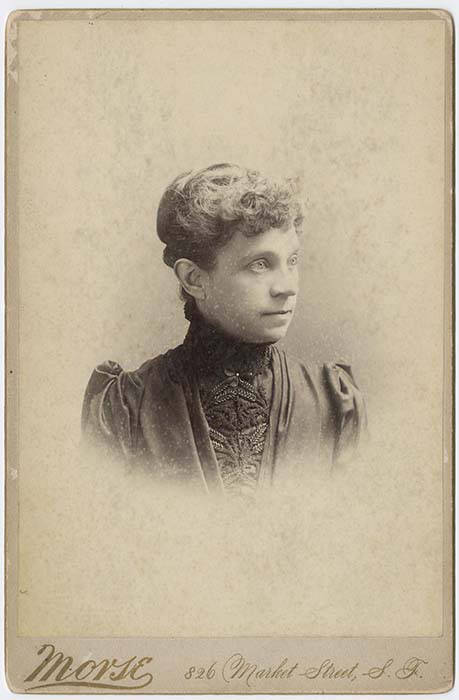
This street is named for Olive Julia Bell Stewart (1846–1921), daughter of William Nathaniel Bell and Sarah Ann Peter Bell. Belltown and Bell Street were named for her father, Virginia Street for her sister, and Stewart Street for her husband, Joseph. She was one of the younger members of the Denny Party, being five years old when they initially settled at Alki Point in 1851.
Originally called Olive Street in the Plat of an Addition to the Town of Seattle, Washington Territory, Laid Off by the Heirs of Sarah A. Bell, Deceased in 1872, it begins at Stewart Street just east of 3rd Avenue and goes one mile northeast, then east, to Broadway E and E John Street.
On September 3, 1920, The Seattle Times reported that:
Extension of Olive Street, by the establishment of a diagonal thoroughfare to be known as Olive Way, running from the intersection of Olive Street in a northeasterly direction to Boylston Avenue North and East Denny Way, is provided in an ordinance completed yesterday afternoon by the city engineer’s office…. The purpose of the whole improvement is to afford an east and west arterial highway, leading from the business district into the residence section of the city, supplementary to Pike Street and Pine Street.
According to the Seattle Post-Intelligencer’s June 24, 1923, issue, it “formally opened to traffic yesterday… a public improvement for which a fight extending over a period of fifteen years was waged,” so this 1920 ordinance was certainly not the first time an improved connection between Downtown and Capitol Hill was proposed. I’m not entirely sure what happened in 1908 the writer might have been referring to, but perhaps it was the Bogue Plan and he was off by a few years?
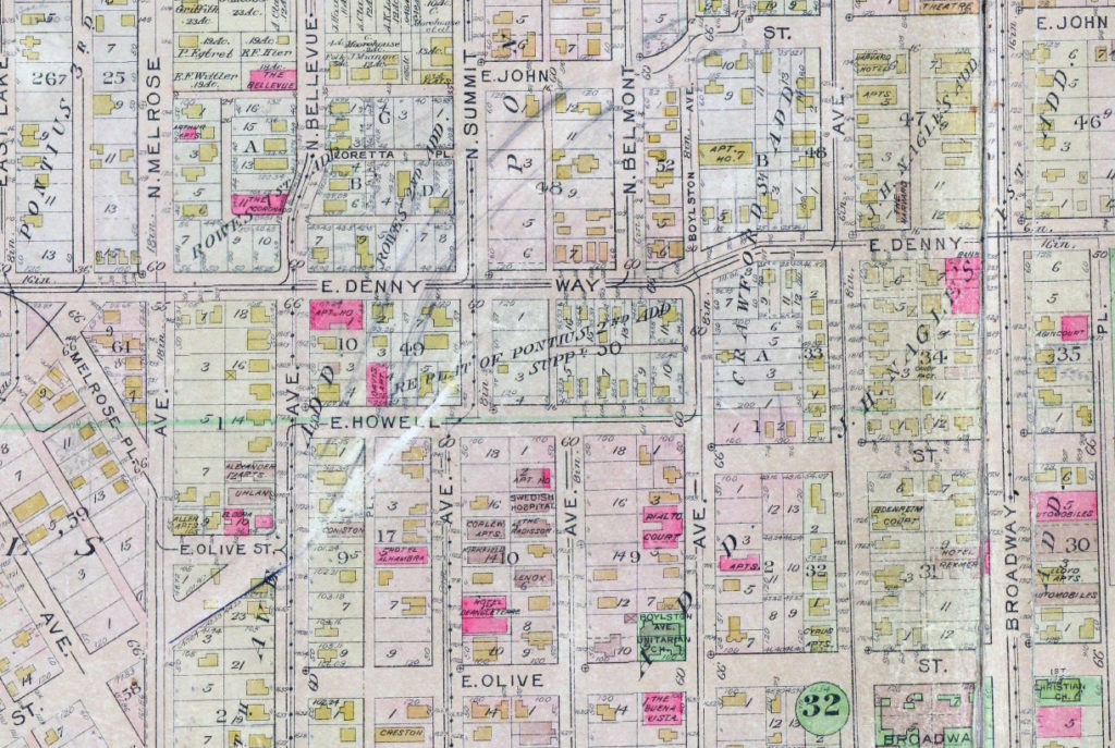
It appears from the 1921 ordinance establishing the extension that the Olive Way name was originally only applied to the street east of Bellevue Avenue; it wasn’t until 1926 that it was extended west to the street’s origin.
One curiosity about E Olive Way addresses: the block numbers are out of sync with other east–west streets in the area. For example, the block east of Melrose Avenue is the 300 block, east of Bellevue Avenue the 400 block, east of Summit 500, east of Belmont 600, east of Boylston 700, etc. — for other streets. For E Olive Way, east of Melrose is 1300, east of Bellevue 1400 and 1500, east of Summit and Belmont 1600, east of Boylston 1700, etc. — essentially continuing on from Downtown, not starting over at what is now the route of Interstate 5, as the other streets do.
Born and raised in Seattle, Benjamin Donguk Lukoff had his interest in local history kindled at the age of six, when his father bought him settler granddaughter Sophie Frye Bass’s Pig-Tail Days in Old Seattle at the gift shop of the Museum of History and Industry. He studied English, Russian, and linguistics at the University of Washington, and went on to earn his master’s in English linguistics from University College London. His book of rephotography, Seattle Then and Now, was published in 2010. An updated version came out in 2015.