Lewis Place SW

This West Seattle street was created in 1919 as part of the plat of Kirkwood, an Addition to the City of Seattle, filed by Isabell A. Kirkwood (1833–1926), who named the nearby Rutan Place SW after her maiden name. The plat document was notarized by lawyer Frank Pardee Lewis (1851–1938), and since I can find no connection to any other Lewis, I assume Kirkwood named it after him. According to Capitol Hill Seattle, Lewis, who lived at the corner of 18th Avenue E and E Denny Way,

…was from Triangle, New York, and moved to Seattle in 1887. He was a prominent attorney with offices in the Lowman Building downtown starting in 1890. He went to the office almost every day until his death in 1938. Mr. Lewis was elected to the Washington State Legislature in 1895; he was also a member of the Scottish Rite Masons.

Lewis Place SW begins at SW Hudson Street between Erskine Way SW and California Avenue SW and goes just over 550 feet northwest, then north, to Erskine Way SW just west of California.
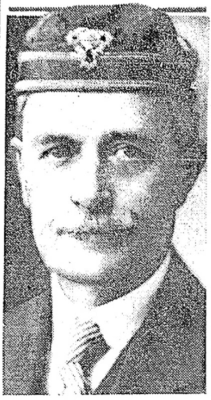
Frank Pardee Lewis, from his Seattle Times obituary, April 12, 1938

Rutan Place SW

This West Seattle street was created in 1919 as part of the plat of Kirkwood, an Addition to the City of Seattle, filed by Isabell A. Kirkwood, née Rutan (1833–1926), widow of William W. Kirkwood (1835–1915).

Rutan Place SW goes around 350 feet south from SW Edmunds Street between 44th Avenue SW and 45th Avenue SW to a dead end just short of 45th, though the undeveloped right-of-way does continue to that street.

Beach Drive SW

Like Harbor Avenue SW, Beach Drive SW was once part of Alki Avenue SW. It became Beach Drive sometime between 1912 and 1920. In contrast to Alki and Harbor Avenues, most of Beach Drive’s beaches are private, though there is a long public stretch at the Emma Schmitz Memorial Outlook, as well as Lowman Beach Park at the south end.

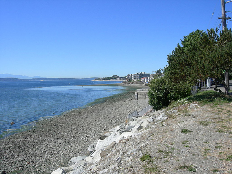
Puget Sound shore looking northwest along Beach Drive with Alki Point in distance, August 2007
Puget Sound shore looking northwest along Beach Drive toward Alki Point, August 2007. Photograph by Joe Mabel, Wikimedia Commons, licensed under Creative Commons Attribution-ShareAlike 3.0 Unported

Beach Drive SW begins at Alki Avenue SW just south of Alki Point and goes just over 3 miles southeast to Trail #1 at Lincoln Park.

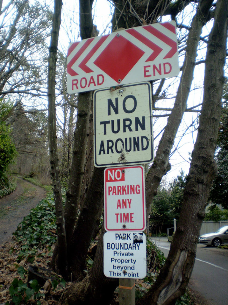
Signs at Beach Drive SW road end, March 2013
Signs along Beach Drive SW a little under 1,000 feet north of Lincoln Park. The park boundary sign is unofficial. Its placement appears to imply that the tail end of Beach Drive is private, which it’s not. Nor is the driveway (SW Othello Street) on the left. Photograph by Benjamin Lukoff, March 10, 2013. Copyright © 2013 Benjamin Lukoff. All rights reserved.

S Graham Street

This street was named for Walter Graham (1828–1919), who came to Seattle in 1853. Three years later, he married Eliza Mercer, second daughter of Thomas Mercer (Mercer Street, Mercer Island), though she unfortunately died six years later. With his third wife, Elizabeth Crammond (or Crommon), he had a daughter, Nellie, who later married David Thomas Denny II, son of early settler David Thomas Denny (Denny Way). Graham’s brother, David, came to Seattle four years after his brother, and was one of the city’s first schoolteachers. He ended up marrying Eliza Mercer’s sister, Susannah.

Graham sold some of his southeast Seattle land in 1865 to Everett Smith, who filed the plat of Brighton Beach in 1890 on which what was then Graham Avenue appeared. He once owned what is today Seward Park on Bailey Peninsula, which was previously known as Graham’s Peninsula.

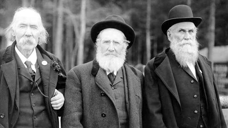
He was present at the Battle of Seattle in 1856, and is pictured below with fellow survivors Ira Woodin and Carson D. Boren (Boren Avenue).

Ira Woodin, Carson Boren, and Walter Graham, November 3, 1905
Ira Woodin, Carson Boren, and Walter Graham at Alki Point, November 3, 1905

S Graham Street begins in the east at Wilson Avenue S and goes 2⅒ miles west to Swift Avenue S and 20th Avenue S, just east of Interstate 5. After a short segment between Corgiat Drive S and 16th Avenue S just west of the freeway, it next appears in West Seattle. Betwen 16th Avenue SW and 22nd Avenue SW, it alternates between roadway, stairway, and pathway, and there is a similar situation between 25th Avenue SW at Delridge Way SW and High Point Drive SW at Bataan Park. SW Graham Street begins again at High Point Drive SW and SW Raymond Street and goes 1¼ miles to its end at 50th Avenue SW,

California Avenue SW

This West Seattle street was established in 1888 as part of the First Plat of West Seattle by the West Seattle Land and Improvement Company. As “most of [its] capital came from San Francisco,” I would assume that is why California Avenue was given its name.

California Avenue SW — a major West Seattle arterial connecting the Admiral, Alaska, and Morgan Junctions (three commercial hubs named after long-gone streetcar line intersections) — runs 4½ miles from California Lane SW in the north, past which it turns into California Way SW on its way down the hill to the waterfront, to SW Sullivan Street in the south. Beyond there it exists as a few short segments, then briefly as part of the SW Brace Point Drive–SW Barton Street arterial, and lastly as a nearly mile-long residential street that ends at Marine View Drive SW.

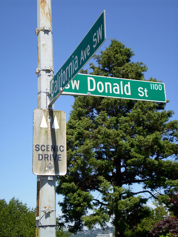
Sign at corner of SW Donald Street and California Avenue SW, July 4, 2011
Sign at corner of SW Donald Street and California Avenue SW, July 4, 2011. Photograph by Benjamin Lukoff. Copyright © 2011 Benjamin Lukoff. All rights reserved.

S Angeline Street

This street lies mostly in Columbia City, where its name originated, and Seward Park, with a few blocks in Beacon Hill and even fewer in West Seattle. It almost reaches Puget Sound at Beach Drive SW, and does reach Andrews Bay of Lake Washington at Lake Washington Boulevard S.

As noted, the name Angeline Street originated in Columbia City, in this 1891 Plat of Columbia, filed at the request of James Kippen Edmiston by Percy W. Rochester and John I. Wiley of the Washington Co-operative Home Company. 

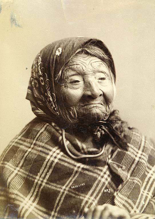
Princess Angeline was born Kikisoblu, the daughter of Si’ahl [siʔaɫ], better known in English as Chief Seattle of the Duwamish and Suquamish Tribes. Her date of birth is unknown; Wikipedia gives it as ca. 1820, whereas this article posted by the Duwamish Tribe, written by elementary school students based on HistoryLink essays, gives it as 1828. She died May 31, 1896.

Princess Angeline received her English name from Catherine Broshears Maynard, wife of David Swinson (“Doc”) Maynard, one of the earliest Seattle settlers. As the HistoryLink Elementary article puts it,

Chief Seattle’s oldest daughter was named Kikisoblu. She became friends with many of Seattle’s founding families. One of her friends was Catherine Maynard. She felt that Kikisoblu should have a name that would let the white settlers know that she was the daughter of a great chief. So she called her Princess Angeline. She thought that name was prettier than the name Kikisoblu.

Photograph of Kikisoblu, or Princess Angeline, by Frank La Roche, ca. 1893
Photograph of Princess Angeline (Kikisoblu), by Frank La Roche, ca. 1893

Fauntleroy Way SW

This 4-mile-long thoroughfare runs from the west end of the West Seattle Bridge to Brace Point, passing Morgan Junction, Lincoln Park, and the Fauntleroy Ferry Terminal on the way. It was named for Fauntleroy Cove, location of that terminal, from which riders depart for Vashon Island and Southworth, on the Kitsap Peninsula.

Fauntleroy Cove was itself named after Robert Henry Fauntleroy by George Davidson, Fauntleroy’s future son-in-law. They were both members of the U.S. Coast Survey. He is one of three Fauntleroys whose names appear on Seattle street signs — Ellinor Drive W and Constance Drive W are named for Mounts Ellinor and Constance in the Olympic Mountains, themselves named by Davidson after his future wife and sister-in-law, respectively.