Dzidzilalich

As I wrote in “Dzidzilalich” to be honorary name for Elliott Way, Alaskan Way, the Lushootseed place name Dzidzilalich has become Seattle’s newest honorary street name. Pronounced dzee-dzuh-lah-leech, it means means “Little Crossing Over Place,” and is the name of a Duwamish village whose site is now covered by Downtown Seattle.

Mockup of a brown street sign reading Dzidzilalich

The designation applies to Elliott Way for its entire length, beginning at Western Avenue and Bell Street and heading southeast to where it meets Alaskan Way at Pine Street. It then continues on Alaskan Way to its intersection with S Dearborn Street, for a total length of 1¼ miles. (Why it doesn’t apply to Alaskan Way for its entire length, I am not sure.)

Where springs of clear water bubbled from the earth and the beach was sandy and free from rocks, there the Indians camped. Such a choice spot was Tzee-tzee-lal-litch, which Arthur Denny called Spring Street.

Sophie Frye Bass, “Pig-Tail Days in Old Seattle

“Dzidzilalich” to be honorary name for Elliott Way, Alaskan Way

Contrary to what I wrote in “Elliott Way” just a placeholder name, it sounds like the new road connecting Western Avenue at Bell Street to Alaskan Way at Pike Street will in fact carry the official name of Elliott Way. To quote from a post on Mayor Bruce Harrell’s blog,

Mayor Bruce Harrell, City Council President Debora Juarez, and key waterfront leaders are proposing to establish an honorary name for Alaskan Way and Elliott Way, between S Dearborn St and Bell St. “Dzidzilalich” (pronounced: dzee-dzuh-lah-leech) means “Little Crossing Over Place” in the Coast Salish language Lushootseed. This honorary name would recognize the deep tribal history and culture on Seattle’s waterfront. The Dzidzilalich street name designation would be honorary; the legal name of “Alaskan Way” would not change nor would the official addresses on the street.

As I wrote in Rob Mattson Way, honorary renamings differ from official (re)namings in three important ways:

  • They are done via resolution rather than ordinance
  • They do not replace the original street name in official records and addresses
  • They appear on brown, rather than green, signs

The Waterfront Seattle page on Dzidzilalich notes that “The Suquamish and Muckleshoot Tribal Councils provided guidance to the city of Seattle’s Mayor’s Office, the Office of the Waterfront and Civic Projects, and the Seattle Department of Transportation in the process of selecting Dzidzilalich as the honorary name for this roadway.”

Mockup of a brown street sign reading Dzidzilalich

I am glad to hear that this new street will carry a Lushootseed name. To the best of my knowledge only Duwamish Avenue S and Shilshole Avenue NW do so currently. To have a major downtown street with a name like this is long overdue.

I should also note that, if this is what the tribes want, I support the proposal — and though I have some issues with it, it is not my place to tell tribal members they deserve more. I have no idea what the negotiations looked like. That said, I do have some issues with the proposal.

First, “Elliott Way” remains an incredibly uncreative name for the new roadway. I said it before and I’ll say it again: “This is a [missed] opportunity to commemorate someone, or something, new, rather than Jared, George, Samuel, or Jesse Elliott (apparently no one is sure just which Elliott the bay is named after)!” There is nothing wrong with dead white men, but take a look at the tag cloud at the bottom of this post for proof that they are far overrepresented when it comes to Seattle street names.

Second, honorary names simply don’t carry the same heft as official ones. No one calls 19th Avenue between E Madison Street and E Union Street “Rev. Dr. S. McKinney Ave,” or 15th Avenue S between S Nevada Street and S Columbian Way “Alan Sugiyama Way.” But they do call Mary Gates Memorial Drive NE, E Barbara Bailey Way, Edgar Martinez Drive S, S Roberto Maestas Festival Street, etc., by those names… because they have no other choice.

I do like the idea of giving Alaskan Way an honorary name. It is far too long and important a street to officially rename without causing a lot of issues. The last time we did something like that was when Empire Way became Martin Luther King Jr. Way in the 1980s. I’m glad that happened, but think the process would be even more drawn out and controversial today. (However, if the street that runs along our waterfront carried the name of, say, a Confederate general, I’d be among the first to call for those signs to come down.) But why just this portion of Alaskan Way? To the best of my knowledge we’ve never given an existing street an honorary name for its entire length. Why not start here, from E Marginal Way S all the way to W Garfield Street?

In addition, one reason behind honorary namings is that existing addresses don’t need to be changed. But Elliott Way is new. There are no existing addresses. Why not, then, simply call it Dzidzilalich, and give Alaskan Way another honorary name? Or, why not give Alaskan Way the honorary name Dzidzilalich for its entire length, and give Elliott Way a different name that “elevate[s] Coast Salish tribal history and culture,” as the mayor’s blog puts it?

A few asides: I, personally, would prefer the spelling Dᶻidᶻəlalič, which uses Lushootseed orthography. (If Port Angeles can do it with their Klallam-language street signs, so can we!) And I notice that only the Suquamish and Muckleshoot tribes are mentioned as having been consulted. I wonder if representatives of the Duwamish Tribe were given a chance to weigh in as well. (My guess is they weren’t, as they are not federally recognized, while the Suquamish and Muckleshoot are, and oppose the efforts of the Duwamish to gain recongition. There is a long-standing controversy regarding the legitimacy of the Duwamish as the present-day representatives of Chief Seattle’s people. See The Politics of Paying Real Rent Duwamish in Seattle Met for an interesting take on the issue.)

Regardless of what happens, though, I am glad to see “Dzidzilalic” return to Seattle’s waterfront.

Where springs of clear water bubbled from the earth and the beach was sandy and free from rocks, there the Indians camped. Such a choice spot was Tzee-tzee-lal-litch, which Arthur Denny called Spring Street.

Sophie Frye Bass, “Pig-Tail Days in Old Seattle

Chelan Avenue SW

This street was created in 1895 as part of the plat of Seattle’s tide lands, which featured streets named for letters of the alphabet, American cities, American states, prominent local politicians, and places in Washington. Among the latter were S Spokane Street, Duwamish Avenue S, Klickitat Avenue SW, and our current subject, Chelan Avenue SW. It appears to have been named for Lake Chelan (an anglicization of ščəl̕ámxəxʷ, meaning ‘deep water’ in Nxaʔamxcín, the language spoken by the Chelan people) — the largest natural lake in Washington and the third deepest lake in the United States (after Crater and Tahoe).

Chelan Avenue SW begins at SW Spokane Street and goes ¼ mile northwest to the West Duwamish Waterway.

Klickitat Avenue SW

Like S Spokane Street, Colorado Avenue S, and Utah Avenue S, this street was created in 1895 as part of the plat of Seattle’s tide lands. As I wrote in S Spokane Street,

Streets in this plat that were not extensions of already existing ones, such as Commercial Street, were named after letters of the alphabet, American cities, American states, prominent local politicians, and places in Washington.

Those places in Washington were Chelan, Duwamish, Kitsap, Klickitat, Queets, Quilcene, Quileute, Quinault, Spokane, Vashon, Wenatchee, and Whatcom, many (though not all) of which were themselves named after Native American groups or people. (Chelan, Duwamish, Klickitat, and Spokane are the only street names that remain.) In this particular case, we have the Klickitat River, a tributary of the Columbia in south central Washington, itself named for the Klickitat people.

Klickitat Avenue SW begins at 16th Avenue SW and goes around ⅖ of a mile southeast to SW Manning Street, all on Harbor Island.

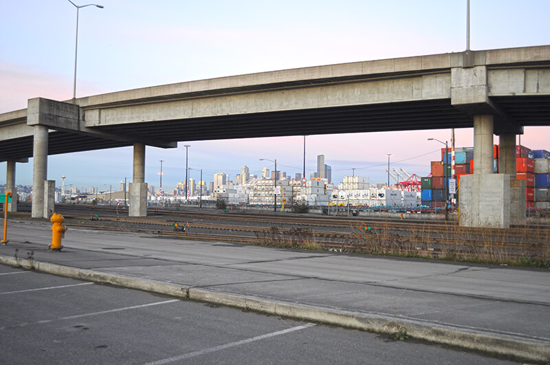
Seattle skyline from Klickitat Avenue
Looking northeast toward the Seattle skyline from Harbor Island, December 2011. The Klickitat Avenue Bridge is in the foreground. Photograph by Joe Mabel, Wikimedia Commons, licensed under Creative Commons Attribution-ShareAlike 3.0 Unported

Duwamish Avenue S

This street was created in 1895 as part of the Seattle Tide Lands plat. As I wrote in S Spokane Street, “Streets in this plat that were not extensions of already existing ones, such as Commercial Street, were named after letters of the alphabet, American cities, American states, prominent local politicians, and places in Washington”; these last included Chelan, Duwamish, Kitsap, Klickitat, Queets, Quilcene, Quileute, Quinault, Spokane, Vashon, Wenatchee, and Whatcom, the ones in italics still existing today. It seems strange to me that the Duwamish name would have been applied to such a short street, it being the name of Seattle’s principal river (dxwdəw) and indigenous inhabitants, the Duwamish Tribe (dxʷdəwʔabš), but there you have it. At least it still exists.

In “Elliott Way” just a placeholder name, I quote an email I wrote to the Seattle City Council and the Waterfront Seattle Program in December 2020 which read, in part, “I urge you… to name [Elliott Way] something else. The Duwamish people, for example, have Duwamish Avenue S named for them (actually more likely for the river…), but it is an insignificant street 2/10 of a mile long hidden under the Spokane Street Viaduct and the Alaskan Freeway. Perhaps Duwamish Avenue would be a better choice, if the tribe approved?” I still think this would be a good idea (and it would give us another naming opportunity as well). They did respond favorably, said they had been thinking along the same lines, and as of January 2022 “continue to coordinate with the tribes and other partners on a proposed name.” I hope they come up with something soon, as what is still being referred to as Elliott Way is due to open by year’s end!

As I mentioned in my email, Duwamish Avenue S is 2/10 of a mile long, beginning at E Marginal Way S and ending at a Port of Seattle road just south of the West Seattle and Spokane Street Bridges.

Update as of February 2, 2023: I posted an article last month  “Dzidzilalich” to be honorary name for Elliott Way, Alaskan Way — noting that, in fact, the roadway will be known as Elliott Way… but will carry the honorary name “Dzidzilalich.” So it seems “Elliott Way,” after all, is unfortunately not just a placeholder name, and for now the Duwamish name remains confined to this obscure thousand-foot-long street.

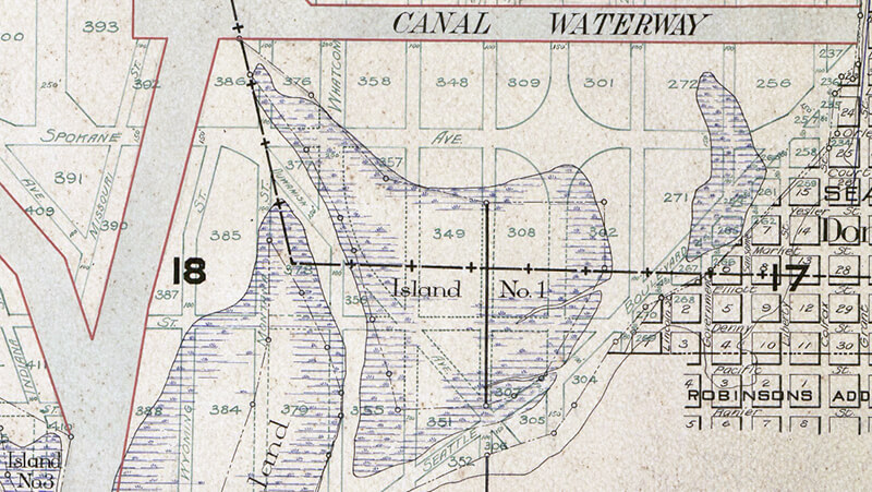
Portion of 1895 plat of Seattle Tide Lands showing Duwamish Avenue, as platted from Spokane Avenue (now Street) in the northwest to Seattle Boulevard in the southeast. The visible portion of Seattle Boulevard is now Diagonal Avenue S, Whatcom Avenue is now E Marginal Way S, and Grant Street is now Airport Way S.

Tillicum Road SW

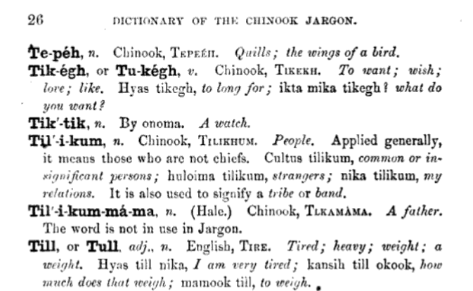
This street, which was created as part of the unrecorded plat of R.B. Wark’s 2nd Addition, is named for the Chinook Jargon word tillikum, meaning ‘people’.

Entry for 'tilikum' in A Dictionary of the Chinook Jargon, Or, Trade Language of Oregon by George Gibbs, 1863
Entry for ‘tilikum’ in A Dictionary of the Chinook Jargon, Or, Trade Language of Oregon, by George Gibbs (published 1863)

Tillicum Road SW begins at 46th Avenue SW just south of SW Thistle Street and goes ¼ mile southeast to SW Donovan Street, with a short interruption between house numbers 8470 and 8471 on the northwest and 8487 and 8488 on the southeast where the public right-of-way seems to be blocked by a private fence, effectively converting the road on either side into private driveways.

Arapahoe Place W

This street was created in 1890 as part of the plat of the Bluff Park Addition to the City of Seattle, filed by Avery Parker of Arapahoe County, Colorado. Originally Arapahoe Avenue, it appears to have been named after that county, whose seat at the time was Denver. (The city was split off from the rest of the county in 1902.) Arapahoe County was itself named in 1861 for the Arapaho, a Native American people whose territory once included the area, but were subsequently forced onto reservations in Wyoming and Oklahoma.

Today, Arapahoe Place W begins at W Dravus Street and goes 450 feet north to just beyond W Prosper Street. It then resumes half a block north at W Bertona Street and goes ¼ mile north to W Emerson Street, along the south edge of Discovery Park.

Seattle Boulevard S

In 2010, the portion of Airport Way S between 4th Avenue S and 6th Avenue S was renamed Seattle Boulevard S at the request of the adjacent property owners, restoring a name that disappeared from the map in 1931.

As I explain in Diagonal Avenue S,

There were a series of roads following the semicircular curve of Elliott Bay from Downtown to the Duwamish River before the tideflats were filled in: first Beach Road (or River Road), then the Grant Street Bridge, which in turn became Seattle Boulevard once the fill was complete. Sometime before 1918… the portion of Seattle Boulevard that ran northeast–southwest (the southern third of the semicircle) was renamed Diagonal Avenue. (In 1931, the rest of Seattle Boulevard was renamed Airport Way.)

Seattle Boulevard was obviously named for the city, which itself was named after Si’ahl [siʔaɫ], better known in English as Chief Seattle of the Duwamish and Suquamish Tribes.

Since 2010, then, there have been two streets in the city that bear its and siʔaɫ’s name: Seattle Boulevard S and SW Seattle Street.

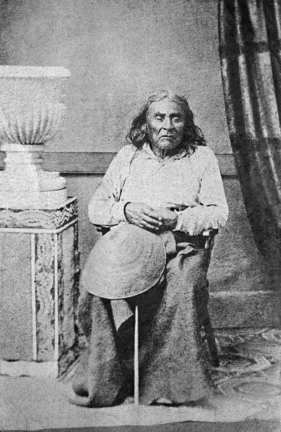
siʔaɫ, or Chief Seattle
The only known photograph of siʔaɫ, or Chief Seattle (1786?–1866), taken by E.M. Sammis in 1864
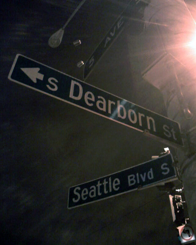
Sign at corner of S Dearborn Street and Seattle Boulevard S, January 30, 2011
Sign at corner of S Dearborn Street and Seattle Boulevard S, January 30, 2011. Photograph by Benjamin Lukoff. Copyright © 2011 Benjamin Lukoff. All rights reserved.

Bernie Whitebear Way

This Discovery Park road was named for Bernie Whitebear (1937–2000), a Native American activist who co-founded the Seattle Indian Health Board, the United Indians of All Tribes Foundation, and the Daybreak Star Indian Cultural Center. Originally part of Illinois Avenue, this portion of the street was renamed for Whitebear in 2011. (Like all streets in Discovery Park except for 45th Avenue W, Bernie Whitebear Way has no directional designation.)

Today, Bernie Whitebear Way begins at Texas Way and Illinois Avenue and goes ½ a mile northwest, then west, to Daybreak Star.

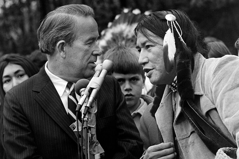
Bernie Whitebear and Senator Henry Jackson
Bernie Whitebear speaking to Senator Henry M. Jackson during the Daybreak Star lease signing ceremony, November 14, 1971. Courtesy of the Seattle Municipal Archives, Identifier 193058
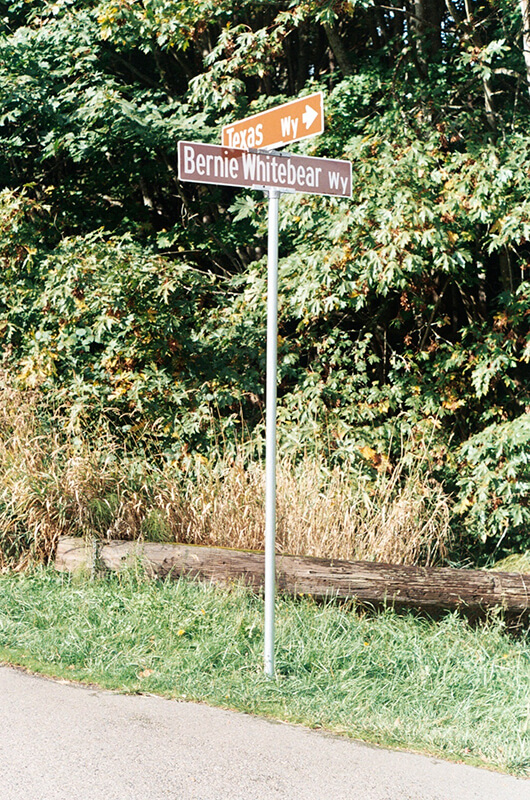
Signs at corner of Texas Way and Bernie Whitebear Way, October 30, 2011
Signs at corner of Texas Way and Bernie Whitebear Way, October 30, 2011. Photograph by Benjamin Lukoff. Copyright © 2011 Benjamin Lukoff. All rights reserved.

S Spokane Street

I haven’t posted in a couple of weeks because I’ve been in Spokane, visiting my wife’s family for the holidays and attending the memorial service of my sister-in-law, may her memory be for a blessing. Since there is no Emily Street in Seattle, why not return, then, with a post on Spokane Street?

S Spokane Street looking west from 1st Avenue South, July 5, 2013
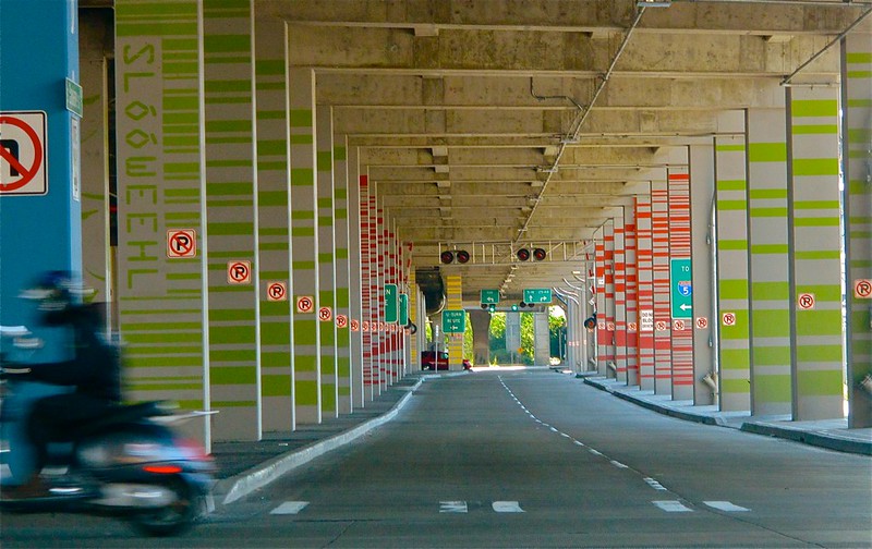
S Spokane Street looking west from 1st Avenue South, July 5, 2013. Photograph by Flickr user Curtis Cronn, licensed under Creative Commons Attribution-NonCommercial-NoDerivs 2.0 Generic. The barcodes on the support columns for the Spokane Street Viaduct was, in the words of the artwork’s creators, Claudia Reisenberger and Franka Diehnelt, intended “to ‘label’ the many layers that constitute SoDo’s history”; the word visible at upper left, ‘slóóweehL’, is a Lushootseed-language word that, according to Coll Thrush, author of Native Seattle: Histories from the Crossing-Over Place, “refers to channels, or ‘canoe-passes’, in the grassy marsh through which canoes can be pushed to effect a shortcut,” and was a Duwamish place name referring to what is now approximately 4th Avenue S and S Spokane Street. (Incidentally, this is the same word rendered as sluʔwiɫ in the IPA-based Lushootseed alphabet, which was also used as a name for what is now University Village, and is now the official name of a street on the University of Washington campus.)

Spokane Street appears to have been created in 1895 as part of the Seattle Tide Lands plat. Streets in this plat that were not extensions of already existing ones, such as Commercial Street, were named after letters of the alphabet, American cities, American states, prominent local politicians, and places in Washington. The letters of the alphabet and the American cities appear in alphabetical order, but the states appear neither in alphabetical nor geographic order, and the places in Washington do not appear to be in any order whatsoever (except that a number beginning with Q are physically clustered together). They are as follows, listed alphabetically:

* Still exists

(I leave out West Point Avenue [which still exists, but only as a paper street] and Seattle Boulevard [now Airport Way S and Diagonal Avenue S] because the former was named for its proximity to West Point and the latter, it seems, for its prominence.)

It isn’t a list entirely composed of cities, islands, peninsulas, lakes, or rivers… the only things I notice are ⅔ of them are in Western Washington, with Chelan, Klickitat, and Wenatchee being in Central Washington and Spokane being in Eastern Washington; plus half the Western Washington locations (those beginning with Q) are on the Olympic Peninsula. It seems what is today Spokane Street could just as easily have been something else, and what is today such a prominent street wasn’t purposefully named after what was then the state’s third largest city (today, it ranks second).

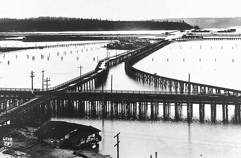
Trestles over the Elliott Bay tideflats, 1905
Trestles over the Elliott Bay tideflats, 1905. Photograph by Ira Webster and Nelson Stevens. According to the Wikimedia Commons entry for a similar photograph, the trestle in the foreground, running right to left (north to south), is today’s Airport Way S; the parallel trestle in the distance is 4th Avenue S; and running perpendicular from lower left to upper right (east to west, toward West Seattle) is S Spokane Street. The Seattle Box Company plant is visible at 4th and Spokane.
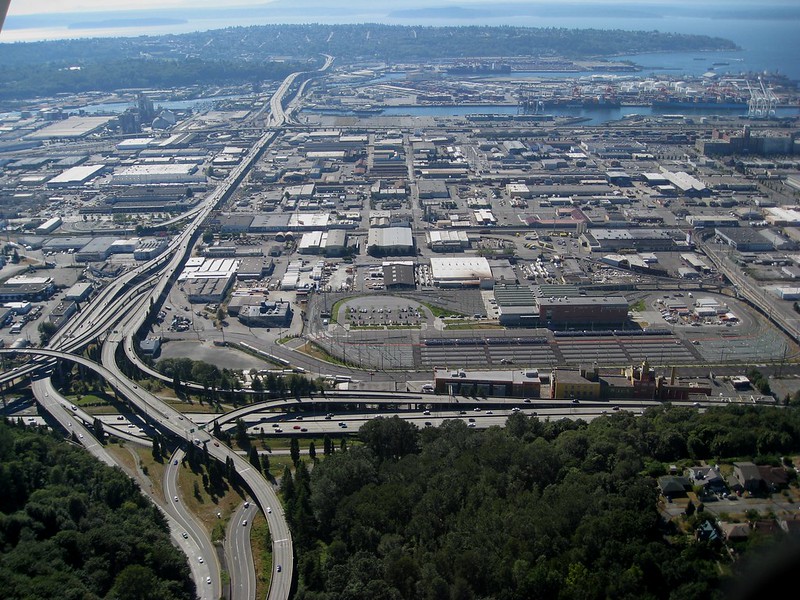
Industrial District, Harbor Island, and West Seattle from above Beacon Hill, with Interstate 5, West Seattle Bridge, and Spokane Street Viaduct, August 15, 2010
A modern view of the Industrial District, Harbor Island, and West Seattle from above Beacon Hill, August 15, 2010. Photograph by Flickr user J Brew, licensed under Creative Commons Attribution-ShareAlike 2.0 Generic. The freeway in the foreground, running right to left (north to south), is Interstate 5. Airport Way S is visible just west of the freeway. The Spokane Street Viaduct and West Seattle Bridge can be seen at left heading from Beacon Hill to West Seattle. 4th Avenue S is still a major arterial, though it isn’t nearly as prominent in this photograph as the one taken 105 years earlier.

Today, SW Spokane Street begins in West Seattle at Beach Drive SW, ½ a mile southeast of Alki Point, then goes nearly ½ a mile east to Schmitz Park, the block between 61st Avenue SW and 60th Avenue SW being a stairway. It resumes on the other side of the park at 51st Avenue SW and goes another ½ mile to 42nd Avenue SW. After a few interrupted segments between 35th Avenue SW and 30th Avenue SW, including another stairway, it begins again in earnest at Harbor Avenue SW and SW Admiral Way. From here it goes a full 2¼ miles east to Airport Way S, crossing the Duwamish Waterway and Harbor Island on the Spokane Street Bridge, and for this entire length runs either underneath or in the shadow of the West Seattle Bridge or the Spokane Street Viaduct, the latter of which leads to S Columbian Way on Beacon Hill.

After a short segment between Hahn Place S and 13th Avenue S, S Spokane Street begins again at 14th Avenue S and S Columbian Way and goes ⅔ of a mile east to 24th Avenue S. With the exception of an even shorter segment hanging off 25th Avenue S north of the Cheasty Boulevard greenspace, it next appears in Mount Baker, where it runs for two blocks between 33rd Avenue S and 35th Avenue S (part of this being stairway); then two more blocks between 36th Avenue S and York Road S (featuring another stairway); and two final blocks between 37th Avenue S and Bella Vista Avenue S.

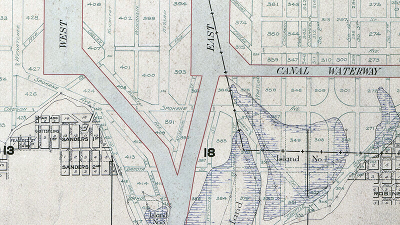
Portion of 1895 plat of Seattle Tide Lands showing Spokane Avenue, now Spokane Street
Portion of 1895 plat of Seattle Tide Lands showing Spokane Avenue, now Spokane Street. The visible portion of Seattle Boulevard is now Diagonal Avenue S, and Whatcom Avenue is E Marginal Way S. Portions of Chelan Avenue, Klickitat Avenue, and Duwamish Avenue still exist, as do Oregon Street, Dakota Street, Idaho Street, Colorado Avenue, and Utah Avenue.

Alki Avenue SW

The settlement at Alki Point established by the Denny Party in 1851 was originally named New York. By a process that is not entirely clear, the name became New York–Alki, and then just Alki. Alki means ‘by and by’ or ‘someday’ in Chinook Jargon, the implication being that the settlement might rival New York… someday. Charles C. Terry officially applied the Alki name to the town plat he filed in 1853, and the point, street, and neighborhood were all named after it.

In the introduction to her 1937 book, Pig-Tail Days in Old Seattle, Sophie Frye Bass writes:

Please everyone, pronounce Alki as the Indians did, as if it were spelled “Alkey.”

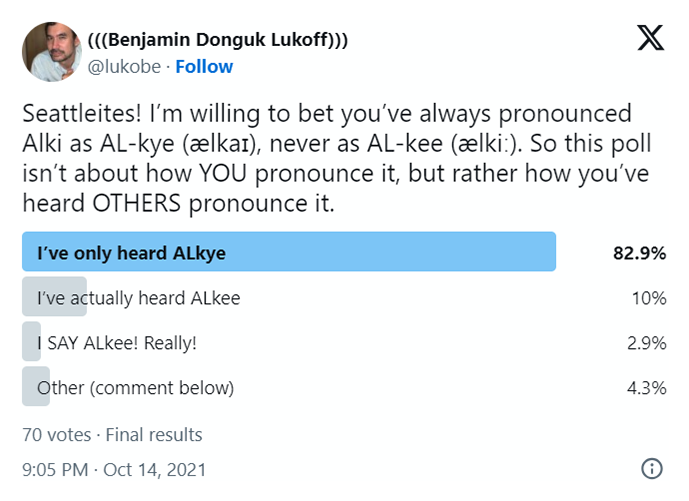
Hardly anyone does this anymore — in fact I don’t think I’ve ever heard someone say /ælkiː/ in all seriousness when talking about West Seattle. /ælkaɪ/ is by far the preferred pronunciation, as shown by this informal Twitter poll I ran:

A screen shot of a Twitter poll by me, asking "Seattleites! I’m willing to bet you’ve always pronounced Alki as AL-kye (ælkaɪ), never as AL-kee (ælkiː). So this poll isn’t about how YOU pronounce it, but rather how you’ve heard OTHERS pronounce it." "I've only heard ALkye" gets 82.9%, "I've actually heard ALkee" 10%, "I SAY ALkee! Really" 2.9%, and Other (comment below) 4.3%

Note: On July 10, 2024, I began converting embedded tweets on this website to screenshots because of issues with how they were integrating with WordPress, which began not too long after Elon Musk purchased Twitter and changed its name to X.

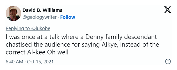
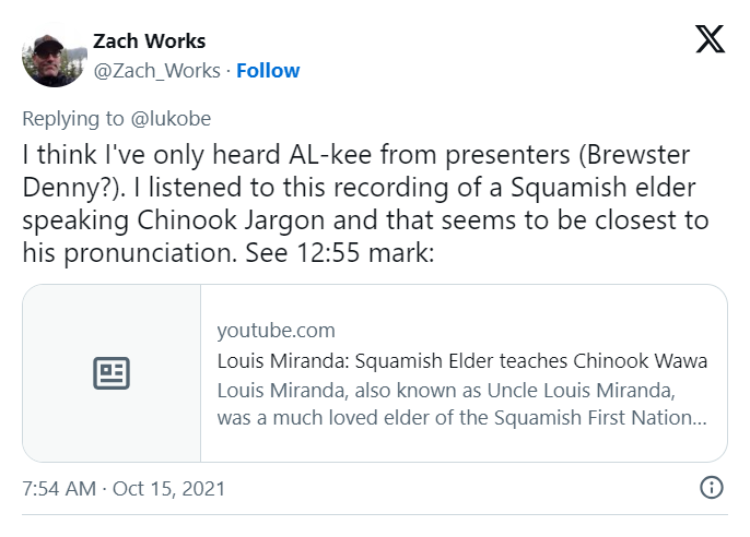
Apparently the Denny descendants (Bass was the daughter of Louisa Catherine Denny, herself the daughter of Arthur Armstrong Denny and Louisa Catherine Boren) still prefer — nay, insist — on ALkee:

A screen shot of a tweet by Knute Berger saying "The Dennys insist on AL-kee"
A screen shot of a tweet by David B. Williams saying "I was once at a talk where a Denny family descendant chastised the audience for saying Alkye, instead of the correct Al-kee Oh well"
A screen shot of a tweet by Zach Works saying "I think I've only heard AL-kee from presenters (Brewster Denny?). I listened to this recording of a Squamish elder speaking Chinook Jargon and that seems to be closest to his pronunciation. See 12:55 mark:"
Louis Miranda: Suqmish Elder teaches Chinook Wawa on YouTube
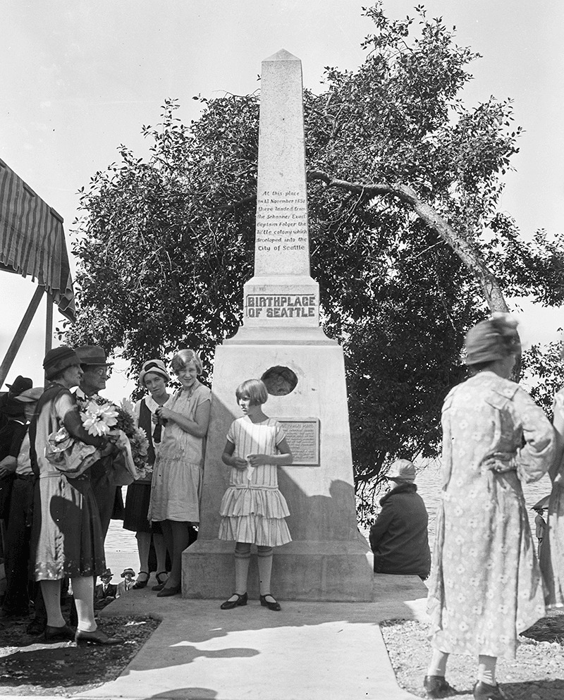
Birthplace of Seattle monument, 1926. Courtesy of the Seattle Municipal Archives, Identifier 46980
Birthplace of Seattle monument, 1926. Originally dedicated in 1905 on the 54th anniversary of the landing of the Denny Party at Alki Point, it reads “At this place on 13 November 1851 there landed from the Schooner Exact Captain Folger [and] the little colony which developed into the City of Seattle.” It was rededicated, with a new foundation, on September 4, 1926 (likely the date of this photograph). A stone from near Plymouth Rock, Massachusetts, was put in the foundation, and the new plaque reads “From Plymouth Rock to Alki Point: Honoring pioneers on the American shores of the Atlantic and Pacific Oceans, the above stone was brought from Plymouth Rock by the First Transcontinental Motorized Caravan, managed by James H. Brown, and endorsed by the American Automobile Association. This tablet was furnished by the Automobile Club of Washington. The unveiling ceremonies on September 4, 1926, was participated in by officers and citizens of. the City of Seattle, the County of King and the State of Washington.” Courtesy of the Seattle Municipal Archives, Identifier 46980

As noted in Harbor Avenue SW and Beach Drive SW, the Alki Avenue name once stretched from Lincoln Park around Alki Point and Duwamish Head to the industrial area near Harbor Island, but sometime between 1912 and 1920 the name was reduced to the portion between Alki Point and Duwamish Head.

Today, Alki Avenue SW begins at Harbor Avenue SW by Duwamish Head and goes 2⅕ miles southwest to Beach Drive SW.

Klallam-language names on Port Angeles street signs

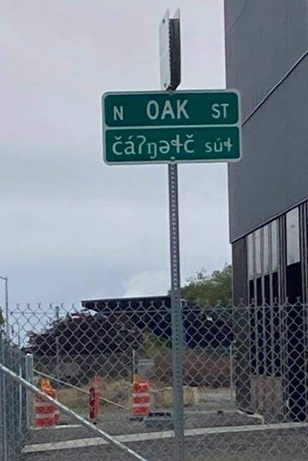
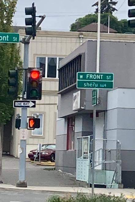
My good friend and former Amazon Music colleague Thomas May — a freelance arts and theatre writer and proprietor of Memeteria.com — was in Port Angeles, Washington, the other day. Knowing, of course, of my address nerdery, he sent me these photos he took of street signs at the corner of W Front Street and N Oak Street:

I was delighted and asked if I could use his photos on Writes of Way. He agreed, and this is the resulting post.

It seems that these Klallam-language signs were installed in 2016 at the N Oak Street/W Front Street and N Oak Street/W Railroad Avenue intersections as part of the redevelopment of the Port Angeles waterfront and as a way to honor the Lower Elwha Klallam Tribe, whose traditional land this is. (The village of č̕ixʷícən was located where downtown Port Angeles is now.) There are similar street signs on the Lower Elwha and Port Gamble S’Klallam reservations, but these are the only ones I am aware of in the middle of a city.

I would love to see something like this in Seattle, whether that be bilingual street signs or signs giving the Lushootseed names of various locations around town — or both. Perhaps someday.

Shilshole Avenue NW

This street, which originates along with the rest of the heart of Ballard in the 1889 plat of Gilman Park, was named for šilšula village of the shill-shohl-AHBSH people along what is today known as Salmon Bay. Meaning ‘tucked away inside’ in the Lushootseed language, it is one of two remaining Native place names in Seattle, the other being Licton Springs (liq’təd). (Note added May 20, 2023: I should have written that it is one of two Native place names in Seattle that remain in common use. The Duwamish are still here, and so are their names.)

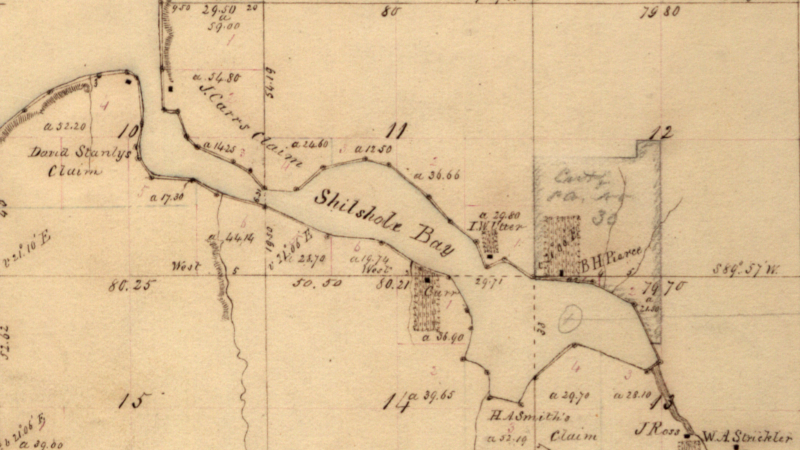
Why, then, is the Shilshole Bay name applied to the body of water west of the Ballard Locks? Shouldn’t Shilshole Avenue, Shilshole Bay, and šilšul all be in the same location? According to Edmond Stephen Meany’s 1923 Origin of Washington Geographic Names, citing early settler Arthur A. Denny’s 1888 Pioneer Days on Puget Sound,

In December, 1852, Arthur A. Denny, knew the bay as “Shilshole.” It was later changed to Salmon Bay because it was thought to be frequented by Salmon.

Today, Shilshole Avenue NW begins at 14th Avenue NW in the east and goes ⅘ of a mile northwest to 24th Avenue NW, just short of NW Market Street.

Section of Map of Township № 25 North, Range № 3 East of the Willamette Meridian, 1855, showing Salmon Bay labeled as Shilshole Bay
Section of Map of Township № 25 North, Range № 3 East of the Willamette Meridian, 1855, showing Salmon Bay labeled as Shilshole Bay.

S Fontanelle Street

This fragmented street starts at Rainier Avenue S and travels two blocks west to 46th Avenue S. It makes its next appearance in Beacon Hill as a block-long street hanging off Military Road S, just east of Interstate 5. There are a few more blocks in South Park, from 5th to 2nd Avenues S, then half a block in West Seattle just west of California Avenue SW and a few final blocks from just east of Vashon Place SW to 47th Avenue SW at Lincoln Park. It is named for Fontanelle, Iowa, where Joseph and Catherine (Henderson) Dunlap (of S Henderson Street) lived before coming to Seattle in 1869.

S Angeline Street

This street lies mostly in Columbia City, where its name originated, and Seward Park, with a few blocks in Beacon Hill and even fewer in West Seattle. It almost reaches Puget Sound at Beach Drive SW, and does reach Andrews Bay of Lake Washington at Lake Washington Boulevard S.

As noted, the name Angeline Street originated in Columbia City, in this 1891 Plat of Columbia, filed at the request of James Kippen Edmiston by Percy W. Rochester and John I. Wiley of the Washington Co-operative Home Company. 

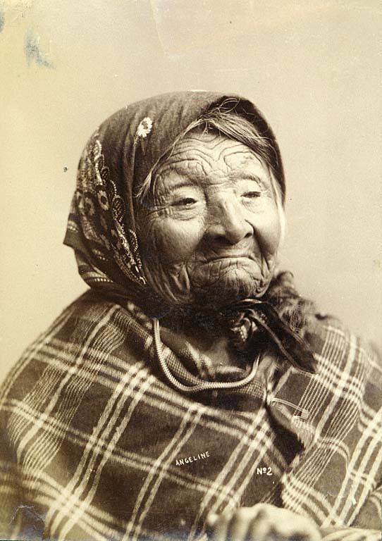
Princess Angeline was born Kikisoblu, the daughter of Si’ahl [siʔaɫ], better known in English as Chief Seattle of the Duwamish and Suquamish Tribes. Her date of birth is unknown; Wikipedia gives it as ca. 1820, whereas this article posted by the Duwamish Tribe, written by elementary school students based on HistoryLink essays, gives it as 1828. She died May 31, 1896.

Princess Angeline received her English name from Catherine Broshears Maynard, wife of David Swinson (“Doc”) Maynard, one of the earliest Seattle settlers. As the HistoryLink Elementary article puts it,

Chief Seattle’s oldest daughter was named Kikisoblu. She became friends with many of Seattle’s founding families. One of her friends was Catherine Maynard. She felt that Kikisoblu should have a name that would let the white settlers know that she was the daughter of a great chief. So she called her Princess Angeline. She thought that name was prettier than the name Kikisoblu.

Photograph of Kikisoblu, or Princess Angeline, by Frank La Roche, ca. 1893
Photograph of Princess Angeline (Kikisoblu), by Frank La Roche, ca. 1893

sluʔwiɫ

I end my piece on Lushootseed-language place names in Seattle, “Native names abide,” thus:

…Let Carkeek remain Carkeek, but know that it was once and is still kʷaatəb, as Montlake is still stəx̌ʷugʷił, the Locks, which lowered x̌ačuʔ and x̌áx̌əʔčuʔ, still xʷiwálqʷ, and University Village still sluʔwił village, and celebrate that wǝɫǝbʔaltxʷ now sits where Whitman and Stevens meet.

wǝɫǝbʔaltxʷ – Intellectual House is “a longhouse-style facility on the [University of Washington] Seattle campus [that] provides a multi-service learning and gathering space for American Indian and Alaska Native students, faculty and staff, as well as others from various cultures and communities to come together in a welcoming environment to share knowledge.” Its location at the corner of Stevens Way and Whitman Court is significant in that almost all campus roads are named for Washington counties, and these two counties were named after Isaac Stevens and Marcus and Narcissa Whitman:

  • As noted in “Should Seattle rename its streets?” Stevens, governor of Washington Territory, “forced Native American tribes to cede their lands to the federal government.… He also pardoned himself for contempt charges relating to unjust declaration of martial law during the Yakima War, and insisted on the capture of the subsequently executed Chief Leschi of the Nisqually Tribe, even though at that point he had ceased fighting and fled the area.
  • The Whitmans’ story is more complex. The missionary couple were among 13 whites killed by a group of Cayuse Indians in what has become known as the Whitman massacre. A measles epidemic in the mission settlement and a nearby Cayuse village produced a death rate far higher among the Cayuse; Marcus Whitman, who was a also a physician and tried to treat the Cayuse as well as the whites, was accused of poisoning tribe members: “the fact that nearly all of his white patients recovered while his Indian patients died convinced some Cayuses that he was deliberately poisoning Indians in order to give their land to white setters.” Even though this is unlikely, the fact remains that they were missionaries and colonizers, and there have been calls to replace the statue of Marcus that stands in the National Statuary hall.

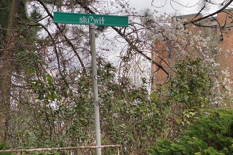
Now the University of Washington has renamed Whitman Court sluʔwiɫ, after a village that once stood where University Village is today. (sluʔwiɫ means ‘Little Canoe Channel’ in the Lushootseed language.)

Street sign reading sluʔwiɫ on University of Washington campus
sluʔwiɫ street sign at corner of Stevens Way, with Padelford Hall in the distance, February 2021. Photograph by Benjamin Lukoff. Copyright © 2021 Benjamin Lukoff. All rights reserved.

The UW Board of Regents made this change in May 2018, but the sign only recently made its appearance. I asked the writer of the University of Washington Magazine piece on the name change, Hannelore Sudermann, if she knew whether “the renaming was official — that Whitman Court no longer exists and the street’s name is now sluʔwiɫ – or if it was honorary and the street is still officially Whitman Court,” and she pointed me to the meeting minutes, which read, in part: 

The Board of Regents chooses to honor the Coast Salish peoples of the land on which the University of Washington sits, and indigenous peoples across the State, by renaming Whitman Court sluʔwił.… In the Lushootseed language of the Coast Salish peoples, sluʔwił is the name for the village site closest to the campus, and means ‘Little Canoe Channel.’… It is the Board’s intention to recognize the native place-names of the region and thereby to enrich the historical context of the campus. The Board feels that this naming action is particularly appropriate, given the proximity of Whitman Court to wǝɫǝbʔaltxʷ, meaning ‘Intellectual House,’ a multi-service learning and gathering space for American Indian and Alaska Native students, faculty, and staff.

Even though an earlier part of the minutes reads “Regent Rice moved, Regent Ayer seconded, and the Board of Regents approved the honorific renaming of Whitman Court sluʔwił” (italics mine), given the excerpt above and the presence of the sign without any reference to Whitman Court, my interpretation is that honorific here means “in honor of,” in contrast to honorary meaning “symbolic.” 

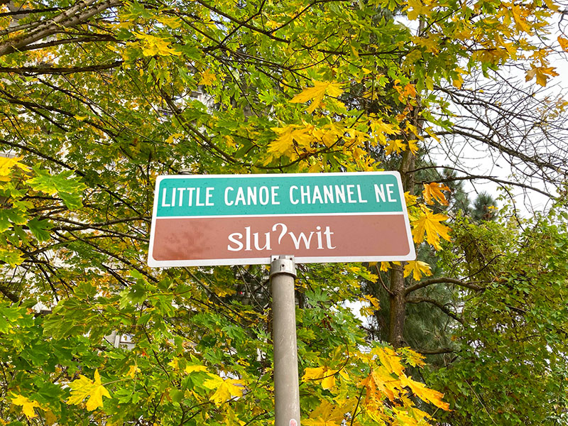
Street sign on the University of Washington campus reading Little Canoe Channel NE / sluʔwit; ‘t’ appears instead of the correct ‘ɫ’. sluʔwiɫ means ‘little canoe channel’ in Lushootseed. October 27, 2021
New street sign, reading Little Canoe Channel NE / sluʔwit; ‘t’ appears instead of the correct ‘ɫ’. Photograph by Leslie Holmes, October 27, 2021. Copyright © 2021 Leslie Holmes. All rights reserved.

Update as of February 16, 2023: I recently noticed that sluʔwiɫ is appearing on maps (UW, OpenStreetMap) as sluʔwiɫ (Little Canoe Channel NE). Per the UW’s page on McMahon Hall, “Whitman Court NE has been renamed Sluʔwił (Little Canoe Channel NE). Although street signs have changed, you may hear the street referred to by both names as the name change awaits formal state recognition. The name change acknowledges the Duwamish Peoples who continue to fight for federal recognition as a tribe, and who lived and engaged in potlaches, gift-giving festivals of sharing and trading, in the area, until the land was colonized by white settlers.” I will try to find out when and how formal state recognition will come.

Native names abide

Before white settlers came to to dᶻidᶻəlalič in 1852, before they came to sčəgʷaliču in 1832, even before they first sighted the shores of x̌ʷəlč in 1792, the dxʷdəwʔabš were here, living at sluʔwił and šilšul, babaqʷəb and t’uʔəlalʔtxʷ, and paq’ác’ałčuʔ and səxʷt’ičib, by the lakes called c’alq’ʷadiʔ and sisałtəb and dxʷƛ’əš and xáx̌əʔčuʔ, and most of all xačuʔthe lake — the smaller ones being fed by springs like liq’təd where the waters run red, the lake being fed by the river whose mouth was at ƛ’ax̌ʷadis, but one by one their names were replaced by the settlers, who though they named the city for siʔał and the river for the dxʷdəwʔabš nevertheless named places Pioneer Square for themselves, or Fremont for where they came from, or Brooklyn for that which they aspired to be, and while šilšul became Shilshole and liq’təd became Licton, other dxʷləšúcid names were left unwritten and hardly spoken for decades but still remembered — so let Carkeek remain Carkeek, but know that it was once and is still kʷaatəb, as Montlake is still stəx̌ʷugʷił, the Locks, which lowered xačuʔ and xáx̌əʔčuʔ, still xʷiwálqʷ, and University Village still sluʔwił village, and celebrate that wǝɫǝbʔaltxʷ now sits where Whitman and Stevens meet.


This piece (originally titled “Lushootseed names remain”) appeared as the first item in One-Sentence Stories: An Intriguing New Anthology of Stories Told in a Single Sentence, Book 2, compiled by Val Dumond in 2018. Apparently I was the first potential contributor to ask if the story could be non-fiction. There was a minimum length of 200 words — this comes in at 203.

The names are in the dxʷləšúcid or Lushootseed language, spoken by many of the Coast Salish Native American tribes in the Puget Sound region. They are written in the Lushootseed alphabet, which is based on the International Phonetic Alphabet.

I selected most, though not all, of the names by using the Burke Museum’s Waterlines Project map. They appear below, along with their translations and the current, settler-given names.

  1. dᶻidᶻəlalič — Little Crossing-Over Place — Pioneer Square
  2. sčəgʷaliču — Extensive Sand Banks Over Which the Water Is Shallow/Big Tide/Long Run-Out — Sequalitchew/Fort Nisqually/DuPont
  3. x̌ʷəlč — Salt Water — Puget Sound
  4. dxʷdəwʔabš — People of the Inside (Elliott Bay) — Duwamish
  5. sluʔwił — Little Canoe Channel — University Village
  6. šilšul — Tucked Away Inside — Salmon Bay (Shilshole is one of two unchanged Native names within Seattle city limits)
  7. babaqʷəb — Little Prairie — Belltown
  8. t’uʔəlalʔtxʷ — Herring’s House — West Seattle Industrial District
  9. paq’ác’ałčuʔ — Brush Spread on the Water — West Point
  10. səxʷt’ičib — Place Where One Wades — Lakeridge
  11. c’alq’ʷadiʔ — Blackcaps on the Sides — Bitter Lake
  12. sisałtəb — Calmed Down a Little — Haller Lake
  13. dxʷƛ’əš — translation unknown — Green Lake
  14. xáx̌əʔčuʔ — Small Lake — Lake Union
  15. xačuʔ — Lake — Lake Washington
  16. liq’təd — Red Paint — Licton Springs, the other unchanged Native name within Seattle city limits
  17. ƛ’ax̌ʷadis — The Growing Place — Squawk (Squak) Slough, mouth of the Sammamish River at Kenmore
  18. siʔał — personal name — Chief Seattle (Sealth)
  19. dxʷləšúcid — Salt Water Language — Lushootseed
  20. kʷaatəb — Dropped Down — Piper’s Creek at Carkeek Park beach
  21. stəx̌ʷugʷił — Carry a Canoe (Portage) — Montlake Cut from Union Bay to Portage Bay 
  22. xʷiwálqʷ — Lots of Water — Commodore Park (Magnolia side of Ballard Locks)
  23. wǝɫǝbʔaltxʷ — Intellectual House

SW Seattle Street

What better way to start things off than with SW Seattle Street?

SW Seattle Street is a minor residential street in West Seattle that runs about ³/₁₀ of a mile from 42nd Avenue SW in the east to Sunset Avenue SW in the west.

It might seem strange that such a short street would be chosen to bear the city’s name — it was the only one to do so until 2010, when the first two blocks of Airport Way S were renamed Seattle Boulevard S — but this has more to do with unimaginative naming than with civic pride.

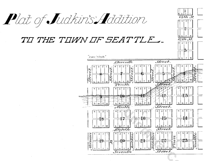
On August 4, 1869, Ike M. Hall — the executor of the estate of Norman B. Judkins — filed the Judkin’s (sic) Addition to the Town of Seattle, located just southwest of where the interchange between I-5 and I-90 is today. From north to south, the east–west streets are named Norman, B, Judkins, Addition, Town, and Seattle.

Portions of the original Seattle Street were vacated over the years (for example, in 1900, 1957, and 2000), and the construction of I-5 took care of the rest. However, when the city annexed West Seattle in 1907 it changed the name of Maple Street to W Seattle Street as part of rationalizing the street grid… and so the name lives on.

(The city itself, of course, was named after Si’ahl [siʔaɫ], better known in English as Chief Seattle of the Duwamish and Suquamish Tribes.)

siʔaɫ, or Chief Seattle
The only known photograph of Chief Seattle (1786?–1866), taken by E.M. Sammis in 1864
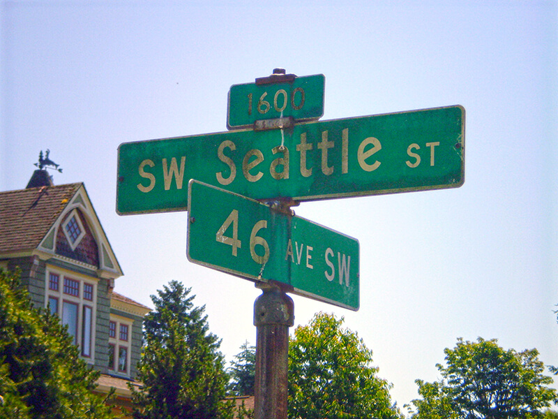
Sign at corner of SW Seattle Street and 46th Avenue SW, July 4, 2011
Sign at corner of SW Seattle Street and 46th Avenue SW, July 4, 2011. Photograph by Benjamin Lukoff. Copyright © 2011 Benjamin Lukoff. All rights reserved.

So, why SW Seattle Street instead of Seattle Street SW?

In Seattle, east–west streets have the directional come first, and north–south avenues have it come last. The Wikipedia article “Street layout of Seattle,” which I helped write, has a more comprehensive description of Seattle’s addressing system, including the answer to this question:

Why was it W Seattle Street in 1907 but SW Seattle Street now?

In 1961, city ordinance 89910 “established a standard system of street name designations” so that in almost all cases streets within a given zone would carry the same directional. West Seattle avenues already carried the SW designation.