Dartmouth Avenue W

This street was created in 1907 as part of the plat of Magnolia Park, filed by the Magnolia Park Company. Insurance man Ferdinand Bosher Edgerly (1881–1966), president of the company, lived most of his life in Manchester, New Hampshire, but according to his obituary moved to Seattle after graduating from Dartmouth College in 1904, returning to Manchester in 1913. It would appear he named Dartmouth Avenue after his alma mater.

Dartmouth Avenue W begins at the end of W Howe Street, just east of Magnolia Way W, and goes just under 300 feet southwest to rejoin Magnolia Way W. Almost all of it, however, functions as private driveways for a number of houses with Magnolia Way addresses; the initial paved portion is less than 75 feet long and serves the only house with a Dartmouth Avenue address.

Elliott Avenue

Elliott Avenue, which originated as Water Street in A.A. Denny’s 6th Addition to the City of Seattle, filed in 1873, received its current name in 1895 as part of the Great Renaming. It was named for Elliott Bay, which was itself named for Midshipman Samuel Bonnyman Elliott (1822–1876), part of the United States Exploring Expedition, otherwise known as the Wilkes Expedition. (Even though for years people thought the bay had been named for Chaplain J.L. Elliott, Howard Hanson makes a convincing argument in “The Naming of Elliott Bay: Shall We Honor the Chaplain or the Midshipman?”, an article in the January 1954 issue of The Pacific Northwest Quarterly, that the honor belongs to the midshipman.)

Elliott Avenue begins at Western Avenue and Lenora Street and goes 2⅕ miles northwest to halfway between W Galer Street and W Garfield Street, where it becomes 15th Avenue W.

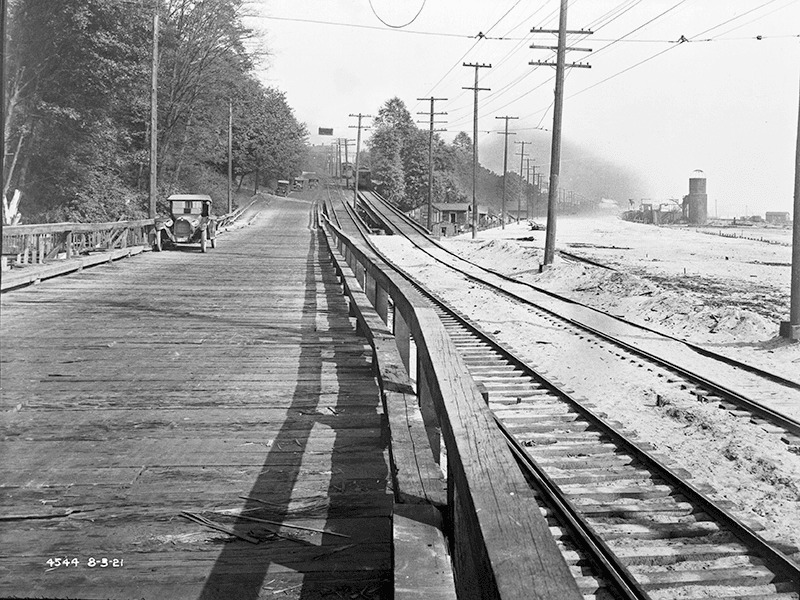
Looking south down Elliott Avenue W at W Mercer Place, August 1921, from http://archives.seattle.gov/digital-collections/index.php/Detail/objects/25558
Looking south down Elliott Avenue W at W Mercer Place, August 1921. Courtesy of the Seattle Municipal Archives, Identifier 1862
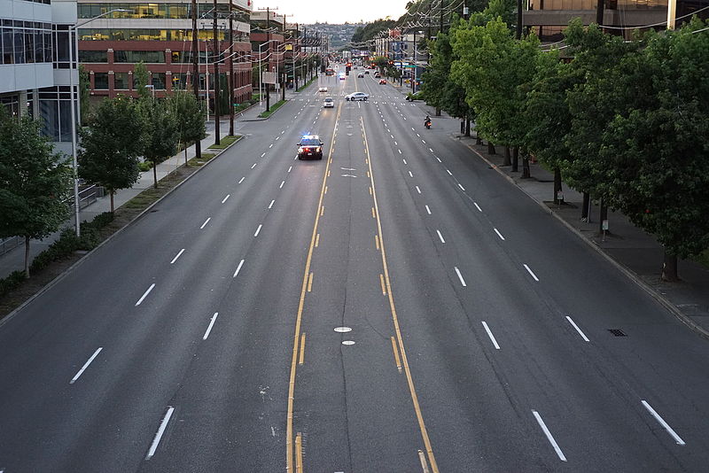
Looking northwest up Elliott Avenue W from the W Thomas Street pedestrian bridge, August 2015. From https://commons.wikimedia.org/wiki/File:Elliott_Ave,_at_3rd_Ave_and_Thomas_Street,_Seattle.JPG
Looking northwest up Elliott Avenue W from the W Thomas Street pedestrian bridge, August 2015. Photograph by Dllu, Wikimedia Commons, licensed under Creative Commons Attribution-ShareAlike 4.0 International

Alaskan Way

Alaskan Way was originally Railroad Avenue. Jennifer Ott writes for HistoryLink.org:

On the central waterfront a web of railroads grew out from the shore in the 1880s and 1890s as various railroads, including the Columbia & Puget Sound, the Seattle, Lake Shore & Eastern, and the Northern Pacific jockeyed for space at the foot of the bluffs that ended at the beach, where Western Avenue is today. In January 1887 the City Council passed an ordinance establishing Railroad Avenue, a street created, according to historian Kurt Armbruster, to provide space for the Seattle, Lake Shore & Eastern franchise to the west of the Northern Pacific’s franchise along the shoreline.

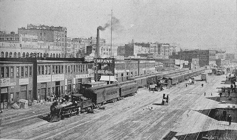
Railroad Avenue looking south from between Madison and Marion Streets, circa 1898

When the tidelands were platted in 1895, Railroad Avenue extended to Harbor Island and West Seattle, but:

  • Sometime between 1912 and 1920 the Harbor Island portion was renamed W Florida Street (SW Florida Street today).
  • In 1907, the West Seattle portion was renamed Alki Avenue.
    • Sometime between 1912 and 1920 the West Seattle portion southeast of Duwamish Head was given its current name, Harbor Avenue.

In an article for Crosscut (now CascadePBS.org), Knute Berger explains why a new name was wanted for the remainder:

Seattle’s waterfront was unpaved — a beat-up plank road ran its length. There was no modern seawall — the street was built over the water. Train tracks were everywhere.… But the waterfront was undergoing a massive renovation. A seawall was being constructed, the shoreline filled in, the road made into a wide, paved boulevard.…

According to Berger and Ott’s articles, names that were proposed but were ultimately rejected included Anchors Way, Artery Way, Battery Way, Bois Boolong, Bread Street, Cargo Way, Chief Seattle Avenue, Cosmos Quay, Dock Street, Export Way, Fleet Way, Gateway Avenue, Golden West Way, Hiak Avenue, Klatawa Avenue, Maritime Avenue, Metropolis Avenue, Olympian Way, Pacific Way, Pier Avenue, Port Strand, Port Way, Port-Haven Drive, Potlatch Avenue, Puget Avenue, Puget Dyke, Puget Portal, Queen City Way, Roadstead Way, Salt Spray Way, Salt Water Avenue, Seawall Avenue, Seven Seas Road, Skookum Way, Steamship Way, Sunset Avenue, Terminal Avenue, Terrebampo Way, The Battery, The Esplanade, Transit Row, Voyage Way, Welcome Way, and Worldways Road. (Those in italics apparently came under serious consideration.)

So how did we end up with Alaskan Way? And why Alaskan instead of Alaska (the already existing S Alaska Street could have been renamed)?

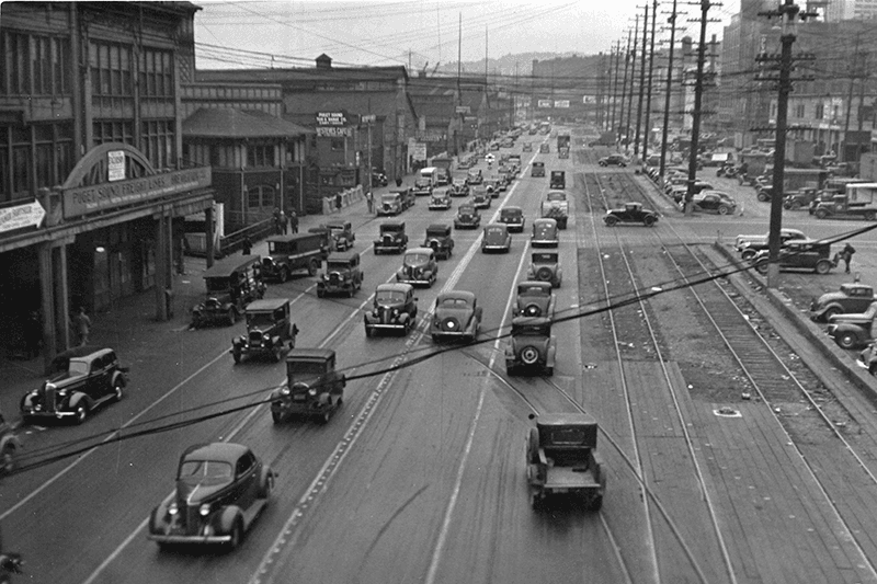
Alaskan Way, July 1939
Alaskan Way between Marion and Madison Streets, Canadian National Dock at left, July 1939. Courtesy of the Seattle Municipal Archives, Identifier 77093

The May 19, 1932, issue of The Seattle Times reports that the Seattle Maritime Association had run a renaming contest which received “more than one thousand letters… some of them contained scores of suggestions.” 4,868 names (including duplications) were received, and the judges selected four finalists, in order of preference: Puget Portal (one submission), Klatawa Avenue (one submission, from Chinook Jargon word meaning ‘to go, to travel’), Hiak Avenue (one submission, from Chinook Jargon word meaning ‘lively, quick and fast’), and Maritime Avenue (49 submissions [Maritime Way received 99 submissions but was not chosen]). The next day, the Times reported that the judges had chosen Maritime Avenue, and awarded the $20 prize to a Mr. B.I. Schwartz, the first to have suggested the name.

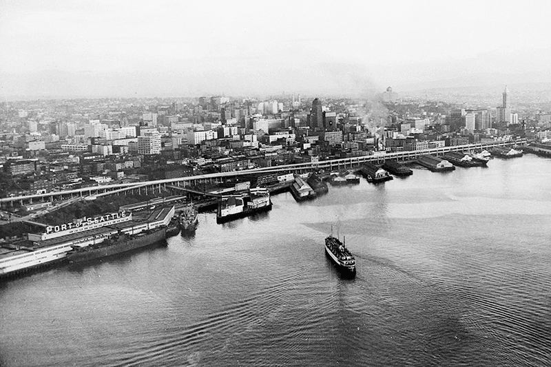
Alaskan Way Viaduct, July 1952
Alaskan Way Viaduct, July 1952, the year before it opened. The double-decker freeway paralleled Alaskan Way as far north as Union Street, where it diverged from the alignment on its approach to Elliott Avenue and the Battery Street Tunnel. Bell Street Pier, with the large Port of Seattle sign, is at left. The Bell Street Overpass can be seen behind the ‘P’ in ‘Port’. The bridge at the southern end of the pier is the Lenora Street Viaduct. Courtesy of the Seattle Municipal Archives, Identifier 43586

However, that July, a George D. Root proposed the name Cosmos Quay. At first, it was met with indifference, and then it seems the entire renaming project was put on the back burner until construction progressed. Somehow, when he restarted his campaign in 1934, Cosmos Quay became a leading candidate, and it was approved unanimously by the city council on January 14, 1935. An ordinance began to be drafted. But, as the Seattle Post-Intelligencer noted the next day, this was only because one councilmember, Frank J. Laube, had been absent… and he was adamantly opposed.

He wasn’t the only one. The Seattle Times published an editorial on January 20 headlined ‘City Locksmith Needed for Pronunciation Key’, which proclaimed that “to burden the waterfront stretch with a name that could be used and understood only through long courses in cosmogony, cosmology, etymology, and articulation would be a sad piece of nonsense for which there is no excuse.” The next day the Times reported that David Levine, city council president, said Cosmos Quay “no longer sounds so good to him. Many citizens have complained its meaning, as well as its pronunciation, mystifies them.” On February 4, according to the P-I, the council killed the ordinance and decided to leave Railroad Avenue as it was.

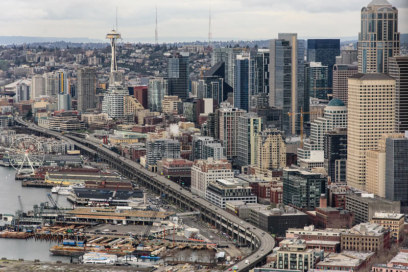
Alaskan Way Viaduct, February 2018
Alaskan Way Viaduct, February 2018. It closed permanently in January 2019; the replacement tunnel opened the next month. and demolition was complete by November of the same year. Photograph by Flickr user Washington State Department of Transportation, licensed under Creative Commons Attribution-NonCommercial-NoDerivs 2.0 Generic

When the new street opened in 1936, the question of renaming came up again. Mayor John F. Dore appointed a committee that chose The Pierway, a suggestion that won a W.C. Denison, Jr., a prize of $50 from the mayor’s own pocket, but the final decision lay with the city council, which was not enthused. Pacific Way emerged as their favorite, according to a Seattle Times article on July 2, 1936, though a July 6 article in the same paper “the public apparently was not in accord with the idea.” On July 7, the Times reported that even though “at least seven votes [were] lined up in advance for the adoption of ‘Pacific Way’… with Council President Austin E. Griffiths contending for ‘Cosmos Quay’ or ‘Cosmos Way’,” an ordinance renaming Railroad Avenue “Alaskan Way” passed unanimously.

Alaska Way had been proposed in 1932 by the Puget Sound Travel Directors, according to an article in the April 13 issue of The Seattle Times. (As an aside, it was also proposed in 1931 by attorney John S. Robinson as an alternate name for Aurora Avenue N and the Aurora Bridge, according to a Times article on June 19.) It was also an entry in the Seattle Maritime Association’s aforementioned naming contest, submitted by Fred E. Pauli, manager of the Alaska Division of the Washington Creamery Company, according to a Times article on April 10, 1932. Then, in 1935, after Cosmos Quay had been rejected by the city council, the Alaska Yukon Pioneers endorsed Alaska Way (The Seattle Times, March 5), followed by the Whittier Heights Improvement Club (Times, March 7) and the Junior Alaska-Yukon Pioneers (Times, July 25). When renaming became a distinct possibility once again in 1936, as discussed above, the Alaska Yukon Pioneers passed a resolution in favor of Alaska Way (Times, July 4): “…It was here that the gold rush activity actually took place… put Seattle on the map and directly made possible the magnificent improvement now about completed.”

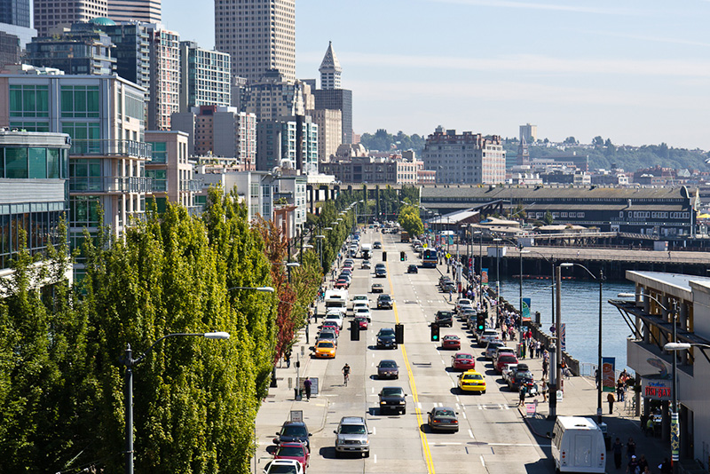
Alaskan Way south from Bell Street
Alaskan Way looking south from the Bell Street pedestrian bridge, August 2011. The Alaskan Way Viaduct is barely visible at center; the Seattle Aquarium is at center right. Photograph by Orange Suede Sofa, Wikimedia Commons, licensed under Creative Commons Attribution-Share Alike 3.0 Unported

It came down to one councilmember, apparently. The Seattle Post-Intelligencer reported on July 7 that, the previous day, Robert H. Harlin proposed that the already-prepared ordinance renaming Railroad Avenue “Pacific Way” be amended to read “Alaskan Way” instead:

Councilman Robert H. Harlin, who offered the motion for adoption of “Alaskan Way,” said he preferred it to “Alaska Way” because it “recognizes the human element, honoring the men and women who pioneered the territory.” Although a majority of the council had informally agreed to support the name “Pacific Way,” sentiment crystallized rapidly in favor of “Alaskan Way” after Harlin’s statement.

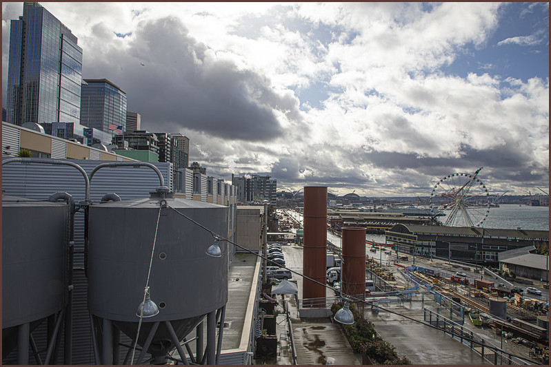
Alaskan Way, March 2021
Alaskan Way from the Pike Place Market’s MarketFront, March 2021. Construction of the street that wasn’t going to be called Elliott Way — but now, as of early 2023, will be — is visible at center right. The Seattle Great Wheel can be seen above the Seattle Aquarium. Photograph by Flickr user Scott Smithson, licensed under Creative Commons Attribution-NonCommercial-NoDerivs 2.0 Generic

Today, Alaskan Way S begins at the north end of E Marginal Way S, at the entrance to the Port of Seattle’s Terminal 30, and goes 2⅓ miles north, then northwest, to Broad Street, having become Alaskan Way on crossing Yesler Way. This is the Alaskan Way most people think of.

But, as they say, wait — there’s more! The right-of-way continues for another 1¾ miles, ending at W Garfield Street under the Magnolia Bridge, at the entrance to the Port of Seattle’s Terminal 91. From the Olympic Sculpture Park, which begins at Broad Street, to Myrtle Edwards Park, the right-of-way is taken up by park land and the tracks of the BNSF Railway — successor to the Columbia & Puget Sound; the Seattle, Lake Shore & Eastern; and the Northern Pacific, the railroads for which Railroad Avenue was originally built. Northwest of Myrtle Edwards, it’s entirely taken up by the tracks that run alongside Centennial Park. It isn’t until W Galer Street that there’s a city street in the right-of-way again, and Alaskan Way W only goes about ⅙ of a mile northwest from there to W Garfield Street. Even less than that is signed Alaskan Way, as the city has put up a sign for Expedia Group Way W where the W Galer Street flyover “touches down.” However, even though southeast of Galer the roadway runs first on Expedia property, then Port of Seattle property, the city appears to still consider it Alaskan Way W between the Expedia campus entrance and the north end of Centennial Park — a distance of just over ⅓ of a mile.

Joliet Avenue W

This street was created in 1895 as part of the Seattle Tide Lands plat (in full, Seattle Tide Lands as Surveyed and Platted by the Board of Appraisers of Tide and Shore Lands for King County, Washington). Streets were laid out from the northern tip of Magnolia (see W Semple Street) to West Seattle, but only the land southeast of Magnolia down to the Duwamish River was ultimately filled and developed.* (Magnolia’s tidelands were intended to become industrial land as part of the Bogue Plan, but this was rejected, and they have remained untouched west of the Elliott Bay Marina.)

* I certainly don’t want to minimize the extent of what was filled — over 92% of the tidelands, according to local historian and geologist David B. Williams.

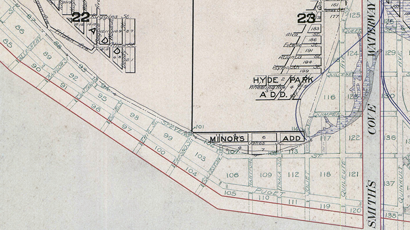
As can be seen in the portion of the plat map reproduced below, the streets perpendicular to the shoreline in southwest Magnolia were named alphabetically after various cities in the United States. (Northwest of here, they were simply given letters of the alphabet, beginning with A and making it as far as O.) The namers began with Allegheny (Pennsylvania), and continued with Bangor (Maine), Chattanooga (Tennessee), Duluth (Minnesota), Erie (Pennsylvania), Fresno (California), Galveston (Texas), Hartford (Connecticut), Ithaca (New York), and our subject, Joliet (Illinois), before switching to yet another series.

Portion of Plat of Seattle Tide Lands showing Smith Cove and Southwest Magnolia
Portion of 1895 Plat of Seattle Tide Lands showing Smith Cove and Southwest Magnolia

Most of these streets have been renamed or vacated, but for some reason this never happened to Joliet Avenue, even when the Navy took over the Smith Cove piers and uplands in 1941 and 1942 to form Naval Supply Depot Seattle. Today, this is the Port of Seattle’s Terminal 90/91 complex, but as the quarter section map shows, it’s still crisscrossed by public right-of-way. It may very well take the proposed redevelopment of the uplands and Washington National Guard armory site to eliminate these paper streets for good.

Van Buren Avenue W

This street first appears in the 1875 plat of the Northern Addition to Seattle, W.T., filed by James Marston McNaught (1842–1919) and his wife, Agnes Martha Hyde McNaught (1856–1918). James was “a wealthy lawyer working in the railroad industry.” I assume it was named for Martin Van Buren, eighth president of the United States, and not for his namesake, Martin Van Buren Stacy, a Seattle real estate developer, though I wouldn’t be surprised if McNaught and Stacy knew each other, as their dwellings, in addition to that of Henry Yesler, were considered “the three most lavish mansions in the city.”

I wasn’t sure whether to label Van Buren Avenue a “paper street” or not. Unlike W Semple Street and Albert Place W, part of the right-of-way has actually been improved (see below). However, like those two streets, it is not signed; and unlike Semple, there are no buildings with Van Buren Avenue addresses. (There are two houses on the street, but one has a W Prospect Street address; the other, an Elliott Avenue W address.)

The right-of-way stretches from just southeast of W Prospect Street, northeast of Elliott Avenue W, to where the Magnolia Bridge onramp turns west at W Garfield Street. The first 350 or so feet are drivable. There is also a foot trail through the Southwest Queen Anne Greenbelt in the right-of-way, beginning at the east end of W Lee Street and heading southeast. Lastly, just under 600 feet of the Magnolia Bridge onramp is located in the right-of-way. It could conceivably be signed Van Buren Avenue W instead of W Galer Street Flyover, but this is not the case.

Blaine Street

This street is named for Catharine V. Paine Blaine (1829–1908) and her husband, David Edwards Blaine (1824–1900). Methodist missionaries from Seneca Falls, New York, where, in 1848, Catharine signed the Declaration of Sentiments at the first women’s rights convention, the Blaines came to Seattle in 1853 but left in 1856, not to return until their retirement from missionary work 26 years later. During their short initial stay in Seattle, however, they managed to build Seattle’s first church (the Little White Church, predecessor of today’s First United Methodist Church of Seattle), and Catharine became Seattle’s first schoolteacher, making $65 a month. Catharine Blaine School in Magnolia is named in her honor.

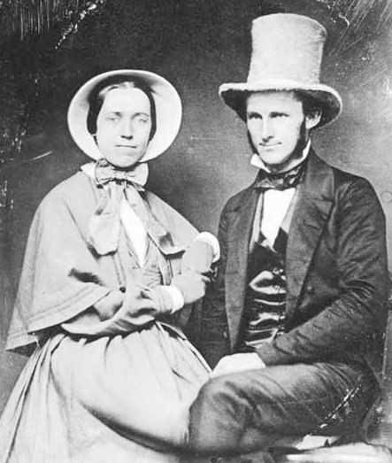
Catharine and David Blaine
Catharine and David Blaine at their 1853 wedding

Unfortunately, though the Blaines may have been feminists, they, according to HistoryLink.org, had no love for Native Americans (or, for that matter, the Irish). Their departure in 1856 was prompted by the Battle of Seattle. Junius Rochester writes:

On January 20, 1856, a son John, was born to Catharine and David Blaine. Six days later the Battle of Seattle erupted. David had duty at one of the blockhouses, but managed to get Catharine and their babe aboard the Decatur in Elliott Bay. David had described the Indians as a “poor degraded race,” which would “soon disappear.” Catharine compared their “stupidity and awkwardness” to that of the Irish. The Indian uprising confirmed their worst fears and prejudices.

Today, W Blaine Street begins in Magnolia at 36th Avenue W and goes a semicircular ⅕ of a mile to 34th Avenue W and W Howe Street. It resumes at 31st Avenue W and goes almost ⅓ of a mile to Thorndyke Avenue W. There is a stub of W Blaine east of 15th Avenue W that is quickly stopped by the Southwest Queen Anne Greenbelt. The street resumes at 12th Avenue W and goes just over a mile to 4th Avenue N, having briefly become a stairway at 9th Avenue W. After a series of short stretches serving as driveways and parking, the Blaine Street right-of-way resurfaces east of Westlake Avenue N and heads into Lake Union. Here, too, it serves as a driveway and offers no access to the water. East of Lake Union, E Blaine Street begins at Fairview Avenue E and goes ⅛ of a mile to Franklin Avenue E, where it becomes part of the I-5 Colonnade park underneath the freeway. From Lakeview Boulevard E to just west of 10th Avenue E it is a stairway, and then two blocks of roadway ending at 12th Avenue E and Lake View Cemetery. There is then a diagonal ¼-mile stretch from 19th Avenue E to E Howe Street in Montlake. E Blaine finishes up as a ⅕-mile stretch from 37th Avenue E to McGilvra Boulevard E and a final two-block run from E Madison Street to 43rd Avenue E, both in Madison Park.

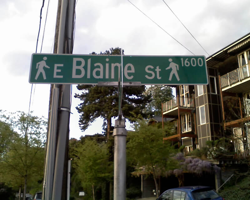
Sign for E Blaine Street, April 22, 2010
Sign for E Blaine Street at Broadway E, April 22, 2010. Blaine is a stairway on both sides of Broadway, hence the double 🚶 icon. Photograph by Benjamin Lukoff. Copyright © 2010 Benjamin Lukoff. All rights reserved.

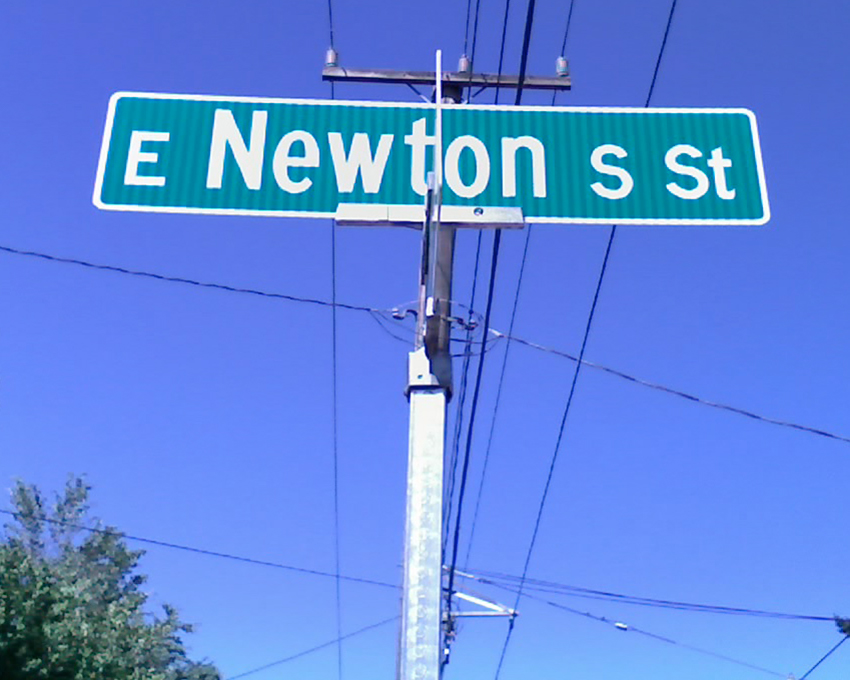
Newton Street

This street originates in the 1882 plat of Bigelow’s Addition to the City of Seattle, filed by Jesse W. George (1835–1895) and Cassandra Eckler George (1840–1920) at the request of Isaac Newton Bigelow (1838–1922). As the Queen Anne Historic Context Statement explains,

In the early 1870s, the Denny and Mercer families gradually began to systematically subdivide their large land holdings on the south and east slopes of Queen Anne Hill. When a severe windstorm blew down thousands of trees in the north district in 1875, views opened up and land seekers turned their attentions beyond Belltown. Real estate speculators new to the territory arrived and began to buy up property on the crest of Queen Anne Hill. Some of these speculators also became developers, such as George Kinnear, or builder-developers, such as Isaac Bigelow.

Though its proximity to Boston and Lynn Streets suggest a tribute to Newton, Massachusetts, neither the Georges nor the Bigelows appear to have a connection to the state, so it seems this one should be chalked up to Isaac Bigelow’s middle name.

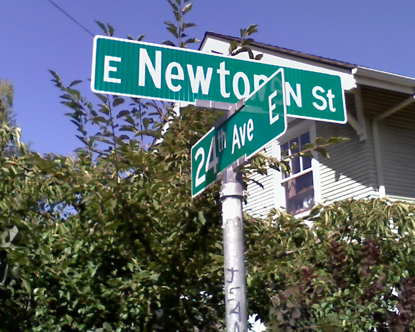
Today, Newton Street begins in Magnolia as W Newton Street at 30th Avenue W, and goes nearly half a mile east to 23rd Avenue W. There is then a two-block stretch from 15th Avenue W to 13th Avenue W in Interbay, and then the “original” Newton Street, which stretches almost a half mile from 1st Avenue N to Taylor Avenue N, followed by another two-block stretch from Dexter Avenue N to just past 8th Avenue N. On the east side of Lake Union, E Newton Street picks up again at Terry Pettus Park, just west of Fairview Avenue E, and goes ¼ mile to Boylston Avenue E and Lakeview Boulevard E. There follows another ¼-mile stretch from Broadway E to Everett Avenue E. East of there, Newton exists in a number of short segments through Montlake, and then enjoys a run of ⅓ of a mile from 37th Place E to 43rd Avenue E in Madison Park. 

W Fort Street

Fort Street originated as Fort Place in the 1905 plat of Lawton Park, an Addition to the City of Seattle. It originally formed part of the “government roadway leading from the east boundary of the military reservation of Fort Lawton,” but in 1961 four of its blocks were officially renamed W Government Way. What remains today is a one-block stretch between 36th Avenue W and 35th Avenue W, a three-block stretch between Kiwanis Memorial Reserve Park and 32nd Avenue W, and a bridge over the BNSF Railway tracks from 28th Avenue W and Gilman Avenue W to 27th Avenue W.

W Bertona Street

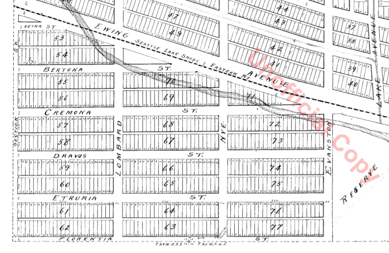
This street, as with Dravus Street, was created in 1888 as part of Denny & Hoyt’s Addition to the City of Seattle, Washington Territory, and is also is part of a series of streets — Aetna, Bertona, Cremona, Dravus, Etruria, and Florentia — that appear in alphabetical order and have the common theme of being locations in Italy. Montebello di Bertona (Mundibbèlle in the Abruzzese dialect) is a small town in Pescara, Abruzzo, located near Mt. Bertona.

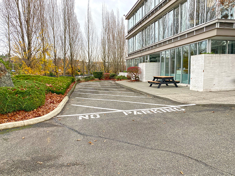
Technically, W Bertona Street begins as Bertona Street at the Ship Canal Trail around 80 feet east of Queen Anne Avenue N, but both streets there are little more than parking aisles nestled up against Seattle Pacific University’s Wallace Field. W Bertona begins in earnest at W Nickerson Street and goes ¾ of a mile west to 14th Avenue W, where it becomes a block-long stairway to 15th Avenue W. On the other side of 15th, it goes two more blocks before being stopped by the BNSF Railway tracks at 17th Avenue W; on the other side of the tracks it goes ⅗ of a mile west from 20th Avenue W to 30th Avenue W, becoming a stairway again for a block just about halfway. As with its Magnolia partner W Dravus Street, it’s ⅓ of a mile from 31st Avenue W to 36th Avenue W, where it becomes a stairway for a block, and then ½ a mile more from 37th Avenue W to 45th Avenue W. There is finally a 300-foot-long segment west of Perkins Lane W, where the roadway ends. (There is a shoreline street end beyond that, but it is currently inaccessible.)

Bertona Street east of Queen Anne Avenue N, November 2021
Bertona Street east of Queen Anne Avenue N, November 2021. The 2 Nickerson Street office building is at right; the row of trees is between the Ship Canal Trail and the Fremont Cut. Fremont and the Aurora Bridge are visible in the distance. Photograph by Benjamin Lukoff. Copyright © 2021 Benjamin Lukoff. All rights reserved.

Dravus Street

This street was created in 1888 as part of Denny & Hoyt’s Addition to the City of Seattle, Washington Territory by Edward Blewett and his wife, Carrie, of Fremont, Nebraska, who had purchased the land a few months earlier from Arthur Denny and John Hoyt. According to Valarie Bunn in her article “Fremont in Seattle: Street Names and Neighborhood Boundaries,” Edward Corliss Kilbourne may have done much of the actual naming of streets as attorney-in-fact for the Blewetts.

Portion of plat map of Denny and Hoyt's Addition to the City of Seattle, Washington Territory (1888) showing Aetna, Bertona, Cremona, Dravus, Etruria, and Florentia Streets
Portion of plat map of Denny and Hoyt’s Addition to the City of Seattle, Washington Territory (1888) showing Aetna, Bertona, Cremona, Dravus, Etruria, and Florentia Streets

As can be seen in the plat map above, Dravus is part of a series of streets — Aetna, Bertona, Cremona, Dravus, Etruria, and Florentia — that appear in alphabetical order and have the common theme of being locations in Italy, which had been unified 17 years earlier. I have yet to find a connection between Denny, Hoyt, the Blewetts, or Kilbourne and Italy. The closest I’ve come is an item in the February 28, 1903, issue of The Seattle Mail and Herald, which reports that “on February 27, the Woman’s Century Club met and discussed the subject ‘Italian Art and Literature.’ Mrs. Bessie L. Savage and Mrs. E.C. Kilbourne [Leilla Shorey] prepared papers relating to these subjects.” I would love to find out if there’s anything more solid!

The Drava River, which originates in the Italian region of the South Tyrol, flows from there through Austria, Slovenia, and Croatia, forming much of the border between that country and Hungary, and joining the Danube on the Croatia–Serbia border. It was known as Dravus in Latin and Δράβος in Greek.

Dravus Street begins in the east at Nickerson Street and goes ⅗ of a mile west to 8th Avenue W and Conkling Place W. It resumes for half a block at 10th Avenue W, is briefly a foot path and stairway, and then is an arterial connecting Queen Anne and Magnolia via Interbay, going just over a mile from 11th Avenue W to 30th Avenue W. (This section was originally known as Grand Boulevard, and indeed W Dravus is double the width of the other streets in the area, though it features wide planting strips instead of a central median.) It’s ⅓ of a mile from 31st Avenue W to 36th Avenue W, where it becomes a stairway for a block, and then ½ a mile more from 37th Avenue W to just west of Magnolia Boulevard W, where the roadway ends. (There is a shoreline street end off Perkins Lane W, but it is currently inaccessible.)

W Armour Street

This street was named in 1890 as part of Gilman’s Addition to the City of Seattle, which, as noted in Gilman Avenue W and other articles on streets in that addition, was associated with Daniel Hunt Gilman and the Seattle, Lake Shore and Eastern Railway (SLS&E).

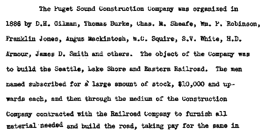
In the below excerpt from Thomas W. Prosch’s A Chronological History of Seattle from 1850 to 1897 (1901), some of Gilman’s fellow investors are listed, including Judge Thomas Burke (Burke Avenue N, Burke–Gilman Trail), James D. Smith (W Commodore Way), and Herman Ossian Armour. (The D is a typo, perhaps because of his brother, Philip Danforth Armour’s, middle initial.) The brothers founded the Chicago meatpacking company Armour and Company in 1867. 

Paragraph on establishment of Puget Sound Construction Company in 1886

In his article “The Orphan Railroad and the Rams Horn Right of Way,” in the April 1923 issue of The Washington Historial Quarterly, C.H. Hanford writes of the SLS&E, “A number of Seattle men… subscribed to the capital of the new company to the extent of their means, and having gained so much, Gilman and Judge Burke were successful in inducing Philip D. Armour of Chicago to advance the money required to start the enterprise.” So it is unclear just which Armour brother the street is named for — perhaps it is named for them both.

W Armour Street starts at 1st Avenue N and goes two blocks west to 1st Avenue W, where it is stopped by Rodgers Park. It makes it two more blocks, from 3rd Avenue W to 5th Avenue W, before again being stopped, this time by Mount Pleasant Cemetery. From there it exists in a number of short segments, including paths and stairs, before being stopped, once again, by the Interbay Golf Center at 15th Avenue W. Once across the railroad tracks in Magnolia, there is a nearly uninterrupted ¾ mile stretch from Thorndyke Avenue W to the West Magnolia Playfield at 32nd Avenue W, and then a few more short segments west of 34th Avenue W, ending for good at 46th Avenue W. (There is a shoreline street end off Perkins Lane W, but it is currently inaccessible.)

W Commodore Way

W Commodore Way, which runs 1⅓ miles along Salmon Bay from 21st Avenue W to 40th Avenue W, obviously has a nautical name, but is its backstory as simple as that, like NE Boat Street along Portage Bay? Or does it honor a particular person?

The only online mention I’ve seen of a possible specific referent of Commodore is in the Don Sherwood Parks History file for Commodore Park:

Who was particularly in mind when the street was named Commodore Way is not recorded. However, the choice of Commodore Peary’s flagship [the SS Roosevelt]… to participate in the dedication of the [Ballard] Locks is significant. Peary must have sailed from Seattle as the port nearest Alaska and the Arctic.

It’s a reasonable theory on its face, but there are some major flaws. The street was named in 1890 as part of Gilman’s Addition to the City of Seattle, when Peary was a lieutenant — 19 years before he reached the North Pole (supposedly) and 27 years before the Ballard Locks were dedicated. In addition, Peary’s port of departure was New York, not Seattle. It doesn’t seem possible Commodore Way was named for Robert E. Peary.

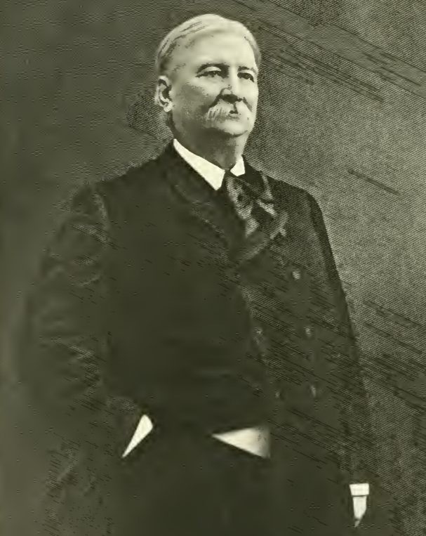
Rather, I think there’s good evidence it was named for James Dickinson Smith (1829–1909), commodore of the New York Yacht Club in 1882 and 1883 and president of the New York Stock Exchange in 1885 and 1886. In Men of Progress: Biographical Sketches and Portraits of Leaders in Business and Professional Life in and of the State of Connecticut (1898), they write that he “has a national and international reputation as a yachtsman, and is best known all over the world as Commodore James D. Smith.” But where is the connection to Seattle? And why Commodore Way instead of Smith Way?

James Dickinson Smith

I first became aware of Smith’s connection to Seattle when I came across this line in the March 30, 1890, issue of the Seattle Post-Intelligencer, while looking for a connection between Commodore and the Seattle, Lake Shore and Eastern Railway: “Mr. J.S. Dunham, treasurer of the Seattle, Lake Shore & Eastern, and Commodore Smith visited Snohomish yesterday.”

Portion of article mentioning Commodore Smith in March 30, 1890, issue of Seattle Post-Intelligencer
Item mentioning Commodore Smith in March 30, 1890, issue of Seattle Post-Intelligencer

Before I go too much farther, I should note that the landowners in the plat of Gilman’s Addition were listed as Dr. Henry A. Smith and Franklin M. Jones and his wife, Carrie B. Jones. Franklin was a member of the New York banking firm Jameson, Smith and Cotting, financiers of the business ventures of Daniel Hunt Gilman, including the Seattle, Lake Shore and Eastern Railway (SLS&E). Hence the search terms I’d been using at Washington Digital Newspapers

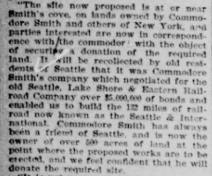
This article from the June 17, 1897, issue of the P-I also came up, further associating Commodore Smith (to distinguish him from Dr. Smith) with the SLS&E and with New York:

Portion of article mentioning Commodore Smith in June 17, 1897, issue of Seattle Post-Intelligencer

I then did some reading on Commodore Smith… but still wasn’t quite sure until I found this passage in Men of Mark in Connecticut: Ideals of American Life Told in Biographies and Autobiographies of Eminent Living Americans (1904): “Among his successful performances was the establishment, in 1865, of the banking firm of Jameson, Smith & Cotting, now the banking house of James D. Smith & Company.” So Commodore Smith was the Smith in Jameson, Smith and Cotting! If J.A. Jameson merited a street (W Jameson Street), surely so did Commodore Smith. And why Commodore Way instead of Smith Way? Because there was another Smith to be honored — Dr. Henry A. Smith (Smith Street, as well as Smith Cove).

It may not have been one of the great mysteries of the ages, but I do think I may have solved this one.

Thorndyke Avenue W

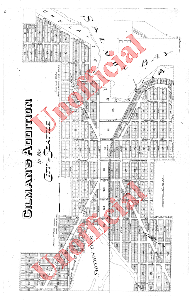
This street was named for Grace Chalmers Thorndike (, who married Daniel Hunt Gilman (Gilman Avenue W) in 1888. It was created in 1890 as part of Gilman’s Addition to the City of Seattle. The original plan was that Gilman and Thorndyke Avenues would intersect each other at Grand Boulevard (now W Dravus Street), but this was changed, as can be seen in the plat map below, likely in the knowledge that the tracks of the Seattle, Lake Shore and Eastern Railway would soon multiply and make that impractical.

Gilman's Addition to Seattle, 1890, two sheets stitched together
Gilman’s Addition to Seattle, 1890

It’s not entirely clear why the street is named Thorndyke rather than Thorndike. There was an announcement of the Gilman–Thorndike wedding in the January 15, 1888, issue of the Seattle Post-Intelligencer that spelled the name with a y, but otherwise the family’s name routinely appears in the Seattle press with an i. Yet we see that Grace’s sister Minnie — wife of James Bothwell (W Bothwell Street) — spelled her name with a y (at any rate, that is what appears on her tombstone).

(It’s also worth noting that Grace’s sister Estella married Captain William Rankin Ballard, after which the Ballard neighborhood is named, and her sister Delia married Ballard’s business partner Captain John Ayres Hatfield. The Thorndikes’ father was himself a ship’s captain, one Ebenezer Augustus Thorndike.)

Today, Thorndyke Avenue W begins at W Galer Street, at the west end of the Magnolia Bridge, and goes just over a mile northwest to 20th Avenue W and W Barrett Street. It picks up again as a minor road on the other side of the BNSF Railway tracks, going about ⅕ of a mile northwest from 17th Avenue W and W Bertona Street to a dead end under the 15th/Emerson/Nickerson overpass at the south end of the Ballard Bridge.

Gilman Avenue W

This street was named for Daniel Hunt Gilman (1845–1913), who among other things was one of the founders of the Seattle, Lake Shore and Eastern Railway (SLS&E) in 1885. The SLS&E is now part of the BNSF Railway, and its old right-of-way along the Lake Washington Ship Canal and Lake Washington is now the Burke–Gilman Trail.

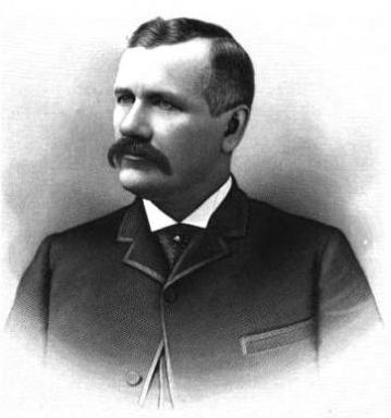
Daniel Hunt Gilman, circa 1890

The street was created in 1890 as part of Gilman’s Addition to the City of Seattle by Dr. Henry A. Smith (Smith Cove) and Franklin M. Jones and his wife, Carrie B. Jones. Franklin was a member of the New York banking firm Jameson, Smith and Cotting, financiers of Gilman’s business ventures.

Today, Gilman Avenue W begins at 20th Avenue W and W Bertona Street and goes ⁹⁄₁₀ of a mile northwest to 28th Place W, where it becomes W Government Way. The right-of-way continues on from there, though, and there is a 120-foot-long segment between 32nd Avenue W and Gay Avenue W and then, on the other side of Kiwanis Memorial Preserve Park, another 120-foot-long segment at the end of 34th Avenue W.

Originally, Gilman Avenue W existed east of the railroad tracks as well, but that section, between 15th Avenue W and 11th Avenue W, was changed to Gilman Drive W in 1961.

Gilman's Addition to Seattle, 1890, two sheets stitched together
Gilman’s Addition to Seattle, 1890

W Jameson Street

This street runs, interrupted by the BNSF Railway, for half a mile from 32nd Avenue W and W Government Way in the west to 23rd Avenue W in the east.

J.A. Jameson, of the New York bank Jameson, Smith & Cotting, was a director of the Seattle, Lake Shore and Eastern Railway. Daniel Hunt Gilman, who filed the plat of Gilman’s Addition to the City of Seattle in 1890, was a founder of the SLS&E, whose tracks, via the Northern Pacific and Burlington Northern, are now part of BNSF.

W Marina Place

This street, established in 1991 as part of the development of the Elliott Bay Marina at the southern foot of Magnolia Bluff, runs ⅖ of a mile west from 23rd Avenue W to just shy of the 30th Avenue W street end beach.

While the origin of its name may not be interesting, the story of its establishment is a bit more so:

  • The marina itself began the permitting process in 1983, but lawsuits delayed its creation for nearly a decade. The Muckleshoot Indian Tribe and Suquamish Tribe sued to block its construction on the basis that “construction of the Marina would eliminate a portion of one of their usual and accustomed fishing areas in Elliott Bay and thus would interfere with their treaty right to fish at the Marina site.” Homeowners on the bluff above intervened on the side of the developers, as “the area has had numerous major landslides that have left several homes at the crest of the bluff at risk and have repeatedly caused breaks in a trunk sewer line located at the base of the bluff.… The Marina construction includes the placement of 500,000 cubic yards of fill at the toe of the bluff, which would stabilize the area.” Eventually, a settlement was reached, which “calls for ongoing fisheries-related expenses paid to the tribe, which will be funded by a percentage of the moorage income.… [the] ‘Indian Treaty Surcharge.’”
  • I believe this was the last major fill operation within Seattle city limits. Such a development would be all but unthinkable today.
  • The marina was built on tidelands where W Lee Street and Puget Avenue W were platted but never built. They were vacated and W Marina Place was established. When it came to naming the access road, the developers originally proposed W Marina Boulevard, contending that as the road fell between the W Oakes Street right-of-way and the former W Lee Street right-of-way, it wasn’t a violation of the city’s principle of maintaining street grid names as much as possible. This was initially rejected by the city, which preferred W Lee Street, but after further discussion, W Marina Place was settled on. An interesting point the developers made was that as W Lee Street had never physically existed in Magnolia, though it had been platted there, calling the access road W Lee Street could actually be confusing, as “people familiar with Seattle streets know that there is no W Lee Street on Magnolia. Rather, they know W Lee Street as being on Queen Anne Hill.” Still, though, I have to believe they were more interested in their own vanity — Marina Boulevard? — than any particular concern for folks’ ability to navigate.
  • For some reason, the public street ends just feet from the 30th Avenue W street end beach. I’m not entirely sure why that is; I don’t think the marina is opposed to public access to the beach; otherwise, they wouldn’t be in favor of the Magnolia Trail project, which would connect W Marina Place to W Galer Street, 32nd Avenue W, and thence to Magnolia Village.
Aerial photograph of Elliott Bay Marina area in the 1930sAerial photograph of Elliott Bay Marina area, present day
Elliott Bay Marina site, 1930s and today

W Armory Way

This Interbay street, established in 1910 as Lawton Way, runs ¼ mile northwest from 15th Avenue W to the BNSF Railway’s Balmer Yard. Its right-of-way runs about 800 feet beyond that, across the railroad tracks, to 20th Avenue W, as it was once the location of a bridge to Magnolia.

W Lawton Way was changed to W Armory Way in 1973, presumably in anticipation of the construction in 1974 of an armory for the Washington Army National Guard. Will its name be changed again once the National Guard moves — or if it becomes the location of a new Magnolia Bridge?

(Another Armory Way near Pike Place Market existed on paper for many years — from 1936 to 2019 — but was never built. Something similar is currently under construction.)

Nickerson Street

This Queen Anne street runs 1½ miles from the meeting of 4th, Dexter, and Westlake Avenues N in the east (at the south end of the Fremont Bridge) to the 15th Avenue W interchange in the west. Some businesses in Fishermen’s Terminal have W Nickerson Street addresses, such as Chinook’s at 1900, but these few blocks of Nickerson are Port of Seattle roads that cannot be accessed directly from the public street.

Nickerson Street was named by Alfred A. Nickerson and Elmyra Nickerson, husband and wife, in their plat of Ross 2nd Addition to the City of Seattle in 1888.

W Ruffner Street

This street, which runs, with interruptions, for 2⅓ miles from Queen Anne to just short of Elliott Bay in Magnolia (though it is platted for several more blocks west over the tideflats) is named, as I learned from the Ruffner Family Association, for Presbyterian minister William Henry Ruffner. A slaveholder who “advocated the gradual emancipation and colonization of the state’s African Americans”, he was also, according to Encyclopedia Virginia, “the designer and first superintendent of Virginia’s public school system.”

How did this “Horace Mann of the South” end up with his name on a Seattle street? Apparently, in addition to being an educator, he was also a geologist, and so was hired by Thomas Burke and Daniel Gilman (of Burke–Gilman Trail fame), two of the founders of the Seattle, Lake Shore and Eastern Railway, to spend just over five weeks in 1887 surveying the area, the results of which were published in the SLS&E’s promotional book A Report on Washington Territory two years later. When it came time in 1890 for the plat of Gilman’s Addition to the City of Seattle to be filed, Ruffner’s name appeared on the map. 

The Seattle, Lake Shore and Eastern became part of the Northern Pacific Railway in 1892. Today, the Interbay Car Shop of the BNSF Railway, successor to the NP, is located at the corner of W Ruffner Street and Gilman Avenue W.

Expedia Group Way W

“Look! They’ve finally signed the W Galer Street Flyover!” I thought to myself the other day as I drove onto the Magnolia Bridge onramp from 15th Avenue W. “I wonder why they took so long?” (It was built in 2002.)

Then I saw the sign that directed drivers to take the flyover if they were headed toward Expedia Group Way W. Of course… it was because Expedia was moving their corporate headquarters from Bellevue to Interbay, and the first employees were scheduled to arrive this month.

It made sense for the private road — originally Amgen Court W after the campus’s previous corporate occupants — to change its name… but why to Expedia Group?

Yes, Expedia’s official name is Expedia Group — it’s the parent company not only of the eponymous online travel agency but of many other brands, including Hotels.com, Orbitz, Travelocity, Hotwire, and CheapTickets — but still. Wouldn’t Expedia Way W sound and look better? Adding the “group” makes the name sound much more corporate to my ear.