Sound View Terrace W

This street was created in 1905 as part of the plat of the Sound View Addition to Queen Anne. Originally a loop off 11th Avenue W and carrying that name, at some point it was renamed after the addition — which itself was named for its fine view of Puget Sound. (I have been unable to find the renaming ordinance, so don’t know exactly when the change was made.)

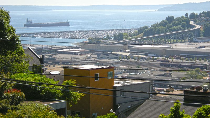
Smith Cove from Soundview Terrace Park, July 2008
Smith Cove, Interbay, and Magnolia from Soundview Terrace Park, July 2008. The industrial area at center is the Port of Seattle’s Terminal 91, the BNSF Railway’s Balmer Yard, and the Washington National Guard’s Seattle Readiness Center. Beyond the Magnolia Bridge is the Elliott Bay Marina. Photograph by Joe Mabel, Wikimedia Commons, licensed under Creative Commons Attribution-Share Alike 3.0 Unported
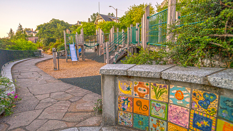
Soundview Terrace playground
Soundview Terrace Playground, July 2015. Sound View Terrace W is between the playground and the houses, all of which have Westview Drive W or 11th Avenue W addresses. Courtesy of the Seattle Municipal Archives, Identifier 178590
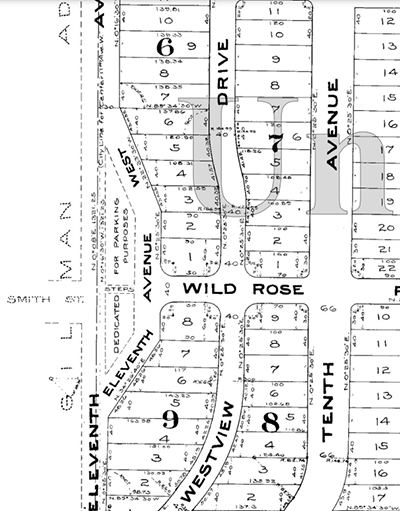
Portion of 1905 Plat of Sound View Addition to Queen Anne
Portion of the 1905 plat. Smith and Wild Rose Streets are now W Wheeler Street; the curving portion of 11th Avenue W is now Sound View Terrace W.

Elliott Way

Seattle’s newest street opened to traffic May 1 — but it has a rather old name.

Elliott Way, which also carries the honorary name Dzidzilalich, is named for Elliott Avenue, which in turn was named in 1895 for Elliott Bay — itself named in 1841 after Midshipman Samuel Bonnyman Elliott (1822–1876), part of the Wilkes Expedition.

The new road begins at the intersection of Western Avenue and Bell Street and goes ⅓ of a mile southeast to Alaskan Way and Pine Street.

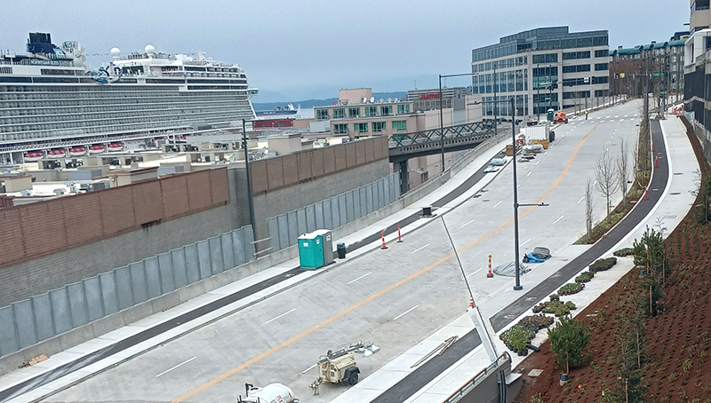
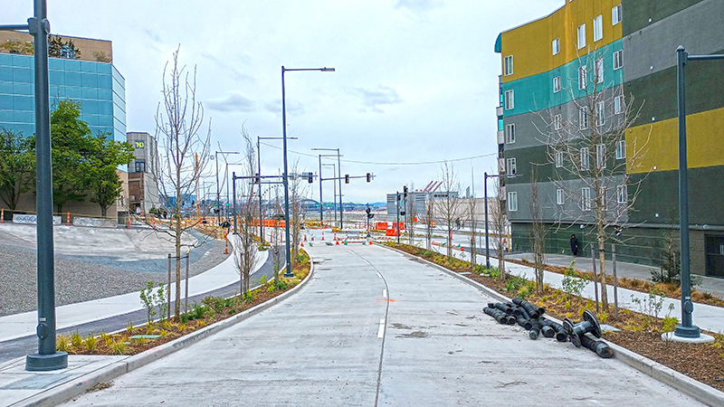
Elliott Way, spring 2023, looking north
Looking north on Elliott Way, shortly before opening, spring 2023. The Lenora Street pedestrian bridge can be seen crossing the railroad tracks at center; the Norwegian Bliss cruise ship is at upper left, docked at the Bell Street Cruise Terminal (Pier 66). Photograph courtesy of Ryan Packer. Copyright © 2023 Ryan Packer. All rights reserved.
Elliott Way, spring 2023, looking south
Looking south on Elliott Way, shortly before opening, Spring 2023. The Elliott Pointe building is at right and the “Blanchard Street Opportunity Site” at left. The intersection of Elliott Way and Elliott Avenue is at center. Photograph courtesy of Ryan Packer. Copyright © 2023 Ryan Packer. All rights reserved.

E Shore Drive

This private road in the gated Broadmoor neighborhood goes just under 800 feet from Broadmoor Drive E in the west to just east of Waverly Way E in the east. The northernmost street in the development, it runs parallel to the Union Bay shoreline about 950 feet to the northwest, whence its name.

Bitter Lake

Writes of Way isn’t just about street names (or just about names, for that matter). So… here is our first post on a body of water! As recounted in Bitter Place N, Bitter Lake was so named because, according to HistoryLink,

A small, lake-bound sawmill operation at the southwest corner of Bitter Lake contracted with the Puget Mill and Brown Bay Logging Company to process their lumber cut from nearby forests. The tannic acid from logs dumped into the lake was so bitter that horses refused to drink from it, thus giving the 20-acre pond its name.

Its native name is čʼalqʼʷadiʔ, meaning ‘blackcaps on the sides’.

“Dzidzilalich” to be honorary name for Elliott Way, Alaskan Way

Contrary to what I wrote in “Elliott Way” just a placeholder name, it sounds like the new road connecting Western Avenue at Bell Street to Alaskan Way at Pike Street will in fact carry the official name of Elliott Way. To quote from a post on Mayor Bruce Harrell’s blog,

Mayor Bruce Harrell, City Council President Debora Juarez, and key waterfront leaders are proposing to establish an honorary name for Alaskan Way and Elliott Way, between S Dearborn St and Bell St. “Dzidzilalich” (pronounced: dzee-dzuh-lah-leech) means “Little Crossing Over Place” in the Coast Salish language Lushootseed. This honorary name would recognize the deep tribal history and culture on Seattle’s waterfront. The Dzidzilalich street name designation would be honorary; the legal name of “Alaskan Way” would not change nor would the official addresses on the street.

As I wrote in Rob Mattson Way, honorary renamings differ from official (re)namings in three important ways:

  • They are done via resolution rather than ordinance
  • They do not replace the original street name in official records and addresses
  • They appear on brown, rather than green, signs

The Waterfront Seattle page on Dzidzilalich notes that “The Suquamish and Muckleshoot Tribal Councils provided guidance to the city of Seattle’s Mayor’s Office, the Office of the Waterfront and Civic Projects, and the Seattle Department of Transportation in the process of selecting Dzidzilalich as the honorary name for this roadway.”

Mockup of a brown street sign reading Dzidzilalich

I am glad to hear that this new street will carry a Lushootseed name. To the best of my knowledge only Duwamish Avenue S and Shilshole Avenue NW do so currently. To have a major downtown street with a name like this is long overdue.

I should also note that, if this is what the tribes want, I support the proposal — and though I have some issues with it, it is not my place to tell tribal members they deserve more. I have no idea what the negotiations looked like. That said, I do have some issues with the proposal.

First, “Elliott Way” remains an incredibly uncreative name for the new roadway. I said it before and I’ll say it again: “This is a [missed] opportunity to commemorate someone, or something, new, rather than Jared, George, Samuel, or Jesse Elliott (apparently no one is sure just which Elliott the bay is named after)!” There is nothing wrong with dead white men, but take a look at the tag cloud at the bottom of this post for proof that they are far overrepresented when it comes to Seattle street names.

Second, honorary names simply don’t carry the same heft as official ones. No one calls 19th Avenue between E Madison Street and E Union Street “Rev. Dr. S. McKinney Ave,” or 15th Avenue S between S Nevada Street and S Columbian Way “Alan Sugiyama Way.” But they do call Mary Gates Memorial Drive NE, E Barbara Bailey Way, Edgar Martinez Drive S, S Roberto Maestas Festival Street, etc., by those names… because they have no other choice.

I do like the idea of giving Alaskan Way an honorary name. It is far too long and important a street to officially rename without causing a lot of issues. The last time we did something like that was when Empire Way became Martin Luther King Jr. Way in the 1980s. I’m glad that happened, but think the process would be even more drawn out and controversial today. (However, if the street that runs along our waterfront carried the name of, say, a Confederate general, I’d be among the first to call for those signs to come down.) But why just this portion of Alaskan Way? To the best of my knowledge we’ve never given an existing street an honorary name for its entire length. Why not start here, from E Marginal Way S all the way to W Garfield Street?

In addition, one reason behind honorary namings is that existing addresses don’t need to be changed. But Elliott Way is new. There are no existing addresses. Why not, then, simply call it Dzidzilalich, and give Alaskan Way another honorary name? Or, why not give Alaskan Way the honorary name Dzidzilalich for its entire length, and give Elliott Way a different name that “elevate[s] Coast Salish tribal history and culture,” as the mayor’s blog puts it?

A few asides: I, personally, would prefer the spelling Dᶻidᶻəlalič, which uses Lushootseed orthography. (If Port Angeles can do it with their Klallam-language street signs, so can we!) And I notice that only the Suquamish and Muckleshoot tribes are mentioned as having been consulted. I wonder if representatives of the Duwamish Tribe were given a chance to weigh in as well. (My guess is they weren’t, as they are not federally recognized, while the Suquamish and Muckleshoot are, and oppose the efforts of the Duwamish to gain recongition. There is a long-standing controversy regarding the legitimacy of the Duwamish as the present-day representatives of Chief Seattle’s people. See The Politics of Paying Real Rent Duwamish in Seattle Met for an interesting take on the issue.)

Regardless of what happens, though, I am glad to see “Dzidzilalic” return to Seattle’s waterfront.

Where springs of clear water bubbled from the earth and the beach was sandy and free from rocks, there the Indians camped. Such a choice spot was Tzee-tzee-lal-litch, which Arthur Denny called Spring Street.

Sophie Frye Bass, “Pig-Tail Days in Old Seattle

Lake Dell Avenue

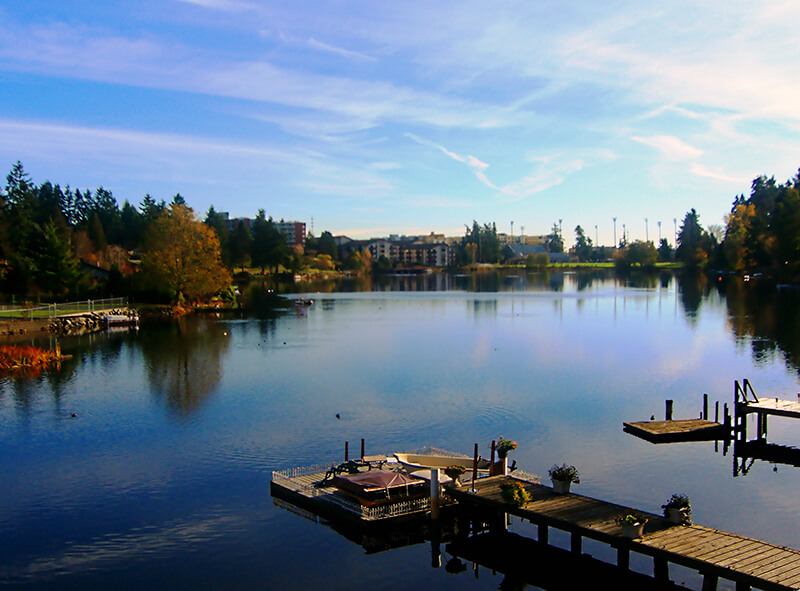
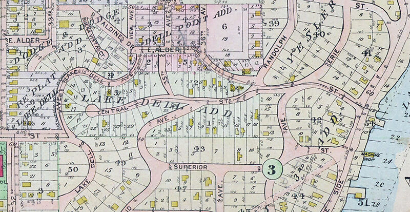
This street was created in 1890 as part of the Lake Dell Addition to the City of Seattle, the lake in question being Lake Washington, and the dell being the valley through which Lake Dell Avenue runs.

Lake Dell Avenue begins at 32nd Avenue just north of E Yesler Way and goes ⅓ of a mile to E Alder Street just west of 35th Avenue, forming part of the arterial connecting Yesler Way to Lakeside Avenue.

Portion of 1912 Baist real estate atlas of Seattle showing Lake Dell Addition
Landslide along Lake Dell Avenue, December 1933. Looking south from near the E Spruce Street right-of-way. Courtesy of the Seattle Municipal Archives, Identifier 8255
Lake Dell Avenue retaining wall, April 2012. Looking north from near the E Spruce Street right-of-way. Courtesy of the Seattle Municipal Archives, Identifier 174892

S Atlantic Street

As part of the Great Renaming of 1895, Texas Street, Town Street, Fontenelle Street, Flemming Street, Davidson Street, and Canal Street became Atlantic Street, from Elliott Bay to Lake Washington. The name was extended into West Seattle in 1907, when Grant Street and Louisiana Street were combined.

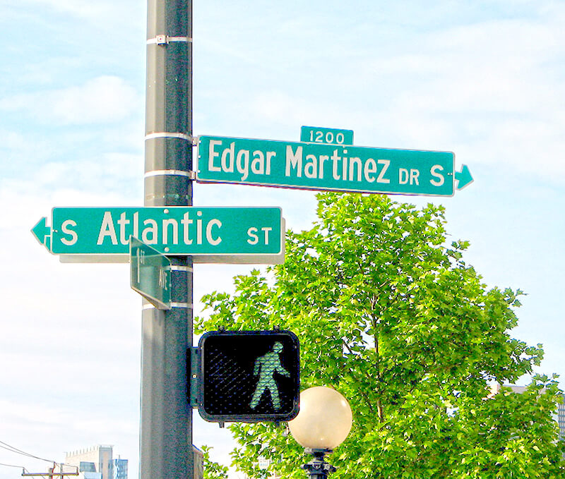
Street sign at 1st Avenue S (incorrectly signed as 1st Avenue), where S Atlantic Street becomes Edgar Martinez Drive S, May 2006
Street sign at 1st Avenue S (incorrectly signed as 1st Avenue), where S Atlantic Street becomes Edgar Martinez Drive S, May 2006. Photograph by Flickr user Dave O, licensed under Creative Commons Attribution-ShareAlike 2.0 Generic

Today, SW Atlantic Street begins in West Seattle at Sunset Avenue SW and goes ¼ of a mile east to Palm Avenue SW. It next appears, as S Atlantic Street, just east of U.S. Coast Guard Base Seattle at Alaskan Way S, and goes around 800 feet east to 1st Avenue S, where it becomes Edgar Martinez Drive S (renamed in honor of the ball player in 2004). Apart from a stub east of Airport Way S that is soon blocked by Interstate 5, the street’s next appearance is on Beacon Hill, where it goes ⅓ of a mile from just west of 11th Avenue S to 17th Avenue S, the portion between 15th Avenue S and 16th Avenue S being a stairway.

After being interrupted for a number of blocks by Interstate 90, S Atlantic Street reappears at 21st Avenue S and goes a block to just east of 22nd Avenue S. (Here, it gives its name to the surrounding Atlantic neighborhood.) It resumes — again having been interrupted by Interstate 90’s Mount Baker Tunnel — at Bradner Place S and goes ⅓ of a mile east to Lake Washington Boulevard S, the portions between 30th Avenue S and 31st Avenue South as well as between 32nd Avenue S and 33rd Avenue S being stairways. The right-of-way begins again at 35th Avenue S and goes around ⅛ of a mile east to Lake Washington, but is either incorporated into adjacent homeowners’ yards or serves as their driveways for most of this distance. Between Lakeside Avenue S and the water, it is one of the city’s shoreline street ends.

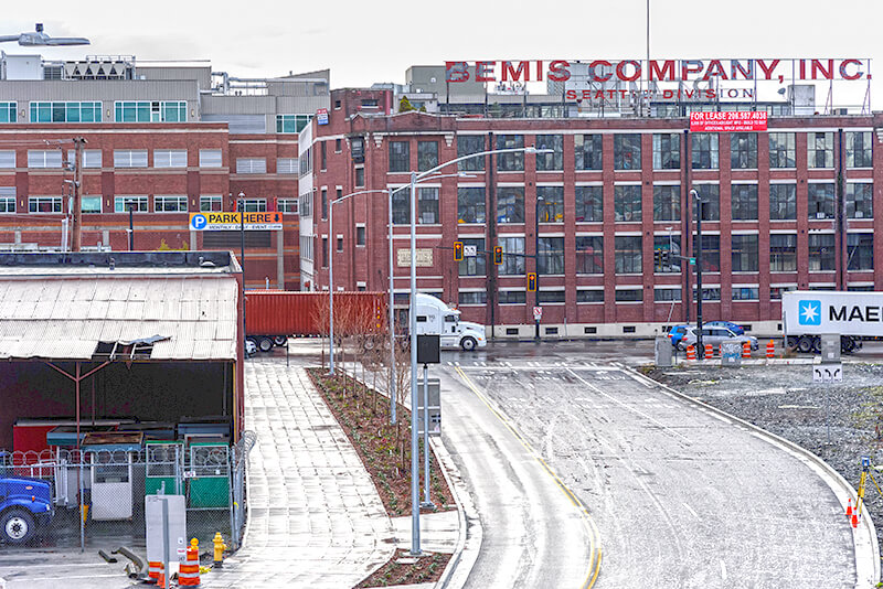
Looking south toward the intersection of Colorado Avenue S and S Atlantic Street, December 2018. The Bemis Building, at 55 S Atlantic Street, housed the local operations of the Bemis Brothers Bag Company from 1905 to 1993.
Looking south toward the intersection of Colorado Avenue S and S Atlantic Street, December 2018. The Bemis Building, at 55 S Atlantic Street, housed the local operations of the Bemis Brothers Bag Company from 1905 to 1993. Renovation began in 1995 and today it houses live/work spaces for artists. Photograph by Flickr user Washington State Department of Transportation, licensed under Creative Commons Attribution-NonCommercial-NoDerivs 2.0 Generic.

Chelan Avenue SW

This street was created in 1895 as part of the plat of Seattle’s tide lands, which featured streets named for letters of the alphabet, American cities, American states, prominent local politicians, and places in Washington. Among the latter were S Spokane Street, Duwamish Avenue S, Klickitat Avenue SW, and our current subject, Chelan Avenue SW. It appears to have been named for Lake Chelan (an anglicization of ščəl̕ámxəxʷ, meaning ‘deep water’ in Nxaʔamxcín, the language spoken by the Chelan people) — the largest natural lake in Washington and the third deepest lake in the United States (after Crater and Tahoe).

Chelan Avenue SW begins at SW Spokane Street and goes ¼ mile northwest to the West Duwamish Waterway.

Klickitat Avenue SW

Like S Spokane Street, Colorado Avenue S, and Utah Avenue S, this street was created in 1895 as part of the plat of Seattle’s tide lands. As I wrote in S Spokane Street,

Streets in this plat that were not extensions of already existing ones, such as Commercial Street, were named after letters of the alphabet, American cities, American states, prominent local politicians, and places in Washington.

Those places in Washington were Chelan, Duwamish, Kitsap, Klickitat, Queets, Quilcene, Quileute, Quinault, Spokane, Vashon, Wenatchee, and Whatcom, many (though not all) of which were themselves named after Native American groups or people. (Chelan, Duwamish, Klickitat, and Spokane are the only street names that remain.) In this particular case, we have the Klickitat River, a tributary of the Columbia in south central Washington, itself named for the Klickitat people.

Klickitat Avenue SW begins at 16th Avenue SW and goes around ⅖ of a mile southeast to SW Manning Street, all on Harbor Island.

Seattle skyline from Klickitat Avenue
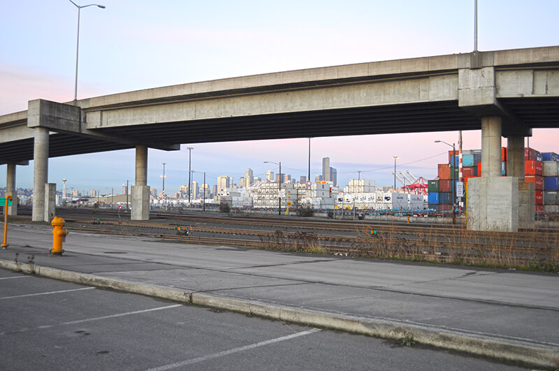
Looking northeast toward the Seattle skyline from Harbor Island, December 2011. The Klickitat Avenue Bridge is in the foreground. Photograph by Joe Mabel, Wikimedia Commons, licensed under Creative Commons Attribution-ShareAlike 3.0 Unported

Duwamish Avenue S

This street was created in 1895 as part of the Seattle Tide Lands plat. As I wrote in S Spokane Street, “Streets in this plat that were not extensions of already existing ones, such as Commercial Street, were named after letters of the alphabet, American cities, American states, prominent local politicians, and places in Washington”; these last included Chelan, Duwamish, Kitsap, Klickitat, Queets, Quilcene, Quileute, Quinault, Spokane, Vashon, Wenatchee, and Whatcom, the ones in italics still existing today. It seems strange to me that the Duwamish name would have been applied to such a short street, it being the name of Seattle’s principal river (dxwdəw) and indigenous inhabitants, the Duwamish Tribe (dxʷdəwʔabš), but there you have it. At least it still exists.

In “Elliott Way” just a placeholder name, I quote an email I wrote to the Seattle City Council and the Waterfront Seattle Program in December 2020 which read, in part, “I urge you… to name [Elliott Way] something else. The Duwamish people, for example, have Duwamish Avenue S named for them (actually more likely for the river…), but it is an insignificant street 2/10 of a mile long hidden under the Spokane Street Viaduct and the Alaskan Freeway. Perhaps Duwamish Avenue would be a better choice, if the tribe approved?” I still think this would be a good idea (and it would give us another naming opportunity as well). They did respond favorably, said they had been thinking along the same lines, and as of January 2022 “continue to coordinate with the tribes and other partners on a proposed name.” I hope they come up with something soon, as what is still being referred to as Elliott Way is due to open by year’s end!

As I mentioned in my email, Duwamish Avenue S is 2/10 of a mile long, beginning at E Marginal Way S and ending at a Port of Seattle road just south of the West Seattle and Spokane Street Bridges.

Update as of February 2, 2023: I posted an article last month  “Dzidzilalich” to be honorary name for Elliott Way, Alaskan Way — noting that, in fact, the roadway will be known as Elliott Way… but will carry the honorary name “Dzidzilalich.” So it seems “Elliott Way,” after all, is unfortunately not just a placeholder name, and for now the Duwamish name remains confined to this obscure thousand-foot-long street.

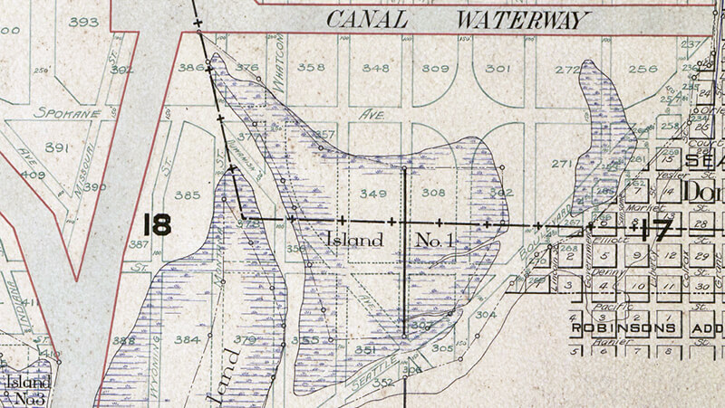
Portion of 1895 plat of Seattle Tide Lands showing Duwamish Avenue, as platted from Spokane Avenue (now Street) in the northwest to Seattle Boulevard in the southeast. The visible portion of Seattle Boulevard is now Diagonal Avenue S, Whatcom Avenue is now E Marginal Way S, and Grant Street is now Airport Way S.

Coniston Road NE

This street in Seattle’s Windermere neighborhood runs around 350 feet on either side of NE Windermere Road (so 700 feet total) just southeast of the neighborhood’s main entrance off Sand Point Way NE. It appears to have been named either after the Lake District village of Coniston, in the county of Cumbria, England, or Coniston Water, England’s fifth largest natural lake. Coniston is about 4⅔ miles west of Windermere, England’s largest natural lake, after which the neighborhood was named.

Padilla Place S

This street was created in 1889 as part of the Commercial Street Steam Motor Addition to the City of Seattle. It appears to have been named for Padilla Bay, which lies between Guemes and Fidalgo Islands and the mainland and is about 60 miles northwest of Seattle, as S Orcas Street appears to honor Orcas Island and S Fidalgo Street, Fidalgo Island. Like Orcas Island, it was named after Juan Vicente de Güemes Padilla Horcasitas y Aguayo, 2nd Count of Revillagigedo, Viceroy of New Spain, who sent an expedition to explore the area in the early 1790s.

Padilla Place S begins at S Homer Street and goes two blocks southwest to S Fidalgo Street, crossing S Orcas Street on the way.

Seola Beach Drive SW

According to Seattle parks historian Don Sherwood’s sheet on Seola Park, this street began as a logging railroad. It was then replaced by the Charles Arey county road (“recently surveyed,” according to an article in the August 26, 1893, Seattle Post-Intelligencer), which was renamed Qualheim Road in 1914 by Carl Olsen Qualheim. It received its current name in 1956 when that portion of Arbor Heights was annexed to Seattle. “Seola” itself was the product of a naming contest:

In 1893, a family named Kakeldy built the first home on the beach.… Before long, children in the vicinity school referred to residents of Kakeldy Beach as the “Cackilty Chickens.”… In 1910 the beach residents sponsored a renaming contest which was won by Mel Miller, friend of the school’s teacher of Spanish, Agnes Quigley; his suggestion: “Se-ola = to know the wave.”

Seola Beach Drive SW begins at SW 106th Street between 28th Avenue SW and 31st Avenue SW and goes ⅞ of a mile south, then southwest, to a dead end at the beach, just past SW Seola Lane.

For its entire length, Seola Beach Drive SW forms the southern city limits of Seattle, separating it from Burien and unincorporated King County (White Center). (Unlike the northern city limits, formed by 145th Street, Seattle’s southern city limits are jagged. If they went due east from Seola Beach, Seattle would encompass large portions of Burien, Tukwila, and Renton; whereas if they followed a parallel set at the city limits’ northernmost point, everything south of Kenyon Street [approximately the north end of the South Park Bridge] would be lost to Seattle.)

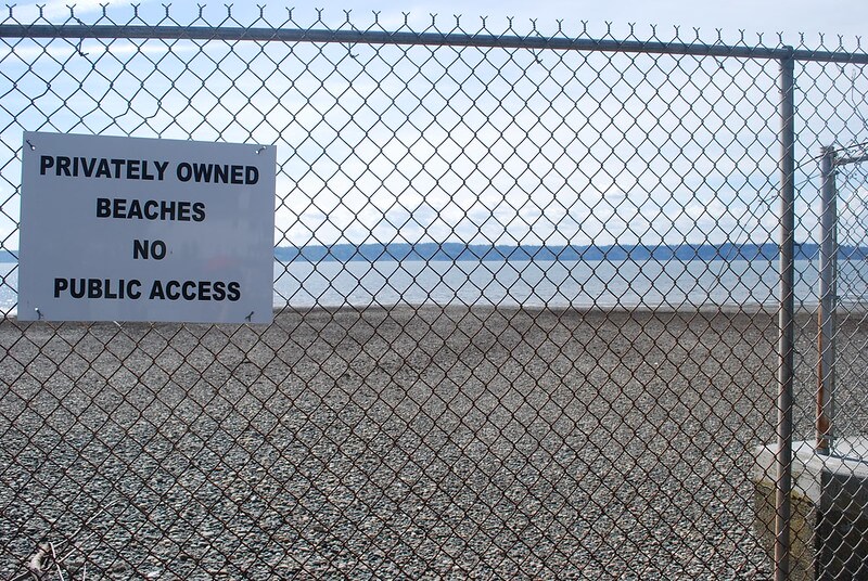
Sign reading Privately Owned Beaches, No Public Access at Seola Beach
Seola Beach, April 8, 2011. Unfortunately, this is not a case where a street was platted into the water, creating a shoreline street end; the right-of-way explicitly ends at the fence, and this portion of the beach belongs to the property owners to the south. Photograph by Flickr user NabeWise, licensed under Creative Commons Attribution 2.0 Generic

Lakeside Avenue

This street first appeared in 1890 as part of Yesler’s Third Addition to the City of Seattle, and ran two blocks from what is now E Alder Street to the north end of what is now Leschi Park. It was so named for running along the Lake Washington shoreline.

Today, Lakeside Avenue begins a block further south, where Lake Washington Boulevard leaves the shoreline and begins winding its way through Leschi and Frink Parks. It becomes Lakeside Avenue S at the north end of Leschi Park, and ends where Lake Washington Boulevard S rejoins the shoreline at Colman Beach, for a total distance of 1¼ miles.

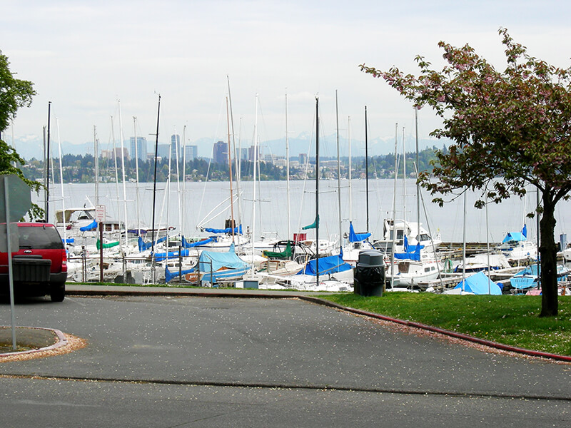
Leschi Marina
Leschi Marina from Lakeside Avenue S, April 30, 2007. Photograph by Joe Mabel, Wikimedia Commons, licensed under Creative Commons Attribution-Share Alike 3.0 Unported.

Lake Park Drive S

Like S Mount Baker Boulevard and Hunter Boulevard S, this street was created in 1907 as part of the plat of Mt. Baker Park, an Addition to the City of Seattle, filed by the Hunter Tract Improvement Company along with Rollin Valentine Ankeny and his wife, Eleanor Randolph Ankeny. It was so named for connecting the north end of the neighborhood to Lake Washington at Mount Baker Beach.

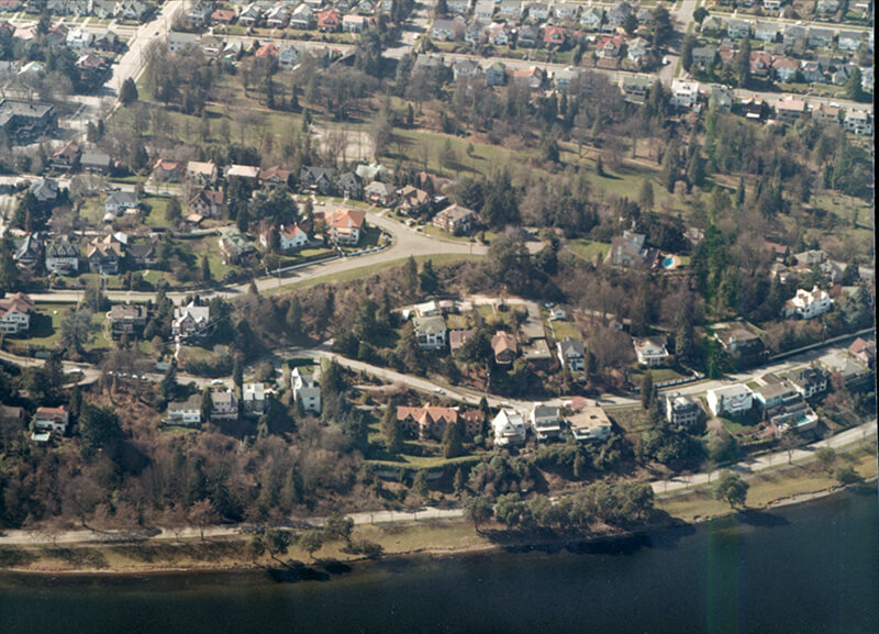
Aerial of Mount Baker Park, March 18, 1971
Aerial of Mount Baker Park, March 18, 1971. Lake Park Drive S is just east (toward the bottom of the photograph) of the green swath at center. Courtesy of the Seattle Municipal Archives, Identifier 78115

Lake Park Drive S begins at the intersection of S McClellan Street, S Mount Baker Boulevard, Mount Baker Drive S, and Mount Rainier Drive S, and goes ⅓ of a mile north to Lake Washington Boulevard S.

Lake Shore Drive S

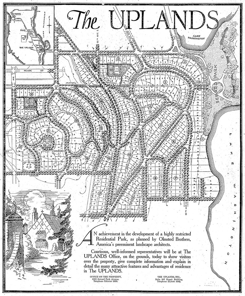
This street, created in 1926 as part of the plat of The Uplands (S Upland Road), was so named because it runs along the Lake Washington shoreline just south of Seward Park.

Full-page ad for The Uplands in The Seattle Times, September 27, 1925
Full-page ad for The Uplands in The Seattle Times, September 27, 1925. Lake Shore Drive is at the lower right-hand corner of the plat.

Lake Shore Drive S begins at Seward Park Avenue S and S Hawthorn Road and goes ¼ mile south to S Eddy Street.

Ferry Avenue SW

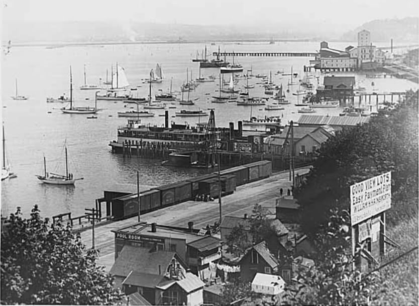
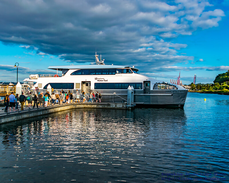
This street, created in 1888 as part of the First Plat of West Seattle by the West Seattle Land and Improvement Company, was originally named Grand Avenue. It was renamed, along with many other West Seattle streets, in 1907, when West Seattle was annexed by Seattle. The name was a reference to the WSL&IC ferry terminal at what is today Harbor Avenue SW at California Way SW. The West Seattle Water Taxi has been operating from the same location since 1997.

Today, Ferry Avenue SW begins at California Way SW and goes about ³⁄₇ of a mile southwest to just past California Avenue SW, at California Place park (built on the site of a former streetcar terminal; before that, a cable car ran up the Ferry Avenue right-of-way from Elliott Bay to this location). It resumes on the other side of the park at SW Hill Street and goes a further 600 feet southwest to SW Walker Street.

Shoreline Park Drive NW

This street was created in 1964 as part of the plat of Shoreline Park Estates. The subdivision was presumably named for Carkeek Park, which surrounds it on three sides and features a long Puget Sound shoreline.

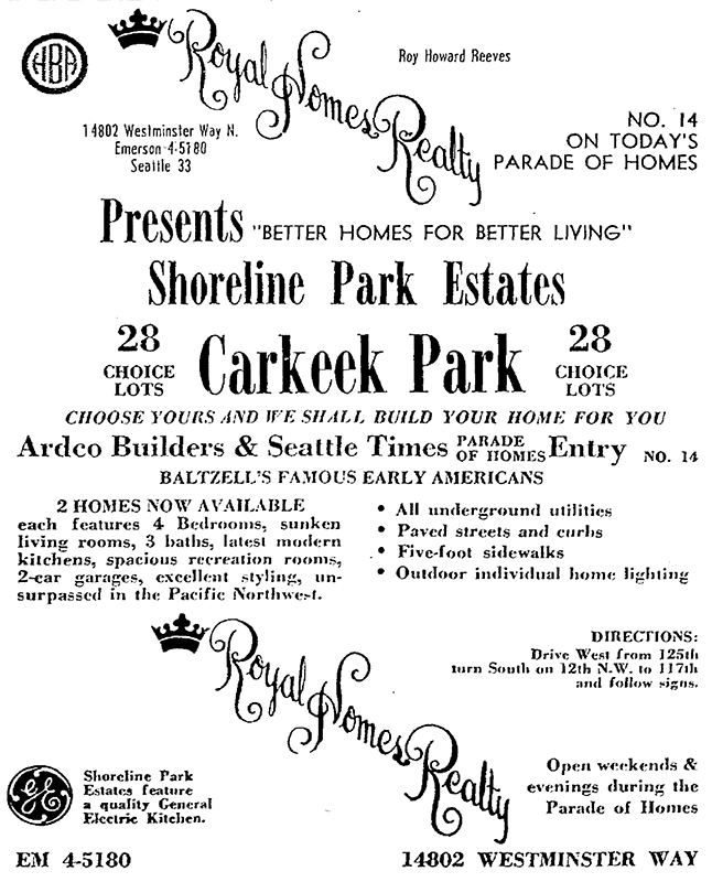
Advertisement for Shoreline Park Estates, The Seattle Times, September 20, 1964
Advertisement for Shoreline Park Estates, The Seattle Times, September 20, 1964. The address and phone number of Royal Homes Realty — 14802 Westminster Way N., Seattle 33, EMerson 4-5180 — would today be Shoreline, WA 98133, 206-364-5180, because of the incorporation of Shoreline in 1995; the mandatory use of ZIP Codes by bulk mailers, which began in 1967; the transition to all-number calling, which was completed in Greater Seattle in 1972; and the mandatory use of 10-digit dialing, which began in Greater Seattle in 2017.

Shoreline Park Drive NW runs about 275 feet between NW 118th Street and NW 117th Street. The developers dedicated a walkway west of NW 117th Street to the public; this connects to the Grand Fir Trail, one of Carkeek Park’s many trails.

NE Thornton Place

Thornton Creek runs 18 miles from Shoreline to Seattle, where it empties into Lake Washington at Matthews Beach Park. Its watershed, which drains 11.6 square miles, is the largest in Seattle. Yet until recently, no street bore its name — and the one that now does is a short private road.

NE Thornton Place, which runs not quite 500 feet between 3rd Avenue NE and NE 103rd Street, cuts through the Thornton Place development, built on the site of a former Northgate Mall parking lot under which the South Fork of Thornton Creek ran in a culvert. A portion of the creek was daylighted as part of the project. (Incidentally, I had the pleasure of seeing the IMAX version of The Beatles: Get Back – The Rooftop Concert at the Regal Thornton Place on January 30 of this year, the 53rd anniversary of the historic event. I am an even bigger fan of the Beatles than I am of odonymy!) You can read more about the Thornton Creek Water Quality Channel at Wedgwood in Seattle History.

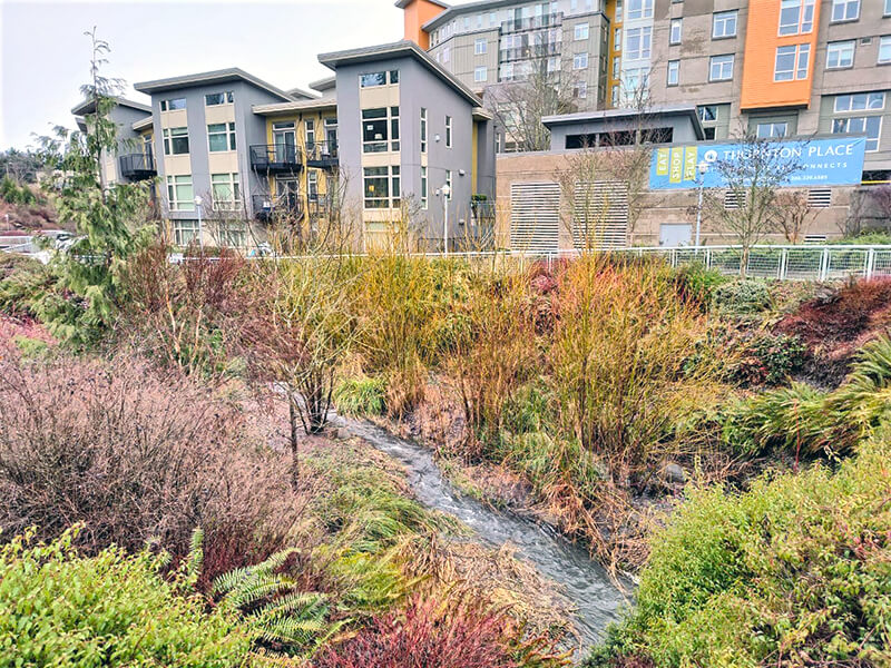
Thornton Creek Water Quality Channel with apartments and Thornton Place sign in background
Thornton Creek Water Quality Channel, with Thornton Place development in background. Photograph courtesy of Wedgwood in Seattle History. Copyright © 2023 Wedgwood in Seattle History. All rights reserved.

I originally wrote here that “The creek is named for John Q. Thornton (1825–1904), who… never actually lived in the Seattle area, but in 1885 bought land near what are today Meridian Park and Twin Ponds Park, at or near the headwaters of Meridian Creek, a tributary of the North Fork of Thornton Creek….” However, in the summer of 2022, the person whose article on Thornton I cited told me that they no longer believed this to be the case, and had edited their article accordingly. The creek’s namesake, therefore, remains a mystery.

Marginal Place SW

This street, created in 1919 by Ordinance 39638, is named for W Marginal Way SW. It begins there and goes just under 800 feet northwest to a dead end underneath the West Seattle Bridge. The Duwamish Trail continues on from there to the West Seattle Bridge Trail, while the 18th Avenue SW stairway heads south up the hill to SW Charlestown Street in Pigeon Point.