Elliott Way

Seattle’s newest street opened to traffic May 1 — but it has a rather old name.

Elliott Way, which also carries the honorary name Dzidzilalich, is named for Elliott Avenue, which in turn was named in 1895 for Elliott Bay — itself named in 1841 after Midshipman Samuel Bonnyman Elliott (1822–1876), part of the Wilkes Expedition.

The new road begins at the intersection of Western Avenue and Bell Street and goes ⅓ of a mile southeast to Alaskan Way and Pine Street.

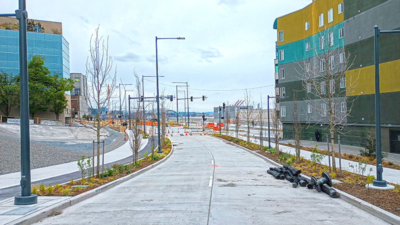
Elliott Way, spring 2023, looking north
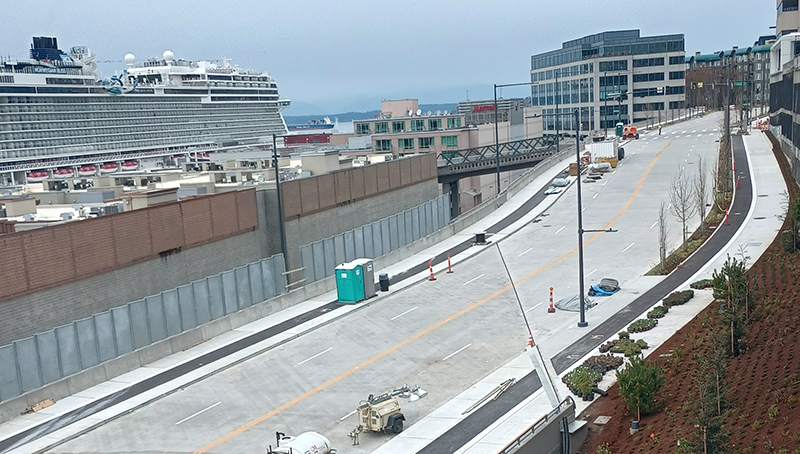
Looking north on Elliott Way, shortly before opening, spring 2023. The Lenora Street pedestrian bridge can be seen crossing the railroad tracks at center; the Norwegian Bliss cruise ship is at upper left, docked at the Bell Street Cruise Terminal (Pier 66). Photograph courtesy of Ryan Packer. Copyright © 2023 Ryan Packer. All rights reserved.
Elliott Way, spring 2023, looking south
Looking south on Elliott Way, shortly before opening, Spring 2023. The Elliott Pointe building is at right and the “Blanchard Street Opportunity Site” at left. The intersection of Elliott Way and Elliott Avenue is at center. Photograph courtesy of Ryan Packer. Copyright © 2023 Ryan Packer. All rights reserved.

“Dzidzilalich” to be honorary name for Elliott Way, Alaskan Way

Contrary to what I wrote in “Elliott Way” just a placeholder name, it sounds like the new road connecting Western Avenue at Bell Street to Alaskan Way at Pike Street will in fact carry the official name of Elliott Way. To quote from a post on Mayor Bruce Harrell’s blog,

Mayor Bruce Harrell, City Council President Debora Juarez, and key waterfront leaders are proposing to establish an honorary name for Alaskan Way and Elliott Way, between S Dearborn St and Bell St. “Dzidzilalich” (pronounced: dzee-dzuh-lah-leech) means “Little Crossing Over Place” in the Coast Salish language Lushootseed. This honorary name would recognize the deep tribal history and culture on Seattle’s waterfront. The Dzidzilalich street name designation would be honorary; the legal name of “Alaskan Way” would not change nor would the official addresses on the street.

As I wrote in Rob Mattson Way, honorary renamings differ from official (re)namings in three important ways:

  • They are done via resolution rather than ordinance
  • They do not replace the original street name in official records and addresses
  • They appear on brown, rather than green, signs

The Waterfront Seattle page on Dzidzilalich notes that “The Suquamish and Muckleshoot Tribal Councils provided guidance to the city of Seattle’s Mayor’s Office, the Office of the Waterfront and Civic Projects, and the Seattle Department of Transportation in the process of selecting Dzidzilalich as the honorary name for this roadway.”

Mockup of a brown street sign reading Dzidzilalich

I am glad to hear that this new street will carry a Lushootseed name. To the best of my knowledge only Duwamish Avenue S and Shilshole Avenue NW do so currently. To have a major downtown street with a name like this is long overdue.

I should also note that, if this is what the tribes want, I support the proposal — and though I have some issues with it, it is not my place to tell tribal members they deserve more. I have no idea what the negotiations looked like. That said, I do have some issues with the proposal.

First, “Elliott Way” remains an incredibly uncreative name for the new roadway. I said it before and I’ll say it again: “This is a [missed] opportunity to commemorate someone, or something, new, rather than Jared, George, Samuel, or Jesse Elliott (apparently no one is sure just which Elliott the bay is named after)!” There is nothing wrong with dead white men, but take a look at the tag cloud at the bottom of this post for proof that they are far overrepresented when it comes to Seattle street names.

Second, honorary names simply don’t carry the same heft as official ones. No one calls 19th Avenue between E Madison Street and E Union Street “Rev. Dr. S. McKinney Ave,” or 15th Avenue S between S Nevada Street and S Columbian Way “Alan Sugiyama Way.” But they do call Mary Gates Memorial Drive NE, E Barbara Bailey Way, Edgar Martinez Drive S, S Roberto Maestas Festival Street, etc., by those names… because they have no other choice.

I do like the idea of giving Alaskan Way an honorary name. It is far too long and important a street to officially rename without causing a lot of issues. The last time we did something like that was when Empire Way became Martin Luther King Jr. Way in the 1980s. I’m glad that happened, but think the process would be even more drawn out and controversial today. (However, if the street that runs along our waterfront carried the name of, say, a Confederate general, I’d be among the first to call for those signs to come down.) But why just this portion of Alaskan Way? To the best of my knowledge we’ve never given an existing street an honorary name for its entire length. Why not start here, from E Marginal Way S all the way to W Garfield Street?

In addition, one reason behind honorary namings is that existing addresses don’t need to be changed. But Elliott Way is new. There are no existing addresses. Why not, then, simply call it Dzidzilalich, and give Alaskan Way another honorary name? Or, why not give Alaskan Way the honorary name Dzidzilalich for its entire length, and give Elliott Way a different name that “elevate[s] Coast Salish tribal history and culture,” as the mayor’s blog puts it?

A few asides: I, personally, would prefer the spelling Dᶻidᶻəlalič, which uses Lushootseed orthography. (If Port Angeles can do it with their Klallam-language street signs, so can we!) And I notice that only the Suquamish and Muckleshoot tribes are mentioned as having been consulted. I wonder if representatives of the Duwamish Tribe were given a chance to weigh in as well. (My guess is they weren’t, as they are not federally recognized, while the Suquamish and Muckleshoot are, and oppose the efforts of the Duwamish to gain recongition. There is a long-standing controversy regarding the legitimacy of the Duwamish as the present-day representatives of Chief Seattle’s people. See The Politics of Paying Real Rent Duwamish in Seattle Met for an interesting take on the issue.)

Regardless of what happens, though, I am glad to see “Dzidzilalic” return to Seattle’s waterfront.

Where springs of clear water bubbled from the earth and the beach was sandy and free from rocks, there the Indians camped. Such a choice spot was Tzee-tzee-lal-litch, which Arthur Denny called Spring Street.

Sophie Frye Bass, “Pig-Tail Days in Old Seattle

Eastmont Way W

Like its twin, Westmont Way W, this street was created in 1915 as part of the plat of Carleton Park, which “afford[ed] a scenic frontage for every building lot in the addition,” according to The Seattle Times. Just as Westmont faces the Olympic Mountains to the west and southwest, Eastmont faces the Cascades to the southeast.

Beginning at Eastmont Place, a pocket park at the south end of Westmont Way W, it goes around 850 feet northeast to W McGraw Street, where it becomes 36th Avenue W.

Westmont Way W

In Viewmont Way W, I discuss the 1915 plat of Carleton Park, in which, as The Seattle Times reported,

The streets and boulevards curve and swing about the bases of elevated portions, escaping the deep cuts and heavy fills that would be necessary in conforming to the strict, rectangular plans of the old plat, and affording a scenic frontage for every building lot in the addition.

Many streets in the subdivision were named in reference to these views, Westmont Way W among them. Beginning at Eastmont Place, a pocket park at the south end of Eastmont Way W, it goes ⅖ of a mile north, then northwest, to W Viewmont Way W, providing westerly and southwesterly views of the Olympic Mountains for its entire length.

Bridge Way N

This street was created in 1930 as part of the ordinance establishing Aurora Avenue N and its approaches. Originally Wallingford Way, as it led from the north end of the Aurora Bridge to Stone Way N just south of N 40th Street, it was changed to Bridge Way in 1960. (A counterpart, Fremont Way, was also created, leading from the north end of the bridge to Fremont Avenue N at N 39th Street.)

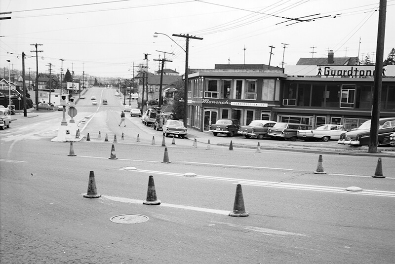
Looking southwest down Bridge Way N from Stone Way N, January 1961. Courtesy of the Seattle Municipal Archives, Identifier 66205

Lincoln Park Way SW

This street was named for Lincoln Park, which occupies Williams Point in West Seattle. Originally called Williams Point Park in the Olmsted Brothers’ 1908 report to the city, the 135-acre park was intended to be named Fauntleroy Park. However, when it opened in 1922, it was decided to name it after President Abraham Lincoln (1809–1865) instead, according to Seattle parks historian Don Sherwood. This required that Lincoln Beach, just to the north, be renamed Lowman Beach, and that Lincoln Park Playfield on Capitol Hill (named for the adjacent Lincoln Reservoir) be renamed Broadway Playfield. (Today, the entire tract is known as Cal Anderson Park, which contains the reservoir and the once-again-renamed Bobby Morris Playfield. A Fauntleroy Park was finally established in the early 1970s.)

Lincoln Park Way SW begins at Beach Drive SW and 48th Avenue SW and goes ¼ of a mile southeast to 47th Avenue SW between SW Myrtle Street and SW Othello Street. The park begins 500 feet to the south, at the corner of 47th Avenue SW and SW Fontanelle Street.

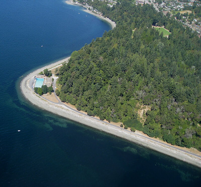
Aerial view of Lincoln Park
Aerial view of Lincoln Park from the southwest, August 15, 2010. The heated saltwater Colman Pool, which opened in 1941, is visible at Williams Point. Photograph by Flickr user J Brew, licensed under Creative Commons Attribution-ShareAlike 2.0 Generic.

SW Bronson Way

This West Seattle street was created in 1900 as part of the Replat of the West Seattle Land & Improvement Co’s. Third Plat. Originally Beach Way, it was renamed Bronson Way in 1907, when Seattle annexed West Seattle. Given that Ira Hull Bronson (1868–1930) was attorney for and vice president of the WSL&IC, it seems a fair assumption that it was named for him.

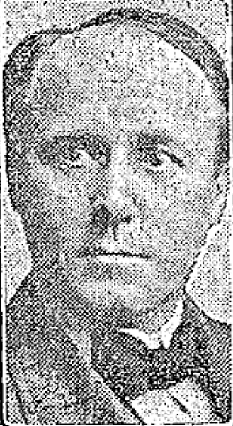
Ira Bronson, from his June 17, 1930, obituary in The Seattle Times
Ira Bronson, from his June 17, 1930, obituary in The Seattle Times. He had died the day before.

Bronson, a former president of the American Bar Association, was described in the June 18, 1930, issue of The Seattle Times as a “pioneer Seattle attorney and leader in admiralty circles… [who] was one of the founders of the Inland Navigation Company, which later became the Puget Sound Navigation Company.” (The PSNC’s domestic ferry routes were bought by the state in 1951, forming Washington State Ferries, and most of its Canadian routes became part of the new BC Ferries system in 1961. The firm, now known as the Black Ball Ferry Line, now runs one boat, the MV Coho, between Port Angeles and Victoria. Through a series of mergers, Bronson’s law firm is now Stoel Rives.)

Though the right-of-way begins further inland, SW Bronson Way only physically exists between Harbor Avenue SW and Elliott Bay. About 180 feet long, it is nearly 90 feet wide (quite a length-to-width ratio!) and essentially serves as a public parking lot. It is a shoreline street end, platted into the water, and features an unobstructed view of the city across the bay.

Rob Mattson Way

This is the first honorary renaming we‘re covering on Writes of Way. It was named for the former “Mayor of Ballard,” Rob Mattson (1949–2018), the year after his death.

Honorary renamings differ from straight renamings in that:

  • They are done via resolution rather than ordinance
  • They do not replace the original street name in official records and addresses
  • They appear on brown, rather than green, signs

Speaking of signs, there appears to be some variation in their design; compare that of Rob Mattson Way, below, to that of Gerard Schwarz Place.

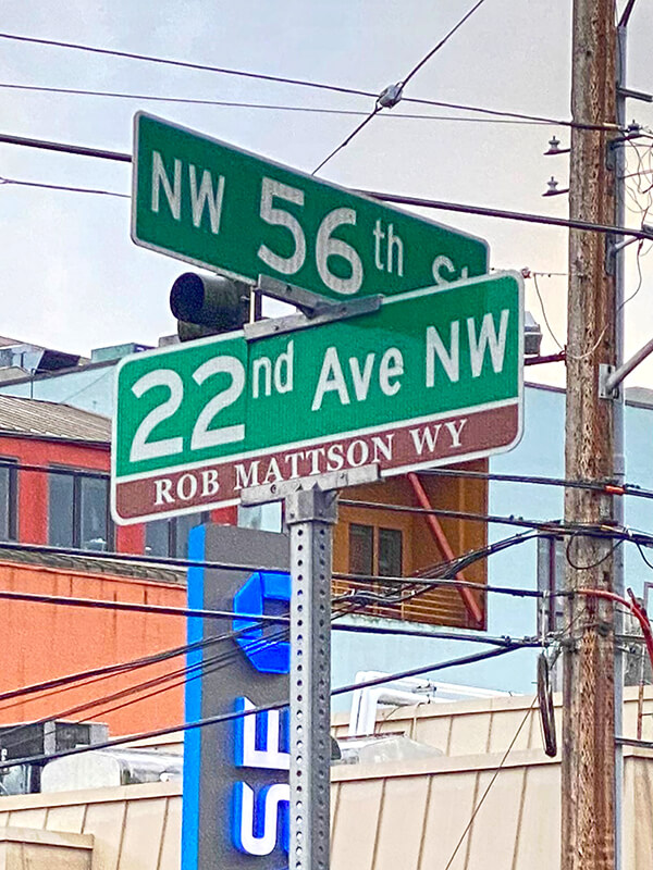
Rob Mattson Way covers 22nd Avenue NW between NW 56th Street and NW 57th Street.

Sign at corner of NW 56th Street and 22nd Avenue NW (Rob Mattson Way), November 10, 2020
Sign at corner of NW 56th Street and 22nd Avenue NW (Rob Mattson Way), November 10, 2020. Photograph by Benjamin Lukoff. Copyright © 2020 Benjamin Lukoff. All rights reserved.

Airport Way S

Airport Way S does not, as one might expect, go from the city to Seattle–Tacoma International Airport (known to locals as Sea–Tac), but rather to King County International Airport (better known as Boeing Field). It got its current name in 1931 at the request of the Georgetown-South Seattle Improvement Club, which, according to an article in the April 12 issue of The Seattle Times,

…asked the City Council to merge portions of Seattle Boulevard, Eighth and Ninth Avenues South and Duwamish Avenue, leading from the central business area to Boeing Field, into a new highway, to be known as Airport Way.… [They contended] that strangers are confused in efforts to find the airport by lack of any specifically designated street leading to it.

Seattle Boulevard originated as

The Beach or River Road… [which] skirted the shore of the bay at the foot of the high Beacon Hill bluff, east of what is now Airport Way, and ran south along the Duwamish.… Built in the early fifties, [it] was a hard road to keep in good condition.… In 1886, a road was built on piling over the mud flats a little west of the Beach Road to avoid the slides and floods. This street became known as the Grant Street Bridge.

Sophie Frye Bass, Pig-Tail Days in Old Seattle

I elaborate in Diagonal Avenue S that

Essentially, there were a series of roads following the semicircular curve of Elliott Bay from Downtown to the Duwamish River before the tideflats were filled in: first Beach Road (or River Road), then the Grant Street Bridge, which in turn became Seattle Boulevard once the fill was complete. Sometime before 1918… the portion of Seattle Boulevard that ran northeast–southwest (the southern third of the semicircle) was renamed Diagonal Avenue. (In 1931, the rest of Seattle Boulevard was renamed Airport Way.)

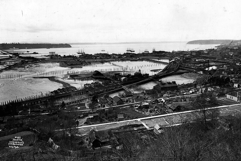
View from Beacon Hill looking northwest over Grant Street Bridge and Elliott Bay tideflats, circa 1900
This photograph, taken circa 1900 by Anders Beer Wilse, looks northwest from Beacon Hill over the Grant Street Bridge and the Elliott Bay tideflats. At upper left is West Seattle; at upper right is Magnolia. From this perspective, Downtown Seattle appears just below Magnolia. Bainbridge Island is in the distance across Puget Sound.

Once Sea–Tac fully opened in 1949, Airport Way S no longer led to the region’s primary airport, which was more directly reached via U.S. 99, but no further name changes took place.

Today, Airport Way S begins at Seattle Boulevard S and 6th Avenue S and goes 6⅗ miles southeast, then south, then southeast again, ending at Boeing Access Road. Its lower 2½ miles parallel the eastern boundary of Boeing Field.

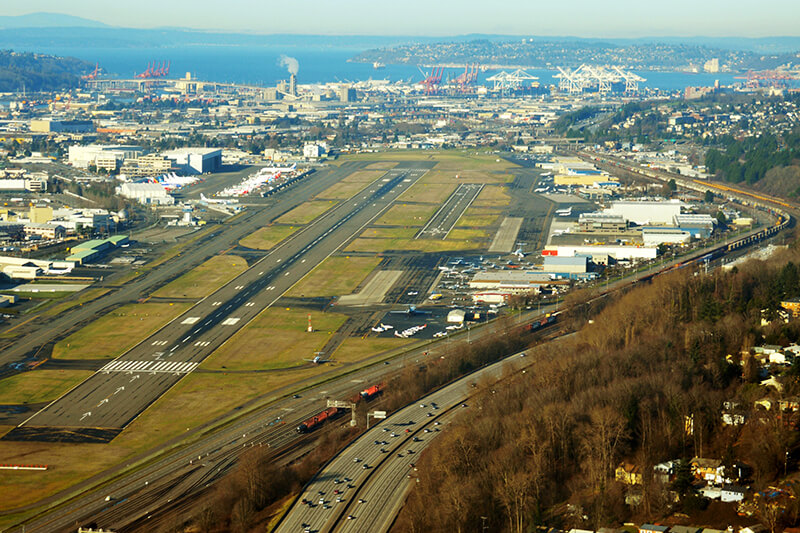
Boeing Field aerial
Aerial of Boeing Field, looking northwest, December 2014. In the foreground is Interstate 5; just to the west are the BNSF Railway tracks, then Airport Way S, then Perimeter Road S. Photograph by Wikimedia Commons user Bernstea, licensed under Creative Commons Attribution-Share Alike 4.0 International

Bernie Whitebear Way

This Discovery Park road was named for Bernie Whitebear (1937–2000), a Native American activist who co-founded the Seattle Indian Health Board, the United Indians of All Tribes Foundation, and the Daybreak Star Indian Cultural Center. Originally part of Illinois Avenue, this portion of the street was renamed for Whitebear in 2011. (Like all streets in Discovery Park except for 45th Avenue W, Bernie Whitebear Way has no directional designation.)

Today, Bernie Whitebear Way begins at Texas Way and Illinois Avenue and goes ½ a mile northwest, then west, to Daybreak Star.

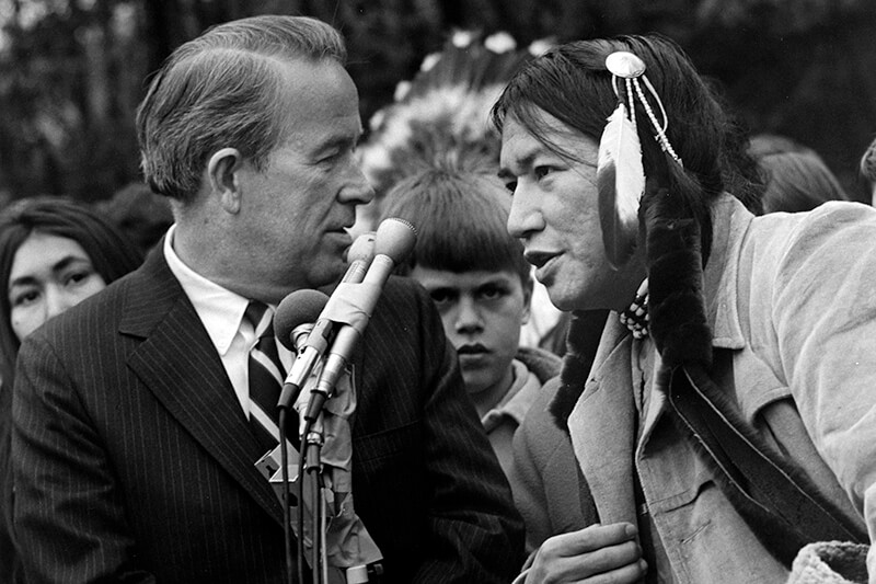
Bernie Whitebear and Senator Henry Jackson
Bernie Whitebear speaking to Senator Henry M. Jackson during the Daybreak Star lease signing ceremony, November 14, 1971. Courtesy of the Seattle Municipal Archives, Identifier 193058
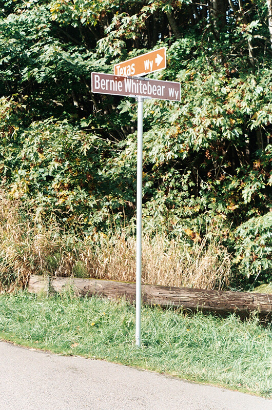
Signs at corner of Texas Way and Bernie Whitebear Way, October 30, 2011
Signs at corner of Texas Way and Bernie Whitebear Way, October 30, 2011. Photograph by Benjamin Lukoff. Copyright © 2011 Benjamin Lukoff. All rights reserved.

Texas Way

As I note in Illinois Avenue, most streets in Fort Lawton (1900−2011), which became Discovery Park, were named after states, and this one is no exception. According to this map, the southernmost part of what is now Texas Way was originally Indiana Avenue and Delaware Avenue — the three were consolidated some time before 1967, when this map was made by the Fort Lawton Office of the Post Engineer. (As with Illinois Avenue and every other street in Discovery Park except for 45th Avenue W, Texas Way has never carried a directional designation.)

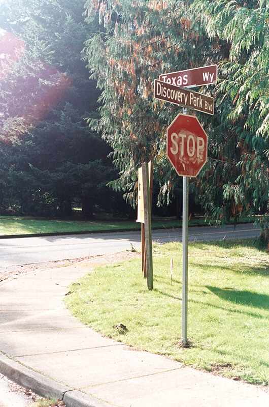
Street sign at corner of Texas Way and Discovery Park Boulevard, October 30, 2011
Street sign at corner of Texas Way and Discovery Park Boulevard, October 30, 2011. Photograph by Benjamin Lukoff. Copyright © 2011 Benjamin Lukoff. All rights reserved.

Today, Texas Way begins as a pathway south of the Discovery Park playground and goes ¼ of a mile east, then north, to 36th Avenue W just south of its intersection with Discovery Park Boulevard and W Government Way. It resumes as a paved road just to the north at Discovery Park Boulevard and goes just over ⅔ of a mile north, then northwest, to Illinois Avenue at the entrance to the park’s North Parking Lot. Here, it once again becomes a pathway and continues another ¾ of a mile northwest, then south, to rejoin Discovery Park Boulevard just west of the Utah Wetlands.

Signs at corner of Texas Way and Bernie Whitebear Way, October 30, 2011
Signs at corner of Texas Way and Bernie Whitebear Way, October 30, 2011. Photograph by Benjamin Lukoff. Copyright © 2011 Benjamin Lukoff. All rights reserved.

Pinehurst Way NE

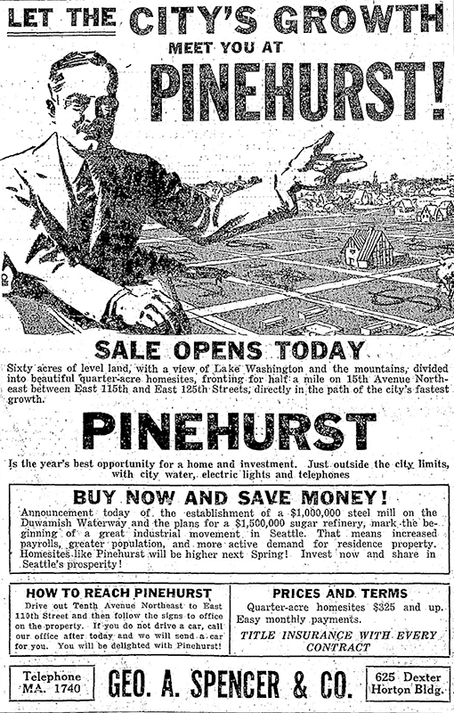
This street was established in 1926 as part of the plat of Pinehurst. Originally beginning at 15th Avenue NE and NE 117th Street and going northeast to 17th Avenue NE between NE 123rd Street and NE 125th Street, it was subsequently extended to connect the 15th Avenue NE and Roosevelt Way NE arterials.

Today, Pinehurst Way NE begins at Roosevelt Way NE and NE 113th Street, and goes ⅔ of a mile northeast to 17th Avenue NE and NE 124th Street.

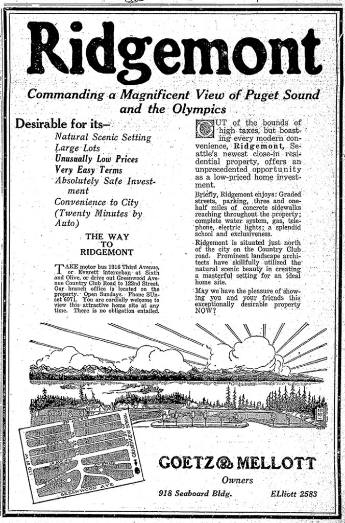
Ad for Pinehurst, The Seattle Times, October 3, 1926

Lenny Wilkens Way

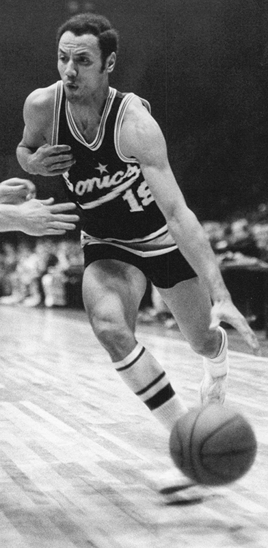
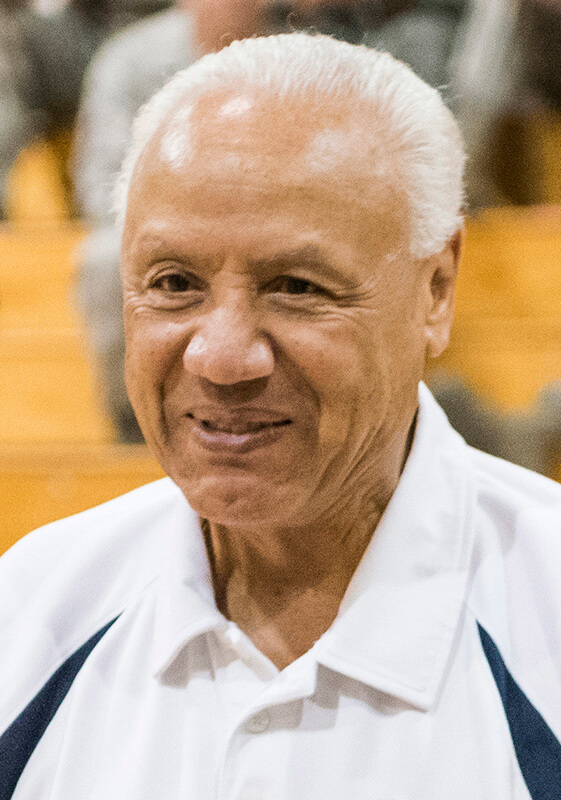
I’m not sure how I missed the news, but in December 2021 the block of Thomas Street between 1st Avenue N and 2nd Avenue N, just south of Climate Pledge Arena, was officially renamed Lenny Wilkens Way, after the Seattle basketball legend.

Leonard Randolph Wilkens (born 1937), who grew up in Brooklyn, New York, played basketball for the Seattle SuperSonics from 1968–1972, also serving as head coach from 1969–1972. He returned to coach the Sonics in 1977 and stayed until 1986, when he went to the Cleveland Cavaliers. He led the Sonics to two consecutive NBA championship games, in 1978 and 1979, the latter of which the Sonics won, giving Seattle its first national title since the Metropolitans won the Stanley Cup in 1917, and its last until 2004, when the Storm won the WNBA Championship. Wilkens finished his career as head coach of the New York Knicks in 2005. Through the Lenny Wilkens Foundation, which recently wound up operations, he also raised millions of dollars for Seattle Children’s Odessa Brown Children’s Clinic.

As far as I know, and please correct me if I’m wrong, this makes Lenny Wilkens only the second Black person to have a street named after him in Seattle, the first being Martin Luther King Jr.

College Way N

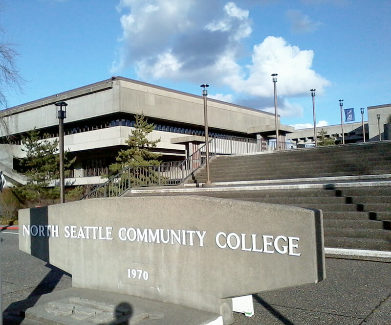
This street was named in 1971 as part of a project to connect Meridian Avenue N at N 103rd Street to Burke Avenue N at N 100th Street; the newly constructed street took the name, as did Burke Avenue south to N 92nd Street. For its entire ½-mile length, College Way N is the western boundary of the campus of North Seattle College, known at its 1970 founding as North Seattle Community College.

Entrance to North Seattle Community College
Entrance to North Seattle Community College, as it was then called, February 7, 2013. Photograph by Wikimedia Commons user Iain Laurence, licensed under Creative Commons Attribution-ShareAlike 3.0 Unported
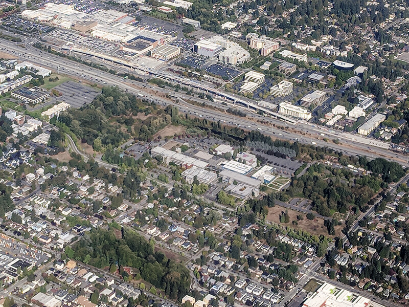
Aerial view of North Seattle College campus
Aerial view of North Seattle College campus, September 16, 2018. Licton Springs Park is in the foreground; North Seattle College is above (east), and Northgate Station and Thornton Place are across Interstate 5. Photograph by Flickr user Atomic Taco, licensed under Creative Commons Attribution-ShareAlike 2.0 Generic

Keen Way N

This street originates in the 1924 plat of Winona Park, an Addition to the City of Seattle, filed by George Emerson Morford (1890–1946) and his wife, Gertrude Alice Keen Morford (1892–1954). According to Florence Helliesen of the Queen Anne Historical Society, George was president of the F.W. Keen Company, a real estate firm owned by his father-in-law, Frederick Walter Keen (1855–1929). The Seattle Civil Rights & Labor History Project writes:

Two real estate firms, F.W. Keen Company and J.L. Grandey, Inc., organized most of the racial restrictive covenants for Queen Anne from 1928 to 1931… specifying that “No person or persons of Asiatic, African or Negro blood, lineage, or extraction shall be permitted to occupy a portion of said property, or any building thereon; except domestic servants may actually and in good faith be employed by white occupants of such premises.”

In addition to being president of F.W. Keen, George Morford was vice president of J.L. Grandey.

Which Keen was honored by Keen Way N — Gertrude Alice Keen Morford, Frederick Walter Keen, or the F.W. Keen Company — isn’t clear; if it was for George Morford’s wife, that would put Keen Way in the same category as Perkins Lane W and Thorndyke Avenue W.

Keen Way N begins at Aurora Avenue N between W Green Lake Drive N and Winona Avenue N and goes ⅕ of a mile northeast to N 76th Street.

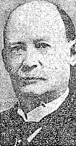
Frederick Walter Keen, from his Seattle Times obituary, August 14, 1929
Frederick Walter Keen, from his Seattle Times obituary, August 14, 1929. I was unable to locate a photograph of his daughter, Gertrude.

NE Northgate Way

This street was named in 1968 for Northgate Station, which opened in 1950 as the Northgate Center shopping mall. According to HistoryLink.org, it was “the country’s first regional shopping center to be defined as a ‘mall’ (although there were at least three predecessor shopping centers).” Newspaper archives show that it became known early on as Northgate Mall, and that became its official name in 1974. As of this writing, the property is in the midst of a massive redevelopment project that began in 2019.

Prior to 1968, Northgate Way was known as (from west to east) N 105th Street, Mineral Springs Way N, N 110th Street, NE 110th Street, and Chelsea Place NE. Today, it begins at N 105th Street and Aurora Avenue N and goes 2⅕ miles east to NE 113th Street and Lake City Way NE.

The Northgate name itself has been attributed to Ben Erlichman. Feliks Banel writes:

Digging into the newspaper archives, The Seattle Times of February 22, 1948, published a big spread on the plans for the shopping center. The story quoted one of the developers, a local investor named Ben Ehrlichman (the uncle of future Watergate figure John Ehrlichman). “The name Northgate was chosen, Ehrlichman [told The Seattle Times], because the development ‘will be the most important northerly business district serving Seattle and vicinity and the gateway to metropolitan Seattle.’” Though a 30th anniversary story in the same paper in 1980 credited Ehrlichman for coming up with the name — based on the 1948 story — we may never know for certain whose idea it was.

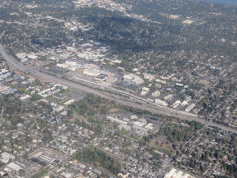
Aerial of Northgate, September 2018, from https://flickr.com/photos/25443792@N05/43844953055
Aerial of Northgate, September 2018, looking northeast. Interstate 5 cuts across the photo from bottom right to upper left. To its west is North Seattle College; to its east is Northgate Station, the Thornton Place complex, the Northgate Transit Center, and the Northgate commercial district. The elevated tracks of Sound Transit’s Line 1 light rail can be seen just east of the freeway. The Lake City commercial district is visible to the northeast of the mall; the greenbelt closer to the mall is one of the forks of Thornton Creek. Photograph by Flickr user Atomic Taco, licensed under Creative Commons Attribution-ShareAlike 2.0 Generic

Alaskan Way

Alaskan Way was originally Railroad Avenue. Jennifer Ott writes for HistoryLink.org:

On the central waterfront a web of railroads grew out from the shore in the 1880s and 1890s as various railroads, including the Columbia & Puget Sound, the Seattle, Lake Shore & Eastern, and the Northern Pacific jockeyed for space at the foot of the bluffs that ended at the beach, where Western Avenue is today. In January 1887 the City Council passed an ordinance establishing Railroad Avenue, a street created, according to historian Kurt Armbruster, to provide space for the Seattle, Lake Shore & Eastern franchise to the west of the Northern Pacific’s franchise along the shoreline.

Railroad Avenue looking south from between Madison and Marion Streets, circa 1898

When the tidelands were platted in 1895, Railroad Avenue extended to Harbor Island and West Seattle, but:

  • Sometime between 1912 and 1920 the Harbor Island portion was renamed W Florida Street (SW Florida Street today).
  • In 1907, the West Seattle portion was renamed Alki Avenue.
    • Sometime between 1912 and 1920 the West Seattle portion southeast of Duwamish Head was given its current name, Harbor Avenue.

In an article for Crosscut, Knute Berger explains why a new name was wanted for the remainder:

Seattle’s waterfront was unpaved — a beat-up plank road ran its length. There was no modern seawall — the street was built over the water. Train tracks were everywhere.… But the waterfront was undergoing a massive renovation. A seawall was being constructed, the shoreline filled in, the road made into a wide, paved boulevard.…

According to Berger and Ott’s articles, names that were proposed but were ultimately rejected included Anchors Way, Artery Way, Battery Way, Bois Boolong, Bread Street, Cargo Way, Chief Seattle Avenue, Cosmos Quay, Dock Street, Export Way, Fleet Way, Gateway Avenue, Golden West Way, Hiak Avenue, Klatawa Avenue, Maritime Avenue, Metropolis Avenue, Olympian Way, Pacific Way, Pier Avenue, Port Strand, Port Way, Port-Haven Drive, Potlatch Avenue, Puget Avenue, Puget Dyke, Puget Portal, Queen City Way, Roadstead Way, Salt Spray Way, Salt Water Avenue, Seawall Avenue, Seven Seas Road, Skookum Way, Steamship Way, Sunset Avenue, Terminal Avenue, Terrebampo Way, The Battery, The Esplanade, Transit Row, Voyage Way, Welcome Way, and Worldways Road. (Those in italics apparently came under serious consideration.)

So how did we end up with Alaskan Way? And why Alaskan instead of Alaska (the already existing S Alaska Street could have been renamed)?

Alaskan Way, July 1939
Alaskan Way between Marion and Madison Streets, Canadian National Dock at left, July 1939. Courtesy of the Seattle Municipal Archives, Identifier 77093

The May 19, 1932, issue of The Seattle Times reports that the Seattle Maritime Association had run a renaming contest which received “more than one thousand letters… some of them contained scores of suggestions.” 4,868 names (including duplications) were received, and the judges selected four finalists, in order of preference: Puget Portal (one submission), Klatawa Avenue (one submission, from Chinook Jargon word meaning ‘to go, to travel’), Hiak Avenue (one submission, from Chinook Jargon word meaning ‘lively, quick and fast’), and Maritime Avenue (49 submissions [Maritime Way received 99 submissions but was not chosen]). The next day, the Times reported that the judges had chosen Maritime Avenue, and awarded the $20 prize to a Mr. B.I. Schwartz, the first to have suggested the name.

Alaskan Way Viaduct, July 1952
Alaskan Way Viaduct, July 1952, the year before it opened. The double-decker freeway paralleled Alaskan Way as far north as Union Street, where it diverged from the alignment on its approach to Elliott Avenue and the Battery Street Tunnel. Bell Street Pier, with the large Port of Seattle sign, is at left. The Bell Street Overpass can be seen behind the ‘P’ in ‘Port’. The bridge at the southern end of the pier is the Lenora Street Viaduct. Courtesy of the Seattle Municipal Archives, Identifier 43586

However, that July, a George D. Root proposed the name Cosmos Quay. At first, it was met with indifference, and then it seems the entire renaming project was put on the back burner until construction progressed. Somehow, when he restarted his campaign in 1934, Cosmos Quay became a leading candidate, and it was approved unanimously by the city council on January 14, 1935. An ordinance began to be drafted. But, as the Seattle Post-Intelligencer noted the next day, this was only because one councilmember, Frank J. Laube, had been absent… and he was adamantly opposed.

He wasn’t the only one. The Seattle Times published an editorial on January 20 headlined ‘City Locksmith Needed for Pronunciation Key’, which proclaimed that “to burden the waterfront stretch with a name that could be used and understood only through long courses in cosmogony, cosmology, etymology, and articulation would be a sad piece of nonsense for which there is no excuse.” The next day the Times reported that David Levine, city council president, said Cosmos Quay “no longer sounds so good to him. Many citizens have complained its meaning, as well as its pronunciation, mystifies them.” On February 4, according to the P-I, the council killed the ordinance and decided to leave Railroad Avenue as it was.

Alaskan Way Viaduct, February 2018
Alaskan Way Viaduct, February 2018. It closed permanently in January 2019; the replacement tunnel opened the next month. and demolition was complete by November of the same year. Photograph by Flickr user Washington State Department of Transportation, licensed under Creative Commons Attribution-NonCommercial-NoDerivs 2.0 Generic

When the new street opened in 1936, the question of renaming came up again. Mayor John F. Dore appointed a committee that chose The Pierway, a suggestion that won a W.C. Denison, Jr., a prize of $50 from the mayor’s own pocket, but the final decision lay with the city council, which was not enthused. Pacific Way emerged as their favorite, according to a Seattle Times article on July 2, 1936, though a July 6 article in the same paper “the public apparently was not in accord with the idea.” On July 7, the Times reported that even though “at least seven votes [were] lined up in advance for the adoption of ‘Pacific Way’… with Council President Austin E. Griffiths contending for ‘Cosmos Quay’ or ‘Cosmos Way’,” an ordinance renaming Railroad Avenue “Alaskan Way” passed unanimously.

Alaska Way had been proposed in 1932 by the Puget Sound Travel Directors, according to an article in the April 13 issue of The Seattle Times. (As an aside, it was also proposed in 1931 by attorney John S. Robinson as an alternate name for Aurora Avenue N and the Aurora Bridge, according to a Times article on June 19.) It was also an entry in the Seattle Maritime Association’s aforementioned naming contest, submitted by Fred E. Pauli, manager of the Alaska Division of the Washington Creamery Company, according to a Times article on April 10, 1932. Then, in 1935, after Cosmos Quay had been rejected by the city council, the Alaska Yukon Pioneers endorsed Alaska Way (The Seattle Times, March 5), followed by the Whittier Heights Improvement Club (Times, March 7) and the Junior Alaska-Yukon Pioneers (Times, July 25). When renaming became a distinct possibility once again in 1936, as discussed above, the Alaska Yukon Pioneers passed a resolution in favor of Alaska Way (Times, July 4): “…It was here that the gold rush activity actually took place… put Seattle on the map and directly made possible the magnificent improvement now about completed.”

Alaskan Way south from Bell Street
Alaskan Way looking south from the Bell Street pedestrian bridge, August 2011. The Alaskan Way Viaduct is barely visible at center; the Seattle Aquarium is at center right. Photograph by Orange Suede Sofa, Wikimedia Commons, licensed under Creative Commons Attribution-Share Alike 3.0 Unported

It came down to one councilmember, apparently. The Seattle Post-Intelligencer reported on July 7 that, the previous day, Robert H. Harlin proposed that the already-prepared ordinance renaming Railroad Avenue “Pacific Way” be amended to read “Alaskan Way” instead:

Councilman Robert H. Harlin, who offered the motion for adoption of “Alaskan Way,” said he preferred it to “Alaska Way” because it “recognizes the human element, honoring the men and women who pioneered the territory.” Although a majority of the council had informally agreed to support the name “Pacific Way,” sentiment crystallized rapidly in favor of “Alaskan Way” after Harlin’s statement.

Alaskan Way, March 2021
Alaskan Way from the Pike Place Market’s MarketFront, March 2021. Construction of the street that wasn’t going to be called Elliott Way — but now, as of early 2023, will be — is visible at center right. The Seattle Great Wheel can be seen above the Seattle Aquarium. Photograph by Flickr user Scott Smithson, licensed under Creative Commons Attribution-NonCommercial-NoDerivs 2.0 Generic

Today, Alaskan Way S begins at the north end of E Marginal Way S, at the entrance to the Port of Seattle’s Terminal 30, and goes 2⅓ miles north, then northwest, to Broad Street, having become Alaskan Way on crossing Yesler Way. This is the Alaskan Way most people think of.

But, as they say, wait — there’s more! The right-of-way continues for another 1¾ miles, ending at W Garfield Street under the Magnolia Bridge, at the entrance to the Port of Seattle’s Terminal 91. From the Olympic Sculpture Park, which begins at Broad Street, to Myrtle Edwards Park, the right-of-way is taken up by park land and the tracks of the BNSF Railway — successor to the Columbia & Puget Sound; the Seattle, Lake Shore & Eastern; and the Northern Pacific, the railroads for which Railroad Avenue was originally built. Northwest of Myrtle Edwards, it’s entirely taken up by the tracks that run alongside Centennial Park. It isn’t until W Galer Street that there’s a city street in the right-of-way again, and Alaskan Way W only goes about ⅙ of a mile northwest from there to W Garfield Street. Even less than that is signed Alaskan Way, as the city has put up a sign for Expedia Group Way W where the W Galer Street flyover “touches down.” However, even though southeast of Galer the roadway runs first on Expedia property, then Port of Seattle property, the city appears to still consider it Alaskan Way W between the Expedia campus entrance and the north end of Centennial Park — a distance of just over ⅓ of a mile.

S Industrial Way

In 1930, Seattle City Light acquired a number of transmission line rights-of-way. The one immediately concerning us approaches the utility’s South Service Center from the southeast. East of Interstate 5, the Chief Sealth Trail runs along the right-of-way from Beacon Hill to Kubota Garden. West of the freeway, a road was built in the late 1960s as part of the South Seattle Redevelopment Project, or South Seattle Industrial Park, as it came to be known. This street was designated Industrial Way in 1969, and runs from Airport Way S in the southeast to 4th Avenue S and Diagonal Avenue S in the northwest, a distance of about ⅓ of a mile.

Aerial view of Industrial District with S Industrial Way at center right
Aerial view of Industrial District, May 2009. S Industrial Way is the boulevard with the grassy median at center right, leading to the City Light South Service Center. The diagonal street at its end is, appropriately, Diagonal Avenue S, and the arterial it stops at is 4th Avenue S. The Union Pacific Railroad’s Argo Yard is in the upper-left-hand corner, and Airport Way S and Interstate 5 run along the bottom. Photograph by Flickr user J Brew, licensed under Creative Commons Attribution-ShareAlike 2.0 Generic

Viewmont Way W

This street was created in 1915 as part of the plat of Carleton Park, a replat of much of southwest Magnolia (basically a triangle formed by W Raye Street, 34th Avenue W, and Magnolia Boulevard W). Arthur A. Phinney (1885–1941) led the project, named after his father, Guy Carleton Phinney (1851–1893) (Phinney Avenue N, Phinney Ridge). As The Seattle Times reported:

The old plat was executed thirty years ago without regard to the preservation of the naturally beautiful contour of the land.… In the new plat the streets and boulevards curve and swing about the bases of elevated portions, escaping the deep cuts and heavy fills that would be necessary in conforming to the strict, rectangular plans of the old plat, and affording a scenic frontage for every building lot in the addition.… This entire district commands an unobstructible view of the Cascade and Olympic Mountains, the state university, Laurelhurst, Denny-Fuhrman addition, the entire waterfront and manufacturing district of Seattle, St. James Cathedral, 42-story L.C. Smith Building, Alaska Building, majestic Mt. Rainier, and about every other phase of natural scenery that has made Seattle attractive as a place of habitation.

Article on Carleton Park, Seattle Times, April 25, 1915

Viewmont Way was obviously named after its view of the mountains, and is of a piece with other Carleton Park streets like Montavista Place, Westmont Way, Eastmont Way, Altavista Place, and the like.

Viewmont Way W begins at the intersection of 34th Avenue W, W Lynn Street, and Montvale Place W in Magnolia Village, and goes ¼ mile southwest to Constance Drive W, where it becomes W Viewmont Way W. The name initially continued about the same distance northwestwards, where the street became 41st Avenue W, but this portion and the rest of 41st Avenue as far north as Fort Lawton (now Discovery Park) were apparently changed at some point to W Viewmont Way. In 1961, the streets became Viewmont Way W and W Viewmont Way W.

W Blewett Way

This street is named for Edward Blewett (1848–1929), one of the developers of the Fremont neighborhood (named after his hometown, Fremont, Nebraska).

“But,” you might say, “if he developed Fremont, why is W Blewett Way in Queen Anne?”

As you can see in the map below, and in this plat he filed in 1888 of what is now Fremont and North Queen Anne before the Fremont Cut was dug, Ewing and Blewett Streets used to be part of both neighborhods. When they became separated, the names were left alone on the Queen Anne side; in Fremont, they were changed as follows: Kilbourne to N 36th Street, Blewett to N 35th Street, and Ewing to N 34th Street.

Portion of 1912 Baist Atlas Showing Fremont Cut
Portion of 1912 Baist Atlas showing Fremont Cut

It’s not quite that simple, though — Blewett never reached quite as far as 13th Avenue W. What appears to have happened is that a name was needed when what is now W Blewett Way was created in 1907, and because the street to the south was still Ewing, Blewett presented itself as a natural choice. The rest of Blewett south of the canal was vacated over the years, so this is all that’s left of the name.

Today, W Blewett Way begins at the north end of 13th Avenue W and goes east just about ⅒ of a mile before it becomes a private driveway.