Montvale Place W

What is now Montvale Place W was originally Montvale Court W, created in 1915 as part of the plat of Carleton Park. When originally platted, Montvale Court formed a horseshoe-shaped loop, but at some point (the quarter section map doesn’t say, and I can find no relevant city ordinance), the eastern and southeastern part of the street, plus the alley connecting to 34th Avenue W, was renamed Montvale Place W.

Montvale Place W begins at 35th Avenue W south of Montvale Court W and goes ⅛ of a mile northeast, then north, to the intersection of Viewmont Way W, 34th Avenue W, and W Lynn Street.

Portion of plat of Carleton Park showing original course of Montvale Court W
Portion of plat of Carleton Park showing original course of Montvale Court W, over half of which is now Montvale Place W

Montvale Court W

Like Viewmont Way W, Crestmont Place W, Eastmont Way W, Westmont Way W, and Piedmont Place W, this street was created in 1915 as part of the plat of Carleton Park, their common mont element referring to the fact that, as The Seattle Times wrote, the “entire district commands an unobstructible view of the Cascade and Olympic Mountains.” Like Piedmont Place W, Montvale Court W lies at the foot of the western Magnolia hill as it slopes down to Pleasant Valley (of which vale is of course a variant).

Montvale Court W begins at 35th Avenue W south of Viewmont Way W and goes just over 300 feet northeast to Montvale Place W. (When it was originally platted, it formed a horseshoe-shaped loop back to 35th, but at some point the eastern and southeastern part of the street was renamed Montvale Place W.)

Portion of plat of Carleton Park showing original course of Montvale Court W

Ridgemont Way N

This street was created in 1925 as part of the plat of Ridgemont. Unnamed at the time, it was presumably later named after the subdivision. I say “presumably” because there is no record of its being named in Seattle’s online legislative database, which there should be if this was done after this part of town was annexed in 1953, and King County’s only goes back to 1969.

Ridgemont, as the below advertisement implies, was named for its location atop a ridge “commanding a magnificent view of Puget Sound and the Olympics.”

Ridgemont Way N begins at Greenwood Avenue N just south of N 125th Street and goes just over 425 feet southwest to N 122nd Street.

Advertisement for the Ridegmont subdivision, The Seattle Times, October 11, 1925
Advertisement for the Ridegmont subdivision, The Seattle Times, October 11, 1925. It would remain outside of the city and “out of the bounds of high taxes” for 28 years.

Alpine Way NW

This street, like NW Culbertson Drive, was created in 1955 as part of the plat of Llandover-by-the-Sound, and was presumably named for the property’s view of the Olympic Mountains to the west. (I say property, singular, because there is only one house with an Alpine Way address).

Alpine Way NW begins at NW Culbertson Drive and goes just over 325 feet south to NW Northwood Road.

Montavista Place W

Created in 1915 as part of the plat of Carleton Park, this is one of the many streets in the subdivision that features the mont element ― Piedmont Place W, Viewmont Way W, Crestmont Place W, Eastmont Way W, and Westmont Way W among them ― a reference to the “entire district[’s]… unobstructible view of the Cascade and Olympic Mountains” (The Seattle Times).

Montavista Place W begins at Magnolia Boulevard W and goes ⅖ of a mile northeast, then northwest, to 38th Avenue W.

Piedmont Place W

Created in 1915 as part of the plat of Carleton Park, this street shares the mont element with a number of other streets in the subdivision, e.g., Viewmont Way W, Crestmont Place W, Eastmont Way W, and Westmont Way W. This because, as The Seattle Times wrote, the “entire district commands an unobstructible view of the Cascade and Olympic Mountains.” I tend to think the element was overused in the neighborhood and would have liked more of its streets to be named after the actual mountains, e.g., Ellinor Drive W and Constance Drive W. But I do have to hand it to whoever came up with these names for their creativity in naming Piedmont Place W — not, I am sure, directly after the region in Italy or that in the United States, but rather because it lies at the eastern foot — pied in French — of the western Magnolia hill as it slopes down to Pleasant Valley.

Piedmont Place W begins at W McGraw Street between 36th Avenue W and 35th Avenue W and goes ¼ mile north to W Raye Street.

Topographic map of part of Carleton Park, from The National Map

Crestmont Place W

This street was created in 1915 as part of the plat of Carleton Park. The Seattle Times wrote of the Magnolia subdivision that the “entire district commands an unobstructible view of the Cascade and Olympic Mountains” — hence the mont portion of its name. Why crest? Because, as you can see on the topographical map below, Crestmont Place W is located at the crest of Carleton Park. (The highest point in all Magnolia, however, is located a number of blocks to the north, close to 40th Avenue W and W Barrett Lane.)

Crestmont Place W begins at Westmont Way W north of Altavista Place W and goes ¼ northeast, then northwest, to W Raye Street, where it becomes 40th Avenue W.

Topographic map of part of Carleton Park, from The National Map

Eastmont Way W

Like its twin, Westmont Way W, this street was created in 1915 as part of the plat of Carleton Park, which “afford[ed] a scenic frontage for every building lot in the addition,” according to The Seattle Times. Just as Westmont faces the Olympic Mountains to the west and southwest, Eastmont faces the Cascades to the southeast.

Beginning at Eastmont Place, a pocket park at the south end of Westmont Way W, it goes around 850 feet northeast to W McGraw Street, where it becomes 36th Avenue W.

Westmont Way W

In Viewmont Way W, I discuss the 1915 plat of Carleton Park, in which, as The Seattle Times reported,

The streets and boulevards curve and swing about the bases of elevated portions, escaping the deep cuts and heavy fills that would be necessary in conforming to the strict, rectangular plans of the old plat, and affording a scenic frontage for every building lot in the addition.

Many streets in the subdivision were named in reference to these views, Westmont Way W among them. Beginning at Eastmont Place, a pocket park at the south end of Eastmont Way W, it goes ⅖ of a mile north, then northwest, to W Viewmont Way W, providing westerly and southwesterly views of the Olympic Mountains for its entire length.

Mount Adams Place S

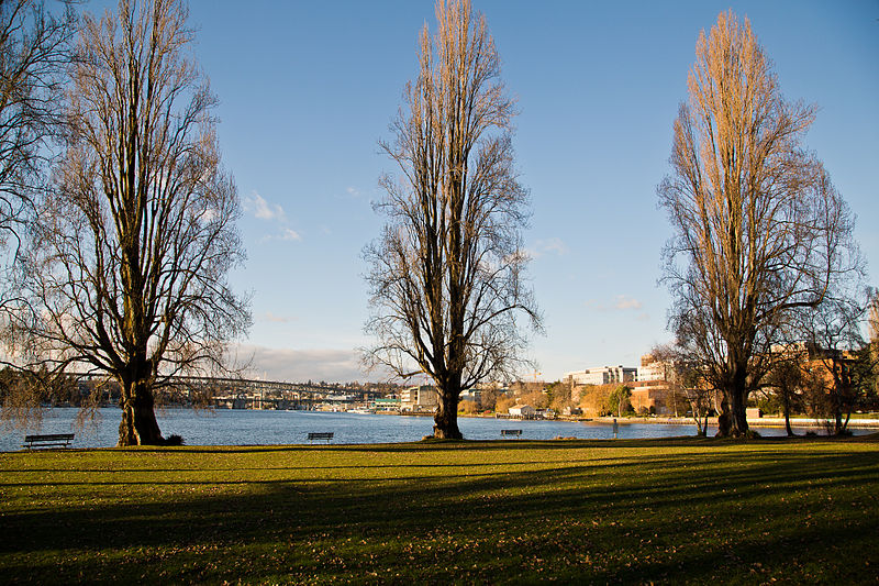
Like Mount Rainier Drive S, Mount St. Helens Place S, and S Mount Baker Boulevard, this street was created in 1907 as part of the Mt. Baker Park addition, named for its view of Mount Baker in the North Cascades. Like the others, it was named after a prominent Cascade Range peak — in this case, Mount Adams.

At 12,281 feet, Adams is the second tallest mountain in Washington, behind Mount Rainier. Known by Native Americans as Pahto or Klickitat, it was named for President John Adams (1735–1826), in a rather roundabout way. Unlike Rainier or St. Helens, it was neither “discovered” by George Vancouver nor named by him; instead, the first non-Natives to spot it were Lewis and Clark, who at first thought they had spotted St. Helens. Then, as Wikipedia relates,

For several decades after Lewis and Clark sighted the mountain, people continued to get Adams confused with St. Helens, due in part to their somewhat similar appearance and similar latitude. In the 1830s, Hall J. Kelley led a campaign to rename the Cascade Range as the President’s Range and rename each major Cascade mountain after a former president of the United States. Mount Adams was not known to Kelley and was thus not in his plan. Mount Hood, in fact, was designated by Kelley to be renamed after President John Adams and St. Helens was to be renamed after George Washington. In a mistake or deliberate change by mapmaker and proponent of the Kelley plan Thomas J. Farnham, the names for Hood and St. Helens were interchanged. And, likely because of the confusion about which mountain was St. Helens, he placed the Mount Adams name north of Mount Hood and about 40 miles (64 km) east of Mount St. Helens. By what would seem sheer coincidence, there was in fact a large mountain there to receive the name. Since the mountain had no official name at the time, Kelley’s name stuck even though the rest of his plan failed. However, it was not official until 1853, when the Pacific Railroad Surveys, under the direction of Washington Territory governor Isaac I. Stevens, determined its location, described the surrounding countryside, and placed the name on the map.

Mount Adams Place S begins at Mount St. Helens Place S and goes ¼ mile southeast to S Ferris Place.

Mount St. Helens Place S

Like Mount Rainier Drive S and S Mount Baker Boulevard, this street was created in 1907 as part of the Mt. Baker Park addition, named for its view of Mount Baker in the North Cascades. The neighborhood featured a number of other streets named for mountains in the Cascade Range, including this one, named after Mount St. Helens.

St. Helens, of course, is best known for its volcanic eruption on May 18, 1980, “the deadliest and most economically destructive volcanic event in U.S. history” according to Wikipedia. It was variously known by the Native Americans as Lawetlat’la (Cowlitz) and Loowit or Louwala-Clough (Klickitat), and, like Mount Rainier and Mount Baker, was given its official English-language name by George Vancouver on HMS Discovery in 1792. In this case, it honored his friend Alleyne FitzHerbert, 1st Baron St Helens (1753–1839), who at the time was British ambassador to Spain.

Mount St. Helens Place S begins at Cascadia Avenue S and goes just over ¼ mile south to Mount Rainier Drive S at 37th Avenue S.

Mount Rainier Drive S

This street was created in 1907 as part of the Mt. Baker Park addition, named for its view of Mount Baker in the North Cascades. In addition to S Mount Baker Boulevard, the neighborhood featured a number of other streets named for mountains in the Cascade Range, including this one, named after Mount Rainier.

According to Wikipedia, at 14,411 feet, Mount Rainier is “the highest mountain in… Washington and the Cascade Range, the most topographically prominent mountain in the contiguous United States, and the tallest in the Cascade Volcanic Arc.” It has been known by a number of other names, including Tacoma (after which, incidentally, Takoma Park, Maryland, was named), which derived from its Lushootseed-language name, təqʷubəʔ (‘permanently snow-covered mountain’). It was given its official English-language name by George Vancouver on HMS Discovery in 1792:

The weather was serene and pleasant, and the country continued to exhibit between us and the eastern snowy range the same luxuriant appearance. At is northern extremity, Mount Baker bore by compass N. 22 E.; the round snowy mountain, now forming its southern extremity, and which, after my friend, Rear Admiral [Peter] Rainier [17411808], I distinguish by the name of Mount Rainier, bore N. 42 E.

Mount Rainier Drive S begins at the intersection of S McClellan Street, Lake Park Drive S, and Mount Baker Drive S, and goes ¼ mile southeast to S Hanford Street and Hunter Boulevard S.

Rainier Avenue S

This street follows the route of the Rainier Avenue Electric Railway Company’s Seattle-to-Renton line, which began to be built in 1891. Both the rail line and street were named for Mount Rainier (təqʷubəʔ), itself named by Captain George Vancouver for his friend, Royal Navy Rear Admiral Peter Rainier (1741–1808). As the Seattle Post-Intelligencer noted on September 3, 1890, “the avenue points straight toward Mount Rainier, which mountain will be in plain view all the way.”

Rainier Avenue S begins at the intersection of S Jackson Street, Boren Avenue S, and 14th Avenue S, and goes nearly 8 miles southeast to the city limits. From there, it continues around 3¾ miles south to the intersection of Interstate 405 and State Route 167 in Renton.

Looking south on Rainier Avenue S from S Jackson Street, with Mount Rainier in background, and two Metro route 7 buses, July 2011. From https://flickr.com/photos/95482862@N00/5914713222
Looking south on Rainier Avenue S from S Jackson Street. “The mountain is out” on this July 2011 day. Metro route 7 trolleybuses follow the route of the old interurban from here to 57th Avenue S. Photograph by Flickr user Oran Viriyincy, licensed under Creative Commons Attribution-ShareAlike 2.0 Generic
Aerial view of Rainier Valley looking north, 2001
Aerial view of Rainier Valley, Beacon Hill, and Downtown, May 22, 2001. Rainier Avenue S is the tree-lined street running up the middle of the photograph. Courtesy of the Seattle Municipal Archives, Identifier 114373.

Montlake Boulevard E

This street originated as University Boulevard. Opening on June 1, 1909, it connected Washington Park Boulevard (now E Lake Washington Boulevard) to the entrance to the Alaska–Yukon–Pacific Exposition (now the campus of the University of Washington). The plan was for it to continue through campus and connect via 17th Avenue NE to Ravenna Boulevard, but this was not done due to opposition from the Board of Regents. Instead, the road was extended along what was then Union Bay shoreline to NE 45th Street. It has been part of the state highway system since 1937.

Montlake Boulevard was named after Montlake Park, an Addition to the City of Seattle, filed in 1908, which later gave its name to the entire neighborhood. Most of the street, however, is on the other side of the Lake Washington Ship Canal.

Montlake Park Ad, Seattle P-I, January 1, 1911
Montlake Park ad, Seattle P-I, January 1, 1911. “Both the Cascade and Olympic range of mountains are within the range of vision, and every lot has an equal and forever unobstructible view of one of the lakes [Lake Union and Lake Washington]. Hence the name, ‘MONT-LAKE.’”

Today, Montlake Boulevard E (as well as Washington State Route 513) begins at the intersection of E Lake Washington Boulevard and E Montlake Place E, just south of the Washington State Route 520 freeway, and goes 1⅓ miles north, then northeast, to NE 45th Street, just south of University Village. It becomes Montlake Boulevard NE as it crosses the Montlake Cut of the Lake Washington Ship Canal. (State Route 513 continues for another 2 miles along NE 45th Street and Sand Point Way NE, ending at NE 65th Street just west of Magnuson Park.)

Montlake Bridge, looking southbound, August 2021
Montlake Bridge, looking southbound, August 2021. The bridge opened in 1925 and is the easternmost bridge over the Lake Washington Ship Canal. Photograph by Flickr user Seattle Department of Transportation, licensed under Creative Commons Attribution-NonCommercial 2.0 Generic
Street sign at corner of E Montlake Place E, E Lake Washington Boulevard, and Montlake Boulevard E, August 24, 2009
Street sign at corner of E Montlake Place E, E Lake Washington Boulevard, and Montlake Boulevard E. Photograph by Benjamin Lukoff, August 24, 2009. Copyright © 2009 Benjamin Lukoff. All rights reserved.
West Montlake Park, January 2013
West Montlake Park, January 2013. The body of water is Portage Bay (Lake Union); South Campus of the University of Washington is at right, across the Montlake Cut, and the University Bridge and Ship Canal Bridge are visible in the distance. Photograph by Orange Suede Sofa, Wikimedia Commons, licensed under Creative Commons Attribution-ShareAlike 3.0

S Mount Baker Boulevard

This street, along with Hunter Boulevard S, was created in 1907 as part of the Mt. Baker Park addition, filed by the Hunter Tract Improvement Company and Rollin Valentine Ankeny (1865–1934) and his wife, Eleanor Randolph Ankeny (1868–1947). (Hunter had been founded in 1905 by J.C. Hunter, Daniel Jones, F.L. Fehren, and Clare E. Farnsworth.) The addition was named for its view of Mount Baker in the North Cascades, itself named for Joseph Baker, who sailed into Puget Sound with George Vancouver and Peter Puget on HMS Discovery in 1792. The actual roadway was built in 1908 and 1909.

S Mount Baker Boulevard at 33rd Avenue S, September 22, 2018
S Mount Baker Boulevard at 33rd Avenue S, September 22, 2018. Photograph by Jon Roanhaus, Wikimedia Commons, licensed under Creative Commmons Attribution-ShareAlike 4.0 International

S Mount Baker Boulevard, intended to connect Lake Washington Boulevard to Beacon Hill, begins at S McClellan Street and Lake Park Drive S (the latter of which leads to Lake Washington Boulevard) and goes just over ½ a mile west to Rainier Avenue S and Martin Luther King Jr. Way S. West of the intersection, the boulevard continues as S Winthrop Street, which connects to Cheasty Boulevard S leading up Beacon Hill.

Advertisement for Mt. Baker Park addition, headlined "Spend Your Money and Your Life," The Seattle Times, September 30, 1906
Advertisement for Mt. Baker Park addition, headlined “Spend Your Money and Your Life,” The Seattle Times, September 30, 1906

Viewmont Way W

This street was created in 1915 as part of the plat of Carleton Park, a replat of much of southwest Magnolia (basically a triangle formed by W Raye Street, 34th Avenue W, and Magnolia Boulevard W). Arthur A. Phinney (1885–1941) led the project, named after his father, Guy Carleton Phinney (1851–1893) (Phinney Avenue N, Phinney Ridge). As The Seattle Times reported:

The old plat was executed thirty years ago without regard to the preservation of the naturally beautiful contour of the land.… In the new plat the streets and boulevards curve and swing about the bases of elevated portions, escaping the deep cuts and heavy fills that would be necessary in conforming to the strict, rectangular plans of the old plat, and affording a scenic frontage for every building lot in the addition.… This entire district commands an unobstructible view of the Cascade and Olympic Mountains, the state university, Laurelhurst, Denny-Fuhrman addition, the entire waterfront and manufacturing district of Seattle, St. James Cathedral, 42-story L.C. Smith Building, Alaska Building, majestic Mt. Rainier, and about every other phase of natural scenery that has made Seattle attractive as a place of habitation.

Article on Carleton Park, Seattle Times, April 25, 1915

Viewmont Way was obviously named after its view of the mountains, and is of a piece with other Carleton Park streets like Montavista Place, Westmont Way, Eastmont Way, Altavista Place, and the like.

Viewmont Way W begins at the intersection of 34th Avenue W, W Lynn Street, and Montvale Place W in Magnolia Village, and goes ¼ mile southwest to Constance Drive W, where it becomes W Viewmont Way W. The name initially continued about the same distance northwestwards, where the street became 41st Avenue W, but this portion and the rest of 41st Avenue as far north as Fort Lawton (now Discovery Park) were apparently changed at some point to W Viewmont Way. In 1961, the streets became Viewmont Way W and W Viewmont Way W.

W Bertona Street

This street, as with Dravus Street, was created in 1888 as part of Denny & Hoyt’s Addition to the City of Seattle, Washington Territory, and is also is part of a series of streets — Aetna, Bertona, Cremona, Dravus, Etruria, and Florentia — that appear in alphabetical order and have the common theme of being locations in Italy. Montebello di Bertona (Mundibbèlle in the Abruzzese dialect) is a small town in Pescara, Abruzzo, located near Mt. Bertona.

Technically, W Bertona Street begins as Bertona Street at the Ship Canal Trail around 80 feet east of Queen Anne Avenue N, but both streets there are little more than parking aisles nestled up against Seattle Pacific University’s Wallace Field. W Bertona begins in earnest at W Nickerson Street and goes ¾ of a mile west to 14th Avenue W, where it becomes a block-long stairway to 15th Avenue W. On the other side of 15th, it goes two more blocks before being stopped by the BNSF Railway tracks at 17th Avenue W; on the other side of the tracks it goes ⅗ of a mile west from 20th Avenue W to 30th Avenue W, becoming a stairway again for a block just about halfway. As with its Magnolia partner W Dravus Street, it’s ⅓ of a mile from 31st Avenue W to 36th Avenue W, where it becomes a stairway for a block, and then ½ a mile more from 37th Avenue W to 45th Avenue W. There is finally a 300-foot-long segment west of Perkins Lane W, where the roadway ends. (There is a shoreline street end beyond that, but it is currently inaccessible.)

Bertona Street east of Queen Anne Avenue N, November 2021
Bertona Street east of Queen Anne Avenue N, November 2021. The 2 Nickerson Street office building is at right; the row of trees is between the Ship Canal Trail and the Fremont Cut. Fremont and the Aurora Bridge are visible in the distance. Photograph by Benjamin Lukoff. Copyright © 2021 Benjamin Lukoff. All rights reserved.

Constance Drive W

This ⅔-mile–long Magnolia street is named for Mount Constance in the Olympic Mountains. Constance was the older sister of Ellinor Fauntleroy, namesake of Mount Ellinor and Ellinor Drive W. (There are no Magnolia streets named Edward, Arthur, or The Brothers.)

W Parkmont Drive and Constance Drive W street sign above One Way sign with Keep Right ghost sign underneath
Street sign at corner of W Parkmont Place and Constance Drive W, with One Way sign over Keep Right ghost sign, January 9, 2022. Photograph by Benjamin Lukoff. Copyright © 2022 Benjamin Lukoff. All rights reserved.

Ellinor Drive W

This short street in Magnolia’s Carleton Park subdivision is named for Mount Ellinor in the Olympic Mountains, which was itself named for Ellinor Fauntleroy, the fiancée of George Davidson of the U.S. Coast Survey, who named the peak in 1853. Nearby Constance Drive W is named for Mount Constance, itself named for Ellinor’s older sister.

Most of Magnolia’s streets follow Seattle’s cardinal-direction grid. Here, however, in the southwest corner of the neighborhood, they are laid out to follow the contour of the steep bluff that affords many streets a view of the Olympic Mountains, the Cascade Range, or both.