This street was created in 1988 as part of the development of Chandler’s Cove, now being redeveloped as Lake Union Piers. Beginning at Fairview Avenue N between Valley Street and Aloha Street and going just over 125 feet north to Waterway 5 on Lake Union, it was presumably named after the avenue.
Born and raised in Seattle, Benjamin Donguk Lukoff had his interest in local history kindled at the age of six, when his father bought him settler granddaughter Sophie Frye Bass’s Pig-Tail Days in Old Seattle at the gift shop of the Museum of History and Industry. He studied English, Russian, and linguistics at the University of Washington, and went on to earn his master’s in English linguistics from University College London. His book of rephotography, Seattle Then and Now, was published in 2010. An updated version came out in 2015.
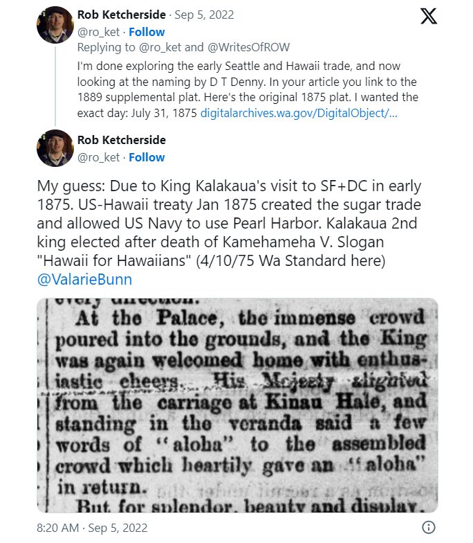
I haven’t posted in two weeks because I recently had the good fortune to visit, and the sad duty to return from, Maui, “the Valley Isle,” second largest of the Hawaiian Islands. That made me think, as I posted about S Spokane Street after traveling there last December, it would be appropriate to post about Aloha Street today.
Four and a half years ago, local historian Valarie Bunn wrote a post on her Wedgwood in Seattle History blog called “Searching for the Origin of Seattle Street Names.” It begins “There is no resource list of the meanings of Seattle’s street names or how the street names were derived,” and that was certainly true at the time. (One reason I started Writes of Way the next year was to eventually provide such a list — and now I rate a mention at the end of her article!) She continues:
Some street names are apparent in their derivation when honoring an early settler, such as Denny Way for the original homestead claim property of David Denny (Arthur’s younger brother) and Mercer Street for Thomas Mercer, an early, influential settler of Seattle. But for some other street names, such as Aloha Street, we may feel bewildered as we wonder, what is “Aloha” for?
She goes on to give a tutorial in trying to determine street name origins. She first notes that the street name was extended beyond Lower Queen Anne as part of the Great Renaming of 1895, and that its first appearance was as part of the 1875 plat of D.T. Denny’s Second Addition to North Seattle (as this part of South Lake Union then was). David Thomas Denny (1832–1903) and Louisa Boren Denny (1827–1916) were members of the Denny Party, who landed at Alki Point in 1851 and are considered the founders of modern Seattle. Here, though, the trail ends, as
The Dennys’ plat map of 1875 does not tell us why David and Louisa Denny chose the street names that they did, including “Aloha.”
But, she continues,
From earliest days, the Dennys knew that lumber was being shipped out from Seattle to San Francisco and as far as Hawaii, so our best guess is that they chose the word “Aloha” as a reference to Seattle’s trade connections.
Not as definitive an answer as the one she goes on to give for Cleopatra Place NW, but a pretty good one nevertheless, and one I can’t improve upon.
Note: On September 5, my friend, local historian Rob Ketcherside, did a bit of a dive into the matter. He began thus —
— and came to this conclusion:
I had come across the Reciprocity Treaty when trying to find any connection between Seattle and Hawaii in 1875,but…
So there, for now, the matter lies.
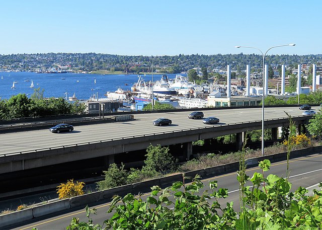
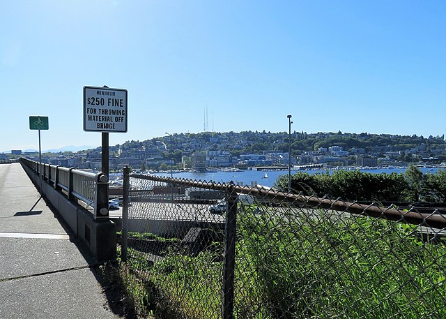
Note added August 13, 2023: The devastating Lāhainā wildfiremade me want to re-read this article, and I realized I neglected to discuss the route Aloha Street takes through Seattle. It begins at 1st Avenue W as W Aloha Street, and becomes Aloha Street a block to the east as it crosses Queen Anne Avenue N. From there, it goes ¾ of a mile east to Westlake Avenue N, where it is interrupted by Lake Union. It resumes at Fairview Avenue N and goes ⅙ of a mile east through the Fred Hutch Cancer Center campus to Eastlake Avenue E. On the other side of Interstate 5, it picks up again at Boylston Avenue E and goes an uninterrupted 1⅓ mileseast to its end at the intersection of 29th Avenue E and E Ward Street at the west end of the Washington Park Playfield.
Note: On August 20, 2024, I finished converting embedded tweets on this website to screenshots because of issues with how they were integrating with WordPress, which began not too long after Elon Musk purchased Twitter and changed its name to X.
Born and raised in Seattle, Benjamin Donguk Lukoff had his interest in local history kindled at the age of six, when his father bought him settler granddaughter Sophie Frye Bass’s Pig-Tail Days in Old Seattle at the gift shop of the Museum of History and Industry. He studied English, Russian, and linguistics at the University of Washington, and went on to earn his master’s in English linguistics from University College London. His book of rephotography, Seattle Then and Now, was published in 2010. An updated version came out in 2015.
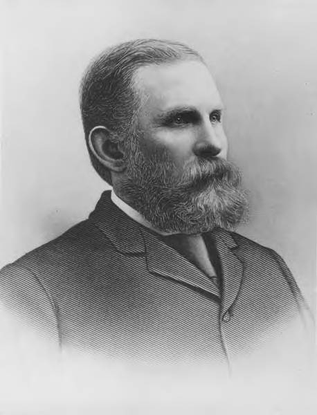
This street is named for David Thomas Denny (1832–1903). He was one of the members of the Denny Party that landed at Alki Point in 1851, led by his older brother, Arthur Armstrong Denny (1822–1899). In 1853, he married his sister-in-law, Louisa Boren (1827–1916). (Louisa’s older sister, Mary Ann Boren [1822–1910], had married Arthur in 1843. She, Louisa, and their brother, Carson Dobbins Boren [1824–1912], were also part of the Denny Party).
The Dennys settled on land in what is now Lower Queen Anne, living in a series of houses in the area until they went bankrupt in the Panic of 1893 and had to leave their mansion for their summer cottage at Licton Springs, where they lived with their oldest child, Emily Inez Denny (1853–1918), until they died.
Denny Park is named for the couple, which had given the land to the city as its first cemetery in 1861; the bodies were moved to the Washelli Cemetery on Capitol Hill in the 1880s, at which time the original cemetery was converted to a park, likewise the city’s first. (Just a few years later, Washelli was also converted to a park, initially known as Lake View Park, then City Park, and finally, in 1901, Volunteer Park. The Dennys’ private burial ground near the no-longer-existent Oak Lake eventually became the Oaklake Cemetery, which, after being sold by their son Victor in 1914, was renamed Washelli after the original cemetery of that name; Evergreen Cemetery, across Aurora Avenue N from Washelli, bought the latter in 1922, and the combined cemetery took its current name, Evergreen Washelli, in 1962.)
David Denny was active in government. According to HistoryLink.org, he was:
…Probate judge, King County commissioner, Seattle City Council member, a director of the Seattle School District, and regent of the Territorial University of Washington.… Denny was an ardent advocate of woman suffrage and helped lead the movement that in the 1880s won Washington women the right to vote. He opposed the expulsion of Chinese immigrants in 1886, which antagonized local nativists.
Denny was also involved in the development of a number of Seattle neighborhoods; in addition to Queen Anne, he developed tracts in South Lake Union, Capitol Hill, and Ravenna, and founded the Rainier Power and Railway Company, which ran the first streetcar from Downtown (Pioneer Square) to the University District (Ravenna Park).
David T. Denny, 1890. Courtesy of the Seattle Municipal Archives, Identifier 175313.
Denny Way — originally named Depot Street by Denny after a proposed train station that never materialized — begins as a shoreline street end on Elliott Bay, indistinguishable from the surrounding Myrtle Edwards Park. On the other side of the BNSF Railway tracks, W Denny Way begins as a pathway and stairway from Elliott Avenue to Western Avenue. From here, it is a major arterial, becoming Denny Way as it crosses Queen Anne Avenue N (originally named Temperance Street by Denny), and going 2½ miles east to E Madison Street and 22nd Avenue. (It becomes a neighborhood street on crossing E Olive Way, and the block between Broadway and 10th Avenue E was renamed E Barbara Bailey Way in 2019). E Denny Way begins again at E Madison Street and 23rd Avenue and goes ⅘ of a mile east to Madrona Place E and 38th Avenue, where it turns into Madrona Drive.
Denny Way, which becomes E Denny Way east of Eastlake Avenue E, also divides five of the city’s directional designation zones from each other, similarly to Yesler Way. North of Denny but west of Queen Anne Avenue N, east–west streets carry the W prefix and north–south avenues carry the suffix W. North of Denny between Queen Anne Avenue N and Eastlake Avenue E, east–west streets carry no prefix and north–south avenues carry the suffix N. North of Denny east of Eastlake Avenue E, east–west streets carry the E prefix and north–south avenues carry the suffix E. South of Denny but west of a line that includes Melrose Avenue, Minor Avenue, E Union Street, and Broadway, neither east–west streets nor north–south avenues carry a prefix or suffix. And south of Denny but east of that line, east–west streets carry the E prefix and north–south avenues carry no suffix.
Born and raised in Seattle, Benjamin Donguk Lukoff had his interest in local history kindled at the age of six, when his father bought him settler granddaughter Sophie Frye Bass’s Pig-Tail Days in Old Seattle at the gift shop of the Museum of History and Industry. He studied English, Russian, and linguistics at the University of Washington, and went on to earn his master’s in English linguistics from University College London. His book of rephotography, Seattle Then and Now, was published in 2010. An updated version came out in 2015.
This street is named for Dexter Horton (1825–1904). Born in Seneca Lake, New York, he was living in Princeton, Illinois before he came west in 1852 with, among others, Thomas Mercer and Daniel and Clarence Bagley. He and Mercer came to Seattle in 1853. In 1870, he founded the city’s first bank, the Dexter Horton Bank. (It later merged with Seattle National Bank and First National Bank to form the First Seattle Dexter Horton National Bank, which unwieldy name became First National Bank of Seattle, then Seattle-First National Bank, and eventually Seafirst, the name it used from 1974 until the brand was retired in favor of Bank of America in 1999. (Bank of America had bought Seafirst in 1983.)
Dexter Horton
Dexter Avenue begins just south of Denny Way at 7th Avenue and becomes Dexter Avenue N north of Denny. From there it goes 2 miles north, then northwest, to the intersection of Westlake Avenue N, 4th Avenue N, and Nickerson Street, just south of the Fremont Bridge.
Born and raised in Seattle, Benjamin Donguk Lukoff had his interest in local history kindled at the age of six, when his father bought him settler granddaughter Sophie Frye Bass’s Pig-Tail Days in Old Seattle at the gift shop of the Museum of History and Industry. He studied English, Russian, and linguistics at the University of Washington, and went on to earn his master’s in English linguistics from University College London. His book of rephotography, Seattle Then and Now, was published in 2010. An updated version came out in 2015.
This street is named after Charles Carroll Terry (1830–1867), one of the members, along with his older brother, Lee, of the Denny Party that landed at Alki Point in November 1851. Shortly after the landing, he opened the first store in King County. Lee had made a land claim in Alki a few months earlier, but went home to New York the next year; Charles remained, even after most of the other settlers left for what is now Pioneer Square. It seems he finally moved north in 1857, trading his Alki land for that of David Swinson “Doc” Maynard in Pioneer Square. He died 10 years later, according to this biography, of tuberculosis. (Whether or not he and his brother were responsible for naming the Alki Point settlement New York, which became New York–Alki [the latter word meaning ‘by and by’ or ‘someday’ in Chinook Jargon] and then just Alki, is unclear, although he did officially apply the Alki name to the town plat he filed in 1853.)
Terry Avenue begins at Alder Street on First Hill and goes ½ a mile to Spring Street, where it is blocked by Virginia Mason Hospital. Resuming at Seneca Street, it goes ⅕ of a mile to Pike Street. On the other side of Interstate 5 and the Washington State Convention Center, it begins again at Howell Street and goes ⅘ of a mile to Valley Street and Lake Union Park, becoming Terry Avenue N as it crosses Denny Way. Amazon.com’s headquarters are at 410 Terry Avenue N, between Harrison Street and Republican Street.
Born and raised in Seattle, Benjamin Donguk Lukoff had his interest in local history kindled at the age of six, when his father bought him settler granddaughter Sophie Frye Bass’s Pig-Tail Days in Old Seattle at the gift shop of the Museum of History and Industry. He studied English, Russian, and linguistics at the University of Washington, and went on to earn his master’s in English linguistics from University College London. His book of rephotography, Seattle Then and Now, was published in 2010. An updated version came out in 2015.
This street is named for Dr. Thomas Taylor Minor (1844–1889), who came to Seattle in 1883 from Port Townsend, where he had lived since 1868 and whose mayor he had been in 1880 and 1881. He was one of the founders of the Seattle, Lake Shore and Eastern Railway in 1885 and became mayor of Seattle from 1887 to 1889. He drowned off Whidbey Island while on a duck-hunting trip on December 2, 1889. The other fatalities were George Morris Haller, brother of Theodore Haller for whom Haller Lake is named, and his brother-in-law, Lewis Cox.
Dr. Thomas Taylor Minor
Minor Avenue begins at Broadway just north of Jefferson Street and goes ⅔ of a mile northwest to Pine Street. Resuming on the other side of Interstate 5 at Olive Way, it goes another ⅔ of a mile northwest, then north, to Mercer Street, having become Minor Avenue N north of Denny Way. After a two-block stretch from Roy Street to Aloha Street, it appears again as Minor Avenue E at E Newton Street, and goes nearly ½ a mile to its end at E Roanoke Street.
Born and raised in Seattle, Benjamin Donguk Lukoff had his interest in local history kindled at the age of six, when his father bought him settler granddaughter Sophie Frye Bass’s Pig-Tail Days in Old Seattle at the gift shop of the Museum of History and Industry. He studied English, Russian, and linguistics at the University of Washington, and went on to earn his master’s in English linguistics from University College London. His book of rephotography, Seattle Then and Now, was published in 2010. An updated version came out in 2015.
“A street of good intentions but easily thwarted,” as Sophie Frye Bass puts it in Pig-Tail Days in Old Seattle, John Street is “named for two Johns,” she writes — “For John Denny [1793–1875], the father of Arthur and David, and John B. [1862–1913], the son of David.”
John Denny
John Bunyan Denny
Today, W John Street begins at Western Avenue W and goes ⅓ of a mile east to 2nd Avenue N and the Pacific Science Center campus. John Street resumes just east of the Space Needle at Broad Street and goes ½ a mile to Terry Avenue N. Picking up half a block to the east, it makes it a further ⅓ of a mile before being blocked by Interstate 5 at Stewart Street and Eastlake Avenue E. Resuming at Melrose Avenue E, it goes ⅙ of a mile to E Olive Way, which itself becomes E John Street a few blocks to the east at Broadway E. From there, it’s ⅓ of a mile to the Kaiser Permanente Capitol Hill Medical Center at 15th Avenue E. After beginning again at 16th Avenue E, E John makes it nearly a mile before being stopped by the Harrison Ridge Greenbelt at 32nd Avenue E. Its final stretch is ⅓ of a mile from the 33rd Avenue E right-of-way to 39th Avenue E at Viretta Park.
Born and raised in Seattle, Benjamin Donguk Lukoff had his interest in local history kindled at the age of six, when his father bought him settler granddaughter Sophie Frye Bass’s Pig-Tail Days in Old Seattle at the gift shop of the Museum of History and Industry. He studied English, Russian, and linguistics at the University of Washington, and went on to earn his master’s in English linguistics from University College London. His book of rephotography, Seattle Then and Now, was published in 2010. An updated version came out in 2015.
This street was named for Carson Dobbins Boren (1824–1912), a member of the Denny Party that landed at Alki Point in November 1851. His sisters Mary Ann (1822–1910) and Louisa (1827–1916) married brothers Arthur (1822–1899) and David Denny (1832–1903) in 1843 and 1853, respectively. These weren’t the only Boren–Denny connections, either: his mother, Sarah Latimer Boren (1805–1888), who had been widowed in 1827, married John Denny (1793–1875) — Arthur and David’s father — in 1848. (Their mother, also named Sarah, had died in 1841.)
Boren is said to have built the first cabin in Seattle, at what is now 2nd Avenue and Cherry Street, in April 1852. He was elected King County’s first sheriff the same year. Boren’s land claim of 320 acres covered what is today a rectangle approximately bounded by (going clockwise) Yesler Way, 15th Avenue, E Cherry Street and its projection west, and Western Avenue and its projection north, but he sold it for $500 to Charles Terry and Edward Lander in 1855.*
* “Its projection” is necessary here because of Boren and Arthur Denny’s decision to have their street grid follow the shoreline, while “Doc” Maynard preferred his to follow the cardinal directions; Maynard’s grid eventually extended through the entire city and, indeed, county. (See “Seattle’s first streets.”) The actual southern boundary is a bit north of Yesler Way since both Boren and Maynard adjusted their initial claims to give Henry Yesler land to build and supply his sawmill.
Why Boren sold his land isn’t entirely clear. Sophie Frye Bass writes in Pig-Tail Days in Old Seattle that he sold it “early at a great sacrifice and became a roamer and, therefore, did not share in the up-building of the town”; her sister, Roberta Frye Watt, is indirectly quoted by Junius Rochester thus: “Carson had an unhappy home life. This compelled him to move deeper and deeper into the forest; to hunt and dream; and to shed most of his possessions.” Indeed, he and his wife, Mary Ann, divorced in 1861.
Carson Dobbins Boren
Today, Boren Avenue S begins at 14th Avenue S, Rainier Avenue S, and S Jackson Street, and goes 2⅕ miles north to Valley Street and Lake Union Park, becoming Boren Avenue as it crosses Yesler Way and Boren Avenue N as it crosses Denny Way. It is one of the few north–south streets in Seattle to have three directional designations.
Born and raised in Seattle, Benjamin Donguk Lukoff had his interest in local history kindled at the age of six, when his father bought him settler granddaughter Sophie Frye Bass’s Pig-Tail Days in Old Seattle at the gift shop of the Museum of History and Industry. He studied English, Russian, and linguistics at the University of Washington, and went on to earn his master’s in English linguistics from University College London. His book of rephotography, Seattle Then and Now, was published in 2010. An updated version came out in 2015.
This street is named for Thomas Dickerson Mercer (1813–1898), who came to Seattle in 1853 and homesteaded 160 acres in what is now Lower Queen Anne, living at what is now Roy Street and Taylor Avenue N. He became a King County commissioner and probate judge, and named Lake Washington and Lake Union, whose Lushootseed names are x̌ačuʔ and xáx̌əʔčuʔ(‘lake’ and its diminutive, respectively). Mercer Island is named for him, as are three of its main streets, W Mercer Way, N Mercer Way, and E Mercer Way. Mercer Slough in Bellevue is named for his brother Aaron (1826-1902), and his brother Asa (1839–1917) is known for being the first instructor at, and first president of, the Territorial University of Washington (being the only college graduate in Seattle in 1861); and for bringing the “Mercer Girls” to Seattle to address the settlement’s severe gender imbalance (thereby inspiring the 1960s TV show Here Come the Brides).
Thomas Dickerson Mercer
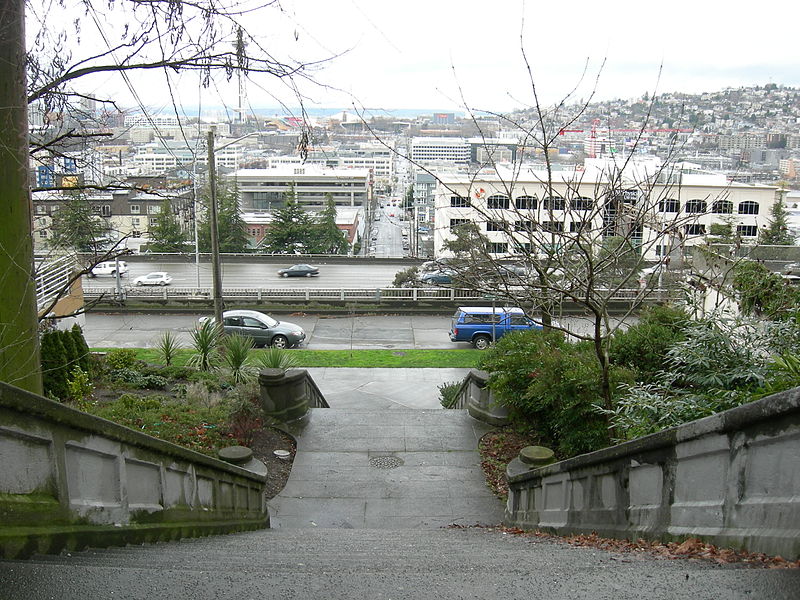
Today, W Mercer Street begins at Elliott Avenue W and goes a block east to 6th Avenue W, where it becomes a stairway. At the top of the stairway, the street becomes a major arterial (connecting directly to Elliott via W Mercer Place) and goes 1⅔ miles east to Eastlake Avenue E and Lakeview Boulevard E, where it is blocked by Interstate 5. (It is, incidentally, laid out on the boundary between the donation land claims of Mercer and David Thomas Denny. Mercer’s claim is today bounded by Queen Anne Avenue N on the west, Lake Union on the east, Highland Drive on the north, and Mercer Street on the south.) Connecting Interbay, Lower Queen Anne, Seattle Center, State Route 99, South Lake Union, Interstate 5, and Capitol Hill, Mercer Street is a linchpin of Seattle’s transportation system — but not a beloved one, having earned the name “Mercer Mess” decades ago.
East of Interstate 5, E Mercer Street begins again at Melrose Avenue E and goes nearly 1½ miles to 28th Avenue E, interrupted only once, at 17th Avenue E, where it is pedestrian-only for half a block. Mercer resumes briefly at Dewey Place E but after a couple hundred feet becomes a stairway connecting to Lake Washington Boulevard E and 31st Avenue E. A block east of that, at 32nd Avenue E, E Mercer Street resumes as another stairway, and becomes a street again just west of 33rd Avenue E. This segment goes about ⅛ of a mile to 36th Avenue E. There is one final 200-foot-long segment of E Mercer Street east of 39th Avenue E. Platted into Lake Washington, this is a shoreline street end, but not, unfortunately, one open to the public. (It was this particular street end that first got me involved with Friends of Street Ends, as I grew up just ¼ of a mile up the hill.)
Born and raised in Seattle, Benjamin Donguk Lukoff had his interest in local history kindled at the age of six, when his father bought him settler granddaughter Sophie Frye Bass’s Pig-Tail Days in Old Seattle at the gift shop of the Museum of History and Industry. He studied English, Russian, and linguistics at the University of Washington, and went on to earn his master’s in English linguistics from University College London. His book of rephotography, Seattle Then and Now, was published in 2010. An updated version came out in 2015.
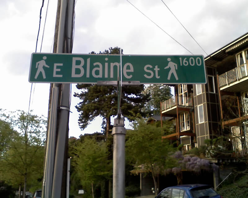
Unfortunately, though the Blaines may have been feminists, they, according to HistoryLink.org, had no love for Native Americans (or, for that matter, the Irish). Their departure in 1856 was prompted by the Battle of Seattle. Junius Rochester writes:
On January 20, 1856, a son John, was born to Catharine and David Blaine. Six days later the Battle of Seattle erupted. David had duty at one of the blockhouses, but managed to get Catharine and their babe aboard the Decatur in Elliott Bay. David had described the Indians as a “poor degraded race,” which would “soon disappear.” Catharine compared their “stupidity and awkwardness” to that of the Irish. The Indian uprising confirmed their worst fears and prejudices.
Today, W Blaine Street begins in Magnolia at 36th Avenue W and goes a semicircular ⅕ of a mile to 34th Avenue W and W Howe Street. It resumes at 31st Avenue W and goes almost ⅓ of a mile to Thorndyke Avenue W. There is a stub of W Blaine east of 15th Avenue W that is quickly stopped by the Southwest Queen Anne Greenbelt. The street resumes at 12th Avenue W and goes just over a mile to 4th Avenue N, having briefly become a stairway at 9th Avenue W. After a series of short stretches serving as driveways and parking, the Blaine Street right-of-way resurfaces east of Westlake Avenue N and heads into Lake Union. Here, too, it serves as a driveway and offers no access to the water. East of Lake Union, E Blaine Street begins at Fairview Avenue E and goes ⅛ of a mile to Franklin Avenue E, where it becomes part of the I-5 Colonnade park underneath the freeway. From Lakeview Boulevard E to just west of 10th Avenue E it is a stairway, and then two blocks of roadway ending at 12th Avenue E and Lake View Cemetery. There is then a diagonal ¼-mile stretch from 19th Avenue E to E Howe Street in Montlake. E Blaine finishes up as a ⅕-mile stretch from 37th Avenue E to McGilvra Boulevard E and a final two-block run from E Madison Street to 43rd Avenue E, both in Madison Park.
Born and raised in Seattle, Benjamin Donguk Lukoff had his interest in local history kindled at the age of six, when his father bought him settler granddaughter Sophie Frye Bass’s Pig-Tail Days in Old Seattle at the gift shop of the Museum of History and Industry. He studied English, Russian, and linguistics at the University of Washington, and went on to earn his master’s in English linguistics from University College London. His book of rephotography, Seattle Then and Now, was published in 2010. An updated version came out in 2015.
This photograph is undated, but must have been taken before Rezin left the family around 1880. Margaret sued Rezin for divorce that year and he “fled to California,” not to return for many years.
Pontius Avenue N runs ⅓ of a mile from John Street north to just past Mercer Street, where it dead-ends at the Interstate 5–Mercer Street interchange (originally constructed in 1962–1963 as part of the planned Bay Freeway, which was cancelled 10 years later with little more progress having been made. Its original northern end was Roy Street.) Pontius originally began one block further south, at Denny Way, but this portion was vacated as part of the construction of the Denny Substation.*
* Or was it? The clerk file indicates the vacation was granted, but I can find no related ordinance, and the King County Parcel Viewer and quarter section map show the Pontius right-of-way still existing between Denny and John. Something for me to look into… sometime.
Born and raised in Seattle, Benjamin Donguk Lukoff had his interest in local history kindled at the age of six, when his father bought him settler granddaughter Sophie Frye Bass’s Pig-Tail Days in Old Seattle at the gift shop of the Museum of History and Industry. He studied English, Russian, and linguistics at the University of Washington, and went on to earn his master’s in English linguistics from University College London. His book of rephotography, Seattle Then and Now, was published in 2010. An updated version came out in 2015.
Today, W Republican Street begins a block west of 4th Avenue W and goes ⅖ of a mile east to Warren Avenue N, where it becomes Seattle Center’s pedestrian August Wilson Way. On the east side of Seattle Center, there is a one-block segment of Republican Street between 4th Avenue N and 5th Avenue N; the street then resumes at Dexter Avenue N at the northbound exit from the State Route 99 Tunnel. From there, it runs ⅔ of a mile east to Eastlake Avenue E, where it is blocked by Interstate 5. Resuming east of I-5 as a stairway at Melrose Avenue E, it becomes a street again after half a block and goes another 1⅕ miles from Bellevue Avenue E to 23rd Avenue E, interrupted only once at 17th Avenue E, which can only be crossed by pedestrians and bicycles. After a substantial gap, E Republican Street begins again at 29th Avenue E and E Arthur Place in Madison Valley, and goes ⅖ east to its end at Lake Washington Boulevard E.
(From 33rd Avenue E to Lake Washington Boulevard E, it forms the northern boundary of the Bush School campus; when I went there in the 1980s and 1990s, people from out of town thought I was joking when I told them I went to Bush School on Republican Street. The school, of course, wasn’t named for a member of the Bush political dynasty, but rather for its founder, Helen Taylor Bush.)
Born and raised in Seattle, Benjamin Donguk Lukoff had his interest in local history kindled at the age of six, when his father bought him settler granddaughter Sophie Frye Bass’s Pig-Tail Days in Old Seattle at the gift shop of the Museum of History and Industry. He studied English, Russian, and linguistics at the University of Washington, and went on to earn his master’s in English linguistics from University College London. His book of rephotography, Seattle Then and Now, was published in 2010. An updated version came out in 2015.
Lakeview Boulevard E, which originated in David and Louisa Denny’s 1886 East Park Addition to the City of Seattle, is named for its view of Lake Union to the west. For a time part of the Pacific Highway (now routed onto Aurora Avenue N), it begins today at an overpass over Interstate 5 at Eastlake Avenue E and Mercer Street and goes a mile north to Boylston Avenue E and E Newton Street.
Interstate 5 blocks the view of the lake from much of the northern section of the street, but the southern section’s view is still more or less intact.
Born and raised in Seattle, Benjamin Donguk Lukoff had his interest in local history kindled at the age of six, when his father bought him settler granddaughter Sophie Frye Bass’s Pig-Tail Days in Old Seattle at the gift shop of the Museum of History and Industry. He studied English, Russian, and linguistics at the University of Washington, and went on to earn his master’s in English linguistics from University College London. His book of rephotography, Seattle Then and Now, was published in 2010. An updated version came out in 2015.
Forming a trio with Eastlake Avenue and Northlake Way, Westlake Avenue is so named for running along the western shore of Lake Union. Beginning today at Stewart Street between 5th Avenue and 6th Avenue, just north of McGraw Square, it runs 2½ miles north to 4th Avenue N between Nickerson Street and Florentia Street — the south end of the Fremont Bridge.
Westlake Avenue once started a couple of blocks to the south, at 4th Avenue and Pike Street, and based on the quarter section map, it appears that its former route through Westlake Park between Pike Street and Pine Street is still public right-of-way as opposed to park land. (The portion between Pine Street and Olive Way was vacated in 1986 to make way for the Westlake Center mall, which opened in 1988, and the portion between Olive Way and Stewart Street was closed in 2010 to allow for the expansion of McGraw Square.)
Westlake was extended south to 4th and Pike from Denny Way in 1902 (one former mayor has called for that extension to be closed to cars); the original Westlake Avenue (now, properly, Westlake Avenue N) was created in 1895 as part of the Great Renaming ordinance, Section 5 of which reads
That the names of Rollin Street, Lake Union Boulevard and Lake Avenue from Depot Street [changed by the same ordinance to Denny Way] to Florentia Street, be and the same are hereby changed to Westlake Avenue.
Rollin Street, the southernmost portion, was named for Rolland Herschel Denny (1851–1939), the youngest member of the Denny Party at just six weeks old. In its honor, an apartment complex that opened at the corner of Westlake and Denny in 2008 is named Rollin Street Flats.
Having covered Northlake, Eastlake, and Westlake so far, one might ask: why is there no Southlake?
There does appear to have been a Southlake Avenue for a time — 1909 to 1924 or so, based on the last mention of it I could find in Seattle newspapers, an article in the August 8, 1924, edition of The Seattle Times on a car crash that had taken place a number of weeks earlier. Now the northern section of Fairview Avenue N, it extended from the intersection of Valley Street northwest to E Galer Street and Eastlake Avenue E, “thus eliminating the present grade on Eastlake for University traffic” in the words of a real estate advertisement in the August 23, 1914, edition of the Seattle Post-Intelligencer. But why the Southlake name disappeared seems clear: once it was decided to extend the Fairview name along the shore lands, there was no other appropriate road to carry it. The northern and eastern shores of Lake Union are just shy of 2 miles long each, but since the lake is shaped like a ? (and, surprisingly, like a uterus if Portage Bay is included) there is hardly any southern shore to speak of — only about ¼ mile.
As for the neighborhood name, I’m not sure why South Lake Union came to be used instead of Southlake. Perhaps it’s as simple as the lack of a similarly named street to “anchor” the neighborhood.
Born and raised in Seattle, Benjamin Donguk Lukoff had his interest in local history kindled at the age of six, when his father bought him settler granddaughter Sophie Frye Bass’s Pig-Tail Days in Old Seattle at the gift shop of the Museum of History and Industry. He studied English, Russian, and linguistics at the University of Washington, and went on to earn his master’s in English linguistics from University College London. His book of rephotography, Seattle Then and Now, was published in 2010. An updated version came out in 2015.
Like NE Northlake Way, Eastlake Avenue E is so named because it runs along the shore of Lake Union — in this case, obviously, the eastern one. It, too, was earlier named Lake Avenue (in part), but this was changed as part of the Great Renaming of 1895. Ordinance 4044, Section 6 reads
That the names of Albert Street, Waterton Street, Lake Avenue and Green Street from Depot Street [changed by the same ordinance to Denny Way] to the shore of Lake Union at the northerly point of the Denny–Fuhrman addition, be and the same are hereby changed to Eastlake Avenue.
Today, Eastlake, at 2⁹⁄₁₀ miles in length, extends slightly farther north and south than the roadway mentioned in the ordinance. It starts in the south at the intersection of Court Place and Howell Street as Eastlake Avenue, then becomes Eastlake Avenue E a block north as it crosses Denny Way. From here to just south of E Galer Street it divides the Avenue: E; Street: E section of town from the Avenue: N; Street section. Just north of Portage Bay Place E it crosses Lake Union as the University Bridge, then continues on as the one-way–northbound Eastlake Avenue NE to 11th Avenue NE just north of NE 41st Street. (Southbound, it is fed by Roosevelt Way NE at NE Campus Parkway.)
Eastlake, like Fairview and Boren Avenues, is one of the few north–south streets in Seattle to have three different directional designations.
Born and raised in Seattle, Benjamin Donguk Lukoff had his interest in local history kindled at the age of six, when his father bought him settler granddaughter Sophie Frye Bass’s Pig-Tail Days in Old Seattle at the gift shop of the Museum of History and Industry. He studied English, Russian, and linguistics at the University of Washington, and went on to earn his master’s in English linguistics from University College London. His book of rephotography, Seattle Then and Now, was published in 2010. An updated version came out in 2015.
At any rate, Ordinance 6947, filed on June 6, 1901, refers to the street as Aurora Street, and Ordinance 7942, filed on November 5 of that year, refers to it as Aurora Avenue. I can find no specific record of the name change, but Ordinance 6864, filed on May 8, has to do with “altering, defining and establishing the names of streets in the City of Seattle in the portion thereof lying north of Lake Union, Salmon Bay and the route of the Lake Washington Canal,” and is likely responsible. (No text is available online for the ordinance, and the drafters of Ordinance 6947 must have neglected to take the change into account.)
Aurora Avenue N might have remained just another North Seattle street were it not for the decision to route the Pacific Highway, U.S. Route 99, across the Lake Washington Ship Canal there instead of Stone Way N, Albion Place N, Whitman Avenue N, or Linden Avenue N. As it happened, Aurora was chosen as the location for the crossing (known today as the Aurora Bridge), and the name was officially extended through Queen Anne to Downtown Seattle in 1930 in preparation for the bridge’s opening in 1932.
Added July 14, 2023: I spoke to Feliks Banel of KIRO Newsradio for one of his All Over the Map segments, this one on how the Aurora Bridge got its name. I didn’t appear on air, but was mentioned in both the audio and web versions of the story.
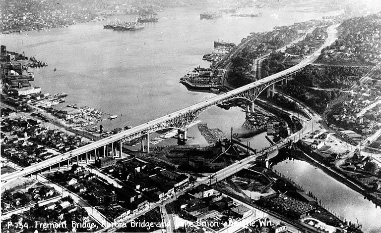
Postcard of Lake Union, Lake Washington Ship Canal, the Fremont Bridge, and the George Washington Memorial Bridge (Aurora Bridge), circa 1932. View looks southeast, with Fremont in foreground. Public domain image from University of Washington Libraries Digital Collections.Aurora Bridge, 2011. View looks east, with Gas Works Park and Wallingford neighborhood at center, Lake Union and Capitol Hill at right. Public domain photo by Flickr user Mike Linksvayer.
Today, Aurora Avenue N begins at 7th Avenue N and Harrison Street by the north portal of the State Route 99 Tunnel and goes 7⅘ miles north to the city limits; the name continues 3 further miles to the King–Snohomish county line, and the highway another 12 miles beyond that to Broadway in Everett. A block-long segment from 6th Avenue and Battery Street to Denny Way has been renamed Borealis Avenue, and Aurora between Denny Way and Harrison Street is once again 7th Avenue N. A two-block-long segment underneath the north approach to the Aurora Bridge has also been changed to Troll Avenue N.
Born and raised in Seattle, Benjamin Donguk Lukoff had his interest in local history kindled at the age of six, when his father bought him settler granddaughter Sophie Frye Bass’s Pig-Tail Days in Old Seattle at the gift shop of the Museum of History and Industry. He studied English, Russian, and linguistics at the University of Washington, and went on to earn his master’s in English linguistics from University College London. His book of rephotography, Seattle Then and Now, was published in 2010. An updated version came out in 2015.
Born and raised in Seattle, Benjamin Donguk Lukoff had his interest in local history kindled at the age of six, when his father bought him settler granddaughter Sophie Frye Bass’s Pig-Tail Days in Old Seattle at the gift shop of the Museum of History and Industry. He studied English, Russian, and linguistics at the University of Washington, and went on to earn his master’s in English linguistics from University College London. His book of rephotography, Seattle Then and Now, was published in 2010. An updated version came out in 2015.
Fairview Avenue is one of a handful in the city that changes directional designations twice along a continuous stretch. The street begins in the south at Virginia Street as Fairview Avenue, but becomes Fairview Avenue N a block and a half to the north as it crosses Denny Way, and a mile north and east of that becomes Fairview Avenue E at E Galer Street and Eastlake Avenue E. It continues to E Roanoke Street, two miles from its origin, where it is interrupted by the Mallard Cove houseboat community. Picking up a block to the north, it then runs half a mile from E Hamlin Street to Fuhrman Avenue E and Eastlake Avenue E, just south of the University Bridge.
The Fairview Homestead Association, according to Paul Dorpat, was intended to “help working families stop paying rents and start investing in their own homes. Innovative installment payments made the lots affordable and many of the homes were built by those who lived in them.”
I assume Fairview took its name from the view of Lake Union and what is now Wallingford that is still barely visible today from what is now the Cascade neighborhood.
1931 view looking north toward Lake Union along Fairview Avenue N, Courtesy of the Seattle Municipal Archives, Identifier 5265
Born and raised in Seattle, Benjamin Donguk Lukoff had his interest in local history kindled at the age of six, when his father bought him settler granddaughter Sophie Frye Bass’s Pig-Tail Days in Old Seattle at the gift shop of the Museum of History and Industry. He studied English, Russian, and linguistics at the University of Washington, and went on to earn his master’s in English linguistics from University College London. His book of rephotography, Seattle Then and Now, was published in 2010. An updated version came out in 2015.


.jpg)
.jpg)