University Street

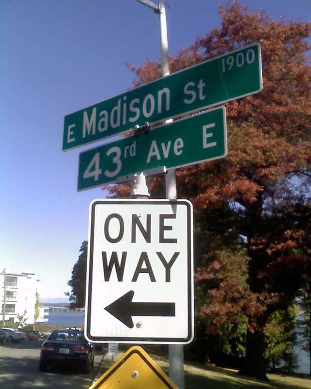
University Street was established as part of the Plat of an Addition to the Town of Seattle as Laid Out by A.A. Denny on November 16, 1861. It was named for the Territorial University of Washington, which had opened 12 days earlier on a 10-acre site atop “Denny’s Knoll.”

Plat of an Addition to the Town of Seattle as Laid Out by A.A. Denny, November 16, 1861
Territorial University on opening day, showing south and west sides of main building, November 4, 1861
Territorial University of Washington on opening day, November 4, 1861

Even though the University of Washington moved to its current location on Portage and Union Bays in 1895, the name was not changed. Nor did the university relinquish the land, though not for lack of trying. This turns out to have been fortunate. The UW owns the Metropolitan Tract to this day, and it earned $25 million in rent on the property during fiscal year 2020 alone.

The street, which originally ran from Front Street (now 1st Avenue) to the university campus, just northeast of 3rd Avenue, today begins at Alaskan Way on the Elliott Bay waterfront, and makes it just one block, to Western Avenue, before it becomes the Harbor Steps. From 1st Avenue, it’s about a third of a mile to 7th Avenue, where University Street is blocked by Interstate 5. It resumes at 9th Avenue and goes for another third of a mile to Boylston Avenue.

Portion of King County quarter section maps covering Metropolitan Tract

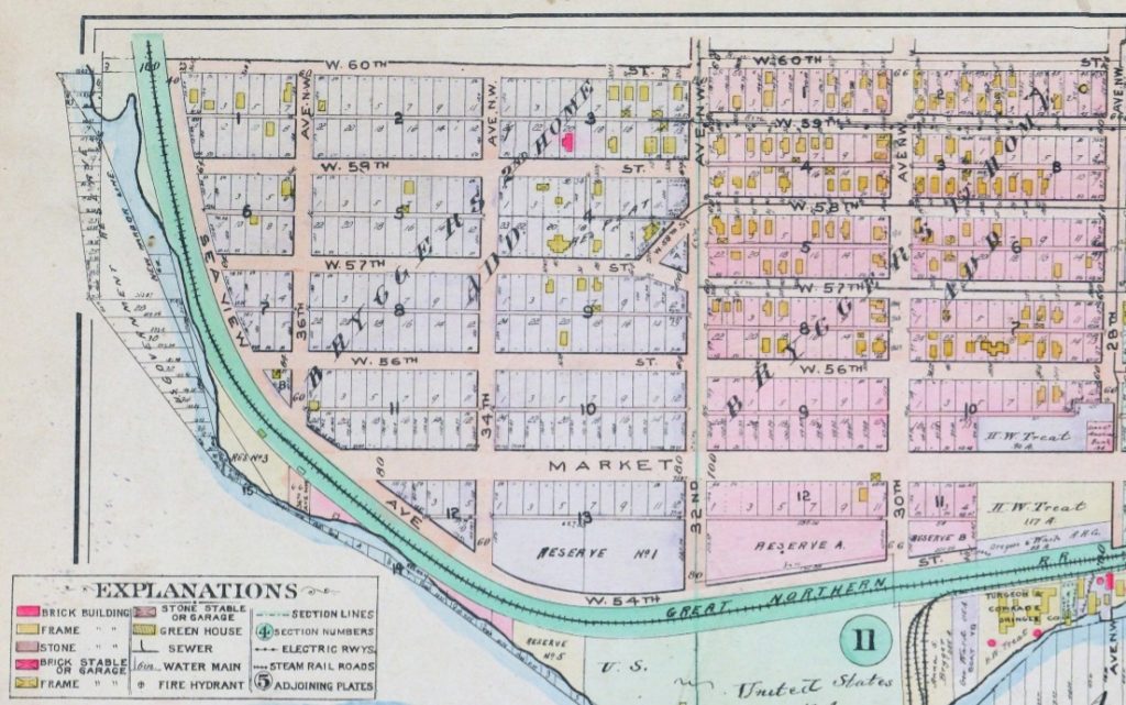
Incidentally, you’ll notice in the map above that 4th and 5th Avenues between Seneca and Union Streets, as well as University Street between 4th and 5th Avenues, plus half a block on either end, are marked private way subject to public use — long term grant of use for street purposes. This fact — that the University of Washington still owns all the land within the Metropolitan Tract and never formally dedicated those streets to the public — was something I never knew until I started taking close looks at King County’s quarter section maps as part of my local history research. It might seem an academic distinction, but as The Seattle Times reported in 2015, there are very real financial consequences.

In 2008… the UW wanted the city to interpret the tract as one undivided lot, streets and all. That novel argument would benefit the UW in calculating the development footprint, or base.… The bigger the base, the logic went, the more square footage a developer could build before triggering affordable-housing fees under the city’s formula.… The university held a heavy hammer in negotiations. Because the UW owned development rights for the land under Fifth Avenue and University Street, it could make the city compensate it, one way or another, for using those streets.

Madison Street

Madison Street — another of Seattle’s “first streets” — was named for James Madison, president of the United States from 1809 to 1817. It is the only street in town that stretches, uninterrupted, from the salt water of Elliott Bay and Puget Sound to the fresh water of Lake Washington.

Originating as the McGilvra Road in 1861, Madison Street begins on the Elliott Bay waterfront at Alaskan Way and ends 3¾ miles northeast of there at a small fishing pier, just east of 43rd Avenue E and north of Madison Park Beach. Apart from a slight bend to the northeast at 22nd Avenue, it is as straight as an arrow from beginning to end.

Signs at corner of E Madison Street and 43rd Avenue E, October 11, 2009
Signs at corner of E Madison Street and 43rd Avenue E, October 11, 2009. Photograph by Benjamin Lukoff. Copyright © 2009 Benjamin Lukoff. All rights reserved.

Spring Street

Spring Street was another of Seattle’s “first streets.” Sophie Frye Bass writes in Pig-Tail Days in Old Seattle:

Where springs of clear water bubbled from the earth and the beach was sandy and free from rocks, there the Indians camped. Such a choice spot was Tzee-tzee-lal-litch [dzidzəlalič], which Arthur Denny called Spring Street.

Spring Street begins at Alaskan Way and runs nearly a mile, to Harvard Avenue, before it is interrupted. A few more segments run through the Central District and Madrona. The last is from 38th Avenue to Grand Avenue, at which point it continues to Lake Washington Boulevard as a footpath and stairway.

Cherry Street

Cherry Street was among the first streets platted in Seattle on May 23, 1853. Sophie Frye Bass, author of Pig-Tail Days in Old Seattle, writes:

I choose to think that Cherry Street is named for the little town of Cherry Grove, Illinois — Mother’s birthplace — where the Dennys started on their long journey over the Oregon Trail.

“Mother,” in this case, refers to Louisa Catherine Denny Frye, one of three children of Arthur Armstrong Denny and Mary Ann Boren Denny of the Denny Party. She was 7 years old when they landed at Alki Point in November 1851.

In 2006, Hunter Brown wrote a People’s History essay for HistoryLink, “Finding Cherry Grove,” detailing his efforts to locate Cherry Grove, whose name was later changed to Cedar Township. The nearest town today is called Abingdon.

Bass began her Pig-Tail Days piece on Cherry Street by calling it “another up-and-up street… with no interferences. It begins at First Avenue, goes east and ends at Thirty-seventh avenue.” This is no longer quite the case because of a very small gap at the south end of the Seattle University campus. Today, Cherry begins at 1st Avenue and ends a block east of Broadway. It starts up again a couple hundred feet to the east as a continuation of the James Street/E James Way arterial, and then does go on to 37th Avenue in Madrona. All told it is 2⅓ miles long.

Marion Street

Marion Street, like James Street, was one of the first streets platted in Seattle on May 23, 1853. It, too, was named by Arthur Armstrong Denny after his younger brother, James Marion Denny (1824–1854). 

Marion Street runs ⅖ of a mile from Alaskan Way to 6th Avenue, where it is interrupted by Interstate 5. It picks up again at 7th Avenue and runs about the same distance to Broadway, where the Seattle University campus begins. East of there it runs in sections of varying lengths until it ends for good at 38th Avenue and Madrona Park.

James Street

James Street, one of the first streets platted in Seattle on May 23, 1853, was named by Arthur Armstrong Denny after his younger brother, James Marion Denny (1824–1854). Histories of Seattle report that James was too sick to leave Oregon and come to Puget Sound with the Denny Party and, indeed, he died in the town of Sublimity, Oregon, just a year after the street was named for him. Nothing I have found reports an actual cause of death. Marion Street is also named after this brother.

James Street runs ¾ of a mile from Yesler Way just east of 1st Avenue to an alley just east of Broadway. It appears east of there in a few short stretches and finally as a stairway from 38th Avenue to Lake Washington Boulevard at Madrona Park.

Seattle’s first streets

The Denny Party landed at Alki Beach on November 13, 1851, and moved to dzidzəlalič  (today known as Pioneer Square) in the spring of 1852. The name “Seattle,” according to local historian Rob Ketcherside, first appeared in print that October. But it wasn’t until May 23, 1853, that David Swinson Maynard, Carson Dobbins Boren, and Arthur Armstrong Denny filed the first plats of the Town of Seattle — thereby creating its first official streets.

Boren and Denny famously aligned their streets with the Elliott Bay shoreline (32° west of north, or very close to northwest by north), while Maynard aligned his with the cardinal directions.

Plat of the Town of Seattle, May 23, 1853, by Carson Dobbins Boren and Arthur Armstrong Denny
Plat of the Town of Seattle, King County, Washington Territory, May 23, 1853, by David Swinson Maynard

Mill Street, which divided the two plats, was renamed Yesler Avenue in 1888, and Yesler Way — its current name — seven years later. Front Street became 1st Avenue and Commercial Street became 1st Avenue S as part of that same “Great Renaming” ordinance of 1895. Streets that were named in these first plats that have kept their names till today include:

Boren and Denny

  • James Street — after James Marion Denny, younger brother of A.A. Denny
  • Cherry Street — after Cherry Grove, Illinois, where the Denny Party’s journey to Seattle began
  • Columbia Street
  • Marion Street — also after James Marion Denny
  • Madison Street — after President James Madison
  • Spring Street — after the springs along Elliott Bay

Mill Street is now Yesler Way, and Front Street is now 1st Avenue.

Maynard

  • Washington Street — after President George Washington
  • Main Street
  • Jackson Street — after President Andrew Jackson
  • King Street — after Vice President William Rufus DeVane King
  • Weller Street — after John B. Weller, senator from California, later governor of California
  • Lane Street — after Joseph Lane, governor of Oregon Territory, later Southern Democratic candidate for vice president in the 1860 election

Commercial Street is now 1st Avenue S.

Dorffel Drive E

This street runs just over ¼ of a mile from 37th Avenue E in the north, by Lakeview Park, to E Howell Street and 39th Avenue in the south. It was named for George and Otilde Dorffel, who might otherwise be best known for giving Ravenna its name.

In the original 1901 plat of Denny-Blaine-Lake Park, the Dorffel Drive name was given to what is now Madrona Place E, and what is now Dorffel Drive was then 37th Avenue. The change, which took place in 1906, would seem to have been done to eliminate the oddity of 39th Avenue becoming 37th Avenue as it crossed E Howell Street.

E Florence Court

This street runs around 650 feet from 34th Avenue E, just north of E Denny Way, to 37th Avenue East. It was established in 1903 as part of Waddell’s Madrona Park Addition to the City of Seattle by, among others, Albert and Florence M. Waddell.

Advertisement for Madrona Park Addition, The Seattle Times, April 7, 1903

Mithun Place NE

This street, which snakes for a third of a mile through the Burke-Gilman Place housing development north of Sand Point Way NE at NE 52nd Street, was named for Mithun, the architectural firm that designed the development in the 1980s.

S Angeline Street

This street lies mostly in Columbia City, where its name originated, and Seward Park, with a few blocks in Beacon Hill and even fewer in West Seattle. It almost reaches Puget Sound at Beach Drive SW, and does reach Andrews Bay of Lake Washington at Lake Washington Boulevard S.

As noted, the name Angeline Street originated in Columbia City, in this 1891 Plat of Columbia, filed at the request of James Kippen Edmiston by Percy W. Rochester and John I. Wiley of the Washington Co-operative Home Company. 

Princess Angeline was born Kikisoblu, the daughter of Si’ahl [siʔaɫ], better known in English as Chief Seattle of the Duwamish and Suquamish Tribes. Her date of birth is unknown; Wikipedia gives it as ca. 1820, whereas this article posted by the Duwamish Tribe, written by elementary school students based on HistoryLink essays, gives it as 1828. She died May 31, 1896.

Princess Angeline received her English name from Catherine Broshears Maynard, wife of David Swinson (“Doc”) Maynard, one of the earliest Seattle settlers. As the HistoryLink Elementary article puts it,

Chief Seattle’s oldest daughter was named Kikisoblu. She became friends with many of Seattle’s founding families. One of her friends was Catherine Maynard. She felt that Kikisoblu should have a name that would let the white settlers know that she was the daughter of a great chief. So she called her Princess Angeline. She thought that name was prettier than the name Kikisoblu.

Photograph of Kikisoblu, or Princess Angeline, by Frank La Roche, ca. 1893
Photograph of Princess Angeline (Kikisoblu), by Frank La Roche, ca. 1893

W Briarcliff Lane

W Briarcliff Lane runs about 400 feet west from 39th Avenue W before it makes a 90° turn to the north and becomes Briarcliff Lane W. That segment runs about 200 feet north to W Dravus Street. A private road, it is part of the Briarcliff development on what was once Briarcliff School (1949–1984, demolished 2003). You can read more about the history of Briarcliff at HistoryLink.com.

As for the school’s name? In an article published August 21, 1948, The Seattle Times noted that “on recommendation of district residents, the board named the new school being built in the Magnolia area the Briarcliff School.”

Erickson Place NE

This street, which runs around 675 feet from 35th Avenue NE at NE 135th Street to Lake City Way NE at NE 137th Street, connecting the two arterials, was named, as local historian Valarie Bunn tells us in Gerhard Ericksen’s Good Road, after Norwegian immigrant Gerhard Johan Ericksen (1860, Molde, Norway – 1920, Bothell, Washington). 

Parade float, July 4, 1908, for Gerhard Ericksen’s Mercantile, Bothell; Ericksen at far left
Parade float, July 4, 1908, for Gerhard Ericksen’s Mercantile, Bothell; Gerhard Ericksen at far left, son George Ericksen at far right

Ericksen, a Bothell merchant and Washington state legislator, was behind the creation of what is now the Washington State Department of Transportation, and the Gerhard Erickson Road (sic) was named in his honor. Bunn writes:

This road preceded the creation of Victory Way (Bothell Way/Lake City Way.)… In Wedgwood today, the Erickson Road route still exists as part of Ravenna Avenue NE north of NE 83rd Street.… as far as NE 110th Street. At the corner where Nathan Hale High School is located… the Erickson Road route took an eastward turn over to what is now 35th Avenue NE. At NE 135th Street, the 35th Avenue NE arterial angles over and merges with Lake City Way NE. The two-block portion from NE 135th to 137th Streets is still called Erickson Place NE.

Why the street is spelled Erickson instead of Ericksen is unknown.

Brygger Drive W

Anna Sophia Brygger, the Norwegian immigrant mentioned in NW Brygger Place, is also the namesake of Magnolia’s Brygger Drive W, a short street that runs not quite a tenth of a mile from 34th Avenue W just north of W Government Way to a dead end at Kiwanis Memorial Preserve Park. Many of the streets on the map below were either never built (Northview Place, Albert Street [Alberta is a typo], Byers Place) or were only partially built (Fort Place, 35th Avenue W, 34th Avenue W, and Brygger Drive itself.)

Map of Lawton Heights Addition, Magnolia, 1912 Baist Atlas

NW Brygger Place

Have I mentioned my friend, local historian Rob Ketcherside? He is the vice president of the Capitol Hill Historical Society, author of Lost Seattle, and blogs about “New Seattle history, mostly,” at Ba-kground.com. I first made his acquaintance when I was a contributor to Crosscut.com and came across his article “Why light rail was predestined for Martin Luther King Jr. Way.”

One of his blog posts is on NW Brygger Place, which runs around 650 feet from 26th Avenue NW in the east to 28th Avenue NW in the west, just south of NW 60th Street and the Ballard Community Center and Playfield. Its namesake was Anna Sophia Brygger (1853–1940), an immigrant from Norway, who also named Brygger Drive W in Magnolia after herself. Do check it out, along with the rest of his posts.

Map of Brygger's 1st Home and 2nd Home Additions, Ballard, 1912 Baist Atlas
Map of Brygger’s 1st Home and 2nd Home Additions, Ballard, 1912 Baist’s Real Estate Atlas

Post Avenue

Counting Post Avenue and Post Alley as one street, and ignoring a couple of block-long gaps, this street runs about ¾ of a mile from Yesler Way in the southeast to Virginia Street in the northwest. (Post Avenue becomes Post Alley northwest of Seneca Street.) According to local historian Jean Sherrard, writing at PaulDorpat.com, it was named for the offices of the Seattle Post, predecessor of today’s Seattle Post-Intelligencer newspaper, which was built at the corner of Yesler and Post in 1881.

Seattle Post Building, by Asahel Curtis

N Clogston Way

N Clogston Way, which runs a mere 200 feet east from Green Lake Way N to a dead end, between N 54th and N 55th Streets, was named after a Union veteran of the Civil War, as Valarie Bunn of Wedgwood in Seattle History notified me tonight.

John D. Clogston served “with the 9th Regiment, New Hampshire Infantry. On the 13th of December, 1862, Clogston was wounded in battle at Fredericksburg, Virginia, losing part of his right hand. His injury was so severe that he was discharged on February 6, 1863.” He and his bride, Lucinda, moved to Seattle in 1889, just a few months after the Great Seattle Fire; he died 20 years later at the age of 71.

Seattle Times article, January 27, 1903, on naming of what was then Clogston Place, now Clogston Way

Bunn also pointed me in the direction of this Seattle Times article that appeared January 27, 1903, which explains how the street got its name:

Someone, in platting land at the south end of Green Lake, near North Fifty-fifth street, omitted to name a street extending some blocks of a certain addition. The other day when J.D. Clogston called upon the building inspector for a permit to erect a house, he could neither give the name of the street nor the number of his premises. Such an obstacle had never been presented to the building inspector, and the only way to overcome it was to pass an ordinance of council giving a designation to the street. For want of a better name the street was called Clogston Place. Thus it has happened that an humble laborer in the city street department, waking from his dreams this morning, finds himself famous and his name perpetuated in municipal history. Only a few days ago Dewey, of Manila fame, was honored in a similar way by the Seattle City Council.

S Angelo Street

This street, which runs not quite a tenth of a mile from Ellis Avenue S in the west to 13th Avenue S in the east, was named by Angelo Boitano after himself as part of Boitano’s Supplemental Addition to the City of Georgetown in 1906. (Incidentally, if I ever had the opportunity to name a street after myself, I would call it Lukoff, not Benjamin.)

There isn’t much on the internet about him, but apparently he was interested in chestnut growing, and was in a bad buggy accident in 1908.

July 19, 1908 article in The Seattle Times on buggy accident that injured Boitano

S Carstens Place

This short street — just over 300 feet long — runs from Airport Way S in the east to Corson Avenue S in the west. It was established in 1903 as Carstens Street, part of Carstens’ Addition to Georgetown, “filed for record at the request of Thomas Carstens on the 4[th] day of June 1903 at 49 Min. past 9 A.M.” This is the first time I’ve seen the actual time of filing on a plat!

Thomas Carstens, born in 1865 in Husum, Germany, near Denmark, came to the Pacific Northwest in 1884, and in 1890 established a butcher shop with his brother, Ernest, which later grew into the Carstens Packing Company.

Carstens Packing Company Matchbook
Carstens Packing Company matchbook. Photo by Oliver Hammond, licensed under CC BY-NC-SA 2.0

Clinton A. Snowden, author of History of Washington: The Rise and Progress of an American State, wrote in 1911 of Carstens:

Mr. Carstens, besides being president of the Carstens Packing Company, is president of the Tacoma Wheat Land Company, president of the Pacific Oil Mills, and director of the National Realty Company of Tacoma. He is a member of the Seattle Chamber of Commerce, Seattle Commercial Club, Arctic Club of Seattle, Seattle Manufacturers’ Association, Duwamish River Improvement Club, Tacoma Commercial Club, and Tacoma Chamber of Commerce.

Prefontaine Place S

This street, which runs just under 400 feet from Yesler Way and 3rd Avenue S in the northwest to S Washington Street and 4th Avenue S in the southwest, cutting a skewed diagonal through the block, is named for Father Francis X. Prefontaine, Seattle’s first Catholic priest. In 1870, he founded Seattle’s first Catholic church, Our Lady of Good Help, on the block Prefontaine Place cuts through today.

Postcard of Father Francis X. Prefontaine and Our Lady of Good Help, first Catholic church in Seattle