Fairview Avenue is one of a handful in the city that changes directional designations twice along a continuous stretch. The street begins in the south at Virginia Street as Fairview Avenue, but becomes Fairview Avenue N a block and a half to the north as it crosses Denny Way, and a mile north and east of that becomes Fairview Avenue E at E Galer Street and Eastlake Avenue E. It continues to E Roanoke Street, two miles from its origin, where it is interrupted by the Mallard Cove houseboat community. Picking up a block to the north, it then runs half a mile from E Hamlin Street to Fuhrman Avenue E and Eastlake Avenue E, just south of the University Bridge.
The Fairview Homestead Association, according to Paul Dorpat, was intended to “help working families stop paying rents and start investing in their own homes. Innovative installment payments made the lots affordable and many of the homes were built by those who lived in them.”
I assume Fairview took its name from the view of Lake Union and what is now Wallingford that is still barely visible today from what is now the Cascade neighborhood.
1931 view looking north toward Lake Union along Fairview Avenue N, Courtesy of the Seattle Municipal Archives, Identifier 5265
This street runs just shy of 2,000 feet from NE Pacific Street in the west, just east of the University Bridge, to NE Columbia Road in the east, on the University of Washington South Campus.
Originally Lake Avenue in the 1890 Brooklyn Addition to Seattle, as it ran along the north shore of Lake Union, it became Northlake Avenue at some point between then and 1901, based on my search of Seattle Times, Seattle Star, and Seattle Post-Intelligencer archives. It starts being referred to as Northlake Way in 1935, though it seems this wasn’t formalized until 1956.
Portion of Map of Brooklyn Addition to Seattle, 1890, showing Lake Avenue (now NE Boat Street) and Railroad Avenue (now NE Pacific Street)
In 1960, Jerry Bryant of Bryant’s Marina proposed that all of Northlake Way — beginning far to the west, at the Fremont Bridge — receive the new name of Boat Street, but the 1962 ordinance establishing Boat Street only changes the name of the few blocks between the University Bridge and the UW campus. The Seattle P-I reports on December 22, 1960, that the Street Naming Committee of the Board of Public works rejected the proposal “because the present name is more descriptive,” but Bryant went ahead and filed his proposal with the City Council anyway in 1961.
According to The Seattle Times on May 24, 1962, the Board of Public Works once again asked the City Council to reject the proposal, which was “backed by more than 50 marine firms or individuals… [and] the University Commercial Club,” but on June 20, the Times reported that the City Council Streets and Sewers Committee approved the change. This met with much opposition. On July 2, the Times published a letter from Vince Lieb, 668 NE Northlake Way, that read, in part, that “numerous business firms… are more than a little chagrined at the City Council’s recent move… to please a minority of merchants who hawk their wares along the way,” and wondered if this might set a precedent:
We can think of such dandies as “Chop Suey Street,” “Gas and Oil Street,” “Beer Street,” and “Fish Street.” How about “Sand and Gravel Street” for a paved thoroughfare?
That same day, according to the P-I, the City Council postponed the implementation of the name change, sending it back to committee, and on July 10, according to the Times, the committee said it would give proponents and opponents two weeks to gather signatures, as the original petition had somehow been lost. Finally, on the 24th, they came up with a compromise: The name would be changed between the University Bridge and 15th Avenue NE only. This is where Bryant’s Marina was located, as well as the Jensen Motor Boat Company, which lasted until 2019 and was the last shipyard left on NE Boat Street.
From The Seattle Times, July 25, 1962
Today, Fritz Hedges Waterway Park — built on the former site of the marina — occupies most of the Boat Street waterfront.
This Olmsted boulevard was designed in 1910 as Jefferson Boulevard, the entrance to Jefferson Park. It runs about 1⅕ miles from Beacon Avenue S and S Alaska Street in the southwest to S Winthrop Street in the northeast, which also forms part of the park boulevard. After crossing Martin Luther King Jr. Way S and Rainier Avenue S, it continues on as S Mount Baker Boulevard, ending at Mount Baker Park.
In 1914, it was renamed Cheasty Boulevard after E.C. (Edward) Cheasty (born 1864), who died that year. He had been police commissioner, commissioner of the Alaska–Yukon–Pacific Exposition, and a member of the park board from 1907 to 1910 and 1912 to his death, according to the Don Sherwood Park History Files. He also ran Cheasty’s Store, a downtown haberdashery, from 1888 until his death.
Speaking of his death, it sadly appears that it was due to suicide. He fell from the 10th floor of the Washington Hotel — the same hotel in which fellow businessman Frank B. Hubbell killed himself in 1905.
Front-page article on Cheasty’s death, The Seattle Star, June 13, 1914
This street runs just about 1,000 feet from 31st Avenue S in the west to Colman Park in the east. West of 31st Avenue, it’s S Walker Street, and the right-of-way extends through the park to Lake Washington Boulevard S as the Dose Terrace steps.
This street runs a tenth of a mile along the Bitter Lake waterfront from N 134th Street to the grounds of Broadview-Thomson K-8 School and Bitter Lake Playground. It was established in 1923 as part of Bitter Lake Villa Tracts.
Bitter Lake itself was so named because, as HistoryLink puts it, “A small, lake-bound sawmill operation at the southwest corner of Bitter Lake contracted with the Puget Mill and Brown Bay Logging Company to process their lumber cut from nearby forests. The tannic acid from logs dumped into the lake was so bitter that horses refused to drink from it, thus giving the 20-acre pond its name.” Its native name is čʼalqʼʷadiʔ, meaning ‘blackcaps on the sides’.
This short street in the Washington Park neighborhood runs just over a tenth of a mile from Lake Washington Boulevard E in the west to 36th Avenue E in the east, a block south of E Mercer Street.
The Pacific Coast Company rail, shipping and coal operations served the West Coast from the mid-19th century until its last railways were abandoned or sold in the mid-20th century. Though the company was organized under the Pacific Coast Company name in late 1897, it comprised several existing organizations, most notably the Pacific Coast Steamship Co., Pacific Coast Coal Co., and the Pacific Coast Railway. In Seattle, the Columbia & Puget Sound Railroad, originally the Seattle & Walla Walla, became part of the Pacific Coast Railway in 1916. The several operations of Pacific Coast Co., which also included a cement company and engineering company, played an important role in the development of King County resources and the development of Seattle and outlying communities.
Continuing the story we began in Hubbell Place, we take up W McLaren Street in Magnolia, which runs about 950 feet from Perkins Lane W in the west to 43rd Avenue W and W Ruffner Street in the east.
As was previously mentioned, the ordinance establishing Hubbell Place “accept[s] a deed of conveyance from George S. McLaren, et ux, and Helen Moore Hubbell” for the land. Who was this McLaren, and was he the namesake of W McLaren Street?
Photo of George S. McLaren that ran in the August 4, 1911, issue of The Seattle Times
George S. McLaren appears to have been on the finance committee of the 1909 Alaska–Yukon–Pacific Exposition, and Clarence Bagley’s History of Seattle from the Earliest Settlement to the Present Time notes that he was among the founders of Seattle’s Nile Shrine Temple in 1908. He is mentioned in the press as being an investment manager for the Northwestern Mutual Life Insurance Company, a founder of the Lake Chelan Land Company, and a representative of the Milwaukee Road in purchasing tideland real estate. And in February 1906, he was apparently one of the local businessmen who proclaimed, in the words of The Seattle Star, that “Something Will Be Done to Lift From the Shoulders of This City the Burden Placed There by the Sunset Telephone Co.,” and managed to get 2,000 similarly minded “long-suffering contributors to the yawning coffers of the Sunset concern” to assemble at the Grand Opera House to determine how best to “[remedy] the existing evil.”
In short, he does appear to have been, as The Hood River Glacier described him on August 10, 1911, “one of the leading business men of Seattle,” whose death “of ptomaine poisoning caused by eating canned mushrooms at a dinner at Tacoma” must have come as a great shock to the community.
As for W McLaren Street? It’s part of the Magnolia Heights subdivision, which was platted in 1907.
Advertisement for the Magnolia Heights subdivision in The Seattle Star, May 4, 1907
I thought it possible that George S. McLaren and W McLaren Street were related, but couldn’t be certain — nothing appeared in historical newspapers to definitively link the two. Then I looked him up in AncestryLibrary.com, which Seattle Public Library cardholders can access for free. And there it was! His probate records from 1911 contained an inventory of his assets, and among them were a “note of Magnolia Heights Co. for $333.33, dated September 5, 1907” and a “note of Parry Investment Co., for $155.64, dated July 17, 1907.” (Incidentally, both were valued at nil, though his total assets amounted to $367,228.76, or about $9.5 million in today’s money.)
Portion of inventory of the assets at death of George S. McLaren, from King County probate records via AncestryLibrary.com
As you can see in the newspaper advertisement above, the Parry Investment Company marketed lots in Magnolia Heights, which was platted by the Magnolia Heights Company. I’m willing on that basis to say that George McLaren’s name lives on in W McLaren Street.
Hubbell Place does not appear in the original plat of the area, A.A. Denny’s Broadway Addition to the City of Seattle (1890). When it was established in 1906, it ran only one block, diagonally from 9th Avenue and Union Street to Terry Avenue and Pike Street. Today, however, it begins farther southwest, at 7th Avenue and Spring Street, making its full length just about ⅓ of a mile. (The extension came about because of the construction of Interstate 5 through Downtown — the frontage road on the east side of I-5 connected to the existing Hubbell Place and took its name in 1966.)
The ordinance establishing Hubbell Place “accept[s] a deed of conveyance from George S. McLaren, et ux, and Helen Moore Hubbell” for the land. Et ux is simply Latin for “and wife.” But who was this Helen Hubbell — and, for that matter, who was this George McLaren? Could he be connected with W McLaren Street in Magnolia? (We’ll take that up in a subsequent post.)
Searching for any city ordinance mentioning Hubbell, we come across one “granting permission to Frank B. Hubbell, his heirs and assigns, to lay down, maintain and operate steam and water pipes in and across certain streets and alleys in the City of Seattle for the purpose of conducting steam and water,” passed in 1905. Yet in 1907 it was repealed, and in 1909 a similar ordinance was passed “granting permission to Helen Moore Hubble [italics mine]” to do the same thing. (This franchise expired a number of decades later.) Why might this have happened?
Apparently, Frank B. Hubbell died in 1905, only a few months after he married Helen. As the (Walla Walla) Evening Statesman reported on October 28 of that year, under the headline ‘Seattle capitalist commits suicide’,
Mystery surrounds the suicide by gas last night of Frank B. Hubbell, one of the most prominent real estate men and capitalists in the city. His bride of three months, who occupied separate apartments in a fashionable hotel, discovered him unconscious on the floor of his room this morning. Hubbell was worth half a million dollars and his financial standing was gilt edge. He came from New York a few years ago. Three physicians failed to save his life and he died at 10 this morning. No cause is known for his suiciding. Hubbel [sic] when found had the gas tube in his mouth. Domestic and not financial troubles, are believed to have been the cause. Hubbell had under way some of the greatest public improvements in the history of the city. He has constantly been drawing on eastern capital to accomplish his plans.
Though the Evening Statesman did not believe financial troubles to be the cause of his suicide, The Yakima Heraldreported in 1910, under the headline ‘Closing of Hubbell estate solves suicide mystery’, that he owed $135,000 to Seattle banks, could not pay without putting his fortune at risk, and so decided to kill himself to keep his creditors at bay and preserve his estate for his wife. (That figure corresponds to $3.5 million in today’s money. The Herald went on to say that his total estate amounted to $650,000, or about $16.8 million.)
Frank and Helen Moore Hubbell had one daughter, Helen Frances Hubbell, who apparently died a few months after her 17th birthday in a car accident. She was born in May 1906, 6½ months after the death of her father. The elder Helen died in 1948 at the age of 70.
This street, which runs about ¼ mile from Lake Washington Boulevard E to the beginning of the Foster Point Trail, all within the Washington Park Arboretum, was without a name until 1968, when it was named for the island in Union Bay to which it led. (It remained unsigned until a few decades later, however. There was no sign at the intersection until at least the 1990s, as I know since my parents’ house was at the south end of the Arboretum and I drove or biked by there weekly, if not more often, while I was growing up.)
Foster Island is known by the Duwamish tribe, who once used it as a burial ground, as Stitici, or ‘little island’. It was named by the settlers for Joel Wellington Foster, who came to Washington in the 1870s from St. Joseph, Missouri. He is said to have donated the island to the city in one HistoryLink article, but another says the city bought it in 1917.
(Note added November 6, 2022: David B. Williams, the “Street Smart Naturalist,” recently posted The Lost Islands of Seattle, in which he wrote that he had “seen various sources for the name Foster but none with good documentation.” I asked him about the HistoryLink article I cite above:
I’m embarrassed to have missed that, but of course he’s right. So if not Joel Wellington Foster, then who? The search continues…
[Note: On July 10, 2024, I began converting embedded tweets on this website to screenshots because of issues with how they were integrating with WordPress, which began not too long after Elon Musk purchased Twitter and changed its name to X.]
When I saw that E Jansen Court fell within Jansen’s Addition to the City of Seattle, filed in 1889 by Mary Jansen, I thought “Ah, another case of a landowner naming a street after themselves,” though I did note it was rare to see a single woman’s, and no one else’s, name on such a plat. But once I got a good look at the plat map I realized that, as is often the case, things weren’t quite that simple.
There’s no Jansen Court on this map — instead, John Street keeps its name as it crosses Mulford Street (now 20th Avenue E). So what happened?
In 1954, E John Street — the arterial east of 21st Avenue E — and E Thomas Street — the arterial west of 20th — were connected directly to each other by lopping off a small part of Miller Playfield (creating Miller Triangle in the process). As part of this, a one-way extension of John was built east of 20th, connecting with the arterial just before 21st. But this meant what is now Jansen Court needed a new name (remember, it originally remained John Street after crossing 20th). The powers that be decided to simply name it after Mary Jansen (or her subdivision). So even though she hadn’t named it after herself, 65 years after she filed her plat Jansen finally had her name on a street sign.
This street runs nearly 6 miles from the north end of the University Bridge in the south (at Eastlake Avenue NE and NE Campus Parkway) to Aurora Avenue N in the north, just shy of Seattle city limits at N 145th Street. It runs north–south for most of its length, but starting at NE 125th Street, its last 1½ miles cut a northwest–southeast diagonal across the street grid, making it Roosevelt Way N once it crosses 1st Avenue NE between N 133rd and N 135th Streets.
Originally 10th Avenue NE south of NE 125th Street, Roosevelt received its current name in 1933. According to local historian Feliks Banel, this was first proposed in 1927 by businesses in the Roosevelt district, itself having taken that name earlier in the decade in honor of President Theodore Roosevelt, who died in 1919. Nothing came of it for six years, but in 1933 they tried again and asked that 10th Avenue be renamed after both Theodore and Franklin Delano Roosevelt, who had been elected president the previous November. As Banel notes in his piece, The Seattle Times had this to say:
This change, we assume, must be pleasing to local Democrats of all sorts and shades. At the same time, due to the incidence of somewhat tenuous family ties, it cannot be at all displeasing to Republicans. The name of Roosevelt has high standing in both political parties, as indeed it has throughout the world. Even now it is quite certain that those who may traverse our Roosevelt Way in years to come will neither know nor particularly care whether it was named for Teddy or for Frank.
As for its diagonal stretch, it appears on old King County maps as M. Roy Sayles Road (County Road 2240), Golf Way, and State Highway 1J (predecessor of today’s SR 513). It ceased to be a state highway in 1991. As for when it, too, became Roosevelt Way, it’s difficult to tell as King County doesn’t have as good a system for looking up ordinances online as Seattle’s. It appears as Roosevelt Way on a 1966 map in local historian Rob Ketcherside’s maps album on Flickr, but as Golf Way in another one from 1947. As the area in question wasn’t annexed into Seattle until 1953, the name must have been changed by the county sometime between 1947 and 1953 in anticipation. (The 1933 Seattle ordinance is the only one on file relating to Roosevelt Way’s name, so this must have been a county change.)
As for M. Roy Sayles, The International Confectioner’s January 1915 issue reports that he, along with Annie B. Sayles, C.M. Sayles, and W.H. Rogers, founded the Rogers Candy Co. in Seattle in 1915; and Golf Way almost certainly comes from the road’s proximity to the public course at Jackson Park, which opened in 1928.
This street, established in 1991 as part of the development of the Elliott Bay Marina at the southern foot of Magnolia Bluff, runs ⅖ of a mile west from 23rd Avenue W to just shy of the 30th Avenue W street end beach.
While the origin of its name may not be interesting, the story of its establishment is a bit more so:
The marina itself began the permitting process in 1983, but lawsuits delayed its creation for nearly a decade. The Muckleshoot Indian Tribe and Suquamish Tribe sued to block its construction on the basis that “construction of the Marina would eliminate a portion of one of their usual and accustomed fishing areas in Elliott Bay and thus would interfere with their treaty right to fish at the Marina site.” Homeowners on the bluff above intervened on the side of the developers, as “the area has had numerous major landslides that have left several homes at the crest of the bluff at risk and have repeatedly caused breaks in a trunk sewer line located at the base of the bluff.… The Marina construction includes the placement of 500,000 cubic yards of fill at the toe of the bluff, which would stabilize the area.” Eventually, a settlement was reached, which “calls for ongoing fisheries-related expenses paid to the tribe, which will be funded by a percentage of the moorage income.… [the] ‘Indian Treaty Surcharge.’”
I believe this was the last major fill operation within Seattle city limits. Such a development would be all but unthinkable today.
The marina was built on tidelands where W Lee Street and Puget Avenue W were platted but never built. They were vacated and W Marina Place was established. When it came to naming the access road, the developers originally proposed W Marina Boulevard, contending that as the road fell between the W Oakes Street right-of-way and the former W Lee Street right-of-way, it wasn’t a violation of the city’s principle of maintaining street grid names as much as possible. This was initially rejected by the city, which preferred W Lee Street, but after further discussion, W Marina Place was settled on. An interesting point the developers made was that as W Lee Street had never physically existed in Magnolia, though it had been platted there, calling the access road W Lee Street could actually be confusing, as “people familiar with Seattle streets know that there is no W Lee Street on Magnolia. Rather, they know W Lee Street as being on Queen Anne Hill.” Still, though, I have to believe they were more interested in their own vanity — Marina Boulevard? — than any particular concern for folks’ ability to navigate.
For some reason, the public street ends just feet from the 30th Avenue W street end beach. I’m not entirely sure why that is; I don’t think the marina is opposed to public access to the beach; otherwise, they wouldn’t be in favor of the Magnolia Trail project, which would connect W Marina Place to W Galer Street, 32nd Avenue W, and thence to Magnolia Village.
This street runs 1¼ mile from NE Pacific Street in the south to NE Ravenna Boulevard and Cowen Park in the north. Until 2001, it was a block longer, starting farther south at NE Boat Street, but that portion was vacated as part of the development of the University of Washington campus.
Originally Columbus Avenue and then 14th Avenue NE, it was renamed University Way in 1920 after the University of Washington, which had moved to the neighborhood from its original home downtown in 1895. As local historian Paul Dorpat explains in this HistoryLink essay,
[In 1919] the University Commercial Club… ran [a contest] to rename 14th Avenue…. Club member Arthur Quigley’s “University Way” won the street name contest easily. To deflect any charges that the contest was fixed, Quigley donated the prize money to charity.
Even though it’s been a “way” for 101 years now, to locals University Way has always been, and always will be, “The Ave.” And that in itself will always cause some confusion, as this street sign demonstrates.
This cul-de-sac, which runs about 300 feet from the end of 35th Avenue just south of E James Street, was named by journalist and real estate developer C.T. (Charles Tallmadge) Conover after himself. Unlike many developers, he didn’t do this when his plat (“Conover Park”) was first filed in 1907, but rather 15 years later when a new street was established in the subdivision. Perhaps his most lasting achievement was Washington’s nickname, “The Evergreen State,” which he coined in 1890.
C.T. Conover in 1893
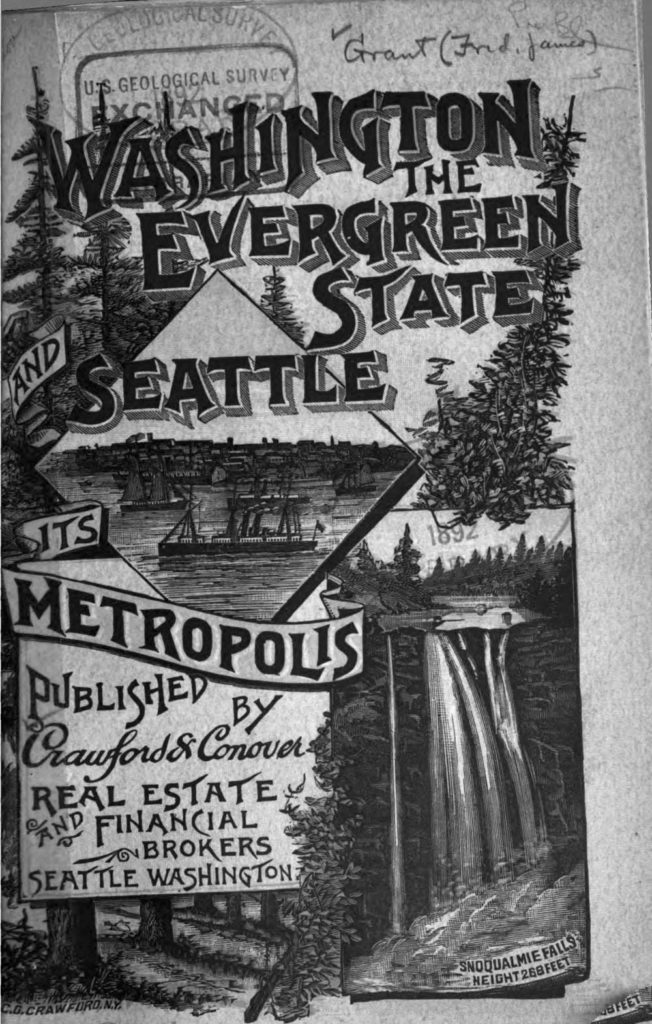
Cover of brochure “Washington the Evergreen State and Seattle Its Metropolis”
This street, which runs ³⁄₁₀ of a mile from Fuhrman Avenue E to E Allison Street, was established as an alley in 1890 as part of the Denny–Fuhrman Addition to the City of Seattle, but only received a name in 1936. It was named for Portage Bay, the eastern arm of Lake Union, which it parallels. Portage Bay was in turn named for the portage from Union Bay (part of Lake Washington) to Lake Union over the Montlake Isthmus, which is today the Montlake Cut of the Lake Washington Ship Canal.
There are only a handful of islands within Seattle city limits, and of them just one — Harbor Island — is large enough to have streets on it. But Island Drive S isn’t on Harbor Island — rather, it’s along the shore of Lake Washington, 5½ miles to the southeast. What gives?
As it turns out, Island Drive once was on an island — Pritchard Island. Known as tleelh-chus (‘little island’) by the Duwamish tribe, it was bought in 1900 by Alfred J. Pritchard (grandfather of Joel Pritchard, who was a congressman from Washington state in the 1970s and 1980s and its lieutenant governor in the 1980s and 1990s). In 1916, Lake Washington was lowered by 9 feet as part of the construction of the Lake Washington Ship Canal, and Pritchard’s island became part of the mainland.
It’s still known as Pritchard Island, though. Today, Pritchard Island Beach, Rainier Beach Urban Farm and Wetlands, and Be’er Sheva Park separate the island from the mainland.
Occidental Avenue S, which begins at Yesler Way in Pioneer Square, is one of those Seattle streets whose names extend into the suburbs. It makes its southernmost appearance at S 197th Street in Des Moines.
It received its name in 1895 as part of the Great Renaming — it had originally been S Second Street. It once had a partner, Oriental Avenue, to the east (originally S Fourth Street), which is today 3rd Avenue S. “Oriental,” of course, means “Eastern,” as “Occidental” means “Western.” (I haven’t been able to determine just when Oriental Avenue became 3rd, but it was last mentioned in The Seattle Times on October 17, 1920.)
And why this particular pairing? The Occidental Hotel, which once overlooked the beginning of Occidental Avenue, is almost certainly the reason, but it’s not spelled out in the ordinance.
This Interbay street, established in 1910 as Lawton Way, runs ¼ mile northwest from 15th Avenue W to the BNSF Railway’s Balmer Yard. Its right-of-way runs about 800 feet beyond that, across the railroad tracks, to 20th Avenue W, as it was once the location of a bridge to Magnolia.
This Industrial District street — a mere 80 feet long — runs from Airport Way S east to the Interstate 5 right-of-way. It may very well be the shortest street in Seattle (I’d love to hear about other candidates).
As explained in SW Seattle Street, the plat of Judkin’s Addition to the Town of Seattle was filed in 1869. From north to south, the east–west streets are named Norman, B, Judkins, Addition, Town, and Seattle. (Did they really think B Street would last, I wonder?)
Of these, Norman, Judkins, Addition, and Seattle Streets remain, though Addition is the only one still in its original location. (SW Seattle Street now only exists for a few blocks in West Seattle, and S Norman and S Judkins Streets only east of Interstate 5.)
This Queen Anne street runs 1½ miles from the meeting of 4th, Dexter, and Westlake Avenues N in the east (at the south end of the Fremont Bridge) to the 15th Avenue W interchange in the west. Some businesses in Fishermen’s Terminal have W Nickerson Street addresses, such as Chinook’s at 1900, but these few blocks of Nickerson are Port of Seattle roads that cannot be accessed directly from the public street.
Nickerson Street was named by Alfred A. Nickerson and Elmyra Nickerson, husband and wife, in their plat of Ross 2nd Addition to the City of Seattle in 1888.