W.T. Campbell was a long-time West Seattle resident living on the hillside above Alki. He was an early advocate for Alki annexation to the City of West Seattle, a real estate developer, early West Seattle school principal, banker, and a member of the Seattle City Council beginning 1924. He would serve as a city councilmember until 1929.
W.T. Campbell, from the October 11, 1933, issue of The Seattle Times
SW Campbell Place begins at SW Lander Street a block west of SW Admiral Way and goes just over 550 feet southwest to 56th Avenue SW at the north edge of Schmitz Park.
I first came across the Alki History Project while doing research for my article on SW Bronson Way. I’m not sure how I missed it before. The paper that mentioned Ira Bronson was “If at First You Don’t Succeed…,” a fascinating history of municipal governance and elections in West Seattle, and when I looked at their list of other papers I was thrilled to see among them “What’s in a Name?” — an investigation of Alki street names, both current and those changed long ago. Frater Avenue SW is the first of a number of posts in which I will be citing this paper, written by Phillip H. Hoffman, director of the project.
Frater Avenue SW originates in the 1955 plat of Anderson’s Soundview Terrace Addition № 2. Why Anderson, Caple, or Knowlton weren’t chosen instead for the honor (this being the only new street in the small subdivision, and those being the surnames of the three couples who filed the plat) isn’t clear. But, as Hoffman notes, SW Frater Street and SW Frater Place (both of which have since been vacated) were just to the west in the adjacent plat. In addition, an earlier Frater Avenue SW had existed, until it was vacated in 1942, just southeast of where today’s Frater Avenue begins at SW Spokane Street. The current Frater Avenue must have been named after one of these three streets.
But, of course, that leaves the question of who those three streets initially honored, and according to Hoffman,
Frater Avenue first appears in the plat Partition of Crawford Tract as ordered in King County Superior Court, Cause № 64110, June 17, 1915. [A.W.] Frater was the presiding judge.… The court commissioners assisting in the adjudication of a land title and ownership dispute before Judge Frater that resulted in the Crawford Tract plat probably named Frater Avenue in 1915, along with all the other streets appearing in the plat.
Archibald Wanless Frater (1856–1925), according to Cornelius Holgate in Seattle and Environs, was born in Ohio and came to Washington in 1888. Initially settling in Tacoma, he moved to Snohomish the next year and came to Seattle in 1898.
Judge Archibald Wanless Frater, from the front cover of The Seattle Mail & Herald, June 3, 1905
Today’s Frater Avenue SW begins at 57th Avenue SW just north of SW Hinds Street and goes ⅛ of a mile southeast to SW Spokane Street just west of 56th Avenue SW.
This West Seattle street was created in 1900 as part of the Replat of the West Seattle Land & Improvement Co’s. Third Plat. Originally Beach Way, it was renamed Bronson Way in 1907, when Seattle annexed West Seattle. Given that Ira Hull Bronson (1868–1930) was attorney for and vice president of the WSL&IC, it seems a fair assumption that it was named for him.
Ira Bronson, from his June 17, 1930, obituary in The Seattle Times. He had died the day before.
Bronson, a former president of the American Bar Association, was described in the June 18, 1930, issue of The Seattle Times as a “pioneer Seattle attorney and leader in admiralty circles… [who] was one of the founders of the Inland Navigation Company, which later became the Puget Sound Navigation Company.” (The PSNC’s domestic ferry routes were bought by the state in 1951, forming Washington State Ferries, and most of its Canadian routes became part of the new BC Ferries system in 1961. The firm, now known as the Black Ball Ferry Line, now runs one boat, the MV Coho, between Port Angeles and Victoria. Through a series of mergers, Bronson’s law firm is now Stoel Rives.)
Though the right-of-way begins further inland, SW Bronson Way only physically exists between Harbor Avenue SW and Elliott Bay. About 180 feet long, it is nearly 90 feet wide (quite a length-to-width ratio!) and essentially serves as a public parking lot. It is a shoreline street end, platted into the water, and features an unobstructed view of the city across the bay.
Originally Ravenna Avenue in the 1890 plat of the Woodlawn Addition to Green Lake, Weedin Place NE was named for the Weedin brothers, early settlers of the area. (Weedin’s Homestead Addition to the City of Seattle, filed by Robert Weedin, his son, and their wives in 1904, lies to the south; it would seem that when Ravenna Boulevard NE was established slightly to the west, Ravenna Avenue needed a new name, and that of the Weedins was chosen.)
In the fall of 1879, 10 years after the first homesteader arrived at Green Lake, a newly erected, simple log cabin schoolhouse opened its doors to 11 pupils.… This was the first Green Lake School.… The children came from four households on the east side of the lake: seven were sons and daughters of the brothers W. L. and Robert Weedin.… Thus began public school education in the territorial School District № 25.
And Valarie Bunn tells us on her blog, Wedgwood in Seattle History, that Robert Joseph Weedin (1842–1910) and William Luther Weedin (1845–1930) were Civil War veterans from Missouri who “did not have to take a full five years to ‘prove up a claim’ and be awarded ownership of land, according to the Homestead Act of 1862,” but could count their time in the service toward that total. Robert’s claim, as noted above, was southeast of Green Lake, while William’s was further east, in Wedgwood and Bryant.
A photograph of brothers W.L. and Robert Weedin that ran in the Seattle Post-Intelligencer, May 23, 1965, in an article about early schools in Green Lake
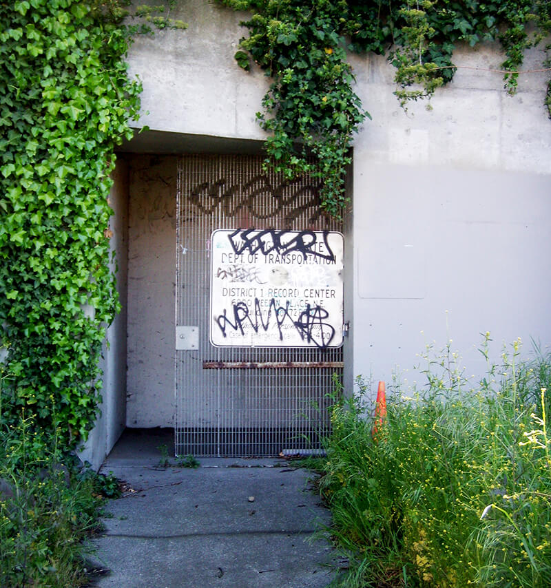
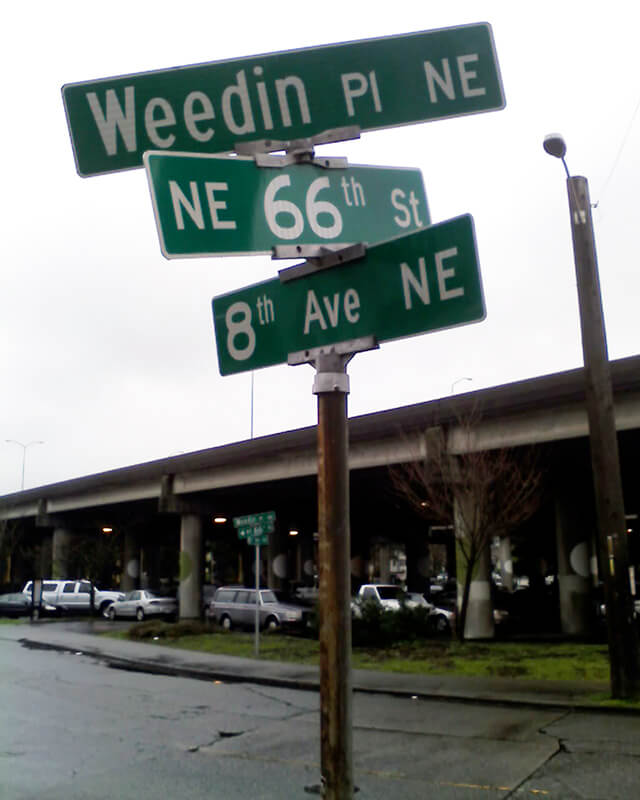
Today, Weedin Place NE begins at 5th Avenue NE and NE 70th Street and goes ¼ of a mile southeast to just past 8th Avenue NE and NE 66th Street, where the right-of-way becomes a park. It is notable for being the location of the Weedin Place fallout shelter, located under Interstate 5. Read more about it in “‘Lifeboat Ethics’ Under the Interstate: Seattle’s Prototype Highway Fallout Shelter,” by Washington State Department of Transportation historian Craig Holstine, who writes that
…The Weedin Place facility was apparently the first, and only, fallout shelter ever constructed in the U.S. under a public roadway. It was built under what would become Interstate 5 at the height of the Cold War in part as a way to demonstrate more effective uses of public rights-of-way.… The Commissioner of Public Roads… proposed putting shelters under the interstates as a way to save costs by combining needs of the national shelter and federal-aid highway programs and provide shelter for the traveling public.
This is the first honorary renaming we‘re covering on Writes of Way. It was named for the former “Mayor of Ballard,” Rob Mattson (1949–2018), the year after his death.
Honorary renamings differ from straight renamings in that:
They are done via resolution rather than ordinance
They do not replace the original street name in official records and addresses
They appear on brown, rather than green, signs
Speaking of signs, there appears to be some variation in their design; compare that of Rob Mattson Way, below, to that of Gerard Schwarz Place.
Rob Mattson Way covers 22nd Avenue NW between NW 56th Street and NW 57th Street.
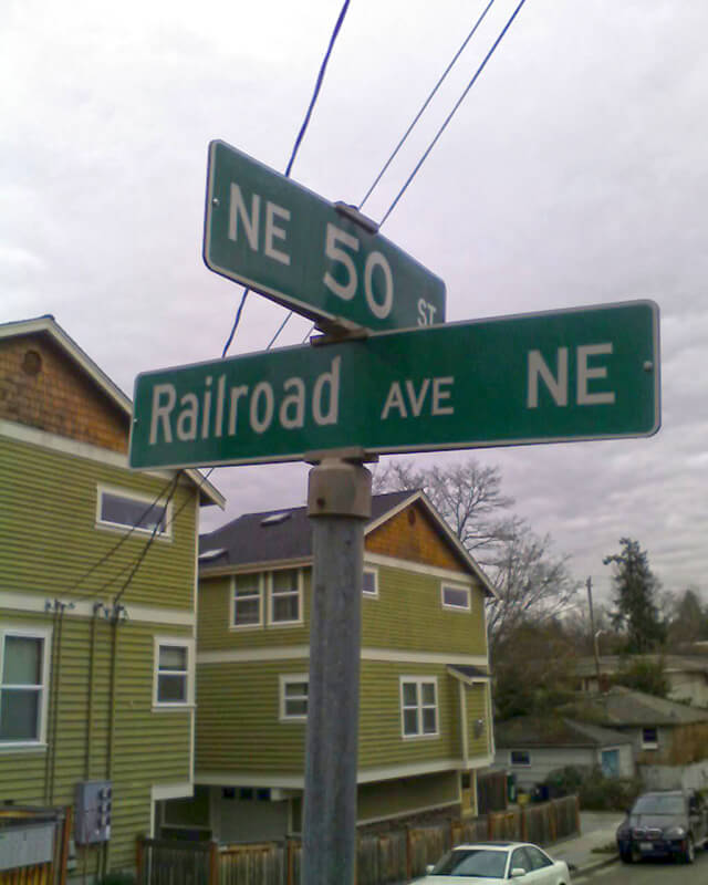
This street was created in 1946 by Ordinance 75507, “an ordinance accepting a deed from Eva M. Barquist, a spinster, to the City of Seattle for street purposes and laying off East 50th Street and Railroad Avenue Northeast.” This restored the Railroad Avenue NE name to a very short street on the east side of the Northern Pacific tracks, six years after it was changed to NE Blakely Street on the west side.
Railroad Avenue NE begins at NE 50th Street just east of 39th Avenue NE and goes 90 feet south to a dead end, essentially serving as a driveway for a cluster of townhouses.
Airport Way S does not, as one might expect, go from the city to Seattle–Tacoma International Airport (known to locals as Sea–Tac), but rather to King County International Airport (better known as Boeing Field). It got its current name in 1931 at the request of the Georgetown-South Seattle Improvement Club, which, according to an article in the April 12 issue of The Seattle Times,
…asked the City Council to merge portions of Seattle Boulevard, Eighth and Ninth Avenues South and Duwamish Avenue, leading from the central business area to Boeing Field, into a new highway, to be known as Airport Way.… [They contended] that strangers are confused in efforts to find the airport by lack of any specifically designated street leading to it.
The Beach or River Road… [which] skirted the shore of the bay at the foot of the high Beacon Hill bluff, east of what is now Airport Way, and ran south along the Duwamish.… Built in the early fifties, [it] was a hard road to keep in good condition.… In 1886, a road was built on piling over the mud flats a little west of the Beach Road to avoid the slides and floods. This street became known as the Grant Street Bridge.
Essentially, there were a series of roads following the semicircular curve of Elliott Bay from Downtown to the Duwamish River before the tideflats were filled in: first Beach Road (or River Road), then the Grant Street Bridge, which in turn became Seattle Boulevard once the fill was complete. Sometime before 1918… the portion of Seattle Boulevard that ran northeast–southwest (the southern third of the semicircle) was renamed Diagonal Avenue. (In 1931, the rest of Seattle Boulevard was renamed Airport Way.)
This photograph, taken circa 1900 by Anders Beer Wilse, looks northwest from Beacon Hill over the Grant Street Bridge and the Elliott Bay tideflats. At upper left is West Seattle; at upper right is Magnolia. From this perspective, Downtown Seattle appears just below Magnolia. Bainbridge Island is in the distance across Puget Sound.
Once Sea–Tac fully opened in 1949, Airport Way S no longer led to the region’s primary airport, which was more directly reached via U.S. 99, but no further name changes took place.
Today, Airport Way S begins at Seattle Boulevard S and 6th Avenue S and goes 6⅗ miles southeast, then south, then southeast again, ending at Boeing Access Road. Its lower 2½ miles parallel the eastern boundary of Boeing Field.
In 2010, the portion of Airport Way S between 4th Avenue S and 6th Avenue S was renamed Seattle Boulevard S at the request of the adjacent property owners, restoring a name that disappeared from the map in 1931.
There were a series of roads following the semicircular curve of Elliott Bay from Downtown to the Duwamish River before the tideflats were filled in: first Beach Road (or River Road), then the Grant Street Bridge, which in turn became Seattle Boulevard once the fill was complete. Sometime before 1918… the portion of Seattle Boulevard that ran northeast–southwest (the southern third of the semicircle) was renamed Diagonal Avenue. (In 1931, the rest of Seattle Boulevard was renamed Airport Way.)
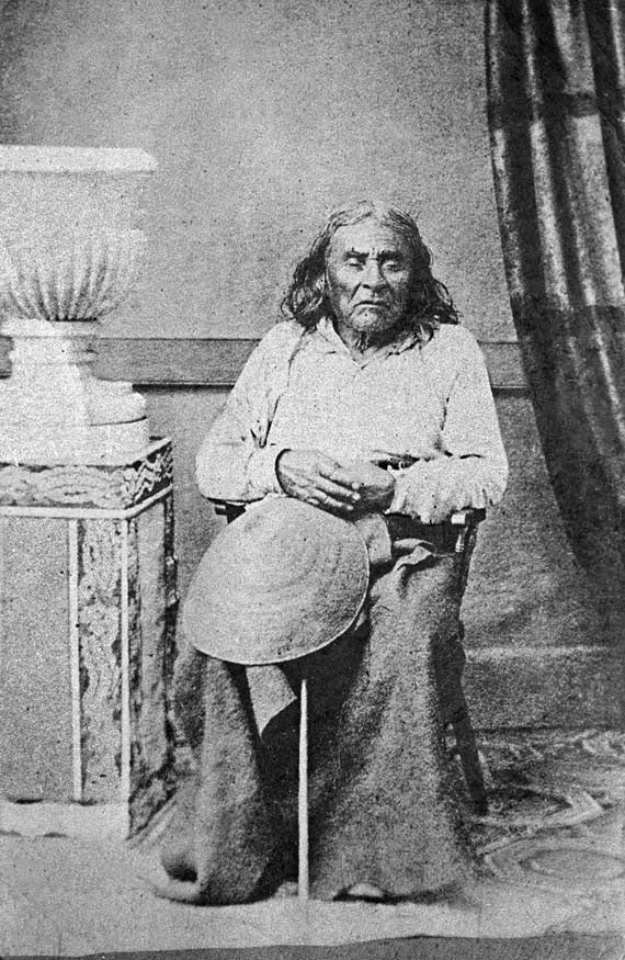
Seattle Boulevard was obviously named for the city, which itself was named after Si’ahl [siʔaɫ], better known in English as Chief Seattle of the Duwamish and Suquamish Tribes.
Since 2010, then, there have been two streets in the city that bear its and siʔaɫ’s name: Seattle Boulevard S and SW Seattle Street.
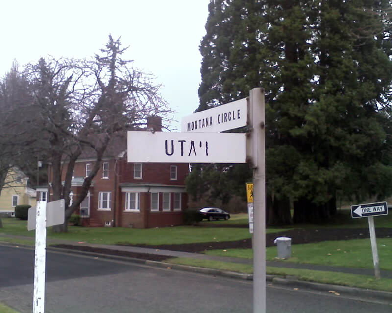
Like almost every other street in Fort Lawton (1900−2011), which became Discovery Park, Montana Circle was named after a state of the Union. Unlike almost every other street in Discovery Park, however, Montana Circle is a private road and in fact not part of the park at all. This is because the houses here, originally built for non-commissioned officers, were in use as military housing at the time the Army officially closed the fort. According to Monica Wooton of the Magnolia Historical Society, writing in the Queen Anne & Magnolia News, this meant that the property had to be sold at market rate instead of returned to the city as surplus, as most of the rest of the park had been. The city did manage to come up with $11 million to demolish some non-historic housing and restore the forest, but
Friends of Discovery Park could not get a partnership with government and other entities needed to purchase the Officer’s Row and NCO housing because of the cost mandated by the Privatization Act [while] the economic recession was taking hold.
The 13 homes in Montana Circle at Fort Lawton all have sold in about three months, and prices on the ones that have closed average $484 a square foot. Prices ranged from $799,000 to $1,050,000.
This provided a nice profit for the real estate firm that bought Officer‘s Row and Montana Circle from the military for $9.5 million.
Montana Circle begins at Discovery Park Boulevard just east of Kansas Avenue and loops around to rejoin Discovery Park Boulevard around 100 feet to the east.
Today, Bernie Whitebear Way begins at Texas Way and Illinois Avenue and goes ½ a mile northwest, then west, to Daybreak Star.
Bernie Whitebear speaking to Senator Henry M. Jackson during the Daybreak Star lease signing ceremony, November 14, 1971. Courtesy of the Seattle Municipal Archives, Identifier 193058
As I note in Illinois Avenue, most streets in Fort Lawton (1900−2011), which became Discovery Park, were named after states, and this one is no exception. According to this map, the southernmost part of what is now Texas Way was originally Indiana Avenue and Delaware Avenue — the three were consolidated some time before 1967, when this map was made by the Fort Lawton Office of the Post Engineer. (As with Illinois Avenue and every other street in Discovery Park except for 45th Avenue W, Texas Way has never carried a directional designation.)
Today, Texas Way begins as a pathway south of the Discovery Park playground and goes ¼ of a mile east, then north, to 36th Avenue W just south of its intersection with Discovery Park Boulevard and W Government Way. It resumes as a paved road just to the north at Discovery Park Boulevard and goes just over ⅔ of a mile north, then northwest, to Illinois Avenue at the entrance to the park’s North Parking Lot. Here, it once again becomes a pathway and continues another ¾ of a mile northwest, then south, to rejoin Discovery Park Boulevard just west of the Utah Wetlands.
This street, like most others in Fort Lawton (1900−2011), which is now Discovery Park, was named by the United States Army after a state of the Union. I am not sure when the post’s streets were so named or who made the decision, but it can have been no later than 1944, when this map was made by the Army Corps of Engineers. (Here’s a much higher-resolution version from the Seattle Municipal Archives, created in 1973 but based on the older map.) One can see there that what are today Illinois Avenue and Bernie Whitebear Way were originally Vermont Way, Illinois Street, Lawton Road, and Florida Avenue. At some point before 1967 (see this map made by the Fort Lawton Office of the Post Engineer) the four were combined, and in 2011 the middle portion was renamed after Native American activist Bernie Whitebear.
Today, the eastern section of Illinois Avenue begins at Discovery Park Boulevard and goes ¼ of a mile north to Texas Way, where it turns into Bernie Whitebear Way. (Except for 45th Avenue W, no street in Discovery Park carries directional designations, nor did they when it was still a fort.) The western section, which is closed to traffic, begins at Texas Way and Discovery Park Boulevard and goes ¼ mile north to connect with footpaths that themselves connect to the North Beach Trail.
This street first appeared in 1890 as part of Yesler’s Third Addition to the City of Seattle, and ran two blocks from what is now E Alder Street to the north end of what is now Leschi Park. It was so named for running along the Lake Washington shoreline.
Today, Lakeside Avenue begins a block further south, where Lake Washington Boulevard leaves the shoreline and begins winding its way through Leschi and Frink Parks. It becomes Lakeside Avenue S at the north end of Leschi Park, and ends where Lake Washington Boulevard S rejoins the shoreline at Colman Beach, for a total distance of 1¼ miles.
Roberts gave the names Inverness Drive and Paisley Drive to the development’s two major connecting roadways. These two names referred to places near Glasgow, Scotland, and were meant to convey the idea of castle-like estate properties on a high vantage point.
Roberts gave the names Inverness Drive and Paisley Drive to the development’s two major connecting roadways. These two names referred to places near Glasgow, Scotland, and were meant to convey the idea of castle-like estate properties on a high vantage point.
Inverness Drive NE begins at Sand Point Way NE and goes ⅖ of a mile southwest to just south of NE 85th Street, at the north end of the Sand Point Country Club.
Aerial of Mount Baker Park, March 18, 1971. Lake Park Drive S is just east (toward the bottom of the photograph) of the green swath at center. Courtesy of the Seattle Municipal Archives, Identifier 78115
Lake Park Drive S begins at the intersection of S McClellan Street, S Mount Baker Boulevard, Mount Baker Drive S, and Mount Rainier Drive S, and goes ⅓ of a mile north to Lake Washington Boulevard S.
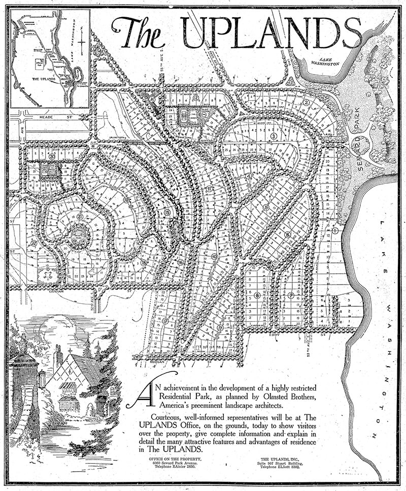
This street, created in 1926 as part of the plat of The Uplands (S Upland Road), was so named because it runs along the Lake Washington shoreline just south of Seward Park.
Full-page ad for The Uplands in The Seattle Times, September 27, 1925. Lake Shore Drive is at the lower right-hand corner of the plat.
Lake Shore Drive S begins at Seward Park Avenue S and S Hawthorn Road and goes ¼ mile south to S Eddy Street.
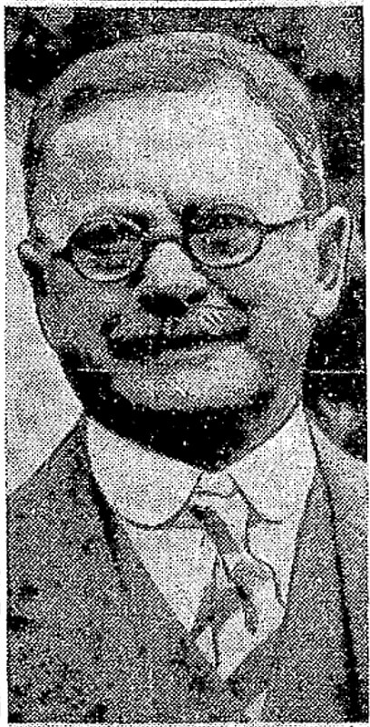
Born Giovanni Domenicio Corgiat in Italy, John was a real estate investor who, according to his Seattle Times obituary, was also notable for “establish[ing] the Louvre Restaurant, the first French-Italian eating place in Seattle, in 1888.” (It was destroyed the next year in the Great Seattle Fire.) He was also apparently involved in a number of legal cases relating to the explusion of restaurateur John Cicoria from the Joseph Mazzini Society in 1907: not only the lawsuit demanding Cicoria’s reinstatement in the Italian-American fraternal organization, but one in which the society succeeded in making him pay its legal fees, and three libel suits — one which Cicoria won against Corgiat, and two which Corgiat filed against The Seattle Times and the Message-Vero-Italo-Americano with Cicoria as co-defendant in each. The suit against the Times was dismissed at Corgiat’s request; I haven’t been able to find any more information about the other.
John Corgiat, from his obituary in the Seattle Times, December 10, 1936
Originally Corgiat Street, S Corgiat Drive begins at the railroad tracks just east of Airport Way S and goes 300 feet northeast to just past Ursula Place S, at which point it turns northwest and becomes S Corgiat Drive (not in the original plat). From there, it goes ⅖ of a mile to S Albro Place, just west of Interstate 5.
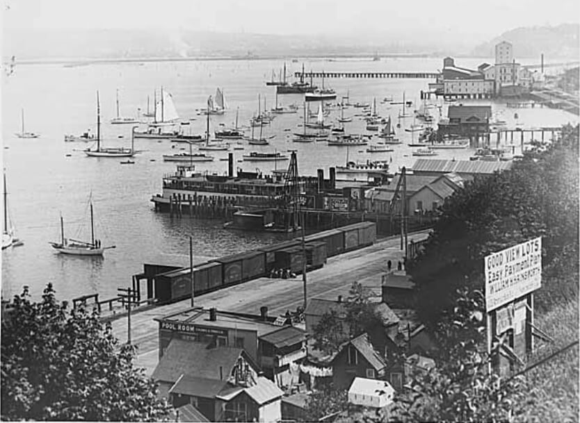
This street, created in 1888 as part of the First Plat of West Seattle by the West Seattle Land and Improvement Company, was originally named Grand Avenue. It was renamed, along with many other West Seattle streets, in 1907, when West Seattle was annexed by Seattle. The name was a reference to the WSL&IC ferry terminal at what is today Harbor Avenue SW at California Way SW. The West Seattle Water Taxi has been operating from the same location since 1997.
Today, Ferry Avenue SW begins at California Way SW and goes about ³⁄₇ of a mile southwest to just past California Avenue SW, at California Place park (built on the site of a former streetcar terminal; before that, a cable car ran up the Ferry Avenue right-of-way from Elliott Bay to this location). It resumes on the other side of the park at SW Hill Street and goes a further 600 feet southwest to SW Walker Street.
This street, established in 1913 as Sturtevant Place, was named for real estate investor, banker, and antique store owner Cullen Kittredge Sturtevant (1865–1946), who developed a number of tracts in what is now Rainier Beach. Unlike many developers, he didn’t name this street after himself; it was added by the city nearly a decade after he filed Sturtevant’s Plat of Rainier Beach Acre Tracts.
Today, Sturtevant Avenue S begins at Rainier Avenue S between 51st Avenue S and 52nd Avenue S and goes ⅕ of a mile southeast to 52nd Avenue S and S Roxbury Street. Sturtevant Ravine, through which Mapes Creek runs on its way from Kubota Garden to Beer Sheva Park and Lake Washington, lies to its west.
Ad for Sturtevant’s Rainier Beach Lake Front Tracts, The Seattle Times, April 8, 1906


.jpg)