Rainier Avenue S

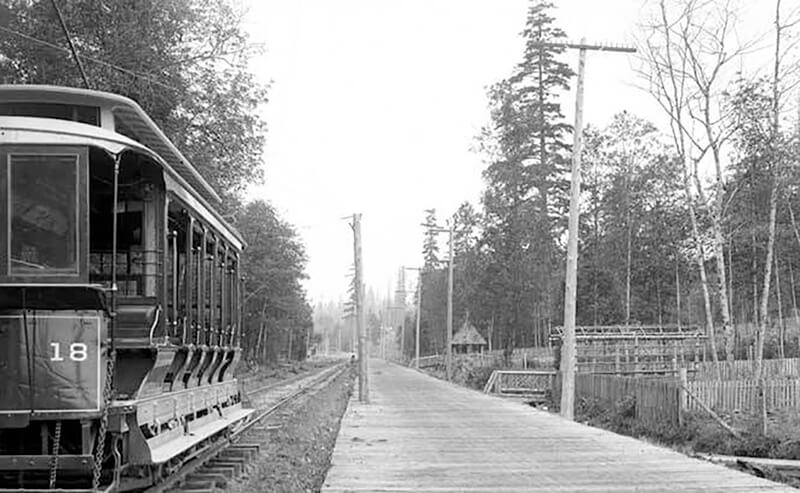
This street follows the route of the Rainier Avenue Electric Railway Company’s Seattle-to-Renton line, which began to be built in 1891. Both the rail line and street were named for Mount Rainier (təqʷubəʔ), itself named by Captain George Vancouver for his friend, Royal Navy Rear Admiral Peter Rainier (1741–1808). As the Seattle Post-Intelligencer noted on September 3, 1890, “the avenue points straight toward Mount Rainier, which mountain will be in plain view all the way.”

Rainier Avenue S begins at the intersection of S Jackson Street, Boren Avenue S, and 14th Avenue S, and goes nearly 8 miles southeast to the city limits. From there, it continues around 3¾ miles south to the intersection of Interstate 405 and State Route 167 in Renton.
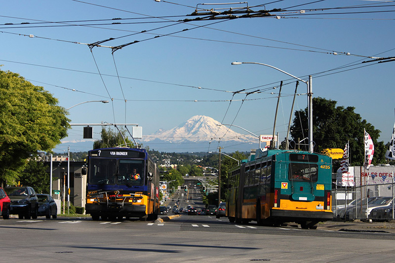
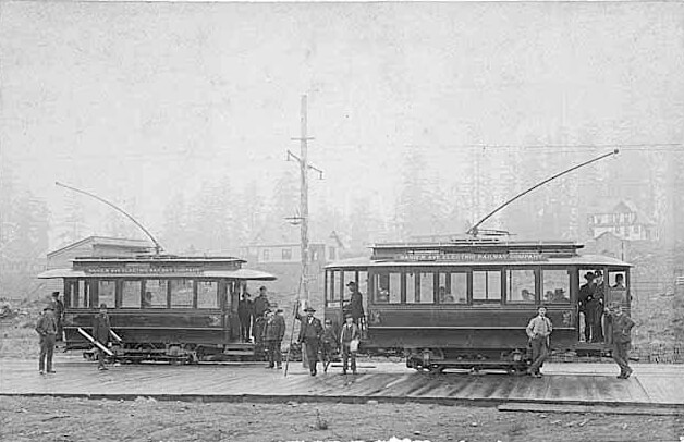
Looking south on Rainier Avenue S from S Jackson Street, with Mount Rainier in background, and two Metro route 7 buses, July 2011. From https://flickr.com/photos/95482862@N00/5914713222
Looking south on Rainier Avenue S from S Jackson Street. “The mountain is out” on this July 2011 day. Metro route 7 trolleybuses follow the route of the old interurban from here to 57th Avenue S. Photograph by Flickr user Oran Viriyincy, licensed under Creative Commons Attribution-ShareAlike 2.0 Generic
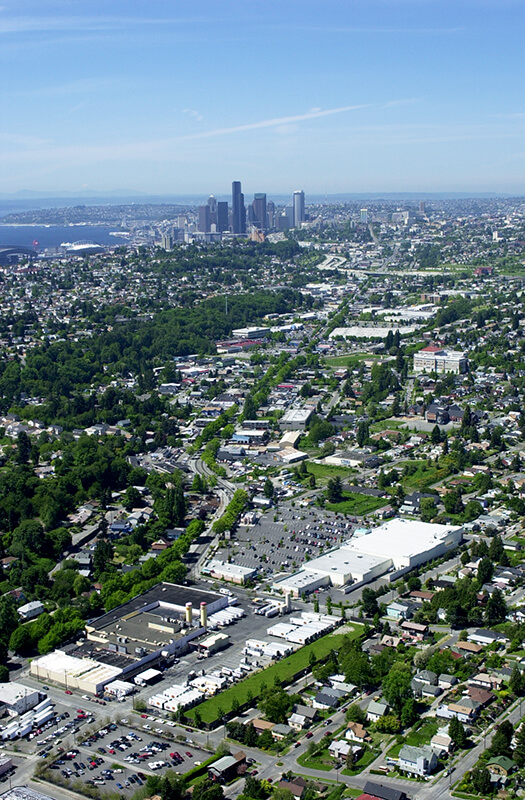
Aerial view of Rainier Valley looking north, 2001
Aerial view of Rainier Valley, Beacon Hill, and Downtown, May 22, 2001. Rainier Avenue S is the tree-lined street running up the middle of the photograph. Courtesy of the Seattle Municipal Archives, Identifier 114373.

Renton Avenue S

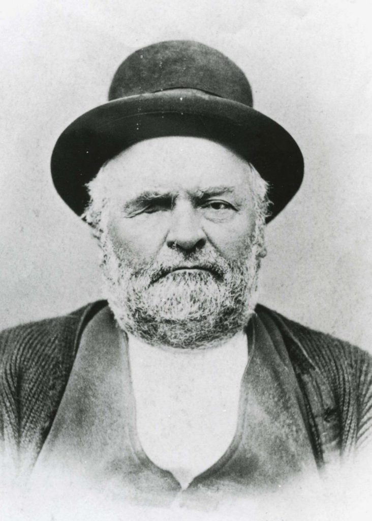
This street is named after the city of Renton, Washington, located southeast of Seattle at the southern end of Lake Washington. The city was itself named after Captain William Renton (1818–1891). Born in Nova Scotia, he came to the Puget Sound area in the mid-1850s and founded the Port Blakely mill on Bainbridge Island in 1864. Erasmus Smithers founded the Renton Coal Company with Captain Renton’s financial backing in 1873 and filed the first town plat in 1875.

William Renton, 1818-1891
William Renton, 1818 – 1891

A Renton Avenue existed in Seattle before this one, but not for very long — it was established in 1894 from streets on Capitol Hill “now called in various portions thereof Black Street, Joy Street, Renton Avenue and Eighteenth Avenue.” (Part of this area had been platted by Captain Renton, and was known at the time as Renton Hill.) It was changed the next year to 16th Avenue as part of the Great Renaming.

The current Renton Avenue was established in 1907 from what had been an old county road, Simpson Avenue, Hillman Boulevard, and a number of unnamed streets. According to the North Rainier Valley Historic Context Statement, this is quite an old route:

King County Road No. 1 ran east down from Beacon Hill at about the location of today’s Cheasty Boulevard, and then followed the approximate line of today’s Renton Avenue South to Renton. It also had been an earlier Indian trail route. Renton Avenue South is the remnant of this original county road to Renton. While portions of this road still exist, some are now incorporated into Martin Luther King, Jr. Way.

Today, Renton Avenue S begins at Martin Luther King Jr. Way S just south of S Walden Street and goes ¾ of a mile southeast to 33rd Avenue S just north of S Alaska Street. It resumes at 35th Avenue S just south of S Hudson Street and goes another ½ mile to S Juneau Street west of 39th Avenue S. It then starts up again at Martin Luther King Jr. Way S and S Webster Street and goes nearly 3 miles to the city limits south of S 116th Place. (Renton Avenue continues beyond there another 2 miles to — of course — Renton, where at 90th Avenue S and Taylor Avenue NW it becomes the Renton Avenue Extension and goes a further ⅛ of a mile to Rainier Avenue S and Airport Way.)

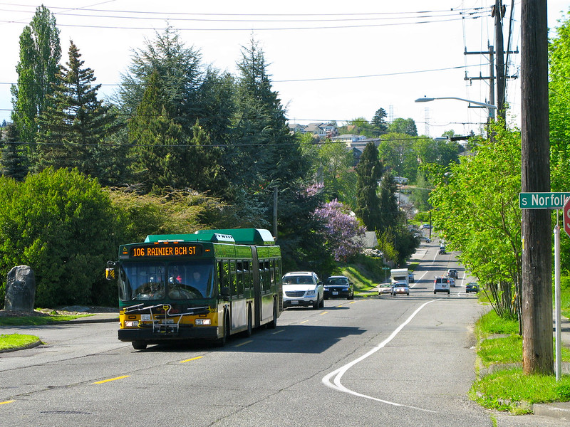
Metro bus at S Norfolk Street and Renton Avenue S, May 2010
Metro bus at Kubota Garden, S Norfolk Street and Renton Avenue S, May 2010. Photograph by Flickr user Oran Viriyincy, licensed under Creative Commons Attribution-ShareAlike 2.0 Generic

S Henderson Street

This street is named for Catherine Henderson (1822–1891), wife of Joseph Dunlap (1818–1893), who gives his name to Dunlap Elementary School and the Dunlap section of Rainier Valley. HistoryLink writes of the couple, who came to Seattle from Fontanelle, Iowa:

Joseph and Catherine (Henderson) Dunlap arrived in the Puget Sound region in September 1869, having traveled by covered wagon from Iowa. According to family legend, when they arrived in the Puget Sound region, they followed a road over Beacon Hill and sent their son George up a tree to view the land to the south and east. There he spotted a flat valley and Lake Washington. The Dunlaps decided to homestead in that valley, located to the south of the Van Asselt and Mapel families. They claimed 120 acres extending east toward Rainier Beach.

It appears to have been Lake Street in the original Dunlap’s Plat of Land on Lake Washington (1889) but was likely changed when Rainier Beach was annexed to Seattle in 1907.

Today, S Henderson Street begins at Seward Park Avenue S, just west of Be’er Sheva Park, and runs ¾ of a mile west to Carkeek Drive S. On the other side of Interstate 5 and the Duwamish River, it runs ⁹⁄₁₀ of a mile through South Park from just east of 14th Avenue S to just west of 2nd Avenue S, the portion over Highway 99/W Marginal Way S being a footbridge. Once in West Seattle, SW Henderson Street runs ⅔ of a mile from 8th Avenue SW, just west of Westcrest Park, to 21st Avenue SW, where the arterial turns into SW Barton Place, and is then a two-block residential street from 22nd Avenue SW to 25th Avenue SW, where it is blocked by the Westwood Village shopping mall. On the other side of the mall, it’s ⅘ of a mile from 28th Avenue SW to SW Barton Street at Fauntleroy Park, and then a final couple of blocks from 43rd Place SW to Fauntleroy Way SW, just north of Washington State Ferries’ Fauntleroy Terminal.


S Fairbanks Street

This street runs not quite 300 feet from Martin Luther King Jr. Way S in the east to 42nd Avenue S in the west, just south of S Henderson Street. Like nearby Valdez Avenue S and Yukon Avenue S, it was established in 1905 as part of Dunlap’s Supplemental to the City of Seattle, and, in keeping with the Alaska theme, was named after the city of Fairbanks, which had been founded just four years earlier. (Fairbanks itself was named after Indiana Senator Charles Warren Fairbanks [1897–1905], who was vice president under Theodore Roosevelt from 1905 to 1909.) 

Yukon Avenue S

This very short street (375 feet long) in the Dunlap neighborhood runs from Spear Place S in the south to S Henderson Street in the north. Like Valdez Avenue S, which it intersects, it was established in 1905 as part of Dunlap’s Supplemental to the City of Seattle, and was named after the Yukon River, likely due to the recent Klondike Gold Rush (ended 1899).

Yukon Avenue S, incidentally, holds the distinction of being the at the very end of the list of Seattle streets taken in alphabetical order — hence the tagline for Streets of Seattle, a blog from 2012 that sadly never seems to have gotten off the ground: “Seattle street names, from Adams to Yukon.”

Valdez Avenue S

This short street (just ⅛ of a mile long) connects Martin Luther King Jr. Way S to Yukon Avenue S in Seattle’s Dunlap neighborhood. Established in 1905 as part of Dunlap’s Supplemental to the City of Seattle, it was named after Valdez, Alaska, which was itself named after Spanish naval officer Antonio Valdés y Fernández Bazán. (Other streets in the plat include the above-mentioned Yukon Avenue as well as Tanana Drive, Fairbanks Drive, and Rampart Drive. Tanana Drive is now part of S Henderson Street; Fairbanks Drive is now S Fairbanks Street; and Rampart Drive is now part of S Director Street.)

I haven’t been able to find a specific connection the Hulbert or Dunlap families might have with Alaska, but 1905 was just six years after the Klondike Gold Rush ended, and just four years before the Alaska–Yukon–Pacific Exposition. Seattle’s population went from 42,837 in 1890 to 80,671 in 1900 — an increase of 88% — and much of this was due to its central role in the gold rush as “the premier supply centre and the departure point for the gold fields.”

Island Drive S

There are only a handful of islands within Seattle city limits, and of them just one — Harbor Island — is large enough to have streets on it. But Island Drive S isn’t on Harbor Island — rather, it’s along the shore of Lake Washington, 5½ miles to the southeast. What gives?

As it turns out, Island Drive once was on an island — Pritchard Island. Known as tleelh-chus (‘little island’) by the Duwamish tribe, it was bought in 1900 by Alfred J. Pritchard (grandfather of Joel Pritchard, who was a congressman from Washington state in the 1970s and 1980s and its lieutenant governor in the 1980s and 1990s). In 1916, Lake Washington was lowered by 9 feet as part of the construction of the Lake Washington Ship Canal, and Pritchard’s island became part of the mainland.

It’s still known as Pritchard Island, though. Today, Pritchard Island Beach, Rainier Beach Urban Farm and Wetlands, and Be’er Sheva Park separate the island from the mainland.