S Fidalgo Street

This street was created in 1889 as part of the Commercial Street Steam Motor Addition to the City of Seattle. It appears to have been named for Fidalgo Island in Skagit County, which is about 60 miles to the northwest, as S Orcas Street appears to honor Orcas Island and Padilla Place S, Padilla Bay. The island itself was named after Salvador Fidalgo y Lopegarcía, who explored the area for the Spanish in the early 1790s.

S Fidalgo Street begins at a shoreline street end on the Duwamish Waterway just west of Ohio Avenue S and goes 700 feet east to E Marginal Way S. It picks up again at 1st Avenue S and goes half a mile east, then southeast, to a dead end just east of Padilla Place S.

S Orcas Street

This street was created in 1889 as part of the Commercial Street Steam Motor Addition to the City of Seattle. It appears to have been named for Orcas Island, largest of the San Juan Islands, which is about 75 miles to the northwest, as S Fidalgo Street appears to honor Fidalgo Island and Padilla Place S, Padilla Bay. The island’s name, per Wikipedia, derives from that of “Juan Vicente de Güemes Padilla Horcasitas y Aguayo, 2nd Count of Revillagigedo, the Viceroy of New Spain who sent an exploration expedition under Francisco de Eliza to the Pacific Northwest in 1791.” Eliza named the surrounding area Horcasitas, but in 1847 the British, who maintained their claim on the San Juans until 1871, assigned a shortened version — Orcas — specifically to the island. (It is a coincidence that Orcas Island is an excellent location for watching orca whales; the two names are completely unrelated.)

S Orcas Street begins at E Marginal Way S and goes ¾ of a mile east, then southeast, to Corson Avenue S, where it becomes S Doris Street. It picks up again east of Interstate 5 at 15th Avenue S and goes three blocks east to 18th Avenue S. Its longest and final stretch begins just west of 20th Avenue S and goes 2¼ miles east to Lake Washington Boulevard S just west of Seward Park.

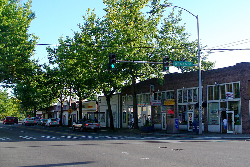
Intersection of S Orcas Street and Rainier Avenue S
Intersection of S Orcas Street and Rainier Avenue S, Columbia City, September 2008. Photograph by Flickr user Matthew Rutledge, licensed under Creative Commons Attribution-NonCommercial 2.0 Generic

S Roberto Maestas Festival Street

This street, formerly the 1600 block of S Lander Street, runs between 16th and 17th Avenues S on Beacon Hill, north of the Beacon Hill light rail station and south of the Plaza Roberto Maestas housing development of El Centro de la Raza, a social service agency. It was renamed in 2011 in honor of Roberto Maestas (1938–2010), who co-founded El Centro in 1972 in the recently closed Beacon Hill Elementary School.

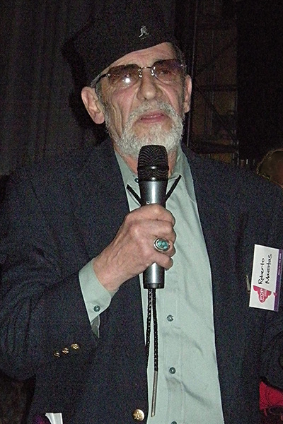
Roberto Maestas, 2008
Roberto Maestas, 2008. Photograph by Joe Mabel, Wikimedia Commons, licensed under Creative Commons Attribution-Share Alike 3.0 Unported

The street is one of a number of “festival streets” in the city of Seattle: “designated portions of streets intended for frequent public events.” E Barbara Bailey Way is the other one we’ve covered so far.

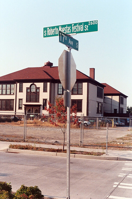
Sign at corner of S Roberto Maestas Festival Street and 17th Avenue S, October 1, 2011
Signs at corner of S Roberto Maestas Festival Street and 17th Avenue S, October 1, 2011. Photograph by Benjamin Lukoff. Copyright © 2011 Benjamin Lukoff. All rights reserved.

Valdez Avenue S

This short street (just ⅛ of a mile long) connects Martin Luther King Jr. Way S to Yukon Avenue S in Seattle’s Dunlap neighborhood. Established in 1905 as part of Dunlap’s Supplemental to the City of Seattle, it was named after Valdez, Alaska, which was itself named after Spanish naval officer Antonio Valdés y Fernández Bazán. (Other streets in the plat include the above-mentioned Yukon Avenue as well as Tanana Drive, Fairbanks Drive, and Rampart Drive. Tanana Drive is now part of S Henderson Street; Fairbanks Drive is now S Fairbanks Street; and Rampart Drive is now part of S Director Street.)

I haven’t been able to find a specific connection the Hulbert or Dunlap families might have with Alaska, but 1905 was just six years after the Klondike Gold Rush ended, and just four years before the Alaska–Yukon–Pacific Exposition. Seattle’s population went from 42,837 in 1890 to 80,671 in 1900 — an increase of 88% — and much of this was due to its central role in the gold rush as “the premier supply centre and the departure point for the gold fields.”

Edgar Martinez Drive S

This street runs ¼ mile from 1st Avenue S in the west to 4th Avenue S in the east. West of 1st, it’s S Atlantic Street — its original name — and east of 4th, it’s the beginning of Interstate 90. It is part of State Route 519, a short highway that connects I-90 to Washington State Ferries’ Colman Dock.

Edgar Martínez was a member of the Seattle Mariners baseball team from 1987 to 2004. This stretch of S Atlantic Street was renamed in his honor the year he retired.

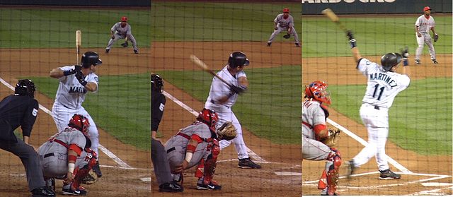
Edgar Martínez at bat, September 15, 2004, licensed under Creative Commons Attribution-Share Alike 3.0 Unported license. https://commons.wikimedia.org/wiki/File:E_Martinez.jpg
Edgar Martínez at bat, September 15, 2004. Photographs by Galaksiafervojo, Wikimedia Commons, licensed under  Creative Commons Attribution-Share Alike 3.0 Unported

Now — why is it Edgar Martinez Drive S instead of S Edgar Martinez Drive, since east–west streets in Seattle have their directional designators at the beginning? I asked Paul Jackson this in 2005. Jackson, who was then the Seattle Department of Transportation’s manager of traffic, signs, and markings, responded:

I appreciate your desire to see our City’s sign system remain consistent.… But ultimately, there is nothing requiring such a naming convention in the Seattle Municipal Code.… In this case, those proposing the street name change wanted to see Edgar Martínez’s name out front. Because this is only a three-block stretch of street (from 1st Avenue S to 4th Avenue S), and does not have any addresses along it, the decision was made to veer slightly from the typical naming convention. The term “drive” was agreed upon to evoke Mr. Martínez’s batting skills at the plate.