S Fidalgo Street

This street was created in 1889 as part of the Commercial Street Steam Motor Addition to the City of Seattle. It appears to have been named for Fidalgo Island in Skagit County, which is about 60 miles to the northwest, as S Orcas Street appears to honor Orcas Island and Padilla Place S, Padilla Bay. The island itself was named after Salvador Fidalgo y Lopegarcía, who explored the area for the Spanish in the early 1790s.

S Fidalgo Street begins at a shoreline street end on the Duwamish Waterway just west of Ohio Avenue S and goes 700 feet east to E Marginal Way S. It picks up again at 1st Avenue S and goes half a mile east, then southeast, to a dead end just east of Padilla Place S.

S Orcas Street

This street was created in 1889 as part of the Commercial Street Steam Motor Addition to the City of Seattle. It appears to have been named for Orcas Island, largest of the San Juan Islands, which is about 75 miles to the northwest, as S Fidalgo Street appears to honor Fidalgo Island and Padilla Place S, Padilla Bay. The island’s name, per Wikipedia, derives from that of “Juan Vicente de Güemes Padilla Horcasitas y Aguayo, 2nd Count of Revillagigedo, the Viceroy of New Spain who sent an exploration expedition under Francisco de Eliza to the Pacific Northwest in 1791.” Eliza named the surrounding area Horcasitas, but in 1847 the British, who maintained their claim on the San Juans until 1871, assigned a shortened version — Orcas — specifically to the island. (It is a coincidence that Orcas Island is an excellent location for watching orca whales; the two names are completely unrelated.)

S Orcas Street begins at E Marginal Way S and goes ¾ of a mile east, then southeast, to Corson Avenue S, where it becomes S Doris Street. It picks up again east of Interstate 5 at 15th Avenue S and goes three blocks east to 18th Avenue S. Its longest and final stretch begins just west of 20th Avenue S and goes 2¼ miles east to Lake Washington Boulevard S just west of Seward Park.

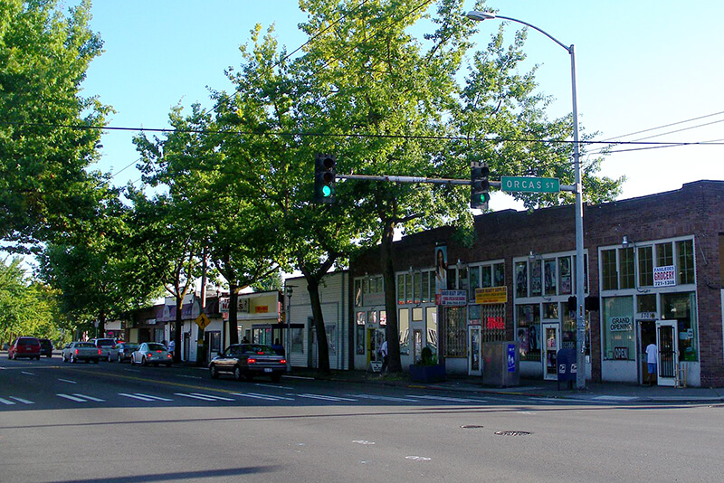
Intersection of S Orcas Street and Rainier Avenue S
Intersection of S Orcas Street and Rainier Avenue S, Columbia City, September 2008. Photograph by Flickr user Matthew Rutledge, licensed under Creative Commons Attribution-NonCommercial 2.0 Generic

Vashon View SW

This cul-de-sac, which goes just about 375 feet northwest from SW Donovan Street between 41st Avenue SW and 42nd Avenue SW, was created as part of the Robert E. Thomas Addition in 1959. Its original name was Fauntlee Place SW, but this was changed in 1963, presumably to avoid confusion with the nearby Fauntlee Crest SW. (No confusion was anticipated with the nearby Vashon Place SW, it seems.) Like Vashon Place, it is named after Vashon Island, located 4 miles to the southwest, across Puget Sound. The island itself was named for Royal Navy Admiral James Vashon by his friend, Royal Navy Captain George Vancouver, in 1792.

Unlike Vashon Place SW, Vashon View SW actually has a view of Vashon Island, though not the one you see below!

(While there are plenty of streets, avenues, and places, and not a few drives, roads, and boulevards in Seattle, this is the only view in the city. [You may be interested in seeing the United States Postal Service’s list of recognized street types and abbreviations, in which view is VW.])

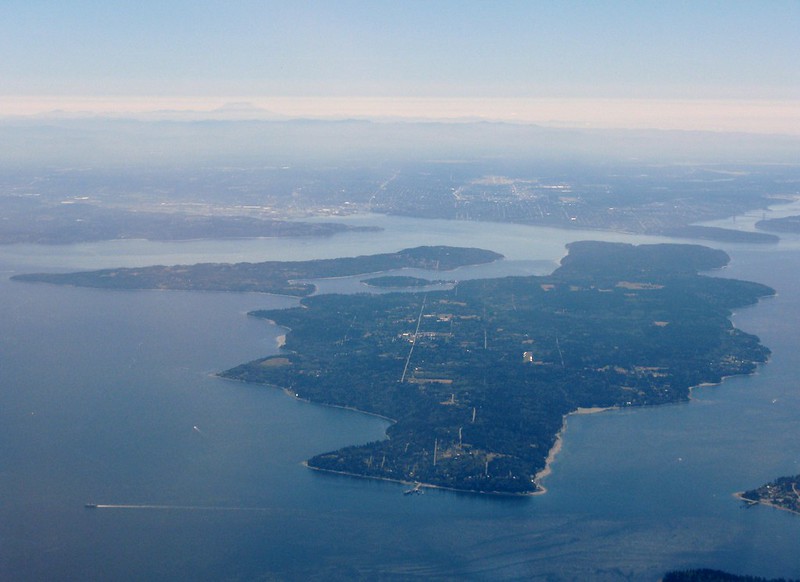
Aerial view of Vashon Island from the northwest
Aerial view of Vashon and Maury Islands from the northwest. Photograph by Flickr user Travis, licensed under Creative Commons Attribution-NonCommercial 2.0 Generic

Vashon Place SW

This street — just about 350 feet long, like its neighbor Blake Place SW — connects SW Othello Street to Fauntleroy Way SW just north of Solstice Park. Created as part of the Lincoln Home Addition in 1907 by builder Albert Eugene Felmley and his wife, Mabel L. Felmley, it is named after Vashon Island, located 4 miles to the southwest, across Puget Sound. The island itself was named for Royal Navy Admiral James Vashon by his friend, Royal Navy Captain George Vancouver, in 1792.

Two other streets in the Lincoln Home Addition are named for Puget Sound islands: the already-mentioned Blake Place SW, and Bainbridge Place SW.

Aerial view of Vashon Island from the northwest
Aerial view of Vashon and Maury Islands from the northwest. Photograph by Flickr user Travis, licensed under Creative Commons Attribution-NonCommercial 2.0 Generic

Blake Place SW

This 350-foot-long street connects SW Othello Street to SW Fontanelle Street just north of Solstice Park. It was created as part of the Lincoln Home Addition in 1907 by builder Albert Eugene Felmley and his wife, Mabel L. Felmley, and is named after Blake Island, located 4⅖ miles to the west, across Puget Sound. The island itself was named for U.S. Navy Commodore George Smith Blake, then head of the United States Coast Survey, by Charles Wilkes in 1841.

Two other streets in the Lincoln Home Addition are named for Puget Sound islands: Bainbridge Place SW and Vashon Place SW.

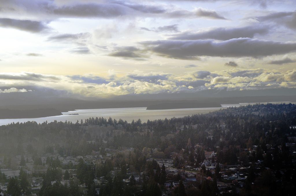
Aerial view of Blake Island from the east
Aerial view of Blake Island from the east (West Seattle in foreground). Photograph by Joe Mabel, Wikimedia Commons, licensed under Creative Commons Attribution-Share Alike 3.0 Unported

Bainbridge Place SW

This short street — not quite 275 feet long — connects SW Othello Street to Fauntleroy Way SW just north of Lincoln and Solstice Parks. Created as part of the Lincoln Home Addition in 1907 by builder Albert Eugene Felmley and his wife, Mabel L. Felmley, it is named after Bainbridge Island, located 5¼ miles to the northwest, across Puget Sound. The island itself was named for U.S. Navy Commodore William Bainbridge, commander of the USS Constitution, by Charles Wilkes in 1841.

Two other streets in the Lincoln Home Addition are named for Puget Sound islands: Blake Place SW and Vashon Place SW.


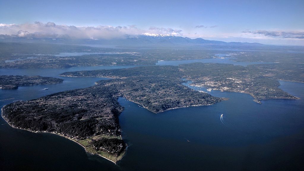
Aerial view of Bainbridge Island from the southeast
Aerial view of Bainbridge Island from the southeast. Photograph by Dicklyon, Wikimedia Commons, licensed under Creative Commons Attribution-Share Alike 4.0 International

E Foster Island Road

This street, which runs about ¼ mile from Lake Washington Boulevard E to the beginning of the Foster Point Trail, all within the Washington Park Arboretum, was without a name until 1968, when it was named for the island in Union Bay to which it led. (It remained unsigned until a few decades later, however. There was no sign at the intersection until at least the 1990s, as I know since my parents’ house was at the south end of the Arboretum and I drove or biked by there weekly, if not more often, while I was growing up.)

Foster Island is known by the Duwamish tribe, who once used it as a burial ground, as Stitici, or ‘little island’. It was named by the settlers for Joel Wellington Foster, who came to Washington in the 1870s from St. Joseph, Missouri. He is said to have donated the island to the city in one HistoryLink article, but another says the city bought it in 1917.

(Note added November 6, 2022: David B. Williams, the “Street Smart Naturalist,” recently posted The Lost Islands of Seattle, in which he wrote that he had seen various sources for the name Foster but none with good documentation. I asked him about the HistoryLink article I cite above:

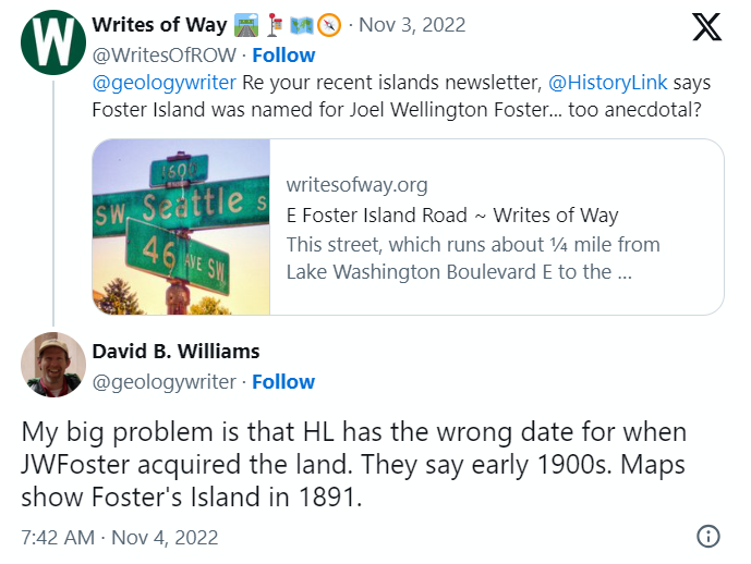
A screen shot of a tweet by me reading "@geologywriter Re your recent islands newsletter, @HistoryLink says Foster Island was named for Joel Wellington Foster... too anecdotal?" and David B. Williams's reply, "My big problem is that HL has the wrong date for when JWFoster acquired the land. They say early 1900s. Maps show Foster's Island in 1891."

I’m embarrassed to have missed that, but of course he’s right. So if not Joel Wellington Foster, then who? The search continues

[Note: On July 10, 2024, I began converting embedded tweets on this website to screenshots because of issues with how they were integrating with WordPress, which began not too long after Elon Musk purchased Twitter and changed its name to X.]

Island Drive S

There are only a handful of islands within Seattle city limits, and of them just one — Harbor Island — is large enough to have streets on it. But Island Drive S isn’t on Harbor Island — rather, it’s along the shore of Lake Washington, 5½ miles to the southeast. What gives?

As it turns out, Island Drive once was on an island — Pritchard Island. Known as tleelh-chus (‘little island’) by the Duwamish tribe, it was bought in 1900 by Alfred J. Pritchard (grandfather of Joel Pritchard, who was a congressman from Washington state in the 1970s and 1980s and its lieutenant governor in the 1980s and 1990s). In 1916, Lake Washington was lowered by 9 feet as part of the construction of the Lake Washington Ship Canal, and Pritchard’s island became part of the mainland.

It’s still known as Pritchard Island, though. Today, Pritchard Island Beach, Rainier Beach Urban Farm and Wetlands, and Be’er Sheva Park separate the island from the mainland.