E Foster Island Road

This street, which runs about ¼ mile from Lake Washington Boulevard E to the beginning of the Foster Point Trail, all within the Washington Park Arboretum, was without a name until 1968, when it was named for the island in Union Bay to which it led. (It remained unsigned until a few decades later, however. There was no sign at the intersection until at least the 1990s, as I know since my parents’ house was at the south end of the Arboretum and I drove or biked by there weekly, if not more often, while I was growing up.)

Foster Island is known by the Duwamish tribe, who once used it as a burial ground, as Stitici, or ‘little island’. It was named by the settlers for Joel Wellington Foster, who came to Washington in the 1870s from St. Joseph, Missouri. He is said to have donated the island to the city in one HistoryLink article, but another says the city bought it in 1917.

(Note added November 6, 2022: David B. Williams, the “Street Smart Naturalist,” recently posted The Lost Islands of Seattle, in which he wrote that he had seen various sources for the name Foster but none with good documentation. I asked him about the HistoryLink article I cite above:

A screen shot of a tweet by me reading "@geologywriter Re your recent islands newsletter, @HistoryLink says Foster Island was named for Joel Wellington Foster... too anecdotal?" and David B. Williams's reply, "My big problem is that HL has the wrong date for when JWFoster acquired the land. They say early 1900s. Maps show Foster's Island in 1891."

I’m embarrassed to have missed that, but of course he’s right. So if not Joel Wellington Foster, then who? The search continues

[Note: On July 10, 2024, I began converting embedded tweets on this website to screenshots because of issues with how they were integrating with WordPress, which began not too long after Elon Musk purchased Twitter and changed its name to X.]

Roosevelt Way NE

This street runs nearly 6 miles from the north end of the University Bridge in the south (at Eastlake Avenue NE and NE Campus Parkway) to Aurora Avenue N in the north, just shy of Seattle city limits at N 145th Street. It runs north–south for most of its length, but starting at NE 125th Street, its last 1½ miles cut a northwest–southeast diagonal across the street grid, making it Roosevelt Way N once it crosses 1st Avenue NE between N 133rd and N 135th Streets.

Originally 10th Avenue NE south of NE 125th Street, Roosevelt received its current name in 1933. According to local historian Feliks Banel, this was first proposed in 1927 by businesses in the Roosevelt district, itself having taken that name earlier in the decade in honor of President Theodore Roosevelt, who died in 1919. Nothing came of it for six years, but in 1933 they tried again and asked that 10th Avenue be renamed after both Theodore and Franklin Delano Roosevelt, who had been elected president the previous November. As Banel notes in his piece, The Seattle Times had this to say:

This change, we assume, must be pleasing to local Democrats of all sorts and shades. At the same time, due to the incidence of somewhat tenuous family ties, it cannot be at all displeasing to Republicans. The name of Roosevelt has high standing in both political parties, as indeed it has throughout the world. Even now it is quite certain that those who may traverse our Roosevelt Way in years to come will neither know nor particularly care whether it was named for Teddy or for Frank.

As for its diagonal stretch, it appears on old King County maps as M. Roy Sayles Road (County Road 2240), Golf Way, and State Highway 1J (predecessor of today’s SR 513). It ceased to be a state highway in 1991. As for when it, too, became Roosevelt Way, it’s difficult to tell as King County doesn’t have as good a system for looking up ordinances online as Seattle’s. It appears as Roosevelt Way on a 1966 map in local historian Rob Ketcherside’s maps album on Flickr, but as Golf Way in another one from 1947. As the area in question wasn’t annexed into Seattle until 1953, the name must have been changed by the county sometime between 1947 and 1953 in anticipation. (The 1933 Seattle ordinance is the only one on file relating to Roosevelt Way’s name, so this must have been a county change.)

As for M. Roy SaylesThe International Confectioner’s January 1915 issue reports that he, along with Annie B. Sayles, C.M. Sayles, and W.H. Rogers, founded the Rogers Candy Co. in Seattle in 1915; and Golf Way almost certainly comes from the road’s proximity to the public course at Jackson Park, which opened in 1928.

Sign at corner of NE Ravenna Boulevard and Roosevelt Way NE, July 4, 2009
Signs at corner of NE Ravenna Boulevard and Roosevelt Way NE, July 4, 2009. Photograph by Benjamin Lukoff. Copyright © 2009 Benjamin Lukoff. All rights reserved.

E Conover Court

This cul-de-sac, which runs about 300 feet from the end of 35th Avenue just south of E James Street, was named by journalist and real estate developer C.T. (Charles Tallmadge) Conover after himself. Unlike many developers, he didn’t do this when his plat (“Conover Park”) was first filed in 1907, but rather 15 years later when a new street was established in the subdivision. Perhaps his most lasting achievement was Washington’s nickname, “The Evergreen State,” which he coined in 1890.

CT Conover in 1893
C.T. Conover in 1893
Cover of Washington the Evergreen State and Seattle Its Metropolis brochure
Cover of brochure “Washington the Evergreen State and Seattle Its Metropolis”

Nickerson Street

This Queen Anne street runs 1½ miles from the meeting of 4th, Dexter, and Westlake Avenues N in the east (at the south end of the Fremont Bridge) to the 15th Avenue W interchange in the west. Some businesses in Fishermen’s Terminal have W Nickerson Street addresses, such as Chinook’s at 1900, but these few blocks of Nickerson are Port of Seattle roads that cannot be accessed directly from the public street.

Nickerson Street was named by Alfred A. Nickerson and Elmyra Nickerson, husband and wife, in their plat of Ross 2nd Addition to the City of Seattle in 1888.

Webster Point Road NE

This very short street in the Laurelhurst neighborhod — just over 200 feet long — was created in 1962 as part of the Webster Point plat. Why it’s a road rather than a place, lane, or court, I’m not sure — roads in Seattle (of which there aren’t many) are usually longer, such as Windermere Road NE, Holman Road NW, and Military Road S. It has the distinction of the lowest-numbered address on a north–south street north of the Lake Washington Ship Canal, as far as I am aware — 3000.

The plat and road are named for Webster Point, at the very southern tip of the Laurelhurst peninsula, which itself was named for Henry A. Webster, who once owned the land. This Webster appears to have been the Indian agent for the Makah tribe at Neah Bay on the Olympic Peninsula.

Dilling Way

This street, which runs a mere 200 feet from 4th Avenue to Yesler Way in front of City Hall Park, is named for George W. Dilling, who was mayor of Seattle from 1911 to 1912.

In 1911, Mayor Dilling took an empty lot that until two years earlier had been the location of the Katzenjammer Castle, Seattle’s second city hall, and converted it into what is now known as City Hall Park — originally named Dilling Park in his honor. In 1916, the municipal offices moved once again, to the newly constructed King County Courthouse, then known as the City–County Building, across the Jefferson Street right-of-way from the park. They remained there until 1962, but the park retains the “City Hall” name.

In a letter dated March 29, 1937 from A.C. Van Soelen, corporation counsel for the city, to the Board of Public Works, regarding the ability of the city to restrict parking on Dilling Way, he writes that “Dilling Way apparently never was established or named by ordinance or other action of the City Council and was opened up or paved in 1915 or 1916, presumably in lieu of Jefferson Street which was closed between Third and Fourth Avenue though never formally vacated,” and suggests that the city council “affirmatively declare its policy” regarding the street by passing an ordinance. Such an ordinance was passed shortly thereafter, making the name of Dilling Way official. (Interestingly, that ordinance refers to the street as a “private way,” but the county’s quarter section map shows it as a public road. That same map shows that the walkway in front of the courthouse is still, technically, Jefferson Street.)

Fauntleroy Way SW

This 4-mile-long thoroughfare runs from the west end of the West Seattle Bridge to Brace Point, passing Morgan Junction, Lincoln Park, and the Fauntleroy Ferry Terminal on the way. It was named for Fauntleroy Cove, location of that terminal, from which riders depart for Vashon Island and Southworth, on the Kitsap Peninsula.

Fauntleroy Cove was itself named after Robert Henry Fauntleroy by George Davidson, Fauntleroy’s future son-in-law. They were both members of the U.S. Coast Survey. He is one of three Fauntleroys whose names appear on Seattle street signs — Ellinor Drive W and Constance Drive W are named for Mounts Ellinor and Constance in the Olympic Mountains, themselves named by Davidson after his future wife and sister-in-law, respectively.

“Elliott Way” just a placeholder name

A new street connecting Elliott Avenue to Alaskan Way as part of the viaduct replacement project is currently under construction. When I first heard in 2016 that they were planning to call it Elliott Way, I thought it was a wasted opportunity. I wrote on my personal Facebook page “This is an opportunity to commemorate someone, or something, new, rather than Jared, George, Samuel, or Jesse Elliott (apparently no one is sure just which Elliott the bay is named after)!”

However, as it turns out, “Elliott Way” is just a placeholder name, just as “E Frontage Road S” was for what is now Colorado Avenue S at the south end of the new 99 tunnel.

On Boxing Day 2020 I finally wrote to the Seattle City Council and the Waterfront Seattle Program letting them know how I felt:

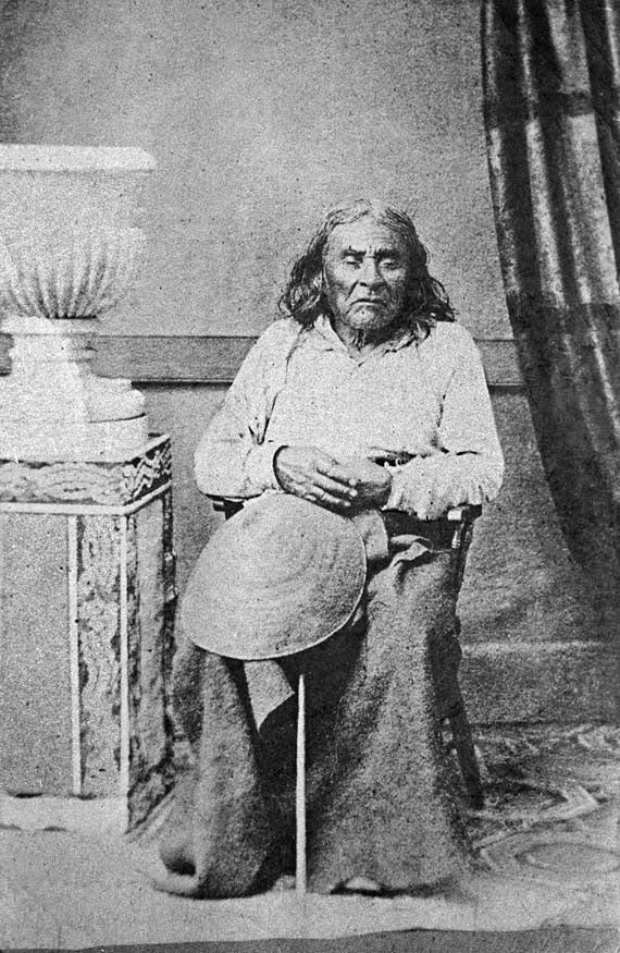
“The bay, and its namesake (most likely midshipman Samuel Elliott of the Wilkes expedition that explored Puget Sound in 1841) already has Elliott Avenue named in its honor. Elliott was, of course, a white man. I don’t know what percentage of Seattle streets are named for white men (although I would be fascinated to find out, and may undertake that as a project for my blog on Seattle street names), but I’m sure it’s very high.

“I urge you instead to take this opportunity to name this street something else. The Duwamish people, for example, have Duwamish Avenue S named for them (actually more likely for the river, as Elliott Avenue was named for the bay, not directly for the sailor), but it is an insignificant street 2/10 of a mile long hidden under the Spokane Street Viaduct and the Alaskan Freeway. Perhaps Duwamish Avenue would be a better choice, if the tribe approved? Or perhaps the street could honor a non-white person associated with the history of Seattle’s waterfront? Frank Jenkins, perhaps?”

I honestly didn’t expect to hear back from anyone, but to my surprise Marshall Foster, director of the Office of the Waterfront and Civic Projects, wrote me himself on January 5, saying:

We completely agree that the naming of this new street is an exciting opportunity. “Elliott Way” has simply been a placeholder until we are closer to its opening. The Coast Salish tribes are an incredibly important part of Seattle’s history and culture today. We have actually been thinking along similar lines about how this naming could help to elevate their presence here, and have been in discussions with our partners in the tribal community about ideas very similar to yours. We expect to have a proposal for public discussion later this year.

I have to say, I’m pretty happy about this.

Update as of January 11, 2022: I wrote Foster and his team over the weekend asking if there were any updates, and heard back today from Lauren Stensland:

We agree that this is a great opportunity and we continue to coordinate with the tribes and other partners on a proposed name. It is definitely high on our list for this year. We do not have any new updates at this time; we expect to have more to share in the next few months. Stay tuned and keep an eye on our website.

Update as of September 21, 2022: I recently wrote back to Stensland to check on the status of the street and its name, and she replied today that:

The elevated roadway is planned to open in early 2023. As for the roadway name, we are continuing to work toward this and will share updates as soon as we have them. Keep staying tuned!

Update as of February 2, 2023: I posted an article last month “Dzidzilalich” to be honorary name for Elliott Way, Alaskan Waynoting that, in fact, the roadway will be known as Elliott Waybut will carry the honorary name “Dzidzilalich.” So it seems “Elliott Way,” after all, is unfortunately not just a placeholder name.

W Ruffner Street

This street, which runs, with interruptions, for 2⅓ miles from Queen Anne to just short of Elliott Bay in Magnolia (though it is platted for several more blocks west over the tideflats) is named, as I learned from the Ruffner Family Association, for Presbyterian minister William Henry Ruffner. A slaveholder who “advocated the gradual emancipation and colonization of the state’s African Americans”, he was also, according to Encyclopedia Virginia, “the designer and first superintendent of Virginia’s public school system.”

How did this “Horace Mann of the South” end up with his name on a Seattle street? Apparently, in addition to being an educator, he was also a geologist, and so was hired by Thomas Burke and Daniel Gilman (of Burke–Gilman Trail fame), two of the founders of the Seattle, Lake Shore and Eastern Railway, to spend just over five weeks in 1887 surveying the area, the results of which were published in the SLS&E’s promotional book A Report on Washington Territory two years later. When it came time in 1890 for the plat of Gilman’s Addition to the City of Seattle to be filed, Ruffner’s name appeared on the map. 

The Seattle, Lake Shore and Eastern became part of the Northern Pacific Railway in 1892. Today, the Interbay Car Shop of the BNSF Railway, successor to the NP, is located at the corner of W Ruffner Street and Gilman Avenue W.

SW Seattle Street

What better way to start things off than with SW Seattle Street?

SW Seattle Street is a minor residential street in West Seattle that runs about ³/₁₀ of a mile from 42nd Avenue SW in the east to Sunset Avenue SW in the west.

It might seem strange that such a short street would be chosen to bear the city’s name — it was the only one to do so until 2010, when the first two blocks of Airport Way S were renamed Seattle Boulevard S — but this has more to do with unimaginative naming than with civic pride.

On August 4, 1869, Ike M. Hall — the executor of the estate of Norman B. Judkins — filed the Judkin’s (sic) Addition to the Town of Seattle, located just southwest of where the interchange between I-5 and I-90 is today. From north to south, the east–west streets are named Norman, B, Judkins, Addition, Town, and Seattle.

Portions of the original Seattle Street were vacated over the years (for example, in 1900, 1957, and 2000), and the construction of I-5 took care of the rest. However, when the city annexed West Seattle in 1907 it changed the name of Maple Street to W Seattle Street as part of rationalizing the street grid… and so the name lives on.

(The city itself, of course, was named after Si’ahl [siʔaɫ], better known in English as Chief Seattle of the Duwamish and Suquamish Tribes.)

siʔaɫ, or Chief Seattle
The only known photograph of Chief Seattle (1786?–1866), taken by E.M. Sammis in 1864
Sign at corner of SW Seattle Street and 46th Avenue SW, July 4, 2011
Sign at corner of SW Seattle Street and 46th Avenue SW, July 4, 2011. Photograph by Benjamin Lukoff. Copyright © 2011 Benjamin Lukoff. All rights reserved.

So, why SW Seattle Street instead of Seattle Street SW?

In Seattle, east–west streets have the directional come first, and north–south avenues have it come last. The Wikipedia article “Street layout of Seattle,” which I helped write, has a more comprehensive description of Seattle’s addressing system, including the answer to this question:

Why was it W Seattle Street in 1907 but SW Seattle Street now?

In 1961, city ordinance 89910 “established a standard system of street name designations” so that in almost all cases streets within a given zone would carry the same directional. West Seattle avenues already carried the SW designation.