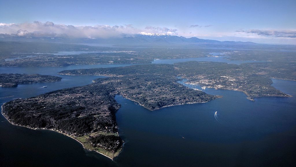
Yukon Avenue S

This very short street (375 feet long) in the Dunlap neighborhood runs from Spear Place S in the south to S Henderson Street in the north. Like Valdez Avenue S, which it intersects, it was established in 1905 as part of Dunlap’s Supplemental to the City of Seattle, and was named after the Yukon River, likely due to the recent Klondike Gold Rush (ended 1899).

Yukon Avenue S, incidentally, holds the distinction of being the at the very end of the list of Seattle streets taken in alphabetical order — hence the tagline for Streets of Seattle, a blog from 2012 that sadly never seems to have gotten off the ground: “Seattle street names, from Adams to Yukon.”

Valdez Avenue S

This short street (just ⅛ of a mile long) connects Martin Luther King Jr. Way S to Yukon Avenue S in Seattle’s Dunlap neighborhood. Established in 1905 as part of Dunlap’s Supplemental to the City of Seattle, it was named after Valdez, Alaska, which was itself named after Spanish naval officer Antonio Valdés y Fernández Bazán. (Other streets in the plat include the above-mentioned Yukon Avenue as well as Tanana Drive, Fairbanks Drive, and Rampart Drive. Tanana Drive is now part of S Henderson Street; Fairbanks Drive is now S Fairbanks Street; and Rampart Drive is now part of S Director Street.)

I haven’t been able to find a specific connection the Hulbert or Dunlap families might have with Alaska, but 1905 was just six years after the Klondike Gold Rush ended, and just four years before the Alaska–Yukon–Pacific Exposition. Seattle’s population went from 42,837 in 1890 to 80,671 in 1900 — an increase of 88% — and much of this was due to its central role in the gold rush as “the premier supply centre and the departure point for the gold fields.”

California Avenue SW

This West Seattle street was established in 1888 as part of the First Plat of West Seattle by the West Seattle Land and Improvement Company. As “most of [its] capital came from San Francisco,” I would assume that is why California Avenue was given its name.

California Avenue SW — a major West Seattle arterial connecting the Admiral, Alaska, and Morgan Junctions (three commercial hubs named after long-gone streetcar line intersections) — runs 4½ miles from California Lane SW in the north, past which it turns into California Way SW on its way down the hill to the waterfront, to SW Sullivan Street in the south. Beyond there it exists as a few short segments, then briefly as part of the SW Brace Point Drive–SW Barton Street arterial, and lastly as a nearly mile-long residential street that ends at Marine View Drive SW.

Sign at corner of SW Donald Street and California Avenue SW, July 4, 2011
Sign at corner of SW Donald Street and California Avenue SW, July 4, 2011. Photograph by Benjamin Lukoff. Copyright © 2011 Benjamin Lukoff. All rights reserved.

University Street

University Street was established as part of the Plat of an Addition to the Town of Seattle as Laid Out by A.A. Denny on November 16, 1861. It was named for the Territorial University of Washington, which had opened 12 days earlier on a 10-acre site atop “Denny’s Knoll.”

Plat of an Addition to the Town of Seattle as Laid Out by A.A. Denny, November 16, 1861
Territorial University on opening day, showing south and west sides of main building, November 4, 1861
Territorial University of Washington on opening day, November 4, 1861

Even though the University of Washington moved to its current location on Portage and Union Bays in 1895, the name was not changed. Nor did the university relinquish the land, though not for lack of trying. This turns out to have been fortunate. The UW owns the Metropolitan Tract to this day, and it earned $25 million in rent on the property during fiscal year 2020 alone.

The street, which originally ran from Front Street (now 1st Avenue) to the university campus, just northeast of 3rd Avenue, today begins at Alaskan Way on the Elliott Bay waterfront, and makes it just one block, to Western Avenue, before it becomes the Harbor Steps. From 1st Avenue, it’s about a third of a mile to 7th Avenue, where University Street is blocked by Interstate 5. It resumes at 9th Avenue and goes for another third of a mile to Boylston Avenue.

Portion of King County quarter section maps covering Metropolitan Tract

Incidentally, you’ll notice in the map above that 4th and 5th Avenues between Seneca and Union Streets, as well as University Street between 4th and 5th Avenues, plus half a block on either end, are marked private way subject to public use — long term grant of use for street purposes. This fact — that the University of Washington still owns all the land within the Metropolitan Tract and never formally dedicated those streets to the public — was something I never knew until I started taking close looks at King County’s quarter section maps as part of my local history research. It might seem an academic distinction, but as The Seattle Times reported in 2015, there are very real financial consequences.

In 2008… the UW wanted the city to interpret the tract as one undivided lot, streets and all. That novel argument would benefit the UW in calculating the development footprint, or base.… The bigger the base, the logic went, the more square footage a developer could build before triggering affordable-housing fees under the city’s formula.… The university held a heavy hammer in negotiations. Because the UW owned development rights for the land under Fifth Avenue and University Street, it could make the city compensate it, one way or another, for using those streets.

Cherry Street

Cherry Street was among the first streets platted in Seattle on May 23, 1853. Sophie Frye Bass, author of Pig-Tail Days in Old Seattle, writes:

I choose to think that Cherry Street is named for the little town of Cherry Grove, Illinois — Mother’s birthplace — where the Dennys started on their long journey over the Oregon Trail.

“Mother,” in this case, refers to Louisa Catherine Denny Frye, one of three children of Arthur Armstrong Denny and Mary Ann Boren Denny of the Denny Party. She was 7 years old when they landed at Alki Point in November 1851.

In 2006, Hunter Brown wrote a People’s History essay for HistoryLink, “Finding Cherry Grove,” detailing his efforts to locate Cherry Grove, whose name was later changed to Cedar Township. The nearest town today is called Abingdon.

Bass began her Pig-Tail Days piece on Cherry Street by calling it “another up-and-up street… with no interferences. It begins at First Avenue, goes east and ends at Thirty-seventh avenue.” This is no longer quite the case because of a very small gap at the south end of the Seattle University campus. Today, Cherry begins at 1st Avenue and ends a block east of Broadway. It starts up again a couple hundred feet to the east as a continuation of the James Street/E James Way arterial, and then does go on to 37th Avenue in Madrona. All told it is 2⅓ miles long.

Bitter Place N

This street runs a tenth of a mile along the Bitter Lake waterfront from N 134th Street to the grounds of Broadview-Thomson K-8 School and Bitter Lake Playground. It was established in 1923 as part of Bitter Lake Villa Tracts.

Bitter Lake itself was so named because, as HistoryLink puts it, “A small, lake-bound sawmill operation at the southwest corner of Bitter Lake contracted with the Puget Mill and Brown Bay Logging Company to process their lumber cut from nearby forests. The tannic acid from logs dumped into the lake was so bitter that horses refused to drink from it, thus giving the 20-acre pond its name.” Its native name is čʼalqʼʷadiʔ, meaning ‘blackcaps on the sides’.

E Foster Island Road

This street, which runs about ¼ mile from Lake Washington Boulevard E to the beginning of the Foster Point Trail, all within the Washington Park Arboretum, was without a name until 1968, when it was named for the island in Union Bay to which it led. (It remained unsigned until a few decades later, however. There was no sign at the intersection until at least the 1990s, as I know since my parents’ house was at the south end of the Arboretum and I drove or biked by there weekly, if not more often, while I was growing up.)

Foster Island is known by the Duwamish tribe, who once used it as a burial ground, as Stitici, or ‘little island’. It was named by the settlers for Joel Wellington Foster, who came to Washington in the 1870s from St. Joseph, Missouri. He is said to have donated the island to the city in one HistoryLink article, but another says the city bought it in 1917.

(Note added November 6, 2022: David B. Williams, the “Street Smart Naturalist,” recently posted The Lost Islands of Seattle, in which he wrote that he had seen various sources for the name Foster but none with good documentation. I asked him about the HistoryLink article I cite above:

A screen shot of a tweet by me reading "@geologywriter Re your recent islands newsletter, @HistoryLink says Foster Island was named for Joel Wellington Foster... too anecdotal?" and David B. Williams's reply, "My big problem is that HL has the wrong date for when JWFoster acquired the land. They say early 1900s. Maps show Foster's Island in 1891."

I’m embarrassed to have missed that, but of course he’s right. So if not Joel Wellington Foster, then who? The search continues

[Note: On July 10, 2024, I began converting embedded tweets on this website to screenshots because of issues with how they were integrating with WordPress, which began not too long after Elon Musk purchased Twitter and changed its name to X.]

W Marina Place

This street, established in 1991 as part of the development of the Elliott Bay Marina at the southern foot of Magnolia Bluff, runs ⅖ of a mile west from 23rd Avenue W to just shy of the 30th Avenue W street end beach.

While the origin of its name may not be interesting, the story of its establishment is a bit more so:

  • The marina itself began the permitting process in 1983, but lawsuits delayed its creation for nearly a decade. The Muckleshoot Indian Tribe and Suquamish Tribe sued to block its construction on the basis that “construction of the Marina would eliminate a portion of one of their usual and accustomed fishing areas in Elliott Bay and thus would interfere with their treaty right to fish at the Marina site.” Homeowners on the bluff above intervened on the side of the developers, as “the area has had numerous major landslides that have left several homes at the crest of the bluff at risk and have repeatedly caused breaks in a trunk sewer line located at the base of the bluff.… The Marina construction includes the placement of 500,000 cubic yards of fill at the toe of the bluff, which would stabilize the area.” Eventually, a settlement was reached, which “calls for ongoing fisheries-related expenses paid to the tribe, which will be funded by a percentage of the moorage income.… [the] ‘Indian Treaty Surcharge.’”
  • I believe this was the last major fill operation within Seattle city limits. Such a development would be all but unthinkable today.
  • The marina was built on tidelands where W Lee Street and Puget Avenue W were platted but never built. They were vacated and W Marina Place was established. When it came to naming the access road, the developers originally proposed W Marina Boulevard, contending that as the road fell between the W Oakes Street right-of-way and the former W Lee Street right-of-way, it wasn’t a violation of the city’s principle of maintaining street grid names as much as possible. This was initially rejected by the city, which preferred W Lee Street, but after further discussion, W Marina Place was settled on. An interesting point the developers made was that as W Lee Street had never physically existed in Magnolia, though it had been platted there, calling the access road W Lee Street could actually be confusing, as “people familiar with Seattle streets know that there is no W Lee Street on Magnolia. Rather, they know W Lee Street as being on Queen Anne Hill.” Still, though, I have to believe they were more interested in their own vanity — Marina Boulevard? — than any particular concern for folks’ ability to navigate.
  • For some reason, the public street ends just feet from the 30th Avenue W street end beach. I’m not entirely sure why that is; I don’t think the marina is opposed to public access to the beach; otherwise, they wouldn’t be in favor of the Magnolia Trail project, which would connect W Marina Place to W Galer Street, 32nd Avenue W, and thence to Magnolia Village.
Aerial photograph of Elliott Bay Marina area in the 1930sAerial photograph of Elliott Bay Marina area, present day
Elliott Bay Marina site, 1930s and today

University Way NE

This street runs 1¼ mile from NE Pacific Street in the south to NE Ravenna Boulevard and Cowen Park in the north. Until 2001, it was a block longer, starting farther south at NE Boat Street, but that portion was vacated as part of the development of the University of Washington campus.

Originally Columbus Avenue and then 14th Avenue NE, it was renamed University Way in 1920 after the University of Washington, which had moved to the neighborhood from its original home downtown in 1895. As local historian Paul Dorpat explains in this HistoryLink essay,

[In 1919] the University Commercial Club… ran [a contest] to rename 14th Avenue…. Club member Arthur Quigley’s “University Way” won the street name contest easily. To deflect any charges that the contest was fixed, Quigley donated the prize money to charity.

Even though it’s been a “way” for 101 years now, to locals University Way has always been, and always will be, “The Ave.” And that in itself will always cause some confusion, as this street sign demonstrates.

Even the city gets street names wrong sometimes. Photograph by Benjamin Lukoff, May 23, 2008. Copyright © 2008 Benjamin Lukoff. All rights reserved.

Portage Bay Place E

This street, which runs ³⁄₁₀ of a mile from Fuhrman Avenue E to E Allison Street, was established as an alley in 1890 as part of the Denny–Fuhrman Addition to the City of Seattle, but only received a name in 1936. It was named for Portage Bay, the eastern arm of Lake Union, which it parallels. Portage Bay was in turn named for the portage from Union Bay (part of Lake Washington) to Lake Union over the Montlake Isthmus, which is today the Montlake Cut of the Lake Washington Ship Canal.

Sign at corner of Fuhrman Avenue E, Eastlake Avenue E, and Portage Bay Place E, August 24, 2009
Sign at corner of Fuhrman Avenue E, Eastlake Avenue E, and Portage Bay Place E, August 24, 2009. Portage By Pl is an error; it should read Portage Bay Pl E, as it’s [[Portage Bay] [Place]], not [[Portage] [Bay Place]]. The original Red Robin restaurant was founded at this intersection in 1940. It has since been demolished, but I’ve seen imagery of this sign — including the error — on the walls of other Red Robin locations. Photograph by Benjamin Lukoff. Copyright © 2009 Benjamin Lukoff. All rights reserved.

Island Drive S

There are only a handful of islands within Seattle city limits, and of them just one — Harbor Island — is large enough to have streets on it. But Island Drive S isn’t on Harbor Island — rather, it’s along the shore of Lake Washington, 5½ miles to the southeast. What gives?

As it turns out, Island Drive once was on an island — Pritchard Island. Known as tleelh-chus (‘little island’) by the Duwamish tribe, it was bought in 1900 by Alfred J. Pritchard (grandfather of Joel Pritchard, who was a congressman from Washington state in the 1970s and 1980s and its lieutenant governor in the 1980s and 1990s). In 1916, Lake Washington was lowered by 9 feet as part of the construction of the Lake Washington Ship Canal, and Pritchard’s island became part of the mainland.

It’s still known as Pritchard Island, though. Today, Pritchard Island Beach, Rainier Beach Urban Farm and Wetlands, and Be’er Sheva Park separate the island from the mainland.

Occidental Avenue S

Occidental Avenue S, which begins at Yesler Way in Pioneer Square, is one of those Seattle streets whose names extend into the suburbs. It makes its southernmost appearance at S 197th Street in Des Moines.

It received its name in 1895 as part of the Great Renaming — it had originally been S Second Street. It once had a partner, Oriental Avenue, to the east (originally S Fourth Street), which is today 3rd Avenue S. “Oriental,” of course, means “Eastern,” as “Occidental” means “Western.” (I haven’t been able to determine just when Oriental Avenue became 3rd, but it was last mentioned in The Seattle Times on October 17, 1920.)

And why this particular pairing? The Occidental Hotel, which once overlooked the beginning of Occidental Avenue, is almost certainly the reason, but it’s not spelled out in the ordinance.

W Armory Way

This Interbay street, established in 1910 as Lawton Way, runs ¼ mile northwest from 15th Avenue W to the BNSF Railway’s Balmer Yard. Its right-of-way runs about 800 feet beyond that, across the railroad tracks, to 20th Avenue W, as it was once the location of a bridge to Magnolia.

W Lawton Way was changed to W Armory Way in 1973, presumably in anticipation of the construction in 1974 of an armory for the Washington Army National Guard. Will its name be changed again once the National Guard moves — or if it becomes the location of a new Magnolia Bridge?

(Another Armory Way near Pike Place Market existed on paper for many years — from 1936 to 2019 — but was never built. Something similar is currently under construction.)

S Addition Street

This Industrial District street — a mere 80 feet long — runs from Airport Way S east to the Interstate 5 right-of-way. It may very well be the shortest street in Seattle (I’d love to hear about other candidates).

Sign at corner of S Addition Street and Airport Way S, January 30, 2011
S Addition Street sign, January 30, 2011. Photograph by Benjamin Lukoff. Copyright © 2011 Benjamin Lukoff. All rights reserved.

As explained in SW Seattle Street, the plat of Judkin’s Addition to the Town of Seattle was filed in 1869. From north to south, the east–west streets are named Norman, B, Judkins, Addition, Town, and Seattle. (Did they really think B Street would last, I wonder?)

Of these, Norman, Judkins, Addition, and Seattle Streets remain, though Addition is the only one still in its original location. (SW Seattle Street now only exists for a few blocks in West Seattle, and S Norman and S Judkins Streets only east of Interstate 5.)

Canterbury Lane E

This stub of a street in Madison Park serves mostly as a driveway to the Canterbury Shores Condominiums, although it is public right-of-way. It appears to have been dedicated to the public in 1965, and its name was changed from 40th Avenue E the next year.

My assumption is the street was named for the condominiums, and that the condominiums were named for the Canterbury subdivision to the south, which was laid out in 1951. According to Shaping Seattle Architecture: A Historical Guide to the Architects, John L. Scott’s Canterbury Land Company purchased the land in 1938. (My further assumption is that the subdivision was named for Canterbury, England.)

Webster Point Road NE

This very short street in the Laurelhurst neighborhod — just over 200 feet long — was created in 1962 as part of the Webster Point plat. Why it’s a road rather than a place, lane, or court, I’m not sure — roads in Seattle (of which there aren’t many) are usually longer, such as Windermere Road NE, Holman Road NW, and Military Road S. It has the distinction of the lowest-numbered address on a north–south street north of the Lake Washington Ship Canal, as far as I am aware — 3000.

The plat and road are named for Webster Point, at the very southern tip of the Laurelhurst peninsula, which itself was named for Henry A. Webster, who once owned the land. This Webster appears to have been the Indian agent for the Makah tribe at Neah Bay on the Olympic Peninsula.

University View Place NE

This short street, which runs from NE 50th Street just south of Calvary Cemetery to NE 45th Place, is named for its view of the University of Washington campus to the southwest. It was laid out in 1907 as part of the Exposition Heights addition, which was named after the upcoming Alaska–Yukon–Pacific Exposition on the UW campus.

Alaska–Yukon–Pacific Exposition Seattle 1909

sluʔwiɫ

I end my piece on Lushootseed-language place names in Seattle, “Native names abide,” thus:

…Let Carkeek remain Carkeek, but know that it was once and is still kʷaatəb, as Montlake is still stəx̌ʷugʷił, the Locks, which lowered x̌ačuʔ and x̌áx̌əʔčuʔ, still xʷiwálqʷ, and University Village still sluʔwił village, and celebrate that wǝɫǝbʔaltxʷ now sits where Whitman and Stevens meet.

wǝɫǝbʔaltxʷ – Intellectual House is “a longhouse-style facility on the [University of Washington] Seattle campus [that] provides a multi-service learning and gathering space for American Indian and Alaska Native students, faculty and staff, as well as others from various cultures and communities to come together in a welcoming environment to share knowledge.” Its location at the corner of Stevens Way and Whitman Court is significant in that almost all campus roads are named for Washington counties, and these two counties were named after Isaac Stevens and Marcus and Narcissa Whitman:

  • As noted in “Should Seattle rename its streets?” Stevens, governor of Washington Territory, “forced Native American tribes to cede their lands to the federal government.… He also pardoned himself for contempt charges relating to unjust declaration of martial law during the Yakima War, and insisted on the capture of the subsequently executed Chief Leschi of the Nisqually Tribe, even though at that point he had ceased fighting and fled the area.
  • The Whitmans’ story is more complex. The missionary couple were among 13 whites killed by a group of Cayuse Indians in what has become known as the Whitman massacre. A measles epidemic in the mission settlement and a nearby Cayuse village produced a death rate far higher among the Cayuse; Marcus Whitman, who was a also a physician and tried to treat the Cayuse as well as the whites, was accused of poisoning tribe members: “the fact that nearly all of his white patients recovered while his Indian patients died convinced some Cayuses that he was deliberately poisoning Indians in order to give their land to white setters.” Even though this is unlikely, the fact remains that they were missionaries and colonizers, and there have been calls to replace the statue of Marcus that stands in the National Statuary hall.

Now the University of Washington has renamed Whitman Court sluʔwiɫ, after a village that once stood where University Village is today. (sluʔwiɫ means ‘Little Canoe Channel’ in the Lushootseed language.)

Street sign reading sluʔwiɫ on University of Washington campus
sluʔwiɫ street sign at corner of Stevens Way, with Padelford Hall in the distance, February 2021. Photograph by Benjamin Lukoff. Copyright © 2021 Benjamin Lukoff. All rights reserved.

The UW Board of Regents made this change in May 2018, but the sign only recently made its appearance. I asked the writer of the University of Washington Magazine piece on the name change, Hannelore Sudermann, if she knew whether “the renaming was official — that Whitman Court no longer exists and the street’s name is now sluʔwiɫ – or if it was honorary and the street is still officially Whitman Court,” and she pointed me to the meeting minutes, which read, in part: 

The Board of Regents chooses to honor the Coast Salish peoples of the land on which the University of Washington sits, and indigenous peoples across the State, by renaming Whitman Court sluʔwił.… In the Lushootseed language of the Coast Salish peoples, sluʔwił is the name for the village site closest to the campus, and means ‘Little Canoe Channel.’… It is the Board’s intention to recognize the native place-names of the region and thereby to enrich the historical context of the campus. The Board feels that this naming action is particularly appropriate, given the proximity of Whitman Court to wǝɫǝbʔaltxʷ, meaning ‘Intellectual House,’ a multi-service learning and gathering space for American Indian and Alaska Native students, faculty, and staff.

Even though an earlier part of the minutes reads “Regent Rice moved, Regent Ayer seconded, and the Board of Regents approved the honorific renaming of Whitman Court sluʔwił” (italics mine), given the excerpt above and the presence of the sign without any reference to Whitman Court, my interpretation is that honorific here means “in honor of,” in contrast to honorary meaning “symbolic.” 

Street sign on the University of Washington campus reading Little Canoe Channel NE / sluʔwit; ‘t’ appears instead of the correct ‘ɫ’. sluʔwiɫ means ‘little canoe channel’ in Lushootseed. October 27, 2021
New street sign, reading Little Canoe Channel NE / sluʔwit; ‘t’ appears instead of the correct ‘ɫ’. Photograph by Leslie Holmes, October 27, 2021. Copyright © 2021 Leslie Holmes. All rights reserved.

Update as of February 16, 2023: I recently noticed that sluʔwiɫ is appearing on maps (UW, OpenStreetMap) as sluʔwiɫ (Little Canoe Channel NE). Per the UW’s page on McMahon Hall, “Whitman Court NE has been renamed Sluʔwił (Little Canoe Channel NE). Although street signs have changed, you may hear the street referred to by both names as the name change awaits formal state recognition. The name change acknowledges the Duwamish Peoples who continue to fight for federal recognition as a tribe, and who lived and engaged in potlaches, gift-giving festivals of sharing and trading, in the area, until the land was colonized by white settlers.” I will try to find out when and how formal state recognition will come.

Bay Street

This street, which runs for a little over a tenth of a mile from Elliott to 1st Avenues, was originally named Grant Street by William Nathaniel Bell in 1881. 14 years later, it was one of the many streets caught up in the Great Renaming of 1895. Per ordinance 4044, it was “ordained… that the name of Grant Street from Elliott Bay to Depot Street, be and the same are hereby changed to Bay Street.” I can’t imagine it took its name from anywhere other than Elliott Bay.

E Interlaken Boulevard

The establishment of E Interlaken Boulevard — the first of Seattle’s Olmsted parks and boulevards we’re covering — was first proposed, according to Seattle parks historian Don Sherwood, in 1903 as Volunteer Hill Parkway. Two years later, the current name was adopted. There is speculation, but no documentation, that it was named for the Swiss resort town of that name. Ask a Seattleite how to pronounce “Interlaken” and you may hear either lake or lock, the latter being more common according to an informal Twitter poll I ran (but the former being the one I grew up with).

Text of a Twitter poll by me, reading "Seattleites! How do you pronounce “Interlaken,” as in Interlaken Drive, Interlaken Boulevard, Interlaken Place, and Interlaken Park?" LOCKen 55.8%, LAYKen 34.7%, something else (comment) 2.7%, results only 6.8%. 147 votes total

Note: On July 10, 2024, I began converting embedded tweets on this website to screenshots because of issues with how they were integrating with WordPress, which began not too long after Elon Musk purchased Twitter and changed its name to X. Here is a screen shot of folks’ comments.

Interlaken Boulevard runs for about 1⅔ miles west to east from Delmar Drive E, by Seattle Preparatory School on Capitol Hill, to Lake Washington Boulevard E, in the Washington Park Arboretum. The middle section, between 19th and 21st Avenues E, is closed to motor vehicles and functions as a pedestrian and bicycle trail. The name also appears on Interlaken Drive E and Interlaken Place E — and should not be confused with Interlake Avenue N, a street in North Seattle.

Advertisement for Interlaken in the Seattle Post-Intelligencer, May 30, 1906
Street sign at corner of Lake Washington Boulevard E and E Interlaken Boulevard, October 11, 2009. Copyright © 2009 Benjamin Lukoff. All rights reserved.
Street sign at corner of Lake Washington Boulevard E and E Interlaken Boulevard. Photograph by Benjamin Lukoff, October 11, 2009. Copyright © 2009 Benjamin Lukoff. All rights reserved.