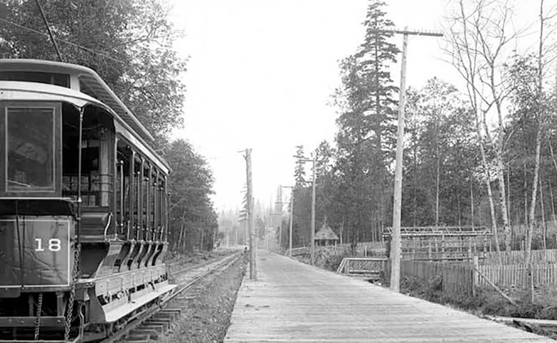
This street follows the route of the Rainier Avenue Electric Railway Company’s Seattle-to-Renton line, which began to be built in 1891. Both the rail line and street were named for Mount Rainier (təqʷubəʔ), itself named by Captain George Vancouver for his friend, Royal Navy Rear Admiral Peter Rainier (1741–1808). As the Seattle Post-Intelligencer noted on September 3, 1890, “the avenue points straight toward Mount Rainier, which mountain will be in plain view all the way.”
Rainier Avenue S begins at the intersection of S Jackson Street, Boren Avenue S, and 14th Avenue S, and goes nearly 8 miles southeast to the city limits. From there, it continues around 3¾ miles south to the intersection of Interstate 405 and State Route 167 in Renton.
Aerial view of Rainier Valley, Beacon Hill, and Downtown, May 22, 2001. Rainier Avenue S is the tree-lined street running up the middle of the photograph. Courtesy of the Seattle Municipal Archives, Identifier 114373.
Born and raised in Seattle, Benjamin Donguk Lukoff had his interest in local history kindled at the age of six, when his father bought him settler granddaughter Sophie Frye Bass’s Pig-Tail Days in Old Seattle at the gift shop of the Museum of History and Industry. He studied English, Russian, and linguistics at the University of Washington, and went on to earn his master’s in English linguistics from University College London. His book of rephotography, Seattle Then and Now, was published in 2010. An updated version came out in 2015.
This street, established in 1913 as Sturtevant Place, was named for real estate investor, banker, and antique store owner Cullen Kittredge Sturtevant (1865–1946), who developed a number of tracts in what is now Rainier Beach. Unlike many developers, he didn’t name this street after himself; it was added by the city nearly a decade after he filed Sturtevant’s Plat of Rainier Beach Acre Tracts.
Today, Sturtevant Avenue S begins at Rainier Avenue S between 51st Avenue S and 52nd Avenue S and goes ⅕ of a mile southeast to 52nd Avenue S and S Roxbury Street. Sturtevant Ravine, through which Mapes Creek runs on its way from Kubota Garden to Beer Sheva Park and Lake Washington, lies to its west.
Ad for Sturtevant’s Rainier Beach Lake Front Tracts, The Seattle Times, April 8, 1906
Born and raised in Seattle, Benjamin Donguk Lukoff had his interest in local history kindled at the age of six, when his father bought him settler granddaughter Sophie Frye Bass’s Pig-Tail Days in Old Seattle at the gift shop of the Museum of History and Industry. He studied English, Russian, and linguistics at the University of Washington, and went on to earn his master’s in English linguistics from University College London. His book of rephotography, Seattle Then and Now, was published in 2010. An updated version came out in 2015.
This street was created in 1924 as part of Mayes’ Addition to the City of Seattle, filed by Wilbur Mayes (1871–1949); his wife, May H. Stutz Mayes (1870–1948); and George Moore. According to the reports of their deaths in The Seattle Times, on October 5, 1949, and October 14, 1948, respectively, the Mayeses were married in 1896 and lived in the Philippines, where Wilbur was a lumberman, from 1905 to 1912. They moved from the Philippines to Seattle, where he became an accountant. He apparently became a house repairman after retirement, and died after falling 15 feet from a University District neighbor’s roof.
Interestingly, it appears on the plat map as Mayes’ Court, with the apostrophe, but its official name lacks the punctuation, as do, I believe, all Seattle streets. (We have no streets named O’Brien, O’Reilly, O’Sullivan, or the like; I suppose an exception would have been made in such cases.)
Mayes Court S begins at S Carver Street and goes about 350 feet northwest to a cul-de-sac.
Born and raised in Seattle, Benjamin Donguk Lukoff had his interest in local history kindled at the age of six, when his father bought him settler granddaughter Sophie Frye Bass’s Pig-Tail Days in Old Seattle at the gift shop of the Museum of History and Industry. He studied English, Russian, and linguistics at the University of Washington, and went on to earn his master’s in English linguistics from University College London. His book of rephotography, Seattle Then and Now, was published in 2010. An updated version came out in 2015.
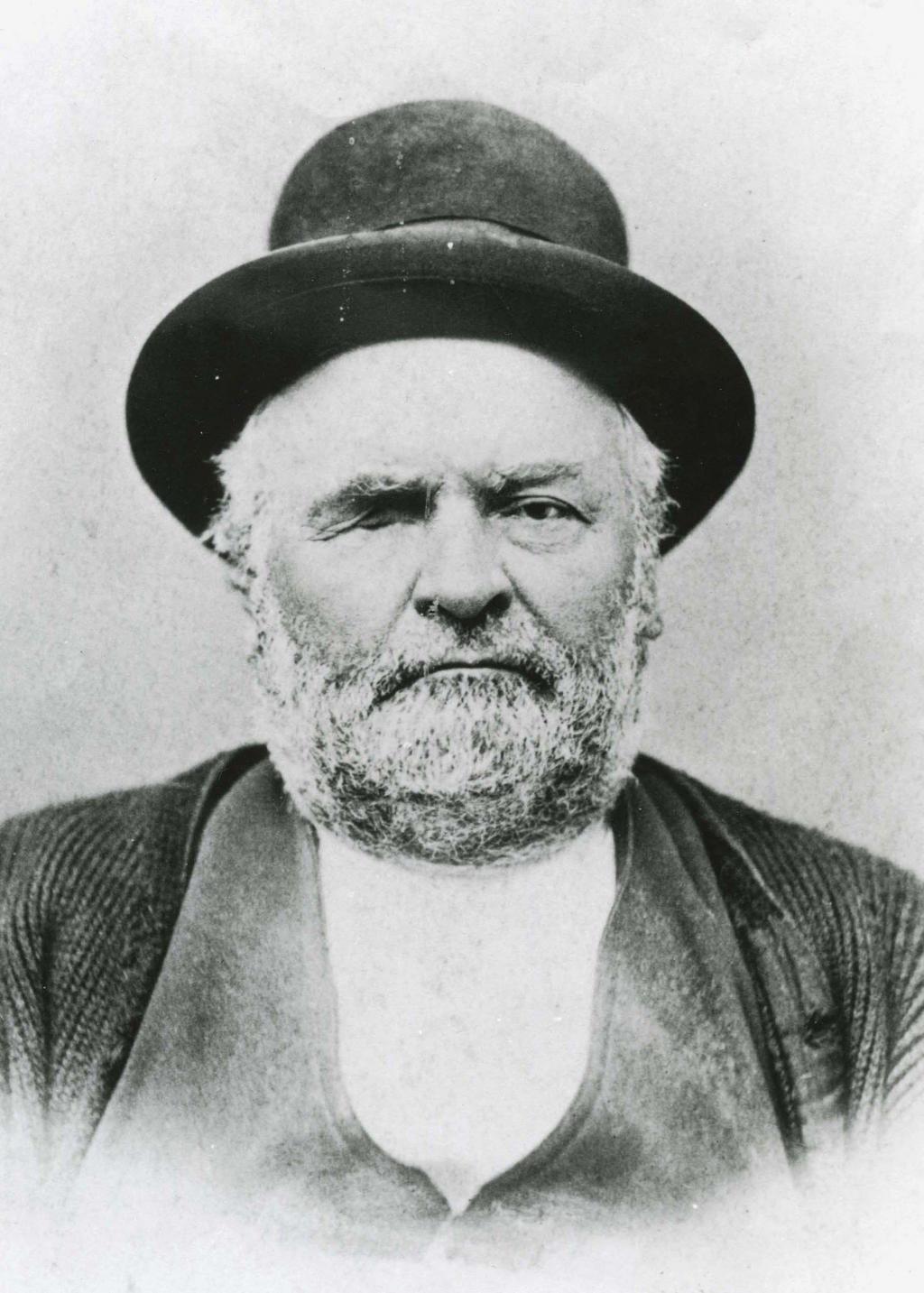
This street is named after the city of Renton, Washington, located southeast of Seattle at the southern end of Lake Washington. The city was itself named after Captain William Renton (1818–1891). Born in Nova Scotia, he came to the Puget Sound area in the mid-1850s and founded the Port Blakely mill on Bainbridge Island in 1864. Erasmus Smithers founded the Renton Coal Company with Captain Renton’s financial backing in 1873 and filed the first town plat in 1875.
William Renton, 1818 – 1891
A Renton Avenue existed in Seattle before this one, but not for very long — it was established in 1894 from streets on Capitol Hill “now called in various portions thereof Black Street, Joy Street, Renton Avenue and Eighteenth Avenue.” (Part of this area had been platted by Captain Renton, and was known at the time as Renton Hill.) It was changed the next year to 16th Avenue as part of the Great Renaming.
The current Renton Avenue was established in 1907 from what had been an old county road, Simpson Avenue, Hillman Boulevard, and a number of unnamed streets. According to the North Rainier Valley Historic Context Statement, this is quite an old route:
King County Road No. 1 ran east down from Beacon Hill at about the location of today’s Cheasty Boulevard, and then followed the approximate line of today’s Renton Avenue South to Renton. It also had been an earlier Indian trail route. Renton Avenue South is the remnant of this original county road to Renton. While portions of this road still exist, some are now incorporated into Martin Luther King, Jr. Way.
Today, Renton Avenue S begins at Martin Luther King Jr. Way S just south of S Walden Street and goes ¾ of a mile southeast to 33rd Avenue S just north of S Alaska Street. It resumes at 35th Avenue S just south of S Hudson Street and goes another ½ mile to S Juneau Street west of 39th Avenue S. It then starts up again at Martin Luther King Jr. Way S and S Webster Street and goes nearly 3 miles to the city limits south of S 116th Place. (Renton Avenue continues beyond there another 2 miles to — of course — Renton, where at 90th Avenue S and Taylor Avenue NW it becomes the Renton Avenue Extension and goes a further ⅛ of a mile to Rainier Avenue S and Airport Way.)
Born and raised in Seattle, Benjamin Donguk Lukoff had his interest in local history kindled at the age of six, when his father bought him settler granddaughter Sophie Frye Bass’s Pig-Tail Days in Old Seattle at the gift shop of the Museum of History and Industry. He studied English, Russian, and linguistics at the University of Washington, and went on to earn his master’s in English linguistics from University College London. His book of rephotography, Seattle Then and Now, was published in 2010. An updated version came out in 2015.