This cul-de-sac was created in 1984 as part of the plat of Valley Ridge, and was named after the nearby S Raymond Street. Raymond Street was itself named by and for Herbert R. Raymond (1862–1933), and his wife, Minnie M. Raymond (1874–1947), née Truax.
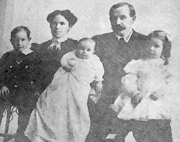
Herbert Raymond in May 1922 ― see S Raymond Street for the Seattle Times article this photo was taken from
Born and raised in Seattle, Benjamin Donguk Lukoff had his interest in local history kindled at the age of six, when his father bought him settler granddaughter Sophie Frye Bass’s Pig-Tail Days in Old Seattle at the gift shop of the Museum of History and Industry. He studied English, Russian, and linguistics at the University of Washington, and went on to earn his master’s in English linguistics from University College London. His book of rephotography, Seattle Then and Now, was published in 2010. An updated version came out in 2015.
This street was named in 1906 as Raymond Avenue, part of Replat Tracts 30 & 31 Sunnyside 5 Acre Tracts, by Herbert R. Raymond (1862–1933) of New Brunswick, Canada, and his wife, Minnie M. Raymond (1874–1947), née Truax, of Massachusetts. In 1907, it and Spencer Avenue became Raymond Street as part of the renaming of streets in Beacon Hill and Rainier Valley, and Grand Avenue, Grand View Avenue, and Sixteenth Street in West Seattle took the name as well. Three years later, when Georgetown was annexed, Raymond Street replaced James Street. (All this information from Rob Ketcherside’s extremely useful searchable table of street name changes.)
Herbert came to Washington as a child, along with his family; Minnie appears to have come later, and the two married in 1895. His eldest brother, George (Herbert was the youngest of eight children), sold shoes in Seattle and was also on the city council and in the territorial, as it then was, legislature. He later moved to Bellingham and was on the city council there in 1912 and 1913, and was mayor for less than two months, in December 1915 and January 1916, his term ending with his sudden death.
Herbert himself was also in the shoe business. As his Seattle Times obituary put it, he was:
Formerly one of the Pacific Northwest’s prominent shoe merchants and leading civic spirits… He had been retired for the past twelve years and had spent most of his time out of doors improving his two-acre residential property which overlooks Lake Washington. Mr. Raymond came to Seattle four years before the Seattle fire and helped fight it. His first shoe store was at First Avenue near Madison Street. He operated in other locations and under other firm names in subsequent years.
Article in the May 7, 1922, Seattle Times, about deer grazing on Herbert Raymond’s lawn and in his orchard. “I believe they came originally from Mercer Island, swimming across to Seward Park. There are no dogs about and the tempting green stuff in my garden coaxed them over the fence…. I don’t see a chance to grow a garden. But the deer are worth it. Their beauty more than repays for their feed.” Download the article as a PDF.
S Raymond Street begins at 51st Place S and goes just over ⅕ of a mile west to 48th Avenue S. It resumes at 44th Avenue S and goes a block west to 42nd Avenue S. There is another short segment that goes 1½ blocks west from Martin Luther King Jr. Way S, and then a longer segment begins at 33rd Avenue S and goes ½ a mile west to Beacon Avenue S, the portion crossing the Chief Sealth Trail being a pathway. A few more segments appear between 24th Avenue S and Swift Avenue S.
SW Raymond Street begins in West Seattle at High Point Drive SW and SW Graham Street and goes 1¼ miles west to 49th Avenue SW.
Born and raised in Seattle, Benjamin Donguk Lukoff had his interest in local history kindled at the age of six, when his father bought him settler granddaughter Sophie Frye Bass’s Pig-Tail Days in Old Seattle at the gift shop of the Museum of History and Industry. He studied English, Russian, and linguistics at the University of Washington, and went on to earn his master’s in English linguistics from University College London. His book of rephotography, Seattle Then and Now, was published in 2010. An updated version came out in 2015.
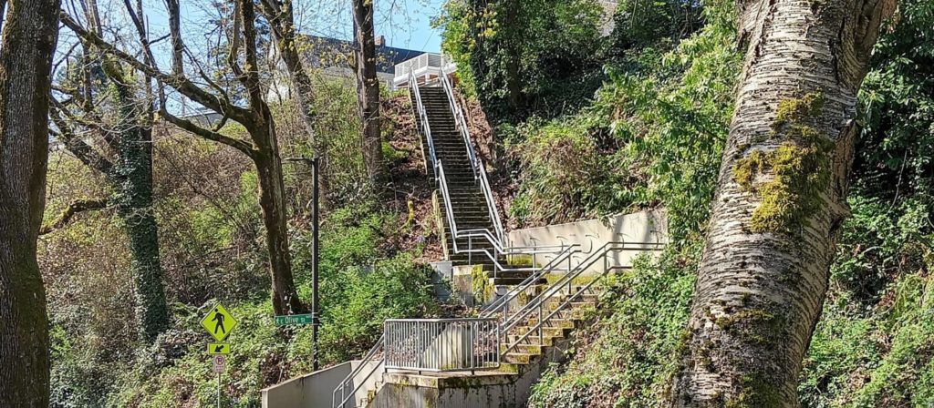
E Olive Lane begins at Lake Washington Boulevard at the bottom of the E Olive Street stairway and, passing Howell Place, goes around 380 feet east to Lake Washington.
Born and raised in Seattle, Benjamin Donguk Lukoff had his interest in local history kindled at the age of six, when his father bought him settler granddaughter Sophie Frye Bass’s Pig-Tail Days in Old Seattle at the gift shop of the Museum of History and Industry. He studied English, Russian, and linguistics at the University of Washington, and went on to earn his master’s in English linguistics from University College London. His book of rephotography, Seattle Then and Now, was published in 2010. An updated version came out in 2015.
E Olive Street between Melrose Avenue and Bellevue Avenue was renamed E Olive Place sometime between 1912, when it was recorded in the Baist Atlas as E Olive Street, and 1919, the first time it appeared as E Olive Place in The Seattle Times. I could not find any information on the name-change ordinance, and no information appears on King County’s quarter section map. The motivation appears to have been the fact that it meets Bellevue Avenue a half block north of its continuation and was very recently established (1910).
Born and raised in Seattle, Benjamin Donguk Lukoff had his interest in local history kindled at the age of six, when his father bought him settler granddaughter Sophie Frye Bass’s Pig-Tail Days in Old Seattle at the gift shop of the Museum of History and Industry. He studied English, Russian, and linguistics at the University of Washington, and went on to earn his master’s in English linguistics from University College London. His book of rephotography, Seattle Then and Now, was published in 2010. An updated version came out in 2015.
E Olive Street continues the original name of Olive Way east of Bellevue Avenue. As noted in that article, it was named for Olive Julia Bell Stewart (1846–1921), who was five when the Denny Party arrived at Alki Point in 1851.
E Olive Street begins at Bellevue Avenue and goes ⅕ of a mile east to Harvard Avenue. On the other side of Seattle Central College and Cal Anderson Park, it resumes at 11th Avenue and goes another ⅖ of a mile east to 18th Avenue, where it’s interrupted by E Madison Street. Picking up again at 20th Avenue, it goes ⅞ of a mile east to 39th Avenue, where it becomes a short stairway down to Lake Washington Boulevard.
Its initial segment, the block between Melrose Avenue and Bellevue Avenue, was renamed E Olive Place sometime between 1912 and 1919, and its final paved segment, the block between Lake Washington Boulevard and Lake Washington, was renamed E Olive Lane in 1971. As noted in that article, the shoreline street end, for some reason, retained the E Olive Street name.
Born and raised in Seattle, Benjamin Donguk Lukoff had his interest in local history kindled at the age of six, when his father bought him settler granddaughter Sophie Frye Bass’s Pig-Tail Days in Old Seattle at the gift shop of the Museum of History and Industry. He studied English, Russian, and linguistics at the University of Washington, and went on to earn his master’s in English linguistics from University College London. His book of rephotography, Seattle Then and Now, was published in 2010. An updated version came out in 2015.
Loyal Way NW begins at 28th Avenue NW and NW 80th Street and goes just over ⅓ of a mile northwest to 32nd Avenue Northwest and NW 85th Street, following the route of the Loyal Electric Street Railway that Treat built in 1907.
Born and raised in Seattle, Benjamin Donguk Lukoff had his interest in local history kindled at the age of six, when his father bought him settler granddaughter Sophie Frye Bass’s Pig-Tail Days in Old Seattle at the gift shop of the Museum of History and Industry. He studied English, Russian, and linguistics at the University of Washington, and went on to earn his master’s in English linguistics from University College London. His book of rephotography, Seattle Then and Now, was published in 2010. An updated version came out in 2015.
This Lower Queen Anne street adjacent to the Seattle Center campus was named in honor of Seattle Storm basketball star Sue Bird (born 1980) in the fall of 2024. As Ordinance 121704 says,
Sue Bird is the winningest and greatest women’s professional basketball player of all time; and… played her entire 20-year professional career for the Seattle Storm, bringing home to Seattle four WNBA titles (2004, 2010, 2018, and 2020), while also winning five Olympic gold medals (2004-2020).
This, incidentally, makes Sue Bird the third Jew and the first Jewish woman to have a Seattle street named for her (Cowen Place NE and Fuhrman Avenue E are the other two).
Originally 2nd Avenue N, the street (obviously redesignated a court in a nod to Bird’s sport) begins at the intersection of 2nd Avenue and Denny Way and goes just over 800 feet north to Lenny Wilkens Way, named for another Seattle basketball star. (North of there, its name changes to Seattle Storm Way.)
Born and raised in Seattle, Benjamin Donguk Lukoff had his interest in local history kindled at the age of six, when his father bought him settler granddaughter Sophie Frye Bass’s Pig-Tail Days in Old Seattle at the gift shop of the Museum of History and Industry. He studied English, Russian, and linguistics at the University of Washington, and went on to earn his master’s in English linguistics from University College London. His book of rephotography, Seattle Then and Now, was published in 2010. An updated version came out in 2015.
In March 2019, the block of University Way NE between NE 50th Street and NE 52nd Street was given the honorary name of Chris Curtis Way. This block is home to the weekly, year-round University District Farmers Market. Founded in 1993 by Chris Curtis and others, it was the first of what are now seven farmers markets spread across the city. As the city council resolution states, Curtis received this honor for, among other things,
…Organiz[ing] the first neighborhood farmers markets in Seattle devoted exclusively to local, small-scale family farms, which focus on good land stewardship and biodiversity and are essential components of a healthy environment, thriving local economy, and safe food system; and… help[ing] to preserve farmers’ livelihoods, revitalize neighborhoods, and support and strengthen Washington’s small family farm industry.
Curtis retired as executive director of the Neighborhood Farmers Market Alliance in 2018.
Born and raised in Seattle, Benjamin Donguk Lukoff had his interest in local history kindled at the age of six, when his father bought him settler granddaughter Sophie Frye Bass’s Pig-Tail Days in Old Seattle at the gift shop of the Museum of History and Industry. He studied English, Russian, and linguistics at the University of Washington, and went on to earn his master’s in English linguistics from University College London. His book of rephotography, Seattle Then and Now, was published in 2010. An updated version came out in 2015.
This pedestrianized stretch of 2nd Avenue N on the Seattle Center campus was renamed in 2018 after the Seattle Storm WNBA team, themselves so named “because of the weather here and what the team plans to do in the league.” Founded in 2000, their home court is Climate Pledge Arena, located between Seattle Storm Way and 1st Avenue N along Lenny Wilkens Way (formerly the 100 block of Thomas Street)
Before the 1962 Century 21 Exposition that brought Seattle the Space Needle and Monorail, 2nd Avenue N (earlier Poplar Avenue) continued north to Mercer Street and up Queen Anne Hill. The stretch between Thomas and Mercer Streets would remain a public right-of-way after its pedestrianization for nearly 30 years until it was vacated in 1991 at the request of Seattle Center “for the purpose of security and event control.”
Seattle Storm Way begins at Lenny Wilkens Way and goes a block north to the old Harrison Street right-of-way; the walkway between there and Mercer Street remains unnamed.
Born and raised in Seattle, Benjamin Donguk Lukoff had his interest in local history kindled at the age of six, when his father bought him settler granddaughter Sophie Frye Bass’s Pig-Tail Days in Old Seattle at the gift shop of the Museum of History and Industry. He studied English, Russian, and linguistics at the University of Washington, and went on to earn his master’s in English linguistics from University College London. His book of rephotography, Seattle Then and Now, was published in 2010. An updated version came out in 2015.
Rutan Place SW goes around 350 feet south from SW Edmunds Street between 44th Avenue SW and 45th Avenue SW to a dead end just short of 45th, though the undeveloped right-of-way does continue to that street.
Born and raised in Seattle, Benjamin Donguk Lukoff had his interest in local history kindled at the age of six, when his father bought him settler granddaughter Sophie Frye Bass’s Pig-Tail Days in Old Seattle at the gift shop of the Museum of History and Industry. He studied English, Russian, and linguistics at the University of Washington, and went on to earn his master’s in English linguistics from University College London. His book of rephotography, Seattle Then and Now, was published in 2010. An updated version came out in 2015.
Wetmore “founded Seattle’s first tannery and shoe making business in 1855” with Milton Daniel Woodin (1800–1869), who was the father of his wife, Ann Woodin Wetmore (1829–1886). (Woodinville, located northeast of Seattle along the Sammamish River, was named after the Woodin family.) He homesteaded land in Rainier Valley, which later became the subject of a lawsuit against him by all his children except Jane. As the Seattle Post-Intelligencer reported on September 17, 1892,
Seymour Wetmore is an old settler in this section, who took up a government claim of 160 acres of land, which lies across the present line of the Rainier avenue electric railway. With the growth of Seattle Wetmore, by the increase of the values of property, found himself quite a wealthy man.… After the death of his wife her share was divided among the seven children, each of whom received $5,500. The amount that the father has kept for himself is now valued at about $25,000.… Last July a petition was filed… asking for the appointment of a guardian for Seymour Wetmore, on the ground that he was an habitual drunkard and incapable of taking care of himself.… The eldest son… swore to the petition, which set out that the father was addicted to dangerous excess in the use of intoxicating liquors, and was in the habit of going around in the company of lewd women and squandering his money.… [Wetmore] admitted that he drank. He had always been a drinking man and always would be. But he indignantly denied the charges that he associated with lewd women. By his answers he intimated that the… proceedings were due to a desire on the part of the children to tie up his property so that they would be sure of it in case of his death.
Finally, in February 1895, the matter was settled, as the Post-Intelligencer reported on the 28th under the headline ‘Seymour Wetmore Will Be Free to Squander His Wealth — He only yearns to spend it’. The article first recapped the origin of the lawsuit:
He felt as rich as any of the lords of creation, and worked himself up to the intoxication of enjoyment by spending money for the sole pleasure of seeing it go. He went about, his pockets lined with $20 pieces. This sort of thing grew tiresome to his prospective heirs, who became desperate on learning that Wetmore had entered into a deal with Byron Young, of Tacoma, whereby the latter received, in return for a bauble, $8,000 in money and 50 lots in Byron addition.
Excerpt from Seattle Post-Intelligencer article, from February 28, 1895, issue on Seymour Wetmore’s guardianship case, in which Wetmore argues for his right to do whatever he wants with his money, including destroying it
The case dragged on for a while, but, as it turns out,
Pending the decision of the supreme court the property involved had been transferred and retransferred again and again until an abstract of title would make a formidable document. In consequence the case of [Wetmore’s guardian] vs. Young was dismissed by stipulation in the equity department last Saturday. There is now nothing left to fight over, and the inevitable conclusion is that the aged ward will be found able to take care of himself.
Wetmore Avenue S begins at 30th Avenue S just south of S Hanford Street, crosses S Byron Street, and goes 800 feet southeast to S Walden Street. There is another short segment — around 150 feet long — south of S Estelle Street, which turns into a footpath of about equal length connecting to S Spokane Street.
Born and raised in Seattle, Benjamin Donguk Lukoff had his interest in local history kindled at the age of six, when his father bought him settler granddaughter Sophie Frye Bass’s Pig-Tail Days in Old Seattle at the gift shop of the Museum of History and Industry. He studied English, Russian, and linguistics at the University of Washington, and went on to earn his master’s in English linguistics from University College London. His book of rephotography, Seattle Then and Now, was published in 2010. An updated version came out in 2015.
This street was named for Carkeek Park, which encompasses 216 acres in the Broadview neighborhood, including Pipers Creek and nearly ½ a mile of Puget Sound waterfront (though the usable beach is much shorter, as the main line of the BNSF Railway cuts off public access to the rest). It was one of the “46 new street names to simplify street addresses” The Seattle Times reported on in its issue November 6, 1960, and was made up of “Sixth Avenue Northwest from West 110th to West 111th Streets, West 111th Street from Sixth to Seventh Avenues Northwest, Seventh Avenue NW from West 111th to West 114th Streets, and West 114th Street from Seventh Avenue NW to West 116th Street.” (Part of this route was once Puget Drive, part of the 1911 View-Lands Addition.)
Morgan Carkeek, 1910Emily Carkeek, 1911
The park itself opened in 1929 and was named for Morgan James Carkeek (1847–1931) and his wife, Emily Gaskill Carkeek (1852–1926). According to the Museum of History & Industry, “Morgan… was an accomplished stonemason and successful building contractor who built several of Seattle’s early stone buildings, such as the Dexter Horton Bank, and large office buildings, including the Burke and Haller buildings.” In 1918, he and Emily donated land to the city for the first Carkeek Park, located along Lake Washington where Magnuson Park is today, but soon thereafter plans were made to develop Naval Air Station Seattle on the land, and the park was taken over by the Navy in 1926. The Carkeeks donated $25,000 to the city to purchase land elsewhere, and with the addition of $100,000 in public funds the city was able to buy Piper’s Canyon.
Report in The Seattle Times, May 28, 1927, on the Carkeeks’ contribution of funds to buy Piper’s Canyon. The Seattle Historical Society, which they had a hand in founding, never did build a museum in Carkeek Park, but ended up building the Museum of History & Industry in Montlake’s McCurdy Park instead. MOHAI opened in 1952 and moved to Lake Union Park in 2012 after having to make way for the expansion of Washington State Route 520.
NW Carkeek Park Road begins at NW 110th Street and Puget Drive NW and winds ½ a mile northwest to the entrance to Carkeek Park at NW 114th Street. Within the park, it goes a further ½ mile west, ending at a parking lot, picnic area, and playground. (This portion appears to have once been known as Piper’s Canyon Road or Pipers Road.) From here, there is a bridge over the BNSF Railway tracks to a beach along Puget Sound and the mouth of Pipers Creek.
Aerial view of Carkeek Park, looking southeast, July 9, 1969. The valley and outlet of Pipers Creek are clearly visible, as is the main line of the BNSF Railway that separates the park’s wooded and grassy areas from Puget Sound. Courtesy of the Seattle Municipal Archives, Identifier 77628.
Born and raised in Seattle, Benjamin Donguk Lukoff had his interest in local history kindled at the age of six, when his father bought him settler granddaughter Sophie Frye Bass’s Pig-Tail Days in Old Seattle at the gift shop of the Museum of History and Industry. He studied English, Russian, and linguistics at the University of Washington, and went on to earn his master’s in English linguistics from University College London. His book of rephotography, Seattle Then and Now, was published in 2010. An updated version came out in 2015.
S Kenny Street begins on Beacon Hill at 21st Avenue S and goes two blocks east to 23rd Avenue S. It resumes in Hillman City at 42nd Avenue S and goes ¼ mile east to a dead end east of Rainier Avenue S. Its final segment, just under 400 feet long, lies west of 51st Avenue S and dead-ends at some private driveways.
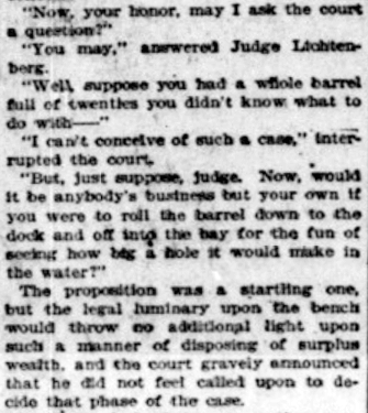
Bessie and C.D. Hillman and family, from a 1910 abstract of title for C.D. Hillman’s Birmingham Water Front Addition to the City of Everett
Born and raised in Seattle, Benjamin Donguk Lukoff had his interest in local history kindled at the age of six, when his father bought him settler granddaughter Sophie Frye Bass’s Pig-Tail Days in Old Seattle at the gift shop of the Museum of History and Industry. He studied English, Russian, and linguistics at the University of Washington, and went on to earn his master’s in English linguistics from University College London. His book of rephotography, Seattle Then and Now, was published in 2010. An updated version came out in 2015.
In History of Seattle from the Earliest Settlement to the Present Time, Clarence Bagley writes that Benton, who was born in Iowa and came to Seattle in 1890 from Montana,
…spent many years with different railroad companies. For a time he was connected with the Great Northern and later he became general passenger and freight agent for the Chicago, Burlington & Quincy Railroad at Seattle. The last few years of his life were spent in connection with the safe and lock trade. He was associated with the Norris Safe & Lock Company… Later Mr. Norris took over the safe and lock company and Mr. Benton the desk department of the business, after which he was joined by Edward Herald in a partnership that was continued under the name of the Benton-Herald Desk & Safe Company until [his death].
Born and raised in Seattle, Benjamin Donguk Lukoff had his interest in local history kindled at the age of six, when his father bought him settler granddaughter Sophie Frye Bass’s Pig-Tail Days in Old Seattle at the gift shop of the Museum of History and Industry. He studied English, Russian, and linguistics at the University of Washington, and went on to earn his master’s in English linguistics from University College London. His book of rephotography, Seattle Then and Now, was published in 2010. An updated version came out in 2015.
SW Teig Place begins at 57th Avenue SW just north of SW Stevens Street and goes around 450 feet northeast to 56th Avenue SW just north of SW Lander Place.
Born and raised in Seattle, Benjamin Donguk Lukoff had his interest in local history kindled at the age of six, when his father bought him settler granddaughter Sophie Frye Bass’s Pig-Tail Days in Old Seattle at the gift shop of the Museum of History and Industry. He studied English, Russian, and linguistics at the University of Washington, and went on to earn his master’s in English linguistics from University College London. His book of rephotography, Seattle Then and Now, was published in 2010. An updated version came out in 2015.
This street, which is part of the unrecorded plat of B.W. Baker’s Rose Lodge Addition, was named after Marguerite Baker (1890–?), eldest daughter of Benjamin Wilton Baker (1860–1934) and Julia Curry Williams (1861–1950). The Bakers were proprietors of Rose Lodge, a summer resort which once stood where the subdivision is now.
The public right-of-way is a footpath that runs just over 300 feet from 63rd Avenue SW in the southeast to 64th Avenue SW in the northwest. Vehicular access to the homes is from a public alley to the north and a private one to the south.
Born and raised in Seattle, Benjamin Donguk Lukoff had his interest in local history kindled at the age of six, when his father bought him settler granddaughter Sophie Frye Bass’s Pig-Tail Days in Old Seattle at the gift shop of the Museum of History and Industry. He studied English, Russian, and linguistics at the University of Washington, and went on to earn his master’s in English linguistics from University College London. His book of rephotography, Seattle Then and Now, was published in 2010. An updated version came out in 2015.
W.T. Campbell was a long-time West Seattle resident living on the hillside above Alki. He was an early advocate for Alki annexation to the City of West Seattle, a real estate developer, early West Seattle school principal, banker, and a member of the Seattle City Council beginning 1924. He would serve as a city councilmember until 1929.
W.T. Campbell, from the October 11, 1933, issue of The Seattle Times
SW Campbell Place begins at SW Lander Street a block west of SW Admiral Way and goes just over 550 feet southwest to 56th Avenue SW at the north edge of Schmitz Park.
Born and raised in Seattle, Benjamin Donguk Lukoff had his interest in local history kindled at the age of six, when his father bought him settler granddaughter Sophie Frye Bass’s Pig-Tail Days in Old Seattle at the gift shop of the Museum of History and Industry. He studied English, Russian, and linguistics at the University of Washington, and went on to earn his master’s in English linguistics from University College London. His book of rephotography, Seattle Then and Now, was published in 2010. An updated version came out in 2015.
Born Giovanni Domenicio Corgiat in Italy, John was a real estate investor who, according to his Seattle Times obituary, was also notable for “establish[ing] the Louvre Restaurant, the first French-Italian eating place in Seattle, in 1888.” (It was destroyed the next year in the Great Seattle Fire.) He was also apparently involved in a number of legal cases relating to the explusion of restaurateur John Cicoria from the Joseph Mazzini Society in 1907: not only the lawsuit demanding Cicoria’s reinstatement in the Italian-American fraternal organization, but one in which the society succeeded in making him pay its legal fees, and three libel suits — one which Cicoria won against Corgiat, and two which Corgiat filed against The Seattle Times and the Message-Vero-Italo-Americano with Cicoria as co-defendant in each. The suit against the Times was dismissed at Corgiat’s request; I haven’t been able to find any more information about the other.
John Corgiat, from his obituary in the Seattle Times, December 10, 1936
Originally Corgiat Street, S Corgiat Drive begins at the railroad tracks just east of Airport Way S and goes 300 feet northeast to just past Ursula Place S, at which point it turns northwest and becomes S Corgiat Drive (not in the original plat). From there, it goes ⅖ of a mile to S Albro Place, just west of Interstate 5.
Born and raised in Seattle, Benjamin Donguk Lukoff had his interest in local history kindled at the age of six, when his father bought him settler granddaughter Sophie Frye Bass’s Pig-Tail Days in Old Seattle at the gift shop of the Museum of History and Industry. He studied English, Russian, and linguistics at the University of Washington, and went on to earn his master’s in English linguistics from University College London. His book of rephotography, Seattle Then and Now, was published in 2010. An updated version came out in 2015.
This street was created in 1900 as part of the plat of the Orchard Hill Addition, filed by Martin Dean, Sarah J. Dean, Elizabeth H. Lewis, William H. Lewis, the W.C. Hill Brick Company, and the First National Bank of Seattle. According to Don Sherwood, it was named for John J. Sturgus, “realtor and agent of [the] W.C. Hill Estate” (Hill had died in 1890).
I do find mentions of a John J. Sturgus, associated with the Hill Company or the Hill Estate, in a number of Polk directories. However, it appears a Dr. John J. Sturgus (1859–1907) was also the brother of Hill’s wife, born Alice Bradley Sturgus (1847–1904).
Article in the (Washington, D.C.) Evening Star, September 9, 1890, on the death of W.C. Hill, mentioning Mrs. Hill’s mother (“Mrs. Sturgus”) and brother (Dr. John J. Sturgus).
Given the unlikelihood of two completely different John J. Sturguses being associated with the Hills, I’m going to assume that the physician and real estate man were one and the same, and that the street was given its name either because Dr. Sturgus was Hill’s brother-in-law or because Sturgus was his wife’s maiden name (or both). If the latter, that puts it in the same category as Perkins Lane W, Thorndyke Avenue W, and Keen Way N.
Today, Sturgus Avenue S begins at S Charles Street, just east of the Jose Rizal Bridge, and goes ½ a mile southeast, then south, to S State Street. The right-of-way continues a block further, to the S Grand Street right-of-way, but houses with addresses on that block are accessed by a private alley north of 16th Avenue S.
Born and raised in Seattle, Benjamin Donguk Lukoff had his interest in local history kindled at the age of six, when his father bought him settler granddaughter Sophie Frye Bass’s Pig-Tail Days in Old Seattle at the gift shop of the Museum of History and Industry. He studied English, Russian, and linguistics at the University of Washington, and went on to earn his master’s in English linguistics from University College London. His book of rephotography, Seattle Then and Now, was published in 2010. An updated version came out in 2015.
Two real estate firms, F.W. Keen Company and J.L. Grandey, Inc., organized most of the racial restrictive covenants for Queen Anne from 1928 to 1931… specifying that “No person or persons of Asiatic, African or Negro blood, lineage, or extraction shall be permitted to occupy a portion of said property, or any building thereon; except domestic servants may actually and in good faith be employed by white occupants of such premises.”
In addition to being president of F.W. Keen, George Morford was vice president of J.L. Grandey.
Which Keen was honored by Keen Way N — Gertrude Alice Keen Morford, Frederick Walter Keen, or the F.W. Keen Company — isn’t clear; if it was for George Morford’s wife, that would put Keen Way in the same category as Perkins Lane W and Thorndyke Avenue W.
Keen Way N begins at Aurora Avenue N between W Green Lake Drive N and Winona Avenue N and goes ⅕ of a mile northeast to N 76th Street.
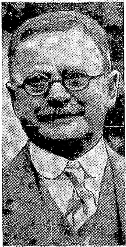
Frederick Walter Keen, from his Seattle Times obituary, August 14, 1929. I was unable to locate a photograph of his daughter, Gertrude.
Born and raised in Seattle, Benjamin Donguk Lukoff had his interest in local history kindled at the age of six, when his father bought him settler granddaughter Sophie Frye Bass’s Pig-Tail Days in Old Seattle at the gift shop of the Museum of History and Industry. He studied English, Russian, and linguistics at the University of Washington, and went on to earn his master’s in English linguistics from University College London. His book of rephotography, Seattle Then and Now, was published in 2010. An updated version came out in 2015.


.jpg)