W Laurelhurst Drive NE

W Laurelhurst Drive NE and E Laurelhurst Drive NE were originally Olympic View Drive and Cascade View Drive, respectively, in the 1906 plat of Laurelhurst, an Addition to the City of Seattle. I am unable to tell exactly when the change was made: I first find “Laurelhurst Drive” being referred to in The Seattle Times in 1920, though a Kroll map from the same year shows the streets as 45th Avenue NE and 47th Avenue NE, respectively.

Laurelhurst itself was annexed to Seattle in 1910 (which makes me wonder why the plat was labelled as an addition to the city four years earlier). “Laurel” must refer to the tree, and “hurst” is an archaic word meaning “wooded hill.” However, as the English Language & Usage Stack Exchange thread that gives that definition notes, “in street names, [hurst is] likely to be a modern invention,” being part of “a name made up from old roots to imbue a sense of history and rootedness” (or, in cases like these, Britishness and stateliness). (I had thought that “Laurel” might refer to a girl or woman [cf. Loyal Avenue NW], but neither of the developers — Joseph Rogers McLaughlin [1851–1923] and Robert F. Booth [1875–1918] — appear to have had a relative by that name.)

(As an aside, the Wikipedia article on the Laurelhurst neighborhood in Portland, Oregon, citing Eugene E. Snyder’s 1979 Portland Names and Neighborhoods, says that “the name Laurelhurst was borrowed from a residential development in Seattle that Laurelhurst Company general manager Paul Murphy had recently completed. The name combined a reference to the laurel shrubbery near the Seattle development with the Old English hurst, denoting a wooded hill.” However, I have my doubts that there were actually enough laurels nearby to warrant the naming [in contrast to Magnolia, which was {mis}named for the plentiful madronas that lined the bluff].)

W Laurelhurst Drive NE begins at 43rd Avenue NE just south of NE 38th Street and goes ½ a mile southeast to just east of Webster Point Road NE, where it becomes E Laurelhurst Dr NE. From there, it goes nearly ⅖ of a mile northeast to a dead end just past 47th Avenue NE.

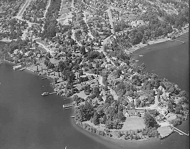
Aerial view of Laurelhurst from the south, 1938
Aerial view of Laurelhurst from the south, 1938. Webster Point dominates the view; W Laurelhurst Drive NE becomes E Laurelhurst Drive NE in front of the house that prominently appears at the southern end of the point. Photograph from the Seattle Post-Intelligencer Collection, Museum of History and Industry, licensed under Creative Commons Attribution 2.0 Generic
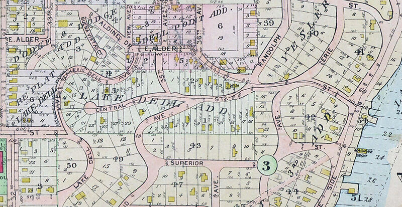
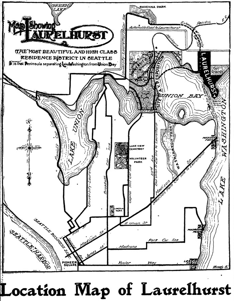
Map of Laurelhurst, Seattle Post-Intelligencer, October 21, 1906
Part of an advertisement for the new Laurelhurst subdivision, Seattle Post-Intelligencer, October 21, 1906. Laurelhurst is called “the most beautiful and high-class residence district in Seattle… that peninsula separating Lake Washington from Union Bay.” Prospective buyers were directed to take the Madison Street Cable Railway to its terminus at Madison Park, from which they could take a 5-minute ride on a steamer to Laurelhurst.

S Atlantic Street

As part of the Great Renaming of 1895, Texas Street, Town Street, Fontenelle Street, Flemming Street, Davidson Street, and Canal Street became Atlantic Street, from Elliott Bay to Lake Washington. The name was extended into West Seattle in 1907, when Grant Street and Louisiana Street were combined.

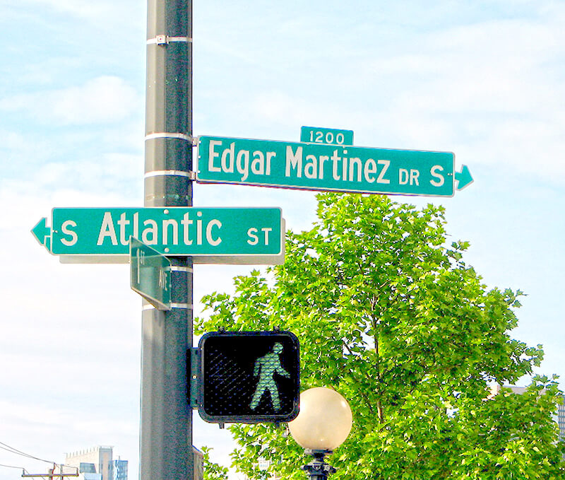
Street sign at 1st Avenue S (incorrectly signed as 1st Avenue), where S Atlantic Street becomes Edgar Martinez Drive S, May 2006
Street sign at 1st Avenue S (incorrectly signed as 1st Avenue), where S Atlantic Street becomes Edgar Martinez Drive S, May 2006. Photograph by Flickr user Dave O, licensed under Creative Commons Attribution-ShareAlike 2.0 Generic

Today, SW Atlantic Street begins in West Seattle at Sunset Avenue SW and goes ¼ of a mile east to Palm Avenue SW. It next appears, as S Atlantic Street, just east of U.S. Coast Guard Base Seattle at Alaskan Way S, and goes around 800 feet east to 1st Avenue S, where it becomes Edgar Martinez Drive S (renamed in honor of the ball player in 2004). Apart from a stub east of Airport Way S that is soon blocked by Interstate 5, the street’s next appearance is on Beacon Hill, where it goes ⅓ of a mile from just west of 11th Avenue S to 17th Avenue S, the portion between 15th Avenue S and 16th Avenue S being a stairway.

After being interrupted for a number of blocks by Interstate 90, S Atlantic Street reappears at 21st Avenue S and goes a block to just east of 22nd Avenue S. (Here, it gives its name to the surrounding Atlantic neighborhood.) It resumes — again having been interrupted by Interstate 90’s Mount Baker Tunnel — at Bradner Place S and goes ⅓ of a mile east to Lake Washington Boulevard S, the portions between 30th Avenue S and 31st Avenue South as well as between 32nd Avenue S and 33rd Avenue S being stairways. The right-of-way begins again at 35th Avenue S and goes around ⅛ of a mile east to Lake Washington, but is either incorporated into adjacent homeowners’ yards or serves as their driveways for most of this distance. Between Lakeside Avenue S and the water, it is one of the city’s shoreline street ends.

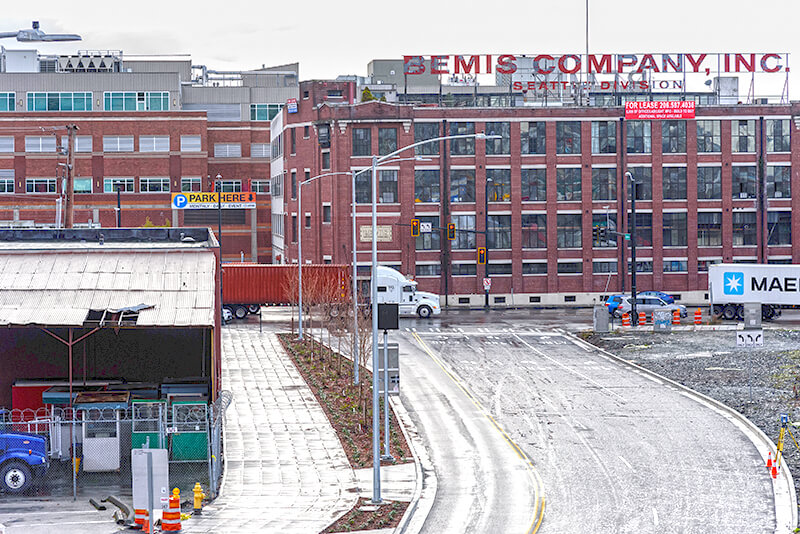
Looking south toward the intersection of Colorado Avenue S and S Atlantic Street, December 2018. The Bemis Building, at 55 S Atlantic Street, housed the local operations of the Bemis Brothers Bag Company from 1905 to 1993.
Looking south toward the intersection of Colorado Avenue S and S Atlantic Street, December 2018. The Bemis Building, at 55 S Atlantic Street, housed the local operations of the Bemis Brothers Bag Company from 1905 to 1993. Renovation began in 1995 and today it houses live/work spaces for artists. Photograph by Flickr user Washington State Department of Transportation, licensed under Creative Commons Attribution-NonCommercial-NoDerivs 2.0 Generic.

S Massachusetts Street

This is another of the many streets created in 1895 as part of the Seattle Tide Lands plat that were named after states, e.g., Utah Avenue SColorado Avenue SS Oregon StreetS Idaho Street, and SW Florida Street.

SW Massachusetts Street begins in West Seattle at the intersection of Bonair Drive SW, 47th Avenue SW, and Sunset Avenue SW, and goes just under ⅓ of a mile east to Palm Avenue SW. It begins again at Ferry Avenue SW and goes just over 450 feet east to Victoria Avenue SW. There is a short segment (just over 400 feet) on Harbor Island east of 13th Avenue SW, and then another one, about the same length, leading from Alaskan Way S to the entrance to U.S. Coast Guard Base Seattle. (Here, the street’s directional designation has changed to S, it being east of the Duwamish Waterway.)

S Massachusetts Street resumes at Colorado Avenue S and goes ⅙ of a mile east to Occidental Avenue S. There is a block-long segment east of 4th Avenue S to just shy of the SODO Busway, and then a longer one — about ¼ of a mile — from the SODO Trail to Airport Avenue S.

East of Interstate 5, on Beacon Hill, S Massachusetts Street begins at 11th Avenue S and goes nearly ¼ of a mile east to just past 15th Avenue S, the portion between 14th Avenue S and 15th Avenue S being pedestrian-only, as the right-of-way between the sidewalks has been turned into the Beacon Bluff P-Patch community garden. It begins again just west of Sturgus Avenue S and goes nearly a mile east to just past 31st Avenue S, the portion that runs for half a block west of 17th Avenue S being a pathway. S Massachusetts Street resumes for the last time at 32nd Avenue S and goes ¼ mile east to Lake Washington, where it is a shoreline street end.

https://www.flickr.com/photos/litlnemo/1354627272
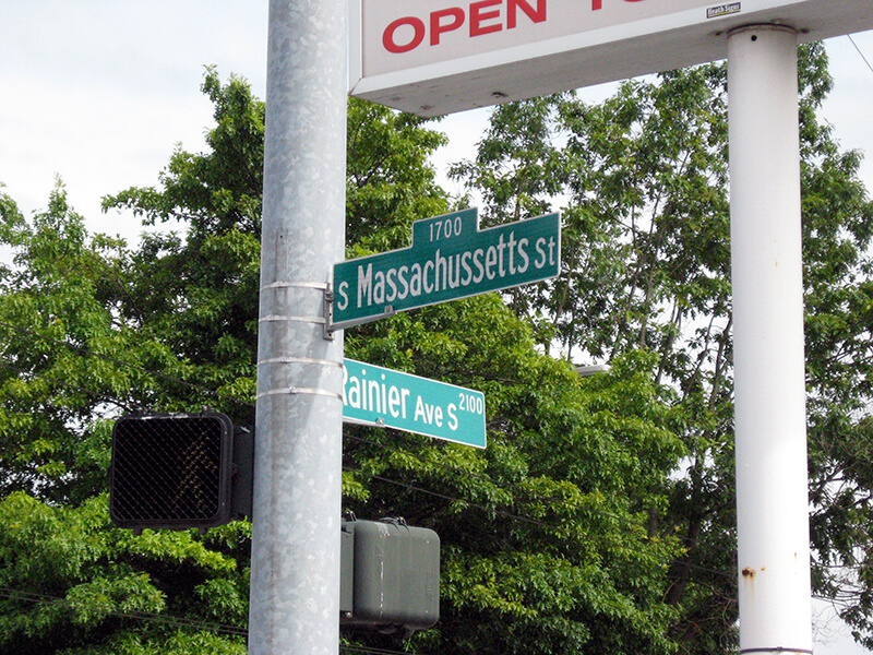
Misspelled street sign at the corner of Rainier Avenue S and S Massachusetts Street, July 2007. Photograph by Flickr user litlnemo (Wendi Dunlap), licensed under Creative Commons Attribution-NonCommercial-ShareAlike 2.0 Generic.

Rob Ketcherside’s Seattle street renaming tables

Before I wrote S Nevada Street, I assumed it was going to be one of the streets created in the 1895 Seattle Tide Lands plat that were named after states, such as Utah Avenue S, Colorado Avenue S, S Oregon Street, S Idaho Street, and SW Florida Street. As it turns out, no — it was originally Rainier Street, and it was renamed in the wake of the 1905 annexation of the town of South Seattle. I found this out by searching the archives of the Seattle Post-Intelligencer; unlike a number of other renaming ordinances, most notably the “Great Renaming” ordinance of 1895, the full text of Ordinance 13271 does not appear in the city database.

It also did not (yet!) appear in my friend Rob Ketcherside’s searchable databases of Seattle street name changes. My article prompted him to do so, however, and last week he published Renaming Seattle in 1906, which “covers neighborhoods across the city, including Ravenna, Queen Anne, Magnolia, Montlake, Capitol Hill, Eastlake, Portage Bay, Madison Valley, Denny-Blaine, Madrona, Leschi, Georgetown, Beacon Hill, and Sodo.” His other such posts include:

They are an indispensable resource for anyone working on Seattle history.

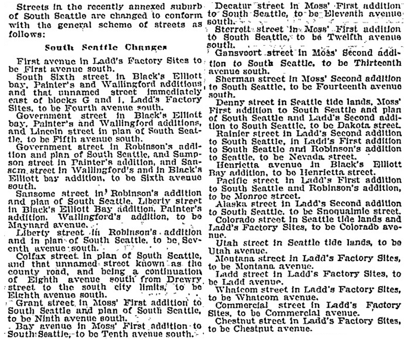
Article on South Seattle street name changes in January 14, 1906, issue of the Seattle Post-Intelligencer
Article on South Seattle street name changes in January 14, 1906, issue of the Seattle Post-Intelligencer. Note the changing of Decatur Street, Sterrett Street (sic), and Gansvoort Street to 11th Avenue S, 12th Avenue S, and 13th Avenue S, respectively. Sterret and Gansvoort Streets were mentioned by Sophie Frye Bass (as Sterrett and Gansevoort) in the “Forgotten Streets” chapter in her Pig-Tail Days in Old Seattle: “Today not even obscure streets bear their names.” The Decatur name was later applied to Decatur Place S, which Bass described in 1937 as “a straggling ungraded hillside street,” hardly a fitting tribute to “the ship that saved Seattle.” She is referring to the 1856 Battle of Seattle, in which a group of Native Americans attacked the small settlement in what is today Pioneer Square. Decatur honored the USS Decatur, which took part in the fighting; Sterret, the ship’s captain, Isaac L. Sterret (who may have later joined the Confederate Navy); and Gansvoort, its commander that day, Guert Gansevoort.

Mountain Drive W

This Magnolia street, created in 1915 as part of the plat of Carleton Park, was originally known as Mt. Olympus Drive. Because not all Seattle ordinances have been scanned, I am unable to tell when the change was made (and am unsure why it was made, as the old name doesn’t appear to conflict with anything).

The Seattle Times wrote of Carleton Park that the “entire district commands an unobstructible view of the Cascade and Olympic Mountains” ― being on the west side of the hill, the view here is of the Olympics, of which Mt. Olympus is the most prominent.

Mountain Drive W begins at Westmont Way W and Altavista Place W and goes ⅕ of a mile to Westmont Way W just east of W Viewmont Way W.

S Oregon Street

This street received its name in 1907, uniting streets formerly known as Nebraska Street, 8th Street, Bedford Street, Conover Street, and G Street. (There had been an Oregon Street in the 1895 Seattle Tide Lands plat in which Nebraska Street was created, but it became Spokane Street and Chelan Avenue in the same 1907 change.)

S Oregon Street begins in West Seattle as SW Oregon Street at the Emma Schmitz Memorial Overlook on Beach Drive SW and goes two blocks east to Me-Kwa-Mooks Park at 56th Avenue SW. It briefly resumes at 52nd Avenue SW and goes two blocks east to 51st Avenue SW, then begins again in earnest at 50th Avenue SW, going nearly a mile east to the West Seattle Stadium at 35th Avenue SW, part of the stretch between there and Fauntleroy Way SW being footpath and stairway. East of the West Seattle Golf Course, it goes around 175 feet to 26th Avenue SW and the Delridge Playfield, and on the other side of the playfield serves as a short connector between Delridge Way SW and 23rd Avenue SW.

S Oregon Street resumes east of the Duwamish Waterway at a shoreline street end and goes ¼ mile east to E Marginal Way S. It then serves as short connectors between Diagonal Avenue S and Denver Avenue S and between 7th Avenue S and Airport Way S.

East of Interstate 5, on Beacon Hill, S Oregon Street begins again at 10th Avenue S and goes ⅓ of a mile east to 15th Avenue S and S Columbian Way. It picks up again in the Rainier Valley at S Columbian Way and Martin Luther King Jr. Way S and goes ⅔ of a mile east to Genesee Park at 42nd Avenue S. East of the park, it resumes at 47th Avenue S and goes ¼ mile east to its end at 52nd Avenue S above the Lakewood Marina on Lake Washington.

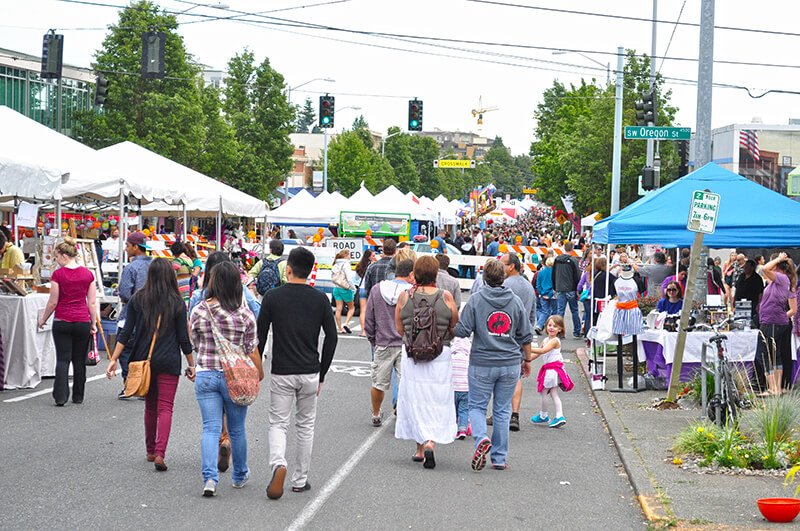
West Seattle Summer Fest at SW Oregon Street, July 2013
Looking south on California Avenue SW toward SW Oregon Street during West Seattle Summer Fest, July 2013. Photograph by Joe Mabel, Wikimedia Commons, licensed under Creative Commons Attribution-ShareAlike 2.0 Generic

S Nevada Street

This street — originally Rainier Street in the Industrial District — received its current name in 1906, a few months after the town of South Seattle was annexed by Seattle in October 1905.

Article on South Seattle street name changes in January 14, 1906, issue of the Seattle Post-Intelligencer
Article listing South Seattle street name changes in January 14, 1906, issue of the Seattle Post-Intelligencer

SW Nevada Street begins in West Seattle at 30th Avenue SW and goes ¼ mile east to 26th Avenue SW. It next appears east of the Duwamish Waterway in the Industrial District, as a ¼-mile-long service road off E Marginal Way S and a 300-foot-long dead-end road off 6th Avenue S. East of Interstate 5 on Beacon Hill, it goes ¼ mile east from 11th Avenue S to 16th Avenue S at Jefferson Park. It resumes for the last time in Rainier Valley at 28th Avenue S and S Adams Street and goes ¼ mile east to 31st Avenue S.

S Idaho Street

This is one of the many streets created as part of the 1895 Seattle Tide Lands plat that were named after U.S. states, including S Dakota Street, Utah Avenue S, and Colorado Avenue S. If I am correct, though, it is by far the shortest, as S Idaho Street begins just east of the Duwamish Waterway and goes just ¼ mile east to E Marginal Way S.

S Dakota Street

This street was created in 1895 as part of the Seattle Tide Lands plat. As I wrote in S Spokane Street,

Streets in this plat that were not extensions of already existing ones, such as Commercial Street, were named after letters of the alphabet, American cities, American states, prominent local politicians, and places in Washington.… the states appear neither in alphabetical nor geographic order.

In this case, of course, the street was named for the Dakotas, not for South Dakota.

SW Dakota Street begins at 56th Avenue SW and goes 1⅓ miles east to 34th Avenue SW. It resumes at 30th Avenue SW and goes a further ⅓ of a mile east to Delridge Way SW, the portion between 28th Avenue SW and 26th Avenue SW being footpaths through the Longfellow Creek Natural Area park. SW Dakota Street begins again just west of 21st Avenue SW and goes just over 750 feet east to 19th Avenue SW, and there is one final segment west of the Duwamish Waterway between 16th Avenue SW and W Marginal Way SW.

East of the Duwamish, S Dakota Street runs for a block between 1st Avenue S and 2nd Avenue S, then picks up again at 6th Avenue S and goes ¼ mile east to 9th Avenue S. East of Interstate 5 on Beacon Hill, S Dakota Street resumes at 12th Avenue S and goes another ¼ mile east to Jefferson Park at 16th Avenue S. It begins again in the Rainier Valley at 29th Avenue S and goes ⅓ of a mile east to 34th Avenue S, picking up again at Rainier Avenue S and going ⅖ of a mile east to Genesee Park at 43rd Avenue S. On the other side of the park, it resumes at 46th Avenue S and goes ⅓ of a mile east to its end at 51st Avenue S, overlooking Lake Washington.

Chelan Avenue SW

This street was created in 1895 as part of the plat of Seattle’s tide lands, which featured streets named for letters of the alphabet, American cities, American states, prominent local politicians, and places in Washington. Among the latter were S Spokane Street, Duwamish Avenue S, Klickitat Avenue SW, and our current subject, Chelan Avenue SW. It appears to have been named for Lake Chelan (an anglicization of ščəl̕ámxəxʷ, meaning ‘deep water’ in Nxaʔamxcín, the language spoken by the Chelan people) — the largest natural lake in Washington and the third deepest lake in the United States (after Crater and Tahoe).

Chelan Avenue SW begins at SW Spokane Street and goes ¼ mile northwest to the West Duwamish Waterway.

SW Florida Street

This street was created in 1895 as part of the Seattle Tide Lands plat along with S Spokane Street, Colorado Avenue S, Utah Avenue S, Duwamish Avenue S, Klickitat Avenue SW, and others. As I wrote in S Spokane Street,

Streets in this plat that were not extensions of already existing ones, such as Commercial Street, were named after letters of the alphabet, American cities, American states, prominent local politicians, and places in Washington.… the states appear neither in alphabetical nor geographic order.

SW Florida Street begins on Harbor Island at 11th Avenue SW and goes ¼ mile southwest to 16th Avenue SW. The right-of-way continues for another ⅖ of a mile through Terminal 5 in West Seattle, though only a small portion (beginning at Harbor Avenue SW and going about 700 feet northeast) corresponds with an actual roadway.

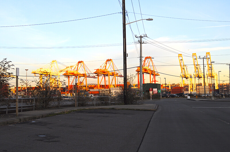
Cranes at the east end of SW Florida Street, Harbor Island, Seattle, Washington, USA, December 17, 2011
Harbor Island cranes at the east end of SW Florida Street, December 2011. Photograph by Joe Mabel, Wikimedia Commons, licensed under Creative Commons Attribution-ShareAlike 3.0 Unported

Klickitat Avenue SW

Like S Spokane Street, Colorado Avenue S, and Utah Avenue S, this street was created in 1895 as part of the plat of Seattle’s tide lands. As I wrote in S Spokane Street,

Streets in this plat that were not extensions of already existing ones, such as Commercial Street, were named after letters of the alphabet, American cities, American states, prominent local politicians, and places in Washington.

Those places in Washington were Chelan, Duwamish, Kitsap, Klickitat, Queets, Quilcene, Quileute, Quinault, Spokane, Vashon, Wenatchee, and Whatcom, many (though not all) of which were themselves named after Native American groups or people. (Chelan, Duwamish, Klickitat, and Spokane are the only street names that remain.) In this particular case, we have the Klickitat River, a tributary of the Columbia in south central Washington, itself named for the Klickitat people.

Klickitat Avenue SW begins at 16th Avenue SW and goes around ⅖ of a mile southeast to SW Manning Street, all on Harbor Island.

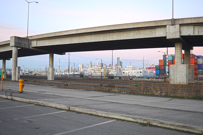
Seattle skyline from Klickitat Avenue
Looking northeast toward the Seattle skyline from Harbor Island, December 2011. The Klickitat Avenue Bridge is in the foreground. Photograph by Joe Mabel, Wikimedia Commons, licensed under Creative Commons Attribution-ShareAlike 3.0 Unported

Ohio Avenue S

This street was created in 1918 as part of the Industrial Addition to the City of Seattle. Named for the Buckeye State, it appears to have been so named simply for its proximity to Colorado Avenue S and Utah Avenue S, as it was a state whose name had not yet been applied to a street. (N.H. Latimer and John H. Powell of the Wauconda Investment Company might have chosen Illinois, instead, both having been born there and having named their company after an Illinois town ― but the name had already been assigned in the same 1895 plat of the Seattle Tide Lands that created Colorado and Utah Avenues.)

Ohio Avenue S begins at Diagonal Avenue S and goes nearly ½ a mile south to E Marginal Way S and S Dawson Street. It resumes ⅛ of a mile south of there at E Marginal Way S and S Brandon Street and goes a further ⅓ of a mile south to S Fidalgo Street.

Madrona Drive

This street was created in 1915 by renaming portions of Hugo Place, Grand Avenue, and E Denny Way. It was named after the Madrona neighborhood, itself named after Madrona Park, which in turn was named for the madrona or Pacific madrone tree (Arbutus menziesii). According to Seattle parks historian Don Sherwood, this was not because of the tree’s prevalence in the area — if they are characteristic of any Seattle neighborhood, it would be Magnolia. Rather,

J.E. Ayer, one of the “contributors” [of land for the park], suggested “Madrona,” based upon the presence of a few trees in the community — but scarcely more than a “few little (madrona) sprouts” in the park area. However, the name caught on and soon became the district name as well.

Madrona Drive begins at the intersection of E Denny Way, 38th Avenue, and Madrona Place E, and goes nearly ½ a mile southeast to Lake Washington Boulevard just north of Madrona Park.

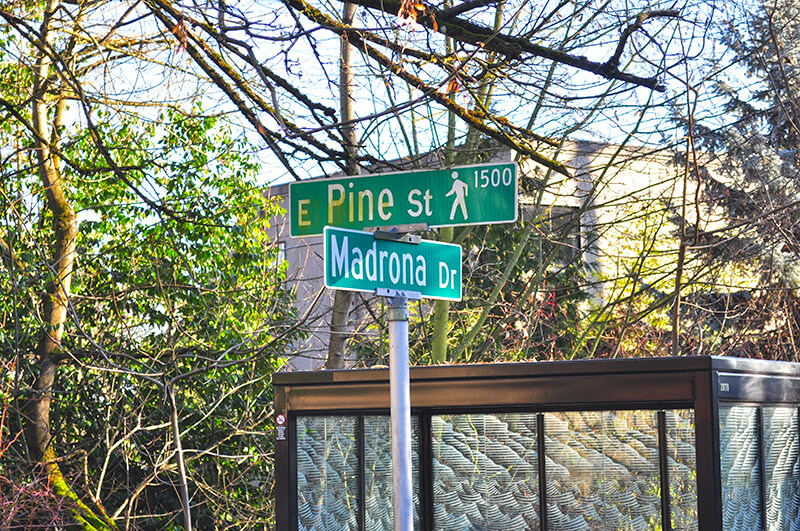
Street sign at corner of Madrona Drive and E Pike Street
Sign at corner of Madrona Drive and E Pine Street pedestrian bridge, January 2014. Photograph by Joe Mabel, Wikimedia Commons, licensed under Creative Commons Attribution-ShareAlike 3.0 Unported

Aloha Street

I haven’t posted in two weeks because I recently had the good fortune to visit, and the sad duty to return from, Maui, “the Valley Isle,” second largest of the Hawaiian Islands. That made me think, as I posted about S Spokane Street after traveling there last December, it would be appropriate to post about Aloha Street today.

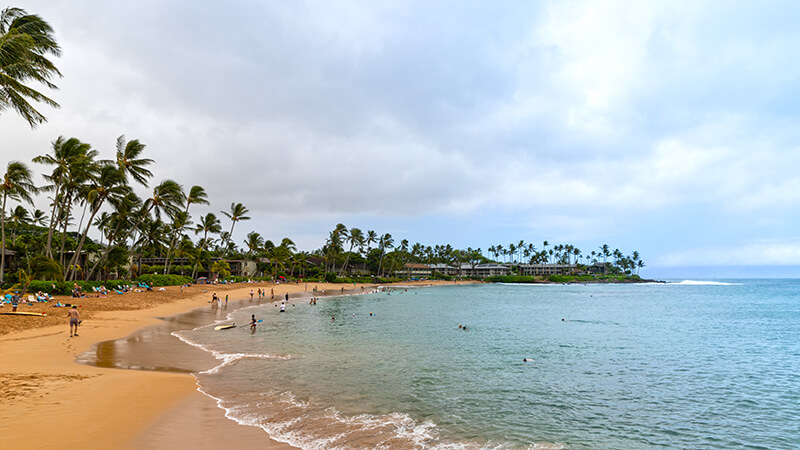
Napili Bay, Maui, Hawaii
One of my favorite places on Maui is the Napili Kai Beach Resort, located in Napili-Honokowai, on Napili Bay. Photograph taken August 2018 by Flickr user dronepicr, licensed under Creative Commons Attribution 2.0 Generic.
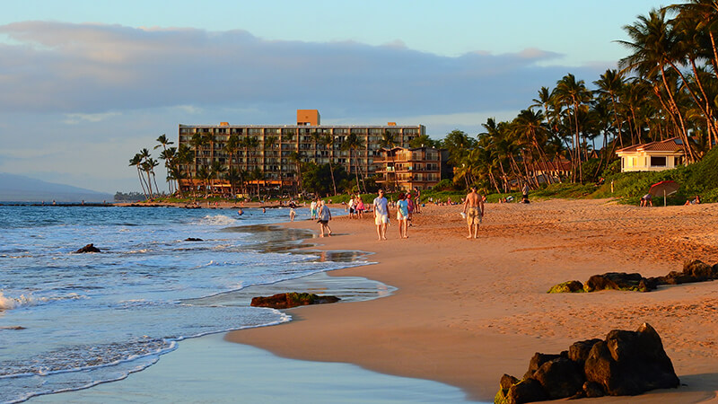
Keawakapu Beach, Maui, Hawaii
A new favorite from this most recent trip to Maui is Keawakapu Beach in south Kihei. Photograph taken January 2018 by Flickr user Jim Mullhaupt, licensed under Creative Commons Attribution-NonCommercial-NoDerivs 2.0 Generic.

Four and a half years ago, local historian Valarie Bunn wrote a post on her Wedgwood in Seattle History blog called “Searching for the Origin of Seattle Street Names.” It begins “There is no resource list of the meanings of Seattle’s street names or how the street names were derived,” and that was certainly true at the time. (One reason I started Writes of Way the next year was to eventually provide such a list — and now I rate a mention at the end of her article!) She continues:

Some street names are apparent in their derivation when honoring an early settler, such as Denny Way for the original homestead claim property of David Denny (Arthur’s younger brother) and Mercer Street for Thomas Mercer, an early, influential settler of Seattle. But for some other street names, such as Aloha Street, we may feel bewildered as we wonder, what is “Aloha” for?

She goes on to give a tutorial in trying to determine street name origins. She first notes that the street name was extended beyond Lower Queen Anne as part of the Great Renaming of 1895, and that its first appearance was as part of the 1875 plat of D.T. Denny’s Second Addition to North Seattle (as this part of South Lake Union then was). David Thomas Denny (1832–1903) and Louisa Boren Denny (1827–1916) were members of the Denny Party, who landed at Alki Point in 1851 and are considered the founders of modern Seattle. Here, though, the trail ends, as

The Dennys’ plat map of 1875 does not tell us why David and Louisa Denny chose the street names that they did, including “Aloha.”

But, she continues,

From earliest days, the Dennys knew that lumber was being shipped out from Seattle to San Francisco and as far as Hawaii, so our best guess is that they chose the word “Aloha” as a reference to Seattle’s trade connections.

Not as definitive an answer as the one she goes on to give for Cleopatra Place NW, but a pretty good one nevertheless, and one I can’t improve upon.

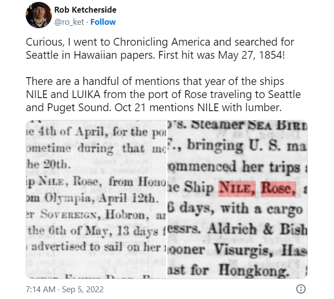
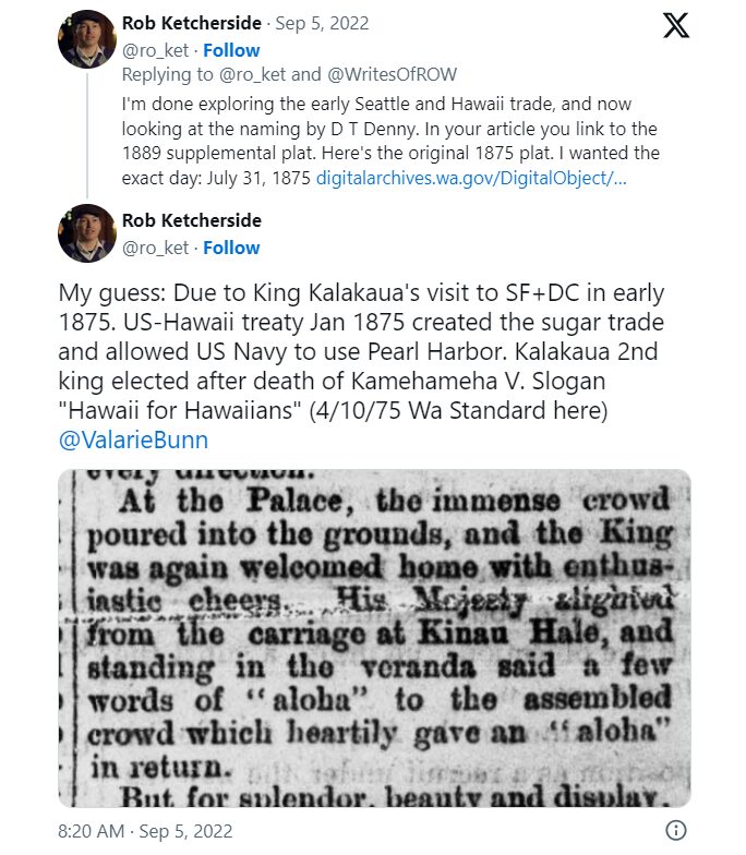
Note: On September 5, my friend, local historian Rob Ketcherside, did a bit of a dive into the matter. He began thus —

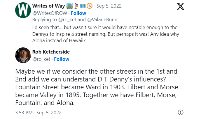
— and came to this conclusion:

I had come across the Reciprocity Treaty when trying to find any connection between Seattle and Hawaii in 1875, but

So there, for now, the matter lies.

Note added August 13, 2023: The devastating Lāhainā wildfire made me want to re-read this article, and I realized I neglected to discuss the route Aloha Street takes through Seattle. It begins at 1st Avenue W as W Aloha Street, and becomes Aloha Street a block to the east as it crosses Queen Anne Avenue N. From there, it goes ¾ of a mile east to Westlake Avenue N, where it is interrupted by Lake Union. It resumes at Fairview Avenue N and goes ⅙ of a mile east through the Fred Hutch Cancer Center campus to Eastlake Avenue E. On the other side of Interstate 5, it picks up again at Boylston Avenue E and goes an uninterrupted 1⅓ miles east to its end at the intersection of 29th Avenue E and E Ward Street at the west end of the Washington Park Playfield.

E Crescent Drive

This street, created in 1905 as part of the plat of Interlaken, is so named because of its shape. Beginning at the intersection of Interlaken Drive E, 19th Avenue E, and E Galer Street, it goes nearly ⅓ of a mile northeast, then east, then southeast, to the intersection of 24th Avenue E and E Galer Street.

Piedmont Place W

Created in 1915 as part of the plat of Carleton Park, this street shares the mont element with a number of other streets in the subdivision, e.g., Viewmont Way W, Crestmont Place W, Eastmont Way W, and Westmont Way W. This because, as The Seattle Times wrote, the “entire district commands an unobstructible view of the Cascade and Olympic Mountains.” I tend to think the element was overused in the neighborhood and would have liked more of its streets to be named after the actual mountains, e.g., Ellinor Drive W and Constance Drive W. But I do have to hand it to whoever came up with these names for their creativity in naming Piedmont Place W — not, I am sure, directly after the region in Italy or that in the United States, but rather because it lies at the eastern foot — pied in French — of the western Magnolia hill as it slopes down to Pleasant Valley.

Piedmont Place W begins at W McGraw Street between 36th Avenue W and 35th Avenue W and goes ¼ mile north to W Raye Street.

Topographic map of part of Carleton Park, from The National Map

Crestmont Place W

This street was created in 1915 as part of the plat of Carleton Park. The Seattle Times wrote of the Magnolia subdivision that the “entire district commands an unobstructible view of the Cascade and Olympic Mountains” — hence the mont portion of its name. Why crest? Because, as you can see on the topographical map below, Crestmont Place W is located at the crest of Carleton Park. (The highest point in all Magnolia, however, is located a number of blocks to the north, close to 40th Avenue W and W Barrett Lane.)

Crestmont Place W begins at Westmont Way W north of Altavista Place W and goes ¼ northeast, then northwest, to W Raye Street, where it becomes 40th Avenue W.

Topographic map of part of Carleton Park, from The National Map

Eastmont Way W

Like its twin, Westmont Way W, this street was created in 1915 as part of the plat of Carleton Park, which “afford[ed] a scenic frontage for every building lot in the addition,” according to The Seattle Times. Just as Westmont faces the Olympic Mountains to the west and southwest, Eastmont faces the Cascades to the southeast.

Beginning at Eastmont Place, a pocket park at the south end of Westmont Way W, it goes around 850 feet northeast to W McGraw Street, where it becomes 36th Avenue W.

Westmont Way W

In Viewmont Way W, I discuss the 1915 plat of Carleton Park, in which, as The Seattle Times reported,

The streets and boulevards curve and swing about the bases of elevated portions, escaping the deep cuts and heavy fills that would be necessary in conforming to the strict, rectangular plans of the old plat, and affording a scenic frontage for every building lot in the addition.

Many streets in the subdivision were named in reference to these views, Westmont Way W among them. Beginning at Eastmont Place, a pocket park at the south end of Eastmont Way W, it goes ⅖ of a mile north, then northwest, to W Viewmont Way W, providing westerly and southwesterly views of the Olympic Mountains for its entire length.