Like its neighbors S Hudson Street and S Americus Street, S Ferdinand Street was created in 1891 as part of the plat of Columbia. (The town incorporated in 1893 and was annexed to Seattle in 1907, becoming the neighborhood of Columbia City.) Along with Columbus Street, which no longer exists, they were part a of series of streets named after explorers — in this case, Ferdinand Magellan (born Fernão de Magalhães, also known as Fernando de Magallanes) (1480–1521), the first explorer to sail from Europe to Asia via the Atlantic and Pacific Oceans.
S Ferdinand Street begins at Lake Washington Boulevard S and goes a block west to just past 55th Avenue S. It is a stairway between 54th Avenue S and 53rd Avenue S, then begins again at 52nd Avenue S. After a half block as roadway and another half block as stairway, it begins in earnest at 51st Avenue S by Lakewood Park and goes just over a mile west to 31st Avenue S. It is another stairway for the next block, and then a stub off 30th Avenue S.
On Beacon Hill, S Ferdinand Street begins again at 28th Avenue S and goes ½ a mile west to 20th Avenue S, then resumes at 19th Avenue S and goes a further ⅖ to 13th Avenue S. It finishes up as a short connector from 12th Avenue S to Corson Avenue S by Maple Wood Playfield.
This street was created in 1930 as part of the ordinance establishing Aurora Avenue N and its approaches. Originally Wallingford Way, as it led from the north end of the Aurora Bridge to Stone Way N just south of N 40th Street, it was changed to Bridge Way in 1960. (A counterpart, Fremont Way, was also created, leading from the north end of the bridge to Fremont Avenue N at N 39th Street.)
Looking southwest down Bridge Way N from Stone Way N, January 1961. Courtesy of the Seattle Municipal Archives, Identifier 66205
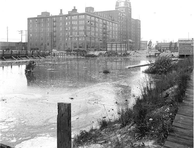
This street was created in 1891 as part of the plat of Columbia, which incorporated in 1893 and was annexed to Seattle in 1907, becoming the neighborhood of Columbia City. Part of a series of streets named after explorers — (Christopher) Columbus Street (subsequently changed to Edmunds Street), Ferdinand (Magellan) Street, and Americus (Vespucci) Street — it was named for English explorer Henry Hudson (c. 1565–disappeared 1611), namesake of Hudson Bay in Canada and the Hudson River in New York and New Jersey.
After a false start as a dead-end road west of 57th Avenue S, S Hudson Street begins at 53rd Avenue S and goes ⅓ of a mile west to 47th Avenue S, becoming a stairway between 50th Avenue S and 49th Avenue S. It resumes at 46th Avenue S and goes ¾ of a mile west to Martin Luther King Jr. Way S. After another couple of short segments, it begins again at 28th Avenue S and goes ¼ mile west to 24th Avenue S. There are two more short segments on Beacon Hill, and then Hudson Street resumes in Georgetown, going ⅖ of a mile from 4th Avenue S to E Marginal Way S.
In West Seattle, SW Hudson Street begins as a service road and footpath within Puget Park off 18th Avenue SW. Its first appearance as a residential street is at Puget Boulevard SW, where it goes ⅕ of a mile to the West Seattle Golf Course. It then picks up again at 35th Avenue SW, where it goes just over a mile to SW Jacobsen Road, becoming a stairway three separate times along the way.
This street was created in 1891 as part of the plat of Columbia, which incorporated in 1893 and was annexed to Seattle in 1907, becoming the neighborhood of Columbia City. It was part of a series of streets named after explorers. Columbus Street, named for Christopher Columbus, is no more, but Ferdinand Street (Ferdinand Magellan), Hudson Street (Henry Hudson), and Americus Street (named for Amerigo Vespucci [1451–1512]) still exist. (Vespucci, of course, is the namesake of the Americas).
S Americus Street exists in two short segments: the Columbia City one begins at 42nd Avenue S and goes a block west to 39th Avenue S, and the Beacon Hill one begins at 26th Avenue S and goes a block west to S Columbian Way.
As Seattle expanded to the south, it became obvious that Commercial Street (1st Avenue S) would not be the westernmost street east of Elliott Bay. Fortunately, instead of using zero or negative numbers, they went with states: the first street west of 1st was named Utah, and the next, Colorado. (Some perpendicular streets were named Alaska, Vermont, Connecticut, Texas, Massachusetts, etc. There doesn’t appear to have been any particular order.)
Utah Avenue S begins at S Atlantic Street and goes 1⅐ miles south to S Hinds Street, the block between S Stacy Street and S Lander Street, in front of the Starbucks Center, being closed to motorized traffic. There is another short segment between Denver Avenue S and S Alaska Street, and a final one that stretches ⅓ of a mile from S Hudson Street to S Findlay Street.
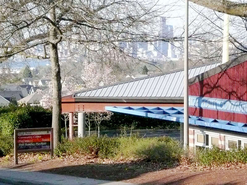
This street was named after High Point, originally developed by the Seattle Housing Authority in 1942 as defense housing and redeveloped in 2004 (see SW Bataan Street and Lanham Place SW for more history). I appear not to have mentioned in either of those posts why the development was so named — as one might guess, the city’s highest point (520 feet) is there, at the corner of 35th Avenue SW and SW Myrtle Street.
High Point Drive SW begins at 30th Avenue SW and SW Juneau Street and goes nearly ⅔ of a mile south to Sylvan Way SW and SW Holly Street.
This street in the Washington Park Arboretum was, like E Foster Island Road, originally unnamed. It received its current name in June 1957. The Arboretum itself was established in 1934 on the western half of a tract that had been logged by the Puget Mill Company; the eastern half became the gated Broadmoor neighborhood and golf course (see Broadmoor Drive E).
The street, which begins at Lake Washington Boulevard E opposite the Washington Park Playfield, goes nearly a mile north to E Foster Island Road just west of the north entrance to Broadmoor. All but the very northernmost portion, which leads to the Graham Visitors Center, has been closed to motorized traffic for over a decade.
This street was created in 1895 as part of the Seattle Tide Lands plat. As I wrote in S Spokane Street, “Streets in this plat that were not extensions of already existing ones, such as Commercial Street, were named after letters of the alphabet, American cities, American states, prominent local politicians, and places in Washington”; these last included Chelan, Duwamish, Kitsap, Klickitat, Queets, Quilcene, Quileute, Quinault, Spokane, Vashon, Wenatchee, and Whatcom, the ones in italics still existing today. It seems strange to me that the Duwamish name would have been applied to such a short street, it being the name of Seattle’s principal river (dxwdəw) and indigenous inhabitants, the Duwamish Tribe (dxʷdəwʔabš), but there you have it. At least it still exists.
In “Elliott Way” just a placeholder name, I quote an email I wrote to the Seattle City Council and the Waterfront Seattle Program in December 2020 which read, in part, “I urge you… to name [Elliott Way] something else. The Duwamish people, for example, have Duwamish Avenue S named for them (actually more likely for the river…), but it is an insignificant street 2/10 of a mile long hidden under the Spokane Street Viaduct and the Alaskan Freeway. Perhaps Duwamish Avenue would be a better choice, if the tribe approved?” I still think this would be a good idea (and it would give us another naming opportunity as well). They did respond favorably, said they had been thinking along the same lines, and as of January 2022 “continue to coordinate with the tribes and other partners on a proposed name.” I hope they come up with something soon, as what is still being referred to as Elliott Way is due to open by year’s end!
As I mentioned in my email, Duwamish Avenue S is 2/10 of a mile long, beginning at E Marginal Way S and ending at a Port of Seattle road just south of the West Seattle and Spokane Street Bridges.
Update as of February 2, 2023: I posted an article last month —“Dzidzilalich” to be honorary name for Elliott Way, Alaskan Way — noting that, in fact, the roadway will be known as Elliott Way… but will carry the honorary name “Dzidzilalich.” So it seems “Elliott Way,” after all, is unfortunately not just a placeholder name, and for now the Duwamish name remains confined to this obscure thousand-foot-long street.
Portion of 1895 plat of Seattle Tide Lands showing Duwamish Avenue, as platted from Spokane Avenue (now Street) in the northwest to Seattle Boulevard in the southeast. The visible portion of Seattle Boulevard is now Diagonal Avenue S, Whatcom Avenue is now E Marginal Way S, and Grant Street is now Airport Way S.
This street was named for Lincoln Park, which occupies Williams Point in West Seattle. Originally called Williams Point Park in the Olmsted Brothers’ 1908 report to the city, the 135-acre park was intended to be named Fauntleroy Park. However, when it opened in 1922, it was decided to name it after President Abraham Lincoln (1809–1865) instead, according to Seattle parks historian Don Sherwood. This required that Lincoln Beach, just to the north, be renamed Lowman Beach, and that Lincoln Park Playfield on Capitol Hill (named for the adjacent Lincoln Reservoir) be renamed Broadway Playfield. (Today, the entire tract is known as Cal Anderson Park, which contains the reservoir and the once-again-renamed Bobby Morris Playfield. A Fauntleroy Park was finally established in the early 1970s.)
Lincoln Park Way SW begins at Beach Drive SW and 48th Avenue SW and goes ¼ of a mile southeast to 47th Avenue SW between SW Myrtle Street and SW Othello Street. The park begins 500 feet to the south, at the corner of 47th Avenue SW and SW Fontanelle Street.
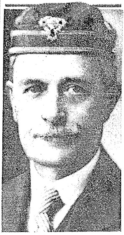
This West Seattle street was created in 1919 as part of the plat of Kirkwood, an Addition to the City of Seattle, filed by Isabell A. Kirkwood (1833–1926), who named the nearby Rutan Place SW after her maiden name. The plat document was notarized by lawyer Frank Pardee Lewis (1851–1938), and since I can find no connection to any other Lewis, I assume Kirkwood named it after him. According to Capitol Hill Seattle, Lewis, who lived at the corner of 18th Avenue E and E Denny Way,
…was from Triangle, New York, and moved to Seattle in 1887. He was a prominent attorney with offices in the Lowman Building downtown starting in 1890. He went to the office almost every day until his death in 1938. Mr. Lewis was elected to the Washington State Legislature in 1895; he was also a member of the Scottish Rite Masons.
Lewis Place SW begins at SW Hudson Street between Erskine Way SW and California Avenue SW and goes just over 550 feet northwest, then north, to Erskine Way SW just west of California.
Frank Pardee Lewis, from his Seattle Times obituary, April 12, 1938
Rutan Place SW goes around 350 feet south from SW Edmunds Street between 44th Avenue SW and 45th Avenue SW to a dead end just short of 45th, though the undeveloped right-of-way does continue to that street.
This street, which was created as part of the unrecorded plat of R.B. Wark’s 2nd Addition, is named for the Chinook Jargon word tillikum, meaning ‘people’.
Tillicum Road SW begins at 46th Avenue SW just south of SW Thistle Street and goes ¼ mile southeast to SW Donovan Street, with a short interruption between house numbers 8470 and 8471 on the northwest and 8487 and 8488 on the southeast where the public right-of-way seems to be blocked by a private fence, effectively converting the road on either side into private driveways.
This street in Seattle’s Windermere neighborhood runs around 350 feet on either side of NE Windermere Road (so 700 feet total) just southeast of the neighborhood’s main entrance off Sand Point Way NE. It appears to have been named either after the Lake District village of Coniston, in the county of Cumbria, England, or Coniston Water, England’s fifth largest natural lake. Coniston is about 4⅔ miles west of Windermere, England’s largest natural lake, after which the neighborhood was named.
This street in Seattle’s Windermere neighborhood runs just over ⅕ of a mile from Kenilworth Place NE in the west to NE Ambleside Road in the east. It appears to have been named after the Lake District town of Penrith, in the county of Cumbria, England. Penrith is about 18¾ miles northeast of Windermere, England’s largest natural lake, after which the neighborhood was named.
This street in Seattle’s Windermere neighborhood runs just over ⅓ of a mile from NE Windermere Road and Elleray Lane NE in the southwest to 64th Avenue NE in the northeast. It appears to have been named after the Lake District town of Keswick, in the county of Cumbria, England. Just north of Derwentwater, Keswick is about 13¾ miles northwest of Windermere, England’s largest natural lake, after which the neighborhood was named.
This street in Seattle’s Windermere neighborhood runs just under 900 feet from the private Windermere Park in the southwest to NE Windermere Road in the northeast. It appears to have been named after the town of Ambleside, in the county of Cumbria, England. As Wikipedia notes, Ambleside “marks the head (and sits on the east side of the northern headwater) of Windermere, England’s largest natural lake.”
This West Seattle street was created in 1907 as part of the plat of Adams 1st Addition to Fauntleroy Park, filed by John F. Adams (1860–1954) and his wife, Maggie W. True Adams (1864–1941). The document was notarized by Bert Avery Northrop (1880–1963), who was the husband of the Adamses’ daughter Abbie T. Adams (1888–1984). In his Seattle Times obituary, we learn that John Adams was “one of Fauntleroy’s first residents, [who]… came here in 1897. He first was in the grocery business and entered the real-estate business in 1903.… Mr. Adams was known as the ‘mayor of Fauntleroy.’” Meanwhile, Northrop’s Times obituary reports he came to Seattle in 1902 and began practicing law in 1906; he married Abbie Adams in 1909.
Bert A. Northrop
Northrop Place SW begins at SW Thistle Street and goes a block north to SW Southern Street.
This street was created in 1890 as part of the plat of the Bluff Park Addition to the City of Seattle, filed by Avery Parker of Arapahoe County, Colorado. Originally Arapahoe Avenue, it appears to have been named after that county, whose seat at the time was Denver. (The city was split off from the rest of the county in 1902.) Arapahoe County was itself named in 1861 for the Arapaho, a Native American people whose territory once included the area, but were subsequently forced onto reservations in Wyoming and Oklahoma.
Today, Arapahoe Place W begins at W Dravus Street and goes 450 feet north to just beyond W Prosper Street. It then resumes half a block north at W Bertona Street and goes ¼ mile north to W Emerson Street, along the south edge of Discovery Park.
This street is named for William Ashworth (1840–1906). According to the Haller Lake Community Club, Ashworth was born in England, emigrated to the United States in 1861, and came to Seattle in 1872.
Ashworth platted a town called Edgewater on the northern shore of Lake Union.… This area is now roughly the eastern part of Fremont and western portion of Wallingford.… Ashworth served as Edgewater’s only postmaster from 1889 until the area was annexed to Seattle two years later. As real estate development moved northward, so did the street bearing Ashworth’s name. Ashworth continued to live in Edgewater until his death in 1906.
Here is an article by local historian Paul Dorpat on Edgewater, on which it looks like I commented 13 years ago. And we learn both from the HLCC and Valarie Bunn of Wedgwood in Seattle History that the land on which berry farmer Ashworth’s home once stood is now the North Transfer Station (i.e., the city dump).
Today, Ashworth Avenue N begins at N 35th Street and goes ⅔ of a mile north to N 43rd Street. It resumes at N 55th Street and goes ¼ mile north to E Green Lake Way N, then begins again on the north side of the lake at Winona Avenue N and W Green Lake Drive N. From here, it goes another ⅔ of a mile to N 90th Street. Picking up again at N 92nd Street, it goes a further ⅞ of a mile to the Evergreen Washelli Cemetery at N 110th Street. It resumes one more time at N 120th Street and Stendall Drive N and goes 1¼ miles north to the city limits at N 145th Street, becoming a footpath for two short stretches west of Haller Lake. (As with many other North Seattle avenues, the name continues on into Shoreline; Ashworth Avenue N continues north of the city limits as far as N 200th Street, just south of the King–Snohomish county line at N 205th Street.)


.jpg)