Fuhrman Avenue E

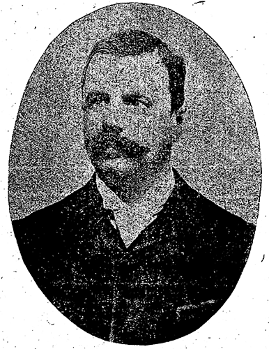
This street, created in 1890 as part of the plat of the Denny-Fuhrman Addition to the City of Seattle, was originally named Randall Street. I haven’t been able to pinpoint the reason for or date of the name change, but it first appears in The Seattle Times and in the city’s ordinances in 1906. The street and addition were named for Henry Fuhrman (1843–1907), who developed the area with David Thomas Denny (1832–1903) (Denny Way).

Fuhrman, who had come to Seattle in 1890, was a German Jew. According to his Seattle Times obituary, he “came to this country from Germany when a boy.… He was engaged as a mercantile solicitor in the early days, but later started a small drygoods business in Fremont, Nebraska, where he has since become famous as the pioneer wholesale drygoods merchant west of Omaha.… It is estimated that his fortune amounts to at least a million dollars.”

Fuhrman and Charles Cowen (né Cohen) (1869–1926) (Cowen Place NE) are the only Jews I am aware of who have Seattle streets named after them.

Henry Fuhrman, from his Seattle Times obituary, August 23, 1907

Fuhrman Avenue E begins at the north end of Fairview Avenue E, under the Ship Canal Bridge, and goes nearly ½ a mile southeast to E Shelby Street, where it becomes Boyer Avenue E. (A short segment begins about 150 feet to the east of Boyer, heads about 225 feet to the south, and mainly functions as a driveway for a number of houseboats; and another short segment begins at the north end of 15th Avenue E at the E Calhoun Street pathway, heads about 275 feet to the northeast, and serves as a driveway for an apartment complex.)
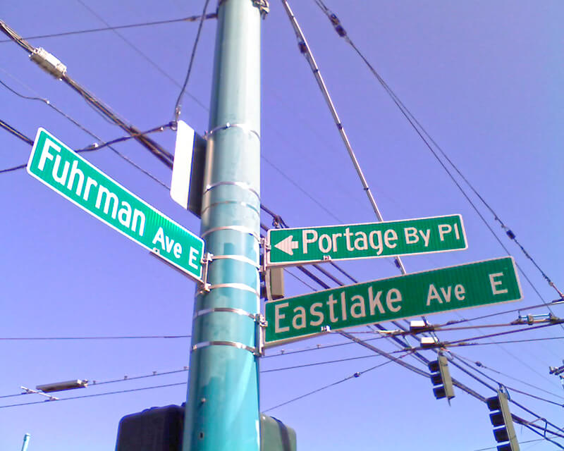
Sign at corner of Fuhrman Avenue E, Eastlake Avenue E, and Portage Bay Place E, August 24, 2009
Sign at corner of Fuhrman Avenue E, Eastlake Avenue E, and Portage Bay Place E, August 24, 2009. (Portage By Pl is an error; it should read Portage Bay Pl E, as it’s [[Portage Bay] [Place]], not [[Portage] [Bay Place]]. The original Red Robin restaurant was founded at this intersection in 1940. It has since been demolished, but I’ve seen imagery of this sign — including the error — on the walls of other Red Robin locations.) Photograph by Benjamin Lukoff. Copyright © 2009 Benjamin Lukoff. All rights reserved.

Red Avenue E

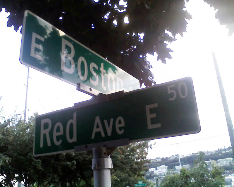
This short street in the Eastlake neighborhood was created in 1887 as part of Greene’s Addition to the City of Seattle, named for and filed by, among others, Roger Sherman Greene (1840–1930) and his wife, Grace Wooster Greene (1833–1917). Instead of naming a street directly after themselves, they dropped an e and named the north–south streets in the plat for (most of) the colors of the rainbow: Red, Orange, Yellow, Green, Indigo, and Violet. Only Red has survived to this day.

Red Avenue E begins at E Boston Street and goes around 150 feet north to a dead end.

Sign at corner of E Boston Street and Red Avenue E, September 1, 2010
Sign at corner of E Boston Street and Red Avenue E, September 1, 2010. Photograph by Benjamin Lukoff. Copyright © 2010 Benjamin Lukoff. All rights reserved.

Minor Avenue

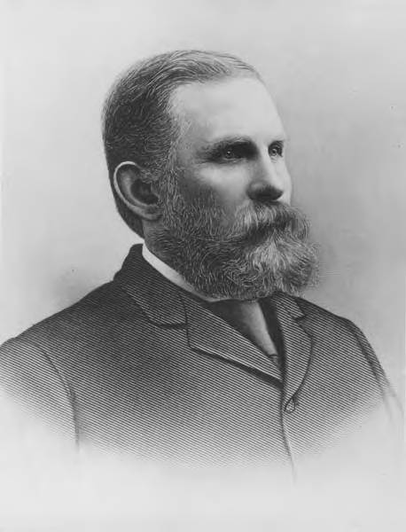
This street is named for Dr. Thomas Taylor Minor (1844–1889), who came to Seattle in 1883 from Port Townsend, where he had lived since 1868 and whose mayor he had been in 1880 and 1881. He was one of the founders of the Seattle, Lake Shore and Eastern Railway in 1885 and became mayor of Seattle from 1887 to 1889. He drowned off Whidbey Island while on a duck-hunting trip on December 2, 1889. The other fatalities were George Morris Haller, brother of Theodore Haller for whom Haller Lake is named, and his brother-in-law, Lewis Cox.

Thomas Taylor Minor
Dr. Thomas Taylor Minor

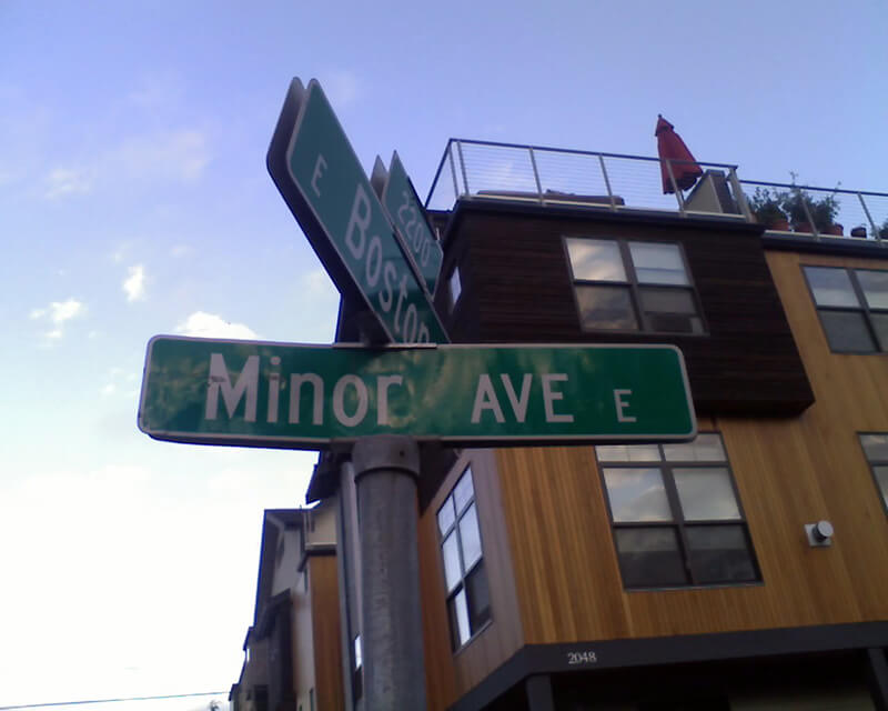
Minor Avenue begins at Broadway just north of Jefferson Street and goes ⅔ of a mile northwest to Pine Street. Resuming on the other side of Interstate 5 at Olive Way, it goes another ⅔ of a mile northwest, then north, to Mercer Street, having become Minor Avenue N north of Denny Way. After a two-block stretch from Roy Street to Aloha Street, it appears again as Minor Avenue E at E Newton Street, and goes nearly ½ a mile to its end at E Roanoke Street.

Sign at corner of E Boston Street and Minor Avenue E, September 1, 2010
Signs at corner of E Boston Street and Minor Avenue E, September 1, 2010. Photograph by Benjamin Lukoff. Copyright © 2010 Benjamin Lukoff. All rights reserved.

Blaine Street

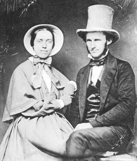
This street is named for Catharine V. Paine Blaine (1829–1908) and her husband, David Edwards Blaine (1824–1900). Methodist missionaries from Seneca Falls, New York, where, in 1848, Catharine signed the Declaration of Sentiments at the first women’s rights convention, the Blaines came to Seattle in 1853 but left in 1856, not to return until their retirement from missionary work 26 years later. During their short initial stay in Seattle, however, they managed to build Seattle’s first church (the Little White Church, predecessor of today’s First United Methodist Church of Seattle), and Catharine became Seattle’s first schoolteacher, making $65 a month. Catharine Blaine School in Magnolia is named in her honor.

Catharine and David Blaine
Catharine and David Blaine at their 1853 wedding

Unfortunately, though the Blaines may have been feminists, they, according to HistoryLink.org, had no love for Native Americans (or, for that matter, the Irish). Their departure in 1856 was prompted by the Battle of Seattle. Junius Rochester writes:

On January 20, 1856, a son John, was born to Catharine and David Blaine. Six days later the Battle of Seattle erupted. David had duty at one of the blockhouses, but managed to get Catharine and their babe aboard the Decatur in Elliott Bay. David had described the Indians as a “poor degraded race,” which would “soon disappear.” Catharine compared their “stupidity and awkwardness” to that of the Irish. The Indian uprising confirmed their worst fears and prejudices.

Today, W Blaine Street begins in Magnolia at 36th Avenue W and goes a semicircular ⅕ of a mile to 34th Avenue W and W Howe Street. It resumes at 31st Avenue W and goes almost ⅓ of a mile to Thorndyke Avenue W. There is a stub of W Blaine east of 15th Avenue W that is quickly stopped by the Southwest Queen Anne Greenbelt. The street resumes at 12th Avenue W and goes just over a mile to 4th Avenue N, having briefly become a stairway at 9th Avenue W. After a series of short stretches serving as driveways and parking, the Blaine Street right-of-way resurfaces east of Westlake Avenue N and heads into Lake Union. Here, too, it serves as a driveway and offers no access to the water. East of Lake Union, E Blaine Street begins at Fairview Avenue E and goes ⅛ of a mile to Franklin Avenue E, where it becomes part of the I-5 Colonnade park underneath the freeway. From Lakeview Boulevard E to just west of 10th Avenue E it is a stairway, and then two blocks of roadway ending at 12th Avenue E and Lake View Cemetery. There is then a diagonal ¼-mile stretch from 19th Avenue E to E Howe Street in Montlake. E Blaine finishes up as a ⅕-mile stretch from 37th Avenue E to McGilvra Boulevard E and a final two-block run from E Madison Street to 43rd Avenue E, both in Madison Park.

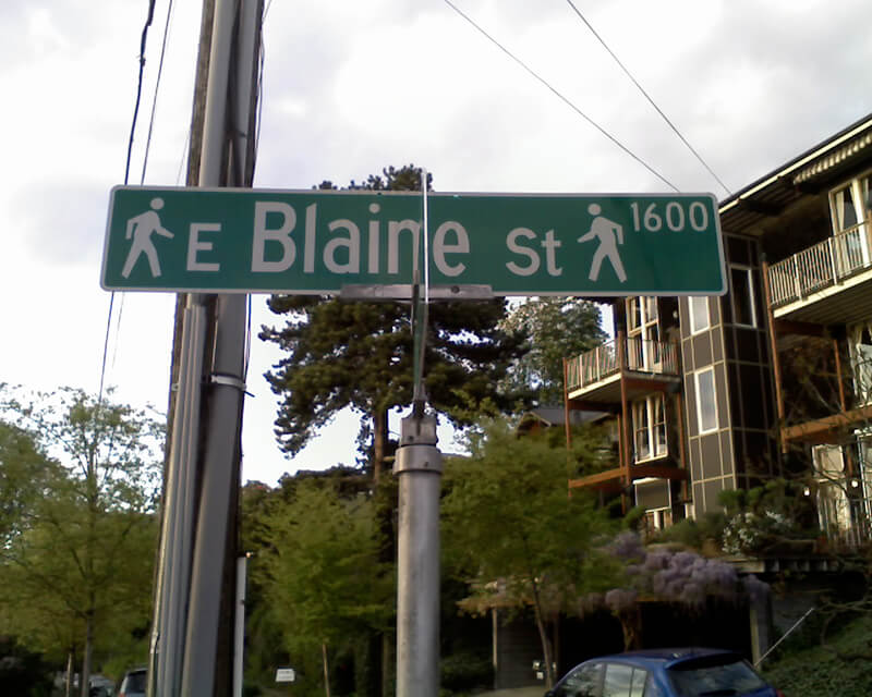
Sign for E Blaine Street, April 22, 2010
Sign for E Blaine Street at Broadway E, April 22, 2010. Blaine is a stairway on both sides of Broadway, hence the double 🚶 icon. Photograph by Benjamin Lukoff. Copyright © 2010 Benjamin Lukoff. All rights reserved.

Newton Street

This street originates in the 1882 plat of Bigelow’s Addition to the City of Seattle, filed by Jesse W. George (1835–1895) and Cassandra Eckler George (1840–1920) at the request of Isaac Newton Bigelow (1838–1922). As the Queen Anne Historic Context Statement explains,

In the early 1870s, the Denny and Mercer families gradually began to systematically subdivide their large land holdings on the south and east slopes of Queen Anne Hill. When a severe windstorm blew down thousands of trees in the north district in 1875, views opened up and land seekers turned their attentions beyond Belltown. Real estate speculators new to the territory arrived and began to buy up property on the crest of Queen Anne Hill. Some of these speculators also became developers, such as George Kinnear, or builder-developers, such as Isaac Bigelow.

Though its proximity to Boston and Lynn Streets suggest a tribute to Newton, Massachusetts, neither the Georges nor the Bigelows appear to have a connection to the state, so it seems this one should be chalked up to Isaac Bigelow’s middle name.

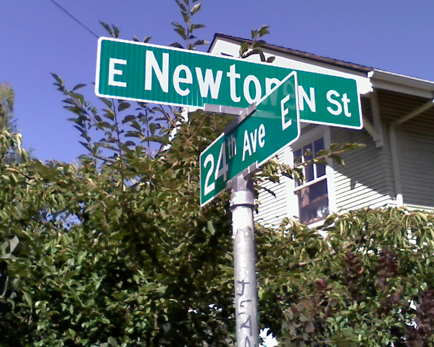
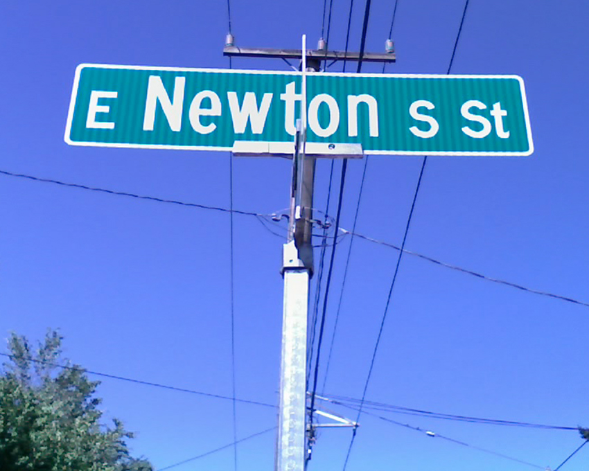
Today, Newton Street begins in Magnolia as W Newton Street at 30th Avenue W, and goes nearly half a mile east to 23rd Avenue W. There is then a two-block stretch from 15th Avenue W to 13th Avenue W in Interbay, and then the “original” Newton Street, which stretches almost a half mile from 1st Avenue N to Taylor Avenue N, followed by another two-block stretch from Dexter Avenue N to just past 8th Avenue N. On the east side of Lake Union, E Newton Street picks up again at Terry Pettus Park, just west of Fairview Avenue E, and goes ¼ mile to Boylston Avenue E and Lakeview Boulevard E. There follows another ¼-mile stretch from Broadway E to Everett Avenue E. East of there, Newton exists in a number of short segments through Montlake, and then enjoys a run of ⅓ of a mile from 37th Place E to 43rd Avenue E in Madison Park. 

E Louisa Street

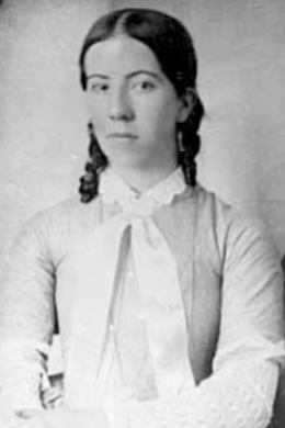
Louisa Street was named for Louisa Boren Denny (1827–1916), who was 24 years old when she and her future husband David Thomas Denny (1832–1903) arrived in Seattle as part of the Denny Party. Their marriage in 1853 was the first in King County. The street name originates in the 1890 plat of the Denny-Fuhrman Addition to the City of Seattle, filed by the Dennys, Henry Fuhrman (Fuhrman Avenue E), and his wife, Carrie Fuhrman.

Daguerreotype portrait of Louisa Boren Denny, no date
Undated daguerreotype portrait of Louisa Boren Denny

Today, E Louisa Street begins at Minor Avenue E and goes a block east to Yale Avenue E. It resumes half a block east at the alley west of Eastlake Avenue E and makes it 2½ blocks before being stopped by Interstate 5 at Boylston Avenue E. Resuming in the Montlake neighborhood just west of W Montlake Place E, it then goes ¼ mile east to 25th Avenue E.

Eastlake Avenue E

Like NE Northlake Way, Eastlake Avenue E is so named because it runs along the shore of Lake Union — in this case, obviously, the eastern one. It, too, was earlier named Lake Avenue (in part), but this was changed as part of the Great Renaming of 1895. Ordinance 4044, Section 6 reads

That the names of Albert Street, Waterton Street, Lake Avenue and Green Street from Depot Street [changed by the same ordinance to Denny Way] to the shore of Lake Union at the northerly point of the Denny–Fuhrman addition, be and the same are hereby changed to Eastlake Avenue.

Today, Eastlake, at 2⁹⁄₁₀ miles in length, extends slightly farther north and south than the roadway mentioned in the ordinance. It starts in the south at the intersection of Court Place and Howell Street as Eastlake Avenue, then becomes Eastlake Avenue E a block north as it crosses Denny Way. From here to just south of E Galer Street it divides the Avenue: E; Street: E section of town from the Avenue: N; Street section. Just north of Portage Bay Place E it crosses Lake Union as the University Bridge, then continues on as the one-way–northbound Eastlake Avenue NE to 11th Avenue NE just north of NE 41st Street. (Southbound, it is fed by Roosevelt Way NE at NE Campus Parkway.)

Eastlake, like Fairview and Boren Avenues, is one of the few north–south streets in Seattle to have three different directional designations.

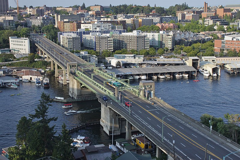
Looking northeast at the University Bridge from the Ship Canal Bridge in Seattle, July 2018
Looking northeast at the University Bridge from the Ship Canal Bridge, July 2018. Photograph by SounderBruce, Wikimedia Commons, licensed under Creative Commons Attribution-Share Alike 4.0 International

Fairview Avenue N

Fairview Avenue is one of a handful in the city that changes directional designations twice along a continuous stretch. The street begins in the south at Virginia Street as Fairview Avenue, but becomes Fairview Avenue N a block and a half to the north as it crosses Denny Way, and a mile north and east of that becomes Fairview Avenue E at E Galer Street and Eastlake Avenue E. It continues to E Roanoke Street, two miles from its origin, where it is interrupted by the Mallard Cove houseboat community. Picking up a block to the north, it then runs half a mile from E Hamlin Street to Fuhrman Avenue E and Eastlake Avenue E, just south of the University Bridge.

Originally Lake Street in Rezin and Margaret Pontius’s 1875 plat of the Fairview Homestead Association for the Benefit of Mechanics and Laborers, it received its current name during the Great Renaming of 1895. (Before 1875, it had been known as Prohibition Street.)

The Fairview Homestead Association, according to Paul Dorpat, was intended to “help working families stop paying rents and start investing in their own homes. Innovative installment payments made the lots affordable and many of the homes were built by those who lived in them.”

I assume Fairview took its name from the view of Lake Union and what is now Wallingford that is still barely visible today from what is now the Cascade neighborhood.

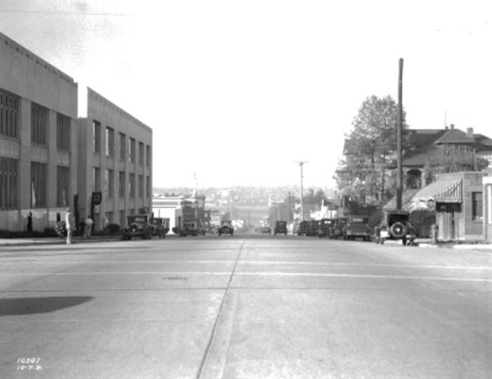
1931 view looking north toward Lake Union along Fairview Avenue N, Courtesy of the Seattle Municipal Archives, Identifier 5265

Portage Bay Place E

This street, which runs ³⁄₁₀ of a mile from Fuhrman Avenue E to E Allison Street, was established as an alley in 1890 as part of the Denny–Fuhrman Addition to the City of Seattle, but only received a name in 1936. It was named for Portage Bay, the eastern arm of Lake Union, which it parallels. Portage Bay was in turn named for the portage from Union Bay (part of Lake Washington) to Lake Union over the Montlake Isthmus, which is today the Montlake Cut of the Lake Washington Ship Canal.

Sign at corner of Fuhrman Avenue E, Eastlake Avenue E, and Portage Bay Place E, August 24, 2009
Sign at corner of Fuhrman Avenue E, Eastlake Avenue E, and Portage Bay Place E, August 24, 2009. Portage By Pl is an error; it should read Portage Bay Pl E, as it’s [[Portage Bay] [Place]], not [[Portage] [Bay Place]]. The original Red Robin restaurant was founded at this intersection in 1940. It has since been demolished, but I’ve seen imagery of this sign — including the error — on the walls of other Red Robin locations. Photograph by Benjamin Lukoff. Copyright © 2009 Benjamin Lukoff. All rights reserved.