Lincoln Park Way SW

This street was named for Lincoln Park, which occupies Williams Point in West Seattle. Originally called Williams Point Park in the Olmsted Brothers’ 1908 report to the city, the 135-acre park was intended to be named Fauntleroy Park. However, when it opened in 1922, it was decided to name it after President Abraham Lincoln (1809–1865) instead, according to Seattle parks historian Don Sherwood. This required that Lincoln Beach, just to the north, be renamed Lowman Beach, and that Lincoln Park Playfield on Capitol Hill (named for the adjacent Lincoln Reservoir) be renamed Broadway Playfield. (Today, the entire tract is known as Cal Anderson Park, which contains the reservoir and the once-again-renamed Bobby Morris Playfield. A Fauntleroy Park was finally established in the early 1970s.)

Lincoln Park Way SW begins at Beach Drive SW and 48th Avenue SW and goes ¼ of a mile southeast to 47th Avenue SW between SW Myrtle Street and SW Othello Street. The park begins 500 feet to the south, at the corner of 47th Avenue SW and SW Fontanelle Street.

Aerial view of Lincoln Park
Aerial view of Lincoln Park from the southwest, August 15, 2010. The heated saltwater Colman Pool, which opened in 1941, is visible at Williams Point. Photograph by Flickr user J Brew, licensed under Creative Commons Attribution-ShareAlike 2.0 Generic.

Tillicum Road SW

This street, which was created as part of the unrecorded plat of R.B. Wark’s 2nd Addition, is named for the Chinook Jargon word tillikum, meaning ‘people’.

Entry for 'tilikum' in A Dictionary of the Chinook Jargon, Or, Trade Language of Oregon by George Gibbs, 1863
Entry for ‘tilikum’ in A Dictionary of the Chinook Jargon, Or, Trade Language of Oregon, by George Gibbs (published 1863)

Tillicum Road SW begins at 46th Avenue SW just south of SW Thistle Street and goes ¼ mile southeast to SW Donovan Street, with a short interruption between house numbers 8470 and 8471 on the northwest and 8487 and 8488 on the southeast where the public right-of-way seems to be blocked by a private fence, effectively converting the road on either side into private driveways.

Northrop Place SW

This West Seattle street was created in 1907 as part of the plat of Adams 1st Addition to Fauntleroy Park, filed by John F. Adams (1860–1954) and his wife, Maggie W. True Adams (1864–1941). The document was notarized by Bert Avery Northrop (1880–1963), who was the husband of the Adamses’ daughter Abbie T. Adams (1888–1984). In his Seattle Times obituary, we learn that John Adams was “one of Fauntleroy’s first residents, [who]… came here in 1897. He first was in the grocery business and entered the real-estate business in 1903.… Mr. Adams was known as the ‘mayor of Fauntleroy.’” Meanwhile, Northrop’s Times obituary reports he came to Seattle in 1902 and began practicing law in 1906; he married Abbie Adams in 1909.

Bert A. Northrop

Northrop Place SW begins at SW Thistle Street and goes a block north to SW Southern Street.

Fauntlee Crest SW

This street was created in 1955 as 43rd Avenue SW in the plat of Fauntlee Hills Division № 5. It received its current name in 1959. “Faunt” is an obvious reference to the greater Fauntleroy neighborhood, and Fauntlee Hills was developed on the western slope of the hill that rose up from Fauntleroy Cove, but I’m not sure where “lee” comes from. (I was thinking, perhaps, from “leeward,” but prevailing winds in Seattle are from the southwest, meaning this is the windward, not leeward, side of the hill. Perhaps Arthur C. Webb, the developer, simply thought it sounded euphonious.)

Like its neighbor Vashon View SW (which was originally named Fauntlee Place SW!), this appears to be the only crest in the city. (The USPS abbreviates these as CRST, while its Seattle street sign abbreviation is Cr.)

Fauntlee Crest SW begins at SW Concord Street and California Avenue SW and goes ¼ mile north to a dead end.

Fauntlee Hills Ad in the November 1, 1953, Seattle Times
Advertisement for Fauntlee Hills in the November 1, 1953, issue of The Seattle Times

Vashon View SW

This cul-de-sac, which goes just about 375 feet northwest from SW Donovan Street between 41st Avenue SW and 42nd Avenue SW, was created as part of the Robert E. Thomas Addition in 1959. Its original name was Fauntlee Place SW, but this was changed in 1963, presumably to avoid confusion with the nearby Fauntlee Crest SW. (No confusion was anticipated with the nearby Vashon Place SW, it seems.) Like Vashon Place, it is named after Vashon Island, located 4 miles to the southwest, across Puget Sound. The island itself was named for Royal Navy Admiral James Vashon by his friend, Royal Navy Captain George Vancouver, in 1792.

Unlike Vashon Place SW, Vashon View SW actually has a view of Vashon Island, though not the one you see below!

(While there are plenty of streets, avenues, and places, and not a few drives, roads, and boulevards in Seattle, this is the only view in the city. [You may be interested in seeing the United States Postal Service’s list of recognized street types and abbreviations, in which view is VW.])

Aerial view of Vashon Island from the northwest
Aerial view of Vashon and Maury Islands from the northwest. Photograph by Flickr user Travis, licensed under Creative Commons Attribution-NonCommercial 2.0 Generic

S Southern Street

Having covered E North Street, Eastern Avenue N, and Western Avenue, we now come to S Southern Street! This street originated in the 1891 plat of River Park, filed by Alexander Prentice (1820–1909) and his wife, Jane Thomson Prentice (1823–1911). It appears to be so named simply because it is the southernmost street in the plat, half a block north of the 1890 plat of South Park.

Portion of River Park addition showing Southern Avenue (now Southern Street)

S Southern Street begins just east of 12th Avenue S on the west bank of the Duwamish Waterway, and goes ½ a mile to just west of 7th Avenue S, where it is blocked by Washington State Route 99 (W Marginal Way S). (Its first tenth of a mile is within unincorporated King County as part of the “Sliver by the River.”) It begins again in West Seattle as SW Southern Street at 35th Avenue SW, and goes ⅗ of a mile to 44th Avenue SW.

Sign at corner of S Southern Street and Dallas Avenue S, May 20, 2013
Signs at corner of S Southern Street and Dallas Avenue S, May 20, 2013. Photograph by Benjamin Lukoff. Copyright © 2013 Benjamin Lukoff. All rights reserved.

S Henderson Street

This street is named for Catherine Henderson (1822–1891), wife of Joseph Dunlap (1818–1893), who gives his name to Dunlap Elementary School and the Dunlap section of Rainier Valley. HistoryLink writes of the couple, who came to Seattle from Fontanelle, Iowa:

Joseph and Catherine (Henderson) Dunlap arrived in the Puget Sound region in September 1869, having traveled by covered wagon from Iowa. According to family legend, when they arrived in the Puget Sound region, they followed a road over Beacon Hill and sent their son George up a tree to view the land to the south and east. There he spotted a flat valley and Lake Washington. The Dunlaps decided to homestead in that valley, located to the south of the Van Asselt and Mapel families. They claimed 120 acres extending east toward Rainier Beach.

It appears to have been Lake Street in the original Dunlap’s Plat of Land on Lake Washington (1889) but was likely changed when Rainier Beach was annexed to Seattle in 1907.

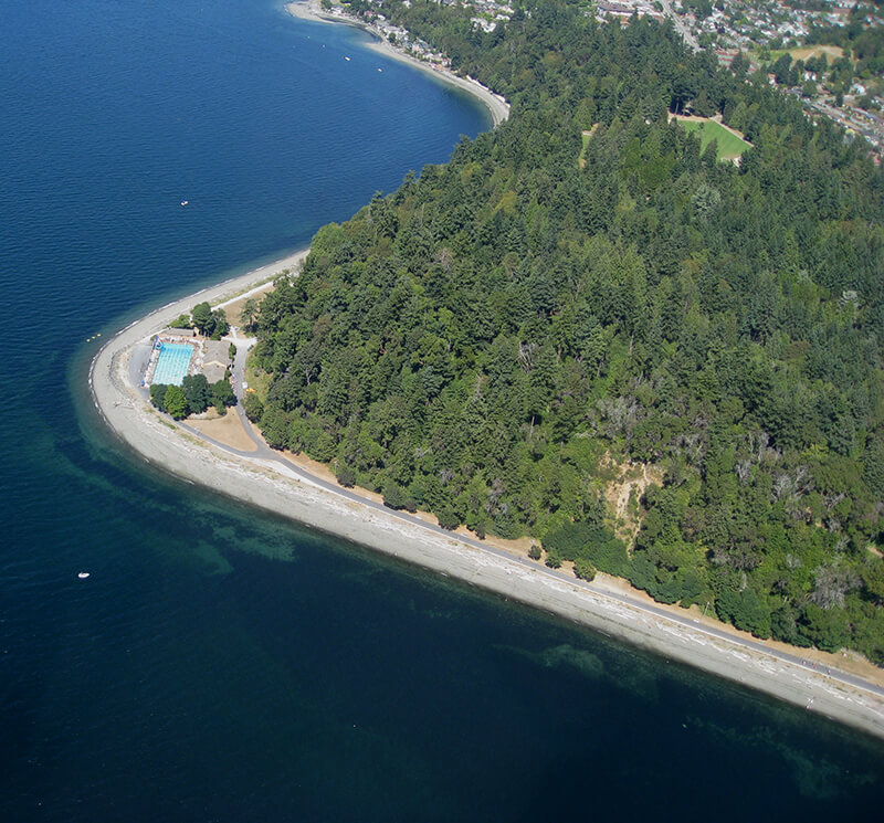
Today, S Henderson Street begins at Seward Park Avenue S, just west of Be’er Sheva Park, and runs ¾ of a mile west to Carkeek Drive S. On the other side of Interstate 5 and the Duwamish River, it runs ⁹⁄₁₀ of a mile through South Park from just east of 14th Avenue S to just west of 2nd Avenue S, the portion over Highway 99/W Marginal Way S being a footbridge. Once in West Seattle, SW Henderson Street runs ⅔ of a mile from 8th Avenue SW, just west of Westcrest Park, to 21st Avenue SW, where the arterial turns into SW Barton Place, and is then a two-block residential street from 22nd Avenue SW to 25th Avenue SW, where it is blocked by the Westwood Village shopping mall. On the other side of the mall, it’s ⅘ of a mile from 28th Avenue SW to SW Barton Street at Fauntleroy Park, and then a final couple of blocks from 43rd Place SW to Fauntleroy Way SW, just north of Washington State Ferries’ Fauntleroy Terminal.


California Avenue SW

This West Seattle street was established in 1888 as part of the First Plat of West Seattle by the West Seattle Land and Improvement Company. As “most of [its] capital came from San Francisco,” I would assume that is why California Avenue was given its name.

California Avenue SW — a major West Seattle arterial connecting the Admiral, Alaska, and Morgan Junctions (three commercial hubs named after long-gone streetcar line intersections) — runs 4½ miles from California Lane SW in the north, past which it turns into California Way SW on its way down the hill to the waterfront, to SW Sullivan Street in the south. Beyond there it exists as a few short segments, then briefly as part of the SW Brace Point Drive–SW Barton Street arterial, and lastly as a nearly mile-long residential street that ends at Marine View Drive SW.

Sign at corner of SW Donald Street and California Avenue SW, July 4, 2011
Sign at corner of SW Donald Street and California Avenue SW, July 4, 2011. Photograph by Benjamin Lukoff. Copyright © 2011 Benjamin Lukoff. All rights reserved.

Fauntleroy Way SW

This 4-mile-long thoroughfare runs from the west end of the West Seattle Bridge to Brace Point, passing Morgan Junction, Lincoln Park, and the Fauntleroy Ferry Terminal on the way. It was named for Fauntleroy Cove, location of that terminal, from which riders depart for Vashon Island and Southworth, on the Kitsap Peninsula.

Fauntleroy Cove was itself named after Robert Henry Fauntleroy by George Davidson, Fauntleroy’s future son-in-law. They were both members of the U.S. Coast Survey. He is one of three Fauntleroys whose names appear on Seattle street signs — Ellinor Drive W and Constance Drive W are named for Mounts Ellinor and Constance in the Olympic Mountains, themselves named by Davidson after his future wife and sister-in-law, respectively.