Stadium Place S

This private street begins at 2nd Avenue S and S King Street and goes 300 feet south to the north parking lot of Lumen Field. It was created in 2011 as part of the Stadium Place development, after which it was named. The development, in turn, was so named for its proximity to Lumen Field, known as Seahawks Stadium from 2002 to 2004, Qwest Field from 2004 to 2011, and CenturyLink Field from 2011 to 2020.

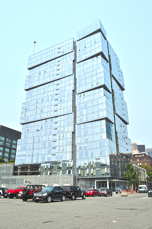
“The Wave” — the west tower of the Stadium Place complex — as seen from the parking lot of Lumen Field in August 2017
“The Wave” — the west tower of the Stadium Place complex — as seen from the parking lot of Lumen Field in August 2017. Stadium Place S is the street to the north of the parking lot, where the white van is parked behind the orange bollards. Photograph by Wikimedia Commons user Joe Mabel, licensed under Creative Commons Attribution 4.0 International.

Alaskan Way

Alaskan Way was originally Railroad Avenue. Jennifer Ott writes for HistoryLink.org:

On the central waterfront a web of railroads grew out from the shore in the 1880s and 1890s as various railroads, including the Columbia & Puget Sound, the Seattle, Lake Shore & Eastern, and the Northern Pacific jockeyed for space at the foot of the bluffs that ended at the beach, where Western Avenue is today. In January 1887 the City Council passed an ordinance establishing Railroad Avenue, a street created, according to historian Kurt Armbruster, to provide space for the Seattle, Lake Shore & Eastern franchise to the west of the Northern Pacific’s franchise along the shoreline.

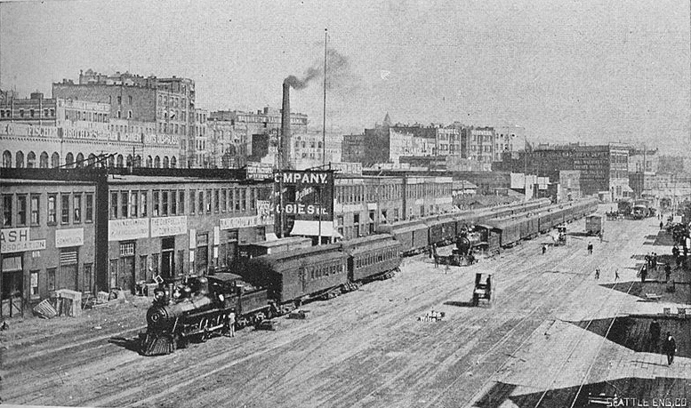
Railroad Avenue looking south from between Madison and Marion Streets, circa 1898

When the tidelands were platted in 1895, Railroad Avenue extended to Harbor Island and West Seattle, but:

  • Sometime between 1912 and 1920 the Harbor Island portion was renamed W Florida Street (SW Florida Street today).
  • In 1907, the West Seattle portion was renamed Alki Avenue.
    • Sometime between 1912 and 1920 the West Seattle portion southeast of Duwamish Head was given its current name, Harbor Avenue.

In an article for Crosscut (now CascadePBS.org), Knute Berger explains why a new name was wanted for the remainder:

Seattle’s waterfront was unpaved — a beat-up plank road ran its length. There was no modern seawall — the street was built over the water. Train tracks were everywhere.… But the waterfront was undergoing a massive renovation. A seawall was being constructed, the shoreline filled in, the road made into a wide, paved boulevard.…

According to Berger and Ott’s articles, names that were proposed but were ultimately rejected included Anchors Way, Artery Way, Battery Way, Bois Boolong, Bread Street, Cargo Way, Chief Seattle Avenue, Cosmos Quay, Dock Street, Export Way, Fleet Way, Gateway Avenue, Golden West Way, Hiak Avenue, Klatawa Avenue, Maritime Avenue, Metropolis Avenue, Olympian Way, Pacific Way, Pier Avenue, Port Strand, Port Way, Port-Haven Drive, Potlatch Avenue, Puget Avenue, Puget Dyke, Puget Portal, Queen City Way, Roadstead Way, Salt Spray Way, Salt Water Avenue, Seawall Avenue, Seven Seas Road, Skookum Way, Steamship Way, Sunset Avenue, Terminal Avenue, Terrebampo Way, The Battery, The Esplanade, Transit Row, Voyage Way, Welcome Way, and Worldways Road. (Those in italics apparently came under serious consideration.)

So how did we end up with Alaskan Way? And why Alaskan instead of Alaska (the already existing S Alaska Street could have been renamed)?

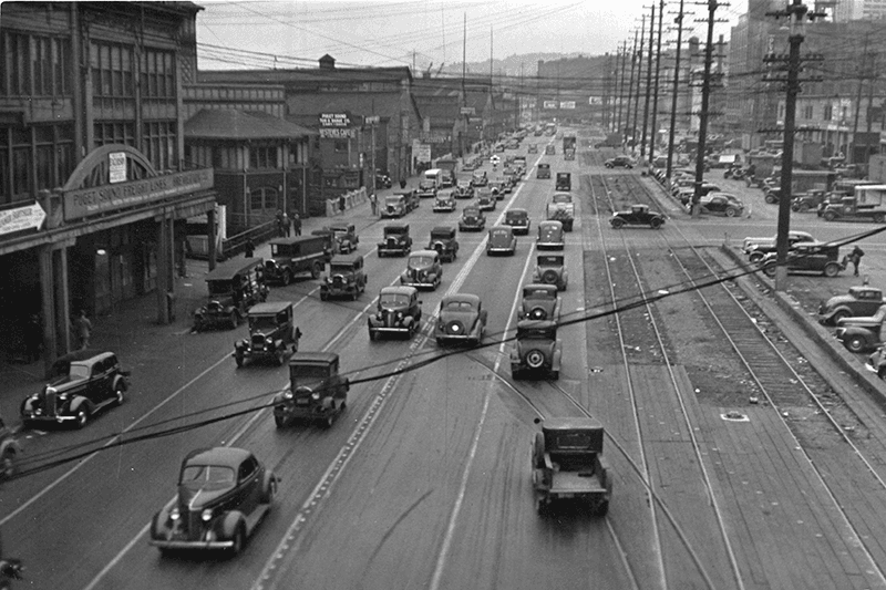
Alaskan Way, July 1939
Alaskan Way between Marion and Madison Streets, Canadian National Dock at left, July 1939. Courtesy of the Seattle Municipal Archives, Identifier 77093

The May 19, 1932, issue of The Seattle Times reports that the Seattle Maritime Association had run a renaming contest which received “more than one thousand letters… some of them contained scores of suggestions.” 4,868 names (including duplications) were received, and the judges selected four finalists, in order of preference: Puget Portal (one submission), Klatawa Avenue (one submission, from Chinook Jargon word meaning ‘to go, to travel’), Hiak Avenue (one submission, from Chinook Jargon word meaning ‘lively, quick and fast’), and Maritime Avenue (49 submissions [Maritime Way received 99 submissions but was not chosen]). The next day, the Times reported that the judges had chosen Maritime Avenue, and awarded the $20 prize to a Mr. B.I. Schwartz, the first to have suggested the name.

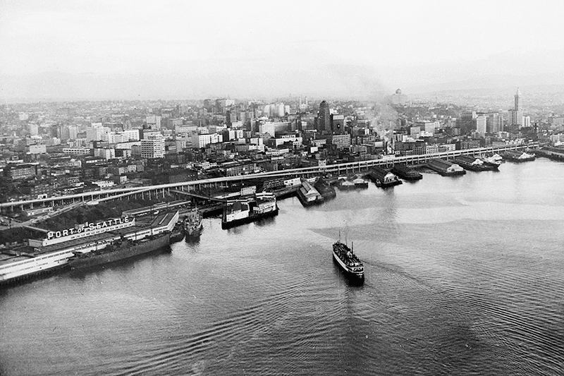
Alaskan Way Viaduct, July 1952
Alaskan Way Viaduct, July 1952, the year before it opened. The double-decker freeway paralleled Alaskan Way as far north as Union Street, where it diverged from the alignment on its approach to Elliott Avenue and the Battery Street Tunnel. Bell Street Pier, with the large Port of Seattle sign, is at left. The Bell Street Overpass can be seen behind the ‘P’ in ‘Port’. The bridge at the southern end of the pier is the Lenora Street Viaduct. Courtesy of the Seattle Municipal Archives, Identifier 43586

However, that July, a George D. Root proposed the name Cosmos Quay. At first, it was met with indifference, and then it seems the entire renaming project was put on the back burner until construction progressed. Somehow, when he restarted his campaign in 1934, Cosmos Quay became a leading candidate, and it was approved unanimously by the city council on January 14, 1935. An ordinance began to be drafted. But, as the Seattle Post-Intelligencer noted the next day, this was only because one councilmember, Frank J. Laube, had been absent… and he was adamantly opposed.

He wasn’t the only one. The Seattle Times published an editorial on January 20 headlined ‘City Locksmith Needed for Pronunciation Key’, which proclaimed that “to burden the waterfront stretch with a name that could be used and understood only through long courses in cosmogony, cosmology, etymology, and articulation would be a sad piece of nonsense for which there is no excuse.” The next day the Times reported that David Levine, city council president, said Cosmos Quay “no longer sounds so good to him. Many citizens have complained its meaning, as well as its pronunciation, mystifies them.” On February 4, according to the P-I, the council killed the ordinance and decided to leave Railroad Avenue as it was.

Alaskan Way Viaduct, February 2018
Alaskan Way Viaduct, February 2018. It closed permanently in January 2019; the replacement tunnel opened the next month. and demolition was complete by November of the same year. Photograph by Flickr user Washington State Department of Transportation, licensed under Creative Commons Attribution-NonCommercial-NoDerivs 2.0 Generic

When the new street opened in 1936, the question of renaming came up again. Mayor John F. Dore appointed a committee that chose The Pierway, a suggestion that won a W.C. Denison, Jr., a prize of $50 from the mayor’s own pocket, but the final decision lay with the city council, which was not enthused. Pacific Way emerged as their favorite, according to a Seattle Times article on July 2, 1936, though a July 6 article in the same paper “the public apparently was not in accord with the idea.” On July 7, the Times reported that even though “at least seven votes [were] lined up in advance for the adoption of ‘Pacific Way’… with Council President Austin E. Griffiths contending for ‘Cosmos Quay’ or ‘Cosmos Way’,” an ordinance renaming Railroad Avenue “Alaskan Way” passed unanimously.

Alaska Way had been proposed in 1932 by the Puget Sound Travel Directors, according to an article in the April 13 issue of The Seattle Times. (As an aside, it was also proposed in 1931 by attorney John S. Robinson as an alternate name for Aurora Avenue N and the Aurora Bridge, according to a Times article on June 19.) It was also an entry in the Seattle Maritime Association’s aforementioned naming contest, submitted by Fred E. Pauli, manager of the Alaska Division of the Washington Creamery Company, according to a Times article on April 10, 1932. Then, in 1935, after Cosmos Quay had been rejected by the city council, the Alaska Yukon Pioneers endorsed Alaska Way (The Seattle Times, March 5), followed by the Whittier Heights Improvement Club (Times, March 7) and the Junior Alaska-Yukon Pioneers (Times, July 25). When renaming became a distinct possibility once again in 1936, as discussed above, the Alaska Yukon Pioneers passed a resolution in favor of Alaska Way (Times, July 4): “…It was here that the gold rush activity actually took place… put Seattle on the map and directly made possible the magnificent improvement now about completed.”

Alaskan Way south from Bell Street
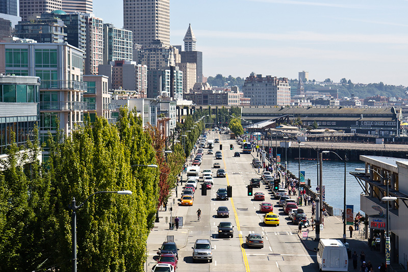
Alaskan Way looking south from the Bell Street pedestrian bridge, August 2011. The Alaskan Way Viaduct is barely visible at center; the Seattle Aquarium is at center right. Photograph by Orange Suede Sofa, Wikimedia Commons, licensed under Creative Commons Attribution-Share Alike 3.0 Unported

It came down to one councilmember, apparently. The Seattle Post-Intelligencer reported on July 7 that, the previous day, Robert H. Harlin proposed that the already-prepared ordinance renaming Railroad Avenue “Pacific Way” be amended to read “Alaskan Way” instead:

Councilman Robert H. Harlin, who offered the motion for adoption of “Alaskan Way,” said he preferred it to “Alaska Way” because it “recognizes the human element, honoring the men and women who pioneered the territory.” Although a majority of the council had informally agreed to support the name “Pacific Way,” sentiment crystallized rapidly in favor of “Alaskan Way” after Harlin’s statement.

Alaskan Way, March 2021
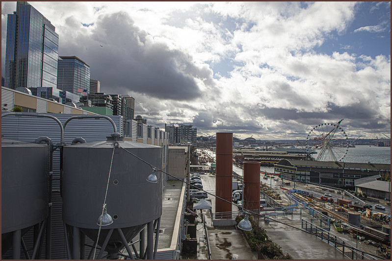
Alaskan Way from the Pike Place Market’s MarketFront, March 2021. Construction of the street that wasn’t going to be called Elliott Way — but now, as of early 2023, will be — is visible at center right. The Seattle Great Wheel can be seen above the Seattle Aquarium. Photograph by Flickr user Scott Smithson, licensed under Creative Commons Attribution-NonCommercial-NoDerivs 2.0 Generic

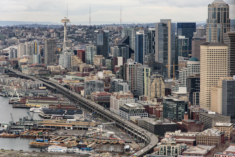
Today, Alaskan Way S begins at the north end of E Marginal Way S, at the entrance to the Port of Seattle’s Terminal 30, and goes 2⅓ miles north, then northwest, to Broad Street, having become Alaskan Way on crossing Yesler Way. This is the Alaskan Way most people think of.

But, as they say, wait — there’s more! The right-of-way continues for another 1¾ miles, ending at W Garfield Street under the Magnolia Bridge, at the entrance to the Port of Seattle’s Terminal 91. From the Olympic Sculpture Park, which begins at Broad Street, to Myrtle Edwards Park, the right-of-way is taken up by park land and the tracks of the BNSF Railway — successor to the Columbia & Puget Sound; the Seattle, Lake Shore & Eastern; and the Northern Pacific, the railroads for which Railroad Avenue was originally built. Northwest of Myrtle Edwards, it’s entirely taken up by the tracks that run alongside Centennial Park. It isn’t until W Galer Street that there’s a city street in the right-of-way again, and Alaskan Way W only goes about ⅙ of a mile northwest from there to W Garfield Street. Even less than that is signed Alaskan Way, as the city has put up a sign for Expedia Group Way W where the W Galer Street flyover “touches down.” However, even though southeast of Galer the roadway runs first on Expedia property, then Port of Seattle property, the city appears to still consider it Alaskan Way W between the Expedia campus entrance and the north end of Centennial Park — a distance of just over ⅓ of a mile.

Western Avenue

This street appears to originate in this 1871 plat made by Arthur A. Denny. Unlike with E North Street or Eastern Avenue N, no mystery here: originally named West Street, it was the first street west of Front Street (today’s 1st Avenue). Front Street ran along the waterfront, as its name implied, south of about Seneca Street, but north of there the Elliott Bay shoreline curved and the street grid didn’t curve with it (that would happen farther north, at Stewart Street). Hence West Street, which was changed to Western Avenue in 1895. (West Street would be extended farther south once they started filling in the tideflats; today, it begins at Yesler Way.)

Western Avenue in Pike Place Market, October 2008
Western Avenue in Pike Place Market, October 2008. Photograph by Joe Mabel, Wikimedia Commons, licensed under Creative Commons Attribution-ShareAlike 3.0 Unported

Today, Western Avenue begins at Yesler Way and goes 1¾ miles northwest to Elliott Avenue W at 3rd Avenue W and W Thomas Street, having become Western Avenue W on crossing W Denny Way.

Yesler Way

This street is named after Henry Leiter Yesler (1810–1892). Originally from Leitersburg, Maryland, which was founded by his great-grandfather, and living in Massillon, Ohio, before coming west, he moved to Seattle from Portland, Oregon, in 1852. As John Caldbick writes for HistoryLink.org:

…[Yesler] quickly established himself as the most important resident of the rain-swept little spot that would soon become Seattle. He had the first steam-powered sawmill on Puget Sound up and running within months, and for several years he employed almost every male settler in Seattle and a considerable number of Native Americans. His mill was early Seattle’s only industry, and without it the town’s development would have been greatly delayed.

Carson Dobbins Boren and David Swinson “Doc” Maynard had already claimed land on Elliott Bay either side of what is today Pioneer Square, but they gave him part of their claims so he could access the water from the claim he made farther up First Hill. Yesler’s mill was built at the foot of what is now Yesler Way but was originally Mill Street, also known as Skid Road — and yes, Seattle may be where the term originated, referring to a neighborhood largely inhabited by the “down and out.”

Yesler was also King County auditor in 1852, and Seattle mayor from 1874 to 1875 and 1885 to 1886.

Yesler had two children: a son, Henry George Yesler (1845–1859), by his wife, Sarah Burgert Yesler (1822–1887); and a daughter, Julia Benson Intermela (1855–1907). Her mother wasn’t Sarah, who didn’t come to Seattle until 1858, but rather a Duwamish woman named Susan, daughter of Salmon Bay Curley (Su-quardle), who had worked at Yesler’s mill. When Sarah finally joined her husband, he sent Susan and Julia to live with Jeremiah S. Benson, a cook at the mill. In the 1870 territorial census, Julia is listed as living with the Bensons, but the next year she is listed as a HB (“half-breed”) house servant for the Yeslers. Unlike Rebecca Lena Graham, who successfully sued the relatives of Franklin Matthias to be recognized as his rightful heir, Julia inherited nothing when her father died in 1892. Even so,

…The settlement of Henry Yesler’s estate was an imbroglio of epic proportions. It pitted Minnie Gagle Yesler [a younger cousin whom he married a few years before his death] and her mother against James Lowman [his nephew] and municipal authorities, who believed that Yesler had made a will that left most of his fortune, by then worth more than $1,000,000, to the city, hoping thereby to cement his reputation as the “Father of Seattle.”

Yesler is also quoted as anticipating “Strange Fruit” by 55 years… though it’s by no means a sentiment Abel Meeropol or Billie Holiday would have shared. In January 1882, a mob lynched James Sullivan, William Howard, and Benjamin Paynes between two of his maple trees. Harper’s Weekly reported Yesler’s reaction: “That was the first fruit them trees ever bore, but it was the finest.”

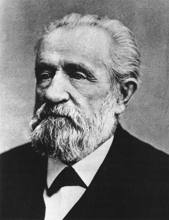
Henry L. Yesler
Henry L. Yesler. Courtesy of the Seattle Municipal Archives, Identifier 12257

Yesler Way begins on the Elliott Bay waterfront at Alaskan Way and goes 2⅙ miles east to Leschi Park, just past 32nd Avenue. It also appears just west of Lake Washington Boulevard, where it goes about 200 feet west and essentially serves as a driveway for a couple of houses.

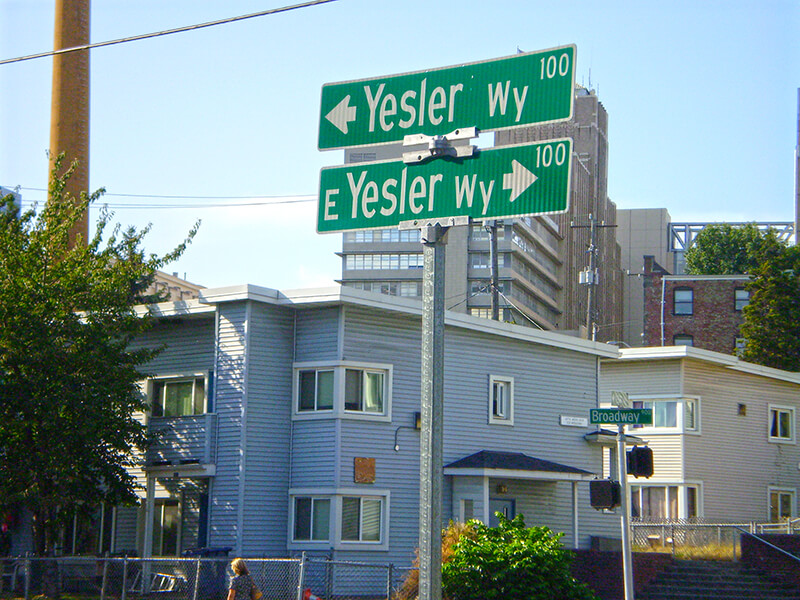
Yesler Way, which becomes E Yesler Way east of Broadway, also divides three of the city’s directional designation zones from each other. South of Yesler, east–west streets carry the S prefix and north–south avenues carry the suffix S. North of Yesler, north–south avenues carry no suffix; east–west streets carry the E prefix east of Broadway and no prefix west of Broadway.

Street sign at corner of Yesler Way and Broadway, August 25, 2009
Street signs at corner of Yesler Way and Broadway, August 25, 2009. Photograph by Benjamin Lukoff. Copyright © 2009 Benjamin Lukoff. All rights reserved.

Terrace Street

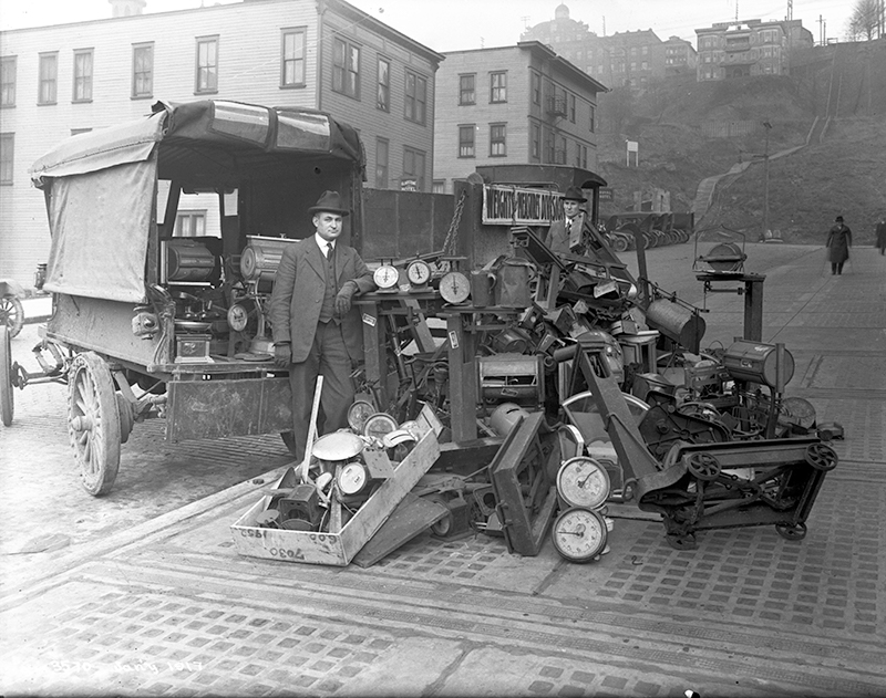
This street — named Pine Street in Terry’s Second Addition to the Town of Seattle, filed in 1872 — was renamed Terrace in 1876, presumably to avoid duplicating the Pine Street to the north. My assumption is it was given this name because of how steep First Hill is at this point — Paul Dorpat, writing for HistoryLink, says “Except at Terrace Street on the south and near Union Street on the north, the hill was readily negotiable first by hikers and later by street graders and trolley tracks.” One can see in the image below the long, steep stairway in the Terrace Street right-of-way “from 5th Avenue east to beyond 7th Avenue,” as Dorpat writes on his own blog.

Official from Seattle Weights and Measures Division with confiscated scales standing in Terrace Street
Seattle Weights and Measures Division officials standing with confiscated scales in Terrace Street, 1917. Note long stairway in upper-right corner. Courtesy of the Seattle Municipal Archives, Identifier 1210.

Today, Terrace Street begins at Yesler Way above 4th Avenue and goes a block and a half up the hill before being blocked by Interstate 5. It resumes just east of Harborview Medical Center and goes ⅓ of a mile east to 12th Avenue. There is another short stretch of E Terrace Street from 20th Avenue to 23rd Avenue by Garfield High School, and then a final ½ mile from 30th Avenue to Lake Washington Boulevard in Leschi, the portion between 36th Avenue and Randolph Avenue being a stairway.

S Royal Brougham Way

This street begins at Colorado Avenue S in the west, at an onramp to the northbound lanes of the State Route 99 tunnel, and goes ⅔ of a mile east to Airport Way S. Originally S Connecticut Street, it was renamed in 1979 in honor of sportswriter Royal Brougham (1894–1978), who worked for the Seattle Post-Intelligencer newspaper from 1910 until his death. Such a name change was formally proposed by city councilman George Benson following a suggestion by P-I columnist Emmett Watson. Originally it was to be Occidental Avenue S whose name was to be changed, then the 2nd Avenue S Extension when objections were raised. Finally S Connecticut Street was settled upon; it was thought to be particularly appropriate because he “worked so hard to see the Kingdome built… and eventually spent his last day on earth there.”

Lumen Field, built on the former Kingdome site, is on the north side of Royal Brougham between 1st Avenue S and 4th Avenue S; and T-Mobile Park is on the south side between 1st Avenue S and 3rd Avenue S.

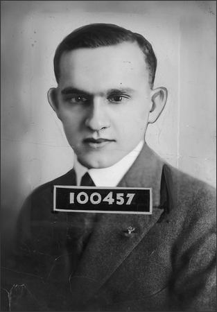
Royal Brougham's ID card for the Seattle Post-Intelligencer newspaper, 1925
Royal Brougham’s Seattle P-I staff ID card, 1925

S Jackson Street

Jackson Street was another one of the first streets platted in Seattle by David Swinson “Doc” Maynard in May 1853. It, like King, Lane, and Weller Streets, was named after a prominent Democratic politician — in this case Andrew Jackson, president of the United States from 1829 to 1837. Because of his history as a slaveholder and a proponent of Indian removal, there have been calls to at least symbolically change the street’s namesake to another Jackson, if not change the name outright.

S Jackson Street begins today at Alaskan Way S on the Elliott Bay waterfront and has an uninterrupted 2-mile run as an arterial to 31st Avenue S in Leschi. On the other side of Frink Park, it makes its way the few remaining blocks to Lake Washington as a minor arterial, then a staircase, then a minor street, and finally a shoreline street end, part of the String of Pearls.

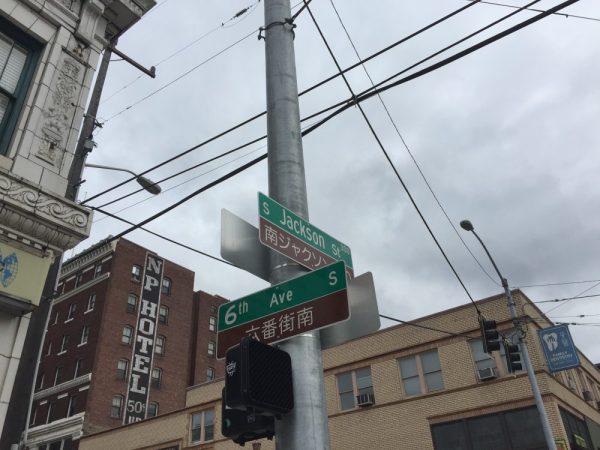
Bilingual (Japanese and English) street sign at corner of 6th Avenue S and S Jackson Street
Bilingual (Japanese and English) street sign at corner of 6th Avenue S and S Jackson Street. Photograph by Stephen Fesler, The Urbanist, licensed under Creative Commons Attribution-NonCommercial-ShareAlike 4.0 International

S Washington Street

Washington Street was one of Seattle’s first streets, platted on May 23, 1853 by David Swinson “Doc” Maynard and named after President George Washington. Its initial segment begins at Alaskan Way S on the Elliott Bay waterfront and ends half a mile to the east at Kobe Terrace Park. East of Interstate 5 it exists in a number of segments interrupted by schools and parks and finally ends at S Frink Place and Frink Park.

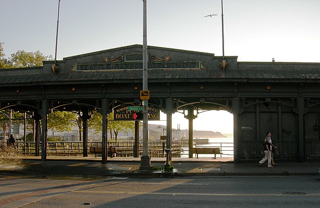
Washington Street Boat Landing, September 2007, by Joe Mabel
Washington Street Public Boat Landing, September 2007. Photograph by Joe Mabel, Wikimedia Commons, licensed under Creative Commons Attribution-Share Alike 3.0 Unported

Cherry Street

Cherry Street was among the first streets platted in Seattle on May 23, 1853. Sophie Frye Bass, author of Pig-Tail Days in Old Seattle, writes:

I choose to think that Cherry Street is named for the little town of Cherry Grove, Illinois — Mother’s birthplace — where the Dennys started on their long journey over the Oregon Trail.

“Mother,” in this case, refers to Louisa Catherine Denny Frye, one of three children of Arthur Armstrong Denny and Mary Ann Boren Denny of the Denny Party. She was 7 years old when they landed at Alki Point in November 1851.

In 2006, Hunter Brown wrote a People’s History essay for HistoryLink, “Finding Cherry Grove,” detailing his efforts to locate Cherry Grove, whose name was later changed to Cedar Township. The nearest town today is called Abingdon.

Bass began her Pig-Tail Days piece on Cherry Street by calling it “another up-and-up street… with no interferences. It begins at First Avenue, goes east and ends at Thirty-seventh avenue.” This is no longer quite the case because of a very small gap at the south end of the Seattle University campus. Today, Cherry begins at 1st Avenue and ends a block east of Broadway. It starts up again a couple hundred feet to the east as a continuation of the James Street/E James Way arterial, and then does go on to 37th Avenue in Madrona. All told it is 2⅓ miles long.

James Street

James Street, one of the first streets platted in Seattle on May 23, 1853, was named by Arthur Armstrong Denny after his younger brother, James Marion Denny (1824–1854). Histories of Seattle report that James was too sick to leave Oregon and come to Puget Sound with the Denny Party and, indeed, he died in the town of Sublimity, Oregon, just a year after the street was named for him. Nothing I have found reports an actual cause of death. Marion Street is also named after this brother.

James Street runs ¾ of a mile from Yesler Way just east of 1st Avenue to an alley just east of Broadway. It appears east of there in a few short stretches and finally as a stairway from 38th Avenue to Lake Washington Boulevard at Madrona Park.

Seattle’s first streets

The Denny Party landed at Alki Beach on November 13, 1851, and moved to dzidzəlalič  (today known as Pioneer Square) in the spring of 1852. The name “Seattle,” according to local historian Rob Ketcherside, first appeared in print that October. But it wasn’t until May 23, 1853, that David Swinson Maynard, Carson Dobbins Boren, and Arthur Armstrong Denny filed the first plats of the Town of Seattle — thereby creating its first official streets.

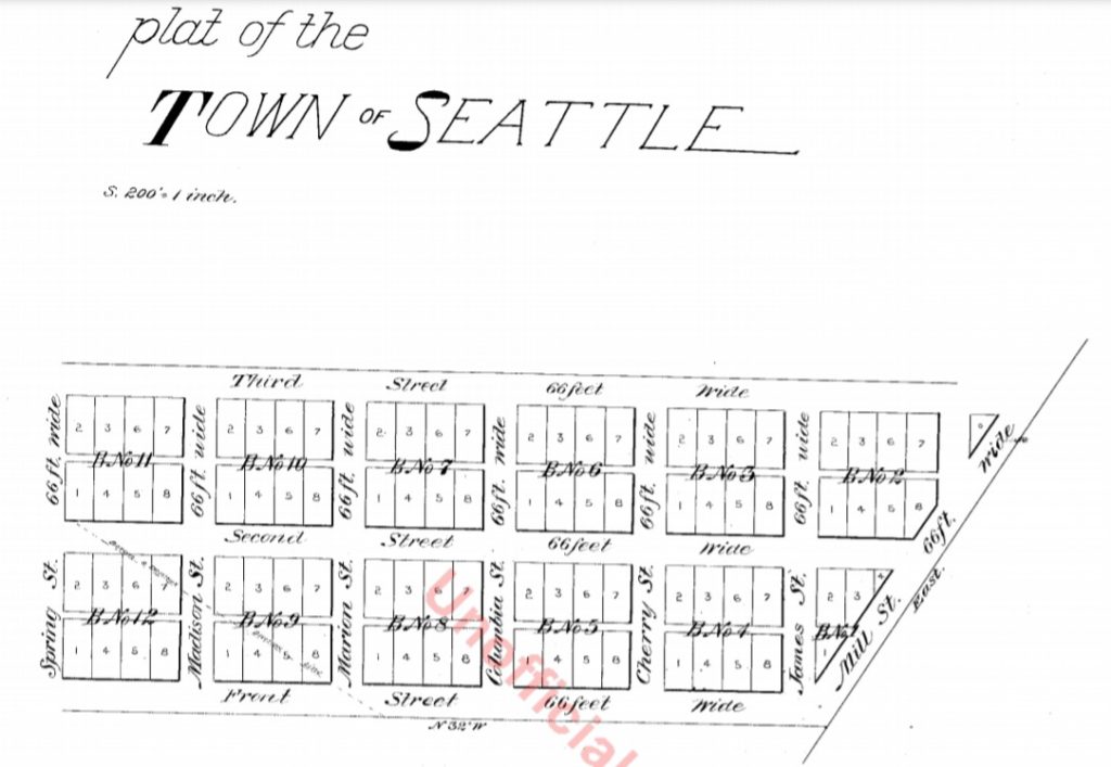
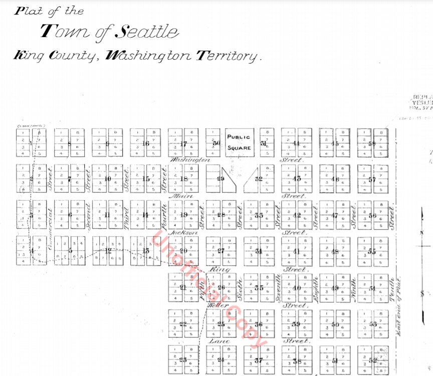
Boren and Denny famously aligned their streets with the Elliott Bay shoreline (32° west of north, or very close to northwest by north), while Maynard aligned his with the cardinal directions.

Plat of the Town of Seattle, May 23, 1853, by Carson Dobbins Boren and Arthur Armstrong Denny
Plat of the Town of Seattle, King County, Washington Territory, May 23, 1853, by David Swinson Maynard

Mill Street, which divided the two plats, was renamed Yesler Avenue in 1888, and Yesler Way — its current name — seven years later. Front Street became 1st Avenue and Commercial Street became 1st Avenue S as part of that same “Great Renaming” ordinance of 1895. Streets that were named in these first plats that have kept their names till today include:

Boren and Denny

  • James Street — after James Marion Denny, younger brother of A.A. Denny
  • Cherry Street — after Cherry Grove, Illinois, where the Denny Party’s journey to Seattle began
  • Columbia Street
  • Marion Street — also after James Marion Denny
  • Madison Street — after President James Madison
  • Spring Street — after the springs along Elliott Bay

Mill Street is now Yesler Way, and Front Street is now 1st Avenue.

Maynard

  • Washington Street — after President George Washington
  • Main Street
  • Jackson Street — after President Andrew Jackson
  • King Street — after Vice President William Rufus DeVane King
  • Weller Street — after John B. Weller, senator from California, later governor of California
  • Lane Street — after Joseph Lane, governor of Oregon Territory, later Southern Democratic candidate for vice president in the 1860 election

Commercial Street is now 1st Avenue S.

Post Avenue

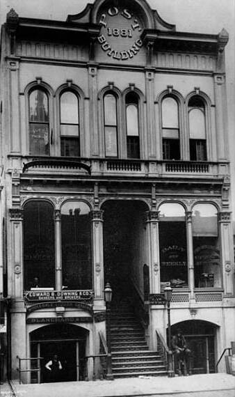
Counting Post Avenue and Post Alley as one street, and ignoring a couple of block-long gaps, this street runs about ¾ of a mile from Yesler Way in the southeast to Virginia Street in the northwest. (Post Avenue becomes Post Alley northwest of Seneca Street.) According to local historian Jean Sherrard, writing at PaulDorpat.com, it was named for the offices of the Seattle Post, predecessor of today’s Seattle Post-Intelligencer newspaper, which was built at the corner of Yesler and Post in 1881.

Seattle Post Building, by Asahel Curtis

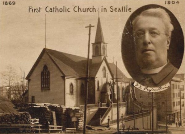
Prefontaine Place S

This street, which runs just under 400 feet from Yesler Way and 3rd Avenue S in the northwest to S Washington Street and 4th Avenue S in the southwest, cutting a skewed diagonal through the block, is named for Father Francis X. Prefontaine, Seattle’s first Catholic priest. In 1870, he founded Seattle’s first Catholic church, Our Lady of Good Help, on the block Prefontaine Place cuts through today.

Postcard of Father Francis X. Prefontaine and Our Lady of Good Help, first Catholic church in Seattle

Occidental Avenue S

Occidental Avenue S, which begins at Yesler Way in Pioneer Square, is one of those Seattle streets whose names extend into the suburbs. It makes its southernmost appearance at S 197th Street in Des Moines.

It received its name in 1895 as part of the Great Renaming — it had originally been S Second Street. It once had a partner, Oriental Avenue, to the east (originally S Fourth Street), which is today 3rd Avenue S. “Oriental,” of course, means “Eastern,” as “Occidental” means “Western.” (I haven’t been able to determine just when Oriental Avenue became 3rd, but it was last mentioned in The Seattle Times on October 17, 1920.)

And why this particular pairing? The Occidental Hotel, which once overlooked the beginning of Occidental Avenue, is almost certainly the reason, but it’s not spelled out in the ordinance.

Dilling Way

This street, which runs a mere 200 feet from 4th Avenue to Yesler Way in front of City Hall Park, is named for George W. Dilling, who was mayor of Seattle from 1911 to 1912.

In 1911, Mayor Dilling took an empty lot that until two years earlier had been the location of the Katzenjammer Castle, Seattle’s second city hall, and converted it into what is now known as City Hall Park — originally named Dilling Park in his honor. In 1916, the municipal offices moved once again, to the newly constructed King County Courthouse, then known as the City–County Building, across the Jefferson Street right-of-way from the park. They remained there until 1962, but the park retains the “City Hall” name.

In a letter dated March 29, 1937 from A.C. Van Soelen, corporation counsel for the city, to the Board of Public Works, regarding the ability of the city to restrict parking on Dilling Way, he writes that “Dilling Way apparently never was established or named by ordinance or other action of the City Council and was opened up or paved in 1915 or 1916, presumably in lieu of Jefferson Street which was closed between Third and Fourth Avenue though never formally vacated,” and suggests that the city council “affirmatively declare its policy” regarding the street by passing an ordinance. Such an ordinance was passed shortly thereafter, making the name of Dilling Way official. (Interestingly, that ordinance refers to the street as a “private way,” but the county’s quarter section map shows it as a public road. That same map shows that the walkway in front of the courthouse is still, technically, Jefferson Street.)