Thackeray Place NE

This street appears to be named for the British writer William Makepeace Thackeray (1811–1863), best known for his 1848 novel Vanity Fair. As local historian Rob Ketcherside explains in his blog post on “Renaming streets of Seattle’s Fremont to the U District”:

42nd St, 50th St, 1st Ave, and 5th Ave are the boundaries of the 1889 Harrison Heights Addition to the City of Seattle (annexed in 1891). J.A. Gould and Anna L. Gould, the owners, had the civil engineers draw a simple box around their property and didn’t bother to make their streets match those adjacent. But when the streets were renamed and woven together in the 1890s, 1st and 2nd Avenues bent west at 42nd while Latona, 4th and 5th bent east. Space for an extra road was left in between: Thackeray Place.

Their Dickens Street became 1st Avenue NE; Scott Street, 2nd Avenue NE; Cooper Street, Latona Avenue NE; Milton Street, 4th Avenue NE; and Kingsley Street, 5th Avenue NE. Thackery Street, as it was originally named, had no corresponding street in the already existing grid. (Why it was left alone instead of being renamed something like 2nd Place NE is unclear.) As Rob points out, these names are almost certainly those of the writers Charles Dickens, Walter Scott, James Fenimore Cooper, John Milton, Charles Kingsley… and William Makepeace Thackeray.

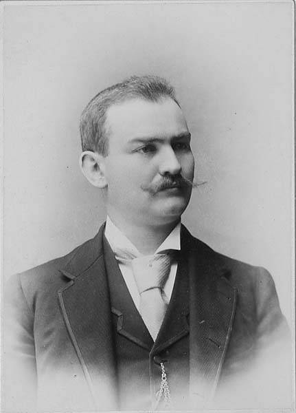
(J.A. [Joel Abdon] Gould, incidentally, appears to have been the founder of the first bank in San Juan County, the aptly named San Juan County Bank in Friday Harbor. His wife’s full name was Anna Lucretia Cary Gould; their son, Eugene Cary Gould Sr., succeeded his father as bank president and was also the first mayor of Friday Harbor.)

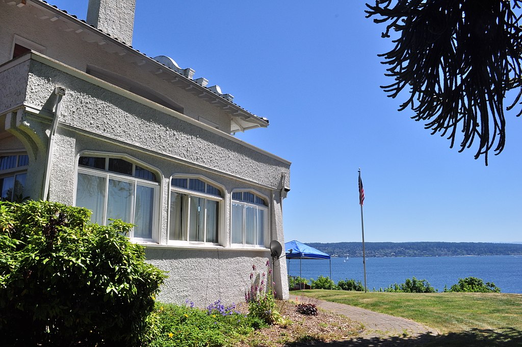
Thackeray Place NE begins at NE 42nd Street and goes ½ a mile north to NE 50th Street.

NE Elk Place

As requested by Steve Sorbo: what’s the deal with NE Elk Place — a rare named street in the sea of numbered ones that is Roosevelt and Maple Leaf?

It looks like the name originated as Elk Street in Pitner’s Division of Green Lake Addition to Seattle, W.T., filed July 30, 1889, by Levi Carroll Pitner (1824–1911), a Methodist minister from Illinois, and his wife, Arminda Francis Cartwright Pitner (1828–1917). Shortly thereafter, on November 16, 1889, Zenas Upham Dodge (1859–1942) and his wife, Mary Jane Jones Dodge (1861–1902), filed Dodge’s Division of Green Lake Addition to the City of Seattle, Wash. Because streets on the two plats do not change names when they cross from one to the other, it’s possible the Pitners and Dodges came up with the names together, or simply that the Pitners named the streets and the Dodges willingly went along. I am not sure when Seattle began requiring that streets not change names when they cross plat lines, but if it was before 1889, that could have been the case as well. I do know it wasn’t long before Ordinance 4044 — the “Great Renaming” — was passed in 1895, which sought to clean up the mess created by the previous decades’ lack of regulation.

At any rate, Elk is part of a series here including Buffalo and Deer, so someone — I’m not sure who — was apparently a fan of large ungulates. As for why Elk remains when Buffalo and Deer are gone, I’m not entirely sure either, although I do see that it’s in line with NE 82nd Street west of Latona Avenue NE, but between NE 82nd Street and NE 83rd Street as they’re laid out east of Latona. I suppose the choice would have been between something like 82nd Place and Elk Place, and Elk won out.

Cleopatra Place NW

This street is named for Cleopatra Lorena Johnson Porter (1888–1961). As FamilySearch tells us, her parents were Archie James Johnson and Sarah Melinda Young. Valarie Bunn, on her blog Wedgwood in Seattle History, explains how she found out the street was named for the Johnsons’ daughter rather than the queen of Egypt:

Plats named Cleopatra Park, 1st and 2nd Additions, were filed in 1905 and 1907 before Ballard was officially annexed to Seattle in May 1907 and before Ballard’s street names were revised to be consistent with the Seattle street system.… The owners of the Cleopatra Park Addition were Archie J. Johnson and his wife Linnie Johnson. We see that even though the property was in Ballard in Seattle, their plat filing document was notarized in Corvallis, Oregon.… Looking on the census of 1910 for this couple, we see the Johnsons recorded as living in Corvallis where Archie was the president of the Benton County State Bank. The census shows that Archie and Linnie Johnson had six children, all of whom were born in Oregon except their first child, daughter Cleopatra, who was born in Seattle in 1888.

Coming across Wedgwood in Seattle History and this post in particular, which also delves into the origins of Aloha Street and provides numerous resources for those who are interested in making their own discoveries, was one of the things that finally prodded me to get Writes of Way off the ground. Thank you, Valarie!

Street sign at NW 65th Street and Cleopatra Place NW, Seattle, October 12, 2021.
Street sign at NW 65th Street and Cleopatra Place NW, Seattle. Photograph by Benjamin Lukoff, October 12, 2021. Copyright © 2021 Benjamin Lukoff. All rights reserved.

W Kinnear Place

This street was named in 1895 for George Kinnear (1836–1912), the namesake of nearby Kinnear Park. Born in Ohio, he grew up first in Indiana, then Illinois. He fought for the Union during the Civil War and came to Seattle in 1878, his brother, John, following a few years later. During the time of anti-Chinese agitation, he was captain of the Home Guard that enforced the rule of law and prevented those who wished to expel Chinese laborers from doing so violently. His account of the events of February 1886 was published in the Seattle Post-Intelligencer in 1911 as “Anti-Chinese Riots at Seattle, Wn., February 8th, 1886.”

W Kinnear Place begins at 1st Avenue W and goes ⅖ of a mile west to W Prospect Street between Willard Avenue W and 7th Avenue W.

Frink Place S

This street, and the park through which it runs, were named for John Melancthon Frink (1855–1914). Born in Pennsylvania but raised in Kansas, he came to Seattle in 1874. At various times he was a teacher, businessman, school board director, city councilman, and state senator. Frink became a parks commissioner in 1906, the same year he bought Washington Park (not to be confused with the park of the same name to the north) and donated it to the city, which renamed it after him. Frink Place was established in 1927; there had been an earlier Frink Boulevard, but it, like University Boulevard, Stixrud Drive, and Blaine Boulevard, among others, had become part of Lake Washington Boulevard by 1920.

John M. Frink
John Melancthon Frink

S Frink Place begins at S Washington Street just east of 32nd Avenue S, and goes ⅙ of a mile through the park to the intersection of S Jackson Street, 34th Avenue S, and Lake Washington Boulevard S.

Orange Place N

This street was created in 1882 as part of Latta’s Addition to the City of Seattle, filed by Marion Cline Latta (1845–1924) and his wife, Mary (1867–1929). An architect, carpenter, and builder by trade, he came to Seattle in 1875 and left for what is now Bellingham in 1883; between then and 1918 he held various political offices, including city councilman, school board director, mayor, county commissioner, city treasurer, and city street superintendent.

In that plat, Orange Avenue, as it was then named, is to the east of Jacobs Avenue, which is today Warren Avenue N. When I first saw this, I immediately thought of Orange Jacobs (1827–1914), associate, then chief justice of the territorial supreme court from 1869 to 1875, territorial delegate to Congress from 1875 to 1879, mayor of Seattle from 1879 to 1880, territorial councilman from 1885 to 1887, city attorney in 1890, and superior court judge from 1896 to 1900. 

I have no proof, of course, that Orange Avenue was named for Orange Jacobs — people rarely, if ever, documented why they gave particular names to streets in their subdivisions — but Jacobs and Latta were both Republicans and, more importantly, members of the same Masonic lodge, so for now I’m willing to put Jacobs down as the namesake of Orange Place N.

Orange Jacobs
Orange Jacobs

E Denny Blaine Place

This short loop connects Lake Washington Boulevard E to 40th Avenue E and Denny Blaine Park on the Lake Washington waterfront. Street, park, and neighborhood — for the neighborhood is called Denny-Blaine too, though this time with a hyphen — are named for Charles Latimer Denny (1861–1919) and Elbert F. Blaine (1857–1942).

Denny was the youngest son of Arthur Armstrong Denny, leader of the Denny Party that landed at Alki Point in 1851; Blaine was a lawyer and parks commissioner from 1902 to 1908, and does not appear to be related to Catherine and David Blaine, after whom Blaine Street is named. Together, they operated the Denny-Blaine Land Company, and in 1901 filed the plat of Denny-Blaine-Lake Park to the City of Seattle (curiously, “Addition” seems to be missing before “to”). The street was originally named Whitman Place, and the park was unnamed; according to Seattle parks historian Don Sherwood, the street was renamed in 1918 to avoid confusion with Whitman Avenue N, and the park soon came to be known as Denny Blaine as well.

Incidentally, both portraits come from scans of newspapers; Blaine’s is from The Seattle Republican, September 27, 1912, and Denny’s is from the Seattle Post-Intelligencer, May 14, 1919 (his obituary). The original caption reads, in part:

The above photograph of Charles L. Denny was the last one he ever had taken. It was taken in the early nineties… and shows Mr. Denny, in the crude photography of that time, as he appeared when starting out on his successful business career.

Lanham Place SW

Like SW Bataan Street, Lanham Place SW is part of High Point, originally developed by the Seattle Housing Authority in 1942 as defense housing and redeveloped in 2004. The name was originally applied to SW Lanham Way, and was preserved while some other names, including SW Snow Court, Cycle Lane SW, and MacArthur Court SW, were eliminated. It was named for Fritz G. Lanham, Texas congressman, who sponsored the Lanham Act that created the Defense Homes Corporation.

Today, Lanham Place SW begins at 32nd Avenue SW and SW Raymond Street and goes ¼ mile southeast to 31st Avenue SW, Sylvan Way SW, and SW Morgan Street.

Knox Place E

This street in Madison Park — one I remember from childhood, as I was interested in maps and streets even then, and this one wasn’t part of the regular grid — is essentially a driveway for three houses. Only 100 feet long, it hangs off E Lee Street between 42nd Avenue E and the Lake Washington shoreline like an afterthought, which indeed it was, appearing neither on the 1875 plat of John J. McGilvra’s 2nd Addition to the City of Seattle nor the 1908 Board of State Land Commissioners’ Map of Lake Washington Harbor. The first reference to it in The Seattle Times is in 1925. I couldn’t find an ordinance establishing it, but I did find Ordinance 63622, passed in 1933:

An ordinance accepting deeds from Hubert W. Youngs and Maude E. Youngs, husband and wife, Harry Richmond, William G. Knox, and Bessie S. Woodworth, for an easement for sewer over and across a portion of J. J. McGilvra’s 2nd Addition and Lake Washington Shore Lands.

Since Knox Place is very close to where the two plats meet, I figure it’s a good bet that William G. Knox has something to do with Knox Place. FamilySearch says a William Gifford Knox (1884–1964) lived in Seattle for a time, and even had a scan of his draft registration card for World War I, from September 12, 1918. He appears to have been a salesman for the Dennison Manufacturing Company downtown, and his address is given as 1836 Laurel Shade Avenue. That street is now 43rd Avenue E, putting his residence just a few blocks north of Knox Place E. So, although I don’t have the whole story, I think we now know who Knox Place is named for.

William Gifford Knox World War I Draft Registration Card, 1918
William Gifford Knox draft registration card for World War I, September 12, 1918

Riviera Place NE

This narrow street, created in 1926 as part of Riviera Beach, an Addition to King County, Washington, Divisions № 1, 2, 3, and 4, and situated between the shoreline of Lake Washington and the right-of-way of the Northern Pacific Railway, appears on the plats simply as “Road” — it first appears in The Seattle Times on July 20, 1930, as “Riviera Beach Road,” and then on July 2, 1932, with its current name. The name simply means ‘coastline’ in Italian.

Today, Riviera Place NE begins at the north city limits, where Seattle meets Lake Forest Park at the NE 145th Street right-of-way, and goes nearly a mile south along the Lake Washington shoreline to a spot a few houses north of NE 125th Street, where it ends at one house and picks up again on the other side of its neighbor. From there, it runs 1¼ miles south to its end at Lake Shore Boulevard NE between NE 100th Street and NE 103rd Street. The portions between the NE 135th Street right-of-way and NE 125th Street are private.

Riviera Place NE is probably most notable to the city at large for being the location of the NE 130th Street End beach (renamed Lake City Beach Park in 2025), which became an official park in 2019 after years of controversy. It’s not, strictly speaking, a shoreline street end, because it’s owned by Seattle Parks and Recreation, rather than being a right-of-way under the jurisdiction of the Seattle Department of Transportation. This is because it was never properly dedicated to the public in 1932 (see background and court filings). For years, it had been treated as just another shoreline street end, but in 2012, when the city announced its intention to make improvements to the beach to improve public access, the neighbors on either side filed suit, and ended up having their ownership of the lot confirmed. The city ended up having to exercise its right of eminent domain, condemned the property, and paid the neighbors $400,000 each. (As unfortunate as it was to have to pay $800,000 for the street end, I’d say it was worth it, as NE 130th is the only accessible shoreline street end north of NE 43rd Street, and the only public lake access, period, north of Matthews Beach [around where NE 95th Street would be if it had been platted into the water].)

View of NE 130th Street park on Lake Washington east of Burke-Gilman Trail and Riviera Place NE, June 18, 2019.
View of NE 130th Street End park on Lake Washington east of Riviera Place NE, June 18, 2019. Photograph by Flickr user Seattle Parks and Recreation, licensed under Creative Commons Attribution 2.0 Generic

NE Kelden Place

This short street in Seattle’s Windermere neighborhood runs from 60th Avenue NE and NE 55th Street in the southwest to 63rd Avenue NE and NE 57th Street in the northeast. It was likely named after Lochkelden, the mansion built in 1907 for Rolland Herschel Denny (1851–1939) and his wife, Alice Martha Kellogg Denny (1857–1940). Rolland was just six weeks old when the Denny Party landed at Alki Point in November 1851. Lochkelden — owned since 1974 by Sun Myung Moon’s Unification Church — was itself named for Lake Washington, of which it has a commanding view (loch being Scottish for ‘lake’) and its owners: Kellogg and Denny.

Note added March 14, 2024: It appears, per Clay Eals at PaulDorpat.com, that the church put Lockhelden on the market in 2022 and it just sold for $6 million. The purchasers are developers, and property owned by religious organizations cannot get landmark protection against the owner’s will, so the mansion’s days are almost certainly numbered.

Note added December 18, 2024: Jean Sherrard just posted a video of Lockhelden being demolished.

South façade of Lochkelden, June 24, 2017
South façade of Lochkelden, June 24, 2017. Photograph by Joe Mabel, Wikimedia Commons, licensed under Creative Commons Attribution 4.0 International

W View Place

W View Place, formerly an unnamed block-long alley between 28th Avenue W and 29th Avenue W just south of W Elmore Place, was named in 1950 at the request of Norman E. Boor, et al. The houses at 2805, 2815, and 2829 were all built in 1947, according to county records; I suppose this necessitated that the street be named, and for some reason no one could come up with anything more interesting than “View,” for the view of Ballard residents were able to enjoy.

Given the choice between W Boor Place and W View Place, I’d take the latter, but really… I’m surprised this was approved, especially given the existence of View Avenue NW near Golden Gardens Park.

Bishop Place W

This Magnolia street, which goes not quite 700 feet from 37th Avenue W just south of W Armour Street in the south to W Fulton Street just west of 36th Avenue W in the north, originated in 1939 as part of the plat of Carleton Park Terrace, an Addition to the City of Seattle, filed by C.F. Bishop, Jr., his wife, Elizabeth, and the city of Seattle itself, owners of the land in question.

Charles F. Bishop, Jr. (1881–1963) was — according to his Seattle Post-Intelligencer and Seattle Times obituaries, and based on information in his father’s Times obituary from 1943 — born in Brockport, New York, near Rochester, and came to Seattle when he was 18. The elder Bishop was a marine engineer for the Alaska Steamship Company and the Puget Sound Navigation Company. Bishop Jr. was a grocery wholesaler who ran the Puget Sound Quality Stores (PSQ Stores) cooperative, which, according to local historian Paul Dorpat in his April 6, 1986 Now & Then column for the P-I, was a predecessor of Associated Grocers — now, after a number of mergers and acquisitions, part of United Natural Foods

Bishop founded Modern Home Builders, Inc., with his brother, Ralph Waldo Bishop, Sr., in 1940, the year after he filed the plat of Carleton Park Terrace. This particular plat of his carried no racial restrictive covenants, but the adjacent Carleton Park Terrace Division № 3, filed in 1941, did, banning non-whites from living in the subdivision unless they were domestic servants of white residents.

Union Bay Place NE

This street, which runs ⅕ of a mile from 30th Avenue NE in the northwest to the “five corners” intersection with NE 45th Street, NE 45th Place, and Mary Gates Memorial Drive NE, was created in 1907 as part of the Exposition Heights addition. Four years later, the street was extended southeast of NE 45th Street through University of Washington property to NE 41st Street. However, in 1995 that portion was renamed Mary Gates Memorial Drive NE.

As can be seen in the map below, it did once parallel Union Bay; however, when the Montlake Cut of the Lake Washington Ship Canal opened in 1916, the lake and bay dropped by 8.8 feet to match the level of Lake Union and this was no longer waterfront property. The southwest corner of this map is now entirely devoted to commercial and residential use.

Portion of plat map of Exposition Heights showing Union Bay and Union Bay Place

Union Bay itself was named in 1854 by settler Thomas Mercer, with the idea that it and Lake Union, which he also named, would one day be part of a connection from Lake Washington to Puget Sound. As mentioned above, this did end up happening 62 years later.

NE Tulane Place

Another one of the “university” streets in the Hawthorne Hills subdivision, created in 1928, NE Tulane Place was named for Tulane University in New Orleans, Louisiana. It runs diagonally a mere tenth of a mile from NE 57th Street and 45th Avenue NE to NE 55th Street.

Vashon Place SW

This street — just about 350 feet long, like its neighbor Blake Place SW — connects SW Othello Street to Fauntleroy Way SW just north of Solstice Park. Created as part of the Lincoln Home Addition in 1907 by builder Albert Eugene Felmley and his wife, Mabel L. Felmley, it is named after Vashon Island, located 4 miles to the southwest, across Puget Sound. The island itself was named for Royal Navy Admiral James Vashon by his friend, Royal Navy Captain George Vancouver, in 1792.

Two other streets in the Lincoln Home Addition are named for Puget Sound islands: the already-mentioned Blake Place SW, and Bainbridge Place SW.

Aerial view of Vashon Island from the northwest
Aerial view of Vashon and Maury Islands from the northwest. Photograph by Flickr user Travis, licensed under Creative Commons Attribution-NonCommercial 2.0 Generic

Blake Place SW

This 350-foot-long street connects SW Othello Street to SW Fontanelle Street just north of Solstice Park. It was created as part of the Lincoln Home Addition in 1907 by builder Albert Eugene Felmley and his wife, Mabel L. Felmley, and is named after Blake Island, located 4⅖ miles to the west, across Puget Sound. The island itself was named for U.S. Navy Commodore George Smith Blake, then head of the United States Coast Survey, by Charles Wilkes in 1841.

Two other streets in the Lincoln Home Addition are named for Puget Sound islands: Bainbridge Place SW and Vashon Place SW.

Aerial view of Blake Island from the east
Aerial view of Blake Island from the east (West Seattle in foreground). Photograph by Joe Mabel, Wikimedia Commons, licensed under Creative Commons Attribution-Share Alike 3.0 Unported

Bainbridge Place SW

This short street — not quite 275 feet long — connects SW Othello Street to Fauntleroy Way SW just north of Lincoln and Solstice Parks. Created as part of the Lincoln Home Addition in 1907 by builder Albert Eugene Felmley and his wife, Mabel L. Felmley, it is named after Bainbridge Island, located 5¼ miles to the northwest, across Puget Sound. The island itself was named for U.S. Navy Commodore William Bainbridge, commander of the USS Constitution, by Charles Wilkes in 1841.

Two other streets in the Lincoln Home Addition are named for Puget Sound islands: Blake Place SW and Vashon Place SW.


Aerial view of Bainbridge Island from the southeast
Aerial view of Bainbridge Island from the southeast. Photograph by Dicklyon, Wikimedia Commons, licensed under Creative Commons Attribution-Share Alike 4.0 International

NE Latimer Place

This semicircular street, about 750 feet long, begins at NE 41st Street just west of 51st Avenue NE, and rejoins 41st just west of 55th Avenue NE. According to articles the Laurelhurst Blog and Puget Sound Business Journal, it was named for Norval Hastings Latimer (1863–1923), who had been president of the Dexter Horton National Bank. It was created in 1935.

The house that was the subject of both articles, 5515 NE Latimer Place, was, according to county records, built in 1925, two years after Latimer’s death — perhaps he had intended to purchase it once it was completed but it was his family who ended up doing so? Or perhaps it was in fact built a few years earlier. At any rate, the Laurelhurst Blog says that “the Latimer Family… re-platted the grounds to be sold in the 1930’s, saving the 20,000+ square foot lot and carriage house for themselves.“ (The recent owner of the house quoted in the PSBJ as saying “Latimer named the street after himself and sub-divided the property” was incorrect, as this happened 12 years after his death.)

Norval Hastings Latimer, 1890. Photograph by Boyd and Braas.

Nicklas Place NE

This short street runs just over a tenth of a mile from 50th Avenue NE by St. Bridget Catholic Church in the northwest to NE 50th Street by Villa Academy in the southeast. It was established in 1913 as part of the Montlake Tracts addition by “Magdalena Nicklas, a widow.” Legal advertisements in The Seattle Republican newspaper in 1908 show her husband’s name to have been John Nicklas. Based on this article by Valarie Bunn, this FamilySearch page, this Find a Grave page, plus an item in the November 25, 1941, issue of the Seattle Post-Intelligencer, saying that 20 years earlier “the first woman to homestead on Sand Point, Mrs. Magdalena Nicklas, eighty-two, dies at her home,” we can expand the Nicklases’ biographical information to be Magdalena Kummer, 1839–1921, and Johann “John” Nicklas, 1834–1908, who were farmers in what is now Přimda, Czech Republic, but was then Pfraumberg, Austria–Hungary. They came to the United States in 1867 and to Seattle in 1878, and their land claim covered the 160 acres between what is now NE 45th Street on the south, NE 55th Street on the north, 45th Avenue NE on the west and 55th Avenue NE on the east.

Map of land claims in what is now Laurelhurst, Seattle
Map of land claims in what is now Laurelhurst, from A History of Laurelhurst by Christine Barrett, published 1981.
Photograph of Joseph and Frances Nicklas, The Seattle Star, June 26, 1924
Joseph and Frances Nicklas featured in The Seattle Star, June 26, 1924. Joseph was the son of John and Magdalena, and was 17 when the family made their claim in 1878. The caption reads: “Just down the lane, over the stile,” you will find it — bowered in trees — the abode of peace and good-will, the “old homestead” of Joseph and Frances Nicklas. They settled there in ’78 — and there they are today, within the limits of a great city — happy and blessed with life’s greatest gift — serenity of soul. To them in their simple life is vouchsafed that which kings of the earth and their royal consorts would perhaps barter for, even unto the half of their kingdoms. But “kings of the earth” literally, indeed, are the homekeeping hearts at 50th and East 55th — Seattle, Washington. (That location is today where NE 55th Street, Ivanhoe Place NE, 50th Avenue NE, and NE Sand Point Way meet.)