This street, which runs ⅕ of a mile from 30th Avenue NE in the northwest to the “five corners” intersection with NE 45th Street, NE 45th Place, and Mary Gates Memorial Drive NE, was created in 1907 as part of the Exposition Heights addition. Four years later, the street was extended southeast of NE 45th Street through University of Washington property to NE 41st Street. However, in 1995 that portion was renamed Mary Gates Memorial Drive NE.
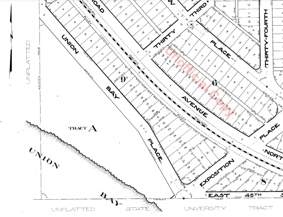
As can be seen in the map below, it did once parallel Union Bay; however, when the Montlake Cut of the Lake Washington Ship Canal opened in 1916, the lake and bay dropped by 8.8 feet to match the level of Lake Union and this was no longer waterfront property. The southwest corner of this map is now entirely devoted to commercial and residential use.

Union Bay itself was named in 1854 by settler Thomas Mercer, with the idea that it and Lake Union, which he also named, would one day be part of a connection from Lake Washington to Puget Sound. As mentioned above, this did end up happening 62 years later.
Born and raised in Seattle, Benjamin Donguk Lukoff had his interest in local history kindled at the age of six, when his father bought him settler granddaughter Sophie Frye Bass’s Pig-Tail Days in Old Seattle at the gift shop of the Museum of History and Industry. He studied English, Russian, and linguistics at the University of Washington, and went on to earn his master’s in English linguistics from University College London. His book of rephotography, Seattle Then and Now, was published in 2010. An updated version came out in 2015.