S Massachusetts Street

This is another of the many streets created in 1895 as part of the Seattle Tide Lands plat that were named after states, e.g., Utah Avenue SColorado Avenue SS Oregon StreetS Idaho Street, and SW Florida Street.

SW Massachusetts Street begins in West Seattle at the intersection of Bonair Drive SW, 47th Avenue SW, and Sunset Avenue SW, and goes just under ⅓ of a mile east to Palm Avenue SW. It begins again at Ferry Avenue SW and goes just over 450 feet east to Victoria Avenue SW. There is a short segment (just over 400 feet) on Harbor Island east of 13th Avenue SW, and then another one, about the same length, leading from Alaskan Way S to the entrance to U.S. Coast Guard Base Seattle. (Here, the street’s directional designation has changed to S, it being east of the Duwamish Waterway.)

S Massachusetts Street resumes at Colorado Avenue S and goes ⅙ of a mile east to Occidental Avenue S. There is a block-long segment east of 4th Avenue S to just shy of the SODO Busway, and then a longer one — about ¼ of a mile — from the SODO Trail to Airport Avenue S.

East of Interstate 5, on Beacon Hill, S Massachusetts Street begins at 11th Avenue S and goes nearly ¼ of a mile east to just past 15th Avenue S, the portion between 14th Avenue S and 15th Avenue S being pedestrian-only, as the right-of-way between the sidewalks has been turned into the Beacon Bluff P-Patch community garden. It begins again just west of Sturgus Avenue S and goes nearly a mile east to just past 31st Avenue S, the portion that runs for half a block west of 17th Avenue S being a pathway. S Massachusetts Street resumes for the last time at 32nd Avenue S and goes ¼ mile east to Lake Washington, where it is a shoreline street end.

https://www.flickr.com/photos/litlnemo/1354627272
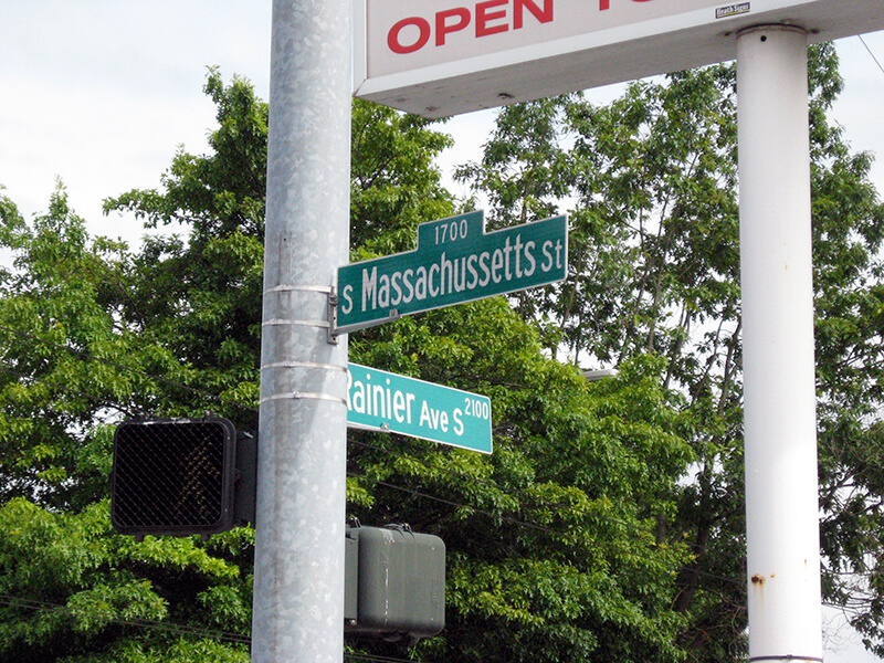
Misspelled street sign at the corner of Rainier Avenue S and S Massachusetts Street, July 2007. Photograph by Flickr user litlnemo (Wendi Dunlap), licensed under Creative Commons Attribution-NonCommercial-ShareAlike 2.0 Generic.

S Oregon Street

This street received its name in 1907, uniting streets formerly known as Nebraska Street, 8th Street, Bedford Street, Conover Street, and G Street. (There had been an Oregon Street in the 1895 Seattle Tide Lands plat in which Nebraska Street was created, but it became Spokane Street and Chelan Avenue in the same 1907 change.)

S Oregon Street begins in West Seattle as SW Oregon Street at the Emma Schmitz Memorial Overlook on Beach Drive SW and goes two blocks east to Me-Kwa-Mooks Park at 56th Avenue SW. It briefly resumes at 52nd Avenue SW and goes two blocks east to 51st Avenue SW, then begins again in earnest at 50th Avenue SW, going nearly a mile east to the West Seattle Stadium at 35th Avenue SW, part of the stretch between there and Fauntleroy Way SW being footpath and stairway. East of the West Seattle Golf Course, it goes around 175 feet to 26th Avenue SW and the Delridge Playfield, and on the other side of the playfield serves as a short connector between Delridge Way SW and 23rd Avenue SW.

S Oregon Street resumes east of the Duwamish Waterway at a shoreline street end and goes ¼ mile east to E Marginal Way S. It then serves as short connectors between Diagonal Avenue S and Denver Avenue S and between 7th Avenue S and Airport Way S.

East of Interstate 5, on Beacon Hill, S Oregon Street begins again at 10th Avenue S and goes ⅓ of a mile east to 15th Avenue S and S Columbian Way. It picks up again in the Rainier Valley at S Columbian Way and Martin Luther King Jr. Way S and goes ⅔ of a mile east to Genesee Park at 42nd Avenue S. East of the park, it resumes at 47th Avenue S and goes ¼ mile east to its end at 52nd Avenue S above the Lakewood Marina on Lake Washington.

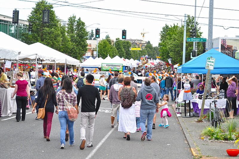
West Seattle Summer Fest at SW Oregon Street, July 2013
Looking south on California Avenue SW toward SW Oregon Street during West Seattle Summer Fest, July 2013. Photograph by Joe Mabel, Wikimedia Commons, licensed under Creative Commons Attribution-ShareAlike 2.0 Generic

S Nevada Street

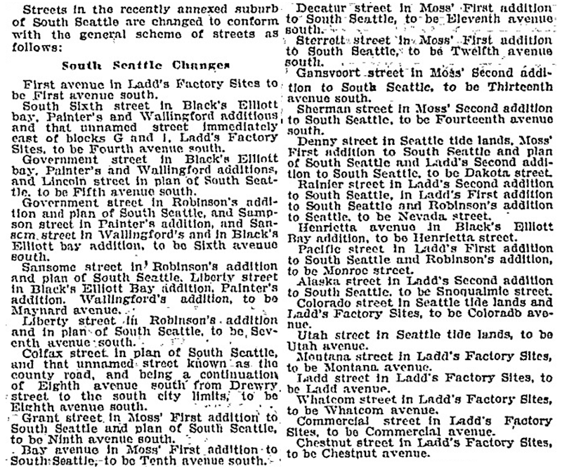
This street — originally Rainier Street in the Industrial District — received its current name in 1906, a few months after the town of South Seattle was annexed by Seattle in October 1905.

Article on South Seattle street name changes in January 14, 1906, issue of the Seattle Post-Intelligencer
Article listing South Seattle street name changes in January 14, 1906, issue of the Seattle Post-Intelligencer

SW Nevada Street begins in West Seattle at 30th Avenue SW and goes ¼ mile east to 26th Avenue SW. It next appears east of the Duwamish Waterway in the Industrial District, as a ¼-mile-long service road off E Marginal Way S and a 300-foot-long dead-end road off 6th Avenue S. East of Interstate 5 on Beacon Hill, it goes ¼ mile east from 11th Avenue S to 16th Avenue S at Jefferson Park. It resumes for the last time in Rainier Valley at 28th Avenue S and S Adams Street and goes ¼ mile east to 31st Avenue S.

S Idaho Street

This is one of the many streets created as part of the 1895 Seattle Tide Lands plat that were named after U.S. states, including S Dakota Street, Utah Avenue S, and Colorado Avenue S. If I am correct, though, it is by far the shortest, as S Idaho Street begins just east of the Duwamish Waterway and goes just ¼ mile east to E Marginal Way S.

S Dakota Street

This street was created in 1895 as part of the Seattle Tide Lands plat. As I wrote in S Spokane Street,

Streets in this plat that were not extensions of already existing ones, such as Commercial Street, were named after letters of the alphabet, American cities, American states, prominent local politicians, and places in Washington.… the states appear neither in alphabetical nor geographic order.

In this case, of course, the street was named for the Dakotas, not for South Dakota.

SW Dakota Street begins at 56th Avenue SW and goes 1⅓ miles east to 34th Avenue SW. It resumes at 30th Avenue SW and goes a further ⅓ of a mile east to Delridge Way SW, the portion between 28th Avenue SW and 26th Avenue SW being footpaths through the Longfellow Creek Natural Area park. SW Dakota Street begins again just west of 21st Avenue SW and goes just over 750 feet east to 19th Avenue SW, and there is one final segment west of the Duwamish Waterway between 16th Avenue SW and W Marginal Way SW.

East of the Duwamish, S Dakota Street runs for a block between 1st Avenue S and 2nd Avenue S, then picks up again at 6th Avenue S and goes ¼ mile east to 9th Avenue S. East of Interstate 5 on Beacon Hill, S Dakota Street resumes at 12th Avenue S and goes another ¼ mile east to Jefferson Park at 16th Avenue S. It begins again in the Rainier Valley at 29th Avenue S and goes ⅓ of a mile east to 34th Avenue S, picking up again at Rainier Avenue S and going ⅖ of a mile east to Genesee Park at 43rd Avenue S. On the other side of the park, it resumes at 46th Avenue S and goes ⅓ of a mile east to its end at 51st Avenue S, overlooking Lake Washington.

SW Florida Street

This street was created in 1895 as part of the Seattle Tide Lands plat along with S Spokane Street, Colorado Avenue S, Utah Avenue S, Duwamish Avenue S, Klickitat Avenue SW, and others. As I wrote in S Spokane Street,

Streets in this plat that were not extensions of already existing ones, such as Commercial Street, were named after letters of the alphabet, American cities, American states, prominent local politicians, and places in Washington.… the states appear neither in alphabetical nor geographic order.

SW Florida Street begins on Harbor Island at 11th Avenue SW and goes ¼ mile southwest to 16th Avenue SW. The right-of-way continues for another ⅖ of a mile through Terminal 5 in West Seattle, though only a small portion (beginning at Harbor Avenue SW and going about 700 feet northeast) corresponds with an actual roadway.

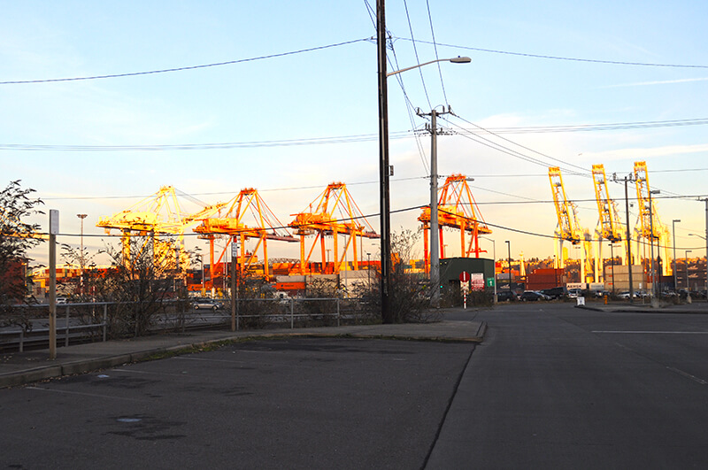
Cranes at the east end of SW Florida Street, Harbor Island, Seattle, Washington, USA, December 17, 2011
Harbor Island cranes at the east end of SW Florida Street, December 2011. Photograph by Joe Mabel, Wikimedia Commons, licensed under Creative Commons Attribution-ShareAlike 3.0 Unported

Ohio Avenue S

This street was created in 1918 as part of the Industrial Addition to the City of Seattle. Named for the Buckeye State, it appears to have been so named simply for its proximity to Colorado Avenue S and Utah Avenue S, as it was a state whose name had not yet been applied to a street. (N.H. Latimer and John H. Powell of the Wauconda Investment Company might have chosen Illinois, instead, both having been born there and having named their company after an Illinois town ― but the name had already been assigned in the same 1895 plat of the Seattle Tide Lands that created Colorado and Utah Avenues.)

Ohio Avenue S begins at Diagonal Avenue S and goes nearly ½ a mile south to E Marginal Way S and S Dawson Street. It resumes ⅛ of a mile south of there at E Marginal Way S and S Brandon Street and goes a further ⅓ of a mile south to S Fidalgo Street.

Utah Avenue S

Like Colorado Avenue S, this street was created in 1895 as part of the plat of Seattle’s tide lands. As I wrote in that post,

As Seattle expanded to the south, it became obvious that Commercial Street (1st Avenue S) would not be the westernmost street east of Elliott Bay. Fortunately, instead of using zero or negative numbers, they went with states: the first street west of 1st was named Utah, and the next, Colorado. (Some perpendicular streets were named Alaska, Vermont, Connecticut, Texas, Massachusetts, etc. There doesn’t appear to have been any particular order.)

Utah Avenue S begins at S Atlantic Street and goes 1⅐ miles south to S Hinds Street, the block between S Stacy Street and S Lander Street, in front of the Starbucks Center, being closed to motorized traffic. There is another short segment between Denver Avenue S and S Alaska Street, and a final one that stretches ⅓ of a mile from S Hudson Street to S Findlay Street.

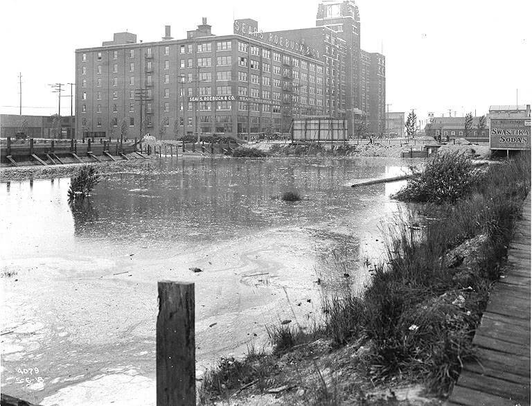
Sears building, 1918
The most famous structure on Utah Avenue S was built between 1912 and 1915 as the West Coast catalog distribution center for Sears, Roebuck and Company. It was once the largest building west of the Mississippi River. This photograph was taken in May 1918.
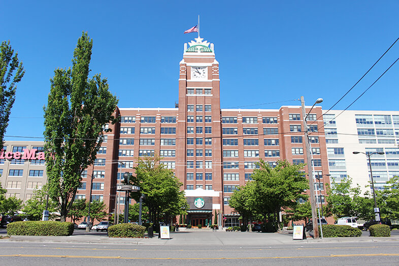
Starbucks Center, 2016
A Sears retail store opened in the building in 1925. The distribution center closed in 1987; Starbucks made the building its world headquarters in 1997, and the retail store closed in 2014. Photograph by Wikimedia Commons user Coolceasar, licensed under Creative Commons Attribution-ShareAlike 4.0 International

Montana Circle

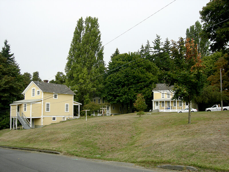
Like almost every other street in Fort Lawton (1900−2011), which became Discovery Park, Montana Circle was named after a state of the Union. Unlike almost every other street in Discovery Park, however, Montana Circle is a private road and in fact not part of the park at all. This is because the houses here, originally built for non-commissioned officers, were in use as military housing at the time the Army officially closed the fort. According to Monica Wooton of the Magnolia Historical Society, writing in the Queen Anne & Magnolia News, this meant that the property had to be sold at market rate instead of returned to the city as surplus, as most of the rest of the park had been. The city did manage to come up with $11 million to demolish some non-historic housing and restore the forest, but

Friends of Discovery Park could not get a partnership with government and other entities needed to purchase the Officer’s Row and NCO housing because of the cost mandated by the Privatization Act [while] the economic recession was taking hold.

As the Seattle Daily Journal of Commerce reported in April 2016,

The 13 homes in Montana Circle at Fort Lawton all have sold in about three months, and prices on the ones that have closed average $484 a square foot. Prices ranged from $799,000 to $1,050,000.

This provided a nice profit for the real estate firm that bought Officer‘s Row and Montana Circle from the military for $9.5 million.

Montana Circle begins at Discovery Park Boulevard just east of Kansas Avenue and loops around to rejoin Discovery Park Boulevard around 100 feet to the east.

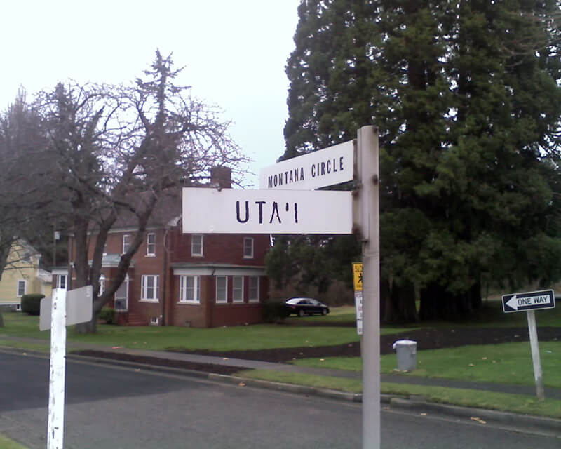
Street sign at corner of Montana Circle and Utah Street, January 15, 2011
Street sign at corner of Montana Circle and Utah Street (now Discovery Park Boulevard), January 15, 2011. Photograph by Benjamin Lukoff. Copyright © 2011 Benjamin Lukoff. All rights reserved.

Texas Way

As I note in Illinois Avenue, most streets in Fort Lawton (1900−2011), which became Discovery Park, were named after states, and this one is no exception. According to this map, the southernmost part of what is now Texas Way was originally Indiana Avenue and Delaware Avenue — the three were consolidated some time before 1967, when this map was made by the Fort Lawton Office of the Post Engineer. (As with Illinois Avenue and every other street in Discovery Park except for 45th Avenue W, Texas Way has never carried a directional designation.)

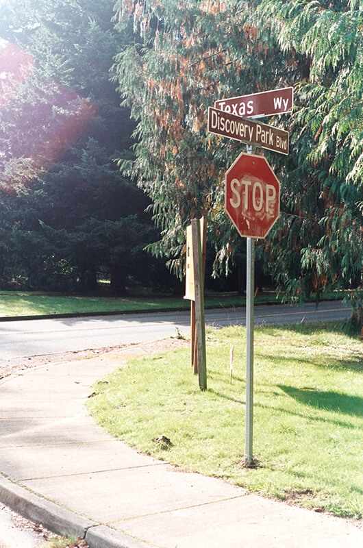
Street sign at corner of Texas Way and Discovery Park Boulevard, October 30, 2011
Street sign at corner of Texas Way and Discovery Park Boulevard, October 30, 2011. Photograph by Benjamin Lukoff. Copyright © 2011 Benjamin Lukoff. All rights reserved.

Today, Texas Way begins as a pathway south of the Discovery Park playground and goes ¼ of a mile east, then north, to 36th Avenue W just south of its intersection with Discovery Park Boulevard and W Government Way. It resumes as a paved road just to the north at Discovery Park Boulevard and goes just over ⅔ of a mile north, then northwest, to Illinois Avenue at the entrance to the park’s North Parking Lot. Here, it once again becomes a pathway and continues another ¾ of a mile northwest, then south, to rejoin Discovery Park Boulevard just west of the Utah Wetlands.

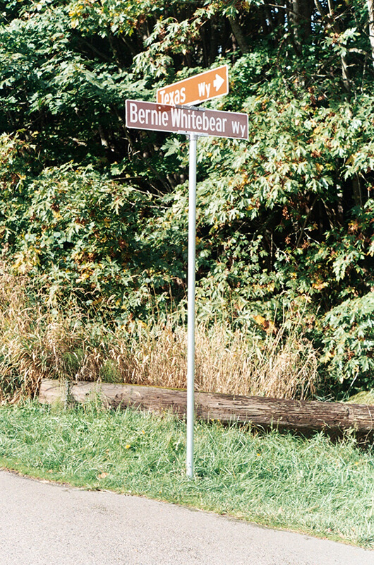
Signs at corner of Texas Way and Bernie Whitebear Way, October 30, 2011
Signs at corner of Texas Way and Bernie Whitebear Way, October 30, 2011. Photograph by Benjamin Lukoff. Copyright © 2011 Benjamin Lukoff. All rights reserved.

Illinois Avenue

This street, like most others in Fort Lawton (1900−2011), which is now Discovery Park, was named by the United States Army after a state of the Union. I am not sure when the post’s streets were so named or who made the decision, but it can have been no later than 1944, when this map was made by the Army Corps of Engineers. (Here’s a much higher-resolution version from the Seattle Municipal Archives, created in 1973 but based on the older map.) One can see there that what are today Illinois Avenue and Bernie Whitebear Way were originally Vermont Way, Illinois Street, Lawton Road, and Florida Avenue. At some point before 1967 (see this map made by the Fort Lawton Office of the Post Engineer) the four were combined, and in 2011 the middle portion was renamed after Native American activist Bernie Whitebear.

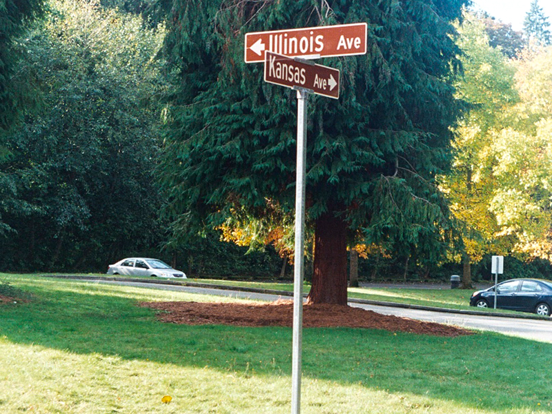
Sign at corner of Illinois Avenue and Texas Way (mislabeled as Kansas Avenue), Discovery Park, October 30, 2011
Sign at corner of Illinois Avenue and Texas Way (mislabeled as Kansas Avenue), Discovery Park, October 30, 2011. Photograph by Benjamin Lukoff. Copyright © 2011 Benjamin Lukoff. All rights reserved.

Today, the eastern section of Illinois Avenue begins at Discovery Park Boulevard and goes ¼ of a mile north to Texas Way, where it turns into Bernie Whitebear Way. (Except for 45th Avenue W, no street in Discovery Park carries directional designations, nor did they when it was still a fort.) The western section, which is closed to traffic, begins at Texas Way and Discovery Park Boulevard and goes ¼ mile north to connect with footpaths that themselves connect to the North Beach Trail.

SW Maryland Place

This short West Seattle street was created along with Elm Place SW as part of the 1888 First Plat of West Seattle by the West Seattle Land and Improvement Company. Originally Courtland Street, it became joined to Maryland Street when the latter was created as part of the 1895 Seattle Tide Lands plat. When West Seattle was annexed to Seattle in 1907, both were renamed Maryland Place.

(The tideland streets in West Seattle were, with a few exceptions, named after states: Illinois, [New] Hampshire, Arkansas, [New] Jersey, Rhode Island, [New] Mexico, Maryland, Louisiana, Georgia, [North and South] Carolina, Florida, Mississippi, Oregon, [North and South] Dakota, and Idaho. Of the ones confined to West Seattle, only Maryland remains [Florida, Oregon, Dakota, and Idaho also, or only, appear east of the West Duwamish Waterway].)

Today, SW Maryland Place begins at Elm Place SW and goes around 130 feet northeast to Harbor Avenue SW.

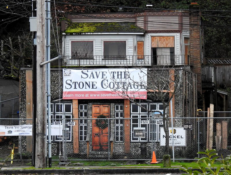
The West Seattle Stone Cottage, corner of SW Maryland Place and Harbor Avenue SW, December 31, 2020
The Stone Cottage, corner of SW Maryland Place and Harbor Avenue SW, December 31, 2020. The campaign to save the building succeeded, and it was moved into storage on August 18, 2021. Photograph by Flickr user Mark Ahlness, licensed under Creative Commons Attribution-NonCommercial-NoDerivs 2.0 Generic

Alaskan Way

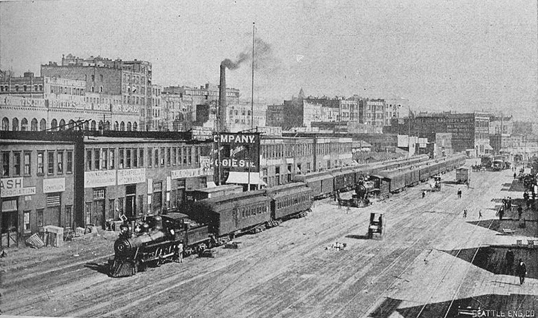
Alaskan Way was originally Railroad Avenue. Jennifer Ott writes for HistoryLink.org:

On the central waterfront a web of railroads grew out from the shore in the 1880s and 1890s as various railroads, including the Columbia & Puget Sound, the Seattle, Lake Shore & Eastern, and the Northern Pacific jockeyed for space at the foot of the bluffs that ended at the beach, where Western Avenue is today. In January 1887 the City Council passed an ordinance establishing Railroad Avenue, a street created, according to historian Kurt Armbruster, to provide space for the Seattle, Lake Shore & Eastern franchise to the west of the Northern Pacific’s franchise along the shoreline.

Railroad Avenue looking south from between Madison and Marion Streets, circa 1898

When the tidelands were platted in 1895, Railroad Avenue extended to Harbor Island and West Seattle, but:

  • Sometime between 1912 and 1920 the Harbor Island portion was renamed W Florida Street (SW Florida Street today).
  • In 1907, the West Seattle portion was renamed Alki Avenue.
    • Sometime between 1912 and 1920 the West Seattle portion southeast of Duwamish Head was given its current name, Harbor Avenue.

In an article for Crosscut, Knute Berger explains why a new name was wanted for the remainder:

Seattle’s waterfront was unpaved — a beat-up plank road ran its length. There was no modern seawall — the street was built over the water. Train tracks were everywhere.… But the waterfront was undergoing a massive renovation. A seawall was being constructed, the shoreline filled in, the road made into a wide, paved boulevard.…

According to Berger and Ott’s articles, names that were proposed but were ultimately rejected included Anchors Way, Artery Way, Battery Way, Bois Boolong, Bread Street, Cargo Way, Chief Seattle Avenue, Cosmos Quay, Dock Street, Export Way, Fleet Way, Gateway Avenue, Golden West Way, Hiak Avenue, Klatawa Avenue, Maritime Avenue, Metropolis Avenue, Olympian Way, Pacific Way, Pier Avenue, Port Strand, Port Way, Port-Haven Drive, Potlatch Avenue, Puget Avenue, Puget Dyke, Puget Portal, Queen City Way, Roadstead Way, Salt Spray Way, Salt Water Avenue, Seawall Avenue, Seven Seas Road, Skookum Way, Steamship Way, Sunset Avenue, Terminal Avenue, Terrebampo Way, The Battery, The Esplanade, Transit Row, Voyage Way, Welcome Way, and Worldways Road. (Those in italics apparently came under serious consideration.)

So how did we end up with Alaskan Way? And why Alaskan instead of Alaska (the already existing S Alaska Street could have been renamed)?

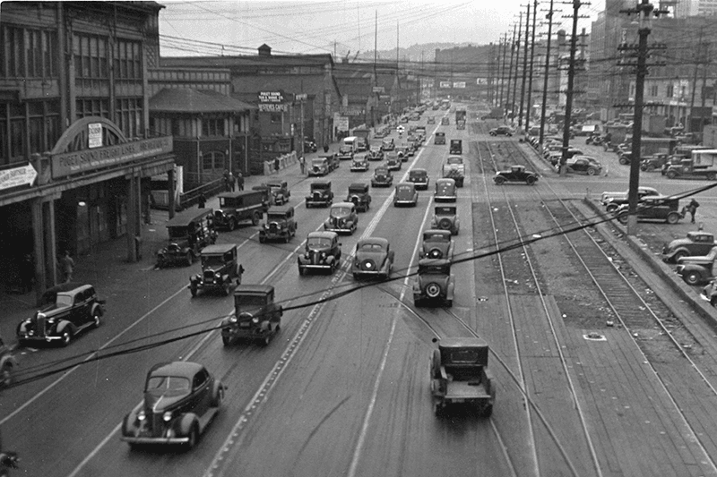
Alaskan Way, July 1939
Alaskan Way between Marion and Madison Streets, Canadian National Dock at left, July 1939. Courtesy of the Seattle Municipal Archives, Identifier 77093

The May 19, 1932, issue of The Seattle Times reports that the Seattle Maritime Association had run a renaming contest which received “more than one thousand letters… some of them contained scores of suggestions.” 4,868 names (including duplications) were received, and the judges selected four finalists, in order of preference: Puget Portal (one submission), Klatawa Avenue (one submission, from Chinook Jargon word meaning ‘to go, to travel’), Hiak Avenue (one submission, from Chinook Jargon word meaning ‘lively, quick and fast’), and Maritime Avenue (49 submissions [Maritime Way received 99 submissions but was not chosen]). The next day, the Times reported that the judges had chosen Maritime Avenue, and awarded the $20 prize to a Mr. B.I. Schwartz, the first to have suggested the name.

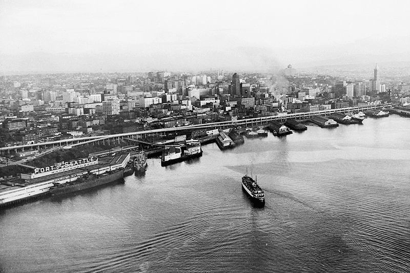
Alaskan Way Viaduct, July 1952
Alaskan Way Viaduct, July 1952, the year before it opened. The double-decker freeway paralleled Alaskan Way as far north as Union Street, where it diverged from the alignment on its approach to Elliott Avenue and the Battery Street Tunnel. Bell Street Pier, with the large Port of Seattle sign, is at left. The Bell Street Overpass can be seen behind the ‘P’ in ‘Port’. The bridge at the southern end of the pier is the Lenora Street Viaduct. Courtesy of the Seattle Municipal Archives, Identifier 43586

However, that July, a George D. Root proposed the name Cosmos Quay. At first, it was met with indifference, and then it seems the entire renaming project was put on the back burner until construction progressed. Somehow, when he restarted his campaign in 1934, Cosmos Quay became a leading candidate, and it was approved unanimously by the city council on January 14, 1935. An ordinance began to be drafted. But, as the Seattle Post-Intelligencer noted the next day, this was only because one councilmember, Frank J. Laube, had been absent… and he was adamantly opposed.

He wasn’t the only one. The Seattle Times published an editorial on January 20 headlined ‘City Locksmith Needed for Pronunciation Key’, which proclaimed that “to burden the waterfront stretch with a name that could be used and understood only through long courses in cosmogony, cosmology, etymology, and articulation would be a sad piece of nonsense for which there is no excuse.” The next day the Times reported that David Levine, city council president, said Cosmos Quay “no longer sounds so good to him. Many citizens have complained its meaning, as well as its pronunciation, mystifies them.” On February 4, according to the P-I, the council killed the ordinance and decided to leave Railroad Avenue as it was.

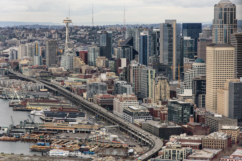
Alaskan Way Viaduct, February 2018
Alaskan Way Viaduct, February 2018. It closed permanently in January 2019; the replacement tunnel opened the next month. and demolition was complete by November of the same year. Photograph by Flickr user Washington State Department of Transportation, licensed under Creative Commons Attribution-NonCommercial-NoDerivs 2.0 Generic

When the new street opened in 1936, the question of renaming came up again. Mayor John F. Dore appointed a committee that chose The Pierway, a suggestion that won a W.C. Denison, Jr., a prize of $50 from the mayor’s own pocket, but the final decision lay with the city council, which was not enthused. Pacific Way emerged as their favorite, according to a Seattle Times article on July 2, 1936, though a July 6 article in the same paper “the public apparently was not in accord with the idea.” On July 7, the Times reported that even though “at least seven votes [were] lined up in advance for the adoption of ‘Pacific Way’… with Council President Austin E. Griffiths contending for ‘Cosmos Quay’ or ‘Cosmos Way’,” an ordinance renaming Railroad Avenue “Alaskan Way” passed unanimously.

Alaska Way had been proposed in 1932 by the Puget Sound Travel Directors, according to an article in the April 13 issue of The Seattle Times. (As an aside, it was also proposed in 1931 by attorney John S. Robinson as an alternate name for Aurora Avenue N and the Aurora Bridge, according to a Times article on June 19.) It was also an entry in the Seattle Maritime Association’s aforementioned naming contest, submitted by Fred E. Pauli, manager of the Alaska Division of the Washington Creamery Company, according to a Times article on April 10, 1932. Then, in 1935, after Cosmos Quay had been rejected by the city council, the Alaska Yukon Pioneers endorsed Alaska Way (The Seattle Times, March 5), followed by the Whittier Heights Improvement Club (Times, March 7) and the Junior Alaska-Yukon Pioneers (Times, July 25). When renaming became a distinct possibility once again in 1936, as discussed above, the Alaska Yukon Pioneers passed a resolution in favor of Alaska Way (Times, July 4): “…It was here that the gold rush activity actually took place… put Seattle on the map and directly made possible the magnificent improvement now about completed.”

Alaskan Way south from Bell Street
Alaskan Way looking south from the Bell Street pedestrian bridge, August 2011. The Alaskan Way Viaduct is barely visible at center; the Seattle Aquarium is at center right. Photograph by Orange Suede Sofa, Wikimedia Commons, licensed under Creative Commons Attribution-Share Alike 3.0 Unported

It came down to one councilmember, apparently. The Seattle Post-Intelligencer reported on July 7 that, the previous day, Robert H. Harlin proposed that the already-prepared ordinance renaming Railroad Avenue “Pacific Way” be amended to read “Alaskan Way” instead:

Councilman Robert H. Harlin, who offered the motion for adoption of “Alaskan Way,” said he preferred it to “Alaska Way” because it “recognizes the human element, honoring the men and women who pioneered the territory.” Although a majority of the council had informally agreed to support the name “Pacific Way,” sentiment crystallized rapidly in favor of “Alaskan Way” after Harlin’s statement.

Alaskan Way, March 2021
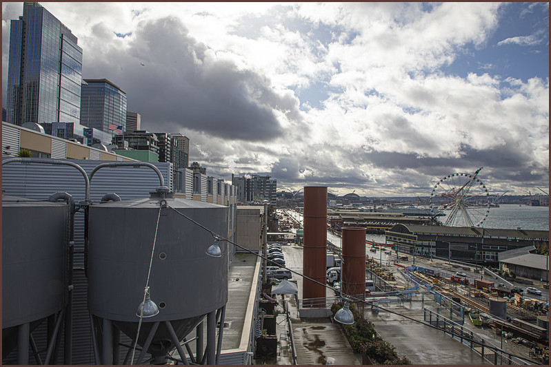
Alaskan Way from the Pike Place Market’s MarketFront, March 2021. Construction of the street that wasn’t going to be called Elliott Way — but now, as of early 2023, will be — is visible at center right. The Seattle Great Wheel can be seen above the Seattle Aquarium. Photograph by Flickr user Scott Smithson, licensed under Creative Commons Attribution-NonCommercial-NoDerivs 2.0 Generic

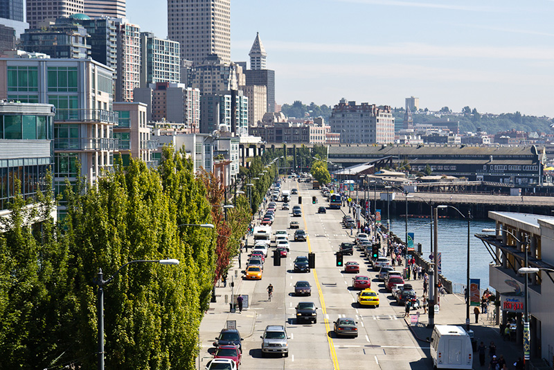
Today, Alaskan Way S begins at the north end of E Marginal Way S, at the entrance to the Port of Seattle’s Terminal 30, and goes 2⅓ miles north, then northwest, to Broad Street, having become Alaskan Way on crossing Yesler Way. This is the Alaskan Way most people think of.

But, as they say, wait — there’s more! The right-of-way continues for another 1¾ miles, ending at W Garfield Street under the Magnolia Bridge, at the entrance to the Port of Seattle’s Terminal 91. From the Olympic Sculpture Park, which begins at Broad Street, to Myrtle Edwards Park, the right-of-way is taken up by park land and the tracks of the BNSF Railway — successor to the Columbia & Puget Sound; the Seattle, Lake Shore & Eastern; and the Northern Pacific, the railroads for which Railroad Avenue was originally built. Northwest of Myrtle Edwards, it’s entirely taken up by the tracks that run alongside Centennial Park. It isn’t until W Galer Street that there’s a city street in the right-of-way again, and Alaskan Way W only goes about ⅙ of a mile northwest from there to W Garfield Street. Even less than that is signed Alaskan Way, as the city has put up a sign for Expedia Group Way W where the W Galer Street flyover “touches down.” However, even though southeast of Galer the roadway runs first on Expedia property, then Port of Seattle property, the city appears to still consider it Alaskan Way W between the Expedia campus entrance and the north end of Centennial Park — a distance of just over ⅓ of a mile.

Colorado Avenue S

This street was created in 1895 as part of the plat of Seattle’s tide lands. As Seattle expanded to the south, it became obvious that Commercial Street (1st Avenue S) would not be the westernmost street east of Elliott Bay. Fortunately, instead of using zero or negative numbers, they went with states: the first street west of 1st was named Utah, and the next, Colorado. (Some perpendicular streets were named Alaska, Vermont, Connecticut, Texas, Massachusetts, etc. There doesn’t appear to have been any particular order.)

Colorado Avenue S begins at S Royal Brougham Way and goes ⅓ of a mile south to S Massachusetts Street. It begins again on the back side of the Starbucks Center and goes ⅘ of a mile to just south of S Spokane Street, and its final segment begins just north of Diagonal Avenue S and goes ⅔ of a mile to S Dawson Street.

California Avenue SW

This West Seattle street was established in 1888 as part of the First Plat of West Seattle by the West Seattle Land and Improvement Company. As “most of [its] capital came from San Francisco,” I would assume that is why California Avenue was given its name.

California Avenue SW — a major West Seattle arterial connecting the Admiral, Alaska, and Morgan Junctions (three commercial hubs named after long-gone streetcar line intersections) — runs 4½ miles from California Lane SW in the north, past which it turns into California Way SW on its way down the hill to the waterfront, to SW Sullivan Street in the south. Beyond there it exists as a few short segments, then briefly as part of the SW Brace Point Drive–SW Barton Street arterial, and lastly as a nearly mile-long residential street that ends at Marine View Drive SW.

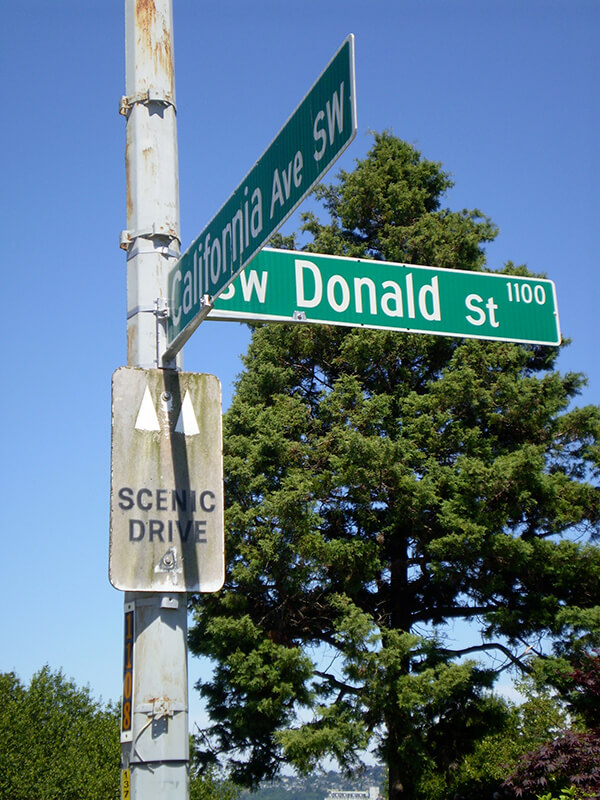
Sign at corner of SW Donald Street and California Avenue SW, July 4, 2011
Sign at corner of SW Donald Street and California Avenue SW, July 4, 2011. Photograph by Benjamin Lukoff. Copyright © 2011 Benjamin Lukoff. All rights reserved.