Canterbury Lane E

This stub of a street in Madison Park serves mostly as a driveway to the Canterbury Shores Condominiums, although it is public right-of-way. It appears to have been dedicated to the public in 1965, and its name was changed from 40th Avenue E the next year.

My assumption is the street was named for the condominiums, and that the condominiums were named for the Canterbury subdivision to the south, which was laid out in 1951. According to Shaping Seattle Architecture: A Historical Guide to the Architects, John L. Scott’s Canterbury Land Company purchased the land in 1938. (My further assumption is that the subdivision was named for Canterbury, England.)

Webster Point Road NE

This very short street in the Laurelhurst neighborhod — just over 200 feet long — was created in 1962 as part of the Webster Point plat. Why it’s a road rather than a place, lane, or court, I’m not sure — roads in Seattle (of which there aren’t many) are usually longer, such as Windermere Road NE, Holman Road NW, and Military Road S. It has the distinction of the lowest-numbered address on a north–south street north of the Lake Washington Ship Canal, as far as I am aware — 3000.

The plat and road are named for Webster Point, at the very southern tip of the Laurelhurst peninsula, which itself was named for Henry A. Webster, who once owned the land. This Webster appears to have been the Indian agent for the Makah tribe at Neah Bay on the Olympic Peninsula.

University View Place NE

This short street, which runs from NE 50th Street just south of Calvary Cemetery to NE 45th Place, is named for its view of the University of Washington campus to the southwest. It was laid out in 1907 as part of the Exposition Heights addition, which was named after the upcoming Alaska–Yukon–Pacific Exposition on the UW campus.

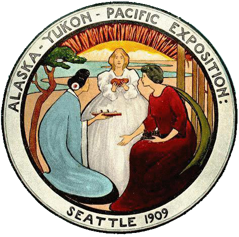
Alaska–Yukon–Pacific Exposition Seattle 1909

sluʔwiɫ

I end my piece on Lushootseed-language place names in Seattle, “Native names abide,” thus:

…Let Carkeek remain Carkeek, but know that it was once and is still kʷaatəb, as Montlake is still stəx̌ʷugʷił, the Locks, which lowered x̌ačuʔ and x̌áx̌əʔčuʔ, still xʷiwálqʷ, and University Village still sluʔwił village, and celebrate that wǝɫǝbʔaltxʷ now sits where Whitman and Stevens meet.

wǝɫǝbʔaltxʷ – Intellectual House is “a longhouse-style facility on the [University of Washington] Seattle campus [that] provides a multi-service learning and gathering space for American Indian and Alaska Native students, faculty and staff, as well as others from various cultures and communities to come together in a welcoming environment to share knowledge.” Its location at the corner of Stevens Way and Whitman Court is significant in that almost all campus roads are named for Washington counties, and these two counties were named after Isaac Stevens and Marcus and Narcissa Whitman:

  • As noted in “Should Seattle rename its streets?” Stevens, governor of Washington Territory, “forced Native American tribes to cede their lands to the federal government.… He also pardoned himself for contempt charges relating to unjust declaration of martial law during the Yakima War, and insisted on the capture of the subsequently executed Chief Leschi of the Nisqually Tribe, even though at that point he had ceased fighting and fled the area.
  • The Whitmans’ story is more complex. The missionary couple were among 13 whites killed by a group of Cayuse Indians in what has become known as the Whitman massacre. A measles epidemic in the mission settlement and a nearby Cayuse village produced a death rate far higher among the Cayuse; Marcus Whitman, who was a also a physician and tried to treat the Cayuse as well as the whites, was accused of poisoning tribe members: “the fact that nearly all of his white patients recovered while his Indian patients died convinced some Cayuses that he was deliberately poisoning Indians in order to give their land to white setters.” Even though this is unlikely, the fact remains that they were missionaries and colonizers, and there have been calls to replace the statue of Marcus that stands in the National Statuary hall.

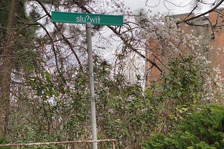
Now the University of Washington has renamed Whitman Court sluʔwiɫ, after a village that once stood where University Village is today. (sluʔwiɫ means ‘Little Canoe Channel’ in the Lushootseed language.)

Street sign reading sluʔwiɫ on University of Washington campus
sluʔwiɫ street sign at corner of Stevens Way, with Padelford Hall in the distance, February 2021. Photograph by Benjamin Lukoff. Copyright © 2021 Benjamin Lukoff. All rights reserved.

The UW Board of Regents made this change in May 2018, but the sign only recently made its appearance. I asked the writer of the University of Washington Magazine piece on the name change, Hannelore Sudermann, if she knew whether “the renaming was official — that Whitman Court no longer exists and the street’s name is now sluʔwiɫ – or if it was honorary and the street is still officially Whitman Court,” and she pointed me to the meeting minutes, which read, in part: 

The Board of Regents chooses to honor the Coast Salish peoples of the land on which the University of Washington sits, and indigenous peoples across the State, by renaming Whitman Court sluʔwił.… In the Lushootseed language of the Coast Salish peoples, sluʔwił is the name for the village site closest to the campus, and means ‘Little Canoe Channel.’… It is the Board’s intention to recognize the native place-names of the region and thereby to enrich the historical context of the campus. The Board feels that this naming action is particularly appropriate, given the proximity of Whitman Court to wǝɫǝbʔaltxʷ, meaning ‘Intellectual House,’ a multi-service learning and gathering space for American Indian and Alaska Native students, faculty, and staff.

Even though an earlier part of the minutes reads “Regent Rice moved, Regent Ayer seconded, and the Board of Regents approved the honorific renaming of Whitman Court sluʔwił” (italics mine), given the excerpt above and the presence of the sign without any reference to Whitman Court, my interpretation is that honorific here means “in honor of,” in contrast to honorary meaning “symbolic.” 

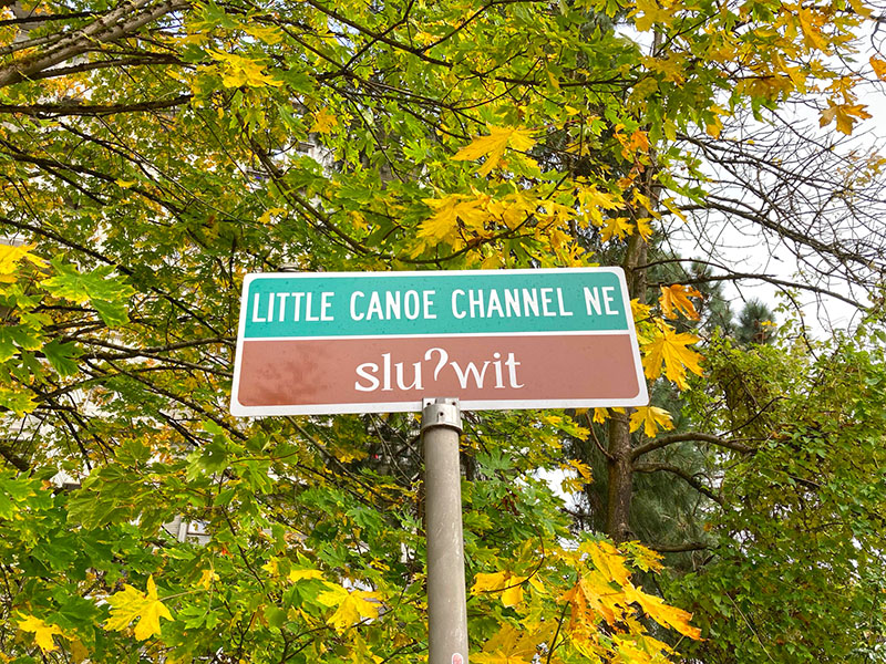
Street sign on the University of Washington campus reading Little Canoe Channel NE / sluʔwit; ‘t’ appears instead of the correct ‘ɫ’. sluʔwiɫ means ‘little canoe channel’ in Lushootseed. October 27, 2021
New street sign, reading Little Canoe Channel NE / sluʔwit; ‘t’ appears instead of the correct ‘ɫ’. Photograph by Leslie Holmes, October 27, 2021. Copyright © 2021 Leslie Holmes. All rights reserved.

Update as of February 16, 2023: I recently noticed that sluʔwiɫ is appearing on maps (UW, OpenStreetMap) as sluʔwiɫ (Little Canoe Channel NE). Per the UW’s page on McMahon Hall, “Whitman Court NE has been renamed Sluʔwił (Little Canoe Channel NE). Although street signs have changed, you may hear the street referred to by both names as the name change awaits formal state recognition. The name change acknowledges the Duwamish Peoples who continue to fight for federal recognition as a tribe, and who lived and engaged in potlaches, gift-giving festivals of sharing and trading, in the area, until the land was colonized by white settlers.” I will try to find out when and how formal state recognition will come.

Eagle Street

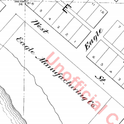
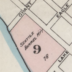
This 600-foot-long street, which runs from Western to 2nd Avenues a block south of Bay Street, was given that name by William Nathaniel Bell in 1881. In his plat, the large lot between Bay (then Grant) and Lake (now Broad) Streets west of Western Avenue (then West Street) was shown as occupied by the Eagle Manufacturing Co. On this 1884 Sanborn map, though, “Seattle Barrel M’f’y” appears instead. This historic survey says that the Seattle Barrel Manufacturing Company opened in 1880, but was located between Bell and Wall Streets, farther south.

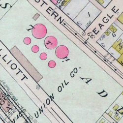
At any rate, it would seem that Eagle Street was named after this Eagle Manufacturing Co., of which I could find no further trace; and that neither Eagle nor Seattle Barrel was there 30 years later, when the 1912 Baist atlas was produced, showing the land to be occupied by Union Oil Company of California (later known as Unocal).

Unocal — which, according to Historylink, had begun using the lot in 1910 — would continue to use it as a fuel depot and marketing terminal until 1975. Cleanup of the contaminated ground began in the 1980s, and the Seattle Art Museum purchased the site in 1999 with help from the Trust for Public Land. In 2007, the Olympic Sculpture Park opened, completing the area’s transformation from open space to industrial area to open space once again.

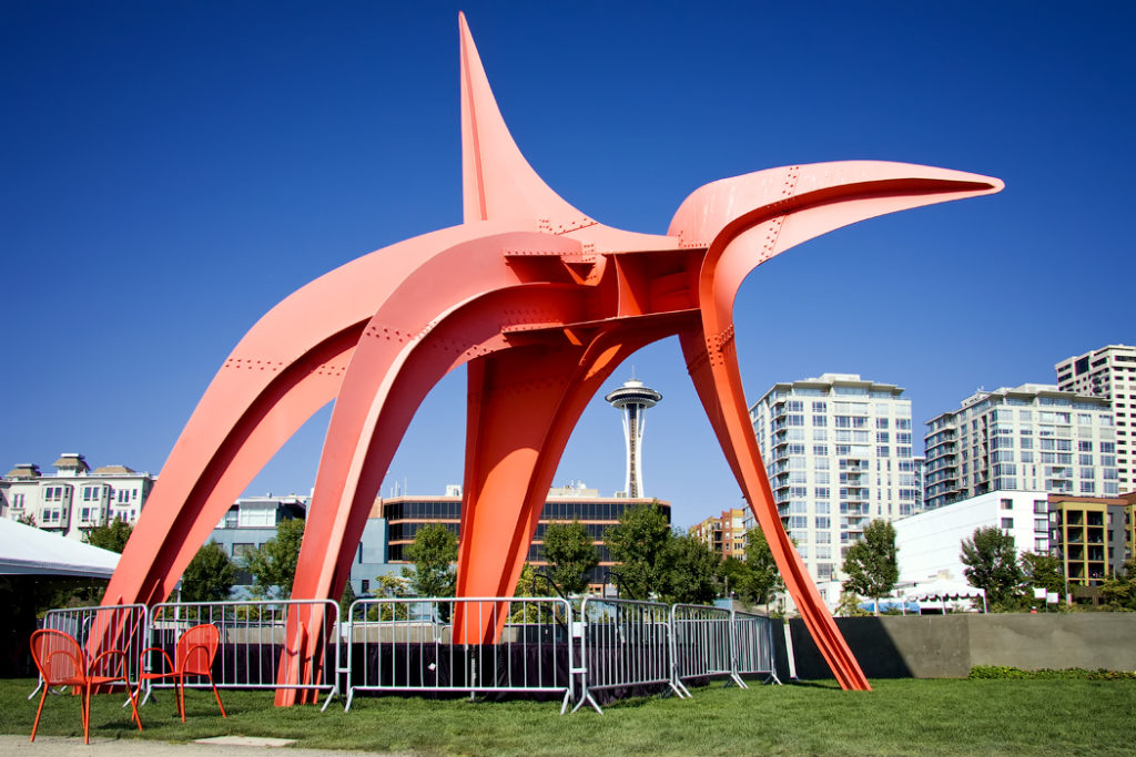
(Local historian Paul Dorpat points out that the cove that once existed here could be [though never was] called “Eagle Cove” — both for Eagle Street and for the fact that Alexander Calder’s Eagle sculpture now makes its home in the lower half of the park.)

Alexander Calder‘s sculpture ”Eagle”

Bay Street

This street, which runs for a little over a tenth of a mile from Elliott to 1st Avenues, was originally named Grant Street by William Nathaniel Bell in 1881. 14 years later, it was one of the many streets caught up in the Great Renaming of 1895. Per ordinance 4044, it was “ordained… that the name of Grant Street from Elliott Bay to Depot Street, be and the same are hereby changed to Bay Street.” I can’t imagine it took its name from anywhere other than Elliott Bay.

Dilling Way

This street, which runs a mere 200 feet from 4th Avenue to Yesler Way in front of City Hall Park, is named for George W. Dilling, who was mayor of Seattle from 1911 to 1912.

In 1911, Mayor Dilling took an empty lot that until two years earlier had been the location of the Katzenjammer Castle, Seattle’s second city hall, and converted it into what is now known as City Hall Park — originally named Dilling Park in his honor. In 1916, the municipal offices moved once again, to the newly constructed King County Courthouse, then known as the City–County Building, across the Jefferson Street right-of-way from the park. They remained there until 1962, but the park retains the “City Hall” name.

In a letter dated March 29, 1937 from A.C. Van Soelen, corporation counsel for the city, to the Board of Public Works, regarding the ability of the city to restrict parking on Dilling Way, he writes that “Dilling Way apparently never was established or named by ordinance or other action of the City Council and was opened up or paved in 1915 or 1916, presumably in lieu of Jefferson Street which was closed between Third and Fourth Avenue though never formally vacated,” and suggests that the city council “affirmatively declare its policy” regarding the street by passing an ordinance. Such an ordinance was passed shortly thereafter, making the name of Dilling Way official. (Interestingly, that ordinance refers to the street as a “private way,” but the county’s quarter section map shows it as a public road. That same map shows that the walkway in front of the courthouse is still, technically, Jefferson Street.)

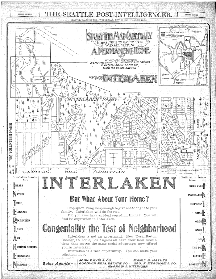
E Interlaken Boulevard

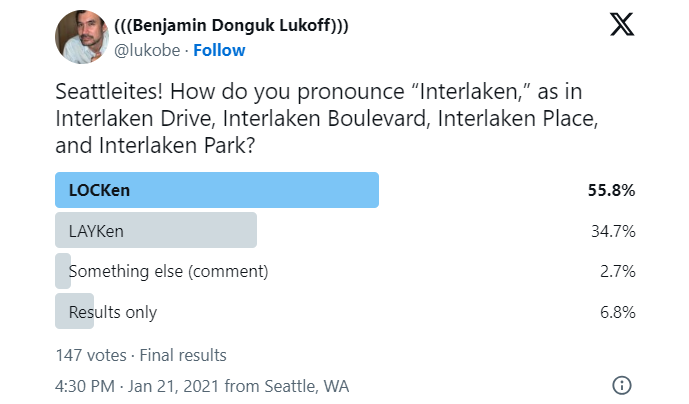
The establishment of E Interlaken Boulevard — the first of Seattle’s Olmsted parks and boulevards we’re covering — was first proposed, according to Seattle parks historian Don Sherwood, in 1903 as Volunteer Hill Parkway. Two years later, the current name was adopted. There is speculation, but no documentation, that it was named for the Swiss resort town of that name. Ask a Seattleite how to pronounce “Interlaken” and you may hear either lake or lock, the latter being more common according to an informal Twitter poll I ran (but the former being the one I grew up with).

Text of a Twitter poll by me, reading "Seattleites! How do you pronounce “Interlaken,” as in Interlaken Drive, Interlaken Boulevard, Interlaken Place, and Interlaken Park?" LOCKen 55.8%, LAYKen 34.7%, something else (comment) 2.7%, results only 6.8%. 147 votes total

Note: On July 10, 2024, I began converting embedded tweets on this website to screenshots because of issues with how they were integrating with WordPress, which began not too long after Elon Musk purchased Twitter and changed its name to X. Here is a screen shot of folks’ comments.

Interlaken Boulevard runs for about 1⅔ miles west to east from Delmar Drive E, by Seattle Preparatory School on Capitol Hill, to Lake Washington Boulevard E, in the Washington Park Arboretum. The middle section, between 19th and 21st Avenues E, is closed to motor vehicles and functions as a pedestrian and bicycle trail. The name also appears on Interlaken Drive E and Interlaken Place E — and should not be confused with Interlake Avenue N, a street in North Seattle.

Advertisement for Interlaken in the Seattle Post-Intelligencer, May 30, 1906
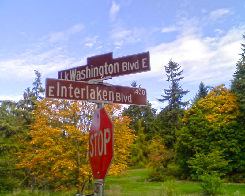
Street sign at corner of Lake Washington Boulevard E and E Interlaken Boulevard, October 11, 2009. Copyright © 2009 Benjamin Lukoff. All rights reserved.
Street sign at corner of Lake Washington Boulevard E and E Interlaken Boulevard. Photograph by Benjamin Lukoff, October 11, 2009. Copyright © 2009 Benjamin Lukoff. All rights reserved.

Fauntleroy Way SW

This 4-mile-long thoroughfare runs from the west end of the West Seattle Bridge to Brace Point, passing Morgan Junction, Lincoln Park, and the Fauntleroy Ferry Terminal on the way. It was named for Fauntleroy Cove, location of that terminal, from which riders depart for Vashon Island and Southworth, on the Kitsap Peninsula.

Fauntleroy Cove was itself named after Robert Henry Fauntleroy by George Davidson, Fauntleroy’s future son-in-law. They were both members of the U.S. Coast Survey. He is one of three Fauntleroys whose names appear on Seattle street signs — Ellinor Drive W and Constance Drive W are named for Mounts Ellinor and Constance in the Olympic Mountains, themselves named by Davidson after his future wife and sister-in-law, respectively.

“Elliott Way” just a placeholder name

A new street connecting Elliott Avenue to Alaskan Way as part of the viaduct replacement project is currently under construction. When I first heard in 2016 that they were planning to call it Elliott Way, I thought it was a wasted opportunity. I wrote on my personal Facebook page “This is an opportunity to commemorate someone, or something, new, rather than Jared, George, Samuel, or Jesse Elliott (apparently no one is sure just which Elliott the bay is named after)!”

However, as it turns out, “Elliott Way” is just a placeholder name, just as “E Frontage Road S” was for what is now Colorado Avenue S at the south end of the new 99 tunnel.

On Boxing Day 2020 I finally wrote to the Seattle City Council and the Waterfront Seattle Program letting them know how I felt:

“The bay, and its namesake (most likely midshipman Samuel Elliott of the Wilkes expedition that explored Puget Sound in 1841) already has Elliott Avenue named in its honor. Elliott was, of course, a white man. I don’t know what percentage of Seattle streets are named for white men (although I would be fascinated to find out, and may undertake that as a project for my blog on Seattle street names), but I’m sure it’s very high.

“I urge you instead to take this opportunity to name this street something else. The Duwamish people, for example, have Duwamish Avenue S named for them (actually more likely for the river, as Elliott Avenue was named for the bay, not directly for the sailor), but it is an insignificant street 2/10 of a mile long hidden under the Spokane Street Viaduct and the Alaskan Freeway. Perhaps Duwamish Avenue would be a better choice, if the tribe approved? Or perhaps the street could honor a non-white person associated with the history of Seattle’s waterfront? Frank Jenkins, perhaps?”

I honestly didn’t expect to hear back from anyone, but to my surprise Marshall Foster, director of the Office of the Waterfront and Civic Projects, wrote me himself on January 5, saying:

We completely agree that the naming of this new street is an exciting opportunity. “Elliott Way” has simply been a placeholder until we are closer to its opening. The Coast Salish tribes are an incredibly important part of Seattle’s history and culture today. We have actually been thinking along similar lines about how this naming could help to elevate their presence here, and have been in discussions with our partners in the tribal community about ideas very similar to yours. We expect to have a proposal for public discussion later this year.

I have to say, I’m pretty happy about this.

Update as of January 11, 2022: I wrote Foster and his team over the weekend asking if there were any updates, and heard back today from Lauren Stensland:

We agree that this is a great opportunity and we continue to coordinate with the tribes and other partners on a proposed name. It is definitely high on our list for this year. We do not have any new updates at this time; we expect to have more to share in the next few months. Stay tuned and keep an eye on our website.

Update as of September 21, 2022: I recently wrote back to Stensland to check on the status of the street and its name, and she replied today that:

The elevated roadway is planned to open in early 2023. As for the roadway name, we are continuing to work toward this and will share updates as soon as we have them. Keep staying tuned!

Update as of February 2, 2023: I posted an article last month “Dzidzilalich” to be honorary name for Elliott Way, Alaskan Waynoting that, in fact, the roadway will be known as Elliott Waybut will carry the honorary name “Dzidzilalich.” So it seems “Elliott Way,” after all, is unfortunately not just a placeholder name.

W Ruffner Street

This street, which runs, with interruptions, for 2⅓ miles from Queen Anne to just short of Elliott Bay in Magnolia (though it is platted for several more blocks west over the tideflats) is named, as I learned from the Ruffner Family Association, for Presbyterian minister William Henry Ruffner. A slaveholder who “advocated the gradual emancipation and colonization of the state’s African Americans”, he was also, according to Encyclopedia Virginia, “the designer and first superintendent of Virginia’s public school system.”

How did this “Horace Mann of the South” end up with his name on a Seattle street? Apparently, in addition to being an educator, he was also a geologist, and so was hired by Thomas Burke and Daniel Gilman (of Burke–Gilman Trail fame), two of the founders of the Seattle, Lake Shore and Eastern Railway, to spend just over five weeks in 1887 surveying the area, the results of which were published in the SLS&E’s promotional book A Report on Washington Territory two years later. When it came time in 1890 for the plat of Gilman’s Addition to the City of Seattle to be filed, Ruffner’s name appeared on the map. 

The Seattle, Lake Shore and Eastern became part of the Northern Pacific Railway in 1892. Today, the Interbay Car Shop of the BNSF Railway, successor to the NP, is located at the corner of W Ruffner Street and Gilman Avenue W.

Constance Drive W

This ⅔-mile–long Magnolia street is named for Mount Constance in the Olympic Mountains. Constance was the older sister of Ellinor Fauntleroy, namesake of Mount Ellinor and Ellinor Drive W. (There are no Magnolia streets named Edward, Arthur, or The Brothers.)

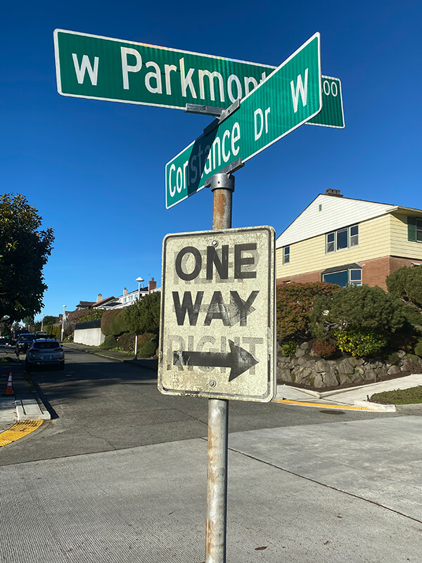
W Parkmont Drive and Constance Drive W street sign above One Way sign with Keep Right ghost sign underneath
Street sign at corner of W Parkmont Place and Constance Drive W, with One Way sign over Keep Right ghost sign, January 9, 2022. Photograph by Benjamin Lukoff. Copyright © 2022 Benjamin Lukoff. All rights reserved.

Ellinor Drive W

This short street in Magnolia’s Carleton Park subdivision is named for Mount Ellinor in the Olympic Mountains, which was itself named for Ellinor Fauntleroy, the fiancée of George Davidson of the U.S. Coast Survey, who named the peak in 1853. Nearby Constance Drive W is named for Mount Constance, itself named for Ellinor’s older sister.

Most of Magnolia’s streets follow Seattle’s cardinal-direction grid. Here, however, in the southwest corner of the neighborhood, they are laid out to follow the contour of the steep bluff that affords many streets a view of the Olympic Mountains, the Cascade Range, or both. 

Should Seattle rename its streets?

Since the killing of George Floyd on May 25, 2020, set off a wave of protests and demonstrations that has not yet abated, calls to rename streets dedicated to Confederate leaders have grown ever louder. Among them are Robert E. Lee Boulevard and Jefferson Davis Parkway in New Orleans; Confederate Avenue in Tyler, Texas; Stonewall Jackson Drive and Bedford Forrest Drive in Wilmington, North Carolina; and Stonewall Jackson Drive and General Lee Avenue in Fort Hamilton, a U.S. Army base in Brooklyn.

In Montgomery County, Maryland, the county council has called for “a comprehensive review of all County owned and maintained street names and public facilities to determine all those named for Confederate soldiers or those who otherwise do not reflect Montgomery County values.” The pull-quotes WTOP News chose from the council’s letter were spot-on:

As we work to dismantle the structures that perpetuate racism, we must target the symbols that normalize and legitimize it. The names of public streets and buildings are not merely a reminder of the past; they are a very clear indication of who and what we value today.… We cannot recreate history, but we can decide how accurately we reflect it, and who we choose to glorify from it. The names of our buildings and streets should reflect the people in and on them, not threaten and intimidate them.

Calls for renaming Seattle streets haven’t been as loud — perhaps because we, fortunately, have none named for Confederates. In fact, we have both a Union Street and a Republican Street.

However, those honored by Seattle street names are not without their own issues. Without even considering the streets named for the settlers and developers who displaced the Native American inhabitants, there are:

Returning to the issue of settlers and developers, in 2008, I wrote “Is it wrong to have a Negro Creek?” for Crosscut. (Tl;dr: Yes, it is, and stringers don’t write their own headlines.) After discussing the Chelan County creek in question, I started wondering just where the line should be drawn. (I mentioned the other day to my friend Thomas May that if it came to light that Beorma was found to be an unsavory character we could hardly change the name of Birmingham.)

[Added September 3, 2021: Upon further research, I have found out that George Kinnear was not responsible for the racial restrictive covenants applied to his subdivision — those were imposed decades later, after his death, by lot owners. I am leaving in the references to Kinnear I made in my Crosscut story, but changing those in this post.]

I wrote:

As for the settlers, though men like “Doc” Maynard (of the International District avenue and alley) may have maintained excellent relations with the city’s original inhabitants, Seattle is also home to neighborhoods like Hawthorne Hills and Kinnear, which are named for men (Safeco founder Hawthorne K. Dent and developer George Kinnear, respectively) who saw fit to exclude non-whites from owning property in their subdivisions.

Yet to eradicate all possible traces of offense from the map seems to be a losing proposition. Kinnear’s story isn’t cut-and-dried: he also served as captain of the Home Guard during Seattle’s anti-Chinese riot of 1886, which militia prevented Seattle’s Chinese from being forcibly deported, as had happened the previous year in Tacoma. And King County is named for a slaveholder, Franklin Pierce’s vice president William Rufus deVane King, though the county and state governments have managed to “rename” it after Martin Luther King, Jr.

Case-by-case, as these issues come up, seems the only sensible way to go. I am brought to mind of Liverpool’s Penny Lane, which was forgiven its association with the slave trade on account of its Beatles-related fame. Blanket proclamations can’t help but run into trouble.

I still do largely agree with what I wrote, although the idea of a renaming that isn’t really a renaming is less objectionable to me now. (My issue with King County’s name wasn’t that I thought William Rufus DeVane King deserved the honor, but that nothing was actually changed — the county’s name remained King County, not Martin Luther King Jr. County.) I would say this to those who still would want to rename Penny Lane: consider it named for the Beatles hit rather than for James Penny. (However, as it turns out, it wasn’t named for him in the first place, so the issue is moot.)

It makes you appreciate the system in Center City Philadelphia that much more — generally speaking, north–south streets numbered and east–west streets after trees.

So… besides Madison, Jackson, Stevens, and Lane — are any other Seattle streets ripe for renaming?

E North Street

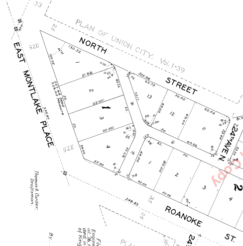
Seattle has a number of streets whose names incorporate directions, such as Northlake Way, Eastern Avenue, Eastlake Avenue, Western Avenue, Westlake Avenue, and Southern Street. But the one I drove by most growing up — and the only one to simply bear the name of a direction in its uncompounded, nominal form — is E North Street, which runs between E Montlake Place E and 24th Avenue E in Montlake, just south of the 520 interchange.

Two questions should spring to mind with a street name like this: North of what? and What happened to South Street?

Portion of Plan of Union City, 1869

The answer to the first question is north of where Harvey Lake Pike, son of John Henry Pike of Pike Street fame, had planned to dig a canal between Union Bay and Portage Bay.

And the answer to the second is that it seems to have been subsumed in Roanoke Street when the Glenwilde Addition was platted in 1925. But North Street’s name was never changed.

(There did use to be an East Street and a West Street, too, as you can see on the full plat map. If I read the quarter section map correctly, East Street is now 24th Avenue E, and State Route 520 now covers the land where West Street would have been.)

NW Locks Place

Seattle’s newest street name is no longer E Barbara Bailey Way but NW Locks Place — formerly the block of NW 54th Street that ran between NW Market Street and the entrance to the Hiram M. Chittenden Locks, more commonly known as the Ballard Locks.

Ordinance 125947, passed by the city council in late September, was signed by the mayor the next week and went into effect a few days ago. As the Seattle Department of Transportation explained this summer, the name change stemmed from a request by emergency dispatchers: previously, there were two locations in which NW Market Street and NW 54th Street intersected; once in front of the locks and once over a mile to the east, where Market descends from Phinney Ridge. This name change will serve to eliminate any confusion about what is meant by “the intersection of 54th and Market.”

A similar change was made to Green Lake street names in 1961, when the various segments of Green Lake Way north of NE Ravenna Boulevard and N 72nd Street were changed to Green Lake Drive — previously, Latona Avenue NE, Sunnyside Avenue N, and Ashworth Avenue N (to name a few) had intersected Green Lake Way twice.

Interestingly, only the Lockspot Cafe’s address (3005) is affected by this name change. The other buildings fronting NW Locks Place have addresses on NW Market Street, and the address of the Ballard Locks remains 3015 NW 54th Street.

Expedia Group Way W

“Look! They’ve finally signed the W Galer Street Flyover!” I thought to myself the other day as I drove onto the Magnolia Bridge onramp from 15th Avenue W. “I wonder why they took so long?” (It was built in 2002.)

Then I saw the sign that directed drivers to take the flyover if they were headed toward Expedia Group Way W. Of course… it was because Expedia was moving their corporate headquarters from Bellevue to Interbay, and the first employees were scheduled to arrive this month.

It made sense for the private road — originally Amgen Court W after the campus’s previous corporate occupants — to change its name… but why to Expedia Group?

Yes, Expedia’s official name is Expedia Group — it’s the parent company not only of the eponymous online travel agency but of many other brands, including Hotels.com, Orbitz, Travelocity, Hotwire, and CheapTickets — but still. Wouldn’t Expedia Way W sound and look better? Adding the “group” makes the name sound much more corporate to my ear.

E Barbara Bailey Way

As of this writing, Seattle’s newest street name is E Barbara Bailey Way — formerly the block of E Denny Way between Broadway and 10th Avenue E.

Barbara Bailey, who died on September 1, 2018, was best known for Bailey/Coy Books, which she founded on Broadway in 1982. As Seattle Mayor Jenny Durkan wrote,

Barbara’s commitment to action made her an early pioneer for LGBTQ+ rights. Her bookstores – B. Bailey Books and Bailey/Coy Books – were nationally beloved independent book stores that regularly brought communities together and hosted renowned authors. They were also safe and welcoming spaces for the LGBTQ+ community, particularly for those just coming out and during the height of anti-LGBTQ+ actions.

Barbara Bailey Way is one of a number of “festival streets” in the city of Seattle. 

Native names abide

Before white settlers came to to dᶻidᶻəlalič in 1852, before they came to sčəgʷaliču in 1832, even before they first sighted the shores of x̌ʷəlč in 1792, the dxʷdəwʔabš were here, living at sluʔwił and šilšul, babaqʷəb and t’uʔəlalʔtxʷ, and paq’ác’ałčuʔ and səxʷt’ičib, by the lakes called c’alq’ʷadiʔ and sisałtəb and dxʷƛ’əš and xáx̌əʔčuʔ, and most of all xačuʔthe lake — the smaller ones being fed by springs like liq’təd where the waters run red, the lake being fed by the river whose mouth was at ƛ’ax̌ʷadis, but one by one their names were replaced by the settlers, who though they named the city for siʔał and the river for the dxʷdəwʔabš nevertheless named places Pioneer Square for themselves, or Fremont for where they came from, or Brooklyn for that which they aspired to be, and while šilšul became Shilshole and liq’təd became Licton, other dxʷləšúcid names were left unwritten and hardly spoken for decades but still remembered — so let Carkeek remain Carkeek, but know that it was once and is still kʷaatəb, as Montlake is still stəx̌ʷugʷił, the Locks, which lowered xačuʔ and xáx̌əʔčuʔ, still xʷiwálqʷ, and University Village still sluʔwił village, and celebrate that wǝɫǝbʔaltxʷ now sits where Whitman and Stevens meet.


This piece (originally titled “Lushootseed names remain”) appeared as the first item in One-Sentence Stories: An Intriguing New Anthology of Stories Told in a Single Sentence, Book 2, compiled by Val Dumond in 2018. Apparently I was the first potential contributor to ask if the story could be non-fiction. There was a minimum length of 200 words — this comes in at 203.

The names are in the dxʷləšúcid or Lushootseed language, spoken by many of the Coast Salish Native American tribes in the Puget Sound region. They are written in the Lushootseed alphabet, which is based on the International Phonetic Alphabet.

I selected most, though not all, of the names by using the Burke Museum’s Waterlines Project map. They appear below, along with their translations and the current, settler-given names.

  1. dᶻidᶻəlalič — Little Crossing-Over Place — Pioneer Square
  2. sčəgʷaliču — Extensive Sand Banks Over Which the Water Is Shallow/Big Tide/Long Run-Out — Sequalitchew/Fort Nisqually/DuPont
  3. x̌ʷəlč — Salt Water — Puget Sound
  4. dxʷdəwʔabš — People of the Inside (Elliott Bay) — Duwamish
  5. sluʔwił — Little Canoe Channel — University Village
  6. šilšul — Tucked Away Inside — Salmon Bay (Shilshole is one of two unchanged Native names within Seattle city limits)
  7. babaqʷəb — Little Prairie — Belltown
  8. t’uʔəlalʔtxʷ — Herring’s House — West Seattle Industrial District
  9. paq’ác’ałčuʔ — Brush Spread on the Water — West Point
  10. səxʷt’ičib — Place Where One Wades — Lakeridge
  11. c’alq’ʷadiʔ — Blackcaps on the Sides — Bitter Lake
  12. sisałtəb — Calmed Down a Little — Haller Lake
  13. dxʷƛ’əš — translation unknown — Green Lake
  14. xáx̌əʔčuʔ — Small Lake — Lake Union
  15. xačuʔ — Lake — Lake Washington
  16. liq’təd — Red Paint — Licton Springs, the other unchanged Native name within Seattle city limits
  17. ƛ’ax̌ʷadis — The Growing Place — Squawk (Squak) Slough, mouth of the Sammamish River at Kenmore
  18. siʔał — personal name — Chief Seattle (Sealth)
  19. dxʷləšúcid — Salt Water Language — Lushootseed
  20. kʷaatəb — Dropped Down — Piper’s Creek at Carkeek Park beach
  21. stəx̌ʷugʷił — Carry a Canoe (Portage) — Montlake Cut from Union Bay to Portage Bay 
  22. xʷiwálqʷ — Lots of Water — Commodore Park (Magnolia side of Ballard Locks)
  23. wǝɫǝbʔaltxʷ — Intellectual House

SW Seattle Street

What better way to start things off than with SW Seattle Street?

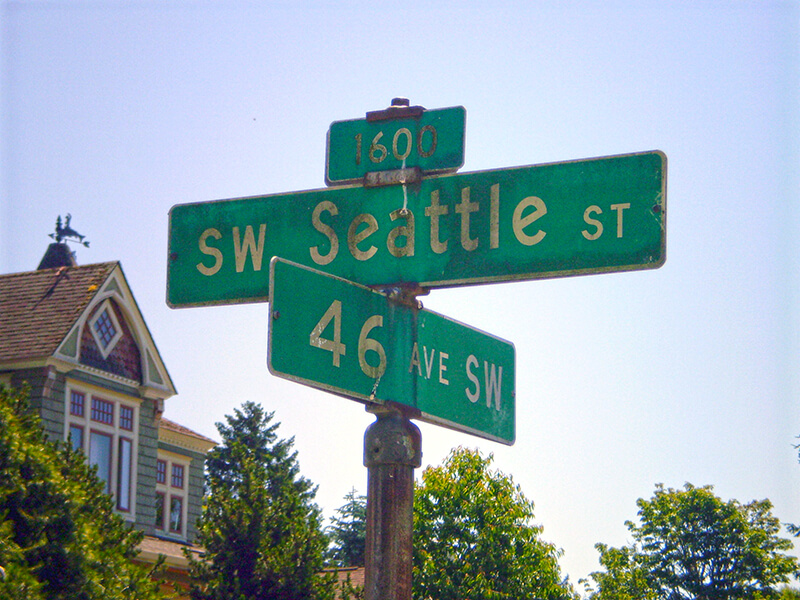
SW Seattle Street is a minor residential street in West Seattle that runs about ³/₁₀ of a mile from 42nd Avenue SW in the east to Sunset Avenue SW in the west.

It might seem strange that such a short street would be chosen to bear the city’s name — it was the only one to do so until 2010, when the first two blocks of Airport Way S were renamed Seattle Boulevard S — but this has more to do with unimaginative naming than with civic pride.

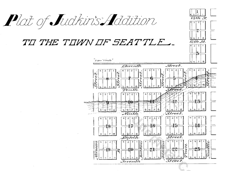
On August 4, 1869, Ike M. Hall — the executor of the estate of Norman B. Judkins — filed the Judkin’s (sic) Addition to the Town of Seattle, located just southwest of where the interchange between I-5 and I-90 is today. From north to south, the east–west streets are named Norman, B, Judkins, Addition, Town, and Seattle.

Portions of the original Seattle Street were vacated over the years (for example, in 1900, 1957, and 2000), and the construction of I-5 took care of the rest. However, when the city annexed West Seattle in 1907 it changed the name of Maple Street to W Seattle Street as part of rationalizing the street grid… and so the name lives on.

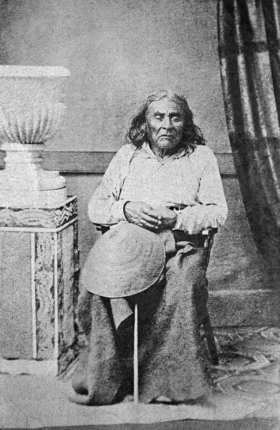
(The city itself, of course, was named after Si’ahl [siʔaɫ], better known in English as Chief Seattle of the Duwamish and Suquamish Tribes.)

siʔaɫ, or Chief Seattle
The only known photograph of Chief Seattle (1786?–1866), taken by E.M. Sammis in 1864
Sign at corner of SW Seattle Street and 46th Avenue SW, July 4, 2011
Sign at corner of SW Seattle Street and 46th Avenue SW, July 4, 2011. Photograph by Benjamin Lukoff. Copyright © 2011 Benjamin Lukoff. All rights reserved.

So, why SW Seattle Street instead of Seattle Street SW?

In Seattle, east–west streets have the directional come first, and north–south avenues have it come last. The Wikipedia article “Street layout of Seattle,” which I helped write, has a more comprehensive description of Seattle’s addressing system, including the answer to this question:

Why was it W Seattle Street in 1907 but SW Seattle Street now?

In 1961, city ordinance 89910 “established a standard system of street name designations” so that in almost all cases streets within a given zone would carry the same directional. West Seattle avenues already carried the SW designation.