Anthony Place S

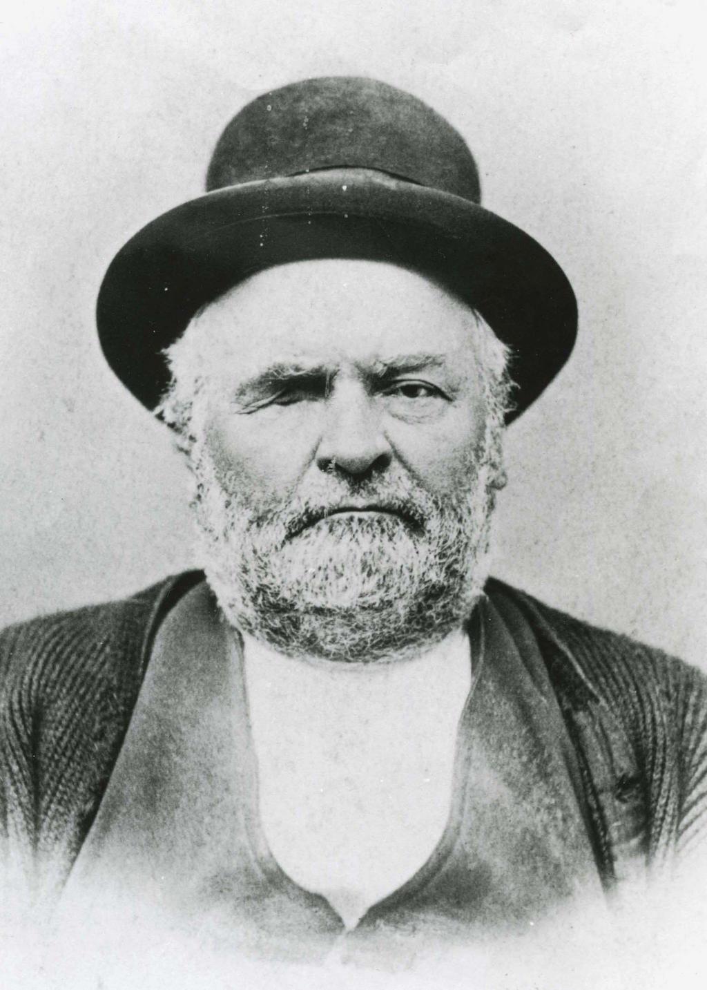
This street originates in the 1907 plat of Cascade View Addition to the City of Seattle, King County, Washington. Originally Della Street, it appears to have been renamed for William Gordon Anthony and his wife, C. Nana Anthony, who filed the plat. William, who died June 8, 1925, at the age of 64, had been working in insurance and real estate since 1910, according to his obituary in the June 10 issue of The Seattle Times. In it, his wife’s name is given as Canana, not C. Nana, as the plat has it. (Curiously, her own death certificate [she died November 6 of the same year at the age of 57] gives her name as C. Nanny!)

Anthony Place S begins at 27th Avenue S just south of S Walden Street and S Della Street and goes less than 100 feet southwest before turning into a private driveway, which turns into an alley, which turns into another private driveway that connects to Cheasty Boulevard S. The undeveloped right-of-way continues southwest for another ⅐ of a mile.

Short Place S

This, well, short street in the Leschi neighborhood originates in Wood’s Supplemental Plat of Blocks 16 and 17, Burke’s 2nd Addition to Seattle, filed in 1887 by, among others, William D. Wood (1858−1917) and his wife, Emma Wallingford Wood (1859−1949). William, who was later mayor of Seattle from 1896 to 1897, was one of the principal developers of the Green Lake neighborhood; Emma was the daughter of John Noble Wallingford (1833–1913), after whom the Wallingford neighborhood and Wallingford Avenue N are named.

Short Place S begins at S Jackson Street and goes about 425 feet south to S King Street.

Sunset Avenue SW

I enjoy writing posts on streets like W Commodore Way (I believe I am the first to have accurately identified its namesake), Division Avenue NW (I show that, even though it doesn’t divide anything from anything else today, it once served as Ballard’s eastern city limit for a few blocks), Loyal Avenue NW (I discover that it’s named not for the concept of loyalty, but for a baby girl whose first name was Loyal), and sluʔwiɫ (the University of Washington’s new Lushootseed-language name for Whitman Court). But sometimes I just like knocking something out quickly (I’m looking at you, W View Place and View Avenue NW). Sunset Avenue SW is another one of those. It originated in the 1888 First Plat of West Seattle by the West Seattle Land and Improvement Company, and the name simply refers to the street’s western view of Puget Sound; Vashon, Blake, and Bainbridge Islands; the Kitsap Peninsula; and the Olympic Mountains.

Sunset Avenue SW begins as a stairway at California Avenue SW, just across the street from Hamilton Viewpoint Park. Once the roadway begins up the hill, it goes ⅘ of a mile southwest to a dead end at the College Street Ravine southwest of 50th Avenue SW.

Victory Lane NE

This street, which was originally named Lake View Lane in the 1920 plat of Victory Heights, appears to have received its current name no later than August 1943, when it first appears in the Seattle Post-Intelligencer as part of the obituary of Dr. Lewis R. Dawson, “dean of Seattle physicians and surgeons.” (Victory Heights was itself named for Victory Way, known today as Lake City Way NE within Seattle city limits and as Bothell Way NE in Lake Forest Park, Kenmore, and Bothell. The road was given this name in the wake of the Allied victory in World War I.)

My first thought was that Lake View Lane had been renamed Victory Lane to preserve the Victory Way name after the highway became Bothell Way, but it turns out that happened a number of years later, so I am unsure as to the reason for this name change.

Mayes Court S

This street was created in 1924 as part of Mayes’ Addition to the City of Seattle, filed by Wilbur Mayes (1871–1949); his wife, May H. Stutz Mayes (1870–1948); and George Moore. According to the reports of their deaths in The Seattle Times, on October 5, 1949, and October 14, 1948, respectively, the Mayeses were married in 1896 and lived in the Philippines, where Wilbur was a lumberman, from 1905 to 1912. They moved from the Philippines to Seattle, where he became an accountant. He apparently became a house repairman after retirement, and died after falling 15 feet from a University District neighbor’s roof.

Interestingly, it appears on the plat map as Mayes’ Court, with the apostrophe, but its official name lacks the punctuation, as do, I believe, all Seattle streets. (We have no streets named O’Brien, O’Reilly, O’Sullivan, or the like; I suppose an exception would have been made in such cases.)

Mayes Court S begins at S Carver Street and goes about 350 feet northwest to a cul-de-sac.

NE Brockman Place

This street appears to have been named for Charles Carl Brockman (1869–1954), proprietor of the unrecorded plat of Brockman’s Tracts. According to the obituary of his son, Charles Clark Brockman (1915–2010), the elder Brockman was “a Seattle pioneer who owned a grocery store [and] various real estate interests in the Denny Regrade and Lake City area.”

NE Brockman Place begins at 19th Avenue NE just north of NE 127th Street and goes ¼ mile northwest to just west of 14th Place NE.

NW Culbertson Drive

This street was created in 1955 as part of the plat of Llandover-by-the-Sound, filed by (among others) Ralph Glossbrerer Culbertson (1886–1975), a developer, and his wife, Jane R. Effie Redding Culbertson (1884–1976). R.G., as he was known, appears to have earlier been in the storage and moving business, and had “an extensive acquaintance with eight [Canadian] provinces.”

NW Culbertson Drive begins at Hilltop Lane NW and goes ⅓ of a mile west to a dead end overlooking Puget Sound.

Sherman Road NW

This street was created in 1958 as part of Northshire, an Addition to the City of Seattle, filed by Sherman O. Jensen (1919–2002) and his wife, Dorothy (1920–2008), along with Jeannette D. Jackson and her husband, Paul J. Jackson.

Sherman Road NW begins at NW 137th Street and goes about 625 feet to the south, where it turns into Northshire Road NW.

Frazier Place NW

This street, originally Sound View Place, was created in 1920 as part of Frazier’s Addition to King County, Washington, filed by Raymond Robert Frazier (1873–1955) and his wife, Augusta Wood Frazier (1874–1969). Raymond was president of Washington Mutual from 1915 to 1933 and its chairman from 1933 to 1941.

Frazier Place NW begins at NW 132nd Street and goes just over 300 feet north to NW 134th Street.

Raymond R. Frazier, circa 1931
Raymond R. Frazier, from The Town Crier, September 26, 1931

E Superior Street

This street, along with E Huron Street and Erie Avenue, was created in 1890 as part of Yesler’s Third Addition to the City of Seattle. It was named for Lake Superior, the largest of the Great Lakes, and the largest freshwater lake in the world by surface area.

E Superior Street begins at Euclid Avenue and goes 1⁄10 of a mile east to Erie Avenue.

E Huron Street

This street, along with E Superior Street and Erie Avenue, was created in 1890 as part of Yesler’s Third Addition to the City of Seattle. It was named for Lake Huron, second largest of the Great Lakes by surface area.

E Huron Street begins at Euclid Avenue and goes 1⁄10 of a mile east to Lake Washington Boulevard.

Erie Avenue

This street, along with E Superior Street and E Huron Street, was created in 1890 as part of Yesler’s Third Addition to the City of Seattle. It was named for Lake Erie, fourth largest of the Great Lakes by surface area.

Erie Avenue begins at Leschi Park south of Lake Washington boulevard and goes ⅓ of a mile north to E Jefferson Street.

E Olin Place

This street was created in 1925 as part of the O.W. Harris Addition, filed by Olin Whitney Harris (a car dealer) and his wife, Lily Georgine Robson Harris. (Their son, Whitney Robson Harris, a University of Washington graduate, was one of the prosecutors at the Nuremberg Trials as an aide to Robert H. Jackson, chief prosecutor and associate justice of the U.S. Supreme Court. Harris was the last Nuremberg prosecutor to die, in 2010. The Whitney R. Harris World Ecology Center at the University of Missouri–St. Louis and the Whitney R. Harris World Law Institute at the Washington University in St. Louis School of Law are named in his honor.)

E Olin Place, which is shaped like a 7, begins at 15th Avenue E north of E Garfield Street and heads 1⁄10 of a mile northeast, then west, to 15th Avenue E south of E Howe Street. Louisa Boren Park is to its east, and features a grand view of Montlake, Union Bay, Laurelhurst, Lake Washington, the Eastside, and the Cascade mountains.

View of Union Bay and Lake Washington from Louisa Boren Park, March 2013
View of Union Bay and Lake Washington from Louisa Boren Park, March 2013. Photograph by Orange Suede Sofa, Wikimedia Commons, licensed under Creative Commons Attribution-ShareAlike 3.0 Unported

Haraden Place S

This street, created in 1910 as part of the Beacon Hill View Addition to the City of Seattle, was named after Colin B. Haraden (1864–1950), secretary of the Elliott Bay Investment Company.

Haraden Place S begins at Carkeek Drive S between 39th Avenue S and 40th Avenue S and goes around 450 feet north to S Cambridge Street.

S Dean Court

This street, created in 1946 along with S Vern Court as part of the Wm Culliton Addition, was named by Jules Vern Nadreau (1894–1979) and his wife, Geraldine “Dean” Mable Harvey Nadreau (1897–1958), after Geraldine’s nickname.

S Dean Court begins at Beacon Avenue S and goes 285 feet west to an alley.

S Vern Court

This street was created in 1946 as part of the Wm Culliton Addition, filed by Jules Vern Nadreau (1894–1979) and his wife, Geraldine “Dean” Mable Harvey Nadreau (1897–1958). It appears to have been named after Jules’s middle name, Vern. (My assumption is that he was himself named after French novelist Jules Verne.) Its sister street, 300 feet to the south, is S Dean Court, named for his wife.

S Vern Court begins at Beacon Avenue S and goes 275 feet west to an alley.

NE Northgate Way

This street was named in 1968 for Northgate Station, which opened in 1950 as the Northgate Center shopping mall. According to HistoryLink.org, it was “the country’s first regional shopping center to be defined as a ‘mall’ (although there were at least three predecessor shopping centers).” Newspaper archives show that it became known early on as Northgate Mall, and that became its official name in 1974. As of this writing, the property is in the midst of a massive redevelopment project that began in 2019.

Prior to 1968, Northgate Way was known as (from west to east) N 105th Street, Mineral Springs Way N, N 110th Street, NE 110th Street, and Chelsea Place NE. Today, it begins at N 105th Street and Aurora Avenue N and goes 2⅕ miles east to NE 113th Street and Lake City Way NE.

The Northgate name itself has been attributed to Ben Erlichman. Feliks Banel writes:

Digging into the newspaper archives, The Seattle Times of February 22, 1948, published a big spread on the plans for the shopping center. The story quoted one of the developers, a local investor named Ben Ehrlichman (the uncle of future Watergate figure John Ehrlichman). “The name Northgate was chosen, Ehrlichman [told The Seattle Times], because the development ‘will be the most important northerly business district serving Seattle and vicinity and the gateway to metropolitan Seattle.’” Though a 30th anniversary story in the same paper in 1980 credited Ehrlichman for coming up with the name — based on the 1948 story — we may never know for certain whose idea it was.

Aerial of Northgate, September 2018, from https://flickr.com/photos/25443792@N05/43844953055
Aerial of Northgate, September 2018, looking northeast. Interstate 5 cuts across the photo from bottom right to upper left. To its west is North Seattle College; to its east is Northgate Station, the Thornton Place complex, the Northgate Transit Center, and the Northgate commercial district. The elevated tracks of Sound Transit’s Line 1 light rail can be seen just east of the freeway. The Lake City commercial district is visible to the northeast of the mall; the greenbelt closer to the mall is one of the forks of Thornton Creek. Photograph by Flickr user Atomic Taco, licensed under Creative Commons Attribution-ShareAlike 2.0 Generic

Elliott Avenue

Elliott Avenue, which originated as Water Street in A.A. Denny’s 6th Addition to the City of Seattle, filed in 1873, received its current name in 1895 as part of the Great Renaming. It was named for Elliott Bay, which was itself named for Midshipman Samuel Bonnyman Elliott (1822–1876), part of the United States Exploring Expedition, otherwise known as the Wilkes Expedition. (Even though for years people thought the bay had been named for Chaplain J.L. Elliott, Howard Hanson makes a convincing argument in “The Naming of Elliott Bay: Shall We Honor the Chaplain or the Midshipman?”, an article in the January 1954 issue of The Pacific Northwest Quarterly, that the honor belongs to the midshipman.)

Elliott Avenue begins at Western Avenue and Lenora Street and goes 2⅕ miles northwest to halfway between W Galer Street and W Garfield Street, where it becomes 15th Avenue W.

Looking south down Elliott Avenue W at W Mercer Place, August 1921, from https://archives.seattle.gov/digital-collections/index.php/Detail/objects/25558
Looking south down Elliott Avenue W at W Mercer Place, August 1921. Courtesy of the Seattle Municipal Archives, Identifier 1862
Looking northwest up Elliott Avenue W from the W Thomas Street pedestrian bridge, August 2015. From https://commons.wikimedia.org/wiki/File:Elliott_Ave,_at_3rd_Ave_and_Thomas_Street,_Seattle.JPG
Looking northwest up Elliott Avenue W from the W Thomas Street pedestrian bridge, August 2015. Photograph by Dllu, Wikimedia Commons, licensed under Creative Commons Attribution-ShareAlike 4.0 International

Renton Avenue S

This street is named after the city of Renton, Washington, located southeast of Seattle at the southern end of Lake Washington. The city was itself named after Captain William Renton (1818–1891). Born in Nova Scotia, he came to the Puget Sound area in the mid-1850s and founded the Port Blakely mill on Bainbridge Island in 1864. Erasmus Smithers founded the Renton Coal Company with Captain Renton’s financial backing in 1873 and filed the first town plat in 1875.

William Renton, 1818-1891
William Renton, 1818 – 1891

A Renton Avenue existed in Seattle before this one, but not for very long — it was established in 1894 from streets on Capitol Hill “now called in various portions thereof Black Street, Joy Street, Renton Avenue and Eighteenth Avenue.” (Part of this area had been platted by Captain Renton, and was known at the time as Renton Hill.) It was changed the next year to 16th Avenue as part of the Great Renaming.

The current Renton Avenue was established in 1907 from what had been an old county road, Simpson Avenue, Hillman Boulevard, and a number of unnamed streets. According to the North Rainier Valley Historic Context Statement, this is quite an old route:

King County Road No. 1 ran east down from Beacon Hill at about the location of today’s Cheasty Boulevard, and then followed the approximate line of today’s Renton Avenue South to Renton. It also had been an earlier Indian trail route. Renton Avenue South is the remnant of this original county road to Renton. While portions of this road still exist, some are now incorporated into Martin Luther King, Jr. Way.

Today, Renton Avenue S begins at Martin Luther King Jr. Way S just south of S Walden Street and goes ¾ of a mile southeast to 33rd Avenue S just north of S Alaska Street. It resumes at 35th Avenue S just south of S Hudson Street and goes another ½ mile to S Juneau Street west of 39th Avenue S. It then starts up again at Martin Luther King Jr. Way S and S Webster Street and goes nearly 3 miles to the city limits south of S 116th Place. (Renton Avenue continues beyond there another 2 miles to — of course — Renton, where at 90th Avenue S and Taylor Avenue NW it becomes the Renton Avenue Extension and goes a further ⅛ of a mile to Rainier Avenue S and Airport Way.)

Metro bus at S Norfolk Street and Renton Avenue S, May 2010
Metro bus at Kubota Garden, S Norfolk Street and Renton Avenue S, May 2010. Photograph by Flickr user Oran Viriyincy, licensed under Creative Commons Attribution-ShareAlike 2.0 Generic

Montlake Boulevard E

This street originated as University Boulevard. Opening on June 1, 1909, it connected Washington Park Boulevard (now E Lake Washington Boulevard) to the entrance to the Alaska–Yukon–Pacific Exposition (now the campus of the University of Washington). The plan was for it to continue through campus and connect via 17th Avenue NE to Ravenna Boulevard, but this was not done due to opposition from the Board of Regents. Instead, the road was extended along what was then Union Bay shoreline to NE 45th Street. It has been part of the state highway system since 1937.

Montlake Boulevard was named after Montlake Park, an Addition to the City of Seattle, filed in 1908, which later gave its name to the entire neighborhood. Most of the street, however, is on the other side of the Lake Washington Ship Canal.

Montlake Park Ad, Seattle P-I, January 1, 1911
Montlake Park ad, Seattle P-I, January 1, 1911. “Both the Cascade and Olympic range of mountains are within the range of vision, and every lot has an equal and forever unobstructible view of one of the lakes [Lake Union and Lake Washington]. Hence the name, ‘MONT-LAKE.’”

Today, Montlake Boulevard E (as well as Washington State Route 513) begins at the intersection of E Lake Washington Boulevard and E Montlake Place E, just south of the Washington State Route 520 freeway, and goes 1⅓ miles north, then northeast, to NE 45th Street, just south of University Village. It becomes Montlake Boulevard NE as it crosses the Montlake Cut of the Lake Washington Ship Canal. (State Route 513 continues for another 2 miles along NE 45th Street and Sand Point Way NE, ending at NE 65th Street just west of Magnuson Park.)

Montlake Bridge, looking southbound, August 2021
Montlake Bridge, looking southbound, August 2021. The bridge opened in 1925 and is the easternmost bridge over the Lake Washington Ship Canal. Photograph by Flickr user Seattle Department of Transportation, licensed under Creative Commons Attribution-NonCommercial 2.0 Generic
Street sign at corner of E Montlake Place E, E Lake Washington Boulevard, and Montlake Boulevard E, August 24, 2009
Street sign at corner of E Montlake Place E, E Lake Washington Boulevard, and Montlake Boulevard E. Photograph by Benjamin Lukoff, August 24, 2009. Copyright © 2009 Benjamin Lukoff. All rights reserved.
West Montlake Park, January 2013
West Montlake Park, January 2013. The body of water is Portage Bay (Lake Union); South Campus of the University of Washington is at right, across the Montlake Cut, and the University Bridge and Ship Canal Bridge are visible in the distance. Photograph by Orange Suede Sofa, Wikimedia Commons, licensed under Creative Commons Attribution-ShareAlike 3.0