This street originated as University Boulevard. Opening on June 1, 1909, it connected Washington Park Boulevard (now E Lake Washington Boulevard) to the entrance to the Alaska–Yukon–Pacific Exposition (now the campus of the University of Washington). The plan was for it to continue through campus and connect via 17th Avenue NE to Ravenna Boulevard, but this was not done due to opposition from the Board of Regents. Instead, the road was extended along what was then Union Bay shoreline to NE 45th Street. It has been part of the state highway system since 1937.
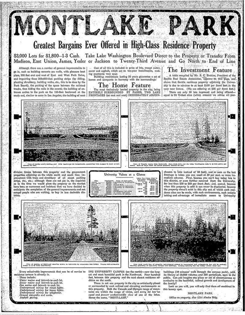
Montlake Boulevard was named after Montlake Park, an Addition to the City of Seattle, filed in 1908, which later gave its name to the entire neighborhood. Most of the street, however, is on the other side of the Lake Washington Ship Canal.
Today, Montlake Boulevard E (as well as Washington State Route 513) begins at the intersection of E Lake Washington Boulevard and E Montlake Place E, just south of the Washington State Route 520 freeway, and goes 1⅓ miles north, then northeast, to NE 45th Street, just south of University Village. It becomes Montlake Boulevard NE as it crosses the Montlake Cut of the Lake Washington Ship Canal. (State Route 513 continues for another 2 miles along NE 45th Street and Sand Point Way NE, ending at NE 65th Street just west of Magnuson Park.)


Born and raised in Seattle, Benjamin Donguk Lukoff had his interest in local history kindled at the age of six, when his father bought him settler granddaughter Sophie Frye Bass’s Pig-Tail Days in Old Seattle at the gift shop of the Museum of History and Industry. He studied English, Russian, and linguistics at the University of Washington, and went on to earn his master’s in English linguistics from University College London. His book of rephotography, Seattle Then and Now, was published in 2010. An updated version came out in 2015.