S River Street is just ½ a mile long, and none of it parallels the Duwamish River. The reason behind this is the same reason S Front Street is perpendicular to the waterway — the rechanneling of the Duwamish River that began in 1913. In Joseph R. McLaughlin’s Water Front Addition to the City of Seattle, filed in 1906, Front Street had a horseshoe shape. North Front Street is today’s Front Street, and South Front Street was changed to River Street in 1907, when West Seattle was annexed to Seattle. The Baist Atlas depiction of the Oxbow, below left, is from 1912, so has the modern name.
Today’s S River Street begins at 7th Avenue S and goes ½ a mile west, ending at 1st Avenue S, below the 1st Avenue S Bridge.
Born and raised in Seattle, Benjamin Donguk Lukoff had his interest in local history kindled at the age of six, when his father bought him settler granddaughter Sophie Frye Bass’s Pig-Tail Days in Old Seattle at the gift shop of the Museum of History and Industry. He studied English, Russian, and linguistics at the University of Washington, and went on to earn his master’s in English linguistics from University College London. His book of rephotography, Seattle Then and Now, was published in 2010. An updated version came out in 2015.
Usually, a Front Street designates a city’s waterfront. Front Street in Philadelphia parallels the Delaware River; NW Front Avenue in Portland, Oregon, goes up the Willamette River; Front Street in Toronto runs along Lake Ontario. Seattle once had a prominent Front Street alongside Elliott Bay, but it was renamed 1st Avenue in 1895. The Front Street we do have runs a grand total of ⅖ of a mile split among three segments, and it runs east–west, while the nearby Duwamish River runs north–south. Why is this?
As it turns out, S Front Street — established as part of Joseph R. McLaughlin’s Water Front Addition to the City of Seattle in 1906 — did use to run along the river, before it was rechanneled beginning in 1913. (Here is an excellent post from the Burke Museum on the Duwamish meanders, with some great maps and aerials.) The maps below show its course along the Duwamish River Oxbow in 1912 (left) and its current landlocked state (right). You can still make out its former location, as well as small remnants in the form of the Slip 2 and Slip 3 inlets. (Incidentally, Front Street originally was shaped like a horseshoe — today’s S Front Street was originally North Front Street, and South Front Street is today S River Street.)
Speaking of the Oxbow, here’s an advertisement for it. So much for that “16,000 feet of deep water frontage.”
Advertisement for Oxbow in June 1, 1906, issue of The Seattle Times
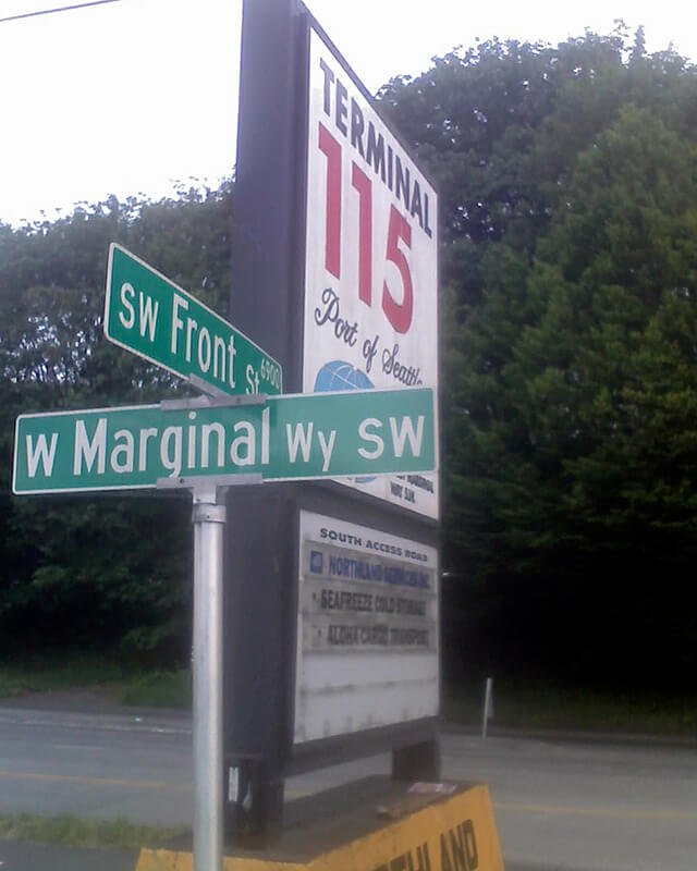
Today’s S Front Street begins at 6th Avenue S and goes ¼ of a mile west, ending just beyond 4th Avenue S. There is another 400-foot-long section between E Marginal Way S and 1st Avenue S, below the approach to the 1st Avenue S Bridge. And then there is one last 200-foot-long section on the west side of the Duwamish River — SW Front Street starts at W Marginal Way SW and ends at the entrance to the Port of Seattle’s Terminal 115 (which used to be Boeing Plant 1, the airplane manufacturer’s first production facility).
Incidentally, here’s a great article on the one in New Orleans I came across while looking up various Front Streets. It’s hard to beat a lede like this: “In a city replete with famed streets, scenic avenues and poetic street names, one particular artery excels at being obscure, nominally insipid, marvelously intermittent, and sometimes barely even a street.”
Born and raised in Seattle, Benjamin Donguk Lukoff had his interest in local history kindled at the age of six, when his father bought him settler granddaughter Sophie Frye Bass’s Pig-Tail Days in Old Seattle at the gift shop of the Museum of History and Industry. He studied English, Russian, and linguistics at the University of Washington, and went on to earn his master’s in English linguistics from University College London. His book of rephotography, Seattle Then and Now, was published in 2010. An updated version came out in 2015.
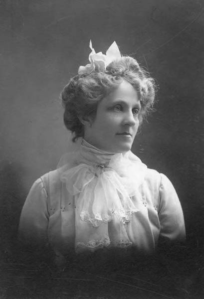
This street is named for Mary Virginia Bell Hall (1847–1931), daughter of William Nathaniel Bell and Sarah Ann Peter Bell. Belltown and Bell Street were named for her father, Olive Way for her sister, and Stewart Street for her brother-in-law. She was just four years old when her family, as part of the Denny Party, settled at Alki Point in 1851.
Born and raised in Seattle, Benjamin Donguk Lukoff had his interest in local history kindled at the age of six, when his father bought him settler granddaughter Sophie Frye Bass’s Pig-Tail Days in Old Seattle at the gift shop of the Museum of History and Industry. He studied English, Russian, and linguistics at the University of Washington, and went on to earn his master’s in English linguistics from University College London. His book of rephotography, Seattle Then and Now, was published in 2010. An updated version came out in 2015.
Born and raised in Seattle, Benjamin Donguk Lukoff had his interest in local history kindled at the age of six, when his father bought him settler granddaughter Sophie Frye Bass’s Pig-Tail Days in Old Seattle at the gift shop of the Museum of History and Industry. He studied English, Russian, and linguistics at the University of Washington, and went on to earn his master’s in English linguistics from University College London. His book of rephotography, Seattle Then and Now, was published in 2010. An updated version came out in 2015.
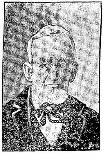
John Pike, from his obituary in the November 22, 1903, issue of The Seattle Times
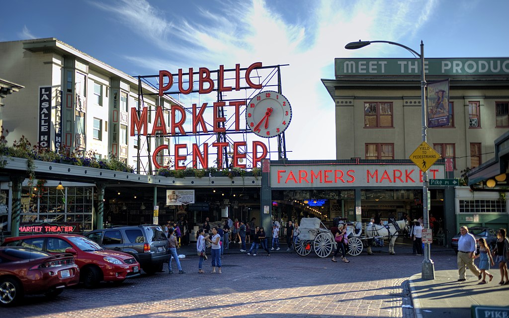
In the original plat, Pike Street (as well as Union and Pine Streets) begins at Front Street — today’s 1st Avenue — but today it begins on the Elliott Bay waterfront at Alaskan Way as the Pike Street Hillclimb. Pike Street proper begins at Pike Place (home of the eponymous market) and Post Alley (underneath the Market Theater sign), both shown below, and makes it a full 1⅔ miles to just past 18th Avenue in the Central District before being interrupted. It then resurfaces at 23rd Avenue and goes another ⅘ of a mile to Grand Avenue in Madrona, a few blocks east of Lake Washington.
Born and raised in Seattle, Benjamin Donguk Lukoff had his interest in local history kindled at the age of six, when his father bought him settler granddaughter Sophie Frye Bass’s Pig-Tail Days in Old Seattle at the gift shop of the Museum of History and Industry. He studied English, Russian, and linguistics at the University of Washington, and went on to earn his master’s in English linguistics from University College London. His book of rephotography, Seattle Then and Now, was published in 2010. An updated version came out in 2015.
This street, which is nowhere longer than a couple of blocks long, begins at 54th Avenue S in the east, just west of Andrews Bay and Seward Park, and finishes up at Corson Avenue S in the west, just east of Interstate 5.
According to Lucile Saunders McDonald, writing in The Seattle Times on January 1, 1956, it is named for Pearl Josephine Hulbert Faurote (1883–1981), granddaughter of Joseph and Catherine (Henderson) Dunlap (of S Henderson Street). I listed her as the street’s namesake when I originally posted this article. However, S Pearl Street is quite a bit north of Dunlap’s Plat of Land on Lake Washington — about 2¼ miles from Henderson. The name appears to have originated in Hillman City Division № 8, filed in 1903. As of May 19, 2021, neither I nor Valarie Bunn nor Rob Ketcherside nor Matt McCauley — who first called my attention to the fact that McDonald’s assertion was unsourced — have been able to find a connection between the Hillmans and anyone named Pearl. Nor does there appear to be any particular connection between the Hillmans and the Dunlaps or Hulberts, other than their all being active in Seattle real estate.
It seems, then, that the origin of Pearl Street should be regarded as an open question.
Born and raised in Seattle, Benjamin Donguk Lukoff had his interest in local history kindled at the age of six, when his father bought him settler granddaughter Sophie Frye Bass’s Pig-Tail Days in Old Seattle at the gift shop of the Museum of History and Industry. He studied English, Russian, and linguistics at the University of Washington, and went on to earn his master’s in English linguistics from University College London. His book of rephotography, Seattle Then and Now, was published in 2010. An updated version came out in 2015.
This fragmented street starts at Rainier Avenue S and travels two blocks west to 46th Avenue S. It makes its next appearance in Beacon Hill as a block-long street hanging off Military Road S, just east of Interstate 5. There are a few more blocks in South Park, from 5th to 2nd Avenues S, then half a block in West Seattle just west of California Avenue SW and a few final blocks from just east of Vashon Place SW to 47th Avenue SW at Lincoln Park. It is named for Fontanelle, Iowa, where Joseph and Catherine (Henderson) Dunlap (of S Henderson Street) lived before coming to Seattle in 1869.
Born and raised in Seattle, Benjamin Donguk Lukoff had his interest in local history kindled at the age of six, when his father bought him settler granddaughter Sophie Frye Bass’s Pig-Tail Days in Old Seattle at the gift shop of the Museum of History and Industry. He studied English, Russian, and linguistics at the University of Washington, and went on to earn his master’s in English linguistics from University College London. His book of rephotography, Seattle Then and Now, was published in 2010. An updated version came out in 2015.
Joseph and Catherine (Henderson) Dunlap arrived in the Puget Sound region in September 1869, having traveled by covered wagon from Iowa. According to family legend, when they arrived in the Puget Sound region, they followed a road over Beacon Hill and sent their son George up a tree to view the land to the south and east. There he spotted a flat valley and Lake Washington. The Dunlaps decided to homestead in that valley, located to the south of the Van Asselt and Mapel families. They claimed 120 acres extending east toward Rainier Beach.
Today, S Henderson Street begins at Seward Park Avenue S, just west of Be’er Sheva Park, and runs ¾ of a mile west to Carkeek Drive S. On the other side of Interstate 5 and the Duwamish River, it runs ⁹⁄₁₀ of a mile through South Park from just east of 14th Avenue S to just west of 2nd Avenue S, the portion over Highway 99/W Marginal Way S being a footbridge. Once in West Seattle, SW Henderson Street runs ⅔ of a mile from 8th Avenue SW, just west of Westcrest Park, to 21st Avenue SW, where the arterial turns into SW Barton Place, and is then a two-block residential street from 22nd Avenue SW to 25th Avenue SW, where it is blocked by the Westwood Village shopping mall. On the other side of the mall, it’s ⅘ of a mile from 28th Avenue SW to SW Barton Street at Fauntleroy Park, and then a final couple of blocks from 43rd Place SW to Fauntleroy Way SW, just north of Washington State Ferries’ Fauntleroy Terminal.
Born and raised in Seattle, Benjamin Donguk Lukoff had his interest in local history kindled at the age of six, when his father bought him settler granddaughter Sophie Frye Bass’s Pig-Tail Days in Old Seattle at the gift shop of the Museum of History and Industry. He studied English, Russian, and linguistics at the University of Washington, and went on to earn his master’s in English linguistics from University College London. His book of rephotography, Seattle Then and Now, was published in 2010. An updated version came out in 2015.
Among the representative business men of Seattle none are more deserving of representation in this volume than James Bothwell, who is now successfully engaged in the mortgage, loan, fire insurance business, and care of property and estates in that city.
Born and raised in Seattle, Benjamin Donguk Lukoff had his interest in local history kindled at the age of six, when his father bought him settler granddaughter Sophie Frye Bass’s Pig-Tail Days in Old Seattle at the gift shop of the Museum of History and Industry. He studied English, Russian, and linguistics at the University of Washington, and went on to earn his master’s in English linguistics from University College London. His book of rephotography, Seattle Then and Now, was published in 2010. An updated version came out in 2015.
This street runs not quite 300 feet from Martin Luther King Jr. Way S in the east to 42nd Avenue S in the west, just south of S Henderson Street. Like nearby Valdez Avenue S and Yukon Avenue S, it was established in 1905 as part of Dunlap’s Supplemental to the City of Seattle, and, in keeping with the Alaska theme, was named after the city of Fairbanks, which had been founded just four years earlier. (Fairbanks itself was named after Indiana Senator Charles Warren Fairbanks [1897–1905], who was vice president under Theodore Roosevelt from 1905 to 1909.)
Born and raised in Seattle, Benjamin Donguk Lukoff had his interest in local history kindled at the age of six, when his father bought him settler granddaughter Sophie Frye Bass’s Pig-Tail Days in Old Seattle at the gift shop of the Museum of History and Industry. He studied English, Russian, and linguistics at the University of Washington, and went on to earn his master’s in English linguistics from University College London. His book of rephotography, Seattle Then and Now, was published in 2010. An updated version came out in 2015.
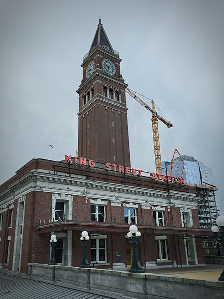
King Street is another of the first streets platted in Seattle by David Swinson “Doc” Maynard in May 1853. It was named after William Rufus DeVane King, a slaveholding Unionist Democratic politician who founded and named Selma, Alabama; was a senator from Alabama from 1819 to 1844 and from 1848 to 1852 (he was ambassador to France in the interim); and was vice president under Franklin Pierce for 45 days in 1853 (he died two days after he returned to the U.S. from Cuba, where he had been convalescing from tuberculosis; King Street was named in his honor 35 days after that).
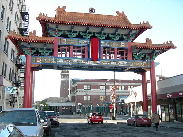
S King Street begins on the Elliott Bay waterfront at Alaskan Way S and runs ¼ of a mile to King Street Station just past 2nd Avenue S. It resumes at at 5th Avenue S, where it is spanned by the Historic Chinatown Gate, then makes it a full mile to 20th Avenue S, passing through Chinatown and Little Saigon along the way. East of there it exists in various segments, none of which is longer than ⅓ of a mile, and it finally ends at Lakeside Avenue S, where it is one of the String of Pearlsshoreline street ends.
Born and raised in Seattle, Benjamin Donguk Lukoff had his interest in local history kindled at the age of six, when his father bought him settler granddaughter Sophie Frye Bass’s Pig-Tail Days in Old Seattle at the gift shop of the Museum of History and Industry. He studied English, Russian, and linguistics at the University of Washington, and went on to earn his master’s in English linguistics from University College London. His book of rephotography, Seattle Then and Now, was published in 2010. An updated version came out in 2015.
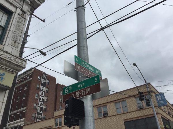
S Jackson Street begins today at Alaskan Way S on the Elliott Bay waterfront and has an uninterrupted 2-mile run as an arterial to 31st Avenue S in Leschi. On the other side of Frink Park, it makes its way the few remaining blocks to Lake Washington as a minor arterial, then a staircase, then a minor street, and finally a shoreline street end, part of the String of Pearls.
Born and raised in Seattle, Benjamin Donguk Lukoff had his interest in local history kindled at the age of six, when his father bought him settler granddaughter Sophie Frye Bass’s Pig-Tail Days in Old Seattle at the gift shop of the Museum of History and Industry. He studied English, Russian, and linguistics at the University of Washington, and went on to earn his master’s in English linguistics from University College London. His book of rephotography, Seattle Then and Now, was published in 2010. An updated version came out in 2015.
Weller Street was among the first streets platted in Seattle by David Swinson “Doc” Maynard in May 1853. It was named after John B. Weller, Democratic senator from California from 1852 to 1857 (Maynard named four streets in his plat after prominent Democratic politicians). Though he wasn’t a slaveowner like President Andrew Jackson or Vice President William R. King, or a future secessionist like Joseph Lane, who was the Southern Democrats’ nominee for vice president in 1860, he was a pro-slavery “Lecompton Democrat” who planned to have California become independent in case of civil war.
S Weller Street begins today at 5th Avenue S and runs ¼ of a mile through the Chinatown–International District to just east of 8th Avenue S, where it, like S Lane Street, is blocked by Interstate 5. It resumes at 10th Avenue S and runs ¾ of a mile to its end at 20th Place S and Washington Middle School.
Born and raised in Seattle, Benjamin Donguk Lukoff had his interest in local history kindled at the age of six, when his father bought him settler granddaughter Sophie Frye Bass’s Pig-Tail Days in Old Seattle at the gift shop of the Museum of History and Industry. He studied English, Russian, and linguistics at the University of Washington, and went on to earn his master’s in English linguistics from University College London. His book of rephotography, Seattle Then and Now, was published in 2010. An updated version came out in 2015.
Lane Street was another one of Seattle’s first streets, platted on May 23, 1853 by David Swinson “Doc” Maynard. It was named after Joseph Lane, governor of Oregon Territory (which then included what is now Washington) from March 1849 to June 1850. Ten years later, he was the pro-slavery, pro-secession Southern Democratic nominee for vice president, with John C. Breckenridge at the head of the ticket.
S Lane Street begins today at 6th Avenue S just east of the flagship Uwajimaya grocery store, and runs ⅕ of a mile through the Chinatown–International District to just east of 8th Avenue S, where it is blocked by Interstate 5. East of there, it is a path and stairway from 10th to 13th Avenues S, past which it appears in segments of varying lengths until it ends for good at Lakeside Avenue S.
Born and raised in Seattle, Benjamin Donguk Lukoff had his interest in local history kindled at the age of six, when his father bought him settler granddaughter Sophie Frye Bass’s Pig-Tail Days in Old Seattle at the gift shop of the Museum of History and Industry. He studied English, Russian, and linguistics at the University of Washington, and went on to earn his master’s in English linguistics from University College London. His book of rephotography, Seattle Then and Now, was published in 2010. An updated version came out in 2015.
Washington Street was one of Seattle’s first streets, platted on May 23, 1853 by David Swinson “Doc” Maynard and named after President George Washington. Its initial segment begins at Alaskan Way S on the Elliott Bay waterfront and ends half a mile to the east at Kobe Terrace Park. East of Interstate 5 it exists in a number of segments interrupted by schools and parks and finally ends at S Frink Place and Frink Park.
Born and raised in Seattle, Benjamin Donguk Lukoff had his interest in local history kindled at the age of six, when his father bought him settler granddaughter Sophie Frye Bass’s Pig-Tail Days in Old Seattle at the gift shop of the Museum of History and Industry. He studied English, Russian, and linguistics at the University of Washington, and went on to earn his master’s in English linguistics from University College London. His book of rephotography, Seattle Then and Now, was published in 2010. An updated version came out in 2015.
Plat of an Addition to the Town of Seattle as Laid Out by A.A. Denny, November 16, 1861
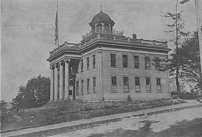
Territorial University of Washington on opening day, November 4, 1861
Even though the University of Washington moved to its current location on Portage and Union Bays in 1895, the name was not changed. Nor did the university relinquish the land, though not for lack of trying. This turns out to have been fortunate. The UW owns the Metropolitan Tract to this day, and it earned $25 million in rent on the property during fiscal year 2020 alone.
The street, which originally ran from Front Street (now 1st Avenue) to the university campus, just northeast of 3rd Avenue, today begins at Alaskan Way on the Elliott Bay waterfront, and makes it just one block, to Western Avenue, before it becomes the Harbor Steps. From 1st Avenue, it’s about a third of a mile to 7th Avenue, where University Street is blocked by Interstate 5. It resumes at 9th Avenue and goes for another third of a mile to Boylston Avenue.
Portion of King County quarter section maps covering Metropolitan Tract
Incidentally, you’ll notice in the map above that 4th and 5th Avenues between Seneca and Union Streets, as well as University Street between 4th and 5th Avenues, plus half a block on either end, are marked private way subject to public use — long term grant of use for street purposes. This fact — that the University of Washington still owns all the land within the Metropolitan Tract and never formally dedicated those streets to the public — was something I never knew until I started taking close looks at King County’s quarter section maps as part of my local history research. It might seem an academic distinction, but as The Seattle Timesreported in 2015, there are very real financial consequences.
In 2008… the UW wanted the city to interpret the tract as one undivided lot, streets and all. That novel argument would benefit the UW in calculating the development footprint, or base.… The bigger the base, the logic went, the more square footage a developer could build before triggering affordable-housing fees under the city’s formula.… The university held a heavy hammer in negotiations. Because the UW owned development rights for the land under Fifth Avenue and University Street, it could make the city compensate it, one way or another, for using those streets.
Born and raised in Seattle, Benjamin Donguk Lukoff had his interest in local history kindled at the age of six, when his father bought him settler granddaughter Sophie Frye Bass’s Pig-Tail Days in Old Seattle at the gift shop of the Museum of History and Industry. He studied English, Russian, and linguistics at the University of Washington, and went on to earn his master’s in English linguistics from University College London. His book of rephotography, Seattle Then and Now, was published in 2010. An updated version came out in 2015.
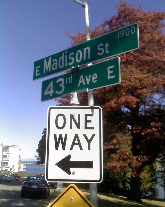
Madison Street — another of Seattle’s “first streets” — was named for James Madison, president of the United States from 1809 to 1817. It is the only street in town that stretches, uninterrupted, from the salt water of Elliott Bay and Puget Sound to the fresh water of Lake Washington.
Originating as the McGilvra Road in 1861, Madison Street begins on the Elliott Bay waterfront at Alaskan Way and ends 3¾ miles northeast of there at a small fishing pier, just east of 43rd Avenue E and north of Madison Park Beach. Apart from a slight bend to the northeast at 22nd Avenue, it is as straight as an arrow from beginning to end.
Born and raised in Seattle, Benjamin Donguk Lukoff had his interest in local history kindled at the age of six, when his father bought him settler granddaughter Sophie Frye Bass’s Pig-Tail Days in Old Seattle at the gift shop of the Museum of History and Industry. He studied English, Russian, and linguistics at the University of Washington, and went on to earn his master’s in English linguistics from University College London. His book of rephotography, Seattle Then and Now, was published in 2010. An updated version came out in 2015.
Spring Street was another of Seattle’s “first streets.” Sophie Frye Bass writes in Pig-Tail Days in Old Seattle:
Where springs of clear water bubbled from the earth and the beach was sandy and free from rocks, there the Indians camped. Such a choice spot was Tzee-tzee-lal-litch [dzidzəlalič], which Arthur Denny called Spring Street.
Spring Street begins at Alaskan Way and runs nearly a mile, to Harvard Avenue, before it is interrupted. A few more segments run through the Central District and Madrona. The last is from 38th Avenue to Grand Avenue, at which point it continues to Lake Washington Boulevard as a footpath and stairway.
Born and raised in Seattle, Benjamin Donguk Lukoff had his interest in local history kindled at the age of six, when his father bought him settler granddaughter Sophie Frye Bass’s Pig-Tail Days in Old Seattle at the gift shop of the Museum of History and Industry. He studied English, Russian, and linguistics at the University of Washington, and went on to earn his master’s in English linguistics from University College London. His book of rephotography, Seattle Then and Now, was published in 2010. An updated version came out in 2015.
Cherry Street was among the first streets platted in Seattle on May 23, 1853. Sophie Frye Bass, author of Pig-Tail Days in Old Seattle, writes:
I choose to think that Cherry Street is named for the little town of Cherry Grove, Illinois — Mother’s birthplace — where the Dennys started on their long journey over the Oregon Trail.
In 2006, Hunter Brown wrote a People’s History essay for HistoryLink, “Finding Cherry Grove,” detailing his efforts to locate Cherry Grove, whose name was later changed to Cedar Township. The nearest town today is called Abingdon.
Bass began her Pig-Tail Days piece on Cherry Street by calling it “another up-and-up street… with no interferences. It begins at First Avenue, goes east and ends at Thirty-seventh avenue.” This is no longer quite the case because of a very small gap at the south end of the Seattle University campus. Today, Cherry begins at 1st Avenue and ends a block east of Broadway. It starts up again a couple hundred feet to the east as a continuation of the James Street/E James Way arterial, and then does go on to 37th Avenue in Madrona. All told it is 2⅓ miles long.
Born and raised in Seattle, Benjamin Donguk Lukoff had his interest in local history kindled at the age of six, when his father bought him settler granddaughter Sophie Frye Bass’s Pig-Tail Days in Old Seattle at the gift shop of the Museum of History and Industry. He studied English, Russian, and linguistics at the University of Washington, and went on to earn his master’s in English linguistics from University College London. His book of rephotography, Seattle Then and Now, was published in 2010. An updated version came out in 2015.
Marion Street runs ⅖ of a mile from Alaskan Way to 6th Avenue, where it is interrupted by Interstate 5. It picks up again at 7th Avenue and runs about the same distance to Broadway, where the Seattle University campus begins. East of there it runs in sections of varying lengths until it ends for good at 38th Avenue and Madrona Park.
Born and raised in Seattle, Benjamin Donguk Lukoff had his interest in local history kindled at the age of six, when his father bought him settler granddaughter Sophie Frye Bass’s Pig-Tail Days in Old Seattle at the gift shop of the Museum of History and Industry. He studied English, Russian, and linguistics at the University of Washington, and went on to earn his master’s in English linguistics from University College London. His book of rephotography, Seattle Then and Now, was published in 2010. An updated version came out in 2015.


.jpg)