S Industrial Way

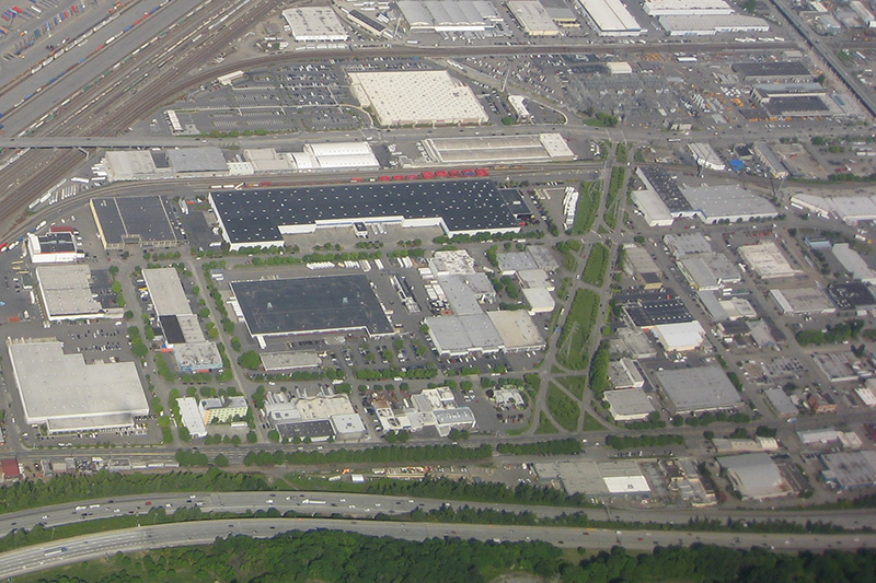
In 1930, Seattle City Light acquired a number of transmission line rights-of-way. The one immediately concerning us approaches the utility’s South Service Center from the southeast. East of Interstate 5, the Chief Sealth Trail runs along the right-of-way from Beacon Hill to Kubota Garden. West of the freeway, a road was built in the late 1960s as part of the South Seattle Redevelopment Project, or South Seattle Industrial Park, as it came to be known. This street was designated Industrial Way in 1969, and runs from Airport Way S in the southeast to 4th Avenue S and Diagonal Avenue S in the northwest, a distance of about ⅓ of a mile.

Aerial view of Industrial District with S Industrial Way at center right
Aerial view of Industrial District, May 2009. S Industrial Way is the boulevard with the grassy median at center right, leading to the City Light South Service Center. The diagonal street at its end is, appropriately, Diagonal Avenue S, and the arterial it stops at is 4th Avenue S. The Union Pacific Railroad’s Argo Yard is in the upper-left-hand corner, and Airport Way S and Interstate 5 run along the bottom. Photograph by Flickr user J Brew, licensed under Creative Commons Attribution-ShareAlike 2.0 Generic

Colorado Avenue S

This street was created in 1895 as part of the plat of Seattle’s tide lands. As Seattle expanded to the south, it became obvious that Commercial Street (1st Avenue S) would not be the westernmost street east of Elliott Bay. Fortunately, instead of using zero or negative numbers, they went with states: the first street west of 1st was named Utah, and the next, Colorado. (Some perpendicular streets were named Alaska, Vermont, Connecticut, Texas, Massachusetts, etc. There doesn’t appear to have been any particular order.)

Colorado Avenue S begins at S Royal Brougham Way and goes ⅓ of a mile south to S Massachusetts Street. It begins again on the back side of the Starbucks Center and goes ⅘ of a mile to just south of S Spokane Street, and its final segment begins just north of Diagonal Avenue S and goes ⅔ of a mile to S Dawson Street.

NE Pacific Street

What is now Pacific Street was Harrison Avenue in the 1889 Latona Addition and Railroad Avenue in the 1890 Brooklyn Addition, corresponding to the eastern part of Northlake and to the University District, respectively. The road was built on either side of railroad tracks that were originally part of the independent Seattle, Lake Shore and Eastern Railway, but which were soon thereafter taken over by the Northern Pacific Railway. (The route of the SLS&E through and east of Seattle is now the Burke–Gilman Trail, the Sammamish River Trail, and the East Lake Sammamish Trail.)

In 1906, Harrison Avenue became Pacific Place and Railroad Avenue became Brintnall Place. (Why the opportunity wasn’t taken to match the names is unclear. Brintnall Place may have been named for Burgess W. Brintnall, who, according to the September 1912 issue of the Northwest Journal of Education, had been school superintendent for Olympia and Thurston County, founded the journal itself, and, after moving to Seattle in 1899, founded the Pacific Teachers Agency. He was murdered on July 3, 1912.)

At some point both streets became Pacific Street. Brintnall Place appears for the last time in The Seattle Times in October 1920, and Pacific Street for the first time in July 1921. The 1920 Kroll atlas shows all three names, including Pacific Place, indicating the change must have been planned at the time of its publication.

I haven’t seen any indication of why the Pacific name was chosen. Seattle got an Atlantic Street in 1895 — maybe it was thought the other major ocean deserved a street as well. But I wonder if it wasn’t named for the Northern Pacific, whose tracks the street ran along?

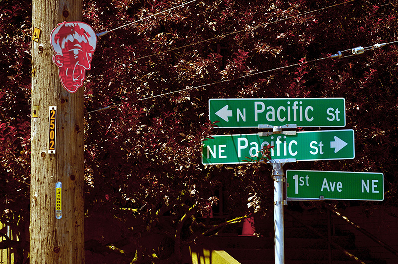
Street sign where NE Pacific Street becomes N Pacific Street on crossing 1st Avenue NE, August 2011. Photograph by Flickr user Panegyrics of Granovetter (Sarah C. Murray), licensed under Creative Commons Attribution-ShareAlike 2.0 Generic

Today, NE Pacific Street begins at Montlake Boulevard NE, at the north end of the Montlake Bridge and the southeastern corner of the University of Washington campus, and goes ¾ of a mile to Eastlake Place NE, underneath the University Bridge, where it becomes NE Northlake Way. It begins again at NE 40th Street just west of the Ship Canal Bridge and goes another ¾ of a mile to N 34th Street just east of Meridian Avenue N.

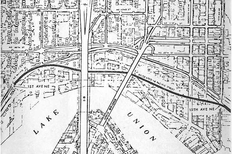
Pacific Street’s current configuration is the result of a realignment that took place in the 1970s; originally, instead of turning west at University Way NE, it kept going northwest, cutting through what is now the University of Washington’s West Campus, and there was no interruption between the University and Ship Canal Bridges. The Burke–Gilman Trail follows the original railroad alignment, though, as does, for a few blocks, the campus road Cowlitz Road NE.

Joliet Avenue W

This street was created in 1895 as part of the Seattle Tide Lands plat (in full, Seattle Tide Lands as Surveyed and Platted by the Board of Appraisers of Tide and Shore Lands for King County, Washington). Streets were laid out from the northern tip of Magnolia (see W Semple Street) to West Seattle, but only the land southeast of Magnolia down to the Duwamish River was ultimately filled and developed.* (Magnolia’s tidelands were intended to become industrial land as part of the Bogue Plan, but this was rejected, and they have remained untouched west of the Elliott Bay Marina.)

* I certainly don’t want to minimize the extent of what was filled — over 92% of the tidelands, according to local historian and geologist David B. Williams.

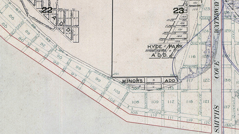
As can be seen in the portion of the plat map reproduced below, the streets perpendicular to the shoreline in southwest Magnolia were named alphabetically after various cities in the United States. (Northwest of here, they were simply given letters of the alphabet, beginning with A and making it as far as O.) The namers began with Allegheny (Pennsylvania), and continued with Bangor (Maine), Chattanooga (Tennessee), Duluth (Minnesota), Erie (Pennsylvania), Fresno (California), Galveston (Texas), Hartford (Connecticut), Ithaca (New York), and our subject, Joliet (Illinois), before switching to yet another series.

Portion of Plat of Seattle Tide Lands showing Smith Cove and Southwest Magnolia
Portion of 1895 Plat of Seattle Tide Lands showing Smith Cove and Southwest Magnolia

Most of these streets have been renamed or vacated, but for some reason this never happened to Joliet Avenue, even when the Navy took over the Smith Cove piers and uplands in 1941 and 1942 to form Naval Supply Depot Seattle. Today, this is the Port of Seattle’s Terminal 90/91 complex, but as the quarter section map shows, it’s still crisscrossed by public right-of-way. It may very well take the proposed redevelopment of the uplands and Washington National Guard armory site to eliminate these paper streets for good.

Viewmont Way W

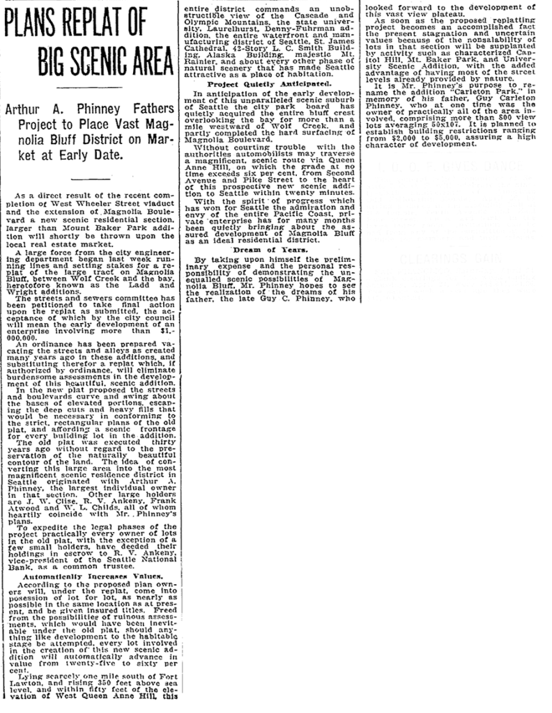
This street was created in 1915 as part of the plat of Carleton Park, a replat of much of southwest Magnolia (basically a triangle formed by W Raye Street, 34th Avenue W, and Magnolia Boulevard W). Arthur A. Phinney (1885–1941) led the project, named after his father, Guy Carleton Phinney (1851–1893) (Phinney Avenue N, Phinney Ridge). As The Seattle Times reported:

The old plat was executed thirty years ago without regard to the preservation of the naturally beautiful contour of the land.… In the new plat the streets and boulevards curve and swing about the bases of elevated portions, escaping the deep cuts and heavy fills that would be necessary in conforming to the strict, rectangular plans of the old plat, and affording a scenic frontage for every building lot in the addition.… This entire district commands an unobstructible view of the Cascade and Olympic Mountains, the state university, Laurelhurst, Denny-Fuhrman addition, the entire waterfront and manufacturing district of Seattle, St. James Cathedral, 42-story L.C. Smith Building, Alaska Building, majestic Mt. Rainier, and about every other phase of natural scenery that has made Seattle attractive as a place of habitation.

Article on Carleton Park, Seattle Times, April 25, 1915

Viewmont Way was obviously named after its view of the mountains, and is of a piece with other Carleton Park streets like Montavista Place, Westmont Way, Eastmont Way, Altavista Place, and the like.

Viewmont Way W begins at the intersection of 34th Avenue W, W Lynn Street, and Montvale Place W in Magnolia Village, and goes ¼ mile southwest to Constance Drive W, where it becomes W Viewmont Way W. The name initially continued about the same distance northwestwards, where the street became 41st Avenue W, but this portion and the rest of 41st Avenue as far north as Fort Lawton (now Discovery Park) were apparently changed at some point to W Viewmont Way. In 1961, the streets became Viewmont Way W and W Viewmont Way W.

W Blewett Way

This street is named for Edward Blewett (1848–1929), one of the developers of the Fremont neighborhood (named after his hometown, Fremont, Nebraska).

“But,” you might say, “if he developed Fremont, why is W Blewett Way in Queen Anne?”

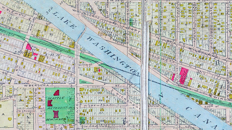
As you can see in the map below, and in this plat he filed in 1888 of what is now Fremont and North Queen Anne before the Fremont Cut was dug, Ewing and Blewett Streets used to be part of both neighborhods. When they became separated, the names were left alone on the Queen Anne side; in Fremont, they were changed as follows: Kilbourne to N 36th Street, Blewett to N 35th Street, and Ewing to N 34th Street.

Portion of 1912 Baist Atlas Showing Fremont Cut
Portion of 1912 Baist Atlas showing Fremont Cut

It’s not quite that simple, though — Blewett never reached quite as far as 13th Avenue W. What appears to have happened is that a name was needed when what is now W Blewett Way was created in 1907, and because the street to the south was still Ewing, Blewett presented itself as a natural choice. The rest of Blewett south of the canal was vacated over the years, so this is all that’s left of the name.

Today, W Blewett Way begins at the north end of 13th Avenue W and goes east just about ⅒ of a mile before it becomes a private driveway.

Van Buren Avenue W

This street first appears in the 1875 plat of the Northern Addition to Seattle, W.T., filed by James Marston McNaught (1842–1919) and his wife, Agnes Martha Hyde McNaught (1856–1918). James was “a wealthy lawyer working in the railroad industry.” I assume it was named for Martin Van Buren, eighth president of the United States, and not for his namesake, Martin Van Buren Stacy, a Seattle real estate developer, though I wouldn’t be surprised if McNaught and Stacy knew each other, as their dwellings, in addition to that of Henry Yesler, were considered “the three most lavish mansions in the city.”

I wasn’t sure whether to label Van Buren Avenue a “paper street” or not. Unlike W Semple Street and Albert Place W, part of the right-of-way has actually been improved (see below). However, like those two streets, it is not signed; and unlike Semple, there are no buildings with Van Buren Avenue addresses. (There are two houses on the street, but one has a W Prospect Street address; the other, an Elliott Avenue W address.)

The right-of-way stretches from just southeast of W Prospect Street, northeast of Elliott Avenue W, to where the Magnolia Bridge onramp turns west at W Garfield Street. The first 350 or so feet are drivable. There is also a foot trail through the Southwest Queen Anne Greenbelt in the right-of-way, beginning at the east end of W Lee Street and heading southeast. Lastly, just under 600 feet of the Magnolia Bridge onramp is located in the right-of-way. It could conceivably be signed Van Buren Avenue W instead of W Galer Street Flyover, but this is not the case.

Albert Place W

Our first paper street, W Semple Street, was in Magnolia, and so is our second!

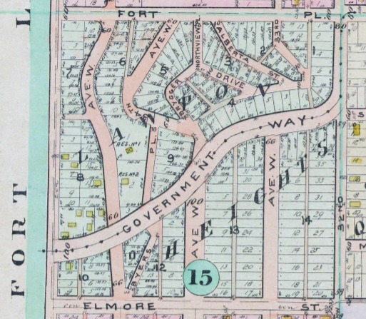
In 1907, Anna Sophia Brygger (1852–1940) (NW Brygger Place, Brygger Drive W) filed the plat of Lawton Heights in Magnolia. Because a good portion of it was taken up by what is now known as Kiwanis Ravine, many of the streets were only partially built (Fort Place, 35th Avenue W, 34th Avenue W, Brygger Drive) or never built at all (Northview Place, Albert Street [Alberta is a typo], Byers Place). For some reason, they have never been vacated, making them all paper streets, and unlike W Semple Street, they don’t even have any buildings with addresses.

Brygger had seven children, one of whom was named Albert (1887–1977). According to Paul Dorpat, he was at one point president of Peoples National Bank (now part of U.S. Bank). It seems a fair bet that she named Albert Street after him.

Map of Lawton Heights Addition, Magnolia, 1912 Baist Atlas

Brooklyn Avenue NE

This street was named after the Brooklyn Addition to Seattle, platted by James Alexander Moore (1861–1929) in 1890. The addition itself was named for Brooklyn, New York (see the history of the University District Paul Dorpat wrote for HistoryLink and this article on his own blog):

[Moore] chose the name because his addition “looked across the water” to Seattle proper like the New York borough of the same name that looks across the East River to Manhattan.

I haven’t been able to find an online source for this assertion, but Dorpat may have been referring to a passage in Roy G. Nielsen’s UniverCity: The Story of the University District in Seattle (1986), which quotes an article in the August 31, 1928, issue of the University Herald in which George F. Cotterill (mayor from 1912–1914) says:

[In 1885], there was no thought of a university and section sixteen was still untouched. J.A. Moore, one of the greatest Seattle real estate promoters of the time, started Brooklyn between 10th Ave. N.E. and the campus. This addition was intended by Mr. Moore to be to Seattle what Brooklyn is to New York.

Today’s Brooklyn Avenue is a block west of Moore’s. Again quoting Paul Dorpat:

None of James Moore’s street names survive. His Tremont Avenue became 15th Avenue. One block west he named University Way — the District’s future “Main Street” — Columbus Avenue. He called the future Brooklyn Avenue, “Broadway,” ­ and this was Moore’s intended “Main Street.” He called 12th Avenue “Brooklyn.”

Brooklyn Avenue NE begins at NE Boat Street just north of Fritz Hedges Waterway Park and goes 1¾ miles north through the University District and Roosevelt neighborhood to NE 66th Street at Roosevelt High School. It resumes at NE 70th Street and goes just short of 300 feet to Froula Playground and the Roosevelt Reservoir. There is another segment between NE 75th Street and NE 77th Street and a final one between NE 80th Street and NE 82nd Street by Maple Leaf Reservoir Park.

Diagonal Avenue S

This street in the Industrial District is so named because it cuts diagonally across the street grid, going northeast–southwest rather than east–west or north–south. But why is it there in the first place?

In a sense, Diagonal Avenue has been around since the 1850s. As Sophie Frye Bass writes in Pig-Tail Days in Old Seattle,

The Beach or River Road… skirted the shore of the bay at the foot of the high Beacon Hill bluff, east of what is now Airport Way, and ran south along the Duwamish.… Built in the early fifties, [it] was a hard road to keep in good condition.… In 1886, a road was built on piling over the mud flats a little west of the Beach Road to avoid the slides and floods. This street became known as the Grant Street Bridge.

Essentially, there were a series of roads following the semicircular curve of Elliott Bay from Downtown to the Duwamish River before the tideflats were filled in: first Beach Road (or River Road), then the Grant Street Bridge, which in turn became Seattle Boulevard once the fill was complete. Sometime before 1918 (the first mention I could find of the name in The Seattle Times), the portion of Seattle Boulevard that ran northeast–southwest (the southern third of the semicircle) was renamed Diagonal Avenue. (In 1931, the rest of Seattle Boulevard was renamed Airport Way.)

Today, Diagonal Avenue S begins at Airport Way S and goes just about 400 feet to S Spokane Street. There is a slightly shorter segment west of 4th Avenue S which is blocked by railroad tracks, and one even shorter west of 2nd Avenue S blocked by the Union Pacific Railroad’s Argo Yard. It resumes for the last time at S Oregon Street, Colorado Avenue S, and Denver Avenue S, and goes ⅓ of a mile to sbəq̓ʷaʔ Park and Shoreline Habitat on the east bank of the Duwamish Waterway, which the Port of Seattle says “is probably the best small boat take-out launch site on the Lower Duwamish Waterway.”

N Canal Street

This street appears to have been built sometime between 1908 and 1912. (It was established by ordinance in 1906, but that was legislation, not construction. [It was also originally named Ewing Street, the original name of N 34th Street, which still exists on the Queen Anne side of the Ship Canal.]) When the plat of Denny & Hoyt’s Addition to the City of Seattle, W.T., was filed in 1888, no such street was needed, because there was no canal. Instead, Ross Creek connected Lake Union to Salmon Bay. However, as work on the Lake Washington Ship Canal progressed, the Fremont Cut came into being, and it must have been felt a street paralleling the canal to the north was needed, since the original plat took no notice of the creek or any future canal route. (One to the south was needed, too, which is why Nickerson Street was extended from 3rd Avenue W to 4th Avenue N, at the southern end of the Fremont Bridge.)

Why, then, is Canal Street so short — not quite ⅓ of a mile from N 34th Street and Phinney Avenue N in the east to 2nd Avenue NW in the west?

As it turns out, even though Canal Street was to run to what was then the boundary between the cities of Seattle and Ballard at 8th Avenue NW, shortly after Seattle annexed Ballard in 1907 another street was laid out parallel to the canal connecting Fremont to the new neighborhood of Ballard: Leary Way NW (then simply Leary Avenue, all the way from Market Street to Fremont Avenue). Leary became the main arterial, and in 1951 NW Canal Street was vacated between 3rd Avenue NW and 8th Avenue NW, reducing it to its present length. (Until 2016, there was a slight discontinuity in the vicinity of 1st Avenue NW and N 35th Street where the built street deviated from its right-of-way, making it even shorter.)

So this isn’t quite the same as our trio of S Front Street, S River Street, and S Riverside Drive literally being cut short by the rechanneling of the Duwamish River into the Duwamish Waterway — more one of Canal Street being supplanted by Leary Way and becoming more valuable to the city as industrial land than as roadway.

S Riverside Drive

As you might expect, this street is so named because it runs along the west bank of the Duwamish Waterway. However, it only does so for about ⅖ of a mile, from S Webster Street east of 5th Avenue S to a dead end on the river just north of a path to t̓ałt̓ałucid Park and Shoreline Habitat (formerly the 8th Avenue S street end, just north of S Portland Street). It is by no means a prominent street, contrary to what such a name usually implies (Los Angeles, Manhattan, Ottawa, Spokane). In this way it is similar to Seattle’s S Front Street and S River Street. Why is this?

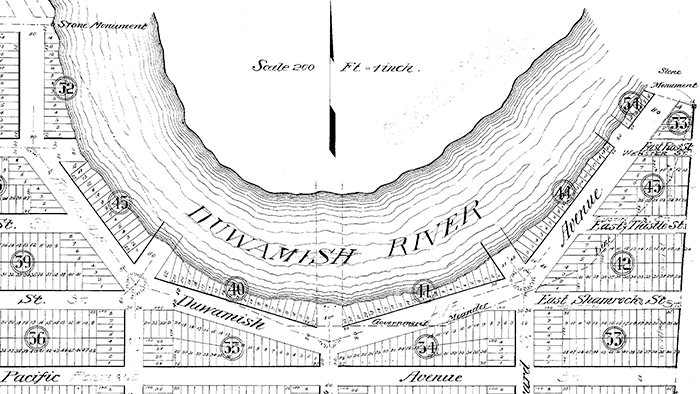
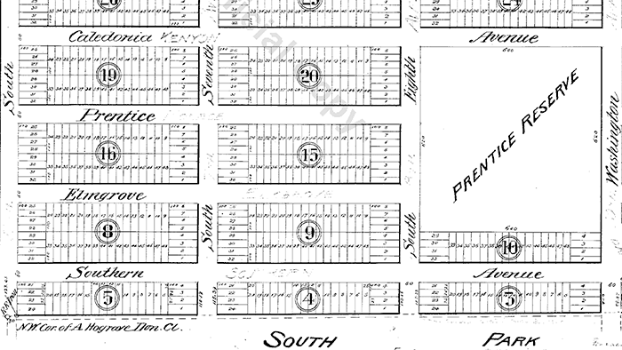
Also as you might expect, it’s for the same reason Front and River Streets are relatively unimportant: the rechanneling of the Duwamish River that started in 1913. Originally Duwamish Avenue in the 1891 plat of River Park, as seen in the image below, Riverside Drive used to curve around a bend in the river. When the river was straightened, the road was cut off right in the middle and became a Riverside Drive to nowhere.

Portion of River Park addition showing Duwamish Avenue (now Riverside Drive)
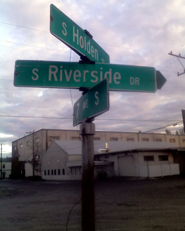
Sign at corner of S Holden Street, S Riverside Drive, and 7th Avenue S, May 20, 2013
Signs at corner of S Holden Street, S Riverside Drive, and 7th Avenue S, May 20, 2013. Photograph by Benjamin Lukoff. Copyright © 2013 Benjamin Lukoff. All rights reserved.

S Southern Street

Having covered E North Street, Eastern Avenue N, and Western Avenue, we now come to S Southern Street! This street originated in the 1891 plat of River Park, filed by Alexander Prentice (1820–1909) and his wife, Jane Thomson Prentice (1823–1911). It appears to be so named simply because it is the southernmost street in the plat, half a block north of the 1890 plat of South Park.

Portion of River Park addition showing Southern Avenue (now Southern Street)

S Southern Street begins just east of 12th Avenue S on the west bank of the Duwamish Waterway, and goes ½ a mile to just west of 7th Avenue S, where it is blocked by Washington State Route 99 (W Marginal Way S). (Its first tenth of a mile is within unincorporated King County as part of the “Sliver by the River.”) It begins again in West Seattle as SW Southern Street at 35th Avenue SW, and goes ⅗ of a mile to 44th Avenue SW.

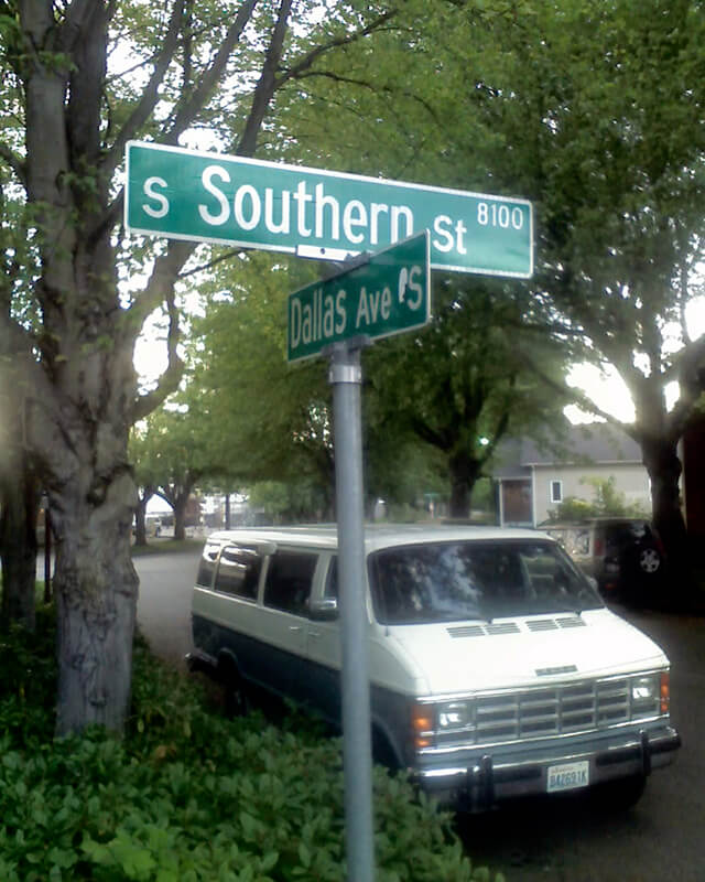
Sign at corner of S Southern Street and Dallas Avenue S, May 20, 2013
Signs at corner of S Southern Street and Dallas Avenue S, May 20, 2013. Photograph by Benjamin Lukoff. Copyright © 2013 Benjamin Lukoff. All rights reserved.

Fremont Avenue N

This street is named for Fremont, Nebraska, hometown of two of the developers of the Fremont neighborhood: Edward Blewett (1848–1929) and Luther Henry Griffith (1861–1925). The city itself was named after John Charles Frémont (1813–1890).

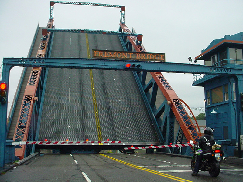
Fremont Bridge in open position, April 2006
Fremont Bridge in open position, April 2006. Opened in 1917, it has a clearance of only 30 feet over the Fremont Cut, which has caused it to become the most frequently opened drawbridge in the country. Photograph by Flickr user Mahalie Stackpole, licensed under Creative Commons Attribution-ShareAlike 2.0 Generic

Fremont Avenue N begins at the north end of the Fremont Bridge (making it a continuation, in a sense, of both Dexter Avenue N and Westlake Avenue N) and goes 1⅙ miles north to N 50th Street and Woodland Park Zoo. It resumes north of the zoo at N 59th Street and goes 3½ miles to N 130th Street and Bitter Lake Playfield, a short portion of the block between N 61st Street and N 62nd Street being stairway. North of the lake, there are two short stretches: one going a couple blocks south from N 143rd Street, adjoining the Bitter Lake Reservoir, and another going a block south from the city limits at N 145th Street.

As with many North Seattle avenues, the Fremont name continues on into Shoreline. Its northernmost appearance is at the King–Snohomish county line at N 205th Street.

Western Avenue

This street appears to originate in this 1871 plat made by Arthur A. Denny. Unlike with E North Street or Eastern Avenue N, no mystery here: originally named West Street, it was the first street west of Front Street (today’s 1st Avenue). Front Street ran along the waterfront, as its name implied, south of about Seneca Street, but north of there the Elliott Bay shoreline curved and the street grid didn’t curve with it (that would happen farther north, at Stewart Street). Hence West Street, which was changed to Western Avenue in 1895. (West Street would be extended farther south once they started filling in the tideflats; today, it begins at Yesler Way.)

Western Avenue in Pike Place Market, October 2008
Western Avenue in Pike Place Market, October 2008. Photograph by Joe Mabel, Wikimedia Commons, licensed under Creative Commons Attribution-ShareAlike 3.0 Unported

Today, Western Avenue begins at Yesler Way and goes 1¾ miles northwest to Elliott Avenue W at 3rd Avenue W and W Thomas Street, having become Western Avenue W on crossing W Denny Way.

Thackeray Place NE

This street appears to be named for the British writer William Makepeace Thackeray (1811–1863), best known for his 1848 novel Vanity Fair. As local historian Rob Ketcherside explains in his blog post on “Renaming streets of Seattle’s Fremont to the U District”:

42nd St, 50th St, 1st Ave, and 5th Ave are the boundaries of the 1889 Harrison Heights Addition to the City of Seattle (annexed in 1891). J.A. Gould and Anna L. Gould, the owners, had the civil engineers draw a simple box around their property and didn’t bother to make their streets match those adjacent. But when the streets were renamed and woven together in the 1890s, 1st and 2nd Avenues bent west at 42nd while Latona, 4th and 5th bent east. Space for an extra road was left in between: Thackeray Place.

Their Dickens Street became 1st Avenue NE; Scott Street, 2nd Avenue NE; Cooper Street, Latona Avenue NE; Milton Street, 4th Avenue NE; and Kingsley Street, 5th Avenue NE. Thackery Street, as it was originally named, had no corresponding street in the already existing grid. (Why it was left alone instead of being renamed something like 2nd Place NE is unclear.) As Rob points out, these names are almost certainly those of the writers Charles Dickens, Walter Scott, James Fenimore Cooper, John Milton, Charles Kingsley… and William Makepeace Thackeray.

(J.A. [Joel Abdon] Gould, incidentally, appears to have been the founder of the first bank in San Juan County, the aptly named San Juan County Bank in Friday Harbor. His wife’s full name was Anna Lucretia Cary Gould; their son, Eugene Cary Gould Sr., succeeded his father as bank president and was also the first mayor of Friday Harbor.)

Thackeray Place NE begins at NE 42nd Street and goes ½ a mile north to NE 50th Street.

Eastern Avenue N

Just as with E North Street, one question that should spring to mind with a street name like this is Eastern side of what? — especially considering that it’s not too far from being equidistant from Lake Washington and Salmon Bay, measured along the east–west axis of 50th Street.

Local historian Rob Ketcherside explains in his blog post on “Renaming streets of Seattle’s Fremont to the U District”:

It was originally named East Street in the 1883 Lake Union Addition plat.… it was the street most east in the addition. That plat… [was] annexed into Seattle in 1891. Sometime apparently after 1893 and before 1895 East Street was renamed Eastern Avenue.… The streets running perpendicular to Eastern Avenue are labeled North until one block east. Then they are labeled Northeast. The first avenue east of Eastern is First Avenue Northeast. So the streets east of First Avenue Northeast are Northeast as well. Eastern Avenue and the avenues west are North.… Say that ten times fast.

So — Eastern Avenue is the easternmost avenue in the section of town where east–west streets carry the N prefix and north–south avenues carry the suffix N, though the actual dividing line is a block east at 1st Avenue NE.

Eastern Avenue N begins on Lake Union at Waterway 17, just south of N Northlake Way, where it essentially functions as a parking lot for the restaurant Westward (much like 5th Avenue NE, a few blocks to the east, does for Ivar’s Salmon House). It begins in earnest on the other side of the Burke–Gilman Trail at N Pacific Street and goes ⅞ of a mile north to N 50th Street.

Division Avenue NW

Division, like Front, is usually a name applied to a major street, like Division Street in Chicago, or to a street that divides one section of town from another, like Division Street in Manhattan, or to a street that does both, like Division Street in Spokane. But in Seattle, Division Avenue NW goes only two blocks, from NW 65th Street to NW 70th Street, and doesn’t appear to serve as any sort of dividing line at all. Why is this?

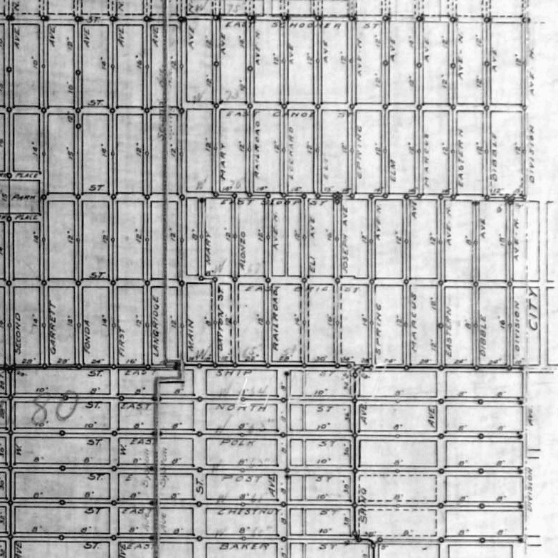
My friend Rob Ketcherside, a local historian, put together this helpful database of and article on old Ballard street names, which got me on the right track. But what helped me figure out this riddle — at least I think I have — was this 1903 sewer map that Rob consulted and linked to. A portion of it appears below.

Portion of map of Ballard sewers, 1903, covering present-day intersection of Division Avenue NW and NW 65th Street
Portion of map of Ballard sewers, 1903, covering present-day intersection of Division Avenue NW and NW 65th Street. Courtesy of the Seattle Municipal Archives, Identifier 1588.

The CITY to the right of Division Avenue N just north of E Ship Street is actually part of BALLARD CITY BOUNDARY, which ran along what is today 8th Avenue NW… except between E Ship Street (65th) and E Sloop Street (70th). The boundary continued in a straight line, but Division Avenue jogged to the west, causing the boundary to go down the center of those two blocks. It appears that 8th Avenue NW was later put straight through (I’m not sure exactly when, but this Baist atlas plate from 1912 appears to have the extension penciled in), but the jog was never renamed to something like 8th Place NW.

And that’s — I think — how you get a two-block–long Division Avenue that doesn’t divide anything!

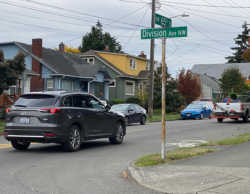
Street sign at NW 65th Street and Division Avenue NW, October 2021
Street sign at NW 65th Street and Division Avenue NW, Seattle. Photograph by Benjamin Lukoff, October 12, 2021. Copyright © 2021 Benjamin Lukoff. All rights reserved.

Matthews Avenue NE

This street was named by and for John Gill Matthews (1864–1937), who, with his wife and son, filed the plat of J.G. Matthews’ Lake Washington Addition, Division One, in 1930. In an extensive article on her blog, Wedgwood in Seattle History, Valarie Bunn tells his story, from his origins in Barbourville, Kentucky, during the Civil War, to his death in 1937, and beyond. For some reason, he, his wife, and three children moved to Seattle in 1910, when he was 45 and already had a well-established legal career in Kentucky. Once in Seattle, he became involved in coal, timber, and automobiles in addition to the law. It appears he and his wife separated around 1924, though they never divorced.

Fortunately for the citizens of Seattle, the Matthews family held onto the portion of their land on Lake Washington, and never developed it either before or after John Matthews’s death. Amy Matthews, who inherited the property, died in 1950, and the city was able to purchase the land for $70,000 the next year to create Matthews Beach Park, the city’s largest bathing beach. As Valarie explains:

The Matthews family was so willing to share the use of their property with neighbors that the area first began to be known as Matthews Beach in the 1920s while still under private ownership. The first appeal to the City of Seattle to buy the property was in 1928. Ironically the Parks Department vigorously opposed the purchase due to differences of opinion between those who wanted to acquire more parks in Seattle, and those who wanted monies to be allocated to maintenance of already-existing parks. Since the City of Seattle was not able to go ahead with purchase of the Matthews Beach property in 1928, the Matthews family could easily have redeveloped or sold the site at any time. It is a tribute to their stewardship and the efforts of north Seattle community clubs and activists that finally in 1951, the City purchased Matthews Beach.

John G. Matthews, from his obituary in the the November 16, 1937, issue of The Seattle Times

Matthews Avenue NE begins and ends at Sand Point Way NE, going about ¼ mile in a semicircle from just south of Matthews Place NE to just north of NE 93rd Street.

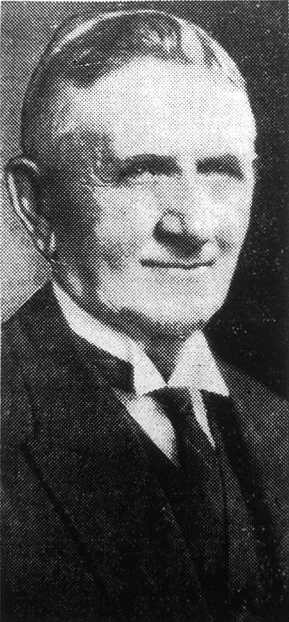
S Stacy Street

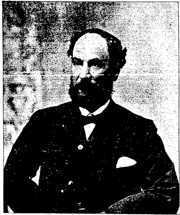
This street is named for Martin Van Buren Stacy (1837–1901), who, according to local historian Paul Dorpat, “brought an inherited wealth to the cash-poor West and bought Seattle land” (and land elsewhere in Western Washington as well). The Northern Pacific Railway’s Stacy Street Yard was named for the street, but was renamed the Seattle International Gateway by Burlington Northern in 1985. His death at Green River Hot Springs apparently came as a shock to many.

Martin Van Buren Stacy, from his obituary in the April 18, 1901 Seattle Post-Intelligencer
Martin Van Buren Stacy, from his obituary in the April 18, 1901, Seattle Post-Intelligencer. He had died at Green River Hot Springs the previous week of “apoplexy.”

S Stacy Street begins at Airport Way S and goes ⅕ of a mile west to 6th Avenue S. There is a block-long segment between 4th Avenue S and 3rd Avenue S, and then on the other side of the former Stacy Yard a two-block–long segment from Occidental Avenue S to Utah Avenue S and the world headquarters of Starbucks.