Fuhrman Avenue E

This street, created in 1890 as part of the plat of the Denny-Fuhrman Addition to the City of Seattle, was originally named Randall Street. I haven’t been able to pinpoint the reason for or date of the name change, but it first appears in The Seattle Times and in the city’s ordinances in 1906. The street and addition were named for Henry Fuhrman (1843–1907), who developed the area with David Thomas Denny (1832–1903) (Denny Way).

Fuhrman, who had come to Seattle in 1890, was a German Jew. According to his Seattle Times obituary, he “came to this country from Germany when a boy.… He was engaged as a mercantile solicitor in the early days, but later started a small drygoods business in Fremont, Nebraska, where he has since become famous as the pioneer wholesale drygoods merchant west of Omaha.… It is estimated that his fortune amounts to at least a million dollars.”

Fuhrman and Charles Cowen (né Cohen) (1869–1926) (Cowen Place NE) are the only Jews I am aware of who have Seattle streets named after them.

Henry Fuhrman, from his Seattle Times obituary, August 23, 1907

Fuhrman Avenue E begins at the north end of Fairview Avenue E, under the Ship Canal Bridge, and goes nearly ½ a mile southeast to E Shelby Street, where it becomes Boyer Avenue E. (A short segment begins about 150 feet to the east of Boyer, heads about 225 feet to the south, and mainly functions as a driveway for a number of houseboats; and another short segment begins at the north end of 15th Avenue E at the E Calhoun Street pathway, heads about 275 feet to the northeast, and serves as a driveway for an apartment complex.)

Sign at corner of Fuhrman Avenue E, Eastlake Avenue E, and Portage Bay Place E, August 24, 2009
Sign at corner of Fuhrman Avenue E, Eastlake Avenue E, and Portage Bay Place E, August 24, 2009. (Portage By Pl is an error; it should read Portage Bay Pl E, as it’s [[Portage Bay] [Place]], not [[Portage] [Bay Place]]. The original Red Robin restaurant was founded at this intersection in 1940. It has since been demolished, but I’ve seen imagery of this sign — including the error — on the walls of other Red Robin locations.) Photograph by Benjamin Lukoff. Copyright © 2009 Benjamin Lukoff. All rights reserved.

E Park Drive E

This street, like W Park Drive E — its twin on the other side of Montlake Boulevard E — was created in 1908 as part of Montlake Park, an Addition to the City of Seattle, and was named after what is now East Montlake Park.

It begins at the east end of E Hamlin Street by the old location of the Museum of History and Industry (currently a staging area for the Montlake Project portion of the rebuilding of Washington State Route 520) and goes 300 feet north to E Shelby Street.

East Montlake Park totem pole, July 2009
East Montlake Park totem pole, carved by John Wallace, July 2009. The pathway is the Lake Washington Ship Canal Waterside trail, which connects East Montlake Park to West Montlake Park along the Montlake Cut. Photograph by Flickr user camknows, licensed under Creative Commons Attribution-NonCommercial-ShareAlike 2.0 Generic

W Park Drive E

This street was created in 1908 as part of Montlake Park, an Addition to the City of Seattle, and was named after what is now West Montlake Park. It has a twin, E Park Drive E, on the other side of Montlake Boulevard E.

W Park Drive E begins at the west end of E Hamlin Street by the Seattle Yacht Club and goes 300 feet north to E Shelby Street.

West Montlake Park, January 2013
West Montlake Park, January 2013. The body of water is Portage Bay (Lake Union); South Campus of the University of Washington is at right, across the Montlake Cut, and the University Bridge and Ship Canal Bridge are visible in the distance. Photograph by Orange Suede Sofa, Wikimedia Commons, licensed under Creative Commons Attribution-ShareAlike 3.0

Montlake Boulevard E

This street originated as University Boulevard. Opening on June 1, 1909, it connected Washington Park Boulevard (now E Lake Washington Boulevard) to the entrance to the Alaska–Yukon–Pacific Exposition (now the campus of the University of Washington). The plan was for it to continue through campus and connect via 17th Avenue NE to Ravenna Boulevard, but this was not done due to opposition from the Board of Regents. Instead, the road was extended along what was then Union Bay shoreline to NE 45th Street. It has been part of the state highway system since 1937.

Montlake Boulevard was named after Montlake Park, an Addition to the City of Seattle, filed in 1908, which later gave its name to the entire neighborhood. Most of the street, however, is on the other side of the Lake Washington Ship Canal.

Montlake Park Ad, Seattle P-I, January 1, 1911
Montlake Park ad, Seattle P-I, January 1, 1911. “Both the Cascade and Olympic range of mountains are within the range of vision, and every lot has an equal and forever unobstructible view of one of the lakes [Lake Union and Lake Washington]. Hence the name, ‘MONT-LAKE.’”

Today, Montlake Boulevard E (as well as Washington State Route 513) begins at the intersection of E Lake Washington Boulevard and E Montlake Place E, just south of the Washington State Route 520 freeway, and goes 1⅓ miles north, then northeast, to NE 45th Street, just south of University Village. It becomes Montlake Boulevard NE as it crosses the Montlake Cut of the Lake Washington Ship Canal. (State Route 513 continues for another 2 miles along NE 45th Street and Sand Point Way NE, ending at NE 65th Street just west of Magnuson Park.)

Montlake Bridge, looking southbound, August 2021
Montlake Bridge, looking southbound, August 2021. The bridge opened in 1925 and is the easternmost bridge over the Lake Washington Ship Canal. Photograph by Flickr user Seattle Department of Transportation, licensed under Creative Commons Attribution-NonCommercial 2.0 Generic
Street sign at corner of E Montlake Place E, E Lake Washington Boulevard, and Montlake Boulevard E, August 24, 2009
Street sign at corner of E Montlake Place E, E Lake Washington Boulevard, and Montlake Boulevard E. Photograph by Benjamin Lukoff, August 24, 2009. Copyright © 2009 Benjamin Lukoff. All rights reserved.
West Montlake Park, January 2013
West Montlake Park, January 2013. The body of water is Portage Bay (Lake Union); South Campus of the University of Washington is at right, across the Montlake Cut, and the University Bridge and Ship Canal Bridge are visible in the distance. Photograph by Orange Suede Sofa, Wikimedia Commons, licensed under Creative Commons Attribution-ShareAlike 3.0

McGraw Street

This street is named for John Harte McGraw (1850–1910). In Pig-Tail Days in Old Seattle, Sophie Frye Bass writes of McGraw:

All in one year John McGraw was Chief of Police, Marshall, Sheriff, Harbor Master and Fire Warden. Later he was Governor of Washington and in between, bank president and attorney-at-law — quite a career.

The second governor of Washington after statehood (1893–1897), he had been King County sheriff during the anti-Chinese riots of 1886. He defended Chinese laborers from the mob that was trying to expel them from the city, although, according to The Role of Federal Military Forces in Domestic Disorders, 1877–1945, he initially sympathized with the rioters and allowed them to force the Chinese (without physically harming them) to the waterfront to be loaded onto the steamship Queen of the Pacific. Both he and Mayor Henry Yesler lost their bids for re-election that summer in what the book calls “a resounding show of support for anti-Chinese forces.”

John H. McGraw
John H. McGraw

Today, W McGraw Street begins as a shoreline street end on Elliott Bay in Magnolia west of Perkins Lane W. It begins in earnest at the intersection of Westmont Way W, Montavista Place W, and Rosemont Place W and goes ⅘ of a mile east to 24th Avenue W, forming the heart of Magnolia Village, the neighborhood’s commercial district, from 35th Avenue W to 32nd Avenue W. It resumes on the other side of Interbay in Queen Anne, beginning at 11th Avenue W and going 1⅛ miles east to the Northeast Queen Anne Greenbelt east of Bigelow Avenue N. There are a few block-long segments heading down the hill to Westlake and, like Blaine Street, a right-of-way platted into Lake Union that serves as a driveway and affords no actual lake access.

E McGraw Street doesn’t appear again until 15th Avenue E and Boyer Avenue E in Montlake, where it goes ⅔ of a mile east to 26th Avenue E at the west end of the Washington Park Arboretum, becoming a stairway for a short distance just before 19th Avenue E. It ends for good in Madison Park as a two-block stretch between 38th Avenue E and 40th Avenue E.

View looking south from the W McGraw street end: Elliott Bay, Puget Sound, and West Seattle
View looking southeast from the W McGraw street end: Elliott Bay, Puget Sound, and West Seattle, November 5, 2014. Photograph by Flickr user Seattle Parks and Recreation, licensed under Creative Commons Attribution 2.0 Generic

Blaine Street

This street is named for Catharine V. Paine Blaine (1829–1908) and her husband, David Edwards Blaine (1824–1900). Methodist missionaries from Seneca Falls, New York, where, in 1848, Catharine signed the Declaration of Sentiments at the first women’s rights convention, the Blaines came to Seattle in 1853 but left in 1856, not to return until their retirement from missionary work 26 years later. During their short initial stay in Seattle, however, they managed to build Seattle’s first church (the Little White Church, predecessor of today’s First United Methodist Church of Seattle), and Catharine became Seattle’s first schoolteacher, making $65 a month. Catharine Blaine School in Magnolia is named in her honor.

Catharine and David Blaine
Catharine and David Blaine at their 1853 wedding

Unfortunately, though the Blaines may have been feminists, they, according to HistoryLink.org, had no love for Native Americans (or, for that matter, the Irish). Their departure in 1856 was prompted by the Battle of Seattle. Junius Rochester writes:

On January 20, 1856, a son John, was born to Catharine and David Blaine. Six days later the Battle of Seattle erupted. David had duty at one of the blockhouses, but managed to get Catharine and their babe aboard the Decatur in Elliott Bay. David had described the Indians as a “poor degraded race,” which would “soon disappear.” Catharine compared their “stupidity and awkwardness” to that of the Irish. The Indian uprising confirmed their worst fears and prejudices.

Today, W Blaine Street begins in Magnolia at 36th Avenue W and goes a semicircular ⅕ of a mile to 34th Avenue W and W Howe Street. It resumes at 31st Avenue W and goes almost ⅓ of a mile to Thorndyke Avenue W. There is a stub of W Blaine east of 15th Avenue W that is quickly stopped by the Southwest Queen Anne Greenbelt. The street resumes at 12th Avenue W and goes just over a mile to 4th Avenue N, having briefly become a stairway at 9th Avenue W. After a series of short stretches serving as driveways and parking, the Blaine Street right-of-way resurfaces east of Westlake Avenue N and heads into Lake Union. Here, too, it serves as a driveway and offers no access to the water. East of Lake Union, E Blaine Street begins at Fairview Avenue E and goes ⅛ of a mile to Franklin Avenue E, where it becomes part of the I-5 Colonnade park underneath the freeway. From Lakeview Boulevard E to just west of 10th Avenue E it is a stairway, and then two blocks of roadway ending at 12th Avenue E and Lake View Cemetery. There is then a diagonal ¼-mile stretch from 19th Avenue E to E Howe Street in Montlake. E Blaine finishes up as a ⅕-mile stretch from 37th Avenue E to McGilvra Boulevard E and a final two-block run from E Madison Street to 43rd Avenue E, both in Madison Park.

Sign for E Blaine Street, April 22, 2010
Sign for E Blaine Street at Broadway E, April 22, 2010. Blaine is a stairway on both sides of Broadway, hence the double 🚶 icon. Photograph by Benjamin Lukoff. Copyright © 2010 Benjamin Lukoff. All rights reserved.

Newton Street

This street originates in the 1882 plat of Bigelow’s Addition to the City of Seattle, filed by Jesse W. George (1835–1895) and Cassandra Eckler George (1840–1920) at the request of Isaac Newton Bigelow (1838–1922). As the Queen Anne Historic Context Statement explains,

In the early 1870s, the Denny and Mercer families gradually began to systematically subdivide their large land holdings on the south and east slopes of Queen Anne Hill. When a severe windstorm blew down thousands of trees in the north district in 1875, views opened up and land seekers turned their attentions beyond Belltown. Real estate speculators new to the territory arrived and began to buy up property on the crest of Queen Anne Hill. Some of these speculators also became developers, such as George Kinnear, or builder-developers, such as Isaac Bigelow.

Though its proximity to Boston and Lynn Streets suggest a tribute to Newton, Massachusetts, neither the Georges nor the Bigelows appear to have a connection to the state, so it seems this one should be chalked up to Isaac Bigelow’s middle name.

Today, Newton Street begins in Magnolia as W Newton Street at 30th Avenue W, and goes nearly half a mile east to 23rd Avenue W. There is then a two-block stretch from 15th Avenue W to 13th Avenue W in Interbay, and then the “original” Newton Street, which stretches almost a half mile from 1st Avenue N to Taylor Avenue N, followed by another two-block stretch from Dexter Avenue N to just past 8th Avenue N. On the east side of Lake Union, E Newton Street picks up again at Terry Pettus Park, just west of Fairview Avenue E, and goes ¼ mile to Boylston Avenue E and Lakeview Boulevard E. There follows another ¼-mile stretch from Broadway E to Everett Avenue E. East of there, Newton exists in a number of short segments through Montlake, and then enjoys a run of ⅓ of a mile from 37th Place E to 43rd Avenue E in Madison Park. 

E Louisa Street

Louisa Street was named for Louisa Boren Denny (1827–1916), who was 24 years old when she and her future husband David Thomas Denny (1832–1903) arrived in Seattle as part of the Denny Party. Their marriage in 1853 was the first in King County. The street name originates in the 1890 plat of the Denny-Fuhrman Addition to the City of Seattle, filed by the Dennys, Henry Fuhrman (Fuhrman Avenue E), and his wife, Carrie Fuhrman.

Daguerreotype portrait of Louisa Boren Denny, no date
Undated daguerreotype portrait of Louisa Boren Denny

Today, E Louisa Street begins at Minor Avenue E and goes a block east to Yale Avenue E. It resumes half a block east at the alley west of Eastlake Avenue E and makes it 2½ blocks before being stopped by Interstate 5 at Boylston Avenue E. Resuming in the Montlake neighborhood just west of W Montlake Place E, it then goes ¼ mile east to 25th Avenue E.

Boyer Avenue E

This street, which runs just over 1⅓ miles from Lake Washington Boulevard E northwest to Fuhrman Avenue E, was established in 1905 as part of Interlaken, an Addition to the City of Seattle, platted by the Interlaken Land Company, whose president was John E. Boyer (1866–1961).

Advertisement for Interlaken in the Seattle Post-Intelligencer, May 30, 1906

E Foster Island Road

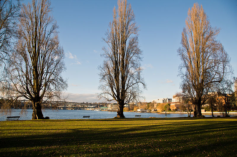
This street, which runs about ¼ mile from Lake Washington Boulevard E to the beginning of the Foster Point Trail, all within the Washington Park Arboretum, was without a name until 1968, when it was named for the island in Union Bay to which it led. (It remained unsigned until a few decades later, however. There was no sign at the intersection until at least the 1990s, as I know since my parents’ house was at the south end of the Arboretum and I drove or biked by there weekly, if not more often, while I was growing up.)

Foster Island is known by the Duwamish tribe, who once used it as a burial ground, as Stitici, or ‘little island’. It was named by the settlers for Joel Wellington Foster, who came to Washington in the 1870s from St. Joseph, Missouri. He is said to have donated the island to the city in one HistoryLink article, but another says the city bought it in 1917.

(Note added November 6, 2022: David B. Williams, the “Street Smart Naturalist,” recently posted The Lost Islands of Seattle, in which he wrote that he had seen various sources for the name Foster but none with good documentation. I asked him about the HistoryLink article I cite above:

I’m embarrassed to have missed that, but of course he’s right. So if not Joel Wellington Foster, then who? The search continues

E Interlaken Boulevard

The establishment of E Interlaken Boulevard — the first of Seattle’s Olmsted parks and boulevards we’re covering — was first proposed, according to Seattle parks historian Don Sherwood, in 1903 as Volunteer Hill Parkway. Two years later, the current name was adopted. There is speculation, but no documentation, that it was named for the Swiss resort town of that name. Ask a Seattleite how to pronounce “Interlaken” and you may hear either lake or lock, the latter being more common according to an informal Twitter poll I ran (but the former being the one I grew up with).

Interlaken Boulevard runs for about 1⅔ miles west to east from Delmar Drive E, by Seattle Preparatory School on Capitol Hill, to Lake Washington Boulevard E, in the Washington Park Arboretum. The middle section, between 19th and 21st Avenues E, is closed to motor vehicles and functions as a pedestrian and bicycle trail. The name also appears on Interlaken Drive E and Interlaken Place E — and should not be confused with Interlake Avenue N, a street in North Seattle.

Advertisement for Interlaken in the Seattle Post-Intelligencer, May 30, 1906
Street sign at corner of Lake Washington Boulevard E and E Interlaken Boulevard, October 11, 2009. Copyright © 2009 Benjamin Lukoff. All rights reserved.
Street sign at corner of Lake Washington Boulevard E and E Interlaken Boulevard. Photograph by Benjamin Lukoff, October 11, 2009. Copyright © 2009 Benjamin Lukoff. All rights reserved.

E North Street

Seattle has a number of streets whose names incorporate directions, such as Northlake Way, Eastern Avenue, Eastlake Avenue, Western Avenue, Westlake Avenue, and Southern Street. But the one I drove by most growing up — and the only one to simply bear the name of a direction in its uncompounded, nominal form — is E North Street, which runs between E Montlake Place E and 24th Avenue E in Montlake, just south of the 520 interchange.

Two questions should spring to mind with a street name like this: North of what? and What happened to South Street?

Portion of Plan of Union City, 1869

The answer to the first question is north of where Harvey Lake Pike, son of John Henry Pike of Pike Street fame, had planned to dig a canal between Union Bay and Portage Bay.

And the answer to the second is that it seems to have been subsumed in Roanoke Street when the Glenwilde Addition was platted in 1925. But North Street’s name was never changed.

(There did use to be an East Street and a West Street, too, as you can see on the full plat map. If I read the quarter section map correctly, East Street is now 24th Avenue E, and State Route 520 now covers the land where West Street would have been.)