Blanchard Street

For Blanchard Street, I can do no better than to quote Sophie Frye Bass, who in Pig-Tail Days in Old Seattle writes:

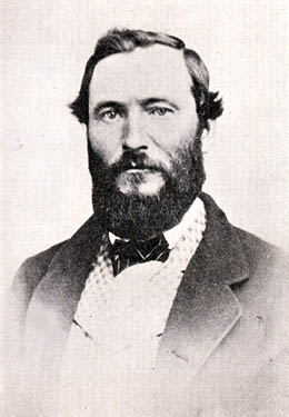
The name of Blanchard Street had long been a puzzle to me, but when I looked over some records of 1872 and found where John M. Blanchard had been one of the witnesses when my grandfather, Arthur Denny, platted a tract of land, then I knew.

Blanchard Street was part of A.A. Denny’s 6th Addition to the City of Seattle, filed in 1873, and indeed John M. Blanchard is one of the witnesses, along with Duncan T. Wheeler. Blanchard appears to have been city treasurer in 1879, as well as an insurance agent. Wheeler is referred to in 1871 as being a merchant, and in 1874 he and Blanchard apparently attended a masquerade ball dressed as members of the Ku Klux Klan(!), predating the establishment of an actual Klan chapter by half a century. (Their wives went as a “Canadian Squaw” and the “Queen of Chess,” respectively.)

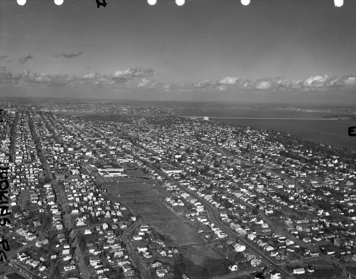
Today, Blanchard Street begins at Elliott Avenue and goes just over half a mile to the northwest, where it ends at Westlake Avenue.

E Spruce Street

This street, like Alder Street and Fir Street — all, of course, named for trees — originates in the 1872 plat of Terry’s Second Addition to the Town of Seattle, filed by Arthur Armstrong Denny, Henry Leiter Yesler, Erasmus Smithers, and Franklin Matthias, the last two as executors of the estate of Charles Carroll Terry, who was part of the Denny Party of settlers in 1851, and died in 1867. However, it was originally named Cedar Street (duplicative of another in Belltown). It received its current name as part of the Great Renaming of 1895, when Cedar Street, Prince William Street, and Erie Street were all changed to Spruce.

Today, E Spruce Street begins at Broadway and goes nearly a mile east to 25th Avenue, only interrupted once, at Boren Avenue, which it connects to as a pair of stairways. It resumes at 28th Avenue and goes just over ¼ of a mile to Lake Dell Avenue (the portion from Peppi’s Playground through Peppi’s Woods as a stairway). Farther east, there is a couple-hundred-foot-long section at the west end of Euclid Avenue, and then a longer one — almost ⅒ of a mile — from near the east end of Euclid Avenue to E Alder Street. (Its complicated end is the result of platted streets not always matching up with topography, or with where people actually ended up building roads.)

Portion of King County Parcel Viewer showing E Spruce Street right-of-way from Lake Dell Avenue to E Alder Street along with Euclid Avenue
King County Parcel Viewer showing E Spruce Street right-of-way from Lake Dell Avenue in the west to E Alder Street in the east. Instead of the eastern portion of Spruce connecting directly to the western portion, there is a gap; instead, the western portion connects to Euclid Avenue by going through private property.

Fir Street

This street, like nearby Alder Street — both, obviously, named for trees — originates in the 1872 plat of Terry’s Second Addition to the Town of Seattle, filed by Arthur Armstrong Denny, Henry Leiter Yesler, Erasmus Smithers, and Franklin Matthias, the last two as executors of the estate of Charles Carroll Terry, who was part of the Denny Party of settlers in 1851, and died in 1867.

Today, Fir Street begins where 8th Avenue and 9th Avenue meet, a block south of Harborview Medical Center. From there to its end at Martin Luther King Jr. Way 1⅕ miles to the east, it is almost completely uninterrupted, except for the portion west of 11th Avenue being blocked by a retaining wall at Boren Avenue.

Alder Street

This street originates in the 1872 plat of Terry’s Second Addition to the Town of Seattle, filed by Arthur Armstrong Denny, Henry Leiter Yesler, Erasmus Smithers, and Franklin Matthias, the last two as executors of the estate of Charles Carroll Terry, who was part of the Denny Party of settlers in 1851, and died in 1867. (In 1857, Matthias was listed as being a carpenter, originally from Indiana, Pennsylvania; not too long thereafter, he apparently married and had a child with the daughter of Shilshole Curley [native name Saxkla’xid{?}], “head-man” of the shill-shohl-AHBSH village at šilšul on Salmon Bay. This child, Rebecca Lena Graham, later had to sue Matthias’s relatives to be recognized as his rightful heir. You can read more about her on the Yale University Press blog, at Fitz-Henry Family History, and in the Pacific Northwest Quarterly.)

Today, Alder Street begins at the south entrance to the Harborview Medical Center parking garage, its original first few blocks having been obliterated by Interstate 5, and goes ⅓ of a mile northeast and then east to the Children and Family Justice Center at 12th Avenue.* It resumes at 14th Avenue and goes just over a mile to 32nd Avenue. Finally, just west of 35th Avenue, the Lake Dell Avenue arterial becomes E Alder Street, which snakes ⅕ of a mile down the hill to end at Lake Washington Boulevard. It was originally part of a group of streets named after trees — Pine, Alder, Cedar, and Fir — though Pine and Cedar have since become Terrace and Spruce, since they duplicated street names in other parts of Downtown.

* The Alder Street right-of-way technically begins at Yesler Way just west of 6th Avenue, but is unimproved and indistinguishable from the adjacent open space, and the Interstate 5 right-of-way begins on the east side of 6th.

S Plummer Street

S Plummer Street, like S Charles Street, was created as part of the 1876 plat of Plummer’s Addition to the City of Seattle, and was named by George Washington Harris after his late stepfather, Charles Plummer, who had died 10 years earlier.

Charles Plummer
Charles Plummer

Unlike S Charles Street, which makes it all the way to Lake Washington, S Plummer Street runs a mere block from Airport Way S and Maynard Avenue S in the west to 7th Avenue S in the east, where it is stopped by the city’s Charles Street Service Center.

S Charles Street

Charles Street originates in the 1876 plat of Plummer’s Addition to the City of Seattle, filed by George Washington Harris (late 1840s–1914).* How did Harris end up with the land, and why would he name the addition after Charles Plummer (who, it appears from the text of the plat description, bought the tract from David Swinson “Doc” Maynard in 1860)?

* I write “late 1840s” because Harris’s birth year is given variously as 1848 (death certificate, historical journal article, Tacoma Public Library), 1847 (Genealogy.com, The Seattle Times), and 1846 (Geni, FamilySearch). 

As it turns out: Plummer married Ellender Smith (sister of Dr. Henry A. Smith, namesake of Smith Cove and Smith Street) in 1855. Harris’s mother, Sarah Jane Crossman, was widowed the next year. Plummer himself became a widower when his wife died giving birth to twins Edward and Frank in 1859, and he married Harris’s mother in 1860, apparently at Maynard’s own Alki Point house. Harris then became Plummer’s stepson (and a daughter, Ida, was born to the newlyweds the next year). When Plummer died in 1866, Harris apparently inherited at least this much of his stepfather’s estate. (It’s unclear just what Edward and Ida may have received; Frank is reported to have inherited $60,000.)

Charles Plummer
Charles Plummer

Today, S Charles Street begins at Airport Way S and 6th Avenue S and is stopped a block and a half to the east at 7th Avenue S by the city’s Charles Street Service Center. (Its twin to the south, S Plummer Street, also ends at the service center, never to return.) It briefly reappears at the northern lip of Beacon Hill between 12th Avenue S and Sturgus Avenue S, and then east of Interstate 90 runs for about ⅓ of a mile between Poplar Place S and 20th Place S at Judkins Park. The right-of-way, which continues through the park, becomes an improved street again at 22nd Avenue S, and ends just east of 26th Avenue S. East of here, S Charles runs three blocks from 28th Avenue S to 30th Avenue S, and then around ¼ mile made up of alternating roadway and stairways from the alley west of 32nd Avenue S to a shoreline street end on Lake Washington — one of Leschi’s String of Pearls.

Note added October 23, 2023: S Charles Street now begins at 1st Avenue S and goes a block east to Occidental Avenue S, before resuming on the other side of Lumen Field at Airport Way S.

S Judkins Street

S Judkins Street, like S Norman Street, S Addition Street, and SW Seattle Street, was named in the 1869 plat of Judkin’s (sic) Addition to the Town of Seattle, whose street names were, from north to south, Norman, B, Judkins, Addition, Town, and Seattle.

Plat of Judkin's Addition to the Town of Seattle

Because its original location is covered by King County Metro’s Atlantic Base and Interstate 5, Judkins Street now starts on Beacon Hill just west of 12th Avenue S and goes around 850 feet east to just east of 14th Avenue S, where it becomes a stairway to 15th Avenue S. The unimproved right-of-way continues through a greenbelt to 16th Avenue S, where there exists a 100-foot stretch of Judkins before it is stopped by Sturgus Avenue S, Daejon Park, and Interstate 90. On the other side of I-90, it resumes at 20th Avenue S and goes ⅘ of a mile east to Lake Washington Boulevard S, the last 50 or so feet being a stairway. Between Lake Washington Boulevard S and Lakeside Avenue S, only the first 150 feet is improved, mainly serving as a driveway for two houses. And east of Lakeside Avenue S there is a very short stretch that, like its neighbor to the north, S Norman Street, turns into a shoreline street end on Lake Washington — one of Leschi’s String of Pearls.

Judkins Street gives its name to Judkins Park and Playfield, which stretches for a number of blocks north of S Judkins Street and 22nd Avenue S, as far as Washington Middle School. The land between S Judkins Street and Interstate 90 through which the I-90 Trail winds (part of the Mountains to Sound Greenway) is also sometimes considered to be part of Judkins Park. The park, in turn, gives its name to the neighborhood of Judkins Park, and to the future Judkins Park station of Sound Transit’s Line 2 extension to the Eastside.

Built on the site of a former ravine landfill that was used for about four decades, Judkins Park was transferred to the parks department in the late 1940s and early 1950s, and opened to the public on October 8, 1977, according to a story in the October 6 issue of The Seattle Times.

Aerial view of Judkins Park and Playground, 1965
Aerial view of Judkins Park and Playfield, 1965. Courtesy of the Seattle Municipal Archives, Identifier 29470. S Judkins Street is at bottom center and right, below the park. Washington Middle School is at the north end of the park and 23rd Avenue S is the arterial to its east. Lake Washington and the Evergreen Point Floating Bridge (Washington State Route 520) are visible in the distance.

S Norman Street

For the origin of S Norman Street, we go back to our first street name post, SW Seattle Street, which read in part:

On August 4, 1869, Ike M. Hall — the executor of the estate of Norman B. Judkins — filed the Judkin’s (sic) Addition to the Town of Seattle, located just southwest of where the interchange between I-5 and I-90 is today. From north to south, the east–west streets are named Norman, B, Judkins, Addition, Town, and Seattle.

Plat of Judkin's Addition to the Town of Seattle

Today, S Norman Street begins on the other side of Beacon Hill, the portion shown above having been obliterated by King County Metro’s Atlantic Base and Interstate 5. (In fact, S Addition Street is the only one remaining in its original location, Judkins Street now starting on Beacon Hill and Seattle Street only existing in West Seattle.) Beginning at Poplar Place S just east of Interstate 90, it goes for a block northeast to Rainier Avenue S. It picks up again at Davis Place S and S Bush Place and goes a block east to 21st Avenue S. Resuming at 22nd Avenue S, just east of Judkins Park (also named for Norman B. Judkins), it goes ⅗ of a mile east to 33rd Avenue S, with only two short interruptions:

  • An unimproved stretch south of St. Gebriel Ethiopian Orthodox Church between 26th Avenue S and Martin Luther King Jr. Way S: what looks to be a bramble patch followed by a driveway for some townhouses; and
  • A stairway from 31st Avenue S to half a block west of 32nd Avenue S.

There appears to be a privately maintained stairway from 33rd Avenue S down to Lake Washington Boulevard S, and the next block is completely unimproved, though in both cases neighbors appear to be incorporating the right-of-way into their yards and driveways. Finally, there is a short stretch of Norman Street east of Lakeside Avenue S that turns into a shoreline street end on Lake Washington — one of Leschi’s String of Pearls

King County Parcel Viewer showing S Norman Street at Martin Luther King Jr. Way S
King County Parcel Viewer showing S Norman Street between 26th Avenue S and Martin Luther King Jr. Way S. What appears to be a private driveway from Martin Luther King is actually public right-of-way.
King County Parcel Viewer showing S Norman Street from 33rd Avenue S to Lake Washington
King County Parcel Viewer showing S Norman Street from 33rd Avenue S to Lake Washington. The private driveway in the public right-of-way east of Lake Washington Boulevard S (center of image) is easily visible, as is the shoreline street end east of Lakeside Avenue S.

E Louisa Street

Louisa Street was named for Louisa Boren Denny (1827–1916), who was 24 years old when she and her future husband David Thomas Denny (1832–1903) arrived in Seattle as part of the Denny Party. Their marriage in 1853 was the first in King County. The street name originates in the 1890 plat of the Denny-Fuhrman Addition to the City of Seattle, filed by the Dennys, Henry Fuhrman (Fuhrman Avenue E), and his wife, Carrie Fuhrman.

Daguerreotype portrait of Louisa Boren Denny, no date
Undated daguerreotype portrait of Louisa Boren Denny

Today, E Louisa Street begins at Minor Avenue E and goes a block east to Yale Avenue E. It resumes half a block east at the alley west of Eastlake Avenue E and makes it 2½ blocks before being stopped by Interstate 5 at Boylston Avenue E. Resuming in the Montlake neighborhood just west of W Montlake Place E, it then goes ¼ mile east to 25th Avenue E.

W Lawton Street

Lawton Street originated as Lawton Place in the 1905 plat of Lawton Park, an Addition to the City of Seattle. Like Government Way and Fort Street, it was named for its proximity to Fort Lawton, which had been opened by the U.S. Army in 1900. The fort itself was named for Major General Henry Ware Lawton (1843–1899), who was killed in December 1899 in the Battle of Paye of the Philippine–American War.

The bulk of W Lawton Street comes not from the Lawton Park plat, which covered 34th Avenue W to 36th Avenue W, but from a grant from the federal government in 1909 for sewer and street purposes. Lawton Street was laid out along the north edge of the fort, from its northwest corner at 36th Avenue W to what is now 40th Avenue W. There is a short discontinuity beginning about 250 feet east of 40th Avenue W consisting of a footpath and stairs; I’m not sure when that was created, but I don’t think it was the original configuration, as that would have defeated the purpose of the street.


W Fort Street

Fort Street originated as Fort Place in the 1905 plat of Lawton Park, an Addition to the City of Seattle. It originally formed part of the “government roadway leading from the east boundary of the military reservation of Fort Lawton,” but in 1961 four of its blocks were officially renamed W Government Way. What remains today is a one-block stretch between 36th Avenue W and 35th Avenue W, a three-block stretch between Kiwanis Memorial Reserve Park and 32nd Avenue W, and a bridge over the BNSF Railway tracks from 28th Avenue W and Gilman Avenue W to 27th Avenue W.

S Roberto Maestas Festival Street

This street, formerly the 1600 block of S Lander Street, runs between 16th and 17th Avenues S on Beacon Hill, north of the Beacon Hill light rail station and south of the Plaza Roberto Maestas housing development of El Centro de la Raza, a social service agency. It was renamed in 2011 in honor of Roberto Maestas (1938–2010), who co-founded El Centro in 1972 in the recently closed Beacon Hill Elementary School.

Roberto Maestas, 2008
Roberto Maestas, 2008. Photograph by Joe Mabel, Wikimedia Commons, licensed under Creative Commons Attribution-Share Alike 3.0 Unported

The street is one of a number of “festival streets” in the city of Seattle: “designated portions of streets intended for frequent public events.” E Barbara Bailey Way is the other one we’ve covered so far.

Sign at corner of S Roberto Maestas Festival Street and 17th Avenue S, October 1, 2011
Signs at corner of S Roberto Maestas Festival Street and 17th Avenue S, October 1, 2011. Photograph by Benjamin Lukoff. Copyright © 2011 Benjamin Lukoff. All rights reserved.

Florentia Street

Florentia Street is the last in a series of streets, created in 1888 as part of Denny & Hoyt’s Addition to the City of Seattle, Washington Territory, that appear in alphabetical order and have the common theme of being locations in Italy. From north to south, they are Aetna, Bertona, Cremona, Dravus, Etruria, and Florentia. As can be seen in the plat map below, Florentia is not only the last in the series but the southern boundary of the plat itself.

Florentia is the Latin name of the city of Florence, known in Italian as Firenze.

Portion of plat map of Denny and Hoyt's Addition to the City of Seattle, Washington Territory (1888) showing Aetna, Bertona, Cremona, Dravus, Etruria, and Florentia Streets
Portion of plat map of Denny and Hoyt’s Addition to the City of Seattle, Washington Territory (1888) showing Aetna, Bertona, Cremona, Dravus, Etruria, and Florentia Streets

Some detail in addition to that gone into in the post on Dravus Street:

Florentia Street begins in the east at 4th Avenue N (the southern end of the Fremont Bridge) and goes ½ a mile west to 3rd Avenue W.

Etruria Street

Etruria Street is another one of those streets created in 1888 as part of Denny & Hoyt’s Addition to the City of Seattle, Washington Territory, part of a series — Aetna, Bertona, Cremona, Dravus, Etruria, and Florentia — that appear in alphabetical order and have the common theme of being locations in Italy. Etruria, the land of the ancient Etruscans, was located in what is now the regions of Tuscany, Lazio, and Umbria, northwest of Rome.

Etruria Street begins in the east at the Ship Canal Trail and 3rd Avenue N, and goes just over ⅖ of a mile west to 3rd Avenue W. It resumes east of 8th Avenue W at a Seattle Pacific University parking lot and goes a further ¼ of a mile west to 10th Avenue W.


Cremona Street

Cremona Street is another street created in 1888 as part of Denny & Hoyt’s Addition to the City of Seattle, Washington Territory, part of a series of streets — Aetna, Bertona, Cremona, Dravus, Etruria, and Florentia — that appear in alphabetical order and have the common theme of being locations in Italy. Cremona, or Cremùna in the local dialect, is a city in Lombardy, perhaps best known for its luthiers, most notably Antonio Stradivari.

Cremona Street begins in the east at the Ship Canal Trail and goes ¼ of a mile west to 3rd Avenue W and the entrance to Seattle Pacific University. On the other side of campus it goes a further ⅕ of a mile west from 6th Avenue W to 9th Avenue W.

W Bertona Street

This street, as with Dravus Street, was created in 1888 as part of Denny & Hoyt’s Addition to the City of Seattle, Washington Territory, and is also is part of a series of streets — Aetna, Bertona, Cremona, Dravus, Etruria, and Florentia — that appear in alphabetical order and have the common theme of being locations in Italy. Montebello di Bertona (Mundibbèlle in the Abruzzese dialect) is a small town in Pescara, Abruzzo, located near Mt. Bertona.

Technically, W Bertona Street begins as Bertona Street at the Ship Canal Trail around 80 feet east of Queen Anne Avenue N, but both streets there are little more than parking aisles nestled up against Seattle Pacific University’s Wallace Field. W Bertona begins in earnest at W Nickerson Street and goes ¾ of a mile west to 14th Avenue W, where it becomes a block-long stairway to 15th Avenue W. On the other side of 15th, it goes two more blocks before being stopped by the BNSF Railway tracks at 17th Avenue W; on the other side of the tracks it goes ⅗ of a mile west from 20th Avenue W to 30th Avenue W, becoming a stairway again for a block just about halfway. As with its Magnolia partner W Dravus Street, it’s ⅓ of a mile from 31st Avenue W to 36th Avenue W, where it becomes a stairway for a block, and then ½ a mile more from 37th Avenue W to 45th Avenue W. There is finally a 300-foot-long segment west of Perkins Lane W, where the roadway ends. (There is a shoreline street end beyond that, but it is currently inaccessible.)

Bertona Street east of Queen Anne Avenue N, November 2021
Bertona Street east of Queen Anne Avenue N, November 2021. The 2 Nickerson Street office building is at right; the row of trees is between the Ship Canal Trail and the Fremont Cut. Fremont and the Aurora Bridge are visible in the distance. Photograph by Benjamin Lukoff. Copyright © 2021 Benjamin Lukoff. All rights reserved.

Dravus Street

This street was created in 1888 as part of Denny & Hoyt’s Addition to the City of Seattle, Washington Territory by Edward Blewett and his wife, Carrie, of Fremont, Nebraska, who had purchased the land a few months earlier from Arthur Denny and John Hoyt. According to Valarie Bunn in her article “Fremont in Seattle: Street Names and Neighborhood Boundaries,” Edward Corliss Kilbourne may have done much of the actual naming of streets as attorney-in-fact for the Blewetts.

Portion of plat map of Denny and Hoyt's Addition to the City of Seattle, Washington Territory (1888) showing Aetna, Bertona, Cremona, Dravus, Etruria, and Florentia Streets
Portion of plat map of Denny and Hoyt’s Addition to the City of Seattle, Washington Territory (1888) showing Aetna, Bertona, Cremona, Dravus, Etruria, and Florentia Streets

As can be seen in the plat map above, Dravus is part of a series of streets — Aetna, Bertona, Cremona, Dravus, Etruria, and Florentia — that appear in alphabetical order and have the common theme of being locations in Italy, which had been unified 17 years earlier. I have yet to find a connection between Denny, Hoyt, the Blewetts, or Kilbourne and Italy. The closest I’ve come is an item in the February 28, 1903, issue of The Seattle Mail and Herald, which reports that “on February 27, the Woman’s Century Club met and discussed the subject ‘Italian Art and Literature.’ Mrs. Bessie L. Savage and Mrs. E.C. Kilbourne [Leilla Shorey] prepared papers relating to these subjects.” I would love to find out if there’s anything more solid!

The Drava River, which originates in the Italian region of the South Tyrol, flows from there through Austria, Slovenia, and Croatia, forming much of the border between that country and Hungary, and joining the Danube on the Croatia–Serbia border. It was known as Dravus in Latin and Δράβος in Greek.

Dravus Street begins in the east at Nickerson Street and goes ⅗ of a mile west to 8th Avenue W and Conkling Place W. It resumes for half a block at 10th Avenue W, is briefly a foot path and stairway, and then is an arterial connecting Queen Anne and Magnolia via Interbay, going just over a mile from 11th Avenue W to 30th Avenue W. (This section was originally known as Grand Boulevard, and indeed W Dravus is double the width of the other streets in the area, though it features wide planting strips instead of a central median.) It’s ⅓ of a mile from 31st Avenue W to 36th Avenue W, where it becomes a stairway for a block, and then ½ a mile more from 37th Avenue W to just west of Magnolia Boulevard W, where the roadway ends. (There is a shoreline street end off Perkins Lane W, but it is currently inaccessible.)

W Armour Street

This street was named in 1890 as part of Gilman’s Addition to the City of Seattle, which, as noted in Gilman Avenue W and other articles on streets in that addition, was associated with Daniel Hunt Gilman and the Seattle, Lake Shore and Eastern Railway (SLS&E).

In the below excerpt from Thomas W. Prosch’s A Chronological History of Seattle from 1850 to 1897 (1901), some of Gilman’s fellow investors are listed, including Judge Thomas Burke (Burke Avenue N, Burke–Gilman Trail), James D. Smith (W Commodore Way), and Herman Ossian Armour. (The D is a typo, perhaps because of his brother, Philip Danforth Armour’s, middle initial.) The brothers founded the Chicago meatpacking company Armour and Company in 1867. 

Paragraph on establishment of Puget Sound Construction Company in 1886

In his article “The Orphan Railroad and the Rams Horn Right of Way,” in the April 1923 issue of The Washington Historial Quarterly, C.H. Hanford writes of the SLS&E, “A number of Seattle men… subscribed to the capital of the new company to the extent of their means, and having gained so much, Gilman and Judge Burke were successful in inducing Philip D. Armour of Chicago to advance the money required to start the enterprise.” So it is unclear just which Armour brother the street is named for — perhaps it is named for them both.

W Armour Street starts at 1st Avenue N and goes two blocks west to 1st Avenue W, where it is stopped by Rodgers Park. It makes it two more blocks, from 3rd Avenue W to 5th Avenue W, before again being stopped, this time by Mount Pleasant Cemetery. From there it exists in a number of short segments, including paths and stairs, before being stopped, once again, by the Interbay Golf Center at 15th Avenue W. Once across the railroad tracks in Magnolia, there is a nearly uninterrupted ¾ mile stretch from Thorndyke Avenue W to the West Magnolia Playfield at 32nd Avenue W, and then a few more short segments west of 34th Avenue W, ending for good at 46th Avenue W. (There is a shoreline street end off Perkins Lane W, but it is currently inaccessible.)

W Grover Street

This Magnolia street, like W Tilden Street, was named by Dr. Francis G. Bryant as part of the 1877 Bay View Addition to the City of Seattle. As I noted in the Tilden Street article, he named his streets for prominent Democratic politicians of the era. Only Tilden and Grover remain. It would appear that the Grover in question was La Fayette Grover, governor of Oregon from 1870 to 1877 and senator from Oregon from 1877 to 1883.

As Wikipedia notes, “During the [disputed] 1876 presidential election, Oregon’s statewide result clearly favored Rutherford Hayes, but then-governor Grover claimed that elector John Watts was constitutionally ineligible to vote since he was an ‘elected or appointed official’. Grover substituted a Democratic elector in his place. The two Republican electors dismissed Grover’s action and each reported three votes for Hayes, while the Democratic elector, C. A. Cronin, reported one vote for Samuel Tilden and two votes for Hayes. The vote was critical because the electoral college without John Watts’s vote was tied 184–184.”

As it turns out, the election was ultimately awarded to Hayes as part of the Compromise of 1877, but it appears Governor Grover did his best to help his fellow Democrat. (There’s more about Oregon’s pivotal role in the Wilamette Week article “That One Time Oregon Decided the Presidential Election.”)

W Grover Street begins at 28th Avenue W at the entrance to Magnolia Manor Park, and runs a tenth of a mile west to 30th Avenue W. It then runs one more block from 31st Avenue W to 32nd Avenue W.

W Tilden Street

This Magnolia street was named by Dr. Francis G. Bryant as part of the 1877 Bay View Addition to the City of Seattle for Samuel J. Tilden, governor of New York from 1875 to 1876 and Democratic candidate for president in the election of 1876. The Compromise of 1877, according to Wikipedia, “resulted in the United States federal government pulling the last troops out of the South, and ending the Reconstruction Era. Through the Compromise, Republican Rutherford B. Hayes was awarded the White House over Democrat Samuel J. Tilden on the understanding that Hayes would remove the federal troops whose support was essential for the survival of Republican state governments in South Carolina, Florida and Louisiana.” The plat was filed on February 17 — while the Electoral Commission was in session and had not yet awarded the election to Hayes.

Of the other named streets in the Bay View Addition, only Grover remains, but most of them appear to be named for prominent Democratic politicians of the era (Jackson excepted, as he died 32 years earlier). I left off the two I could not associate with anyone (Randall, Nichols) and am not as sure about Williams as I am about the others:

As for Dr. Bryant, I was unable to find out much about him other than he was some sort of doctor and filed a patent in 1877 for a new type of fire escape.

W Tilden Street begins at 28th Avenue W and goes just about 1,000 feet west to 31st Avenue W, its last hundred feet being a footpath through the landscaped right-of-way. On the other side of the valley, there is a 225-foot-long segment from 37th Avenue W to 38th Avenue W.